|
Tropical Cyclones TREVOR and VERONICA made landfall on Australia on March 19 / 21 and on March 24. While TREVOR suffered
hardly any damage due to sparsely populated areas, Veronica led to restrictions in shipping and local industry.
Development of cyclone TREVOR
Tropical cyclones TREVOR developed on March 17 from a tropical depression about 500 km east northeast of Port Moresby (PG).
Shortly after its development, it crossed the southeastern end of Papua New Guinea in a southwest-facing tracetory over the
Coral Sea. With water temperatures around 30°C and low vertical wind shear, TREVOR intensified and reached its preliminary
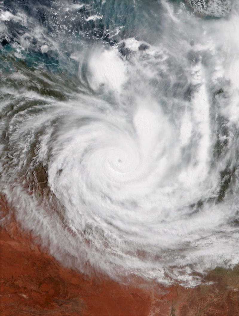
peak intensity at 06 UTC on March 19. Wind speeds were about 185 kph, making TREVOR a Category 3 Cyclone.
Shortly thereafter Trevor hit the mainland in the north of Queensland (AU) about 300 km southeast of Cape York in
almost completely uninhabited areas. Due to the rough terrain and the high friction, the cyclone was quickly weakened.
Just 24 hours after landfall, the storm lost its tropical cyclone status.
TREVOR maintained its westward course and returned to the open sea on March 21. The low water depth and the associated
high water temperatures in the Gulf of Carpentaria again caused an explosive intensification.
On March 22 at 18 UTC, the cyclone again reached Category 3 with wind speeds of 185 kph. Shortly thereafter, the storm
made landfall in the Northern Territory about 100 km east of Borroloola (AU).
The enormous amount of precipitation led to floods and landslides. Due to the sparsely populated area, however,
there was no significant damage.
|
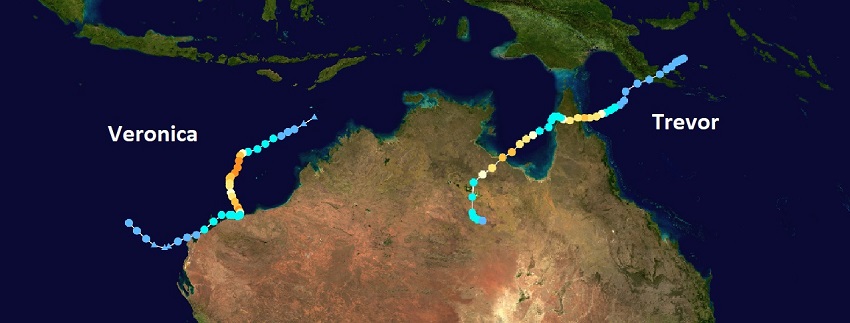
TREVORs and VERONICAs trajectory from March 17 to March 27 |
Image Credit: NASA, tracking information: NOAA
|
 |
Development of cyclone VERONICA
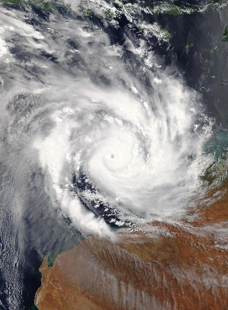
On March 20 at 19 UTC, the Bureau of Meteorology assessed the developing tropical low as a tropical cyclone and named the
system VERONICA. Tropical cyclone VEROINCA, which experienced extremely favourable atmospheric conditions and very warm sea
surface temperatures, intensified rapidly during the day and only 24 hours later reached Category 4 status.
TREVOR approached the mainland at a low displacement speed. A few km before reaching the mainland he changed his direction
of displacement and moved parallel to the northwest coast. The maximum mean wind speeds were 215 kph and occurred in March 24
at 00 UTC. During its relocation along the coast, VERONICA weakened rapidly. Already at 18 UTC on the same day, the storm was
downgraded to a tropical depression.
Tropical cyclone VERONICA led to heavy precipitation. Selected 24 h precipitation values are listed in the table below.
| Location |
24h precipitation in mm |
Date |
Roebourne Airport
Port Hedland
Marble Bar
Port Hedland
Pardoo Station
Roebourne Airport
|
459
179
138
137
121
106
|
26.03.2019
24.03.2019
25.03.2019
26.03.2019
25.03.2019
24.03.2019
|
|
Impact and Aftermath of VERONICA
Many shipping ports on the Pilbara coast ceased operations for safety reasons. The Port of Port Hedland, Australia's most valuable
export hub and one of the largest iron ore loading ports in the world, had to close for almost 4 days, with Ashburton and Dampier
ports also affected, with closures of 5 and 6 days respectively.
|
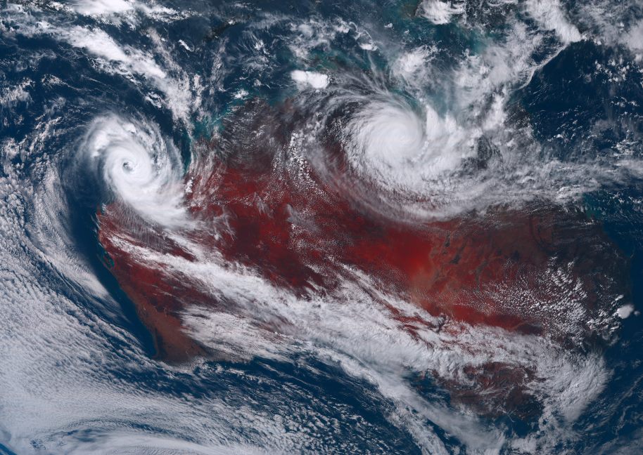
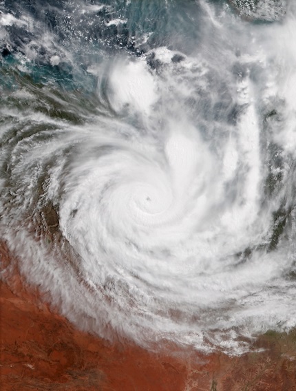
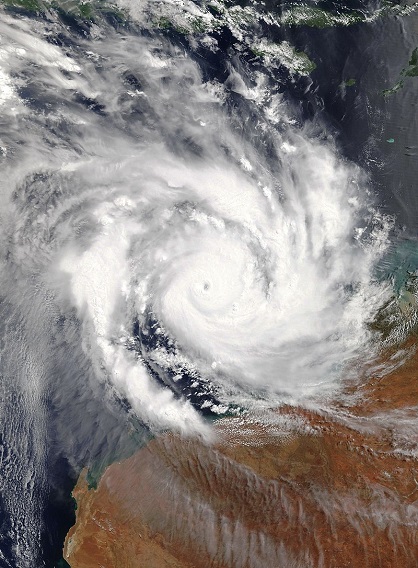
Satellite image of TREVOR and VERONICA during their peak intensities (TREVOR: 23 March, VERONICA 20 March) |
Source:
NASA Worldview
|
 |
 |
Text: FS
28 Mar, 2019
|