|
At the beginning of March, several storm lows swept across Europe in succession. Above all, the United Kingdom, Ireland, the Benelux countries and
Germany were affected. Winterstorm ALEXANDER first swept with gusts up to 181 kph on 02 March 2019 over the UK. Two days later, Winterstorm BENNET followed,
that also produced gusts up to 144 kph in Germany. On the backside of BENNET several squall lines formed over Germany, which also had heavy storm gusts. Directly
after BENNET storm low CORNELIUS followed.
Weather Situation
After the fierce high-pressure area of FRAUKE gradually weakened at the end of February, which had led to spring-like and summer-like temperatures in many parts
of Europe, it was again possible for the low pressure areas to reach Europe. Winterstorm ALEXANDER and BENNET kicked off, whirling trough Britain and Germany.
There were also stormy gusts in the Benelux and France. With the low pressure areas precipitation also reached Germany again. Since February was too dry and the
deficit of 2018 still needs to be made up, these came just right. In addition, the low BENNET swept just over Germany on monday.
|
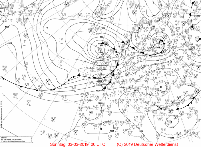
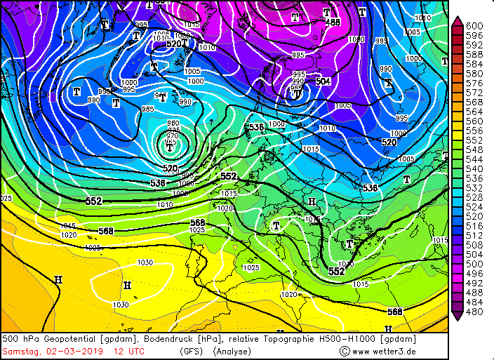
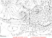
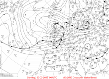
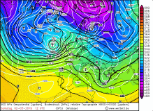
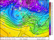
Sea level pressure, 02 till 04 March |
Source:
wetter3.de
|
 |
 |
 |
 |
|
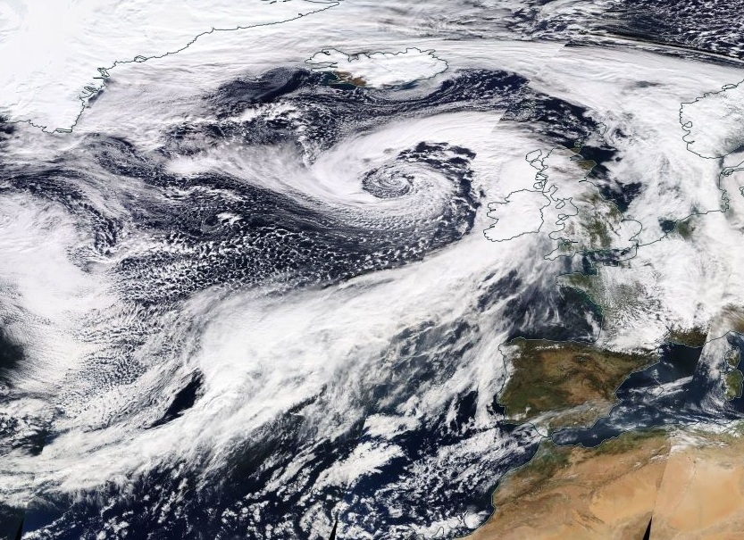
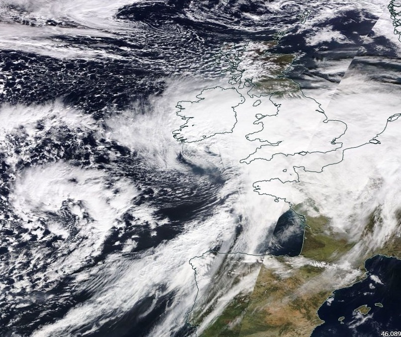
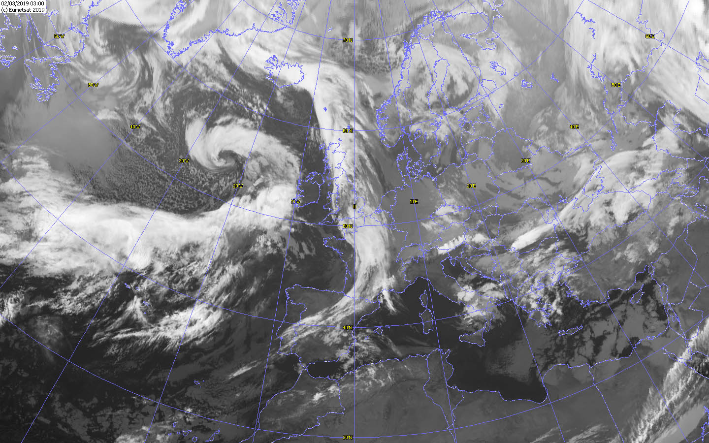
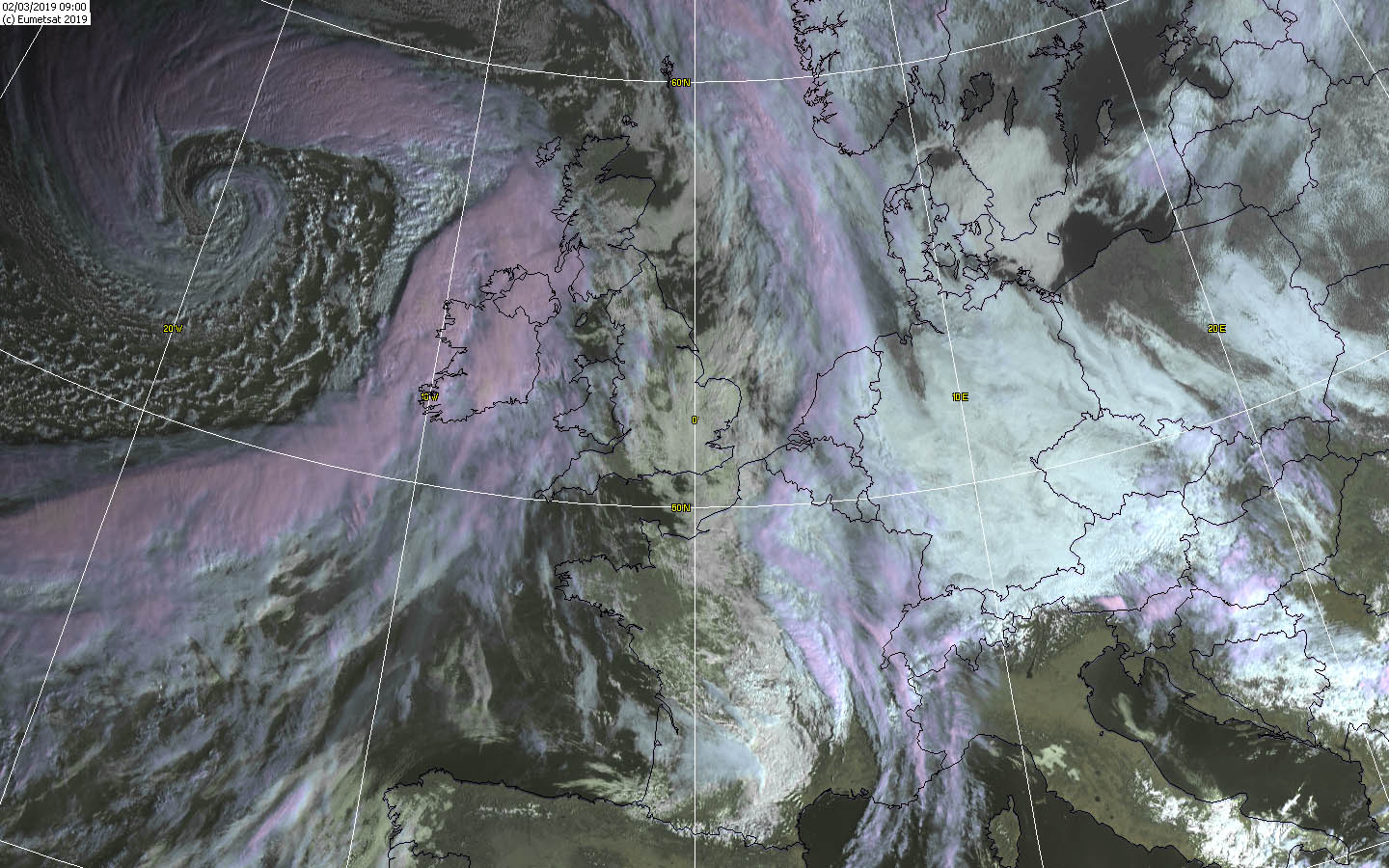
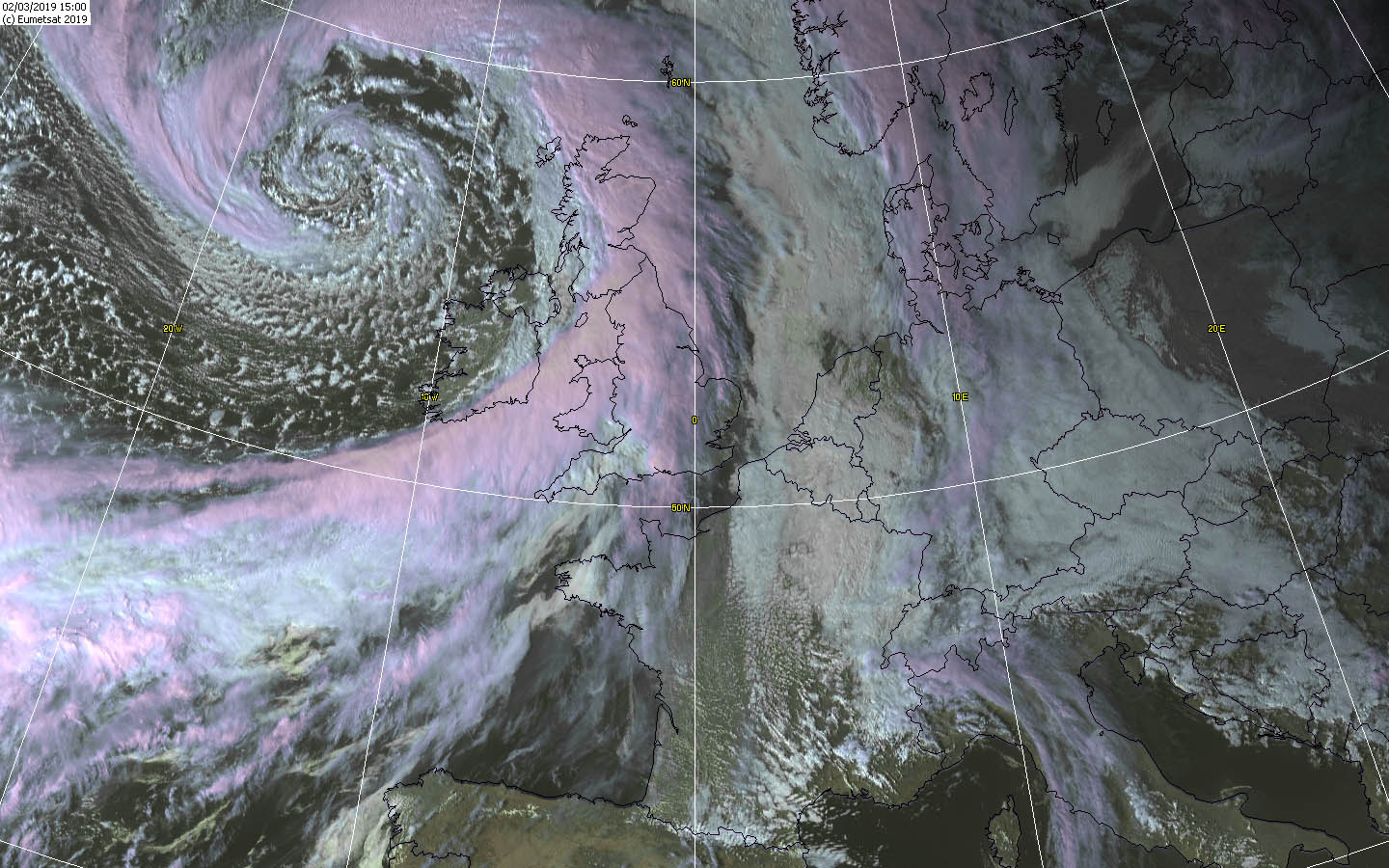
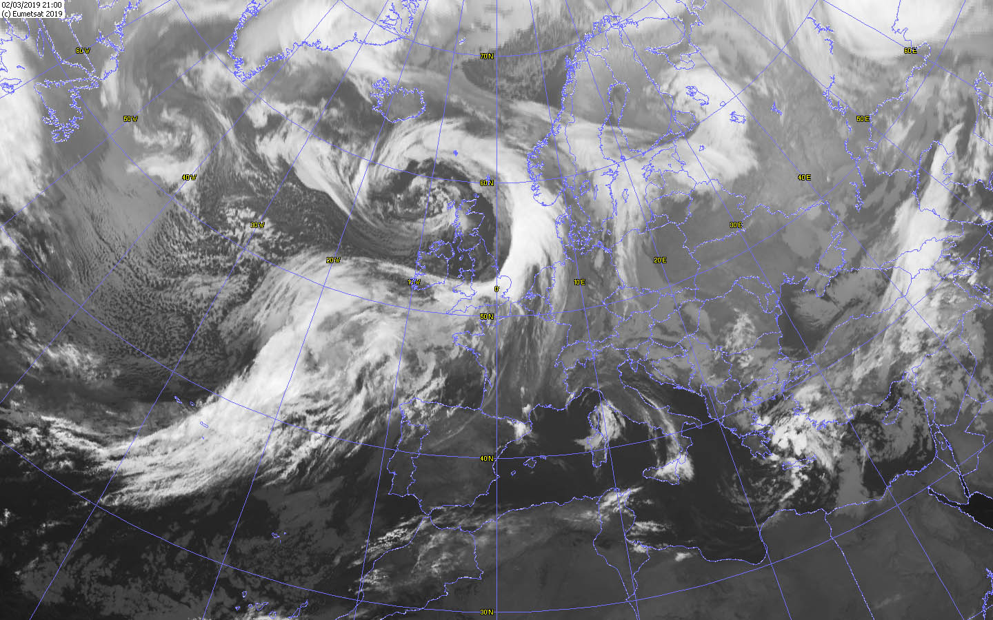
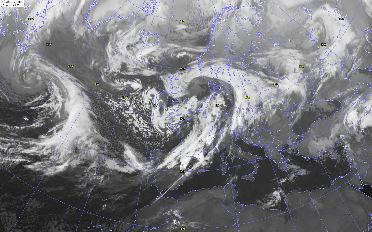
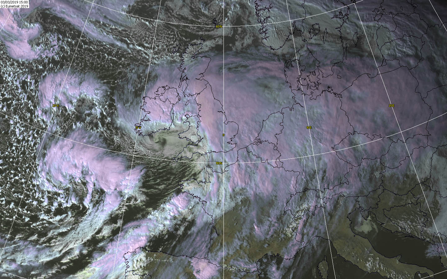
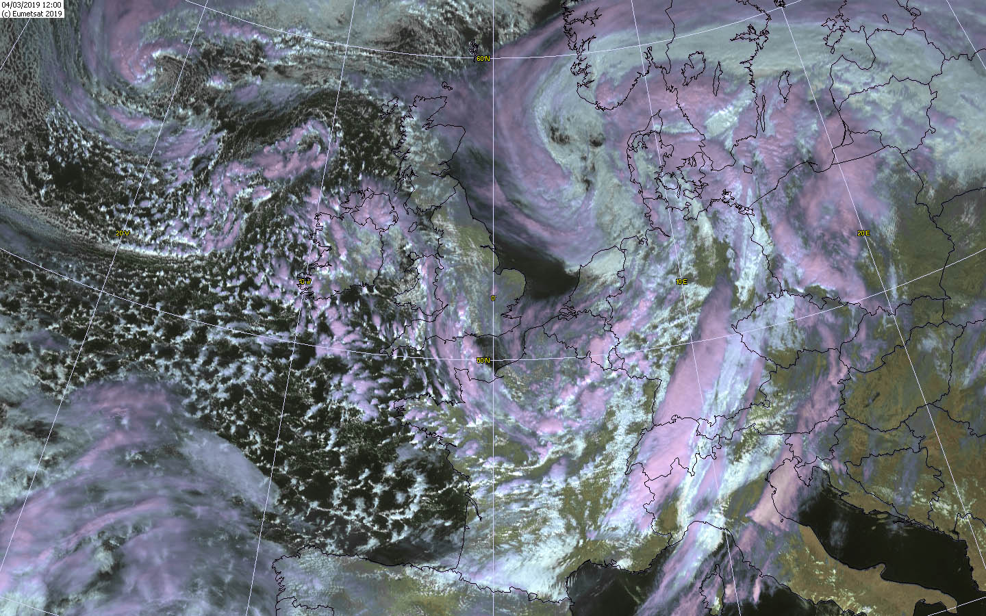
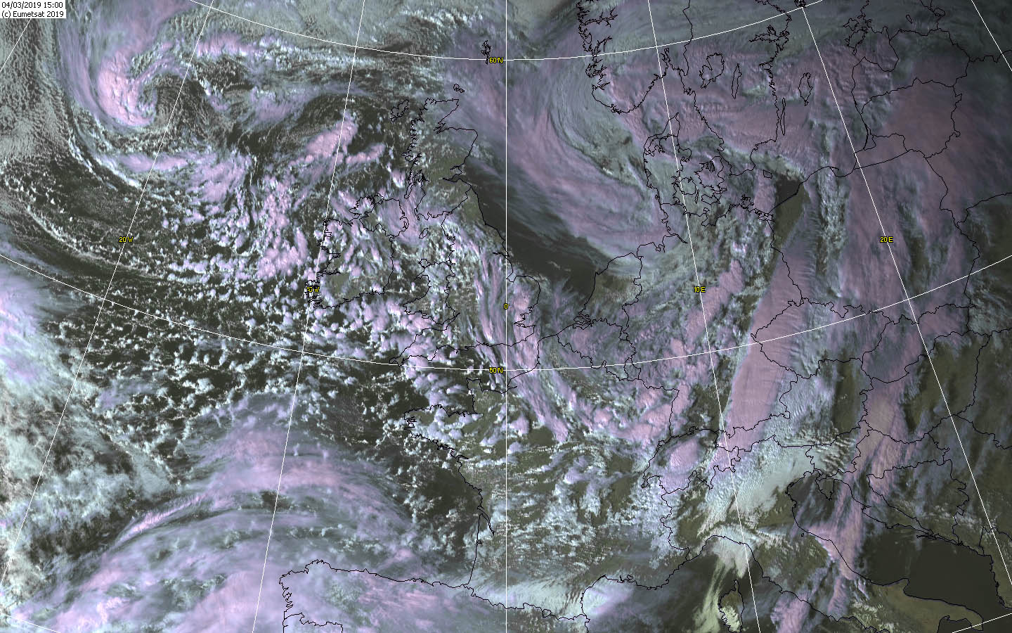
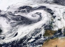
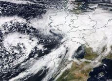
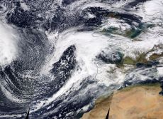
Satellite images, ALEXANDER, BENNET and CORNELIUS |
Source: NASA |
 |
 |
 |
The partly heavy storm gusts and gale-force gusts presented a big danger for the carnival parades, so that some of them had to be canceled.
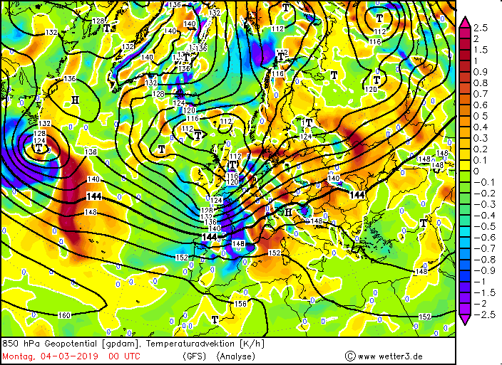
In the carnival strongholds such as Mainz, Dusseldorf and Cologne, they could take place anyway, albeit belatedly. On the frontside of BENNET strong warm air
advection took place, so that in some places in Germany again vernal temperatures were reached, such as in Dresden-Klotzsche with 17°C. On the other hand, strong
cold air advection took place on the rearside, causing the air to become labil. On the evening of March 05, another low hit the UK. CORNELIUS also brought storm and
rain to many parts of Europe.
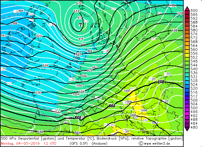
Evolution
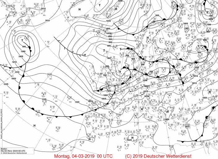
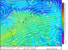
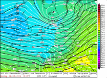
Deep ALEXANDER was already recognizable on Friday, March 01 as a wave disturbance on the Atlantic in the pressure charts. During the day it developed
to a small edge low with a core pressure of 995 hPa. Due to the favorable situation in the zonal jet stream and a dry intrusion it began to intensify
rapidly and the displacement speed increased at first. By the evening, the pressure fell to 985 hPa, the displacement speed, however, decreased.
By the following day, the pressure in the center dropped to 965 hPa by noon. In 24 hours, the pressure dropped by 30 hPa, which corresponds to a rapid cyclogenesis.
The center was now west of Ireland and shifted in the night of Sunday, March 3, towards east-northeast and moved north past Scotland. At night and in the morning,
the gusts were the strongest due to the high pressure gradient. In Cairngron gusts up to 189 kph were registered. ALEXANDER made itself felt in Germany by the
resurgent wind, as well as a rain band in the northwest. BENNET was not long in becoming noticeable and met the same day in the evening on the coasts of England
and Ireland.
|
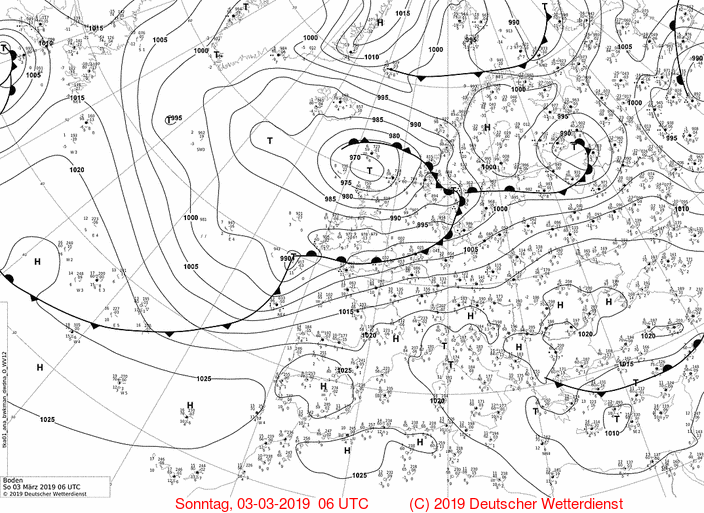
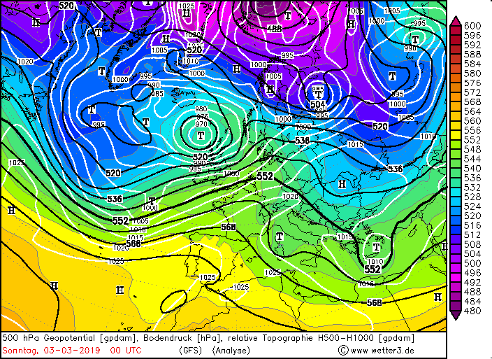
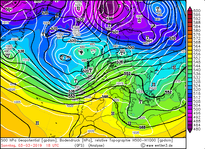
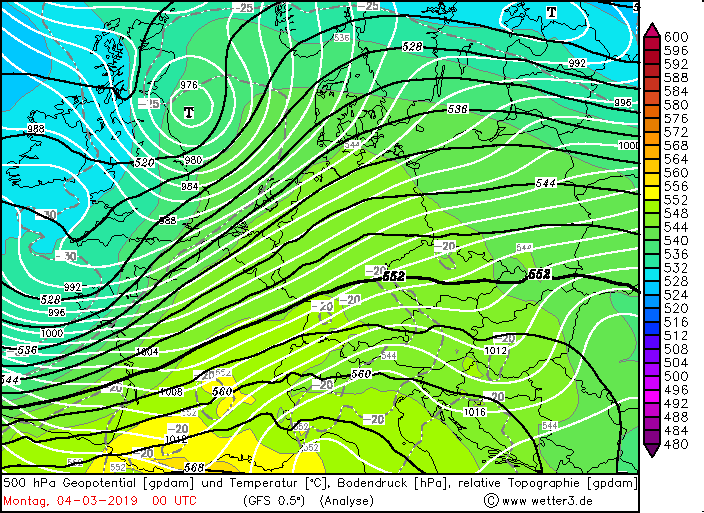
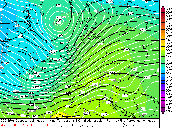
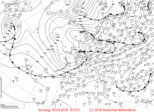
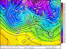
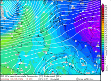
500hPa geopotential with sea level pressure |
Source:
wetter3.de
|
 |
 |
 |
 |
 |
 |
 |
 |
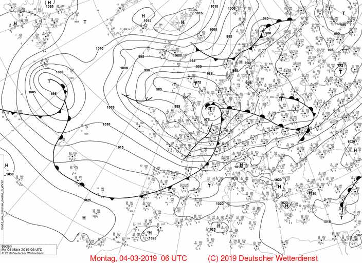
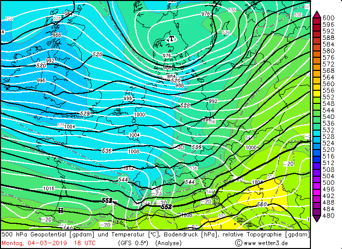
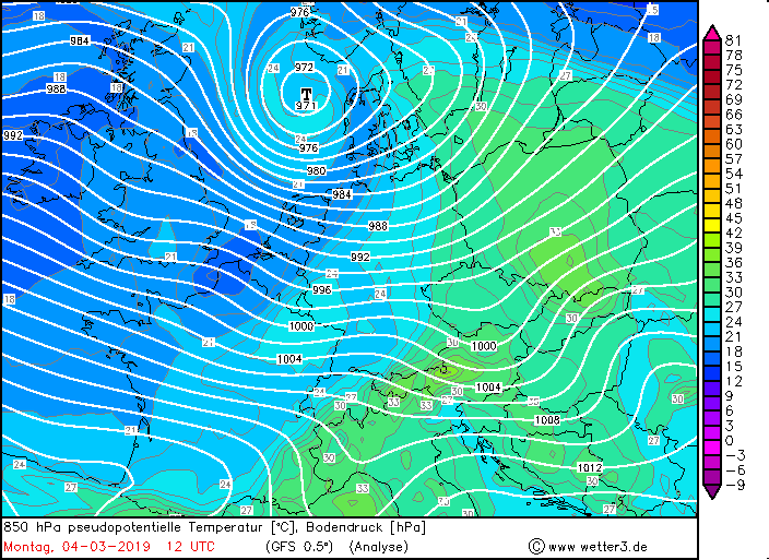
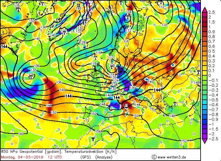
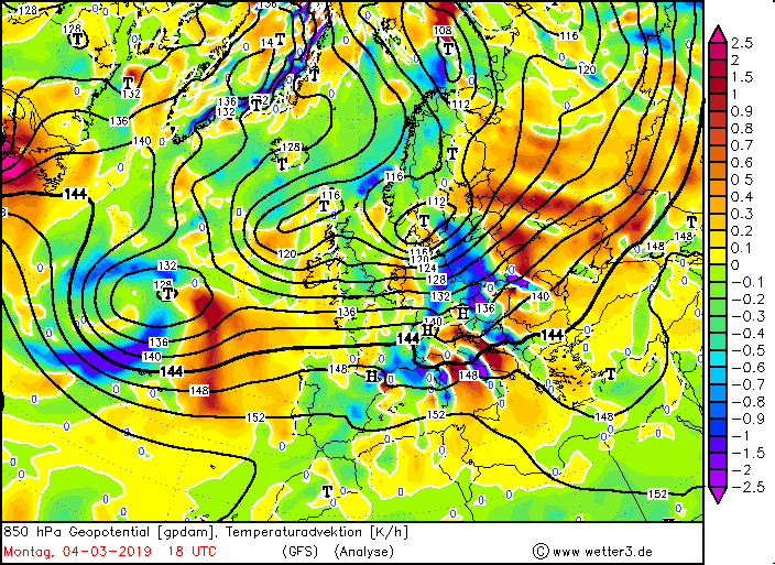
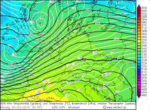
On the morning of March 3, BENNET was a wave disturbance with a pressure of 1000 hPa on the Atlantic and developed until the
evening to a small very fast-moving edge low. He, too, underwent a rapid cyclogenesis as his pressure dropped by 25 hPa in 24 hours.
As well as ALEXANDER, the reason lay in the favorable location in a jet stream branch. BENNET's center moved across the south of the UK and then
shifted northeast across the North Sea. In the evening gusts up to 151 kph were measured in Great Britain. The main storm field hit Germany in the
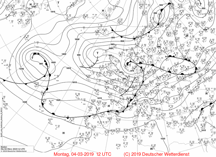
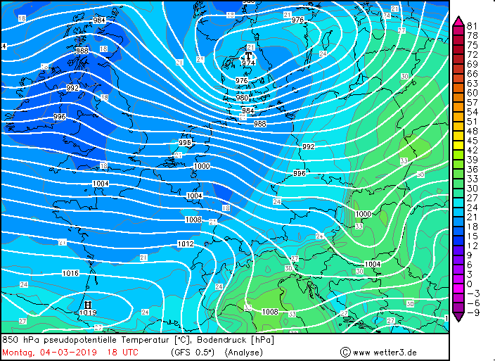
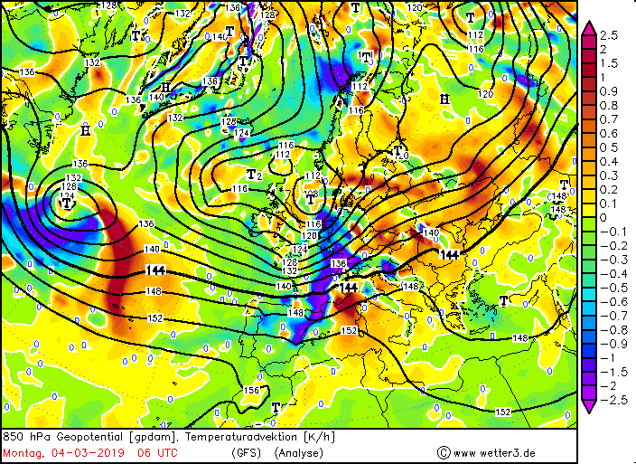
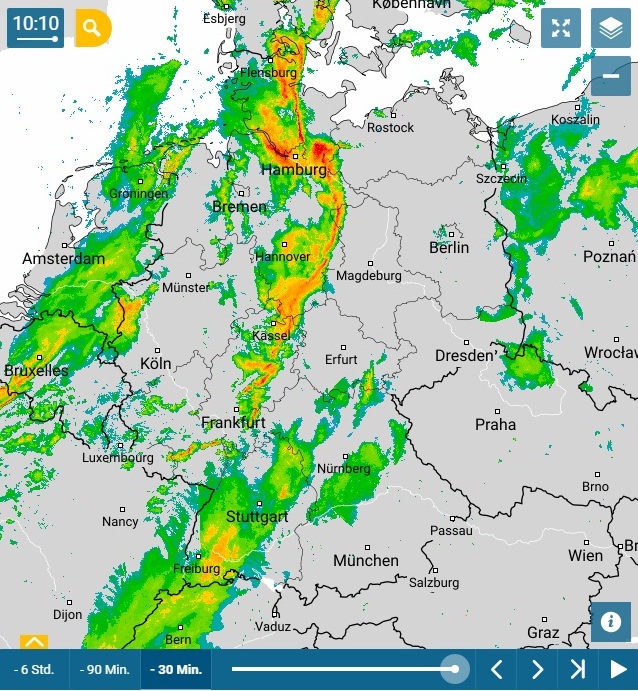
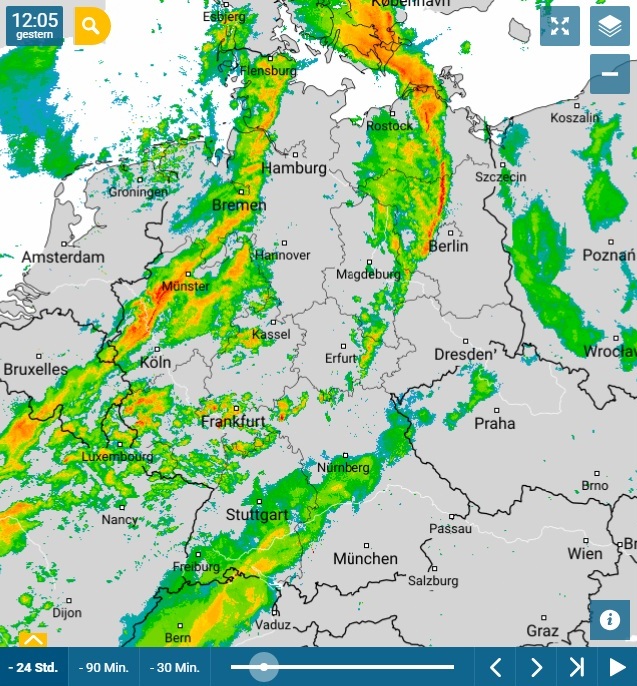
early morning of 4 March and there also caused gusts up to 144 kph on the Brocken or Feldberg in the Black Forest. On the backside of BENNET there was
strong cold air advection. This led to a labilisation of the air mass and thus to showers and thunderstorms. There were several squall lines. The speed of
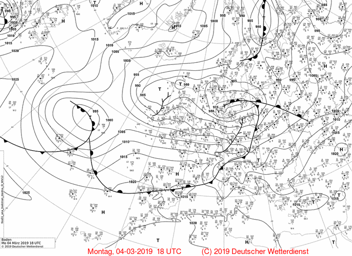
displacement of BENNET decreased rapidly until the evening and its pressure stagnated at 975 hPa. It remained over the Baltic Sea and slowly shifted northeast
towards the Finian coasts. The pressure gradient was slow to fan up so that it still remained stormy on Tuesday.
|
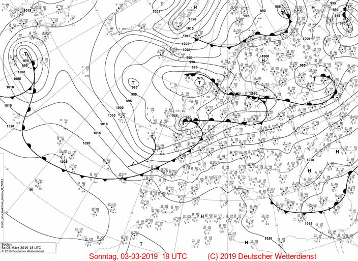
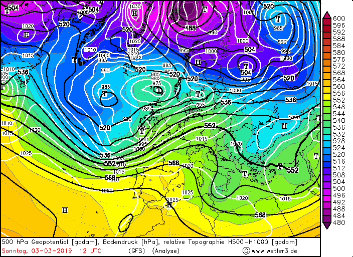
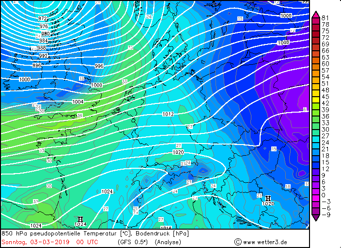
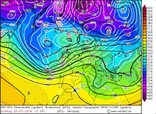
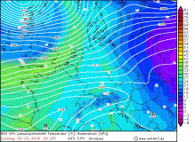
500hPa geopotential with sea level pressure, 850 hPa geopoential temperature, 850 hPa temperature advection |
Source:
wetter3.de
|
 |
 |
 |
 |
There was no storm break for the Europe. Already on the evening of March 5, another storm low called CORNELIUS
moved on. Stored in a longwave trough it lingered until the 7th of March over Irland and the United Kingdom. Its core pressure was 975 hPa and it shifted only slowly.
With it led a cold front, which extends far to the south and formed the trough front. This cold front hit Spain and Portugal during the night from 5 to 6 March
and had severe precipitation as well as storm gusts and gale-force gusts. In Spain gusts up to130 kph (la Pinalla) were measured and in 24 hours fell locally more
than 76 mm precipitation (Pontevedra, Padron). France also was hit by severe thunderstorms and showers. Gusts up to 162 kph (Mont Aigonal) were measured.
Wind
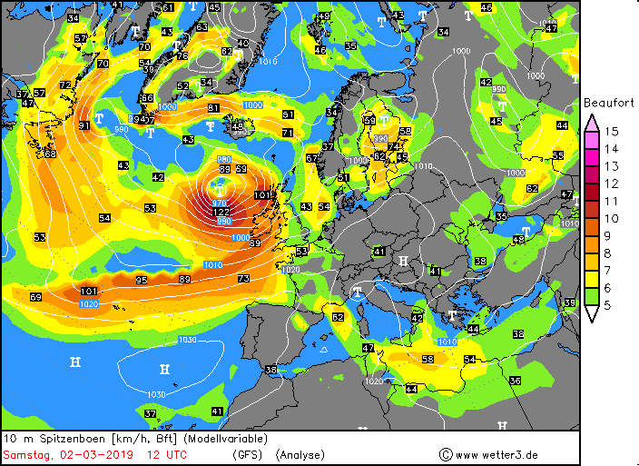
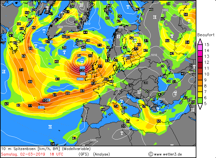
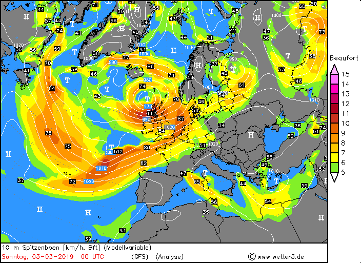
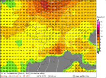
ALEXANDER
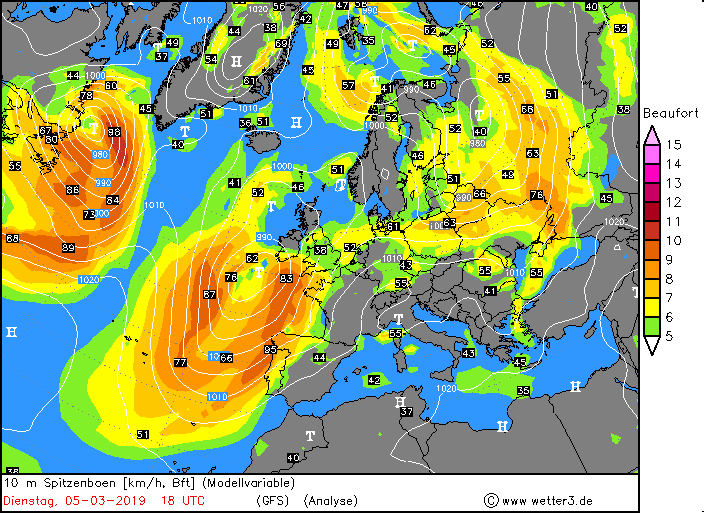
The strong winds were caused by the high pressure gradients. This amounted to 100 km about 12 hPa (1000 km about 38 hPa). In Scotland, gusts up to 189 kph were
registered, which corresponds to a category 3 hurricane on the Saffir-Simpson scale.
Measured wind gusts (selection) in the United Kingdom (data source: Ogimet):
| Location |
Wind Gusts in kph |
Beach Na Ba No2
Caingorn
Bojee 62107
Glen Ogle
Mumbles
Capel Curing
|
189
181
141
130
123
117
|
|
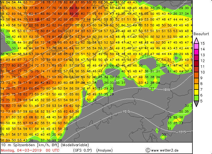
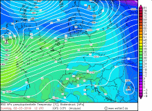
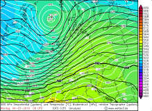
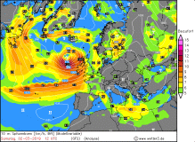
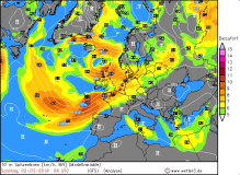
ALEXANDER's peak gusts in 10m (modell) |
Source:
wetter3.de
|
 |
 |
 |
 |
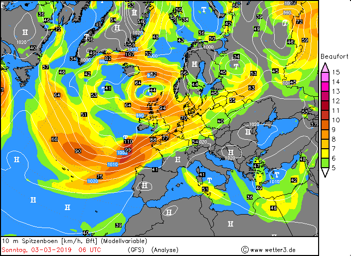
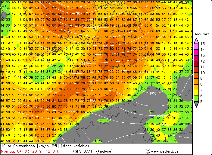
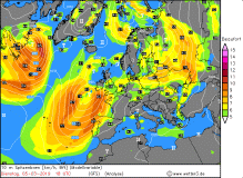
BENNET
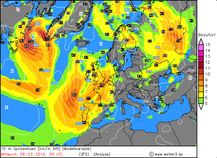
Winterstorm BENNET caused gusts up to 181 kph in the UK on the evening of 03 March. The strongest gusts in Germany were recorded on 04 March along a narrow
strip, the cold front. This moved in the morning from the northwest and shifted during the day to the southeast over Germany. While it was already stormy in the
west and in the middle of Germany, the southeast was initially wind weaker with around 60 kph. From the afternoon and evening, the storm gusts and thunderstorms
but also arrived there. A second storm field formed over northern Germany in the early evening. This was triggered by the high pressure gradient on the southwest
flank of the low.
From noon onwards, several showers and thunderstorms also caused heavy storm gusts and heavy precipitation that fell as rain or snow. Gravel showers and
small-grained hail were also present, which was e.g. the case in Offenbach am Main. Only on Monday evening, the thunderstorms subsided and the wind settled down.
Also on Tuesday it remained windy in most parts of Germany and it blew a stormy wind with wind speeds around 70-90 kph, on exposed positions and in showers or
thunderstorms up to 133 kph. On this day too, there were occasional showers and thunderstorms, because the air mass remained unstable due to the inflow of cold air.
Only on Wednesday, the weather calmed down a little bit. But in the starting blocks is already the low CORNELIUS, which will cause stormy gusts on Thursday in Germany
again.
Measured wind gusts (selection), data source: Ogimet
| Location (DE) |
Wind Gusts in kph |
Location (GB) |
Wind Gusts in kph |
Feldberg/Schwarwald
Brocken
Zugspitze
Hohenpeissenberg
Leuchtturm Kiel
Wasserkuppe
|
144
144
133
119
119
119
|
Cairngorn
Mumbles
Beach Na Ba No2
Capel Curing
Emley Moor No2
Pembrey Sands
|
181
122
117
117
113
113
|
|
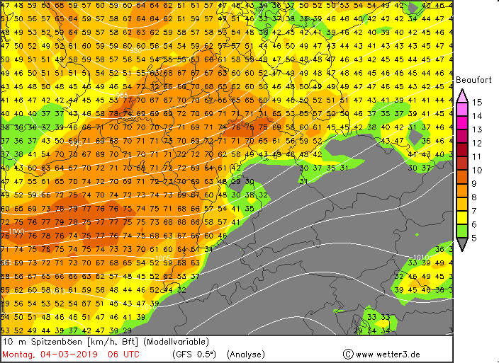
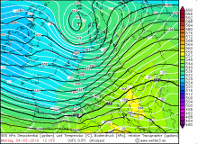
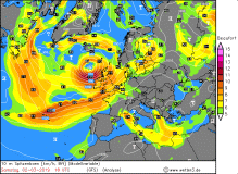
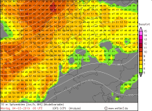
BENNET's peak gusts in 10m (modell) |
Source:
wetter3.de
|
 |
 |
 |
 |
Measured wind gusts (selection) Europe (data source: Ogimet):
| Country |
Location |
Wind Gusts in kph |
Great Britian
France
France
France
Germany
Germany
Germany
Netherlands
|
Caingorn
Cap Corse
Le Talut
Chemoulin
Feldberg(Schwarwald)
Brocken
Zugspitze
Le Georee
|
181
151
151
148
144
144
133
122
|
|
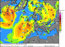
CORNELIUS
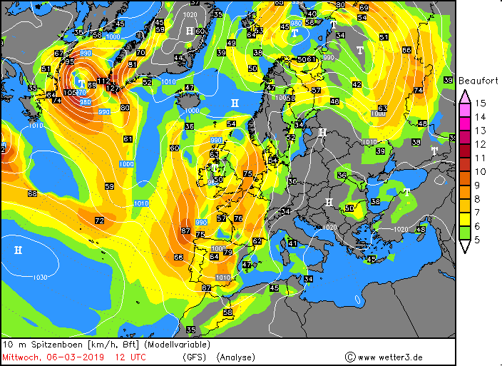
As soon as BENNET left Europe Winterstrom CORNELIUS reach Europe. With a central pressure of 978 hPa the low moved over the UK in the evening of March 05. Remarkable was its
long cold front, that reached from the UK over France down to Spain and Portugal. On the backside of the cold front a squall line has formed, which led to showers and
thunderstorms with severe gusts and accumulated precipitation. The main reason for the heavy storm gusts was the cold front, in the UK the strong pressure gradient.
Also in southeast of France severe thunderstorms were registered.
Measured wind gusts (selection) Europe March 06 and 07 (data source: Ogimet):
| Country |
Location |
Wind Gusts in kph |
France
Switzerland
France
Switzerland
Switzerland
Germany
Spain
Spain
Spain
|
Aiguille du midi
Gütsch
Mont Aigonal
Les Diablerets
Titlis
Zugspitze
La Pinilla-Estacion
Estaca de Bares
Nestares
|
244
183
162
159
152
144
130
122
122
|
|
|
|
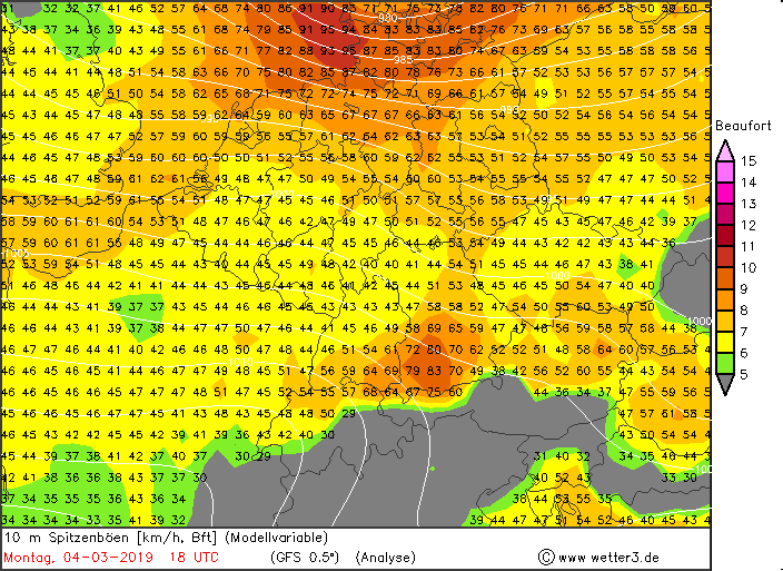
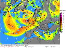
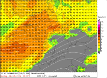
CORNELIUS's peak gusts in 10m (modell) |
Source:
wetter3.de
|
 |
 |
 |
 |
Carnival Parades and damage
Since the main storm field of deep BENNET already passed in the morning, there was just little danger for the
carnival parades. The real problem were the subsequent showers and thunderstorms in the squall lines that formed around noon.
Also local thunderstorms and showers developed in the postfrontal weather. Showers and above all thunderstorms can also cause severe storm
gusts due to their heavy rainfall, but are much harder to predict as they are local phenomena. As a result, some organizers, such as in Fulda and
Bottrop, decided to cancel their parades. With a delay and some restrictions due to the squall lines, the parades could take place in Cologne and
Dusseldorf and Mainz. Three years ago Winterstorm Ruzica and Susanna also hit Germany during the carnival time. Since the parade was canceled in
Dusseldorf back then, the parade could take place in Cologne and Mainz.
The heavy storm gusts and gale-force winds brought down many trees or kinked branches, which then crashed on cars and roads and caused
traffic obstructions. Also the Deutsche Bahn got problems, so that it came to delays and / or train failures, since trees or branches blocked the rails.
In Munich rescue workers had to move out, as a scaffolding had partially solved and threatened to cause further damage. On a country road in NRW, a man in
his car was killed by a falling tree. In Hessen a man was seriously injured by a collapsing wall due to the strong gusts. At Frankfurt Airport, there were also
impairments and delays, due to the storm.
|
|