|
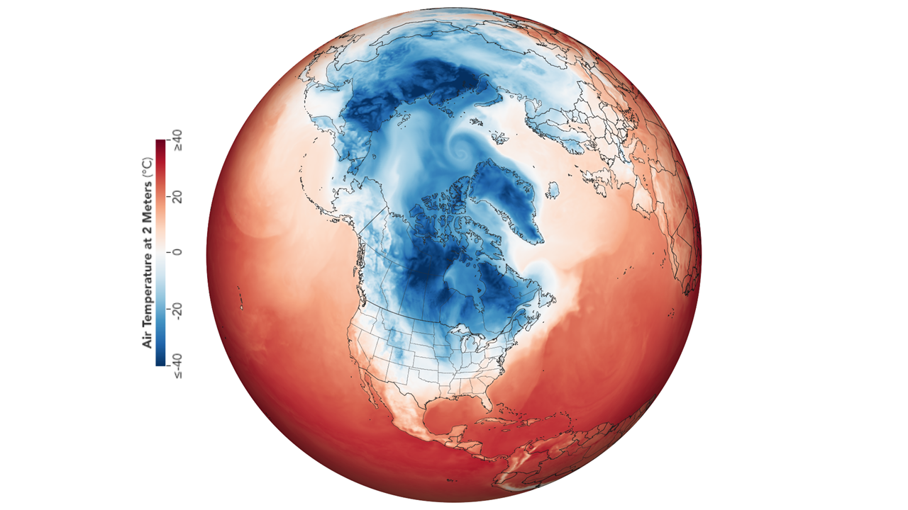
At the end of January, arctic weather plunges into North America, causing temperatures down to -50°C. The Midwest
of the USA experienced the sharpest cold spell ("Arctic Outbreak ") in more than 20 years. The wind made the
temperatures feel even colder (wind chill below -50°C).
Development of the cold spell
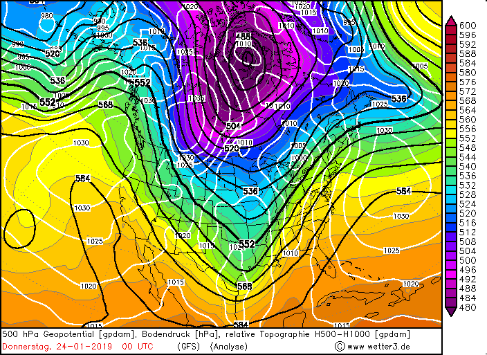
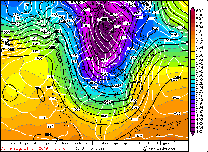
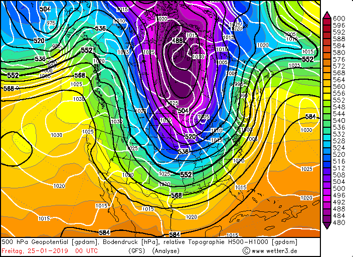
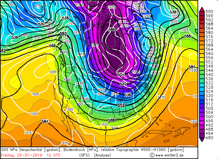
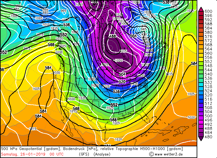
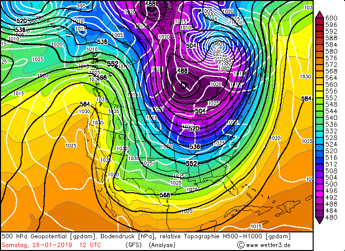
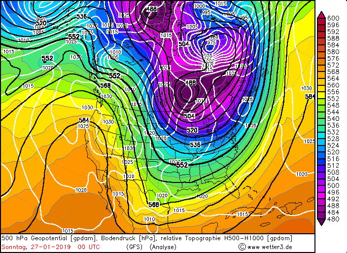
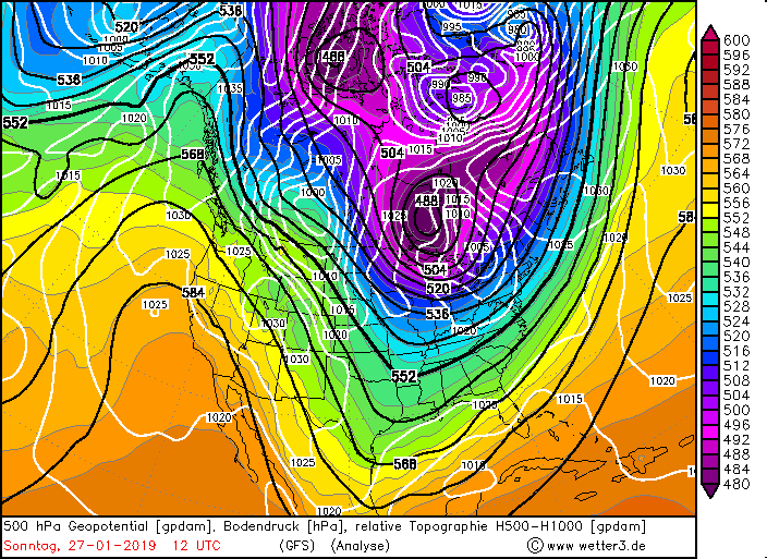
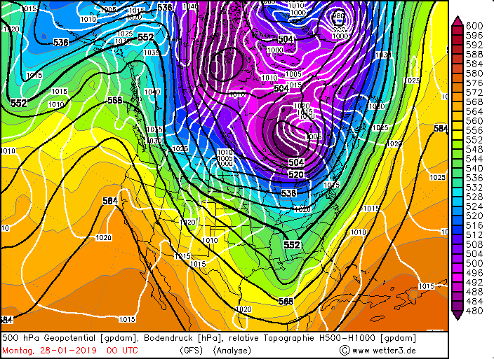
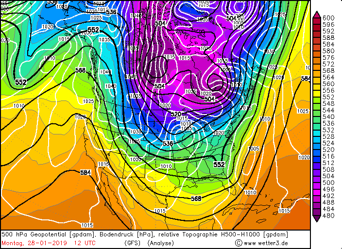
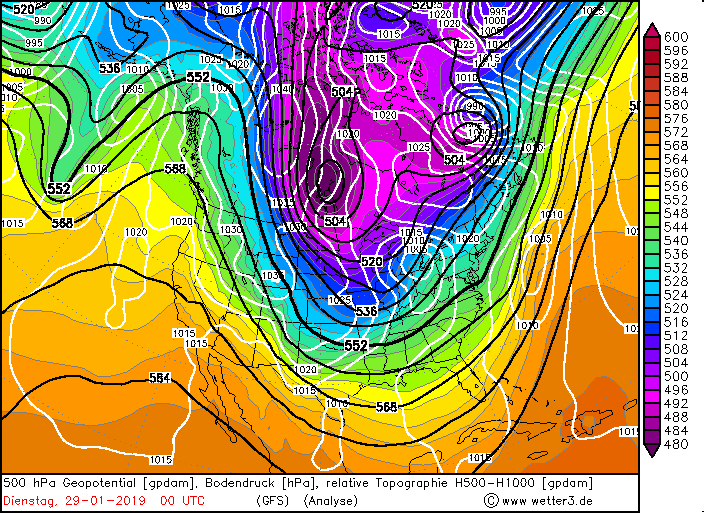
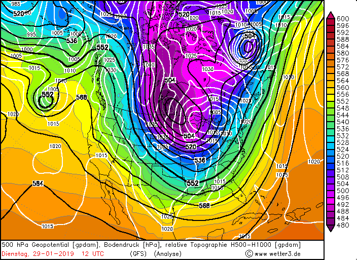
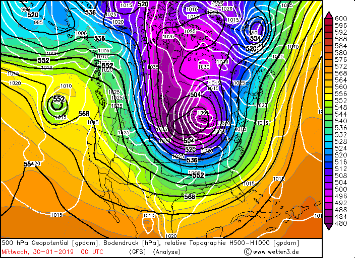
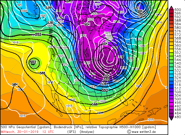
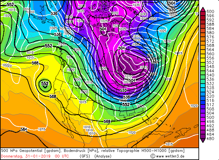
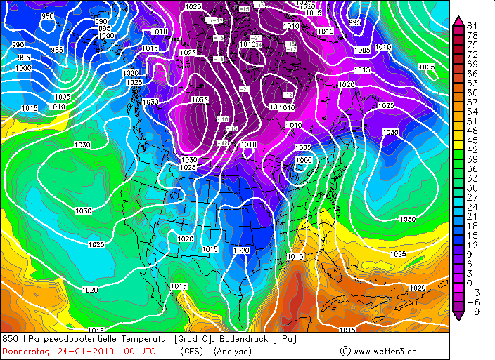
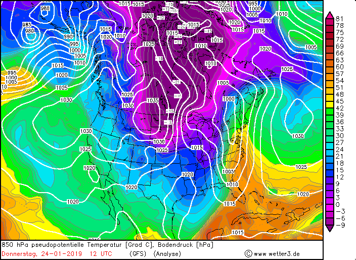
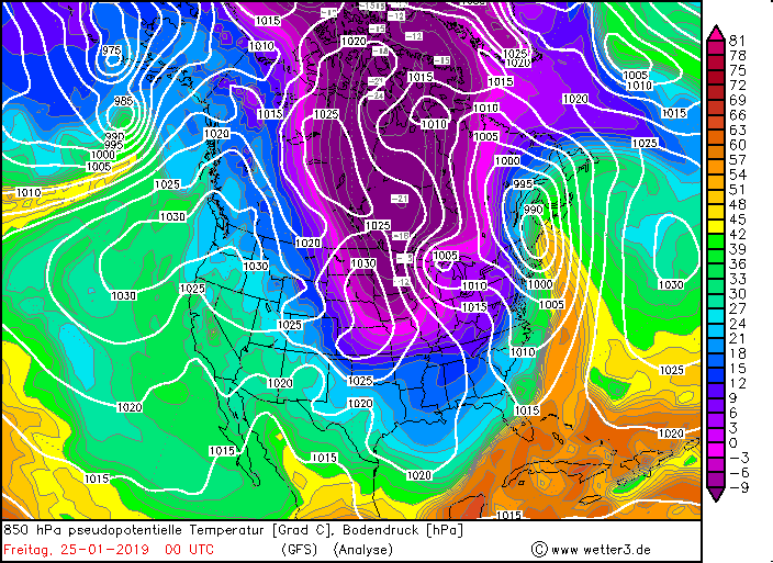
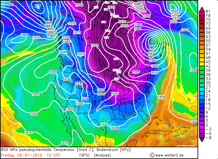
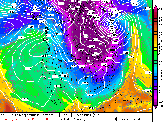
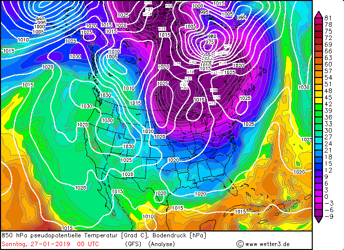
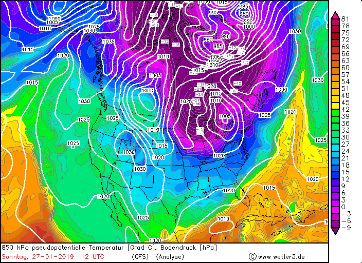
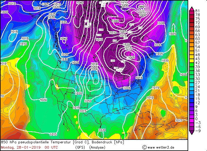
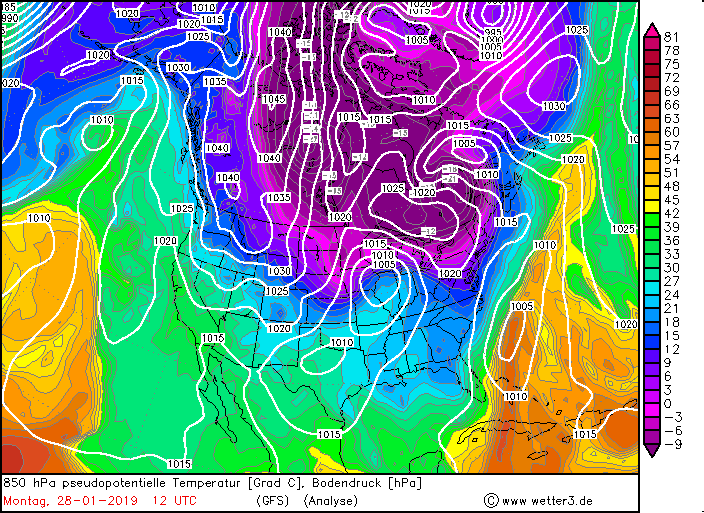
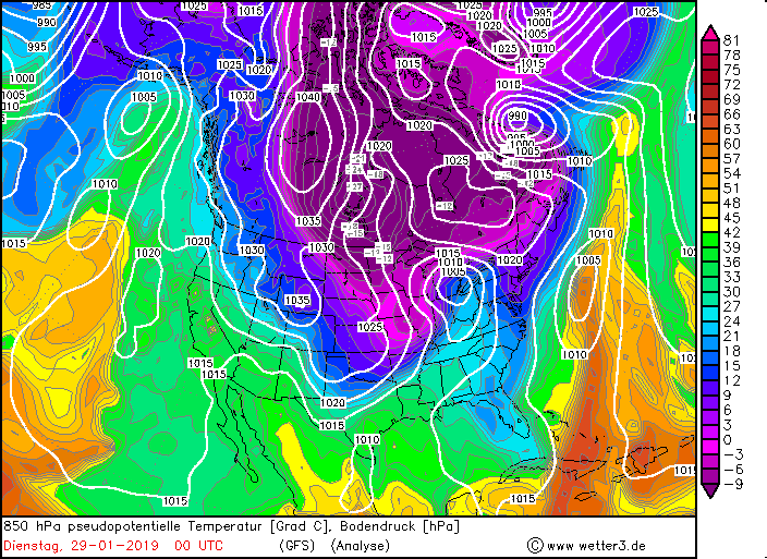
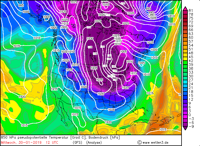
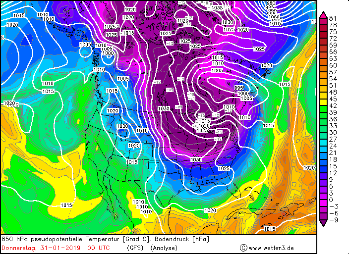
The extreme cold wave in the Midwest can be explained by the fact that part of the polar vortex has now settled
unusually far south over Canada and the northern Midwest. Temperatures like in the Arctic are the result.
During the nights there were widespread temperatures below -30°C. In Collins Bay (Canada) the lowest temperature
of the day was -47.0°C on 30.01. In Chicago the lowest temperatures were -31°C. The cold spell was so severe
that all-time records were tied or set at least for four weather stations. What is extremely unusual about
this cold wave, however, is that it is accompanied by strong winds. Due to the high wind speeds, the
temperature is perceived as even colder, as the warmer air layer close to the body is blown away by the
wind. This is also called the wind chill or wind chill effect. The feeling of cold is particularly bad
in Minnesota. In Ponsfond, a perceived temperature of -54 °C was registered. The record for Minnesota
is -57 °C. At -45°C the skin cools down so quickly that it becomes painful. Frostbites and frostbite on
unprotected skin threaten after only a few minutes.
|
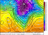
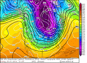
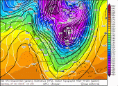
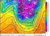
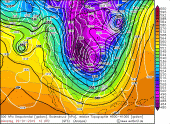
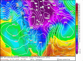
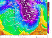
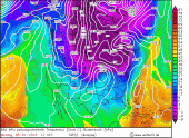
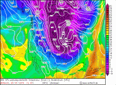
500 hPa geopotential from 24 Jan, 00 UTC to 31 Jan, 00 UTC |
Source:
Wetter3
|
 |
 |
 |
 |
 |
 |
 |
 |
 |
 |
 |
 |
 |
 |
 |
There is a persistent rumour that severe cold air break-ins in the USA will also occur in Europe after some
time. Although there is no direct connection, it is possible that cold air break-ins in Europe are more
likely than usual due to the weak polar vortex and that this gives the impression that there is such a
direct connection. In the following week it became indeed with us colder, correctly cold arctic cold air
did not come however to us.
Minimum Temperatures (30 Jan, 18 UTC), data source: National Weather Service
| Location |
12h Minimum Temperatur in °C
30 Jan, 18 UTC |
Collins Bay (Canada)
Carberry (Canada)
Yorkton (Canada)
Fargo (North Dakota)
Rochester (Minnesota)
Sioux Falls (South Dakota)
Waterloo (Iowa)
Minneapolis (Minnesota)
|
-47.0
-44.2
-40.3
-36.1
-33.9
-33.8
-33.3
-31.7
|
|
The high temperature difference between air and water leads to strong lake effect precipitation especially on the eastern
coasts of Lake Superior, Lake Michigan, Lake Hudson and Lake Erie. Although the arctic air hardly brings any moisture,
the stations Traverse City-Cherr and Muskegon in the east of Lake Michigan registered 30 cm of fresh snow since January 27.
Total snow amount (30 Jan, 18 UTC),
data source: National Weather Service
| Location |
Total snow amount in cm
30 Jan, 18 UTC |
Lake Superior Provincial Park (Canada)
Wawa (Canada)
Tobermory (Canada)
Traverse City-Cherr (Minnesota)
Muskegon (Minnesota)
Chicago (Illinois)
|
80
69
51
41
38
20
|
|
|
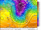
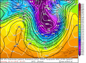
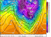
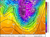
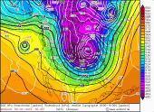
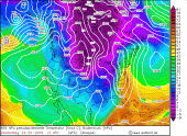
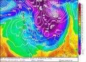
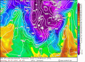
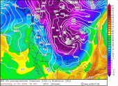
Pseudopotential temperature from 24 Jan, 00 UTC to 31 Jan, 00 UTC |
Source:
Wetter3
|
 |
 |
 |
 |
 |
 |
 |
 |
 |
 |
 |
 |
 |
 |
 |
|
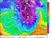
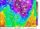
Animation 2 meters temperature, Jan 23-29 | Quelle: NASA |
|
Temperature records
During the cold spell in the USA and Canada, some all-time low temperature records were broken (see table).
In addition to the all-time records, numerous new monthly and decade records were set or set.
Due to the strong wind the temperature felt much colder (wind chill). Nevertheless, the records set were extraordinary.
| City |
State |
Date |
Temperature (°C) |
Northwest of Mather
Moline
Rockford
Cedar
|
Wisconsin
Illinois
Illinois
Iows
|
Jan. 30
Jan. 31
Jan. 31
Jan. 31
|
-42
-36
-35
-34
|
|
Impacts
At least 17 people lost their lives due to the cold spell and numerous frostbites were treated in the hospitals.
Some schools in the USA and Canada had closed due to the extreme cold. The delivery of postal items was
also interrupted. In Chicago, 21 passengers had to be rescued from a bus because the bus collapsed.
The reason was gelled diesel fuel due to the extreme cold.
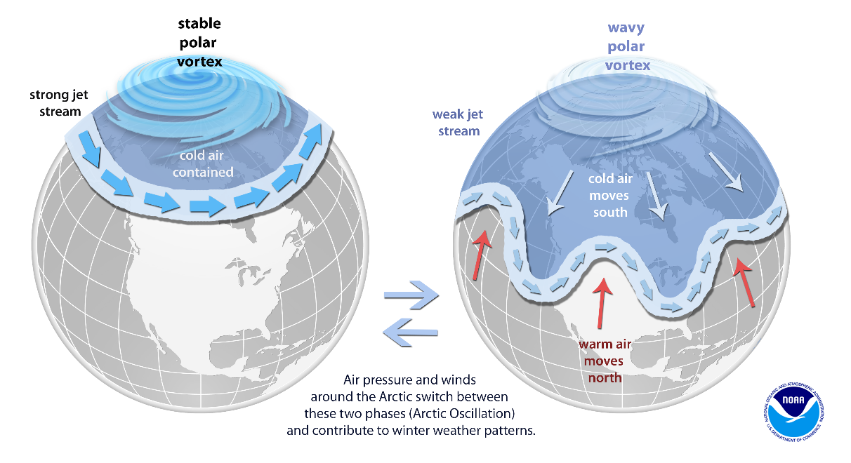
The science behind the polar vortex
"Arctic Outbreak" is the name given to an eruption of extremely cold Arctic air masses far into southern latitudes.
The Midwest of the USA experiences such an "Arctic Outbreak" at the end of January. This is due to the so-called
polar vortex. This vortex is formed in winter above the pole, where no sunlight can warm up the atmosphere,
so that cold air accumulates. As a result, a strong depression forms, which generates stronger western winds
in the northern hemisphere and is called the polar vortex.
Normally, the polar vortex with its center is above the Arctic and is mostly stable. However,
if the polar vortex weakens, or even divides, then the partial vertebrae start to stagger and
are often pushed into southern latitudes. Strong cold air eruptions far to the south are the result.
A sudden stratospheric warming at the end of December could be responsible for the weakening of the
polar vortex and a temporary division. Such stratospheric warming usually weakens the polar vortex
considerably.
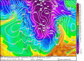
|
Information about polar vortex |
Source:
NOAA
|
 |
Text: CL
06 Feb, 2019
|