Thursday, 24 December 2020, 09:00 UTC
|
|
|
|
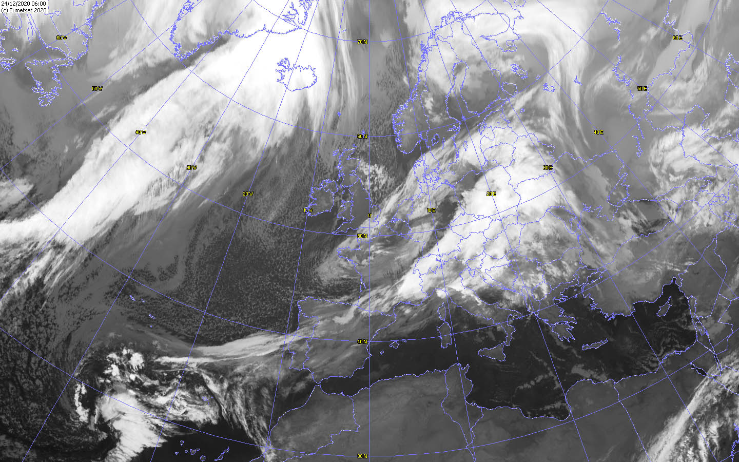
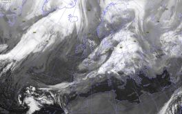
Satellite image (VIS),
24.12. 06 UTC
Data Source: Wokingham
|
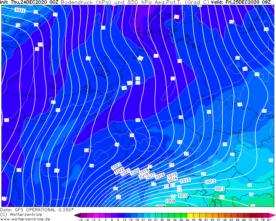
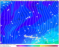
850 hPa equivalent pot. Temperature,
25.12. 09 UTC
Data Source: Wetterzentrale
|
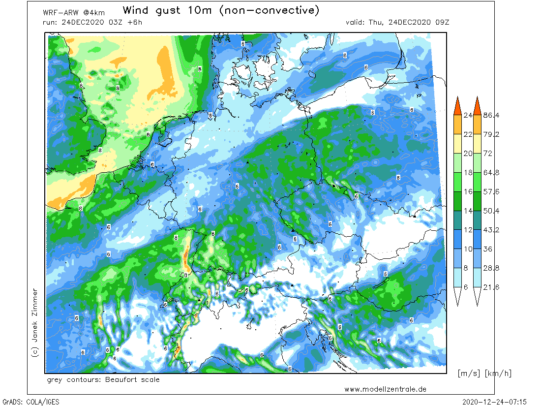
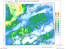
10m Wind gusts,
Central Europe, 24.12., 09 UTC
Data Source: Modellzentrale
|
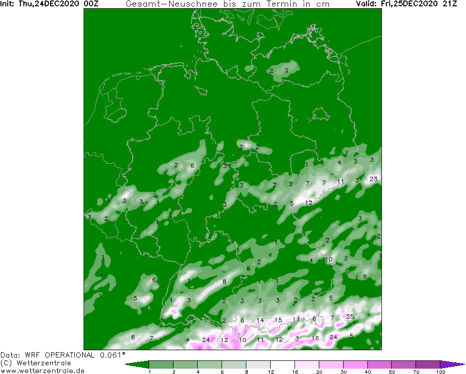
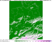
Fresh snow amount
Central Europe till 25.12., 21 UTC
Data Source: Wetterzentrale
|
Winterstorm
Central Europe
Issued: Thursday, 24 December 2020, 09:00 UTC
Windstorm GRETA will cause stormy and rainy weather today, especially in Germany. In exposed areas like the Feldberg or the Brocken, gusts around 120 km/h are expected, in lower areas gusts between 40 and 60 km/h can occur.
23.-25.12.2020
Shapiro-Keyser Cyclone GRETA with its core over the Baltic region rapidly moves further east during the course of the day. The storm field caused stormy weather last
night, especially in western and southern Germany. The wind will increase during the course of the day. In Baden-Württemberg and Bavaria, gusts of around
120 km/h are possible in exposed locations. Gusts around 120 km/h are also expected on the Brocken. At lower altitudes, gusts between 40 and 60 km/h may occur.
GRETA's warm front and its clouds brought heavy rain yesterday and also this morning. However, these will gradually turn into snow as the day progresses.
The first cold front drops the snow line to about 1000 to 800m. However, a second cold front will follow in the night to Friday. This will bring much colder
polar air to Central Europe and will lower the snow line to below 300m. At high and medium altitudes, fresh snowfall amounts between 10 and 15 cm are expected
(over the Alps about 25 cm are expected). Snow may also fall at low altitudes, especially in combination with stronger precipitation, which will be the case in
Baden-Württemberg and southern Bavaria. Due to a wave in the air pressure field, precipitation will be especially intense here. In the lowlands, however, the
snow will not last long due to the warm soils.
Lothar 2.0 or even a blizzard are not expected. With this in mind, Merry Christmas and happy holidays.
Wednesday, 23 December 2020, 19:00 UTC

|

|
|

|
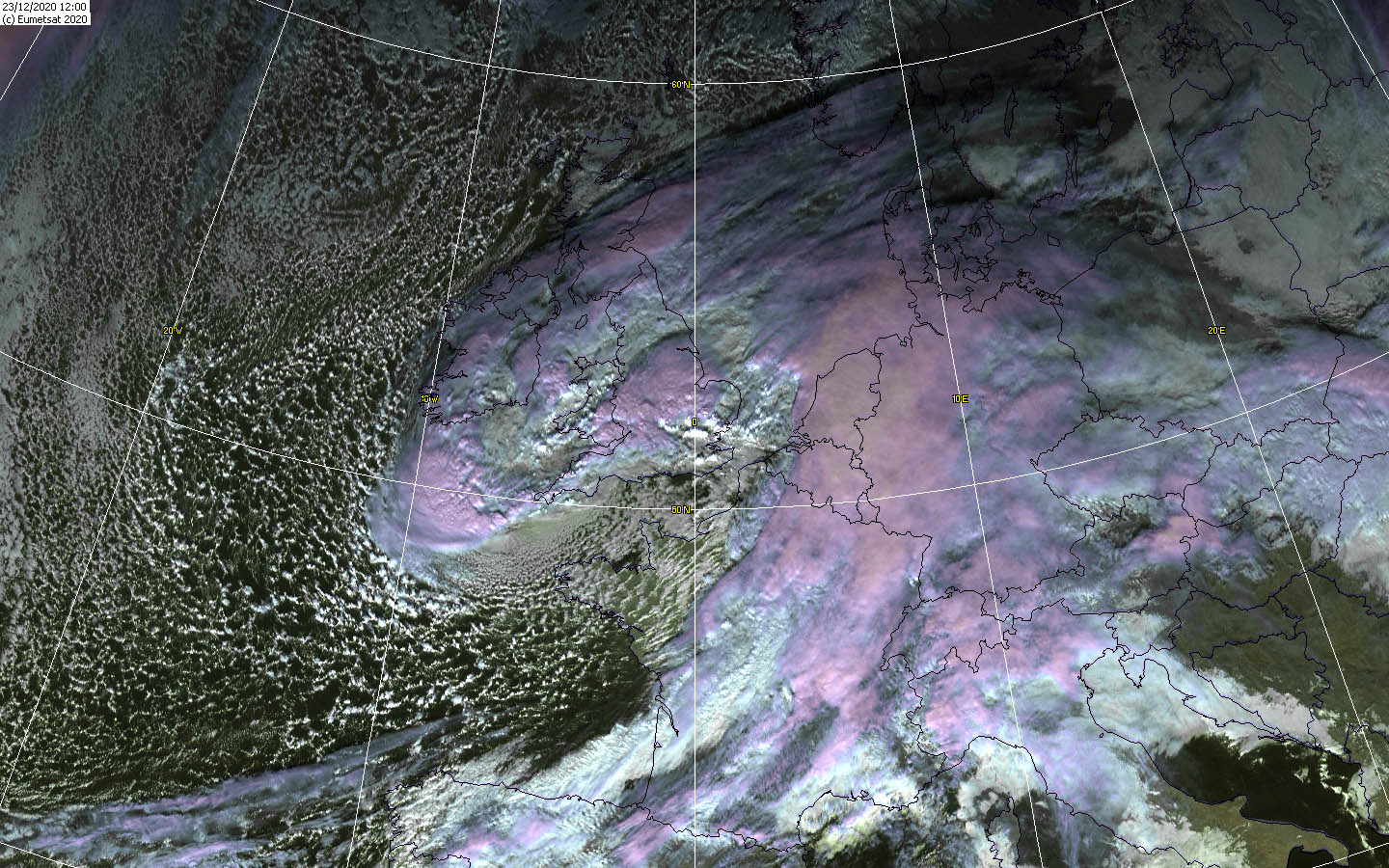
Satellite image (VIS),
23.12. 12 UTC
Data Source: Wokingham
|
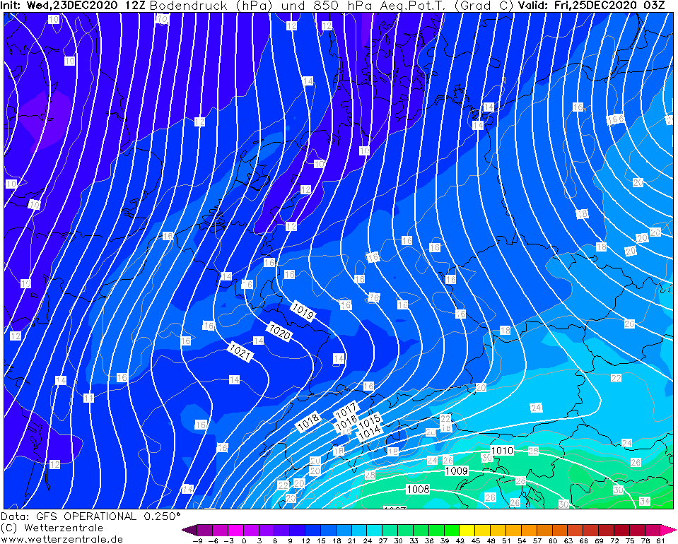
850 hPa equivalent pot. Temperature,
25.12. 03 UTC
Data Source: Wetterzentrale
|
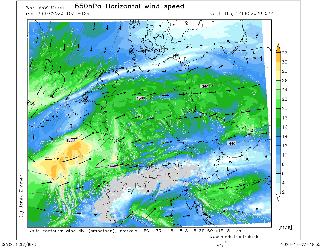
850 hPa Wind speed and direction,
Central Europe, 24.12., 03 UTC
Data Source: Modellzentrale
|
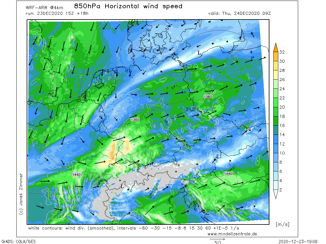
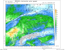
850 hPa Wind speed and direction,
Central Europe, 24.12., 09 UTC
Data Source: Modellzentrale
|
Winterstorm
Central Europe
Issued: Wednesday, 23 December 2020, 19:00 UTC
After the unusually mild weather of the past few days, it will be significantly cooler and windier. Winterstorm GRETA brings gusts of 120 km/h in France and Germany, especially at exposed locations.
23.-25.12.2020
The windstorm GRETA with its core over BeNeLux and the North Sea brings stormy and cooler weather to Central Europe. Already this afternoon,
gusts above 120 km/h (135 km/h Iraty Orgambide, 128 km/h Ouessant) were recorded in northwestern France. GRETA is a Shapiro-Keyser cyclone. As is
typical for this type of cyclone, the warm front is prominent and brought France and Germany partly heavy rainfall in the past hours.
The main storm field is located south of the core and will continue to move eastward across central France into western Germany, mainly Baden-Württemberg
and Rhineland-Palatinate, in the coming hours and during the night on Thursday. There, gusts of around 120 km/h are expected in exposed locations tomorrow
morning, and around 40-60 km/h in the lowlands. In the morning, the storm field will reach Bavaria. There, wind speeds of up to 120 km/h are also expected,
and around 50 to 60 km/h in the lowlands. Towards evening, wind speeds will then decrease to around 20-30 km/h. The low-pressure core will move over
the center of Germany to Eastern Europe. Therefore in the north of Germany, the wind will remain calm.
In addition to gale force winds, GRETA will continue to bring significant precipitation to France and Germany. This will mainly fall as
moderate rain. However, behind the first cold front on the back of the low, fresh polar air flows into Central Europe. This warms up
somewhat over the water masses of the North Sea, but the snow line begins to drop from tomorrow afternoon. In conjunction with heavier
precipitation or showers, some snowflakes may even reach the lowlands. A second cold front will make itself felt tomorrow evening,
dropping the snow line to between 600 and 300m. Here, too, the possibility is not excluded that it may snow briefly in lower altitudes
with more intense precipitation. This should be the case especially in the south of Baden-Württemberg. A wave-like structure can be seen
in the pressure field here, which will intensify the precipitation. Especially in the Black Forest and the Eastern Alb, as well as the Swabian Alb
and the Allgäu as well as the Alps, between 10 and 15 cm of fresh snow may accumulate by Friday evening. In the lowlands, the snow will not last long, as the soils
are too warm due to the mild weather of the past days.
Lothar 2.0 or even a blizzard are not expected. With this in mind, Merry Christmas and happy holidays.
Issued: December 23, 2020, 19:00 UTC
MG
Issued: December 24, 2020, 09:00 UTC
MG
|