Wednesday, 29 January 2020, 10:30 CET
|
|
|
|
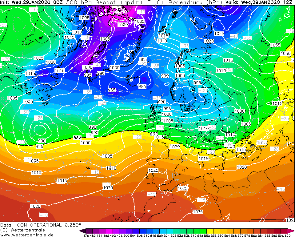
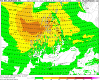
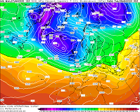
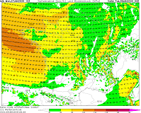
500 hPa Geopotential and
Temperature, 29.01., 12 UTC
Image Credit: Wetterzentrale
|
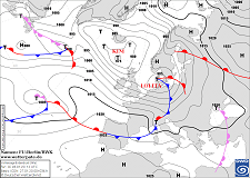
Sea level pressure and fronts, 30.01., 12 UTC
Image Credit: DWD
|
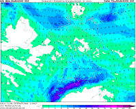
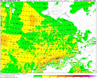
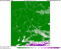
Accumulated precipitation 30.01., 00 UTC
Image Credit: Wetterzentrale
|
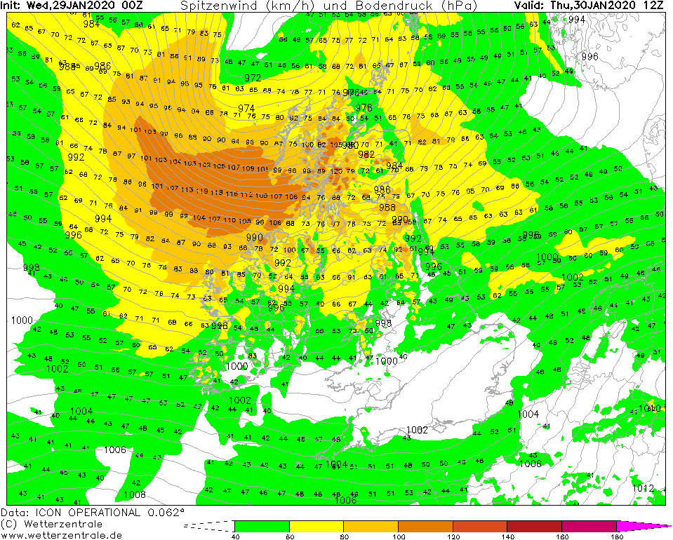
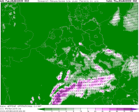
Gusts, 30.01., 12 UTC
Image Credit: Wetterzentrale
|
Winterstorm
Western and Central Europe
Issued: Wednesday, 29 January 2020, 10:30 CET
In the wake of low pressure area LOLITA cold and moist air leads to snowfall above 700 m altitude. In the northern Alps up to 50 cm of
fresh snow are possible on todays Wednesday. On Thursday low MAREILE brings stormy winds to northern Great Britain.
Jan 27 - Jan 29, 2020
At the wake of low pressure area LOLITA cold and relatively humid air continues to flow towards Central Europe. This
causes convective showers with low intensity. The snowfall line is about 500 m in the north of Germany and about 750 m
in the southern part. In the Alps, especially in the north-western region, up to 50 cm of new snow may accumulate today,
Wednesday, due to stagnant precipitation. It is possible, but unlikely, that the snow will also reach the lowlands during
heavier showers.
Tomorrow Thursday the north of Great Britain will be under the influence of Low MAREILE. In the north of Ireland and on the west
coast of Scotland there are average wind speeds of 80 kph and gusts of up to 120 kph possible. On the coast waves of up to 7 m
height have to be expected.
Tuesday, 28 January 2020, 11:30 CET
|
|
|
|
Satellite image (visible), 28.01., 08:45 UTC
Image Credit: Sat24
|
Sea level pressure and fronts, 28.01., 00 UTC
Image Credit: DWD
|
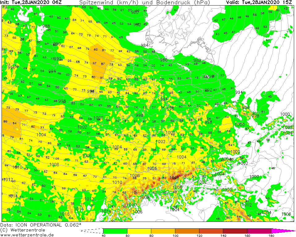
Gusts, 28.01., 15 UTC
Image Credit: Wetterzentrale
|
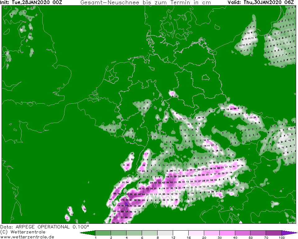
Fresh snow until 30.01., 06 UTC
Image Credit: Wetterzentrale
|
Winterstorm
Western and Central Europe
Issued: Tuesday, 28 January 2020, 11:30 CET
Low pressure area LOLITA provides wind gusts up to 100 kph on Central Europe. Precipitation of up to 100 mm can be
expected until Thursday. In the mountains there will be up to 1 m of fresh snow.
Jan 27 - Jan 29, 2020
Central Europe is currently on the front side of an extensive low pressure complex with core over Iceland with a
strong high altitude flow from southwest to west. A marginal depression called LOLITA today directs a cold front
across Central Europe. It is possible that individual thunderstorms could occur in the area of the cold front.
In addition, gusts of up to 100 kph must be expected. In exposed locations gusts of up to 140 kph are also possible.
Behind the cold front, high-altitude cold air causes the air mass to become unstable.
Tomorrow, Wednesday, a north-westerly high-altitude flow will push moist air to the north side of the Alps,
where heavy precipitation of up to 100 mm is possible. The snowfall line continues to fall. Especially in the Alps,
1m of fresh snow must be expected in the next few days. Snow can also fall in the lowlands.
Monday, 27 January 2020, 17:30 CET
|
|
|
|
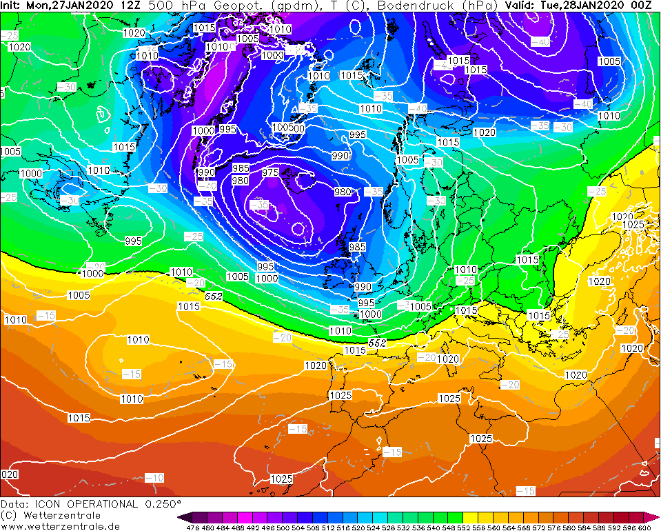
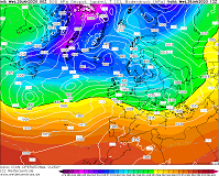
500 hPa Geopotential and
Temperature, 28.01., 00 UTC
Image Credit: Wetterzentrale
|
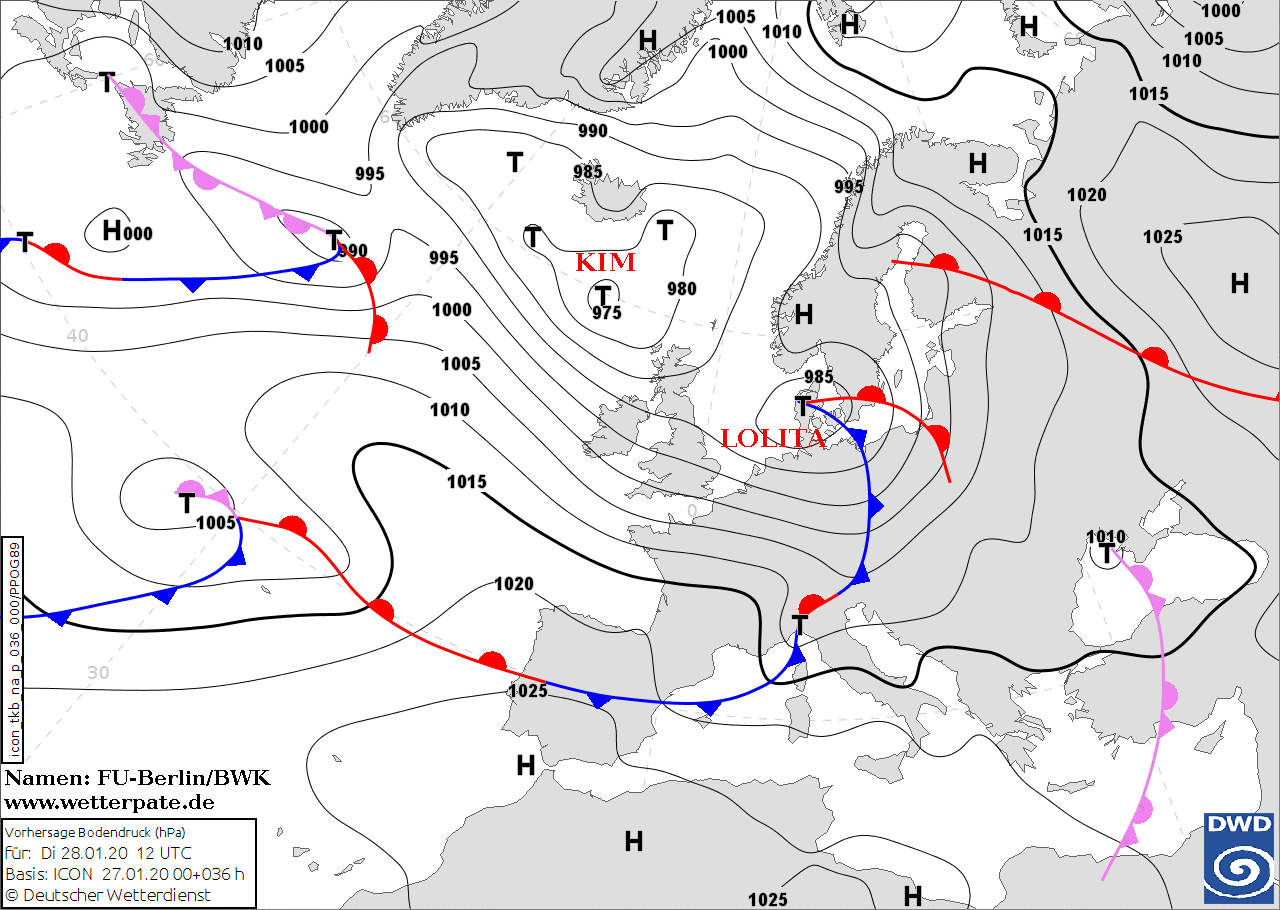
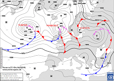
Sea level pressure and fronts, 28.01., 12 UTC
Image Credit: DWD
|
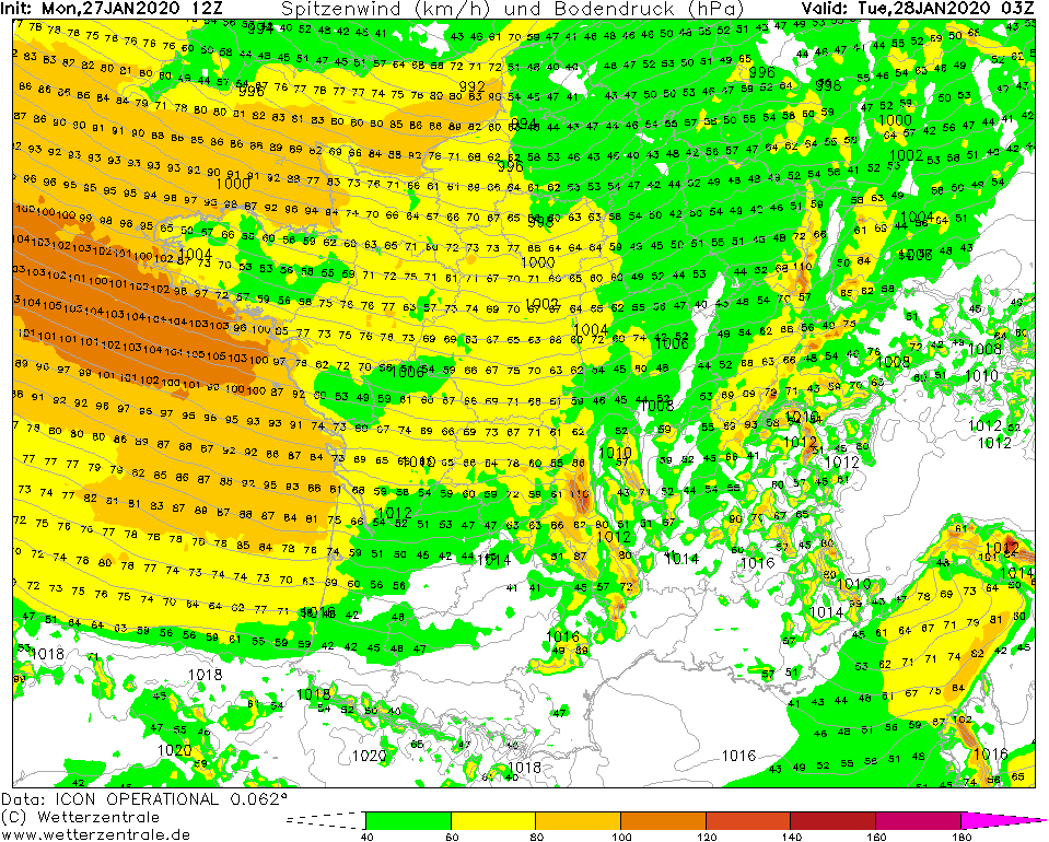
Gusts (France), 28.01., 03 UTC
Image Credit: Wetterzentrale
|
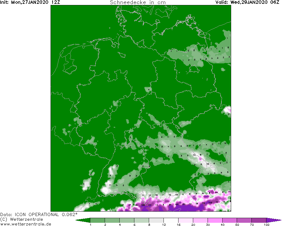
Snow depth, 29.01., 06 UTC
Image Credit: Wetterzentrale
|
Winterstorm
Western and Central Europe
Issued: Monday, 27 January 2020, 17:30 CET
Low pressure area LOLITA provides wind gusts up to 105 kph on the French Atlantic coast and in the northern Mediterranean Sea.
Precipiation of up to 50 mm possible until Tuesday evening. Decrease of snowline to 700-300 m expected.
Jan 28 - Jan 29, 2020
While warm air advection from the southwest has caused mild temperatures in Western and Central Europe today (Monday),
the inflow of colder air will begin tomorrow, Tuesday, in the area behind the trough axis.
Between the Icelandic low KIM and a widespread high air pressure reaching from the Azores over the western Mediterranean Sea,
there are significant horizontal pressure gradients. This results in stormy wind with gusts of up to 105 kph on the French
Atlantic coast during the night of Tuesday and on Tuesday morning. Similar wind speeds are also possible in the northern Mediterranean
and the Italian coast.
A significant reduction of the 850 hPa temperature from approx. +1°C to -6°C on Tuesday also increases the probability of
snowfall. The snowfall line falls to about 700 m in the south of Germany and to about 300 m in the north. In case of intensive
precipitation the snowline can also reach the lowlands.
Issued: January 27, 2019, 17:30 CET
FS
Issued: January 28, 2019, 11:30 CET
CL
Issued: January 29, 2019, 10:30 CET
FS
|