Sunday, 22 December 2019, 12:00 CET
|
|
|
|
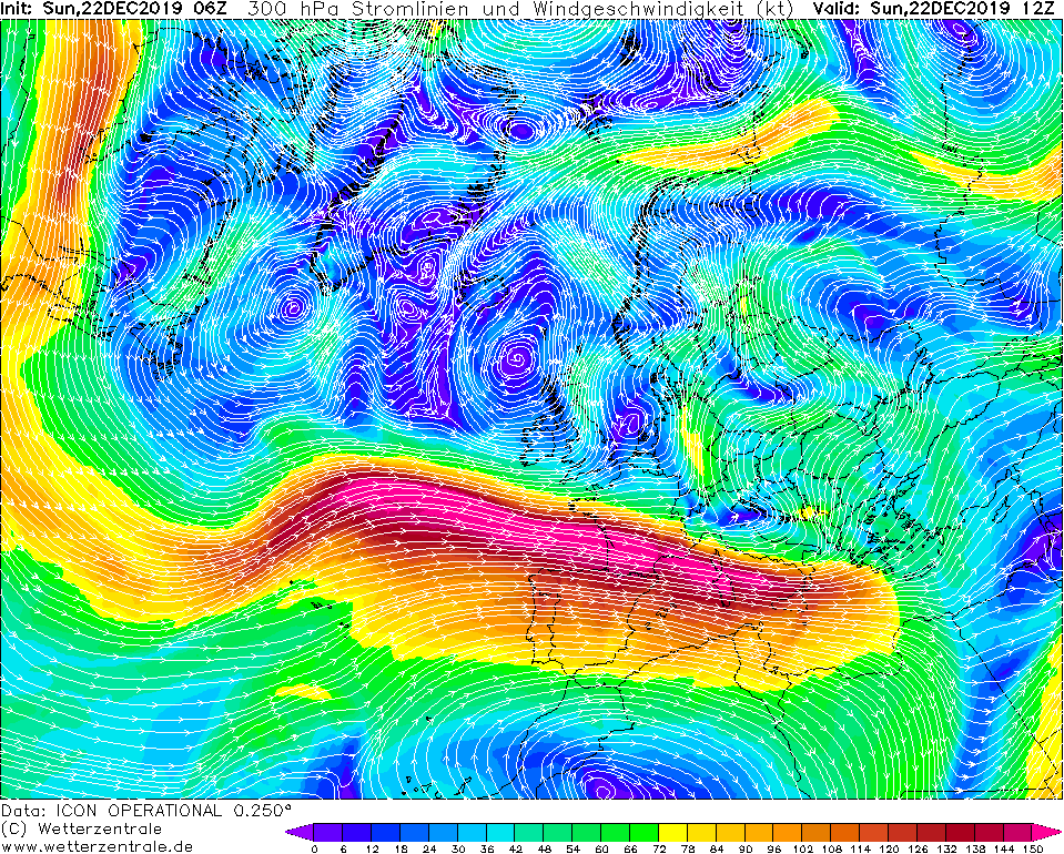
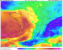
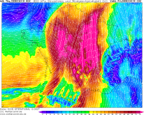
300 hPa Streamlines and Wind, 22.12., 12 UTC
Image Credit: Wetterzentrale
|
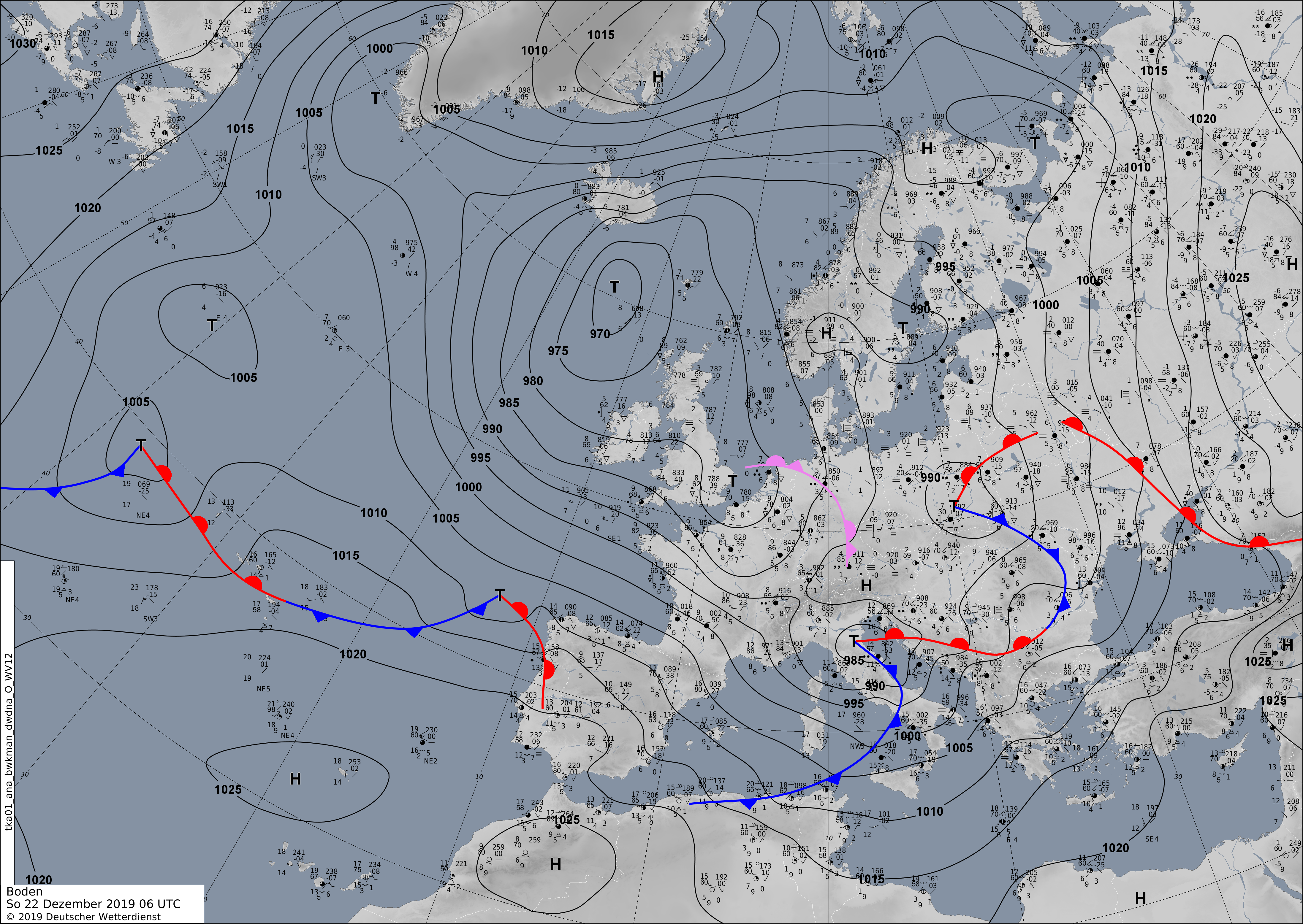
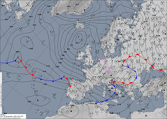
Sea level pressure and fronts, 22.12., 06 UTC
Image Credit: DWD
|
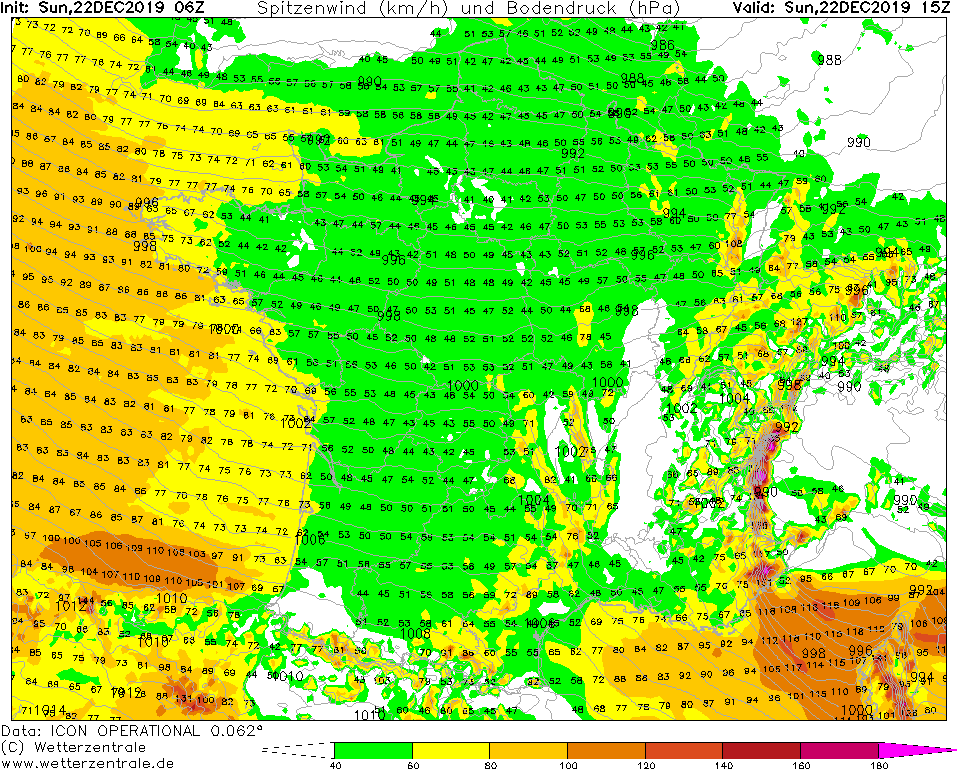
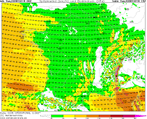
Gusts (France), 22.12., 15 UTC
Image Credit: Wetterzentrale
|
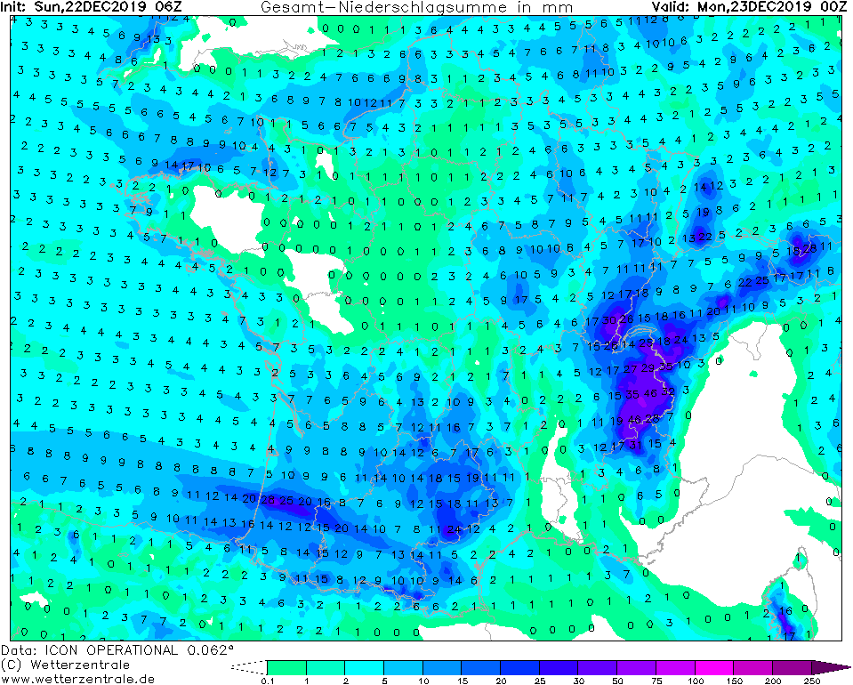
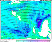
Accumulated precipitation (France) 23.12., 00 UTC
Image Credit: Wetterzentrale
|
Winterstorm
Western Europe
Issued: Saturday, 21 December 2019, 10:00 CET
In the southwestern flank of low pressure system AILTON I there are gusts of up to 110 kph. AILTON II
causes hurricane-like gusts of up to 120 kph in the north-western Mediterranean. Precipitation of up
to 60 mm is possible in the French Alps and on Corsica.
Dec 19 - Dec 23, 2019
Due to a polar cold-air trough extending from Iceland over the British Isles to north-west Germany, the polar jet, which is
visible in the 300 hPa windfield, is shifting far south over France, the Iberian Peninsula and the western Mediterranean. At
the southern edge of the zonal jet stream band there is high level divergence, which promotes the formation of low-pressure
areas. This leads to strong horizontal pressure gradients between the low pressure areas ZELIO, AILTON I and AILTON II and the
typical Azores high.
Today, especially on the Atlantic coast of France and northern Spain, stormy winds from west-northwest directions are expected.
The southern part of the Alps, which is therefore exposed to the wind almost perpendicular, provides an appropriate pattern for
orographic rain. Up to 60 mm may fall on the upwind side, locally even more.
AILTON II is located in northern Italy and causes storms in the north-western Mediterranean Sea with gusts of up to 120 kph. On
the mountainous island of Corsica (Monte Cinto - 2706 m) this also causes orographic rain up to 60 mm.
Saturday, 21 December 2019, 10:00 CET
|
|
|
|
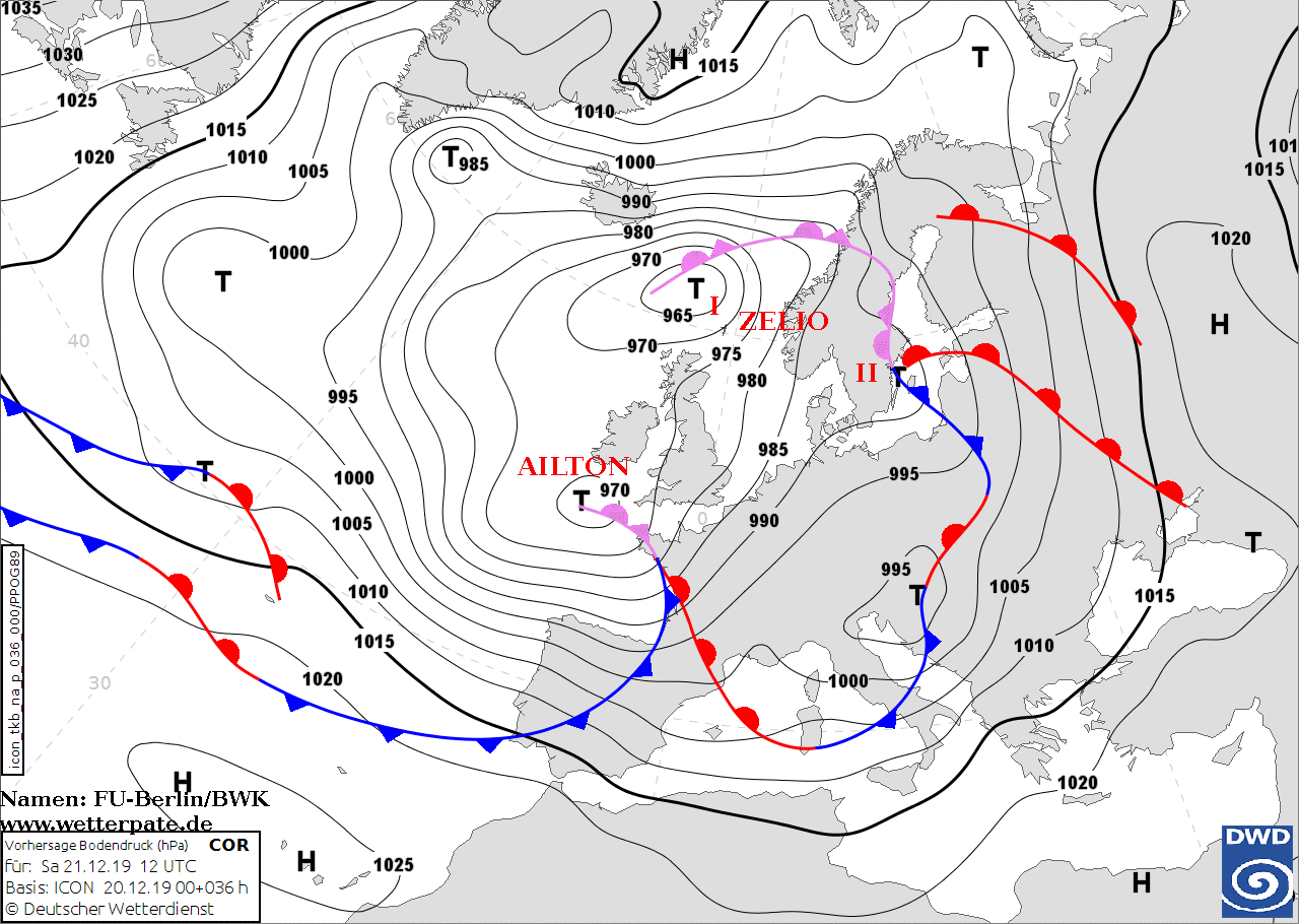
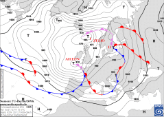
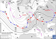
Sea level pressure and fronts, 21.12., 12 UTC
Image Credit: FU-Berlin/DWD
|
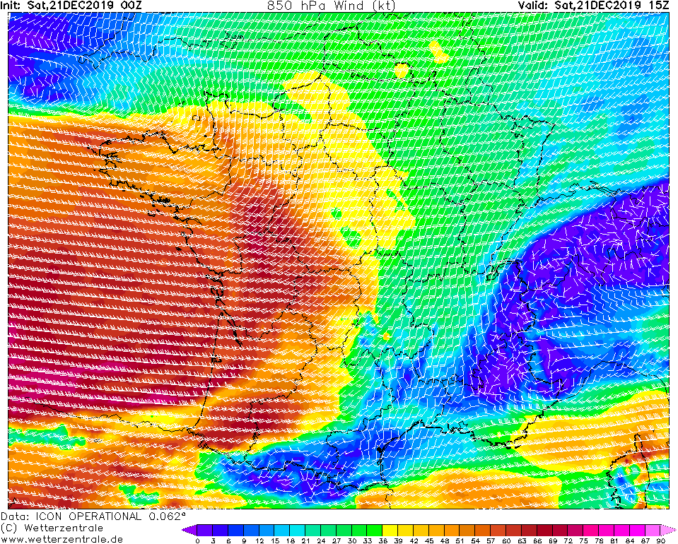
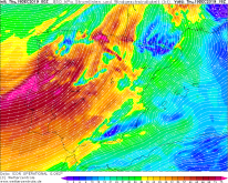
850 hPa Wind France, 21.12., 15 UTC
Image Credit: Wetterzentrale
|
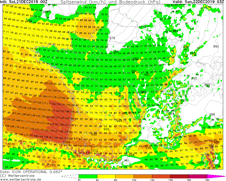
Gusts over France, 22.12., 03 UTC
Image Credit: Wetterzentrale
|
48h precipitation in France till 23.12., 00 UTC
Image Credit: Wetterzentrale
|
Winterstorm AILTON
Western Europe
Issued: Saturday, 21 December 2019, 10:00 CET
Winter storm ZELIO is followed now by AILTON, which will cause gusts of up to 140 km/h on the French coast from this afternoon.
Tomorrow, heavy precipitation, especially in the mountainous areas of France, will begin.
Dec 19 - Dec 23, 2019
At present, winter storms repeatedly reach Central Europe. After ZELIO has moved on towards Scandinavia, the next
low called AILTON is already following. Today, with a predicted core pressure of 970 hPa at 12 UTC, the low will
continue to move eastwards. Today at 12 UTC, AILTON is in the area of Great Britain and Northwest France. On its
southern flank, gusts are occurring from noon today on the west coast of France. In the night from Saturday to
Sunday, the low pressure area intensifies and gusts up to 140 km/h are reached on the coast of France. In exposed
locations even stronger gusts can occur. In addition to the wind, heavy precipitation poses a danger. Especially
on Sunday, heavy precipitation will occur in the Massif Central and the Alps. There, 50 mm precipitation can fall
within 12 hours. In the high altitudes, the precipitation falls as snow.
A storm surge is expected on the French coast from this afternoon. These strong gusts of wind can also uproot
trees and damage the infrastructure. Flooding may also occur. In the higher altitudes, the danger of avalanches
is rising sharply due to fresh snow.
Thursday, 19 December 2019, 09:00 CET
|
|
|
|
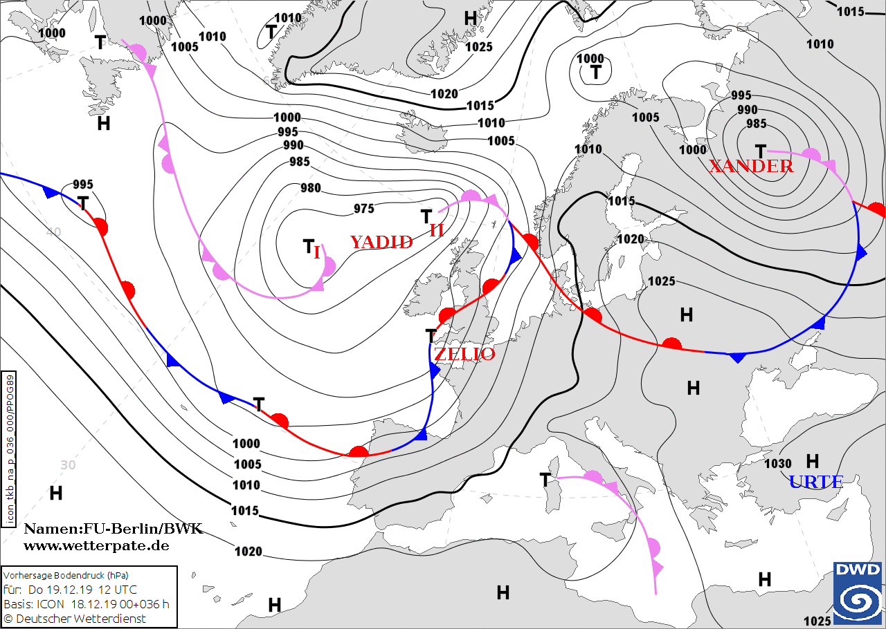
Sea level pressure and fronts, 19.12., 12 UTC
Image Credit: FU-Berlin/DWD
|
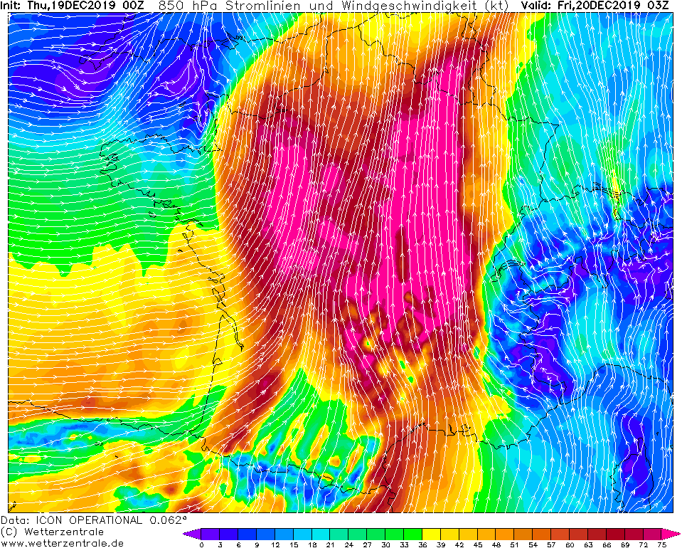
850 hPa Wind and Streamslines over
France, 20.12., 03 UTC
Image Credit: Wetterzentrale
|
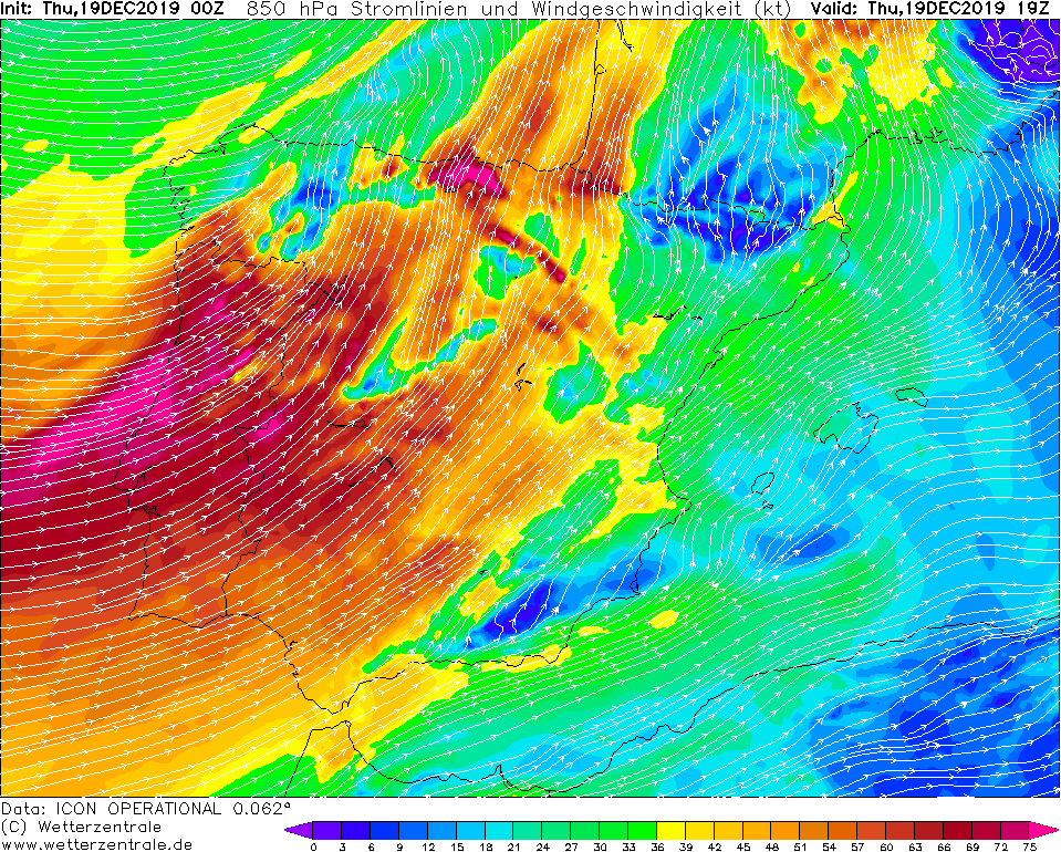
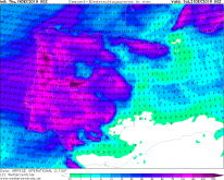
850 hPa Wind and Streamslines over
Spain/Portugal, 19.12., 19 UTC
Image Credit: Wetterzentrale
|
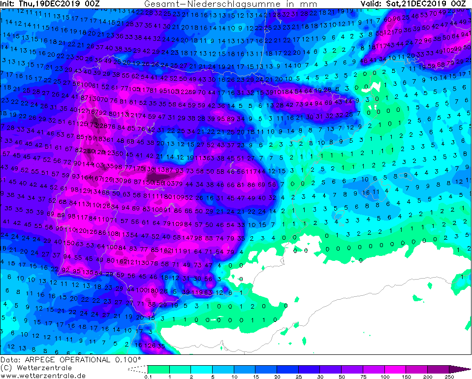
48h precipitation Spain/Portugal
till 21.12., 00 UTC
Image Credit: Wetterzentrale
|
Winterstorm ZELIO
Central Europe, South Europe
Issued: Thursday, 19 December 2019, 09:00 CET
The winterstorm series does not stop in Europe at the moment. Last night the storm low YADID caused gusts up to 194 kph in Great Britain. Along its front system
further low pressure areas will reach Europe and will cause gusts of around 140 kph and accumulated precipitation of 250 mm.
Dec 19 - Dec 23, 2019
At the moment one winterstorm follows the next. Low YADID caused gusts up to 194 kph in Great Britain tonight (Cairngorm). YADID will stay in the next days at Great
Britain on the Atlantic and becomes the controlling central low. The weather calm down here, but not in Europe. Several boundary lows develop along the front system,
which will cause stormy and rainy weather in the next few days. The start is made by low ZELIO.
ZELIO develops over the course of the day and moves across the English Channel to Ireland. Its core pressure drops to 982 hPa and its storm field weakens rapidly.
On the coasts and in exposed locations, gusts of up to 120 kph are expected.
In the afternoon, a second low, probably called ZELIO II, with a core pressure of 988 hPa, hits Portugal and Spain and causes gusts of up to 100 kph, in exposed
locations gusts of up to 140 kph are possible. The warm and humid air is carried from the Atlantic to the mainland by the west wind. This results in accumulated
precipitation. Up to 150 mm are expected in the next 48 hours. Locally these precipitation amounts can reach up to 250 mm or even higher.
ZELIO II shifts to France on Friday night and provides gusts of up to 140 kph. In the southeast there is also accumulated precipitation of up to 140 mm. In northern
Italy, too, rainfall of up to 140 mm must be expected.
The next storm low develops from Saturday to Sunday and hits France. It causes gusts of up to 140 kph and storm surges. Due to the favourable location in the
jet stream, a rapid intensification is to be expected. This low will shift towards the Mediterranean Sea and will also cause gusts of up to 140 kph in Italy.
Meanwhile in Scandinavia the storm low XANDER and later low ZELIO provides blizzard similar conditions. On the coasts winds up to 100 kph occur and accumulated
precipitaion mainly in the form of snow also occurs. Until Saturday, quantities around 50 mm (snow amounts of 30 to 45cm) are calculated,
locally these can be higher.
In the affected areas, floods occure, which will be intensified on the coasts by storm surges due to strongs winds.
Falling trees and falling branches can cause damage to buildings and
cars. Because of the persistent storm situation, traffic disruptions must be expected in the affected regions, as well as delays and cancellations
in public transport as well as power cuts.
In Scandinavia the severe winds and heavy snowfall will lead to dangerous blizzard conditions, snow drifts and difficult driving conditions.
Some roads might become impassable.
Issued: December 19, 2019, 09:00 CET
MG
Issued: December 21, 2019, 10:00 CET
CL
Issued: December 22, 2019, 12:00 CET
FS
|