Sunday, 24 November 2019, 11:30 CET
|
|
|
|
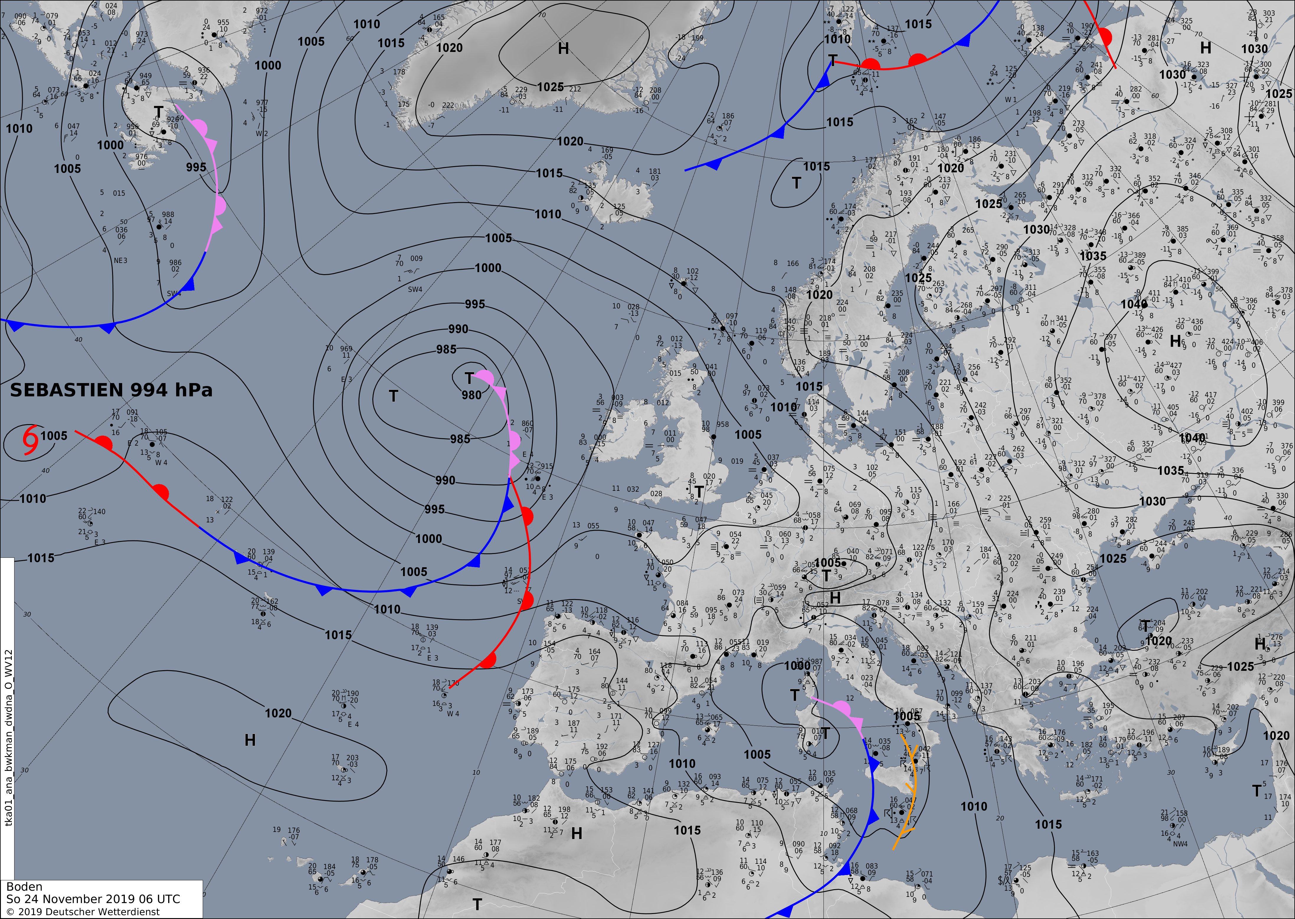
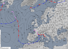
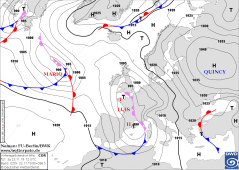
Soil pressure and fronts, 24.11., 06 UTC
Image Credit: DWD
|
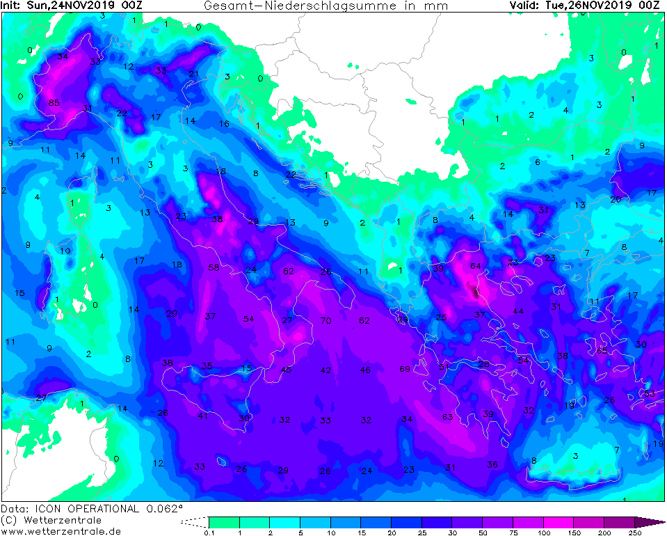
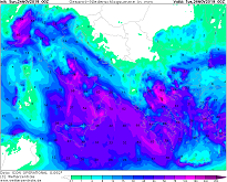
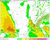
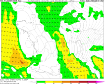
Accumulated precipitaion until 26.11, 00 UTC
Image Credit: Wetterzentrale
|
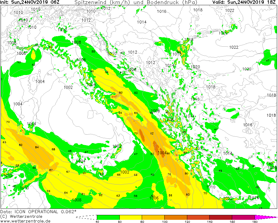
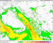
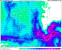
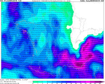
Gusts (kph), 24.11, 18 UTC
Image Credit: Wetterzentrale
|
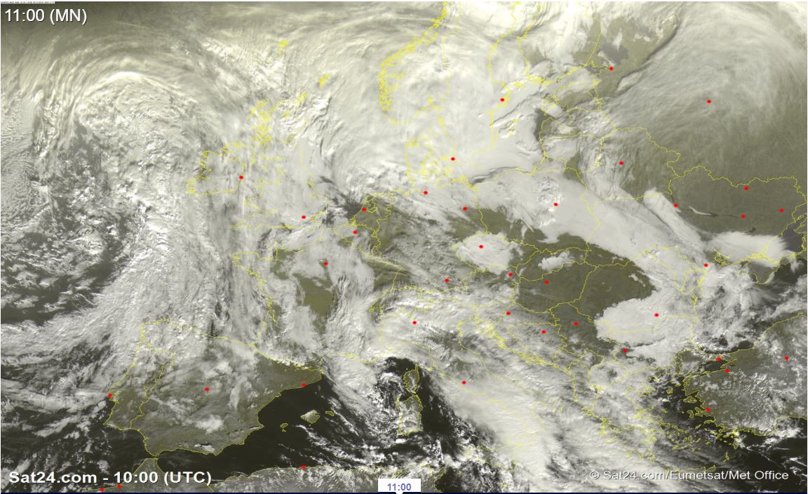
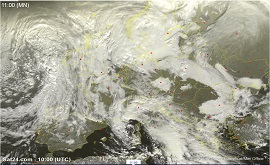
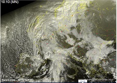
Satellite image (visible), 24.11., 10 UTC
Image Credit: Sat24
|
Heavy precipitation, storm
France, Italy, Balkan, Adriatic Sea, Greece
Issued: Sunday, 24 November 2019, 11:30 CET
LUIS II is located above the open Mediterranean Sea and provides peak gusts of up to 110 kph. Today rainfall
of up to 60 mm/24h in Italy and Sicily. Tomorrow similar total amounts in the south of Greece and on the Ionian islands.
22.-24.11 2019
Whereas the low pressure area LUIS I is located above the English Channel and is hardly noticeable any more, LUIS II
has moved to the western Mediterranean. The centre is currently a few kilometres west of Corsica and still has a pressure
of less than 1000 hPa. Wind speeds of up to 75 kph occur at the front cold front, up to 110 kph in gusts. Gusts of up to
95 kph are also possible at the wake of the front, i.e. in the cold air section.
Positive layer thickness advection causes strong lifting at the front of the system. On Sicily and in the south of Italy
precipitation of up to 60 mm/24h occurs today. The precipitation continues tomorrow Monday and shifts further in the
direction of Greece. In the south of the country and on the Ionian islands tomorrow also up to 60 mm/24 can fall.
Saturday, 23 November 2019, 10:30 CET
|
|
|
|
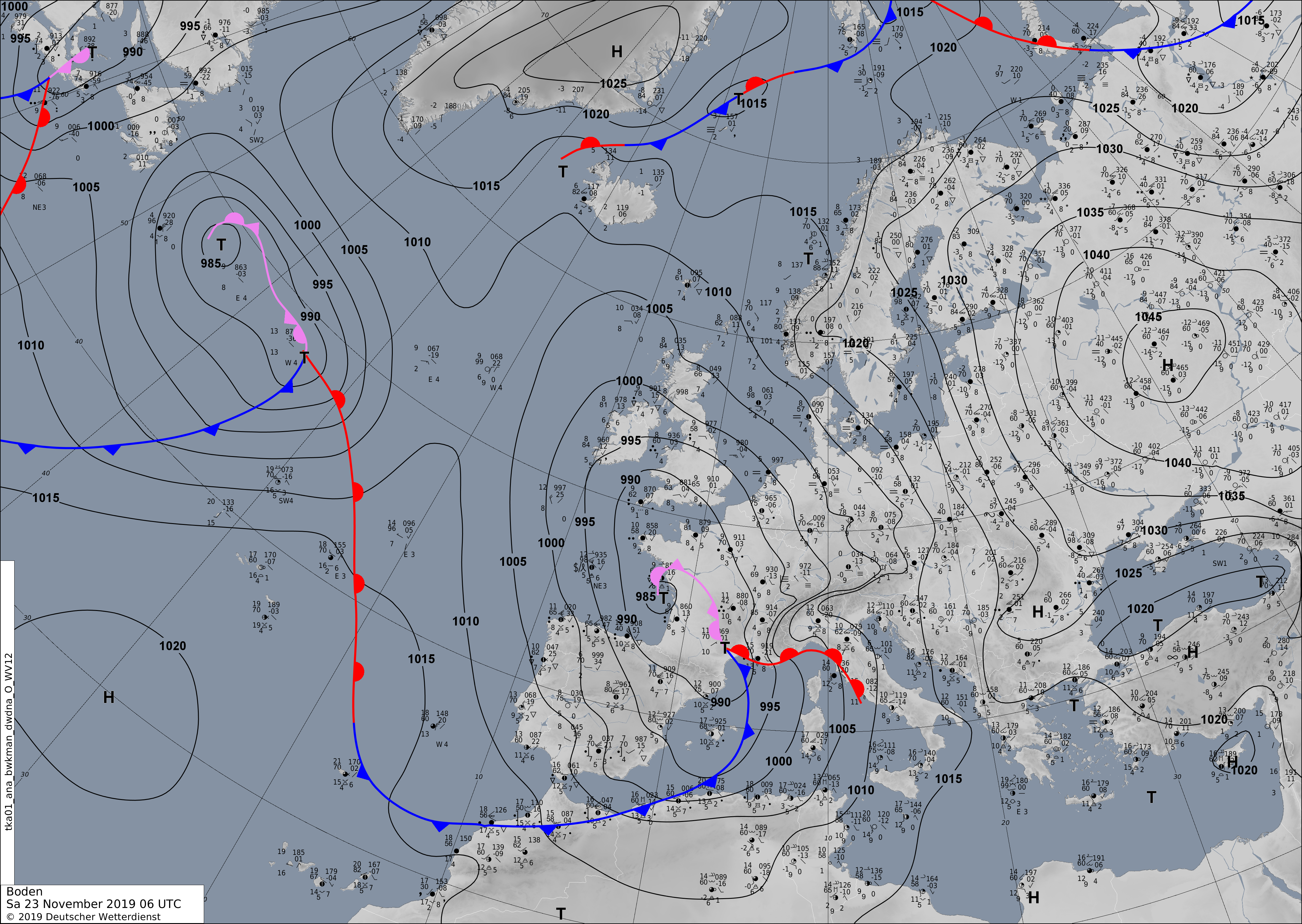
Soil pressure and fronts, 23.11., 06 UTC
Image Credit: DWD
|
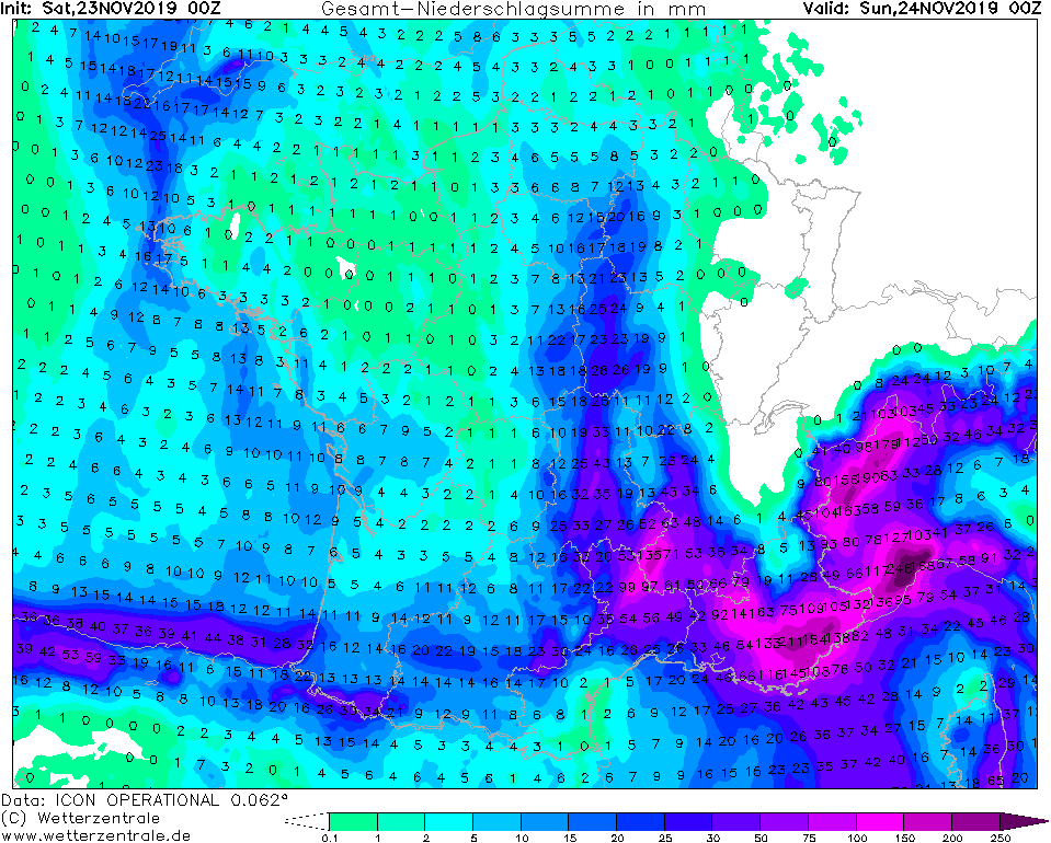
Accumulated precipitaion until 24.11, 00 UTC
Image Credit: Wetterzentrale
|
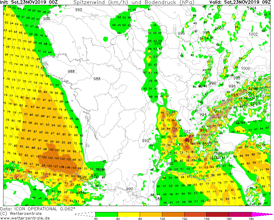
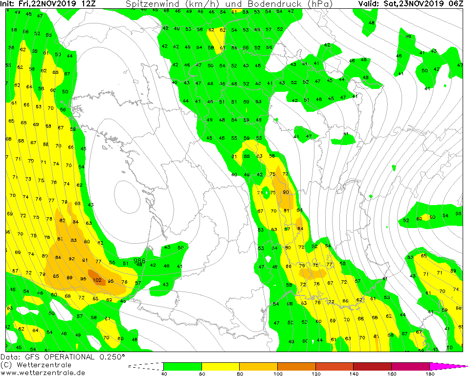
Gusts (kph), 23.11, 09 UTC
Image Credit: Wetterzentrale
|
Satellite image (visible), 24.11., 09 UTC
Image Credit: Sat24
|
Heavy precipitation, storm
France, Italy, Balkan, Adriatic Sea, Greece
Issued: Saturday, 23 November 2019, 10:30 CET
Two low pressure areas over France lead to strong winds in France an the western Mediterranean. Gusts up to
125 kph expected, in exposed areas up to 140 kph. On the south side of the Alps precipitation of 100 mm/24 is expected.
Orography may lead to much higher values, locally up to 300 mm/24 possible.
22.-24.11 2019
Low pressure area LUIS II is currently located above the southeast coast of France at the boundary to the Mediterranean
Sea. LUIS I is located about 500km northwest on the French Atlantic coast. The two systems create a low-pressure ridge
with a pressure of less than 980 hPa and lead to high horizontal pressure gradients over France and the western Mediterranean.
To the south, wind speeds of up to 80 kph occur, in gusts up to 125 kph. On the mountain tops of the Pyrenees up to 140 kph
are possible.
Furthermore, at the front of LUIS II there is strong uplift and associated precipitation. On the French-Italian
border and in southern Switzerland, up to 100 mm of precipitation is possible today on Saturday. Due to orographic rain,
local precipitation can be significantly higher, up to 300 mm.
Friday, 22 November 2019, 21:00 CET
|
|
|

|
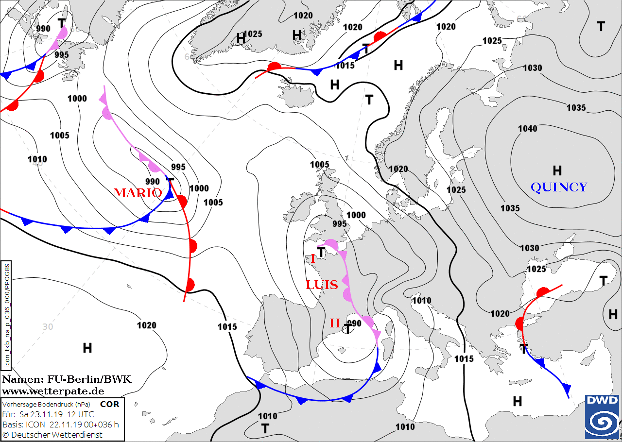
Soil pressure and fronts, 23.06., 12 UTC
Image Credit: FU Berlin
|
Accumulated precipitaion until 24.11, 00 UTC
Image Credit: Wetterzentrale
|
Gusts (kph), 23.11, 06 UTC
Image Credit: Wetterzentrale
|
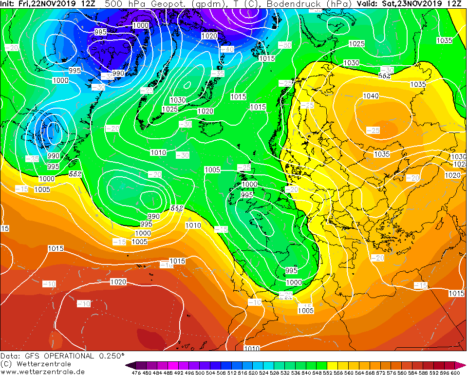
500 hPa Geopot. and SLP, 23.11., 12 UTC
Image Credit: Wetterzentrale
|
Heavy precipitation
France, Italy, Balkan, Adriatic Sea, Greece
Issued: Friday, 22 November 2019, 21:00 CET
A cut off low forms on tomorrow's Saturday and moves towards the Mediterranean. Rainfall of up to 240 mm is expected by
Saturday evening. Also storm gusts of up to 120 kph are possible.
22.-24.11 2019
Low LUIS is currently over the Bay of Biscay and will reach the French coast tomorrow. A cut off low is formed,
which crosses the Mediterranean Sea. On Saturday, the high-altitude air flow turns southwards to southeast
in Switzerland. On the southern side of the Alps, humid air from the Mediterranean reaches the mountains,
causing stagnant precipitation. Until Saturday evening, up to 240 mm precipitation can fall in congested
areas in the southeast of France, Switzerland and parts of Italy. The island of Kefalonia in Greece is
also affected by the precipitation. In the higher altitudes precipitation falls as snow. The foehn also
increases and reaches up to 100 kph in gusts. In exposed locations gusts of up to 120 kph are also possible.
Floods and damage to the infrastructure can occur in the affected areas. Avalanches can also be expected in
the high altitudes.
Issued: November 22, 2019, 21:00 CET
CL
Issued: November 23, 2019, 10:30 CET
FS
Issued: November 24, 2019, 11:30 CET
FS
|