Sunday, 17 November 2019, 09:00 CET
|
|
|

|
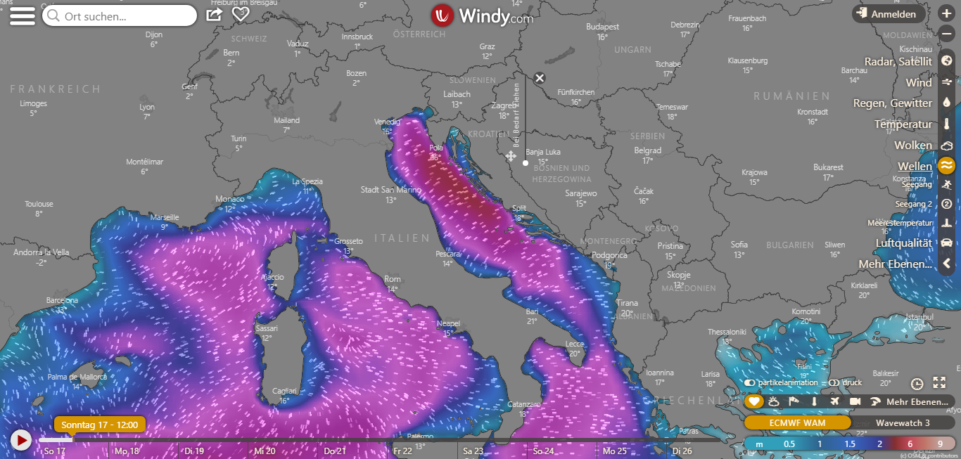
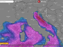
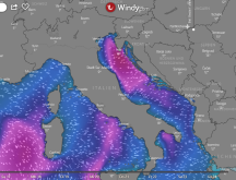
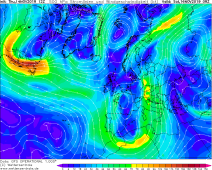
Wave Height, Nov 17, 12 UTC
Image Credit: Windy
|
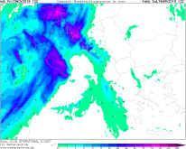
Accumulated precipitaion until Nov 17, 21 UTC
Image Credit: Wetterzentrale
|
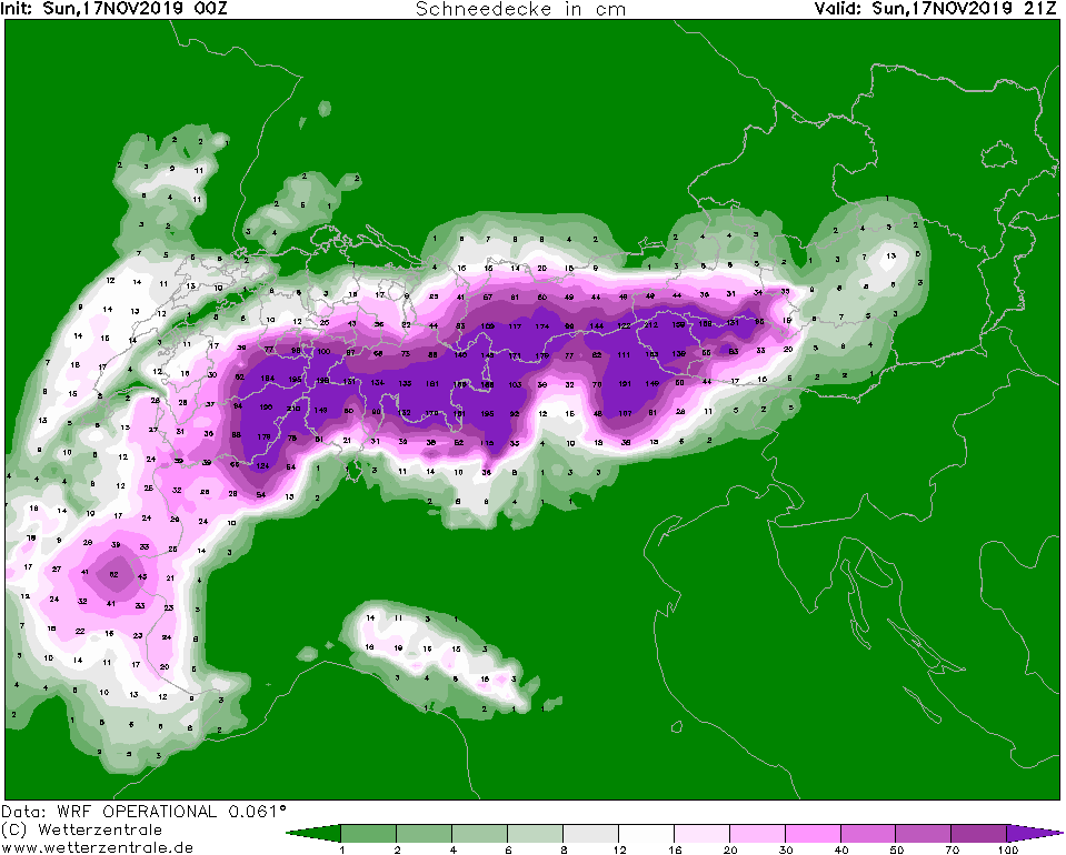
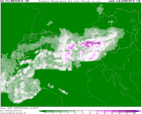
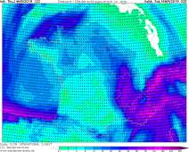
Snow height until Nov 17, 21 UTC
Image Credit: Wetterzentrale
|
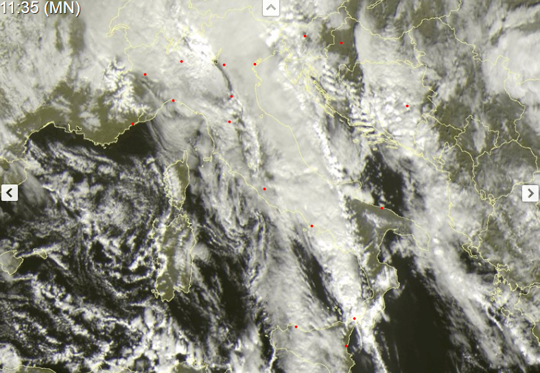
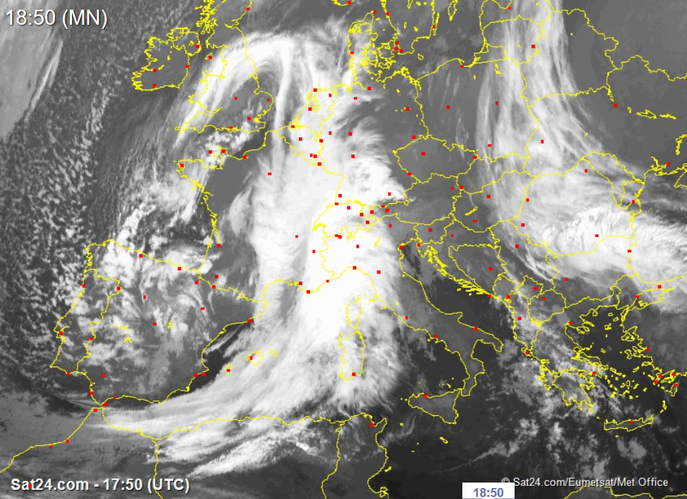
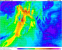
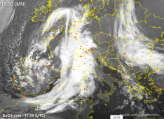
Satellite iamges (visible), Nov 17, 10:35 UTC
Image Credit: Sat24
|
Heavy precipitation
Alps, Italy, Balkan, Adriatic Sea
Issued: Sunday, 17 November 2019, 09:00 CET
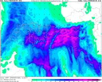
The cut off low is now above Italy and is shifting towards the northeast to Germany. There is a congestion of air masses on the south side of the Alps, which
means that rainfall of up to 130 mm is calculated today till 21 UTC. In Croatia, gusts of up to 135 kph must be expected.
Nov 14-Nov 17, 2019
In the course of the day, the cut off low quickly crosses the Alps and reaches the southeast of Germany in the afternoon. Due to the congestion of the air masses
on the south side of the Alps, severe precipitation of up to 60 mm continues on the Adriatic coast. Due to the strong winds the floods are intensified by wave
heights up to 6m.
In Croatia, severe precipitation and thunderstorms must also continue to be expected. Rain amonts of up to 70 mm are possible till Sunday evening. Gusts of
about 90 kph must be expected. On the coasts gusts of around 135 kph and storm surges must be expected. Warnings are also active here. Power outages and traffic
interruptions must be expected, as well as damage to buildings and infrastructure. Ship traffic is also affected.
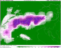
In Austria especially in Tyrol and East Tyrol accumulated precipitation of up to 130 mm expected and about 50cm fresh snow till Sunday evening are possible.
Warnings are already active. Gusts up to 130 kph are possible as well. There is also a low probability of thunderstorms.
Friday, 15 November 2019, 18:00 CET
|
|
|
|
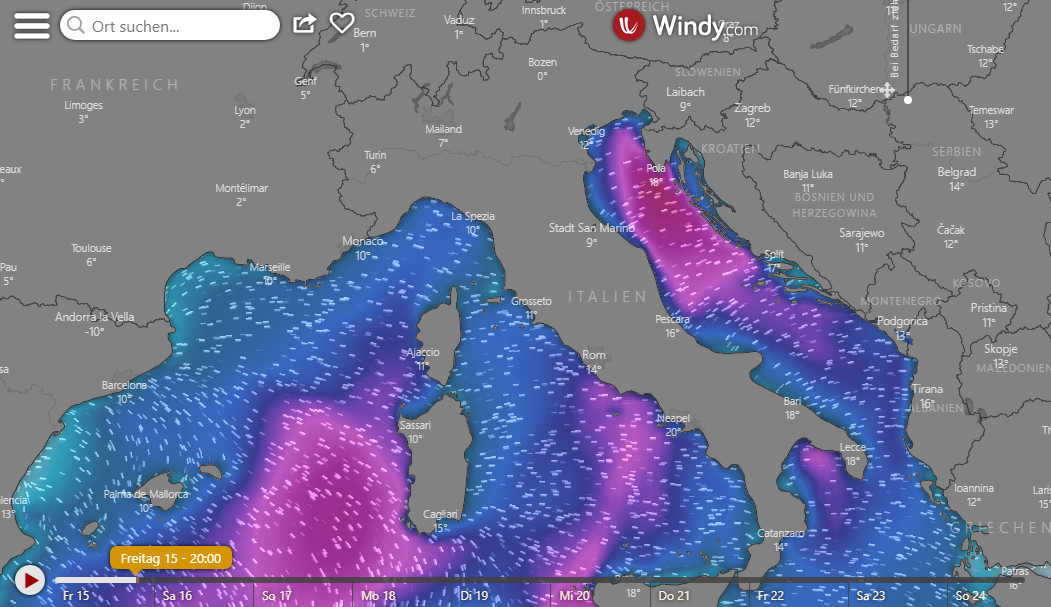
Wave Height, Nov 15, 20 UTC
Image Credit: Windy
|
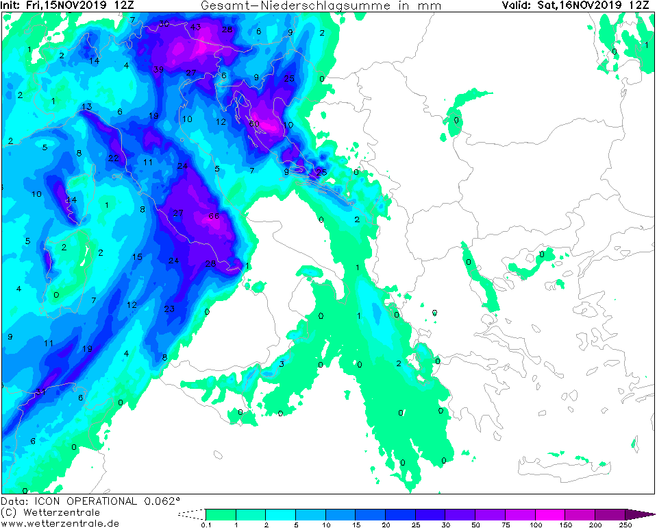
Accumulated precipitaion until Nov 16, 12 UTC
Image Credit: Wetterzentrale
|
Accumulated fresh snow until Nov 16, 12 UTC
Image Credit: Wetterzentrale
|
850 hPa Wind, Nov 15, 18 UTC
Image Credit: Wetterzentrale
|
Heavy precipitation
France, Italy, Balkan, Adriatic Sea
Issued: Friday, 15 November 2019, 18:00 CET
A new cut off low has formed today over the Mediterranean Sea and brings severe precipitation again especially to the Adriatic coast and Croatia.
Rainfall of up to 100mm are expected in till Saturday afternoon.
Nov 14- Nov 17, 2019
Already on Tuesday and Wednesday Medicane TRUDY crossed the Mediterranean and brought heavy rain, which caused major flooding in Venice.
Today a new cut off low and its thunderstorms front has formed and brings new torrential rainfall in the area of the Adriatic coast. In addition, there is
stormy wind, which intensifies the tide and raises the waves height. Venice is still in a state of emergency and rainfall of over 100mm is expected there until
tomorrow. Some of the ships traffic is still at a standstill.
Also in Switzerland and Austria, as well as in Tyrol fresh snow quantities of over 50cm are expected. Some of the trees are still covered with leaves and cannot
withstand the weight of the fresh snow. Traffic disruptions must be expected. The danger of avalanches is also increasing and some ski areas/pistes have been closed
today.
Thursday, 14 November 2019, 20:00 CET
|
|
|
|
Satellite Images (infrared), 14.11
Image Credit: Sat24
|
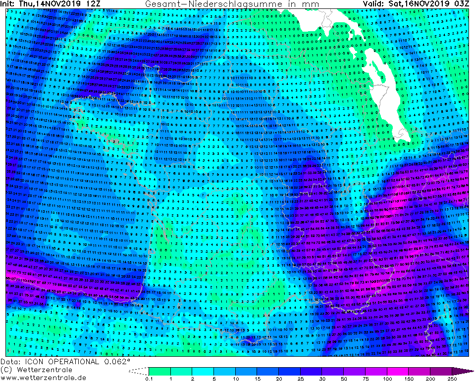
Accumulated precipitaion until 16.11, 03 UTC
Image Credit: Wetterzentrale
|
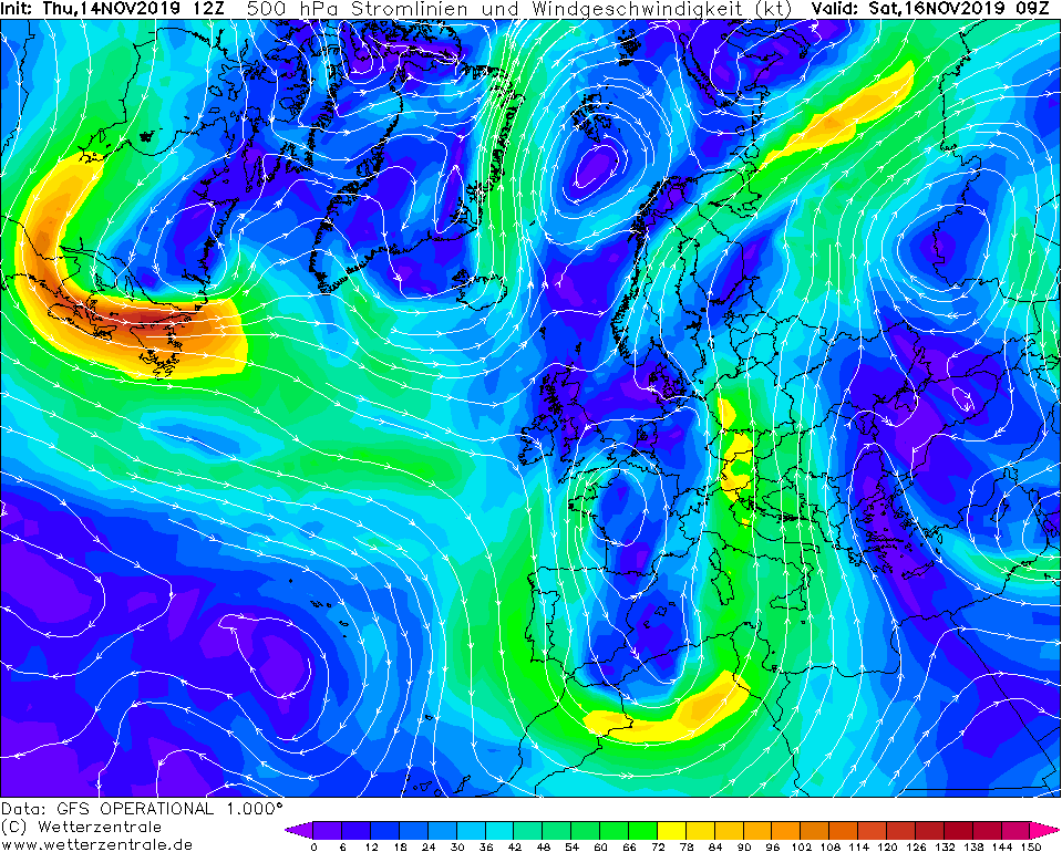
500 hPa Streamline (kt), 16.11, 09 UTC
Image Credit: Wetterzentrale
|
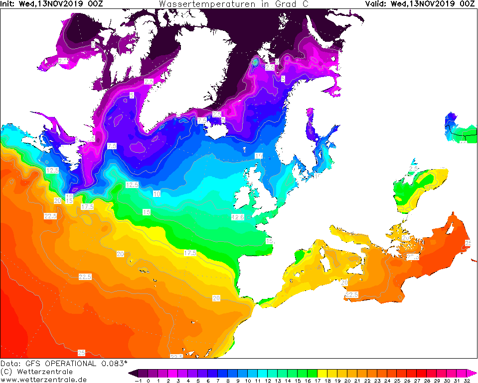
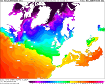
SST November 14, 00 UTC
Image Credit: Wetterzentrale
|
Heavy precipitation
France, Italy, Balkan, Adriatic Sea
Issued: Tursday, 14 November 2019, 20:00 CET
A cut off low forms on tomorrow's Friday and moves towards the Mediterranean. Rainfall of up to 100 mm is expected by
Friday evening. Also storm gusts of up to 120 kph are possible.
14.-17.11 2019
After Medicane TRUDY, a new depression called GÜNTHER II is moving towards the Mediterrenean Sea.
Currently there is a huge trough with a very low 500 hPa geopotential over Europe. In the night to
Friday, a new low is cut off from the low pressure complex. Tomorrow, Friday, the depression will
move further in the direction of the Mediterranean Sea and could develop into a Medicane again. At
the moment this is still uncertain. What is certain is that there will be heavy precipitation in the
southeast of France, Italy and the Balkans. This could result in rainfall of up to 100 mm by Friday
morning. The pressure gradient will increase and therefore wind gusts of up to 120 kph must be expected.
At the mountains it comes again to stagnation precipitation, so that there is to be counted on floods.
There may also be landslides. At higher altitudes there is heavy snowfall and up to 1 m of fresh snow
can be expected.
Issued: November 14, 2019, 20:00 CET
CL
Issued: November 15, 2019, 18:00 CET
MG
Issued: November 17, 2019, 09:00 CET
MG
|