Friday, 25 October 2019, 10:30 CET
|

|
|
|
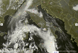
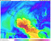
Satellite image (visible), 25.10., 07:55 UTC
Image Credit: Sat24
|
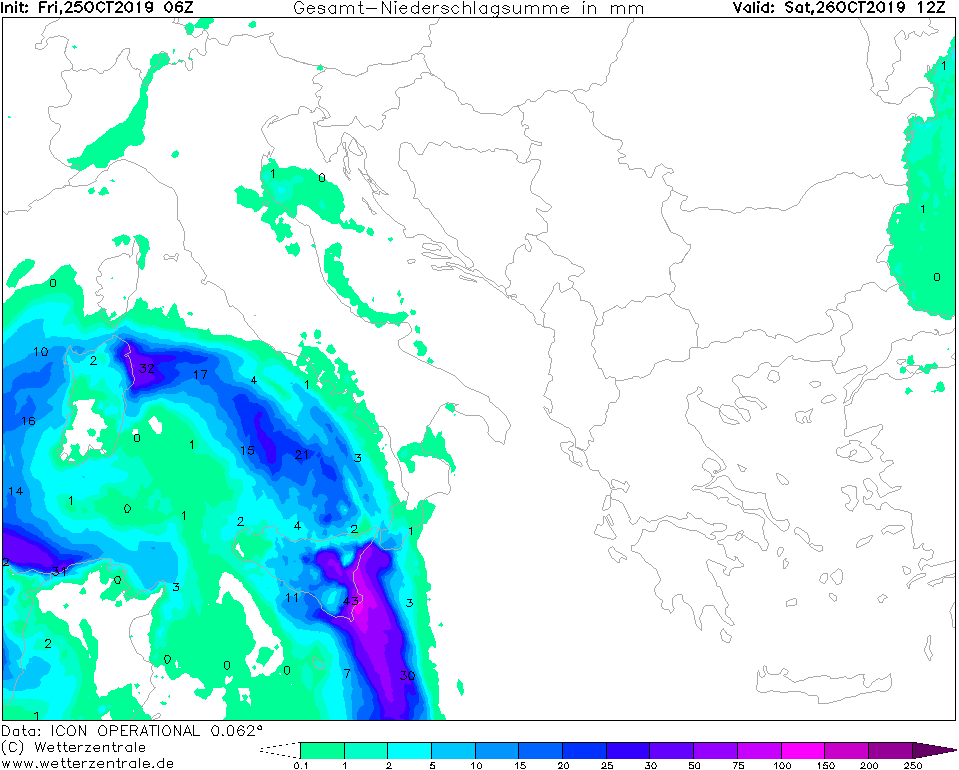
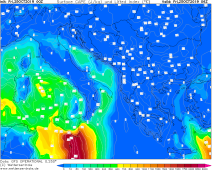
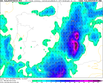
30 hours Accumulated precipitation, 26.10., 12 UTC
Image Credit: Wetterzentrale
|
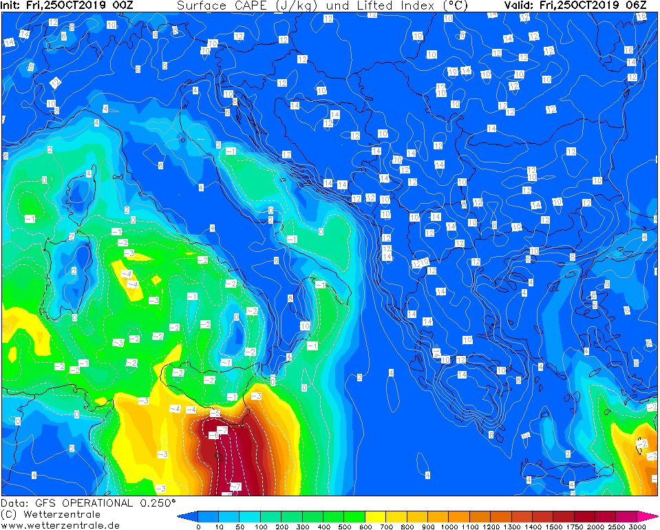
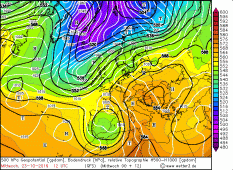
CAPE, 25.10., 06 UTC
Image Credit: Wetterzentrale
|
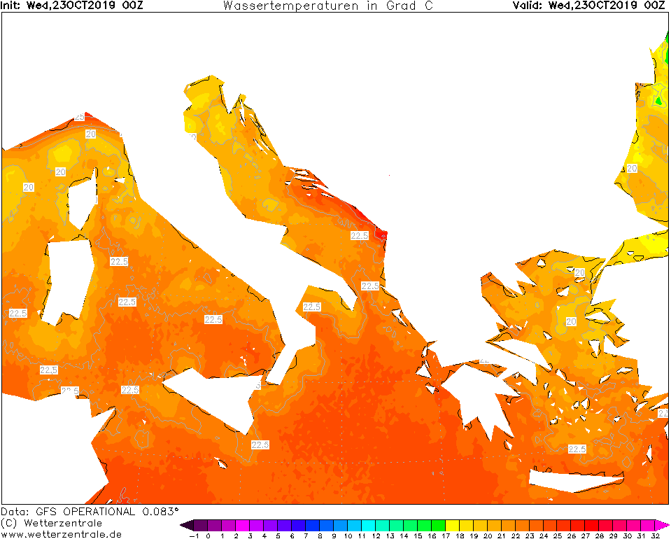
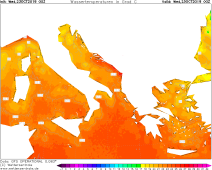
SST, 23.10., 00 UTC
Image Credit: Wetterzentrale
|
Thunderstorm, heavy rain
Eastern Spain, Balearic Islands, Southern France, Italy
Issued: Friday, 25 October 2019, 10:30 CET
The cut off low that formed last weekend is still active. It is located over the Mediterranean Sea south of Sicily.
In the next couple of hours, rainfall of up to 150 mm has to be expected.
21 Oct - 23 Oct 2019
Along the front severe thunderstorms are still active and has reached Sicily. The thunderstorms also move very little due to the slow speed
of displacement. Heavy precipitation, lightningstrikes and flooding must be expected. In the next 30 hours, rainfall of up to 150 mm must be expected.
Locally, however, these can also be higher.
The cut off low remains longer on the Mediterranean Sea and partly shifts back to the southwest. Due to the high sea surface temperatures
there is still the possibility that it will develop into a medicane.
Wednesday, 23 October 2019, 10:30 CET
|
|

|
|
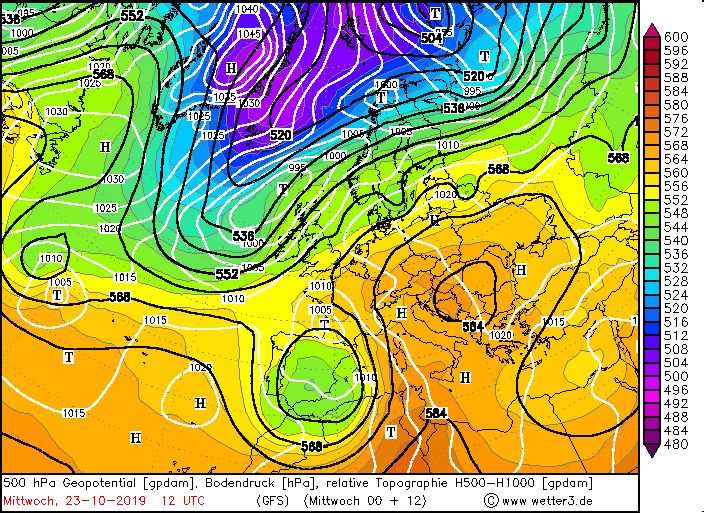
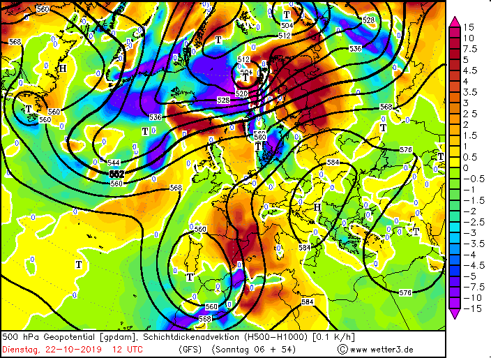
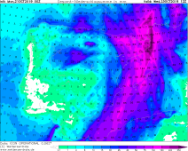
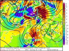
500 hPa Geopot. and SLP, 23.10., 12 UTC
Image Credit: wetter3
|
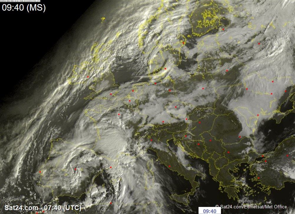
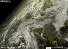
Satellite image (visible), 23.10., 07:40 UTC
Image Credit: Sat24
|
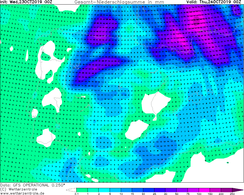
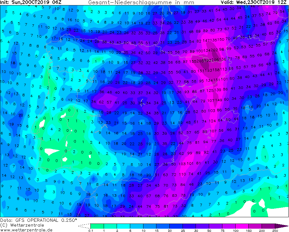
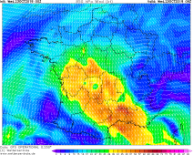
Accumulated precipitation, 24.10., 00 UTC
Image Credit: Wetterzentrale
|
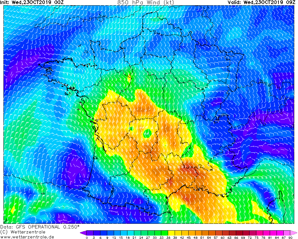
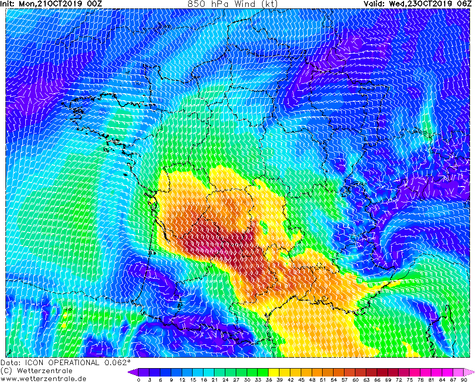
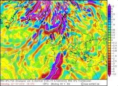
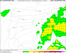
850 hPa Wind, 23.10., 09 UTC
Image Credit: Wetterzentrale
|
Thunderstorm, heavy rain
Eastern Spain, Balearic Islands, Southern France
Issued: Wednesday, 23 October 2019, 10:30 CET
A cut of low on Tuesday causes heavy rain and thunderstorms in north-eastern Spain and in southwestern France.
Rainfall of up to 70 mm/3h and gusts of wind of up to 100 kph are possible.
21 Oct - 23 Oct 2019
As already in the last days falls to this evening in the area of northeast Spain and south France productive rain.
Also storm gusts and thunderstorms cannot be excluded further. In the area of the Massif Central in southern
France, rain can still fall up to 70 mm within 3 hours. In addition, gusts of wind of up to 100 kph must
be expected in southern France and northern Spain even today. In exposed locations, peak gusts of up to 120
kph are also possible. A storm surge must also be expected along the coasts.
The reason for the enormous rainfall is a cut-off low, which moves only slowly towards the east
and currently lies above northern Spain/Southern France. Warm air from Africa and humid air
from the very warm Mediterranean Sea to Central and Southern Europe are advected by the
southwesterly winds, which increase precipitation even more.
It is possible that the low, which will move towards the Mediterranean Sea in the next few days, will intensify
into a Medicane, as the water temperatures are still quite warm for this time of year and the required
energy supply is therefore given.
Sunday, 20 October 2019, 17:15 CET
|

|
|
|
850 hPa Frontal zones, 22.10., 06 UTC
Image Credit: wetter3
|
Satellite image (visible), 21.10., 08:30 UTC
Image Credit: Sat24
|
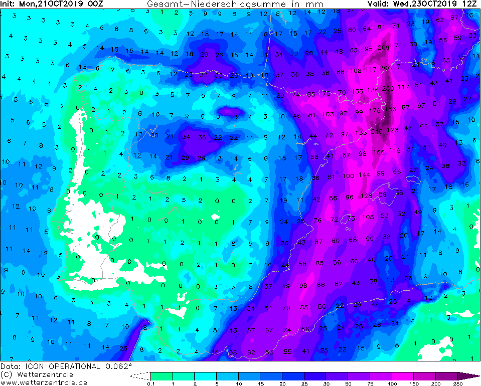
Accumulated precipitation, 23.10., 12 UTC
Image Credit: Wetterzentrale
|
850 hPa Wind, 23.10., 06 UTC
Image Credit: Wetterzentrale
|
Thunderstorm, heavy rain
Eastern Spain, Balearic Islands, Southern France
Issued: Monday, 21 October 2019, 10:15 CET
A cut of low on Tuesday causes heavy rain and thunderstorms in eastern Spain and across the Balearic Islands as well as in southwestern France.
Rainfall of up to 70 mm/3h and gusts of wind of up to 120 kph are possible.
21 Oct - 23 Oct 2019
Up to Wednesday noon, there will be accumulated precipitation of up to 250 mm on the Massif Central in SW France and up to 180 mm on the southeast coast by Tuesday.
In the east of Spain, torrential precipitation of up to 240 mm is also expected by Wednesday afternoon. In northern Italy, too, precipitation of around 150 mm must
be expected by Tuesday morning.
Furthermore, in the southwest of France, especially in the Rhone valley, gusts of around 54 km/h must be expected on exposed locations with heavy and hurricane-like
gusts of up to 120 km/h.
The reason for the severe precipitation is a cut-off low that is almost stationary above the north of Portugal and Spain. Due to the massive ridge over Central and
Eastern Europe, the low is blocked in its shift to the East and its fronts are partly receding.
Warm air from Africa and humid air from the very warm Mediterranean Sea to Central and Southern Europe are advected by the southwesterly winds, which increase
precipitation even more.
By also increasing Vorticity advection strong thunderstorms are not excluded. These can bring up to 70 mm of rain within 3 hours.
The surface CAPE rises to 2000 J/kg, the mixed layer CAPE to around 700 J/kg. Convective clouds can already be seen on the satellite images this morning.
There is the possibility that the cut-off low can develop into a Medicane due to the high water temperature around 23°C.
Sunday, 20 October 2019, 17:15 CET
|
|

|
|
Layer thickness advection, 22.10., 12 UTC
Image Credit: wetter3
|
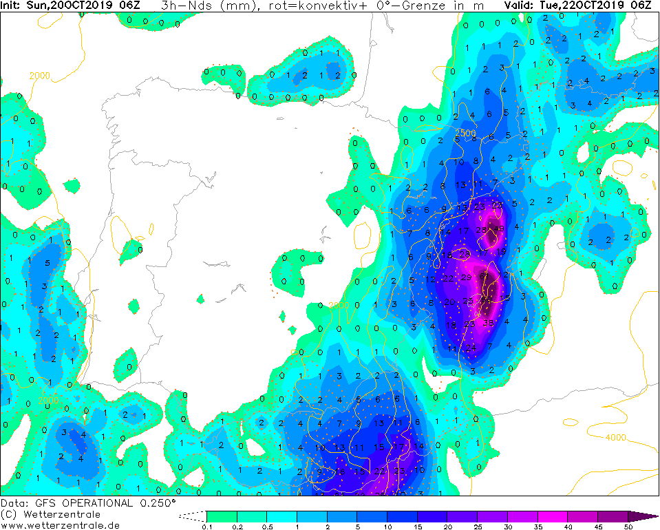
3 h precipitation, 22.10., 06 UTC
Image Credit: Wetterzentrale
|
Accumulated precipitation, 23.10., 12 UTC
Image Credit: Wetterzentrale
|
Maximum wind gusts, 22.10., 06 UTC
Image Credit: Wetterzentrale
|
Thunderstorm, heavy rain
Eastern Spain, Balearic Islands
Issued: Sunday, 20 October 2019, 17:15 CET
A cut of low on Tuesday causes heavy rain and thunderstorms in eastern Spain and across the Balearic Islands. Rainfall of up to 70 mm/3h and gusts of wind of up to 85 kph possible.
21 Oct - 23 Oct 2019
From a stationary trough, which is located over the Atlantic coast of France and Spain, a cut-off low with a high vertical extension is formed
on Monday. On the eastern flank of this system, warm air is advected from North Africa across the western Mediterranean. In connection with
a still relatively high sea surface temperature of the Mediterranean Sea (23°C) and with the height of increasing vorticity advection, strong
convection develops.
Heavy thunderstorms may occur, producing precipitation of up to 70 mm/3h. Until Wednesday noon (12UTC) total precipitation
of up to 200 mm is possible. In addition there are gusts of up to 80 kph, in the vicinity of heavy thunderstorms stronger gusts are also possible.
The formation of tornadoes cannot be ruled out.
There is a low probability that the cut-off low above the still warm waters of the Mediterranean Sea will develop into a Medicane.
Issued: October 21, 2019, 10:15 CET
MG
Issued: October 20, 2019, 17:15 CET
FS
Issued: October 23, 2019, 10:30 CET
CL
Issued: October 25, 2019, 10:30 CET
MG
|