Monday 10 June 2019, 16:30 CET

|
|
|
|
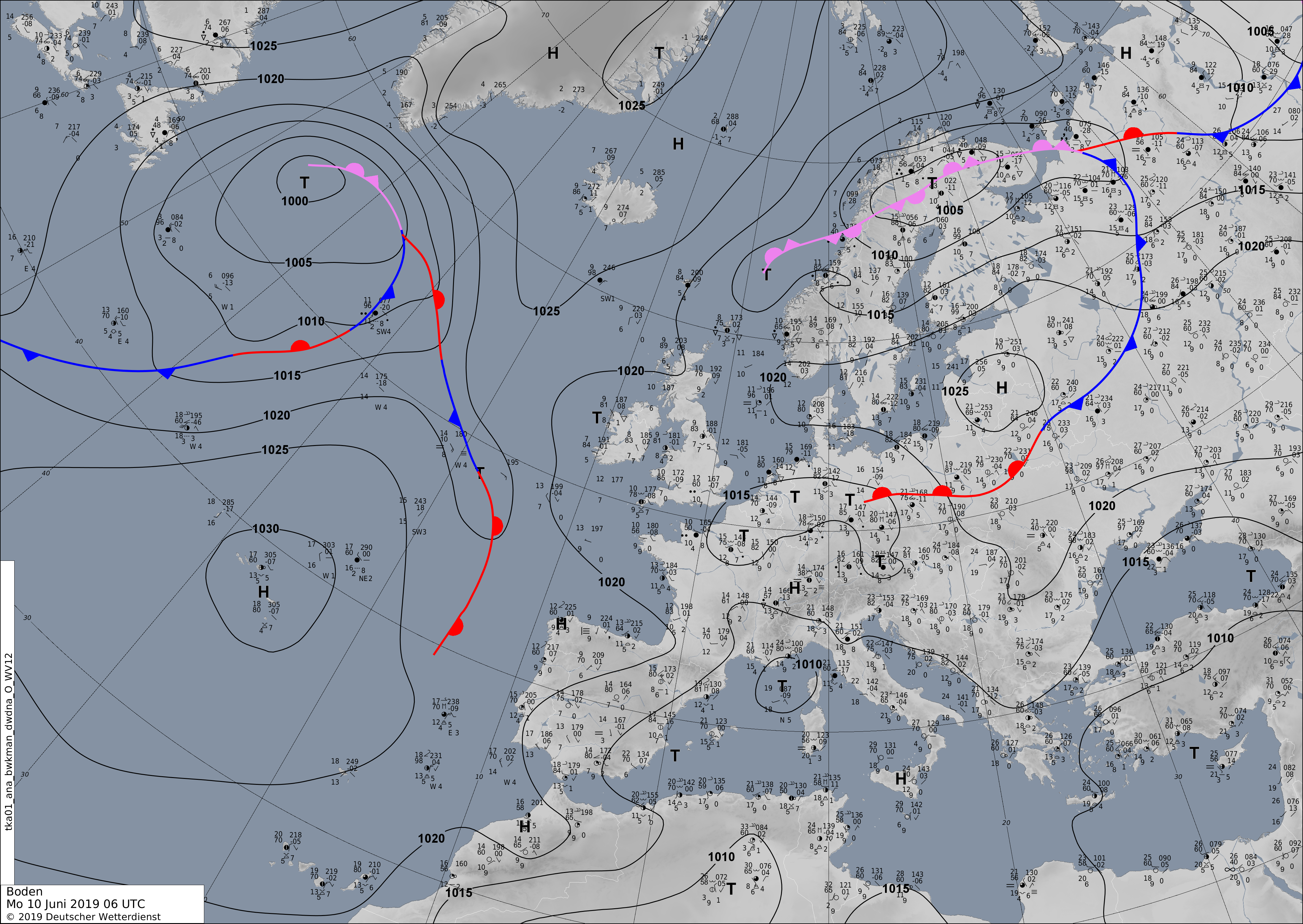
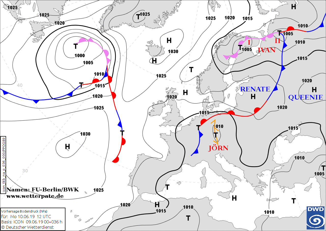
Soil pressure and fronts (Europe), 10.06., 06 UTC
Image Credit: Deutscher Wetterdienst
|
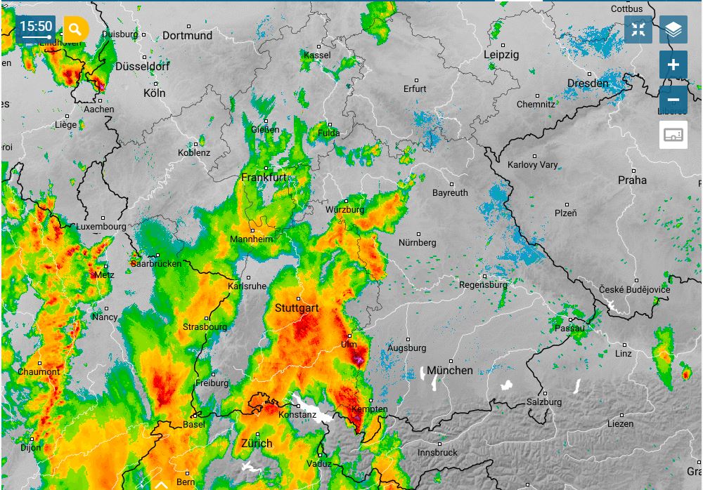
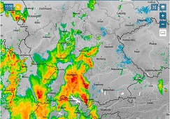
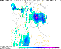
Precipitation radar, 10.06., 13:50 UTC
Image Credit: Wetteronline
|
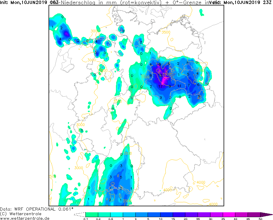
1 h precipitation, 10.06., 23 UTC
Image Credit: Wetterzentrale
|
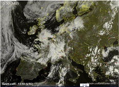
Satellite image, 10.06., 13:50 UTC
Image Credit: Sat24
|
Thunderstorms
Germany
Issued: Monday, 10 June 2019, 16:30 CET
On Monday noon, a thunderstorm cell formed in the area of Lake Constance , which moves in a northeasterly direction
and may develop into a thunderstorm cluster, leading to severe weather in Baden-Württemberg, northern Bavaria, Thuringia, Saxony, Saxony-Anhalt and Brandenburg.
10 June 2019
At the front of a trough lying over Western Europe on Monday there are strongly ascending air masses which cause showers
and thunderstorms. The formation of super cells is not excluded.
Today, on Monday a large area of rain formed around the area of Lake Constance, moving in a northeasterly direction. It is expected that heavy
thunderstorms will form from this area in the north of Baden Württemberg or Bavaria and in Thuringia. The formation of super cells is also possible.
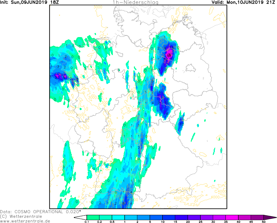
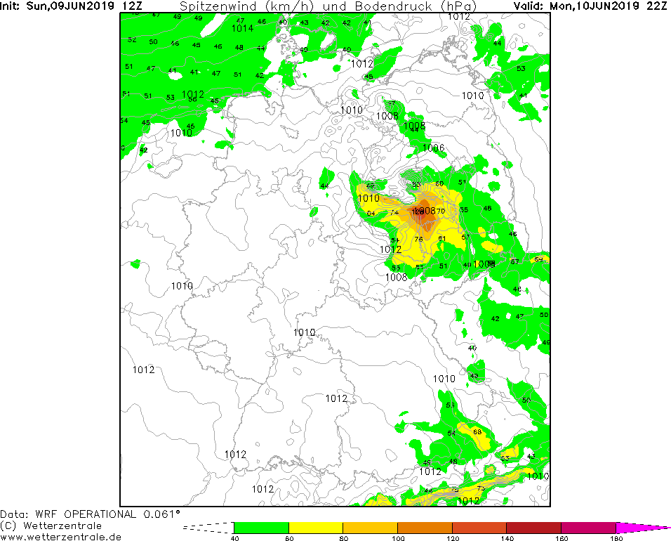
In the eastern federal states of Germany, heavy rainfall of up to 50 mm/h and hail must be expected. Stormy gusts can occur near thunderstorms.
Due to downbursts even hurricane-like gusts of up to 130 kph are possible.
The highest precipitation amounts occur south of the Black Forest due to orographic precipitation. Here up to 50 mm within 24 hours are expected.
Sunday 09 June 2019, 23:30 CET
Thunderstorms
Germany
Issued: Sunday, 09 June 2019, 23:30 CET
On Monday afternoon heavy thunderstorms may form alongside a line from Lake Constance to the German Baltic Sea coast.
Precipitation intensities of up to 50 mm/h and hurrican-like gusts expected.
10 June 2019
At the front of a trough situated above the French Atlantic coast strong convection develops on Monday afternoon.
Advection of humid air masses from the southwest and an unstable atmospheric stratification cause a high
threat of thunderstorms.
It is not clear precisely where the thunderstorm cells will form.
A strong southern overflow of the Alps leads to descending air masses on the northern side of the mountains,
which counteracts convection and ensures high CIN values making the formation of thunderstorms rather unlikely.
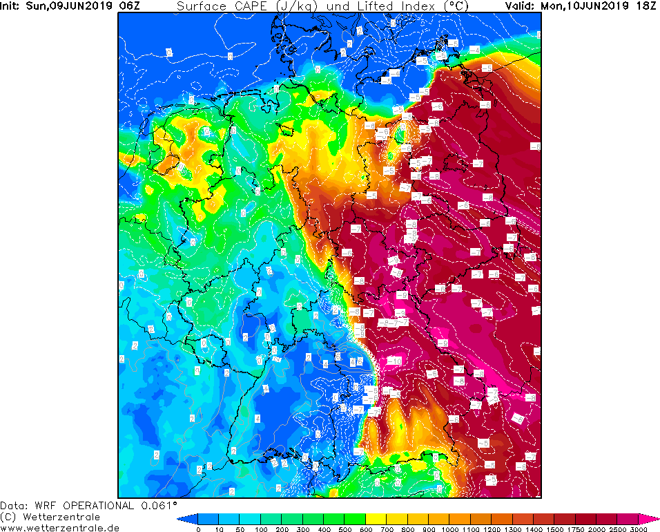
The highest probability, however, is along a low-pressure trough over Bavaria, Thuringia, Saxony, Saxony-Anhalt
and Brandenburg, where the CAPE values are maximized by high-energy warm air and unstable atmosphreic stratification.
Orogaphic precipitation and thunderstorms may also form on the Black Forest in Baden-Württemberg.
Local rain intensities of up to 50 mm/h are possible. Due to strong updrafts in the thunderstorm cells, the formation of hail
with grain sizes of up to 10 mm is not excluded. Stormy winds occur near thunderstorms. Due to downbursts, hurricane-like gusts up to 130 kph
are also possible.
The thunderstorm cells will move rapidly in a northeasterly direction. Total precipitation intensities of up to 70 mm are expected.
Issued: June 09, 2019, 23:30 CET
FS
Issued: June 10, 2019, 16:30 CET
FS
|