Friday 05 April 2019, 14:45 CET

|
|

|
|
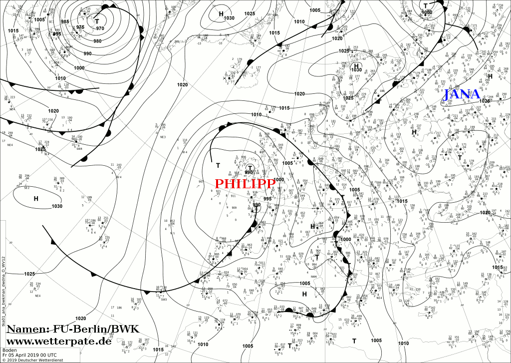
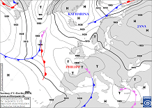
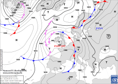
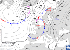
Soil pressure and fronts, 05.04., 00 UTC
Image Credit: DWD
|
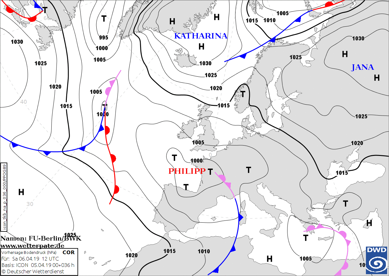
Soil pressure and fronts, 06.04., 12 UTC
Image Credit: DWD
|
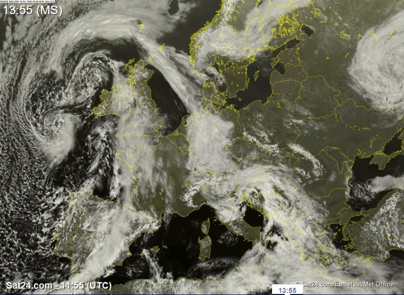
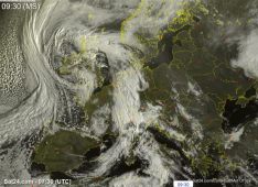
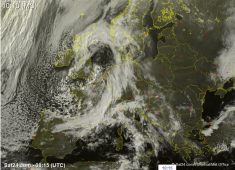
Satellite image (visible), 05.04. 12 UTC
Image Credit: Sat24
|
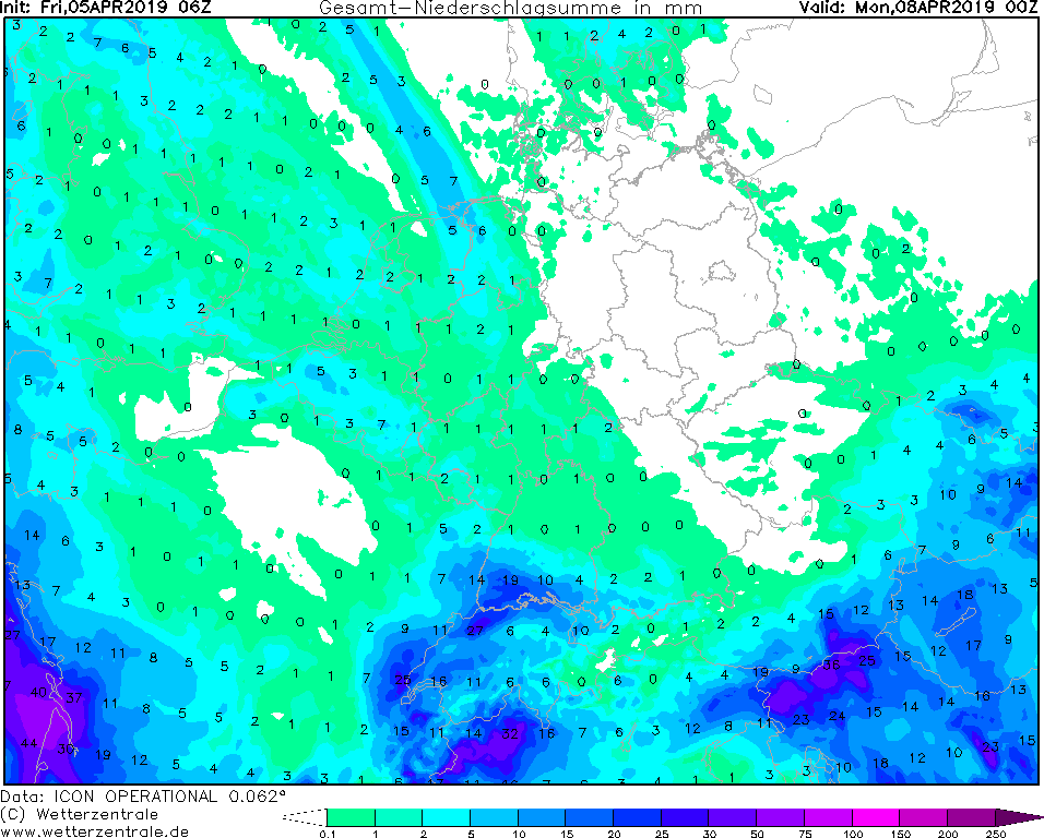
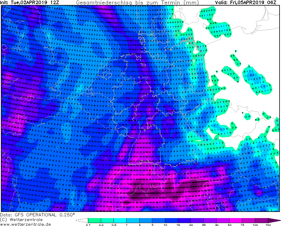
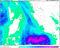
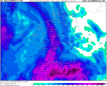
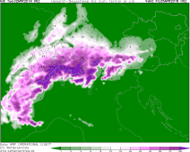
Total precipitation, 08.04. 00 UTC
Image Credit: Wetterzentrale
|
Heavy precipitation - Warning
Southern Alps
Issued: Friday, 05 April 2019, 14:45 CET
On the south side of the Alps, precipitation of up to 75 mm is still possible over the weekend.
02-05 April 2019
Low pressure area PHILIPP is currently located above the south of Great Britain with a core
pressure of about 990 hPa . Due to the cyclonic rotation, moist, mild air continues to be
led to Central Europe.
Due to a slight increase in the 850 hPa temperature in the southern Alpine region to 5 to 7 °C,
snow line rises to over 2000 m. Further precipitation causes an enormous avalanche risk.
In Austria and Italy, warning level 4 is widespread.
Low PHILIPP is currently almost stationary and will maintain the southern inflow of the Alps also
on Saturday. By 12 UTC, however, the low pressure area will already have weakened to a core
pressure of 1000 hPa. On Sunday low pressure area PHILIPP will no longer be of any importance.
Thursday 04 April 2019, 10:00 CET
|
|
|
|
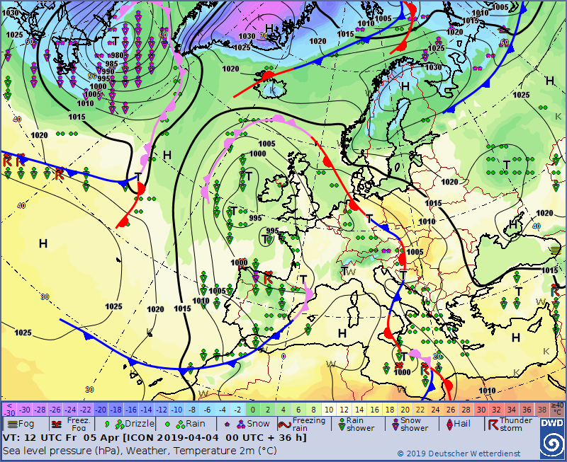
Soil pressure and fronts, 05.04., 12 UTC
Image Credit: DWD
|
Satellite image (visible), 04.04., 07:30 UTC
Image Credit: Sat24
|
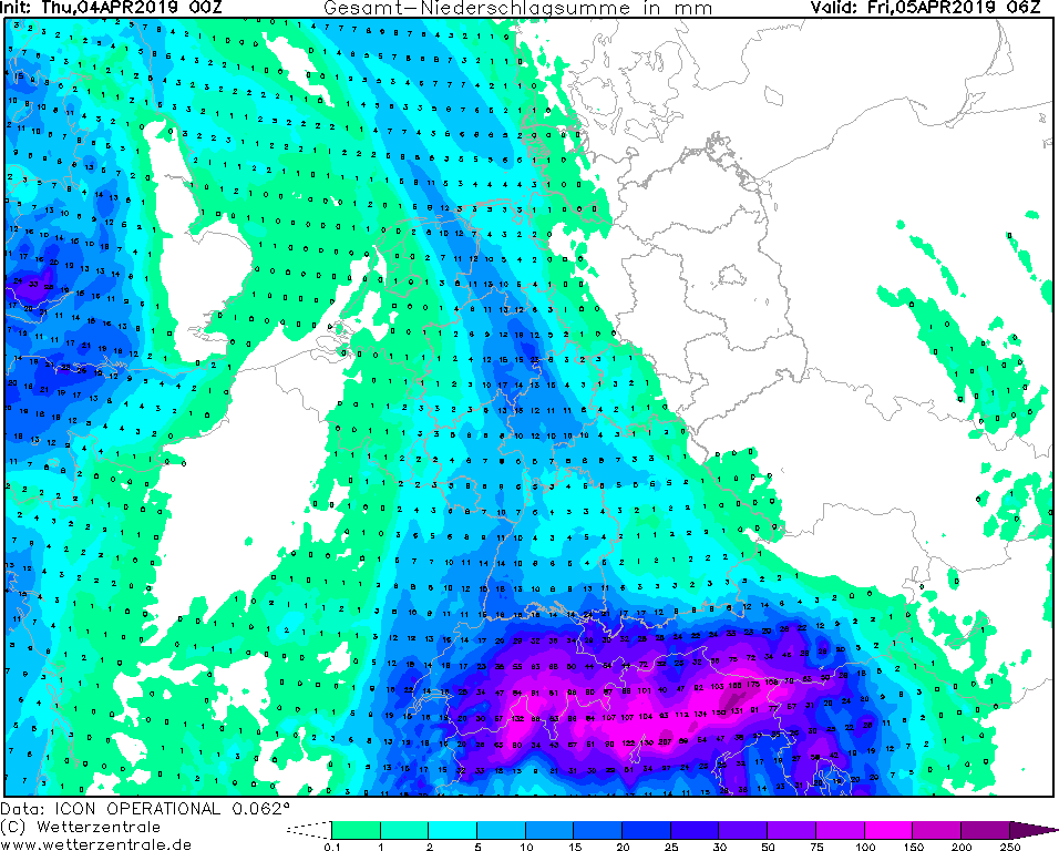
Total precipitation up to 05.04. 06 UTC
Image Credit: Wetterzentrale
|
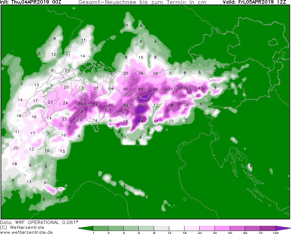
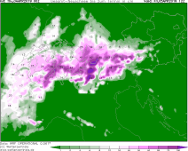
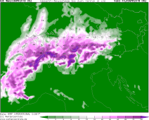
Total amount of new snow up to 05.04. 12 UTC
Image Credit: Wetterzentrale
|
Heavy precipitation - Warning
Southern Alps
Issued: Thursday, 04 April 2019, 10:00 CET
On the south side of the Alps, massive stagnation precipitation of up to 170 mm is expected until Friday morning.
02-05 April 2019
The PHILIPP low pressure area continues to be almost stationary over Great Britain with a core pressure of
995hPa around 00UTC. The low will strengthen slightly in the course of the day and reaches a core pressure
of 990hPa in the afternoon. Due to the front system, which reaches almost straight from north to south
(from Hamburg to Switzerland), it remains cloudy in this area throughout the day.
At night, as expected, precipitation has intensified and will continue until Friday morning. In the
Black Forest above about 500m the precipitation falls as snow. This can mean up to 30cm of new snow
in the high altitudes of the Black Forest and the Allgäu.
Also on the southern side of the Alps (Switzerland and Austria) precipitation started tonight.
Due to the supply of moisture and the congestion situation in the Alps, 150-180 mm of precipitation
can fall in places on the southern side of the Alps until Friday morning. The snowfall line continues
to fall. Fresh snow can fall up to 80cm.
In the area of the Gotthard Tunnel, the road has to be closed again and again due to snow clearance,
as more than 10cm of snow fall within one hour.
Due to the snow, there is not only slippery snow but also snow breakage.
Therefore, delays in road and rail traffic must be expected in these areas.
Wednesday 03 April 2019, 11:15 CET
|
|
|
|
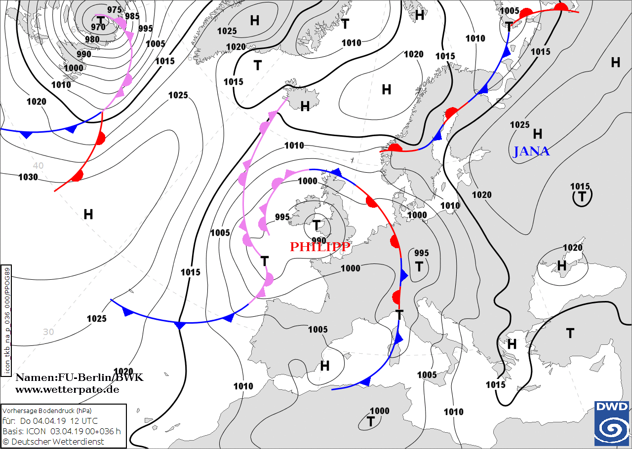
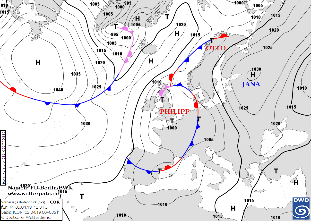
Soil pressure and fronts, 04.04., 12 UTC
Image Credit: DWD/FU Berlin
|
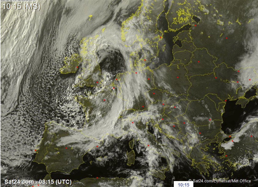
Satellite image (visible), 03.04., 08:15 UTC
Image Credit: Sat24
|
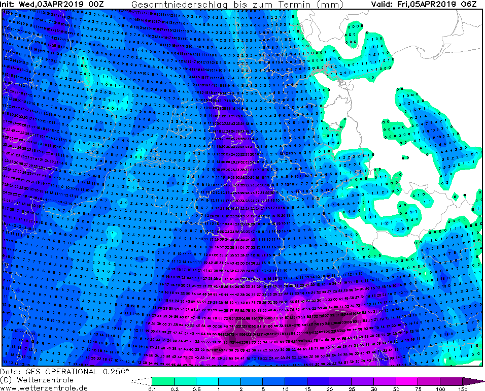
Total precipitation up to 05.04. 06 UTC
Image Credit: Wetterzentrale
|
Total amount of new snow up to 05.04. 06 UTC
Image Credit: Wetterzentrale
|
Heavy precipitation - Warning
Southern Alps
Issued: Wednesday, 03 April 2019, 11:15 CET
On the south side of the Alps, massive stagnation precipitation of up to 200 mm is expected over the next few days.
02-05 April 2019
Low pressure system PHILIPP had a core pressure of 1000hPa today at 00UTC and is still located in the
area of Great Britain. By tomorrow (12UTC) the low will continue to strengthen. Due to the location
of the depression, moist air masses accumulate in the mountains in the south. In the Black Forest up
to 50mm precipitation will fall until Thursday noon. At higher altitudes it falls snow.
It looks even more dramatic on the south side of the Alps. Due to the congestion situation at the
Alps and the southwestern inflow, there will be heavy rainfall at the Alpine regions, which will continue
until Friday. In these regions, 150mm of precipitation is widespread, and considerably more (up to 200mm)
near the Alps. Above 1500m, especially towards the west up to 2 meters of fresh snow fall.
This is an enormous amount within the short time, so that snow breakage can be expected there. In addition,
the danger of avalanches increases. Towards the east, in warmer air, the snow line is much higher and
precipitation usually falls as rain. This creates the danger of flooding and mudslides.
Tuesday 02 April 2019, 21:00 CET
|
|
|
|
Soil pressure and fronts, 03.04., 12 UTC
Image Credit: DWD/FU Berlin
|
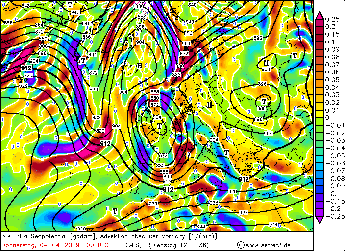
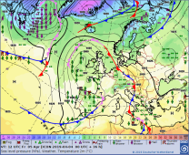
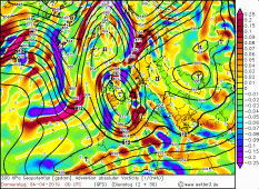
300 hPa geopot., vorticity advection, 04.04., 00 UTC
Image Credit: Wetter3
|
Total precipitation up to 05.04. 06 UTC
Image Credit: Wetterzentrale
|
Total amount of new snow up to 05.04. 00 UTC
Image Credit: Wetterzentrale
|
Heavy precipitation - Warning
Southern Alps
Issued: Tuesday, 02 April 2019, 21:00 CET
On the south side of the Alps, massive stagnation precipitation of up to 200 mm is expected over the next few days.
02-05 April 2019
Currently, PHILIPP is a low pressure system in the UK and will intensify tomorrow. Tomorrow it will already
cover the entire western half of Europe. Due to the cyclonic rotation of the low, warm air from the south
reaches far north. At the same time, cold air enriched with moisture from the sea reaches Western Europe.
This creates, as is already the situation today, an air mass border over Germany. Especially on Thursday, a
temperature difference of up to 15°C is possible.
But especially on the southern side of the Alps, massive precipitation is expected in the coming days.
This is mainly due to two decisive factors: the increasing vorticity advection with altitude, which
provides the necessary lifting mechanism, and the congestion on the southern side of the Alps. Rainfall
of 100 to 200 mm can be expected along the Alpine arc from Piedmont to Friuli by Friday morning. In congested
areas, more than 200 mm can also be achieved. Rainfall can also be expected in Switzerland in the Ticino region.
Due to the lower temperatures, precipitation in the form of snow falls to the west above 1500 metres. New snow
quantities of 1 to 2 metres can occur, which can lead to snow breakage and avalanches. Roads and rail traffic
may be severely impaired. Due to the warmer air to the east, the snowfall line there is much higher, so that
floods and mudslides can be expected.
Issued: Apr 02, 2019, 21:00 CET
CL
Issued: Apr 03, 2019, 11:15 CET
CL
Issued: Apr 04, 2019, 10:00 CET
CL
Issued: Apr 05, 2019, 14:45 CET
FS
|