Sunday 24 March 2019, 12:45 CET
Tropical cyclone VERONICA - Warning
Queensland, Northern Territory, Western Australia
Issued: Sunday, 24 March 2019, 12:45 CET
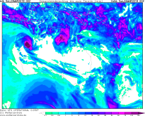
Tropical storm VERONICA belongs to category 3 and is moving across the north eastern coast of Australia.
20-27 March 2019
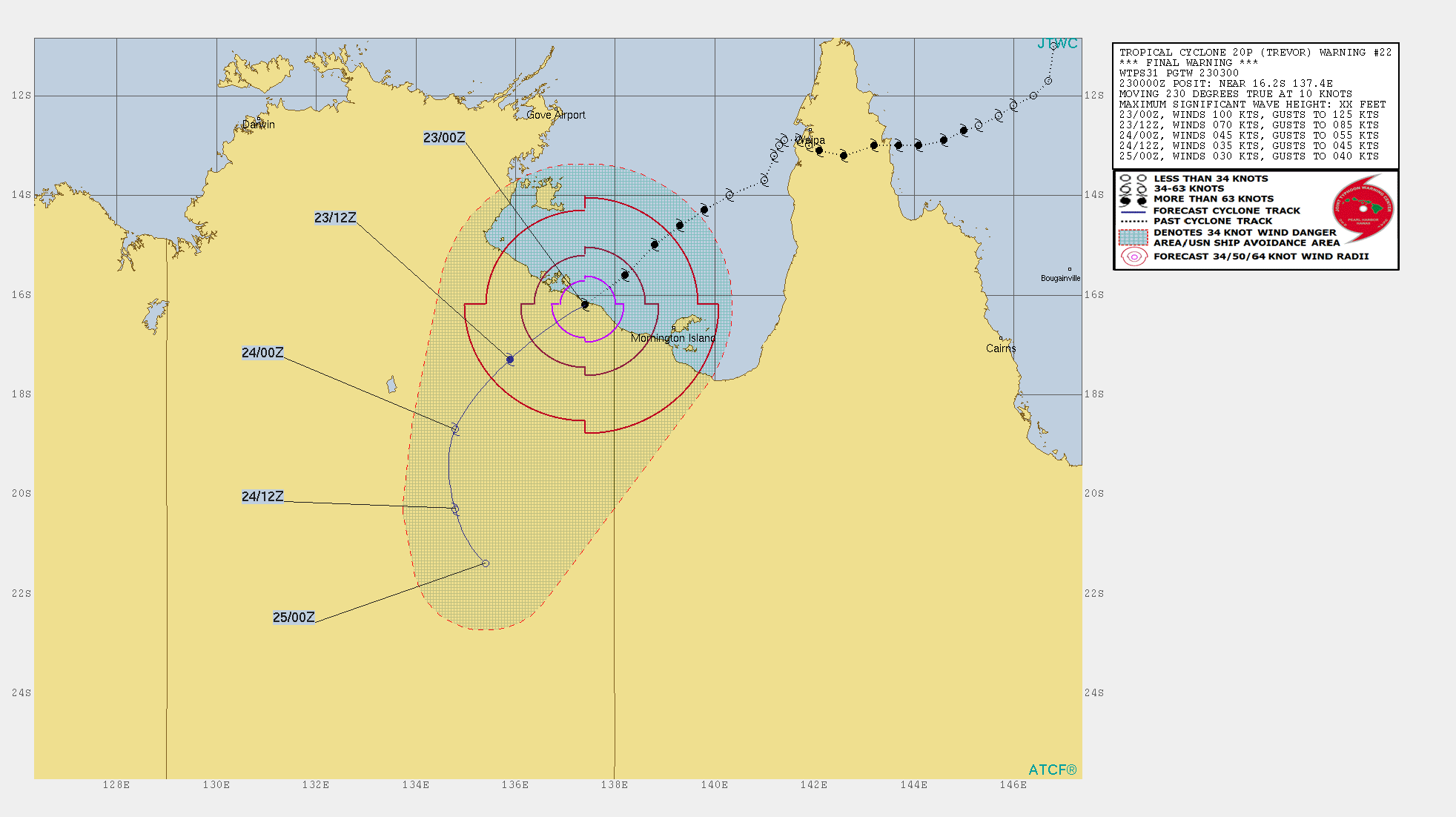
Tropical storm TREVOR hit land aorund 23 March 00 UTC and has weakened due to increasing friction. Wind speeds
of 65 kph and gusts of up to 80 kph are still possible.
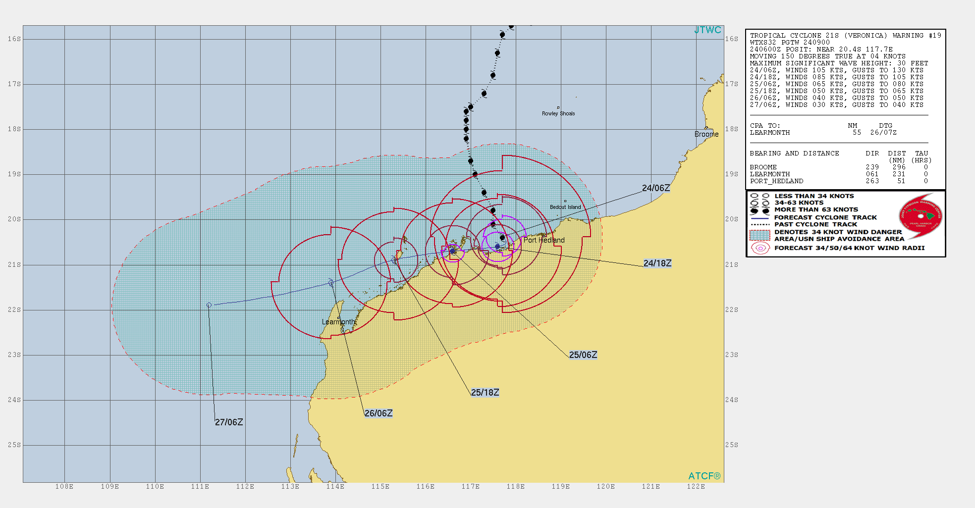
In contrast to latest predictions, cyclone VERONICA has again strengthened and belongs to category 3 with wind
speeds of up to 190 kph and gusts of up to 240 kph. VERONICA is shifting southwest along the Australian coast with
a low displacement velocity of 6 kph. In the next 24 hours, VERONICA will have weakened to a Category 1 cyclone,
and shortly thereafter to a tropical depression.
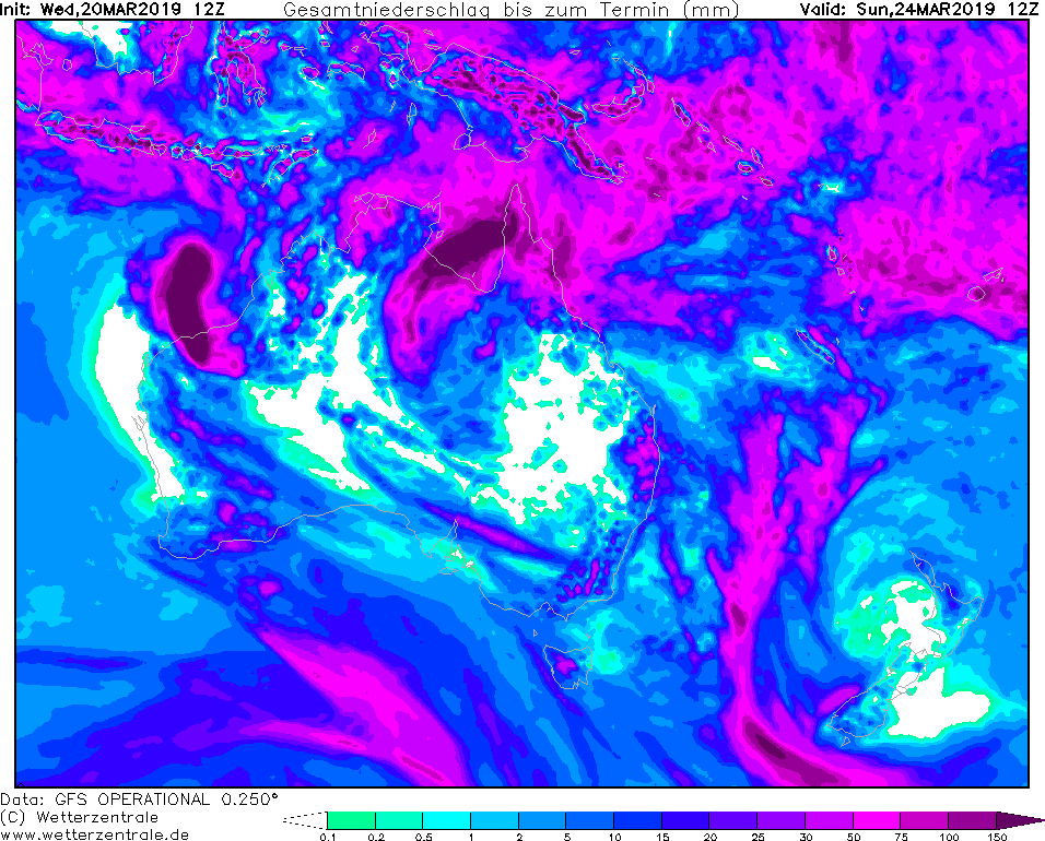
On the coast there is a danger of waves up to 10 m high and 24 h precipitation of over 150 mm.
Saturday 23 March 2019, 10:30 CET
|
|
|
|
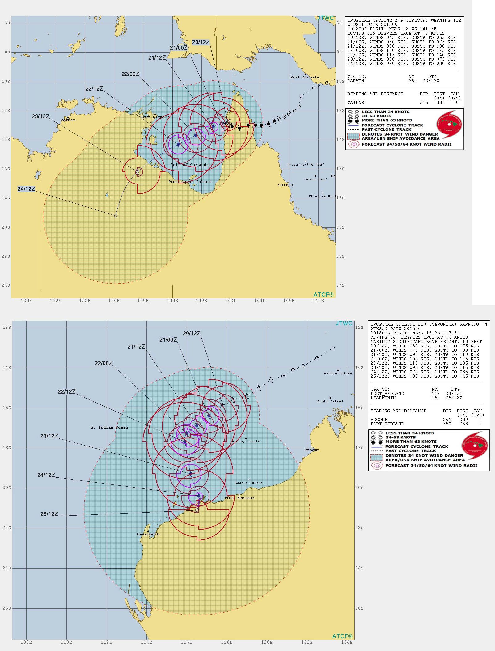
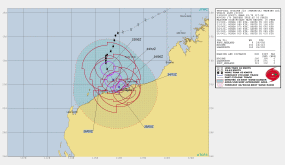
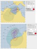
Track cyclone VERONICA, 23.03.
Image Credit: JTWC
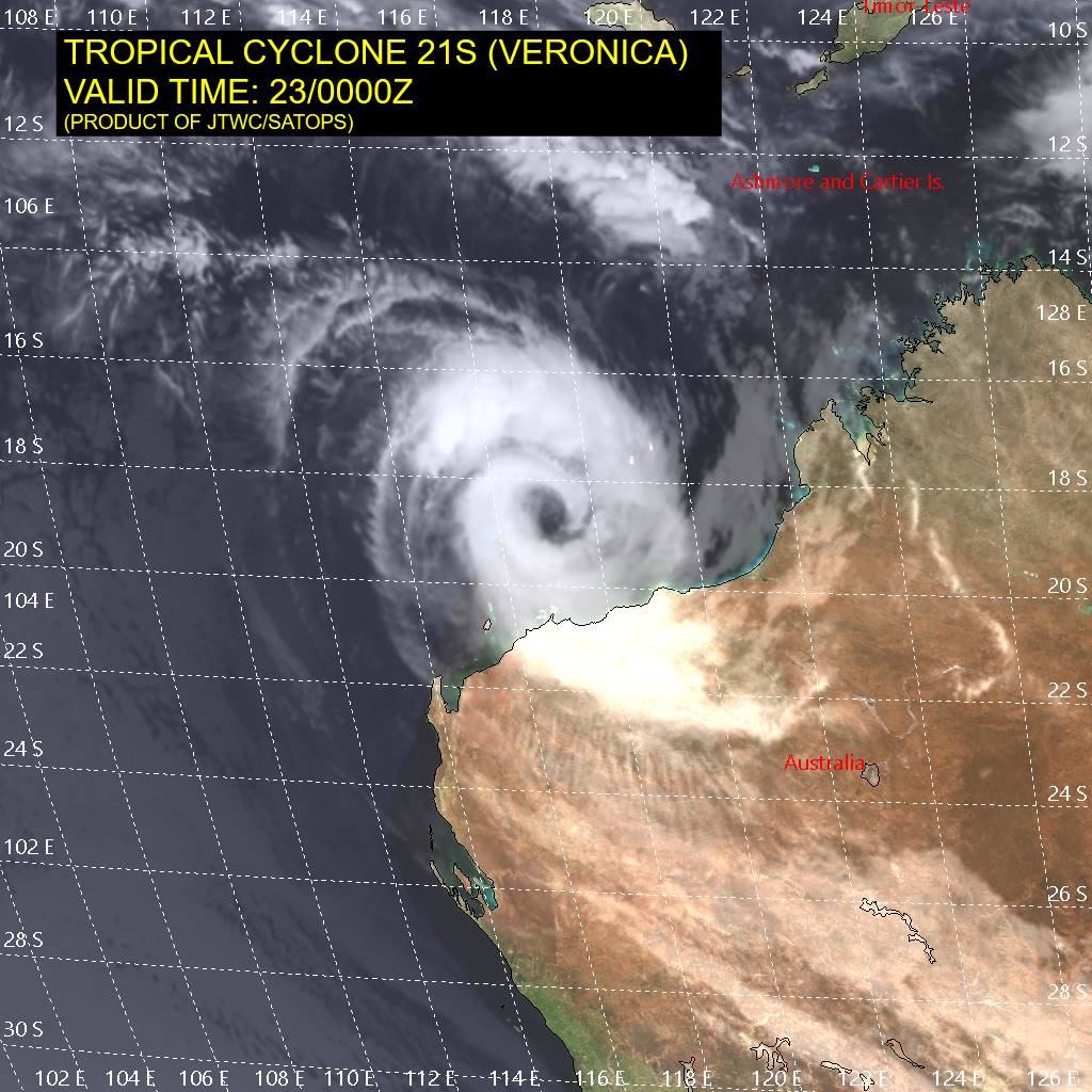
|
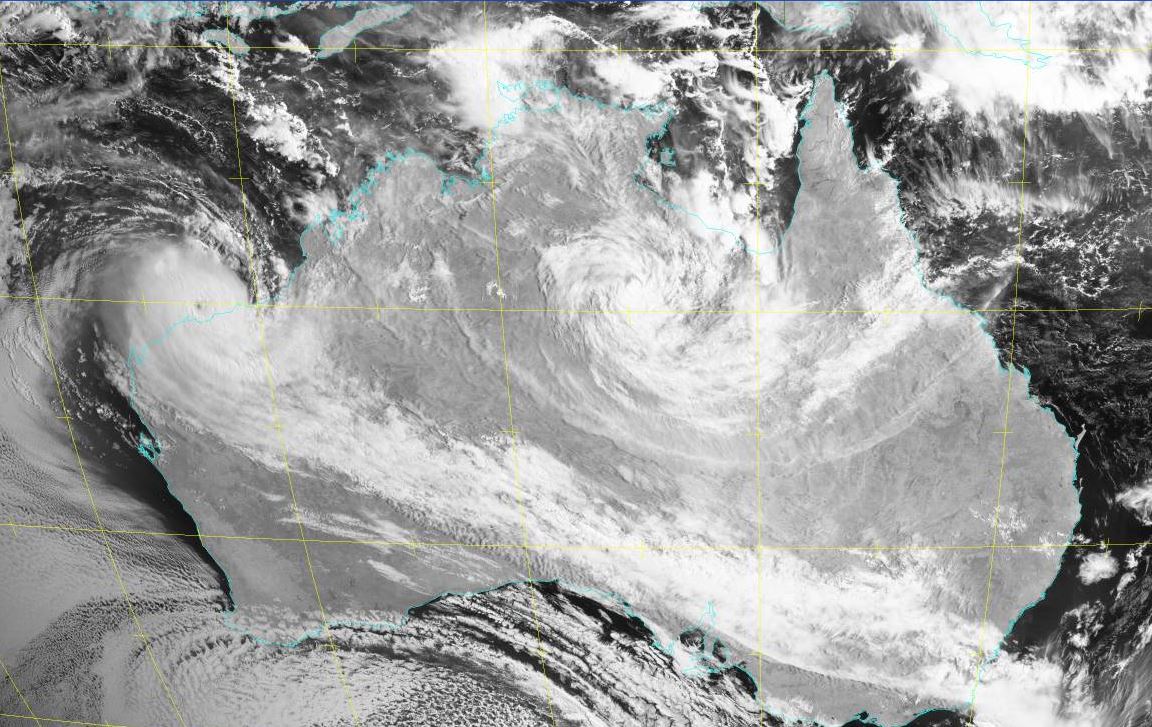
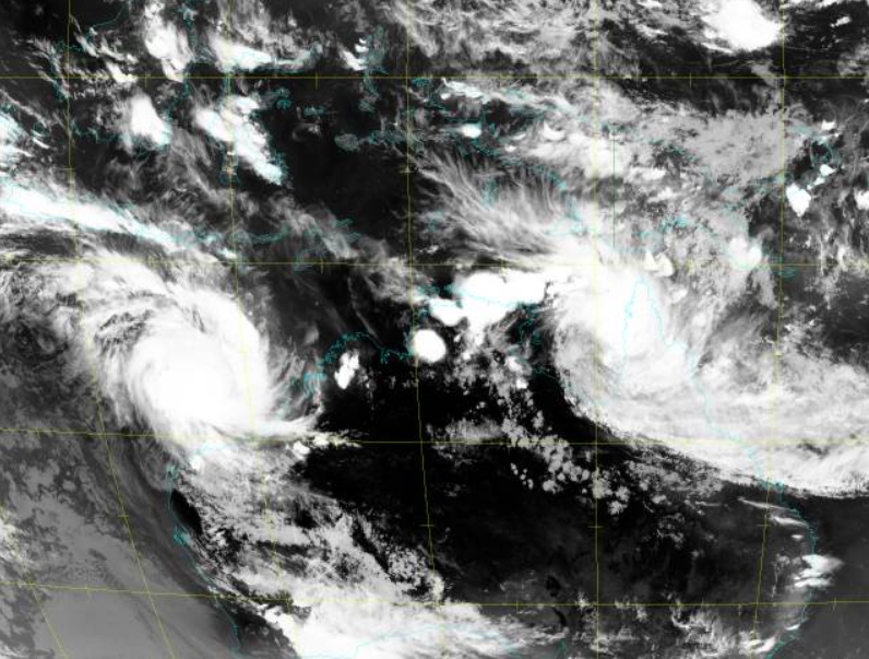
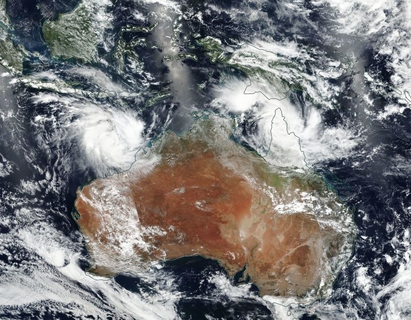
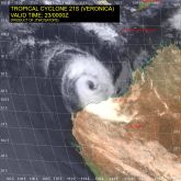
Satellite image, 22.03.
Image Credit: JTWC
|
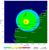
Wind prob., 23.03.
Image Credit: TSR
|
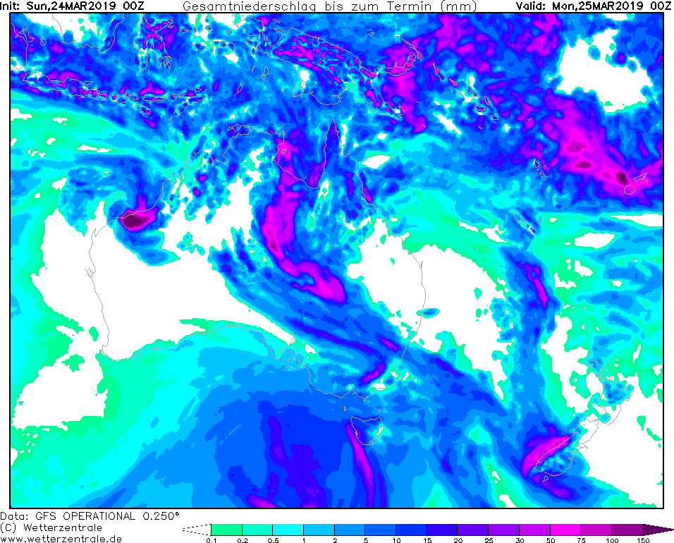
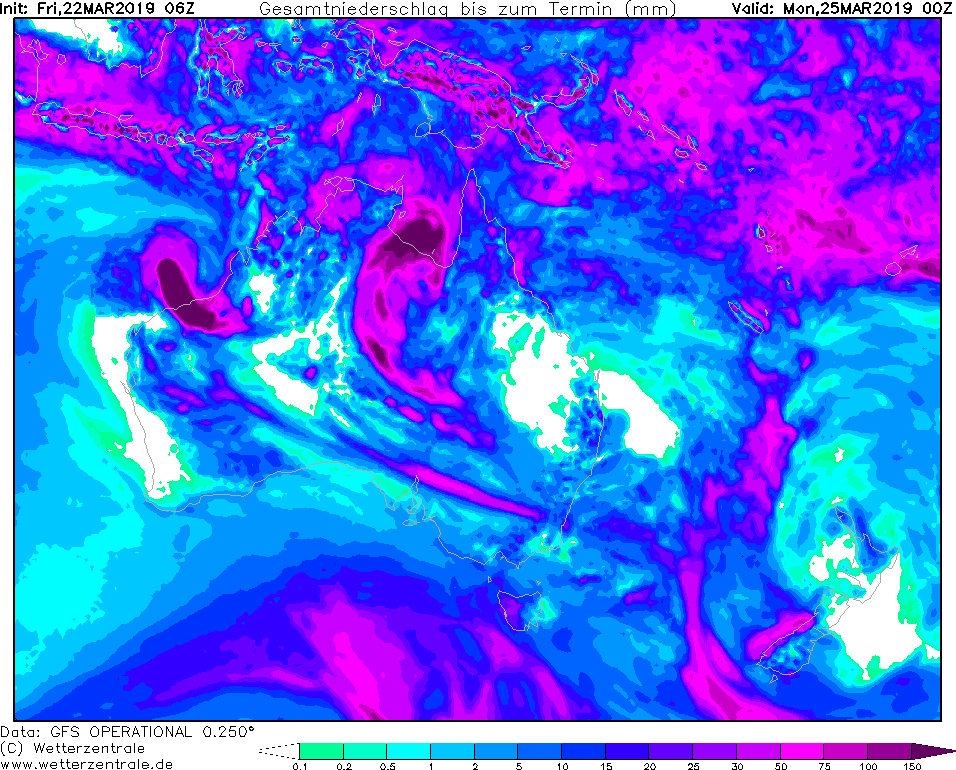
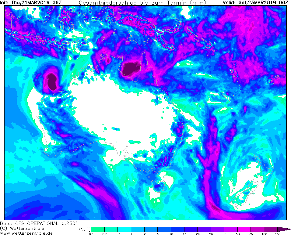
Accumulated precipitation, 24.03. 00 UTC
Image Credit: Wetterzentrale
|
Tropical cyclone VERONICA - Warning
Queensland, Northern Territory, Western Australia
Issued: Saturday, 23 March 2019, 10:30 CET
Tropical storm VERONICA belongs to category 1
20-27 March 2019
Tropical storm TREVOR hit land last night and has weakened due to increasing friction. Nevertheless, there is
still the danger of heavy rain and flooding. Rainfall of up to 150 mm can accumulate within the next 24 hours.
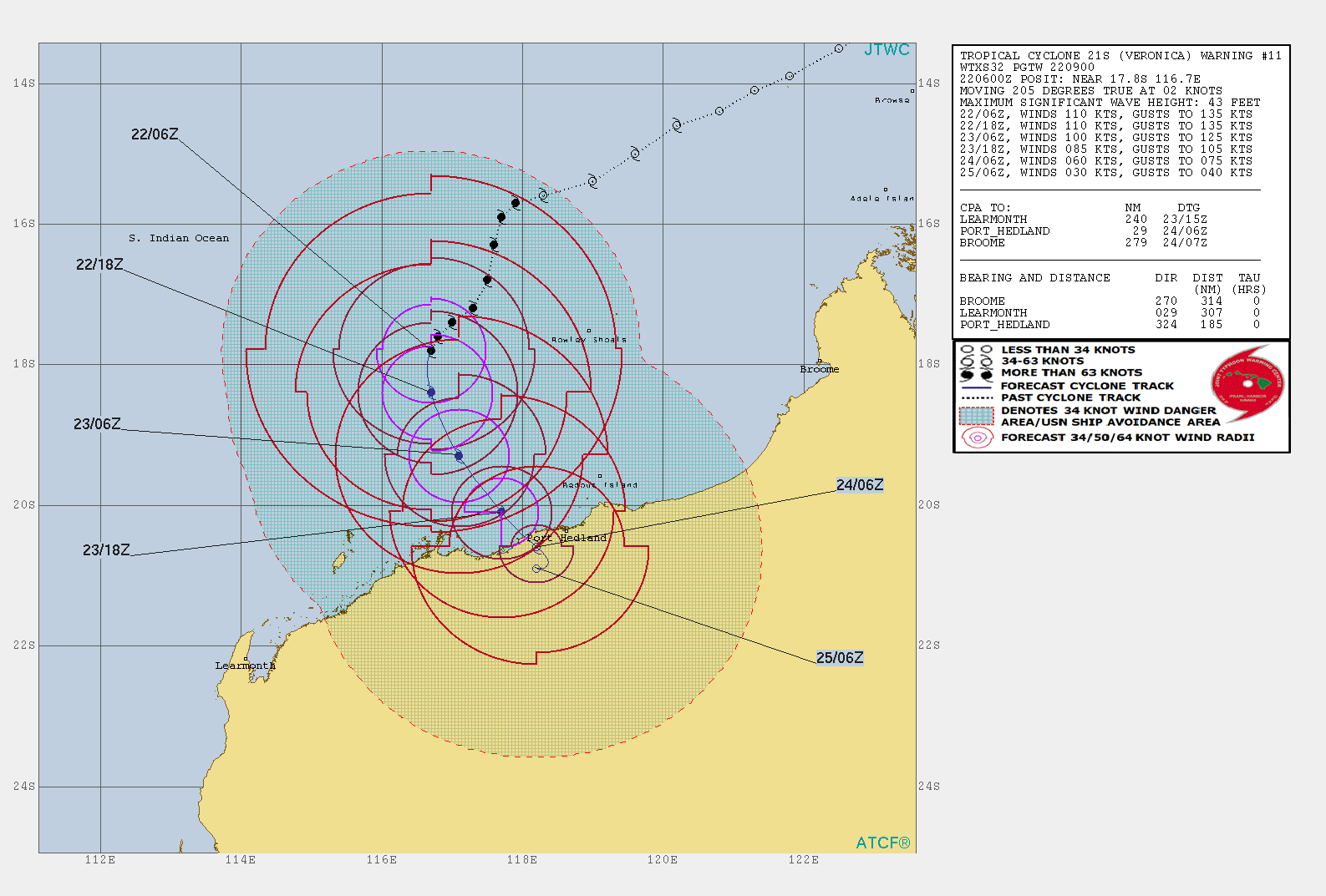
The other tropical storm in the area of Australia (VERONICA) continues to move towards the west coast of
Australia. VERONICA is currently located not far from the coast from the port in Hedland and is watching the
port with a slight left turn. It still belongs to category 1 with wind speeds of up to 100 kn (185 kph).
Shortly after the landfall, which is expected tomorrow, Sunday morning, it will take a sharp right turn
according to the current forecasts and will then head out to sea again along the coast. Due to the
increasing friction along the coast, the intensity continues to decrease (then only belongs to the
category of tropical storms). In addition to the high wind speeds, heavy precipitation also occurs
in the VERONICA area. Precipitation of up to 200 mm can occur within the next 24 hours.
Friday, 22 March 2019, 12:00 CET
Tropical cyclone TREVOR/VERONICA - Warning
Queensland, Northern Territory, Western Australia
Issued: Friday, 22 March 2019, 12:00 CET
Tropical storm TREVOR will intensify to category 2 till the end of the week and tropical storm VERONICA still belongs to category 4
20-27 March 2019
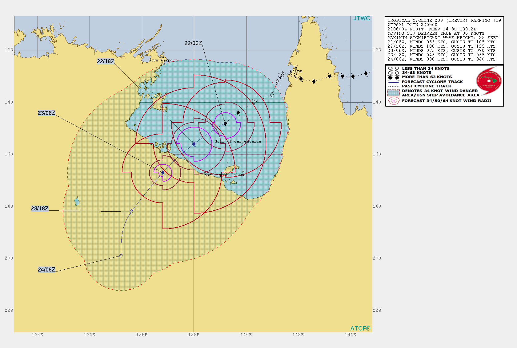
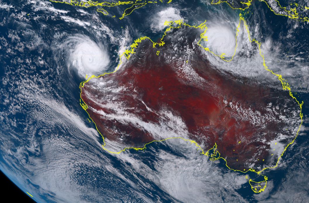
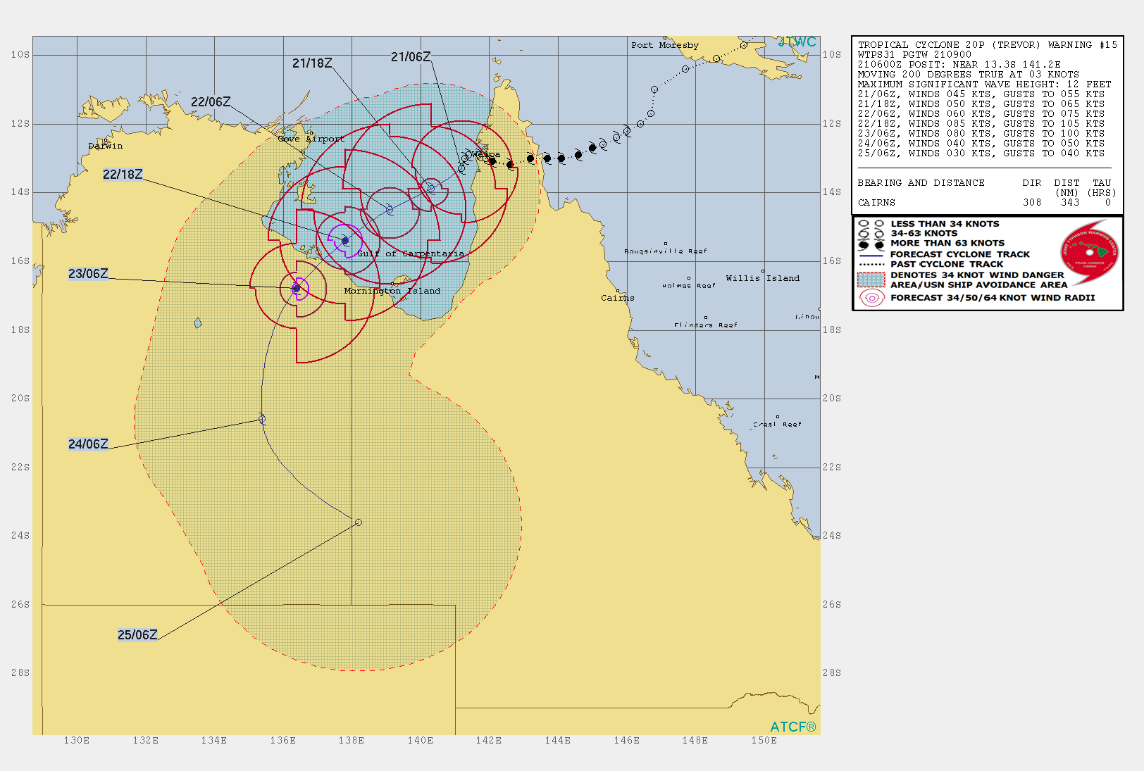
Tropical cyclone TREVOR is currently located above the Gulf of Carpentaria and is experiencing an intensification due to high water temperatures
and low vertical wind shear. It moves southwest at a speed of 10 kph. During landfall (expected at 23 March, 00 UTC around the Pellew Islands) it
will belong to category 4 with average wind speeds of 180 kph and gusts of up to 220 kph.
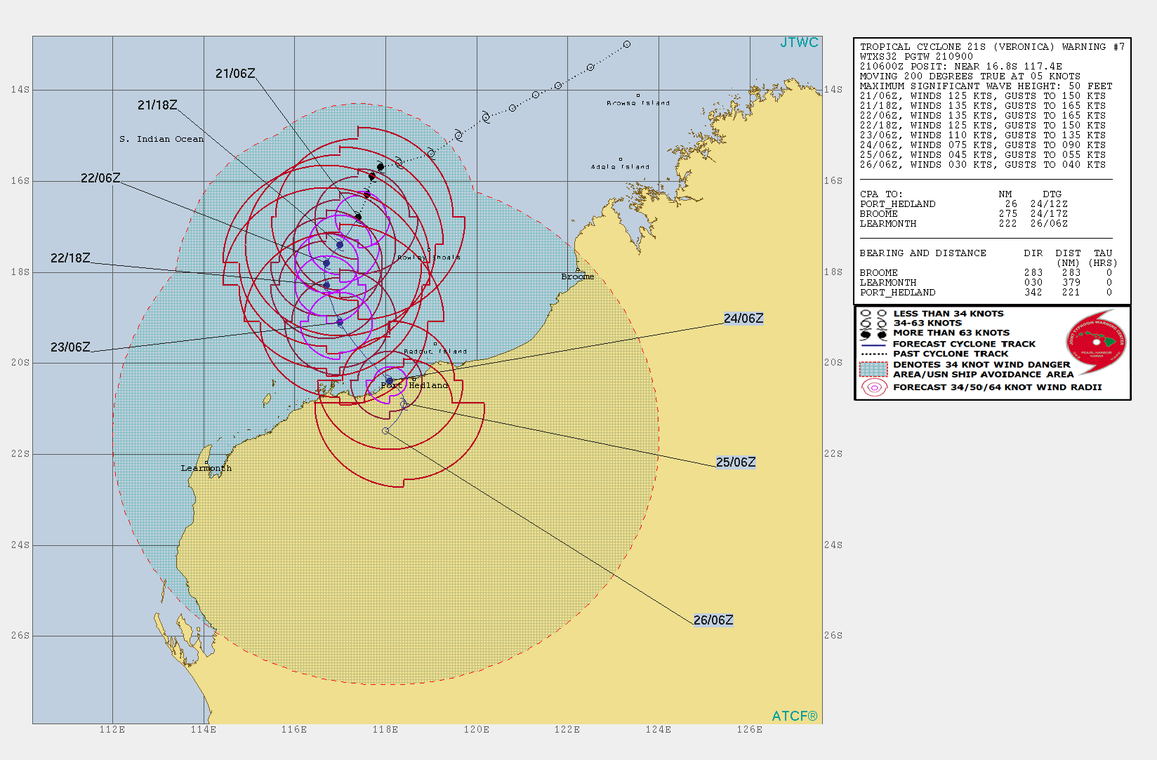
Tropical cyclone VERONICA is currently situated about 300 km north of Karratha (AU) and is moving south with about 5 kph. The maximum mean wind speeds are 200 kph,
gusts even reach 250 kph. The storm belongs to the upper edge of category 4 and is close to category 5. Due to the low displacement speed of the storm,
it will take about 48 hours until the eye reaches the land. In the next 24 hours, wind speeds of up to 100 kph can be expected in the coastal areas around
Port Hedland (AU).
Both storms bring high amounts of precipitation with them. In the coverage area of both storms up to 50 mm/3h and total precipitation
from over 150 mm to 25 March, 00 UTC is possible.
Thursday, 21 March 2019, 13:15 CET
Tropical cyclone TREVOR/VERONICA - Warning
Queensland, Northern Territory, Western Australia
Issued: Thursday, 21 March 2019, 13:15 CET
Tropical storm TREVOR will intensify to category 2 till the end of the week and tropical storm VERONICA still belongs to category 4
20-27 March 2019
The tropical storm TREVOR is currently moving across the sea again and is expected to return to land during the night from Friday to Saturday. During this phase, the tropical cyclone will intensify again due to the warm sea temperature and lower friction. So it will probably be in the night on Saturday (category 2) with 85 kn (157 kph) on land near the city of Borroloola. Even though TREVOR was rated even higher yesterday, the tropical cyclone provides a lot of precipitation (up to 150 mm in 96 hours) and high wind speeds.
The second hurricane in Australia, VERONICA, currently belongs to the Category 4 hurricane and moves very slowly (5 kn/9 kph) in a left arc further towards the west coast of Australia. Due to the warm sea temperature and the low wind shear, the cyclone is expected to hold category 4 and will fall on land on Sunday morning near the port of Hedland. Wind speeds of around 110 knots (204 kph) are expected. Enormous amounts of precipitation of up to 200 mm are also expected within 96 hours.
Wednesday, 20 March 2019, 22:0 CET
|
|
|
|
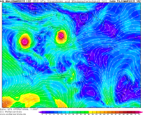
Track cyclone TREVOR (upper) and VERONICA, 20.03.
Image Credit: JTWC
|
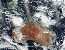
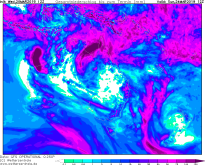
Satellite image, 20.03.
Image Credit: NASA
|
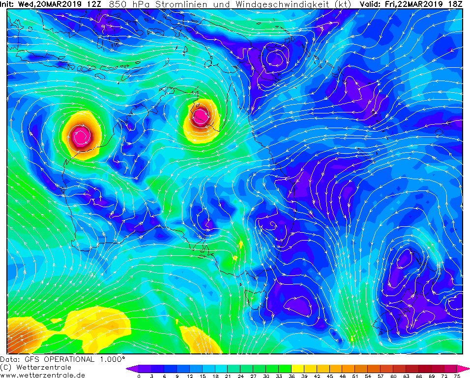
850 hPa wind
Image Credit: Wetterzentrale
|
96 hours accumulated precipitation
Image Credit: Wetterzentrale
|
Tropical cyclone TREVOR/VERONICA - Warning
Queensland, Northern Territory, Western Australia
Issued: Wednesday, 20 March 2019, 22:00 CET
Tropical storm TREVOR (actual category 1) will intensify to category 4 or 5 till the end of the week and so does
VERONICA (actual category 4).
20-27 March 2019
After TREVOR reached the shores of Queensland on March 19 and caused destructive winds and severe precipitation, it now moves to the southwest and
is already over water again. The core pressure is currently 989 hPa and the maximum wind speeds 45 kt / 81 kph, which corresponds to category 1.
Due to favorable conditions such as high water temperatures and low wind shear, TREVOR intensifies very quickly to a category 4 or even 5 cyclone tonight
and tomorrow and will hit the shores of the Northern Territory during the course of March 22. Wind speeds over 200 kph are expected. Due to the high wind
speeds storm surges must be expected. Within 3 hours, rainfall can reach more than 50mm. TREVOR will move south / southwest into the interior of the country.
There it will dissolve quickly due to the lack of water vapor and increased friction over the coming weekend.
On the west coast of Australia, a tropical disturbance had developed on March 18 and has now become a Category 1 cyclone. Meanwhile, VERONICA is a
category 4 cyclone heading southeast and make landfall between Fort Hedland and Learmonth next Monday (March 25). Here, too, winds of far more than 200 kph
must be expected, as well as storm surges and precipitation over 50 mm in 3 hours. Currently VERONICA is located about 500 km north of Port Hedland with a core
pressure of 948 hPa and is heading southeast. The current maximum wind speeds are 110 kt / 198 kph, which corresponds to category 4 and category 5 misses only
by 2 kph.
In the affected areas, precipitation of more than 150 mm in 96 hours is expected in both cases.
Issued: Mar 20, 2019, 22:00 CET
MG
Issued: Mar 21, 2019, 13:15 CET
CL
Issued: Mar 22, 2019, 13:15 CET
FL
Issued: Mar 23, 2019, 10:30 CET
CL
|