Tuesday, 05 March 2019, 12:00 CET
|
|
|
|
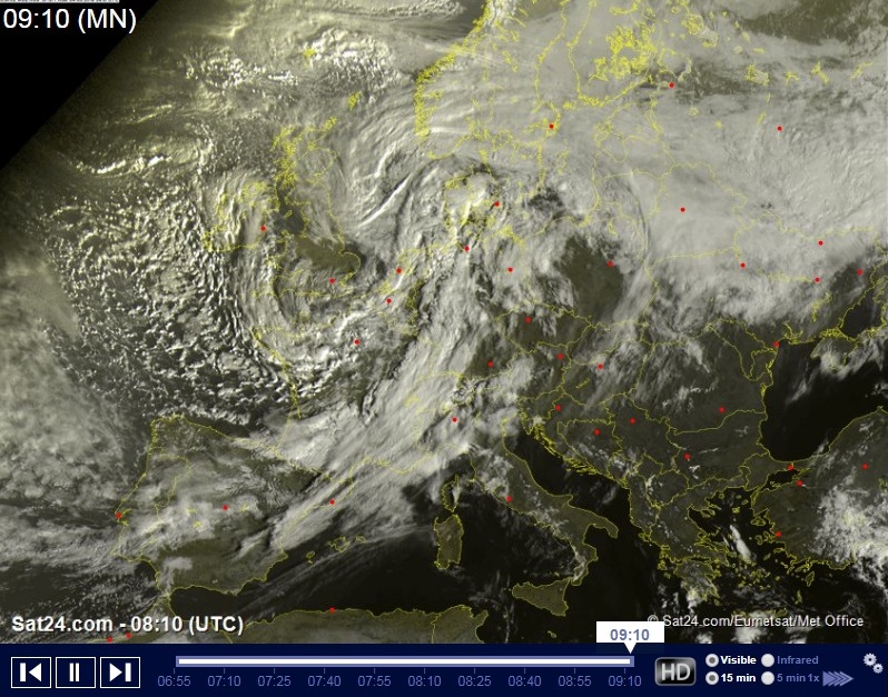
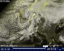
Satellite image, 05.03., 09 UTC
Image Credit: Sat24
|
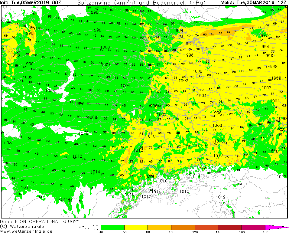
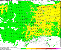
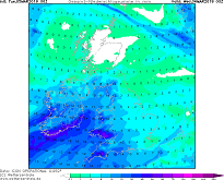
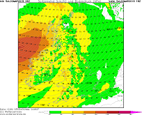
Wind gusts (CE), 05.03., 12 UTC
Image Credit: Wetteronline
|
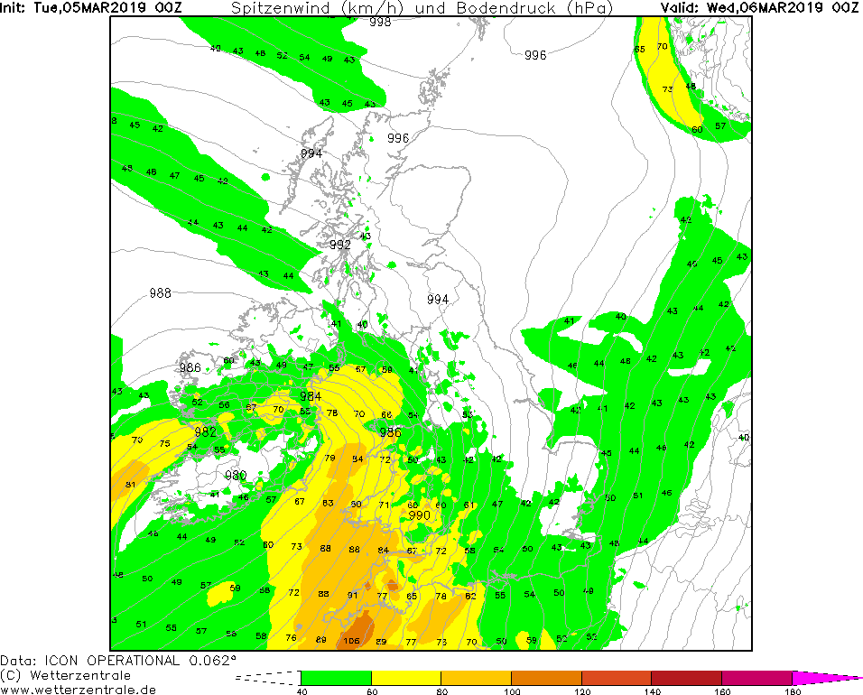
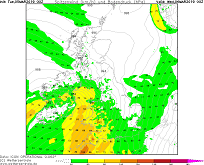
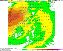
Wind gusts (GB), 06.03., 00 UTC
Image Credit: Wetterzentrale
|
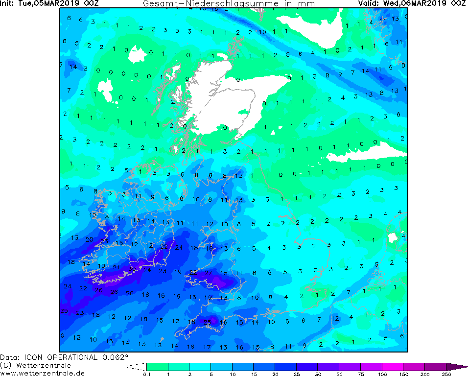
Accumulated Precipitation (BG), 06.03., 12 UTC
Image Credit: Wetterzentrale
|
Storm - Warning
Great Britain, Ireland, Central Europe
Issued: Tuesday, 05 March 2019, 12:00 CET
Storm low BENNET has moved over Germany and Great Britain on monday and brought stormy gusts, in higher altitudes gale-force gusts.
On Tuesday gusts of up 80 kph and more are still possible in exposed locations in Germany. In Great Britain low pressure are CORNELIUS will produce
storm and gale force gusts again in the night from Tuesday to Wednesday.
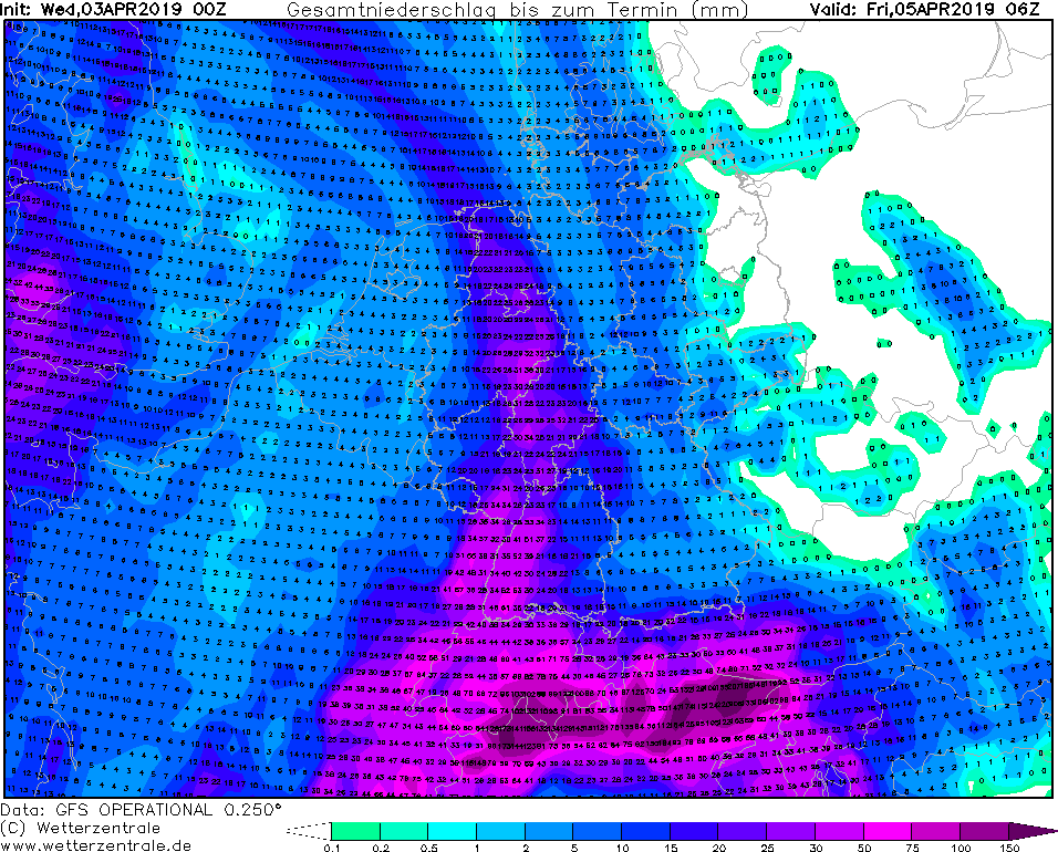
01-06 March 2019
In the wake of winterstorm Bennet there is still danger of wind gusts up to 80 kph and more in exposed locations. The weather station Feldberg already registered wind speeds of
111 kph on Tuesday morning (05 UTC).
Great Britain will be influenced by low pressure are CORNELIUS on Tuesday evening. After crossing Ireland on its northeastern course, CORNELIUS will slow down and almost become
stationary over southern Scotland.
In the southwest of England mean wind speeds of up to 60 kph and gusts of up to 100 kph are expected. Locally there is also the danger of up to 50 mm precipitation within 24 hours.
Monday, 04 March 2019, 10:00 CET
|
|
|
|
Satellite image, 04.03., 09 UTC
Image Credit: Sat24
|
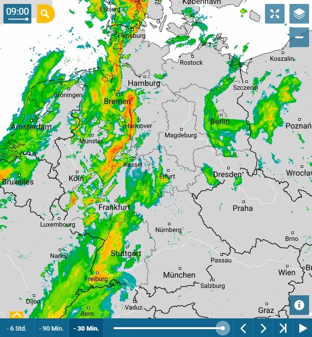
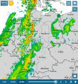
Precipitation Radar, Germany 04.03., 9 CET
Image Credit: Wetteronline
|
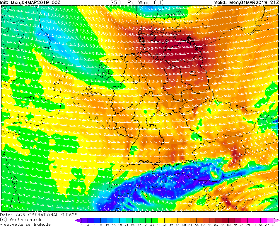
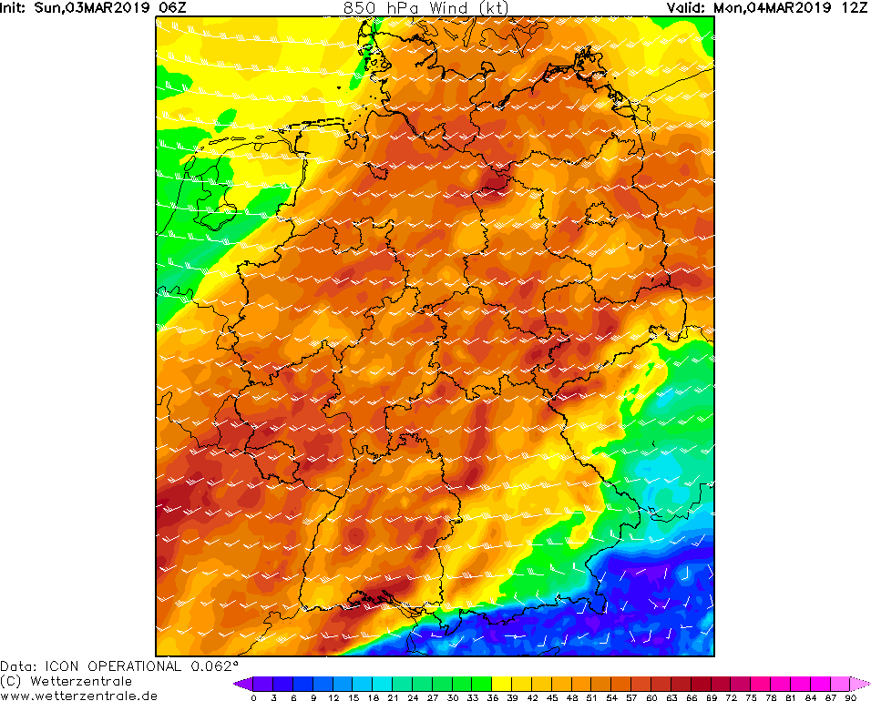
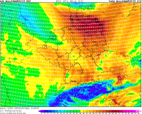
850 hPa wind 04.03., 21 UTC
Image Credit: Wetterzentrale
|
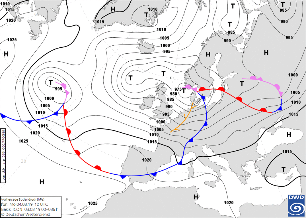
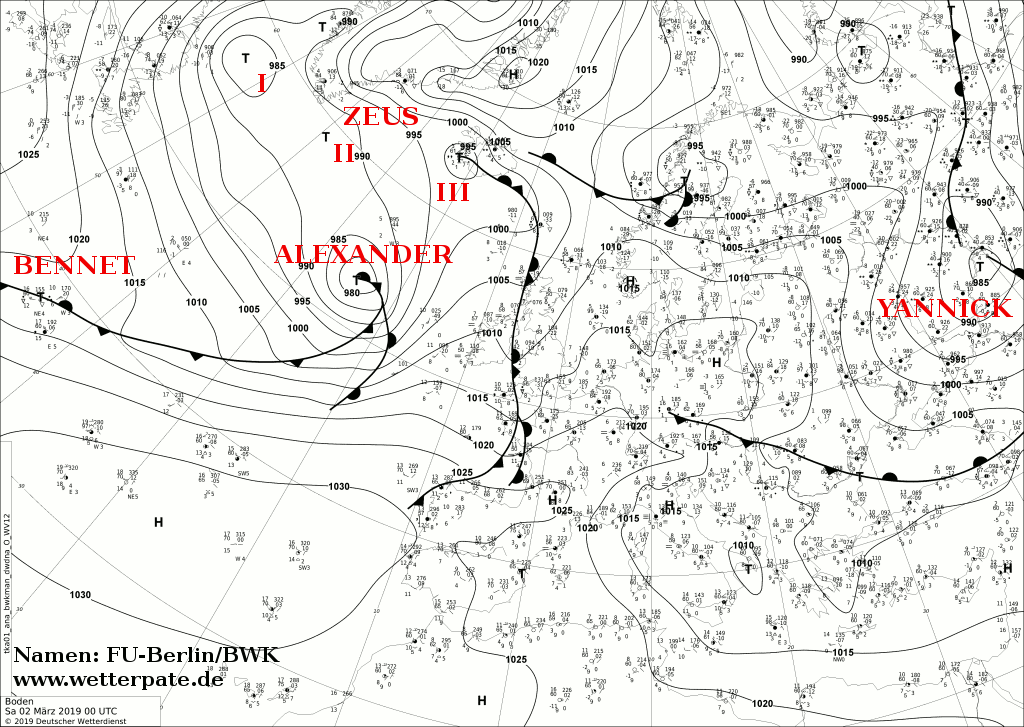
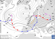
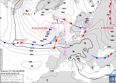
Sea Level pressure and fronts, 04.03., 06 UTC
Image Credit: DWD/FU-Berlin
|
Storm - Warning
Great Britain, Ireland, Central Europe
Issued: Monday, 04 March 2019, 10:00 CET
Storm low BENNET will move over Germany and Great Britain on the monday and bring stormy gusts, in higher altitudes gale-force gusts.
It must be expected speeds of up to 144 kph. Dangerous for the upcoming carnival parades are especially the thunderstorms that start
from noon from the northwest. These can also produce gale gusts.
01-06 March 2019
Winterstorm BENNET reached Germany in the night and during this morning. First storm gusts and heavy storm gusts, as well as gale gusts were already
registered (Brocken 139 kph). The main storm field is currently in the west and southwest. The center of BENNET currently travels across the North Sea with a
core pressure of about 980 hPa. Later on, the pressure will continue to drop, to about 970 hPa. The reason is the still favorable location on the front of the
trough and in the left jet exit.
Also in the south of the UK, BENNET caused gale-force and heavy storms last night. In the morning, Winterstorm ALEXANDER caused gusts up to 181 kph (Cairngorn).
BENNET will shift to the northeast and slightly intensify. According to the latest model runs, the wind speeds will stay at the storm level throughout the day.
Especially towards evening, the wind in the north and northeast again increases significantly. Heavy storm gusts and gale-force gusts of 140 kph can be expected
here. Another problem that will make the carnival parades more of a concern is the passage of a convergence line or squall line line. Heavy storm gusts can also
occur near the showers and thunderstorms. The line of convergence moves from the northwest across Germany and will reach the middle of Germany by noon and in the
evening the east and southeast. The associated precipitation falls as rain but also as snow (especially at higher altitudes). On the precipitation radar, it can
be seen that the line of convergence has already reached the northwest and west. First thunderstorms were also registered, such as in Lower Saxony west of
Hanover or in NRW and Rhineland-Palatinate.
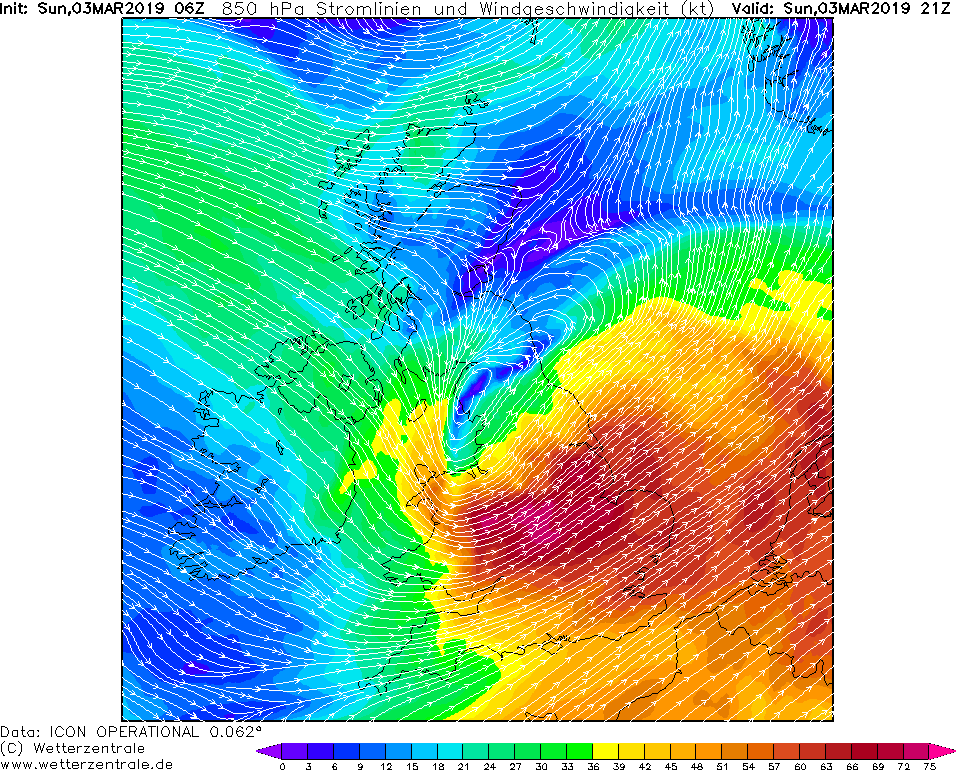
Sunday, 03 March 2019, 13:00 CET
Storm - Warning
Great Britain, Ireland, Central Europe
Issued: Sunday, 03 March 2019, 13:00 CET
Storm low BENNET will move over Germany and Great Britain on the monday and bring stormy gusts, in higher altitudes gale-force gusts.
It must be expected speeds of up to 144 kph. Dangerous for the upcoming carnival parades are especially the thunderstorms that start
from noon from the northwest. These can also produce gale gusts.
01-06 March 2019
Ironically the storm situation for upcoming monday, that was calculated at the beginning of the week is confirmed.
Winterstorm BENNET has formed on the front side of a trough as a small edge low of storm depression ALEXANDER. At the moment it is
still over the Atlantic southwest of Ireland. Due to the favorable location on the front of the trough and on the left jet exit BENNET
intensifies in the night to monday into a storm. The center will move over Ireland and the UK with a core pressure of 975 hPa and will be
located over the northern North Sea on monday morning. Again, storm and gale gusts must be expected, in the UK already on Sunday evening.
The main storm field in Germany with gusts up to 144 kph on exposed positions will move over Germany in the early morning hours between 3 o'clock and 9 o'clock.
The wind maxima extend as a narrow strip over the center of Germany and are strongest in the west. In the east and southeast, it remains initially windy.
However, the main problem will be the showers and thunderstorms that will form in the area of the postfrontal weather after the cold front has passed through.
These start from noon onwards from the northwest and are the biggest danger for the carnival parades. Showers and thunderstorms can also cause severe storm gusts,
as they lead with their rain the high winds to the ground and possibly accelerate them. Since they are locally limited, the prediction is very difficult, especially
in relation to the parades. Due to the strong vertical wind shear, organized thunderstorms are not excluded (see Convergence Line SLP Weather Maps).
Saturday, 02 March 2019, 12:30 CET
|
|
|
|
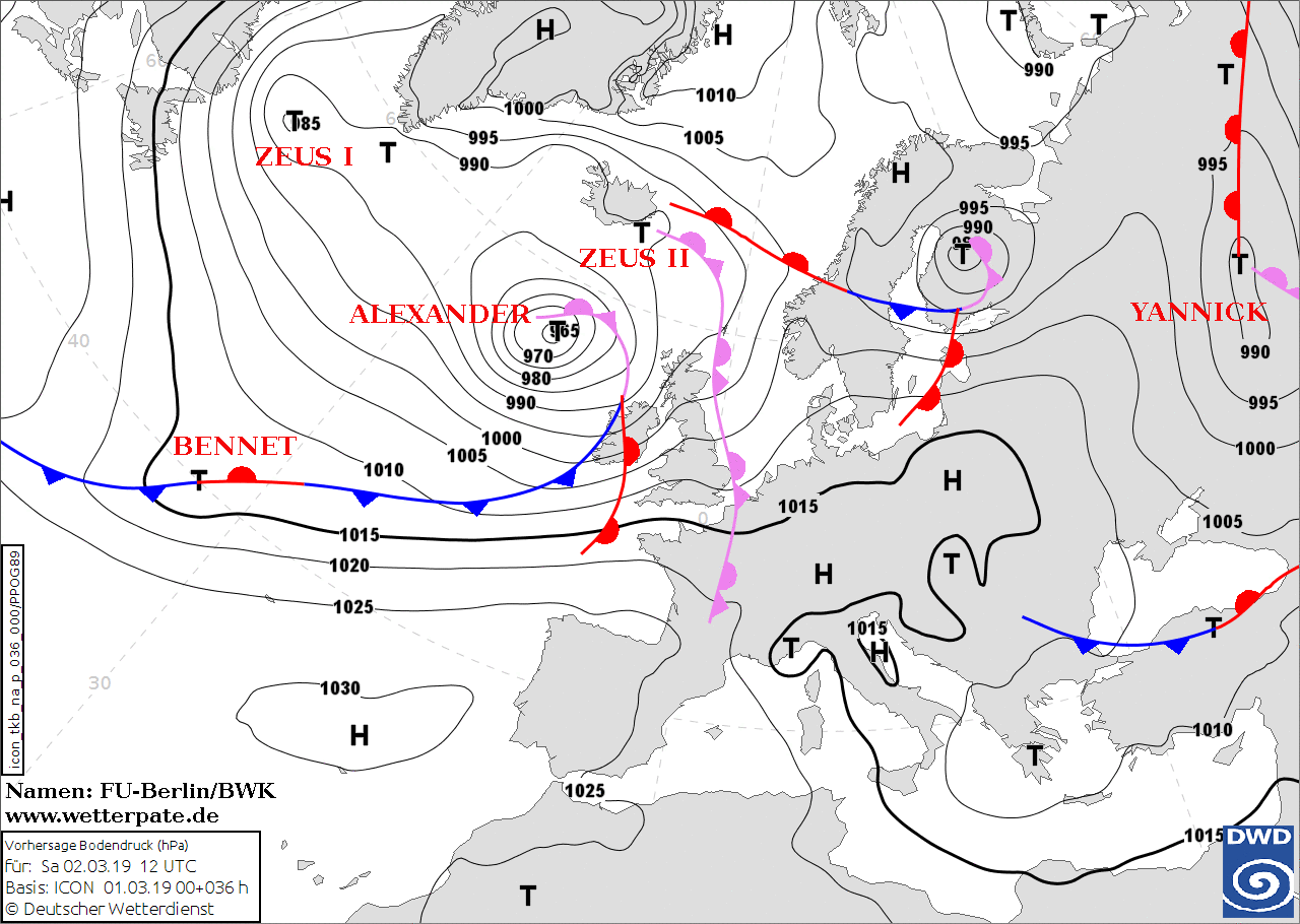
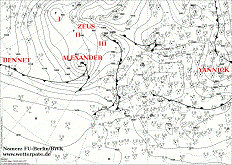
Sea level pressure and fronts, 02.03., 00 UTC
Image Credit: DWD/FU-Berlin
|
Accumulated precipitation GB,IE, 03.03., 00 UTC
Image Credit: Wetterzentrale
|
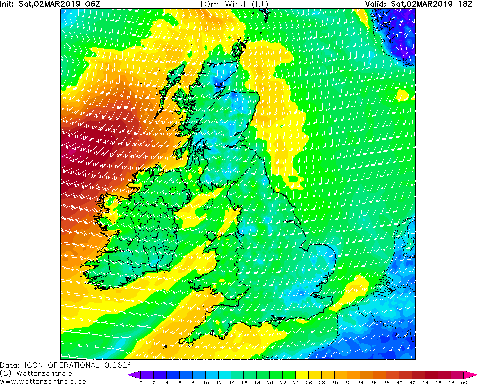
Mean wind GB,IE, 02.03., 18 UTC
Image Credit: Wetterzentrale
|
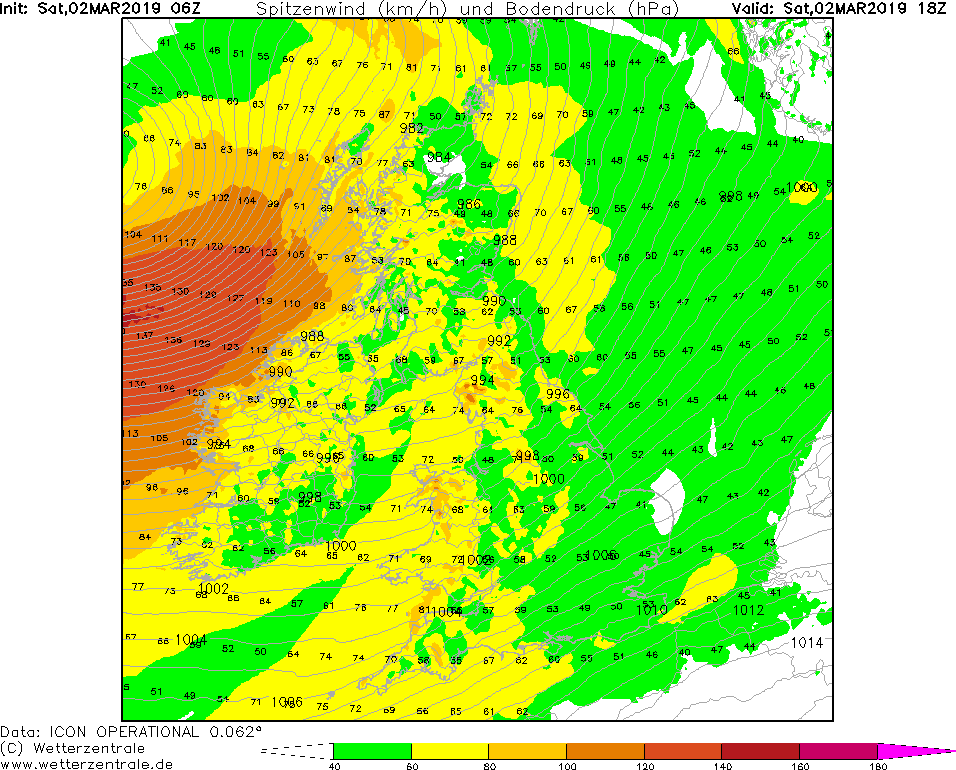
Gusts GB,IE, 02.03., 18 UTC
Image Credit: Wetterzentrale
|
Storm - Warning
Great Britain, Ireland, Central Europe
Issued: Saturday, 02 March 2019, 12:30 CET
Low pressure area ALEXANDER ends the period of unusually warm temperatures and brings precipitation of
up to 50 mm/24h and gusts of wind of up to 130 kph or more. Great Britain will be affected on Saturday and Sunday.
The effects will also be noticeable in Central Europe on Sunday and Monday.
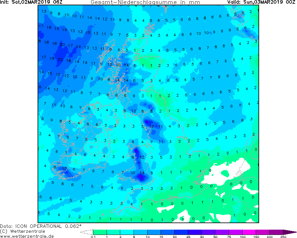
01-06 March 2019
Low ALEXANDER formed on 01 March over the Atlantic and experienced an intensification of about 30 hPa from
01 March 12 UTC to 02 March 12 UTC due to its favourable location at the jetstream exit. At 12 UTC the storm
center is located about 1000 km west of Edinburgh (GB) and moves with 50 kph in northeast direction. The core pressure is about 965 hPa.
The strongest wind speeds are expected during the night from 02 to 03 March in Northern Ireland and the
islands off the southwest coast of Scotland. Gusts may exceed 130 kph.
There is a threat of objects flying around or trees falling over. Buildings can be damaged and road traffic restrictions are to be expected.
In the warm air sector of the cyclones there are widespread rainfalls. Locally more than 50 mm/24h are possible In the area of the cold
front shower-like precipitation is to be expected, in parts of Scotland precipitation above 1000 m may also fall as snow.
Friday, 01 March 2019, 12:15 CET
|
|
|
|
Sea level pressure and fronts, 02.03., 12 UTC
Image Credit: DWD/FU-Berlin
|
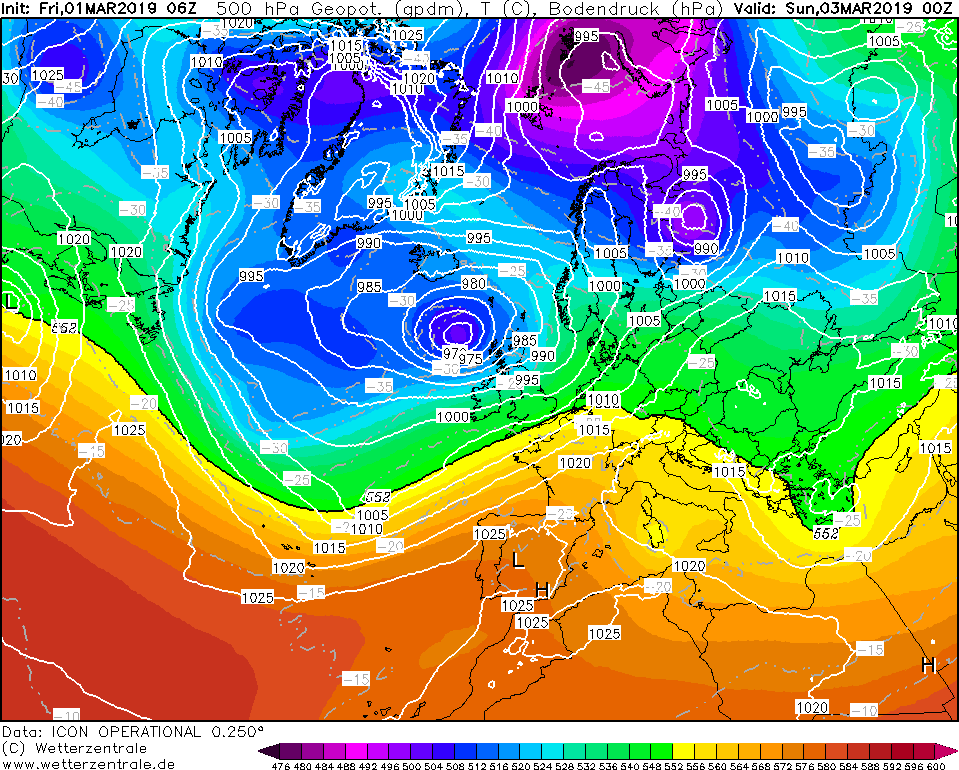
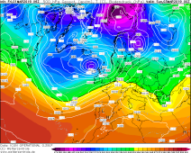
500 hPa geopot., 03.03., 00 UTC
Image Credit: Wetterzentrale
|
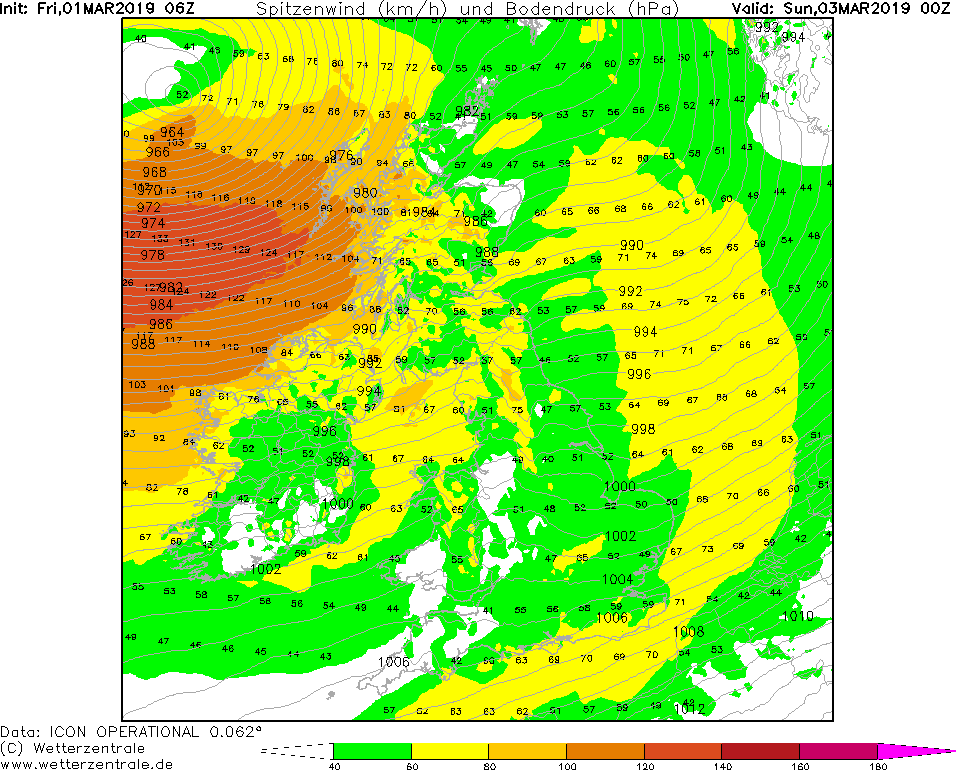
Gusts GB,IE, 03.03., 00 UTC
Image Credit: Wetterzentrale
|
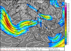
300 hPa wind, 03.03., 00 UTC
Image Credit: Wetter3
|
Storm - Warning
Great Britain, Ireland, Central Europe
Issued: Friday, 01 March 2019, 12:15 CET
After spring and summer temperatures were reached in Central Europe in the last week and the 20°C mark was cracked
in some places, the blocking ridge becomes weaker and low-pressure areas can again reach Central Europe.
Several storm lows will occur in the coming days.
01-06 March 2019
Tomorrow, storm low "Alexander" is approaching Great Britain and Ireland. This morning only a disturbance of the waves
can be seen on the Atlantic, this wave disturbance intensifies however in the course of the day to a storm low
called Alexander. This storm low will cause stormy gusts in this region on Saturday and Sunday. Until noon
today it is still a small marginal low with 995 hPa. Due to the privileged location (zonal to the jetstream)
the marginal low can intensify quickly. The displacement speed increases and the ground pressure drops to
985 hPa until this evening. Shortly before the storm hits land, the speed of the displacement slows down
again, but the pressure continues to drop. With a core pressure of 965 hPa, the storm low will pass north
of Great Britain on Sunday morning. Already on Saturday gusts of up to 90 kph are to be expected.
The highlight is expected on Sunday morning in Northern England and Ireland. Gusts of about 130 kph have to be expected, in exposed places up to 150 kph.
This can cause damage to buildings and trees can be uprooted. In addition, road and rail traffic can be impeded.
Storm gusts are expected in Central Europe on Monday. Another storm low will form over the Atlantic at the
weekend and move eastwards. Already on Sunday evening, individual gusts of wind can be expected in France,
the Benelux countries and Germany. The strongest gusts are expected on Monday morning between 2-10 UTC in
the middle of Germany. The exact train line is still uncertain, they will be here on our site with a daily
update kept up to date.
Issued: Mar 01, 2019, 12:15 CET
CL
Issued: Mar 02, 2019, 12:30 CET
FS
Issued: Mar 03, 2019, 13:00 CET
MG
Issued: Mar 04, 2019, 10:00 CET
MG
Issued: Mar 05, 2019, 12:00 CET
FS
|