Sunday, 10 February 2019, 11:15 CET
|
|
|
|
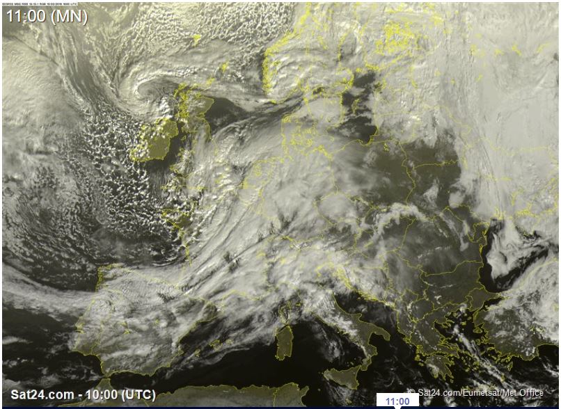
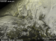
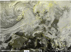
Satellite image (visible), 10.02., 10 UTC
Image Credit: Sat24
|
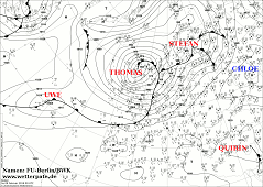
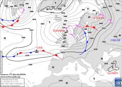
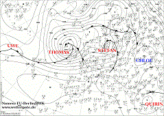
Soil pressure and fronts, 10.02., 00 UTC
Image Credit: DWD/FU-Berlin
|
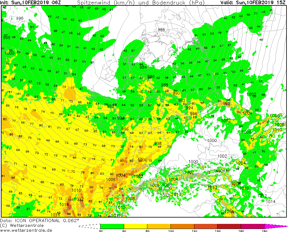
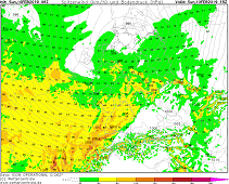
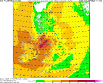
Gusts, 10.02., 15 UTC
Image Credit: Wetterzentrale
|
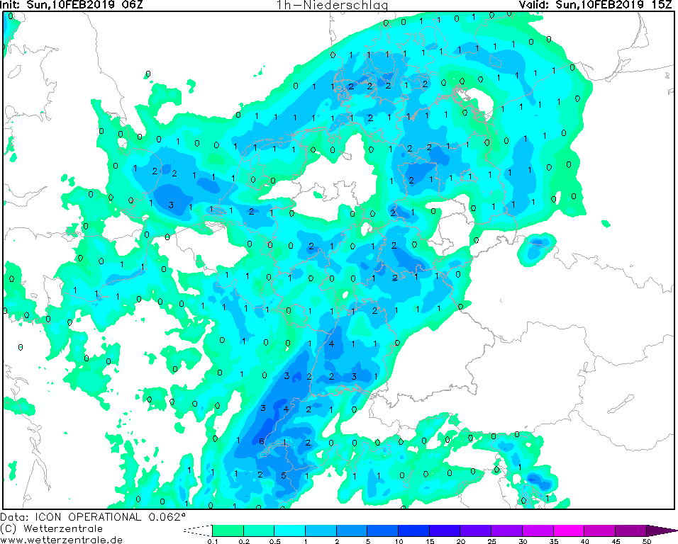
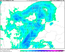
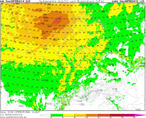
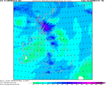
1 h precipitation, 12.02., 15 UTC
Image Credit: Wetterzentrale
|
Storm - Warning
Europe (Central Europe)
Issued: Sunday, 10 February 2019, 11:15 CET
Still strong winds with mean velocities up to 70 kph. Gusts up to 105 kph possible. Highest wind speeds may occur in Baden Württemberg and Bavaria on exposed locations.
Locally rain amounts of 40 mm/24h are expectod on Sunday, 10 January. Due to the high temperatures there is no danger of freezing rain.
08-10 February 2019
In the wake of depression THOMAS a new low pressure area (UWE) is forming over the southern part of Great Britain. It also moves in a west-northwest direction
and crosses the federal state of Schleswig Holstein on Sunday afternoon with a core pressure of 984 hPa.
Due to the location of the low-pressure area, a significant horizontal pressure gradient of about 4 hPa/100km is established, particularly in southern Germany.
This leads to strong winds with gusts of up to 105 kph from the west.
In the area around the cold front and behind, intense precipitation may occur. In western Germany more than 40 mm in 24 hours are possible.
The snowline is about 700m. Due to the relativly high ground temperatures there is no danger of freezing rain.
Saturday, 09 February 2019, 10:15 CET
|
|
|
|
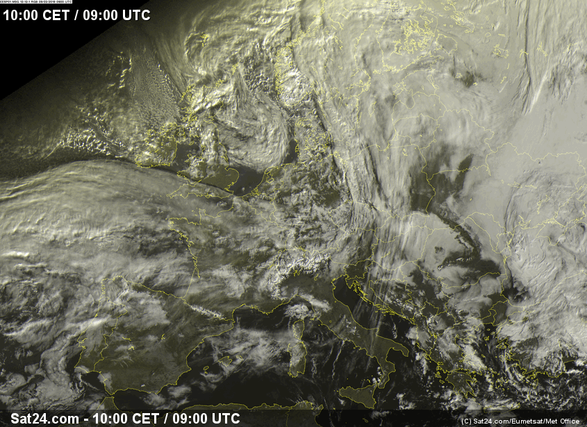
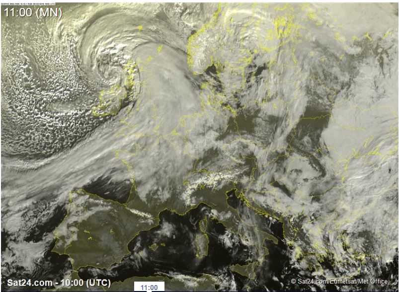
Satellite image (visible), 09.02., 9 UTC
Image Credit: Sat24
|
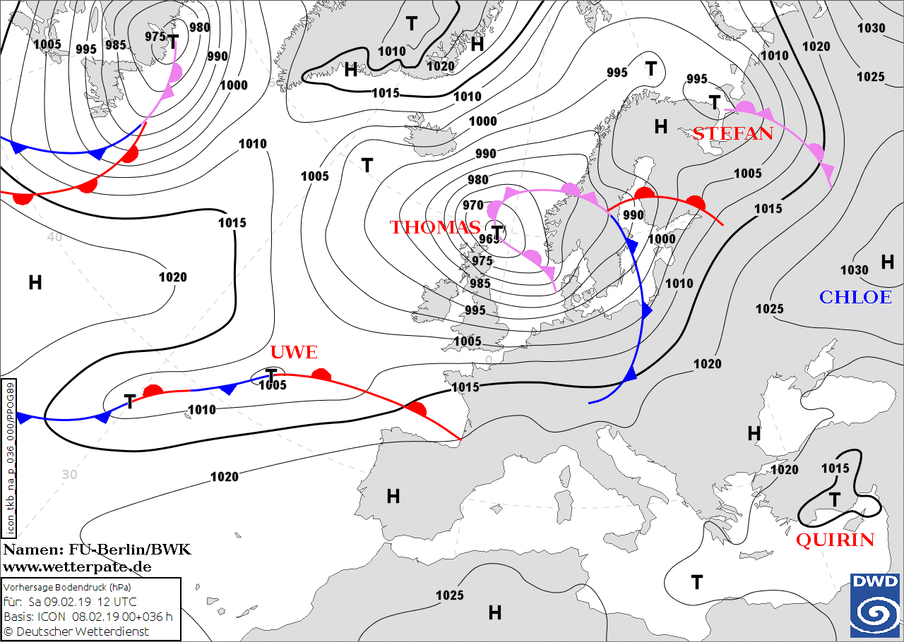
Soil pressure and fronts, 09.02., 12 UTC
Image Credit: DWD/FU-Berlin
|
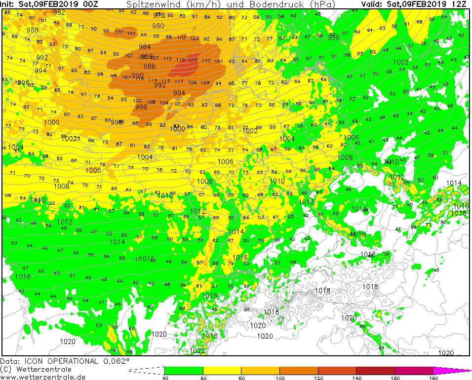
Gusts, 09.02., 12 UTC
Image Credit: Wetterzentrale
|
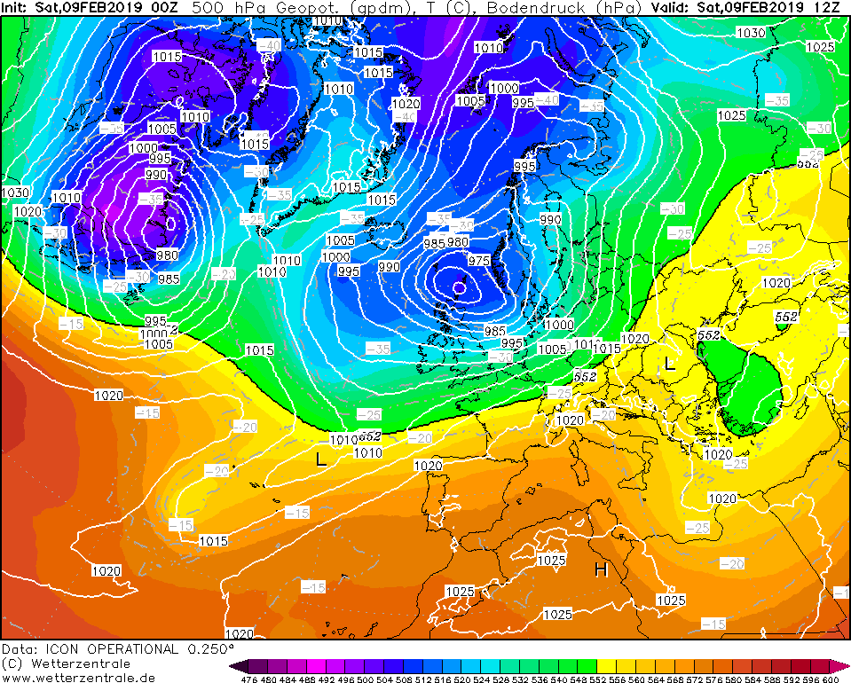
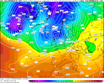
500 hPa geopot., 09.02., 12 UTC
Image Credit: Wetterzentrale
|
Storm - Warning
Europe (British Isles, Central Europe)
Issued: Saturday, 09 February 2019, 10:15 CET
Strong winds on 08 and 09 February on the British Isles and Central Europe. Gusts up to 140 kph possible on the west coastline
of British Isles. Locally still gusts up to 120 kph possible in the Netherlands, France, Germany and Denmark. Danger due to heavy swell, falling trees
and flying objects.
08-10 February 2019
Last night storm low THOMAS (core pressure 965 hPa) shifted further eastwards, so that this morning the cold front over
Germany lies on a line between Mecklenburg-Western Pomerania and the Black Forest and shifts eastward with weakening.
In northern Germany and in Skaninavia, gusts of up to 140 kph must be expected during the saturday. The low pressure
continues to shift in the direction of southern Norway until evening.
In the night to Sunday, 10 February, a new small storm low called UWE forms over the English Channel,
which then moves quickly eastwards over France and the Benelux countries to Germany. Already on Sunday
morning the associated warm front reaches the west of Germany. A stormy southwest stream sets in, and storm
gusts must also be expected in exposed locations. But also in the lowlands stormy gusts of up to 120 kph are
possible. The exact train route is still uncertain. With the passage of the cold front, which already lies over Germany at
noon, partly high reaching unstable stratified sea air flows into Central Europe.
On Monday, UWE moves off in the direction of the Baltic States, with cooler and unstable stratified sea
air flowing in at the rear during a strong north-west current. At the northern edge of the Alps,
a north jam sets in, so that rainfall of up to 50 mm/24h can be expected there.
Difficult driving conditions, road closures and delays or cancellations in train and bus services must be taken into account.
Friday, 08 February 2019, 13:00 CET
|
|
|
|
Satellite image (visible), 08.02., 10 UTC
Image Credit: Sat24
|
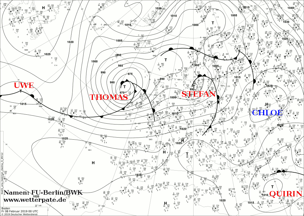
Soil pressure and fronts, 08.02., 00 UTC
Image Credit: DWD/FU-Berlin
|
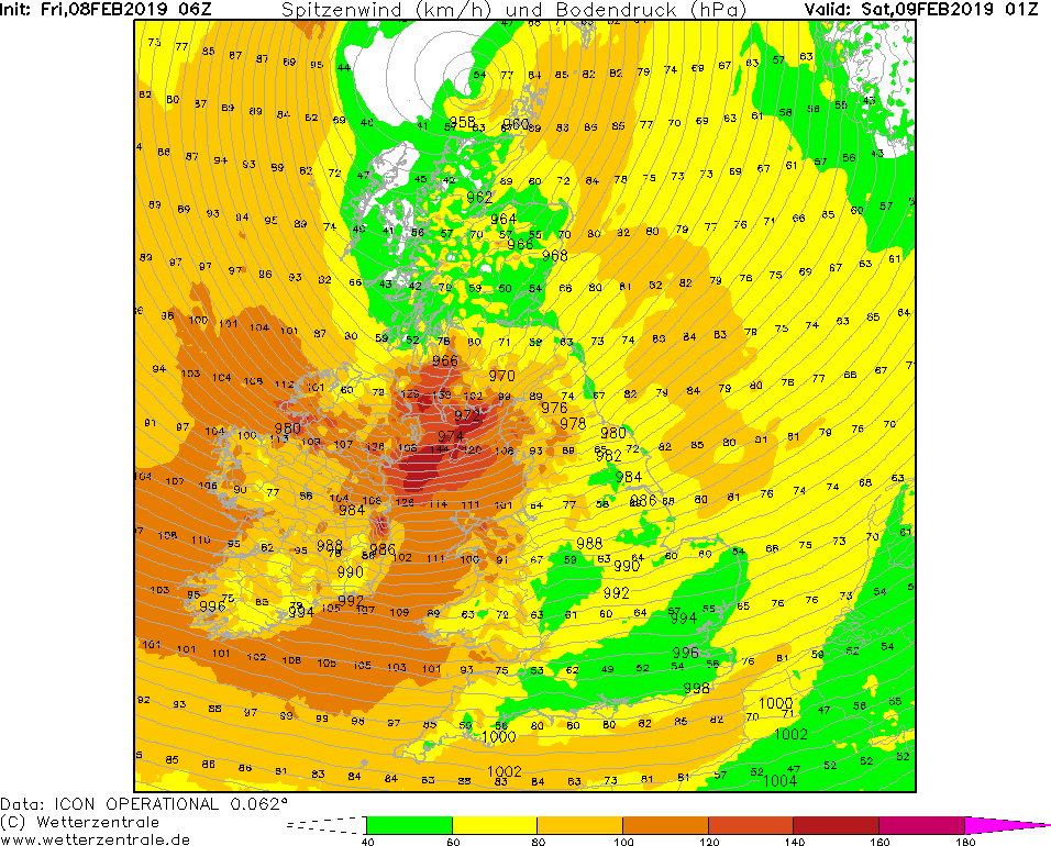
Gusts, 09.02., 01 UTC
Image Credit: Wetterzentrale
|
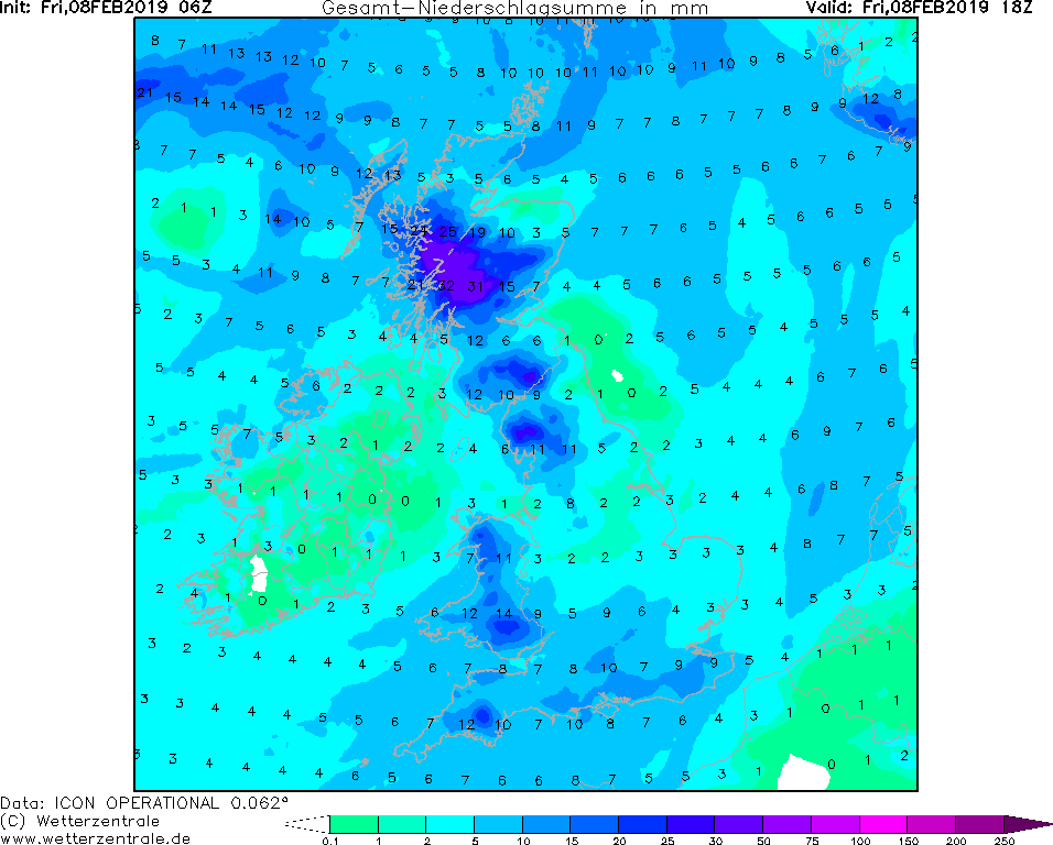
12 h precipitation, 08.02., 18 UTC
Image Credit: Wetterzentrale
|
Storm - Warning
Europe (British Isles, Northern Central Europe)
Issued: Friday, 08 February 2019, 13:00 CET
Strong winds on 08 and 09 February on the British Isles and Northern Central Europe. Gusts up to 150 kph possible on the west coastline
of British Isles. Locally still gusts up to 120 kph possible in the Netherlands, Northern Germany and Denmark. Danger due to heavy swell, falling trees
and flying objects.
08-10 February 2019
Low pressure area THOMAS formed over the Northern Atlantic and experienced an intensification of 30 hPa in 24 hours due to a favourable crossing of the polar
jet stream on 07 February.
With a core pressure of 960 hPa, the depression will reach the British Isles on early Friday, 08 February. The strongest wind speeds
around 100 kph occur in Ireland and Scotland. At the west coast of Ireland the swell reachs up to 9m height.
England, Wales and the German-Dutch North Sea coast are also expected to experience strong winds and gale-force gusts.
On Saturday, 09 February, the wind direction changes from south-southwest to a more westerly direction. With mean winds of up to 100 kph an gusts up to 140 kph
Ireland and England are most affected. On the Isle of Man even gusts up to 150 kph are possible. At the German-Dutch North Sea coast gusts will reach 130 kph.
In Scotland there is an additional risk of flooding due to heavy rainfall of up to 35 mm in 12 hours. Difficult driving conditions, road closures and delays
or cancellations in train and bus services must be taken into account.
Issued: Feb 08, 2019, 13:00 CET
FS
Issued: Feb 09, 2019, 10:15 CET
CL
Issued: Feb 10, 2019, 11:15 CET
CL
|