|
Tropical Cyclone BULBUL developed in the Western Pacific an caused damage (as MATMO) in Vietnam before re-intensifying in
the Bay of Bengal and leading to destruction by wind and flooding in north-eastern India and Bangladesh.
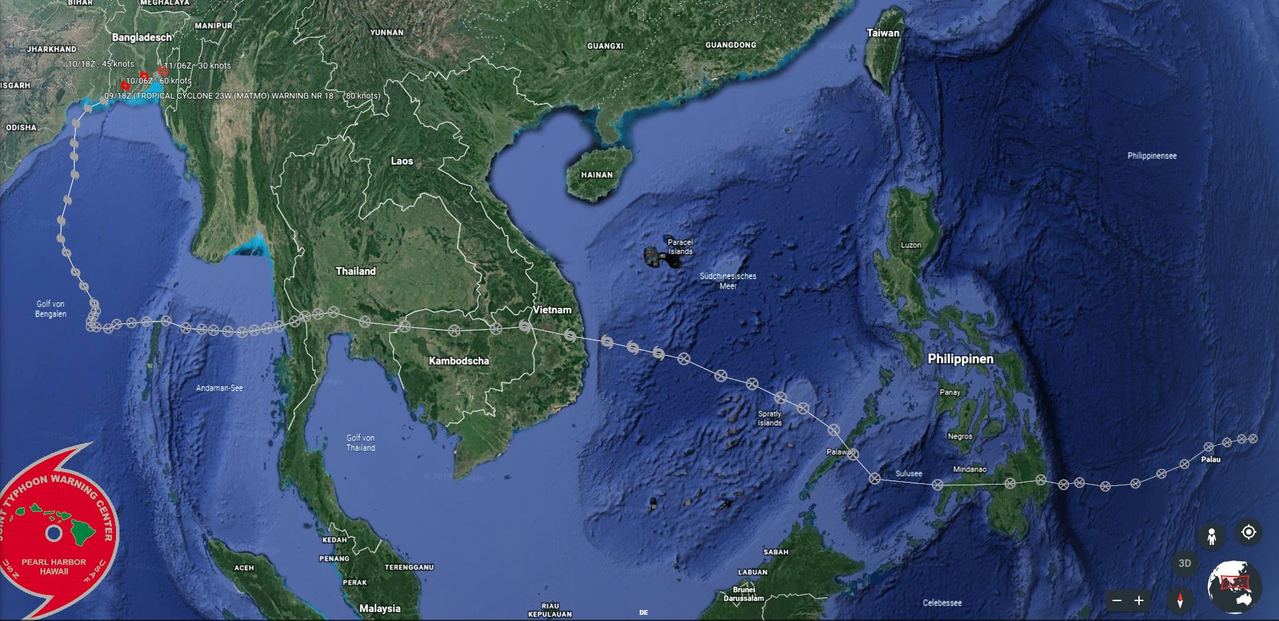
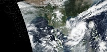
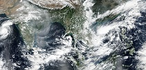
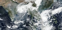
On October 28 the Joint Typhoon Warning Center registered a tropical depression about 350 km westwards of the Philippine Island of Palawan and named it MATMO.
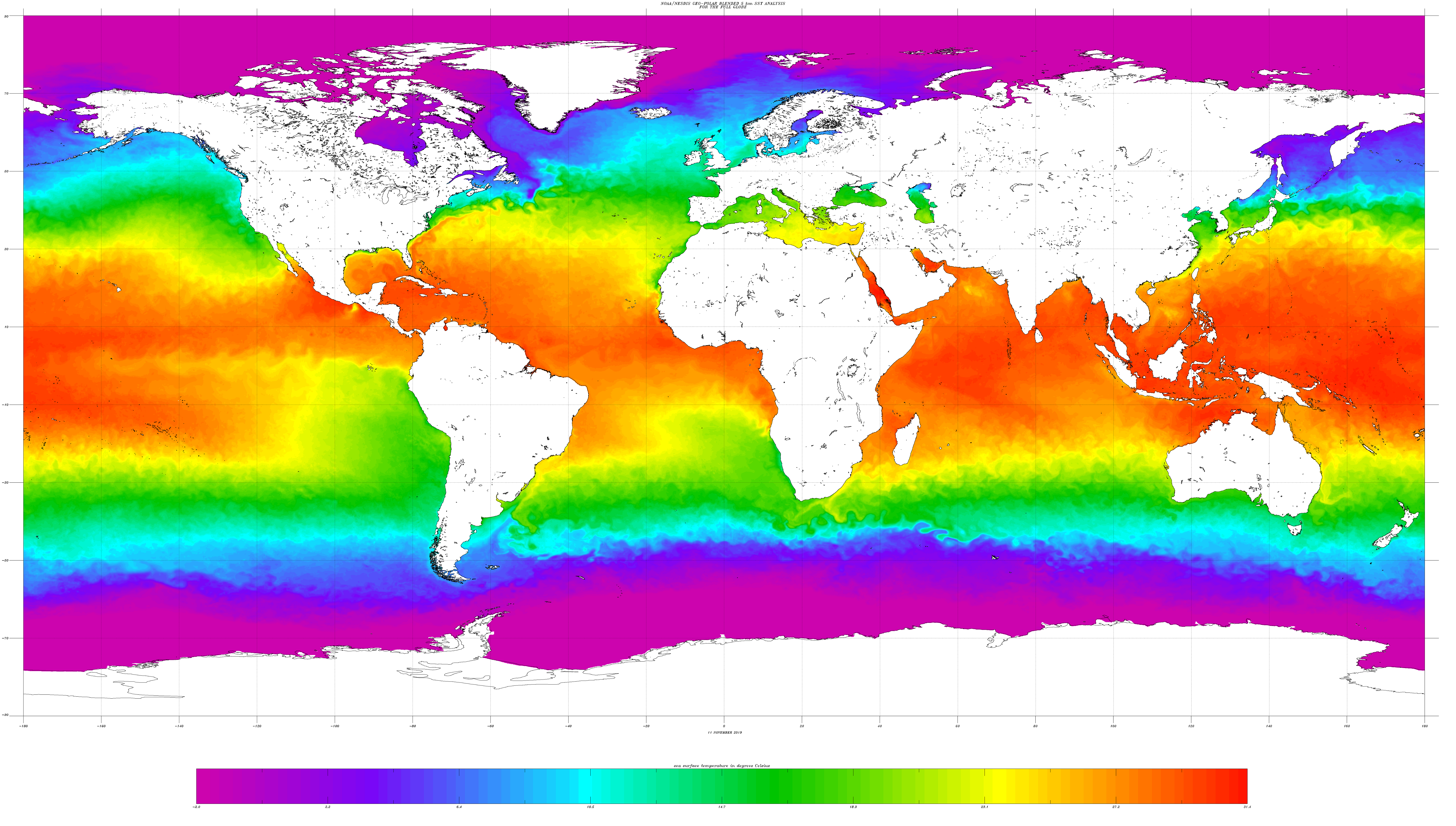
Due to the still high sea surface temperature at the edge of the Pacific Warm Pool (approx. 28°), the system was quickly strengthened to a
Severe Tropical Storm before it made landfall in Vietnam on 30 October due to the easterly basic wind flow.
|
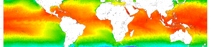
Sea Surface Temperature 11 Nov 2019,
NOAA
|
 |
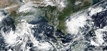
MATMO reached its peak intensity shortly before making landfall. The maximum sustainend winds were 95 kph, the core pressure 992 hPa. The effects were
felt especially in the form of abundant precipitation. In Quang Ngai (VN) on 31 October at 00 UTC a 24h precipitation of 248 mm was registered. On
the Chinese island Sanhu Dao (CN) the rainfall amount was 203.6 mm. With a covered path length of 771 km and a duration of 33 hours, the life
cycle of the system seemed to be over. The increasing trade winds in the South China Sea at this time of year drove the system over the Indochinese Peninsula
within a few days.
|
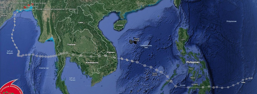
BULBULs / MATMOs Trajectory from 28 October until 11 November
JWTC and
Google Earth
|
 |
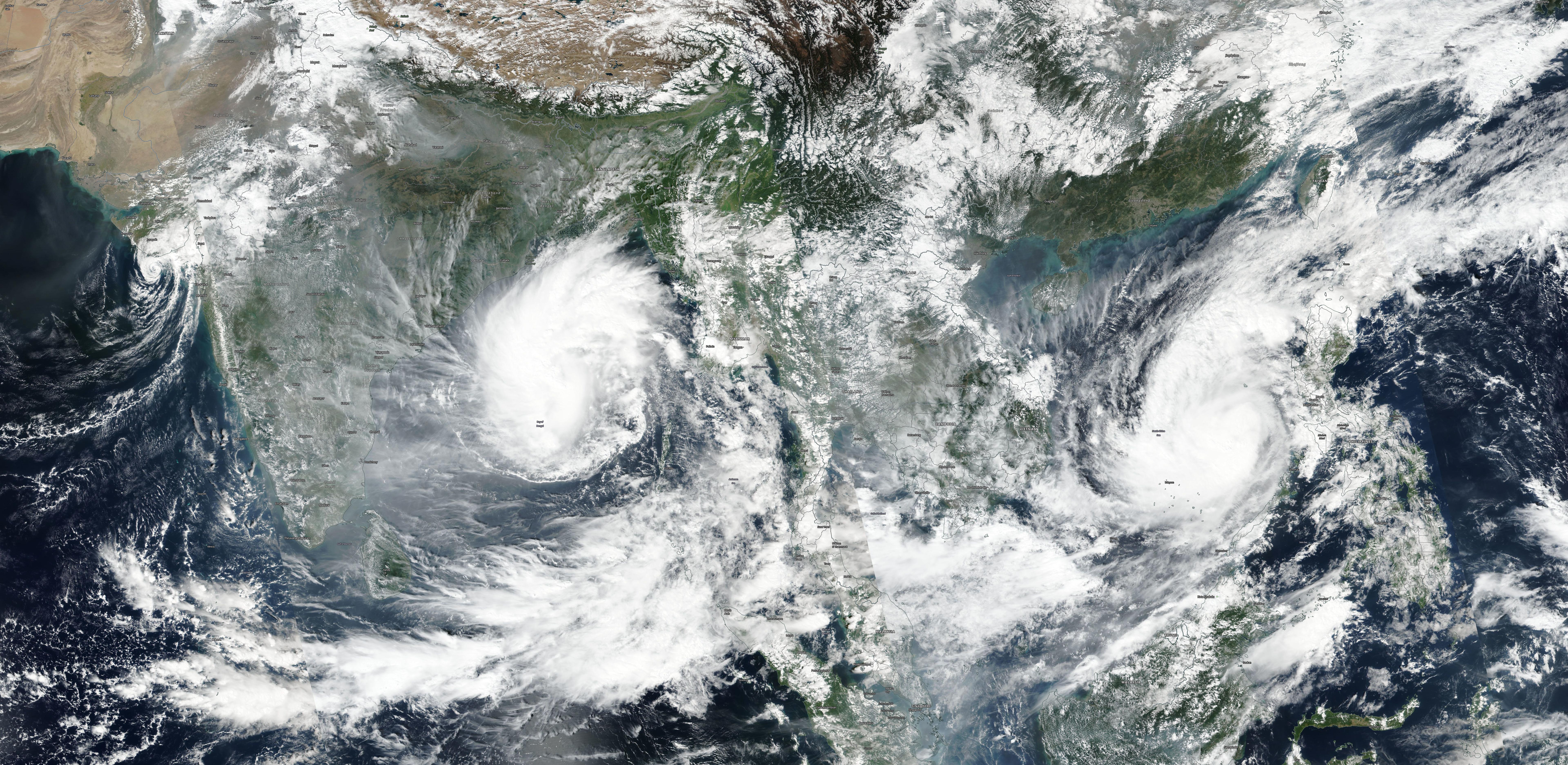
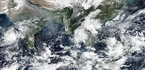
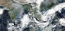
On 01 November at 18 UTC, the system moved over the Southwest coast of Myanmar to the northern Andaman Sea. With wind speeds of approx. 25 kph, the system was
hardly noticeable anymore. However, it was possible to verify by cloud trajectories that it was indeed the remnants of Typhoon MATMO that moved east over
the Andaman and Nokobar Islands and intensified into a tropical storm in the southern Gulf of Bengal on 06 November. Since the system had now also changed
the area of responsibility, it was given the name BULBUL by the India Meteorological Department. Over water temperatures of 28-29° and an area of low
vertical wind shear, BULBUL intensified to Category 2. The shift into the Indian Ocean also changed the nomenclature of the storm.
|
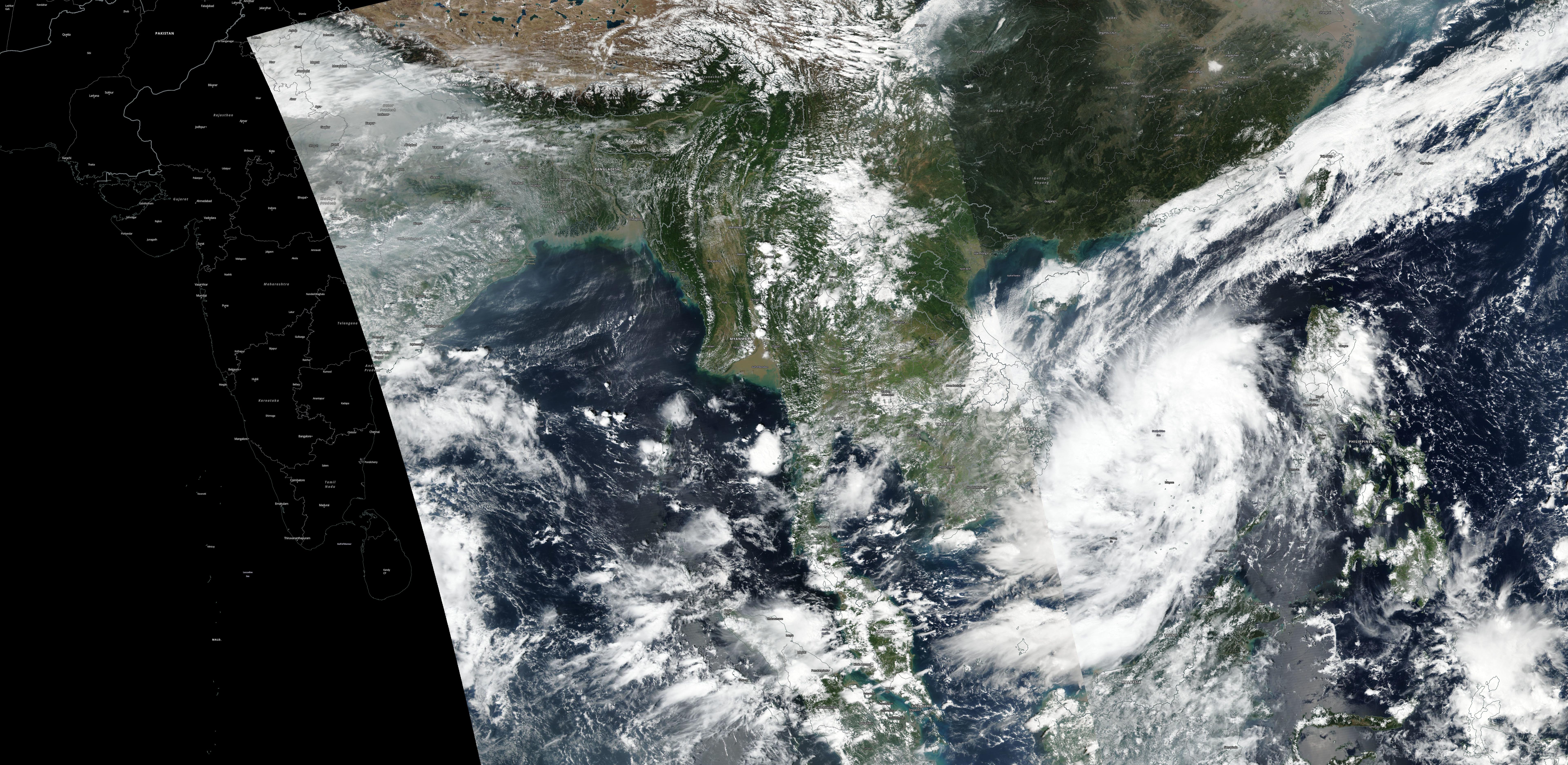
Satellite images of MATMO, 29.10. until 02.11.,
Source: NASA Worldview
|
 |
 |
 |
 |
Tropical cyclones with a wind speed of more than 119 kph are called hurricanes when they occur in the North Atlantic, the Caribbean, the
Gulf of Mexico or the central eastern North Pacific. In the western North Pacific, the correct nomenclature is typhoon. In the Indian
Ocean and in the western South Pacific - as in the case of BULBUL - the systems are called cyclones.
|
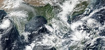
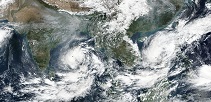
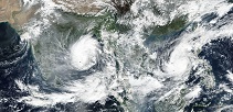
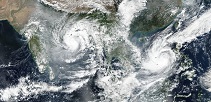
Satellite images of BULBUL, 03.11. until 10.11.,
Source: NASA Worldview
|
 |
 |
 |
 |
 |
 |
 |
 |
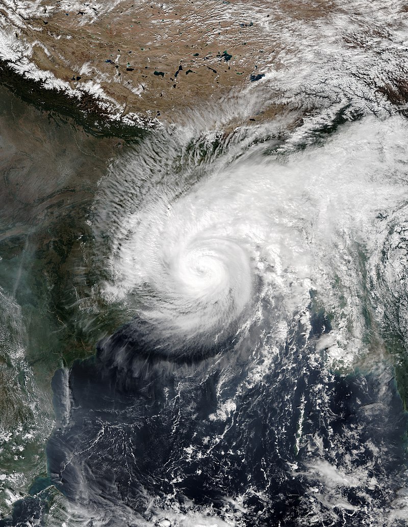
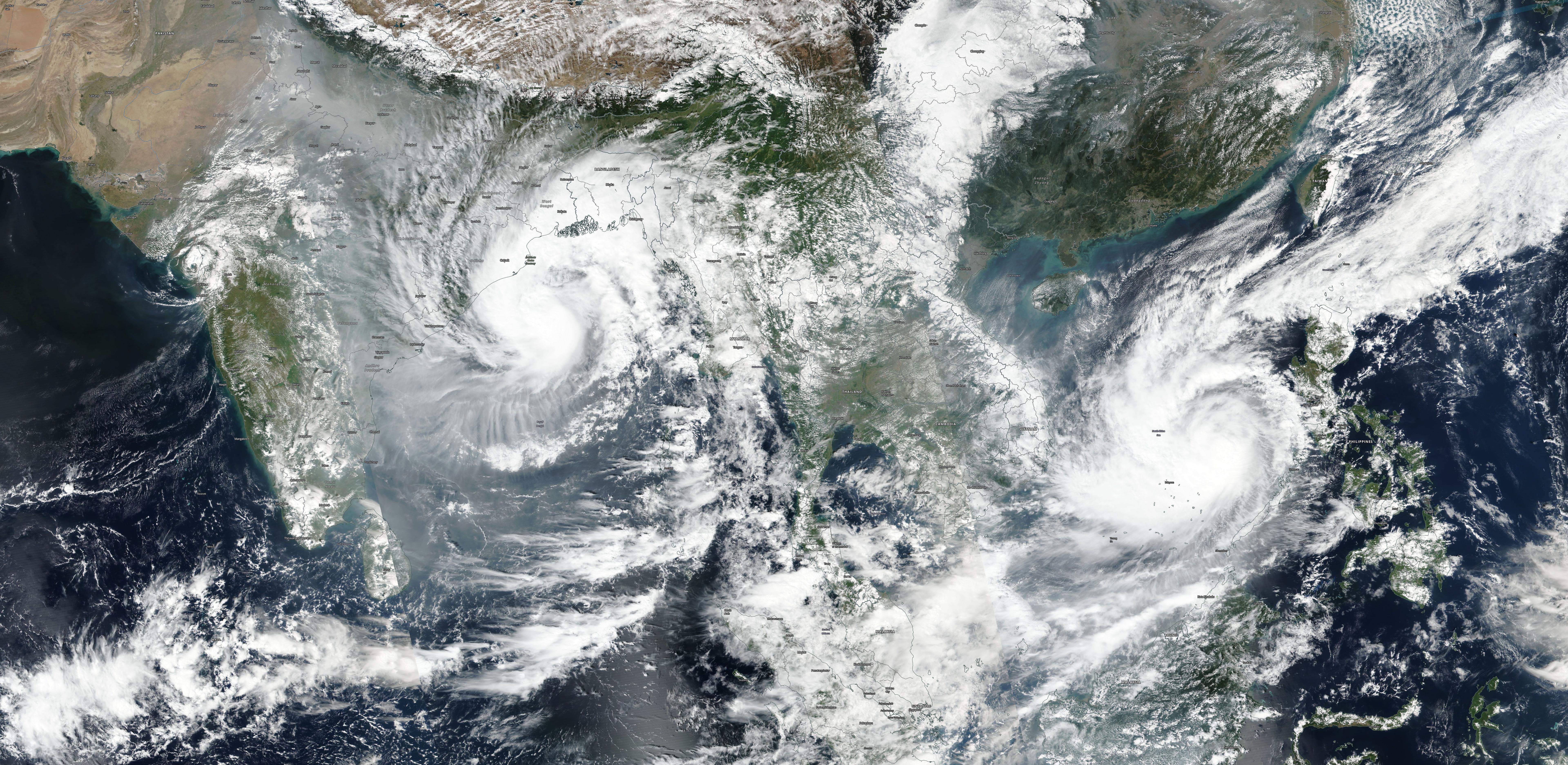
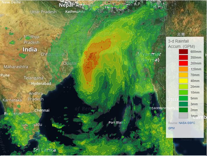
Tropical Cyclone BULBUL reached its peak intensity in the evening hours of 08 November with maximum seustained mean winds of 155 kph. From now on, BULBULs trajectory led
north. The water temperatures remained at a high level of 27-28°, but BULBUL approached the area of the subtropical jet stream, which increased the vertical wind shear.
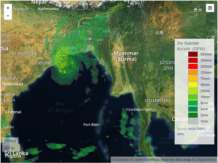
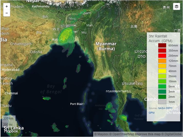
With a slightly decreasing intensity, the storm moved towards the western border between India and Bangladesh. On 09 November at 18 UTC, the storm made landfall in the
western part of the Ganges Delta, approximately in the area of Sundarban National Park with wind speeds of approximately 135 kph.
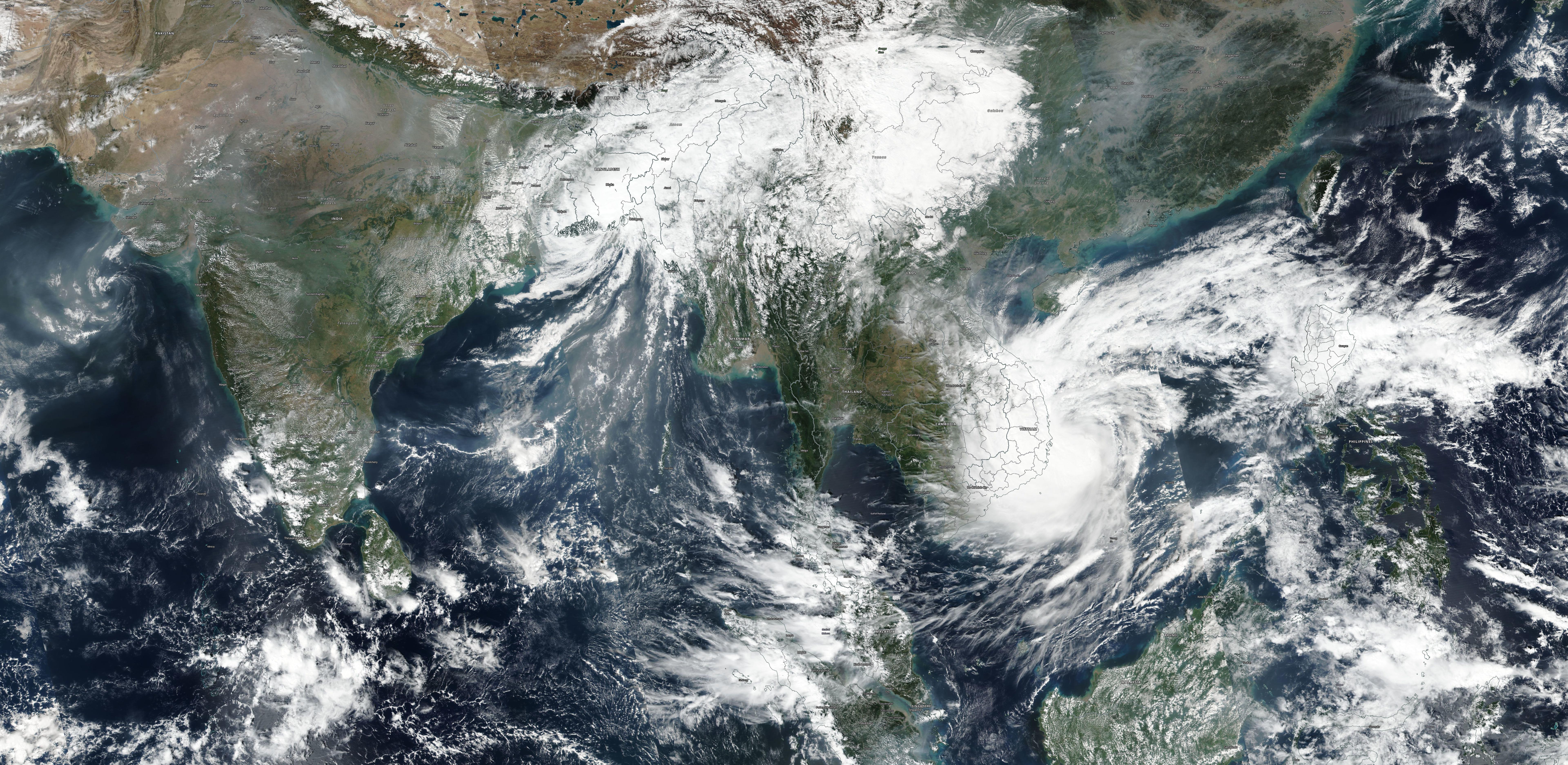
Although the storm only belonged to category 1, the effects were enormous. The positioning of the storm was almost ideal to push water masses
into the many river estuaries of the Ganges Delta at its eastern flank. In coastal regions many houses were destroyed by wind or flooding.
BULBUL caused a storm surge of up to 2.5m in isolated regions of Bangeladesh. More than 2 Million people moved to shelters in Bangladesh.
There were restrictions in air travel and road traffic due to fallen trees or masts. There were also disturbances in the electricity network.
Fishermen had to stop working for several days. Despite the many preparations, there were numerous injuries and at least 38 deaths in India
and Bangladesh. The economic damage is estimated at 36.9 million USD (Source: Banglatribune).
|
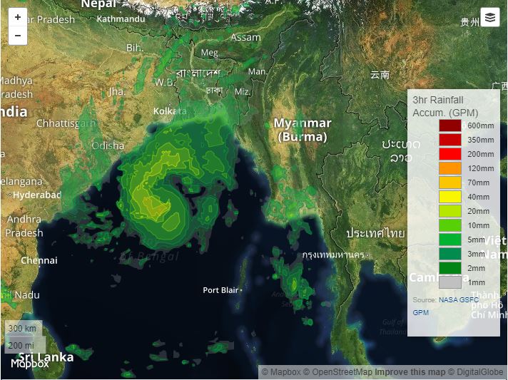
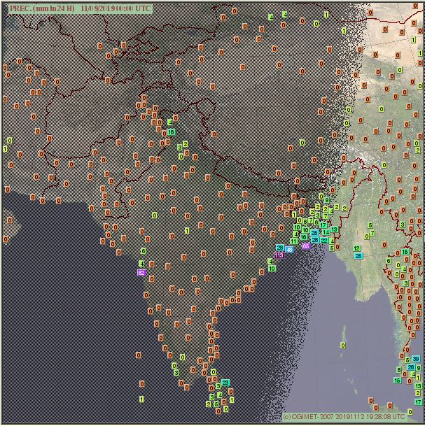
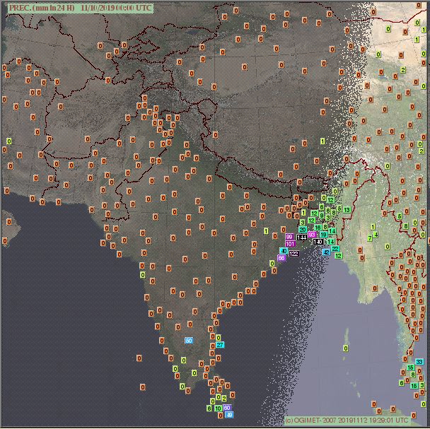
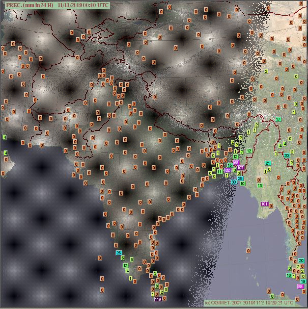
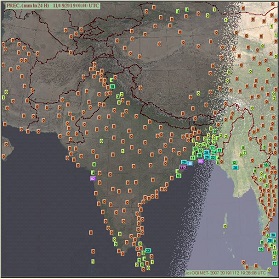
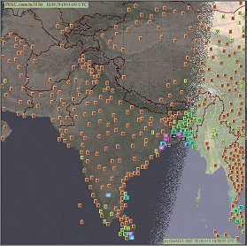
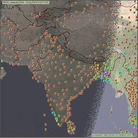
24 hour precipitation (observation) of Nov 09, 10 and 11, 00 UTC
Source: Ogimet
|
 |
 |
 |
BULBUL was the sixth storm of the recent North Indian Ocean cyclone season to reach hurricane force. The 2019 season
thus marks a new record since the observations started in 1972. The previous record was set in 1998 with 5 systems that
reached hurricane force. MATMO/BULBUL is the first storm to be named in the western North Pacific and then travel into
the North Indian Ocean and become a named storm again since Wilma in 2013 (Source: Philip Klotzbach).
| Location |
24 h precipitation amount |
Date |
Quang Ngai (VN)
Sanhu Dao (CN)
Quy Nhon (VN)
Xisha Dao (CN)
Hue (VN)
Banmethuot (VN)
Pleiku City (VN)
Dong Hoi (VN)
Da Nang (VN)
Hue (VN)
Chandbali (IN)
Digha (IN)
Barisal (BD)
Balasore (IN)
Digha (IN)
Calcutta / Dum Dum (IN)
Diamond Harbour (IN)
Chandbali (IN)
Jessore(BD)
Cox's Bazar (BD)
Balasore (IN)
Rangamati (BD)
Feni (BD)
Cox's Bazar (BD)
Kutubdia (BD)
|
248.0
203.6
164.0
72.1
68.0
61.0
58.0
131.0
81.0
75.0
113.2
48.0
28.0
25.7
122.0
108.0
99.0
66.0
65.0
42.0
40.0
107.0
68.3
30.0
28.0
|
31.10.2019, 00 UTC
31.10.2019, 00 UTC
31.10.2019, 00 UTC
31.10.2019, 00 UTC
31.10.2019, 00 UTC
31.10.2019, 00 UTC
31.10.2019, 00 UTC
01.11.2019, 00 UTC
01.11.2019, 00 UTC
01.11.2019, 00 UTC
09.11.2019, 00 UTC
09.11.2019, 00 UTC
09.11.2019, 00 UTC
09.11.2019, 00 UTC
10.11.2019, 00 UTC
10.11.2019, 00 UTC
10.11.2019, 00 UTC
10.11.2019, 00 UTC
10.11.2019, 00 UTC
10.11.2019, 00 UTC
10.11.2019, 00 UTC
11.11.2019, 00 UTC
11.11.2019, 00 UTC
11.11.2019, 00 UTC
11.11.2019, 00 UTC
|
|
Data source:
Source: Ogimet.
Text: FS
November 13, 2019
|