|
Super Typhoon LEKIMA is the thirteenth named tropical storm of the 2019 Pacific typhoon season. It developed
east of the Philippines, passed north of Taiwan and grazed the east coast of China. At its peak intensity
LEKIMA was a Category 4 Typhoon.
Development and trajectory
LEKIMA developed from a tropical depression in the Philippine Sea that was monitored by the Japan Meteorological
Agency (JMA) and the Joint Typoon Warning Center (JWTC) on 02 August. Due to the absence of a steering current,
the system hardly moved, but intensified over high water temperatures of 31-32°C and an area of only moderate
vertical wind shear.
|
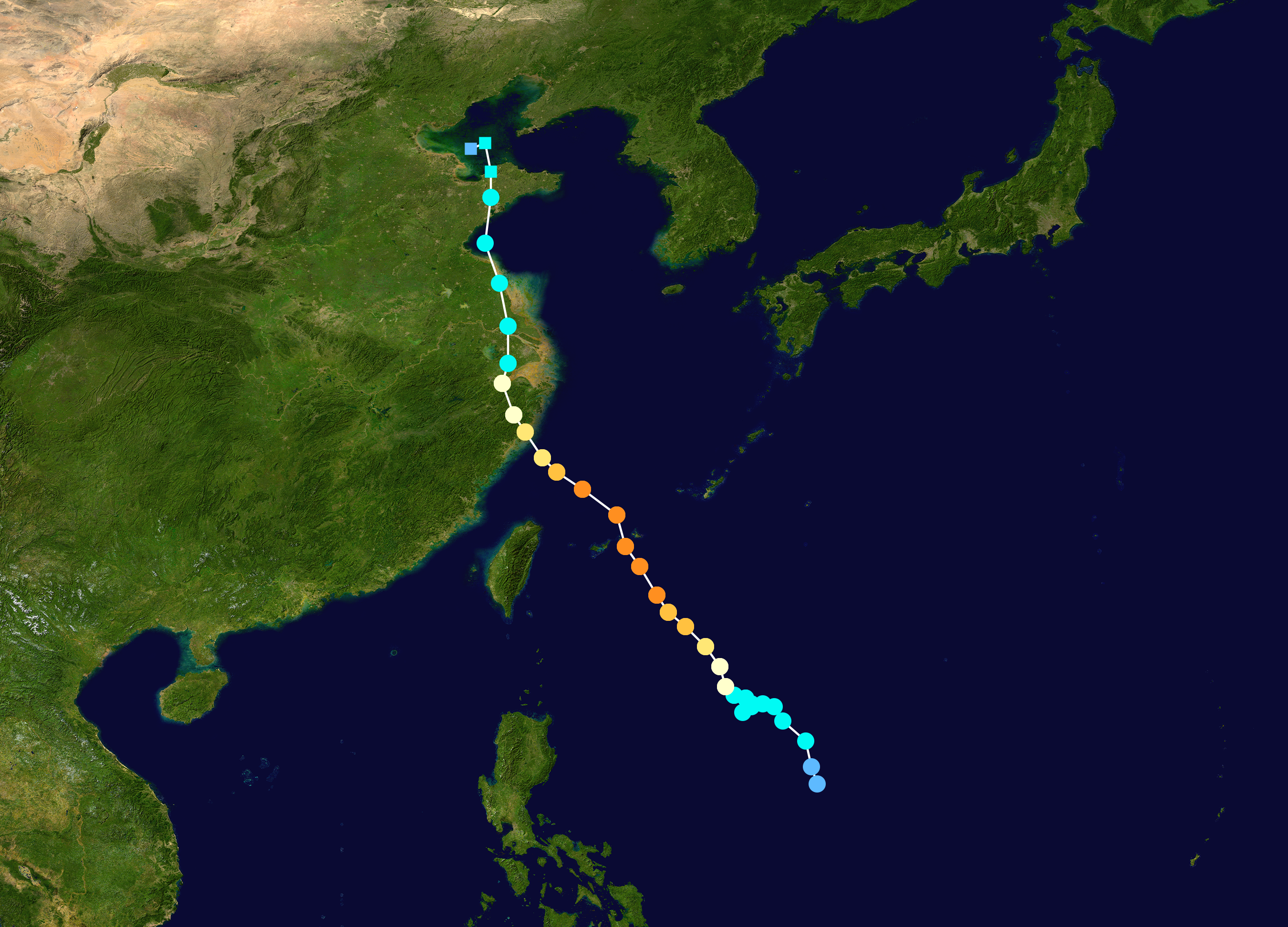
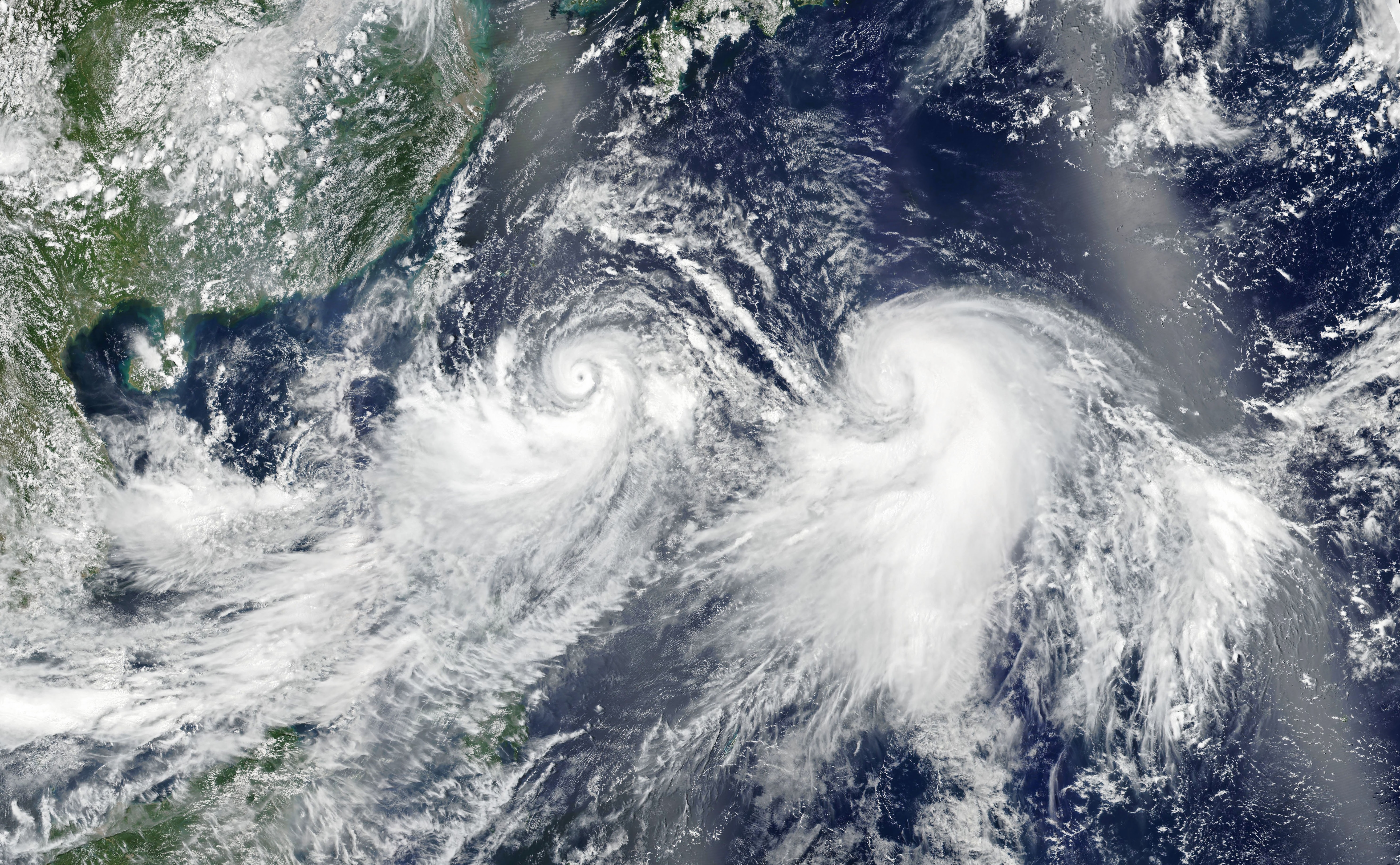
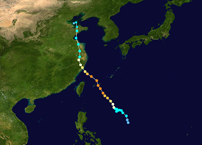
LEKIMAs trajectory and satellite image of LEKIMAS and KROSAs origination, 07.08.: source
NOAA
NASA
|
 |
 |
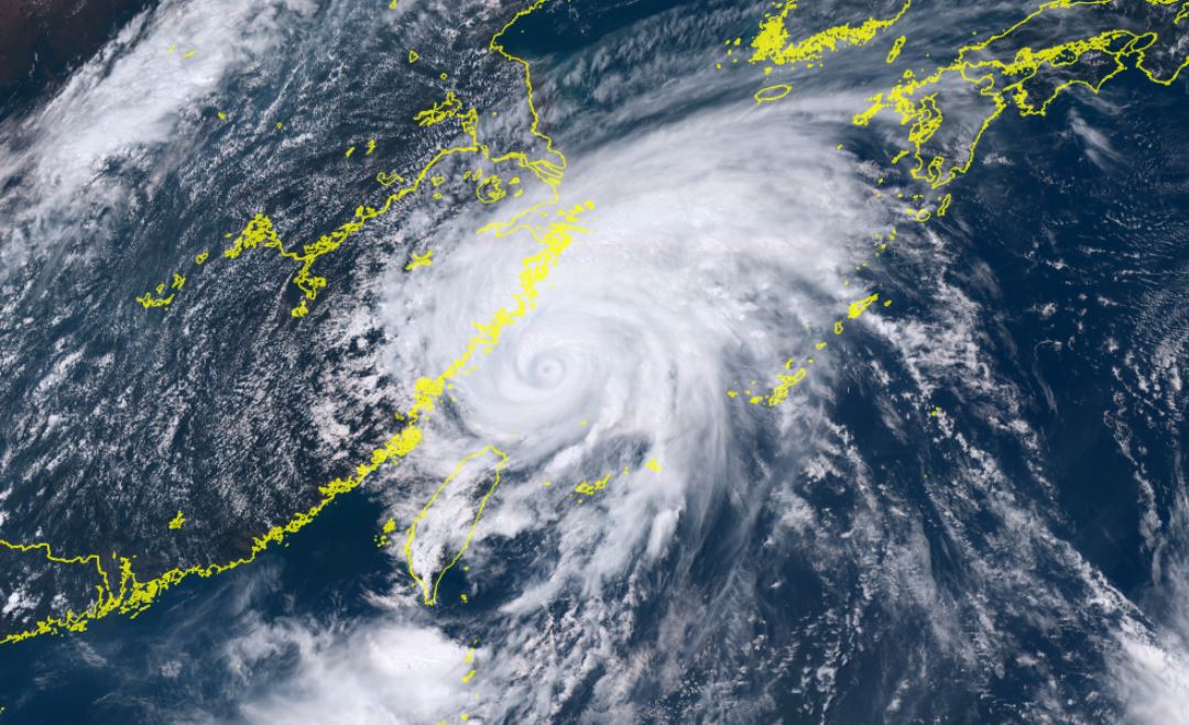
On 06 August, the system moved northwest and intensified to a typhoon, before a rapid intensification occured
on 07 August, which resulted in an visible eye on the satellite images. On 08 August, shortly before it reached
its maximum intensity, LEKIMA was upgraded to a Super Typhoon. With a core pressure of 920 hPa and mean wind
speeds of 195 kph, LEKIMA reached its peak intensity on the evening of August 08.
Source: NICT
On 09 August a second Eyewall formed as can be seen on the rain radar images. The eyewall replacement cycle, which
is common in tropical cyclones with mean winds stronger than 180 kph, caused a weakening of the cyclone to category 2.
Since the cycle was not completed entirely, there was no further re-intensification possible.
On the way to the eastern Chinese coast LEKIMA came in less favourable conditions with water temperatures of less
than 30°C. It approached the coast with a gradual decreasing intensity and made landfall as category 2 typhoon
on 10 August at 06 UTC in Wenling, Zhejiang. Overland, the storm rapidly weakened and was downgraded to a tropical
storm on the evening of 10 August.
Observations and aftermath
Even before LEKIMA reached its full destructive power, it provided abundant precipitation in the Philippines by
intensifying the local monsoon system. The Ryukyu Islands, a Japanese group of islands northeast of Taiwan, also
suffered storm damage as well as flooding and landslides due to 24-hour precipitation of more than 200 mm.
Storm damage and flooding also occurred in Taiwan. More than 300 mm/24 fell locally. In Taipe, Taiwans capital
city, many houses were damaged or destroyed.
In China, the effects were felt primarily in the form of severe rainfall. The Yongan River carried high water and
flooded several cities. Furthermore, landslides occurred - especially in the highlands.
| Location |
24 h Precipitation
amount in mm |
Date |
Bailan (TW)
Xueba (TW)
Tianpufenxiao (TW)
Quingquan (TW)
Yueling (TW)
Niaozuishan (TW)
Baishi (TW)
Yufeng (TW)
Shaolai (TW)
Miyakojima (JP)
Ishigakijima (JP)
Sinait (PH)
Dinghai (CN)
Dachen Dao (CN)
Xianju (CN)
Shipu (CN)
Hangzhou (CN)
Huang Shan (CN)
Huaiyin (CN)
Sheyang (CN)
|
328.0
289.5
283.0
278.0
272.5
271.5
271.0
266.0
257.5
204.5
190.5
138.0
236.4
184.1
174.3
118.6
108.3
129.9
121.1
105.7
|
09.08.2019
09.08.2019
09.08.2019
09.08.2019
09.08.2019
09.08.2019
09.08.2019
09.08.2019
09.08.2019
09.08.2019
09.08.2019
09.08.2019
10.08.2019
10.08.2019
10.08.2019
10.08.2019
10.08.2019
11.08.2019
11.08.2019
11.08.2019
|
|
Data source:
Source: Central Weather Bureau Taiwan,
Ogimet.
Text: FS
August 13, 2019
|