|
Wednesday, January 2nd, 2019 21:30 UTC
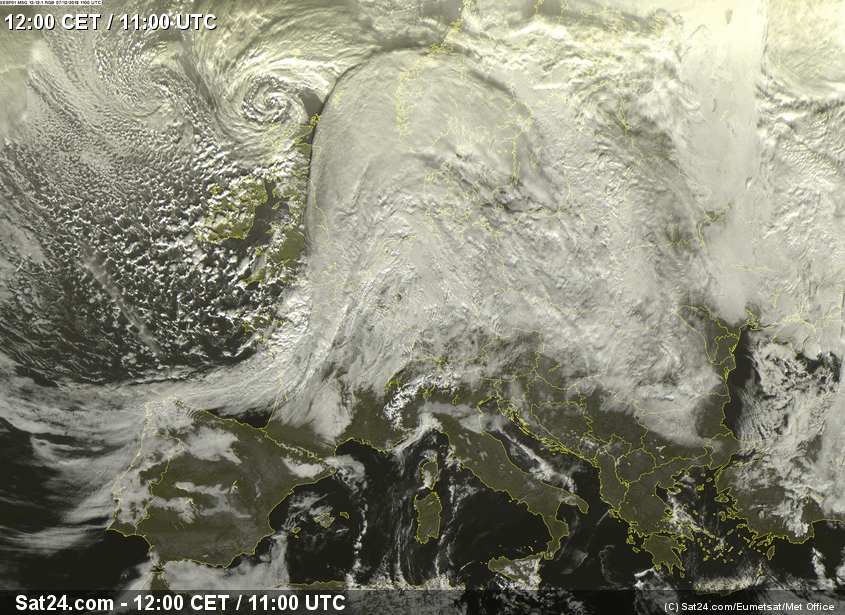
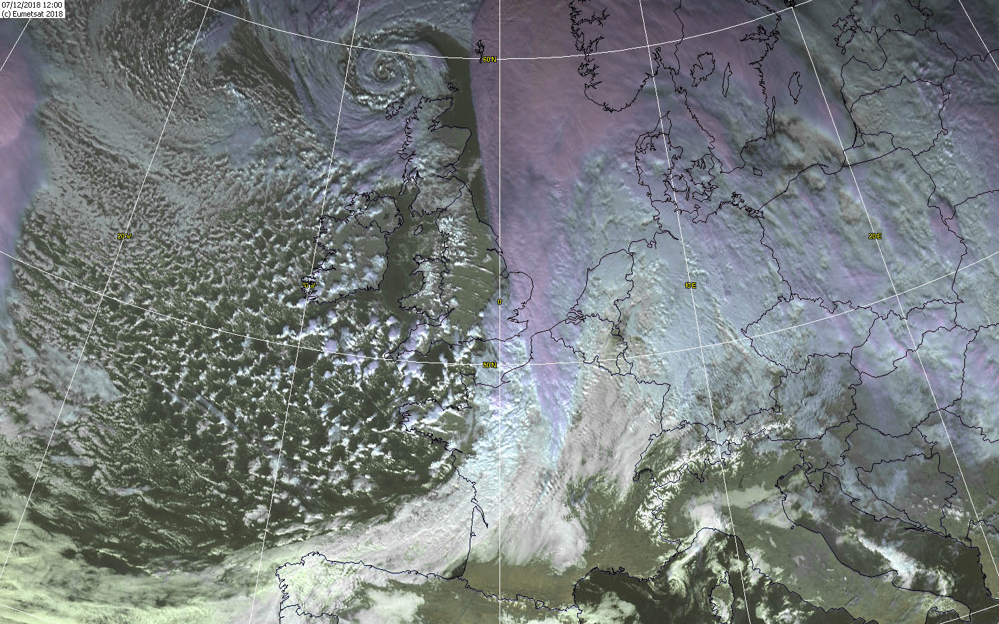
Winterstorm Europe 07.12.-09.12.2018 Winterstorm MARIUELOU December 7th, 2018 Source: Sat24 |
|
|
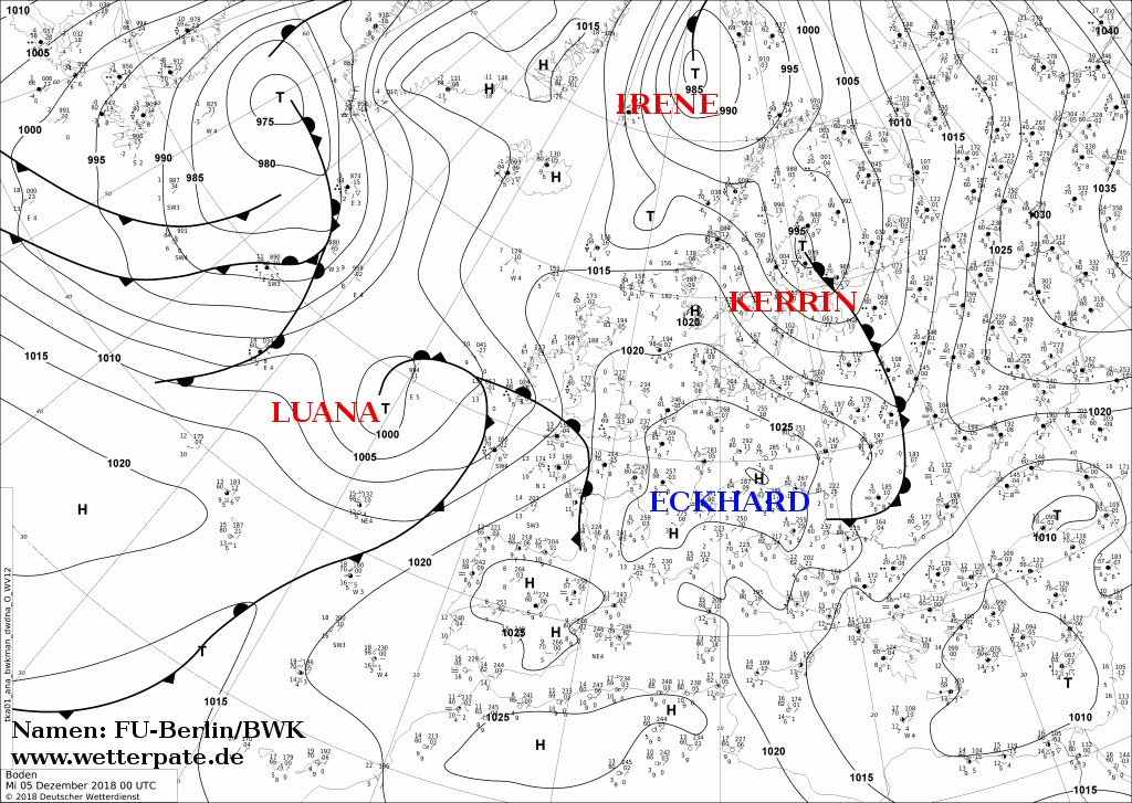
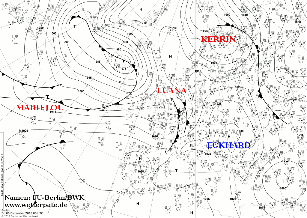
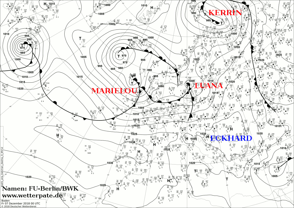
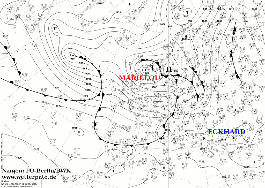
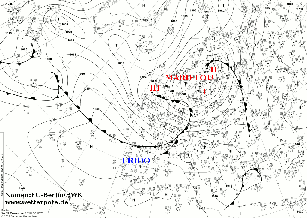
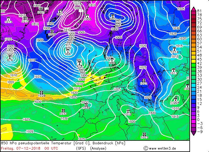
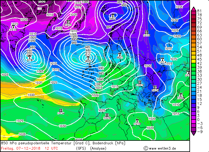
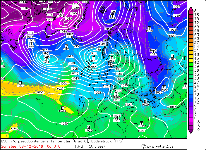
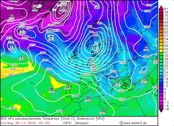
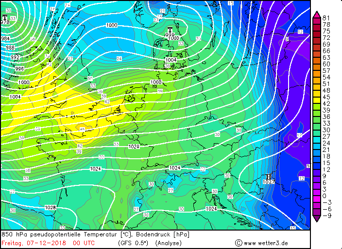
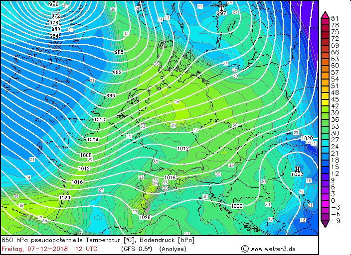
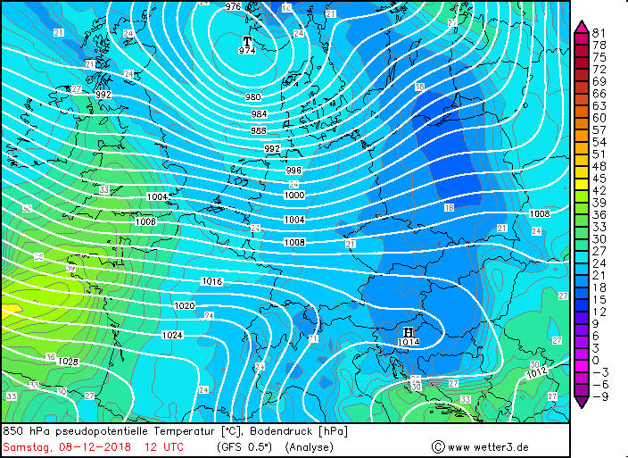
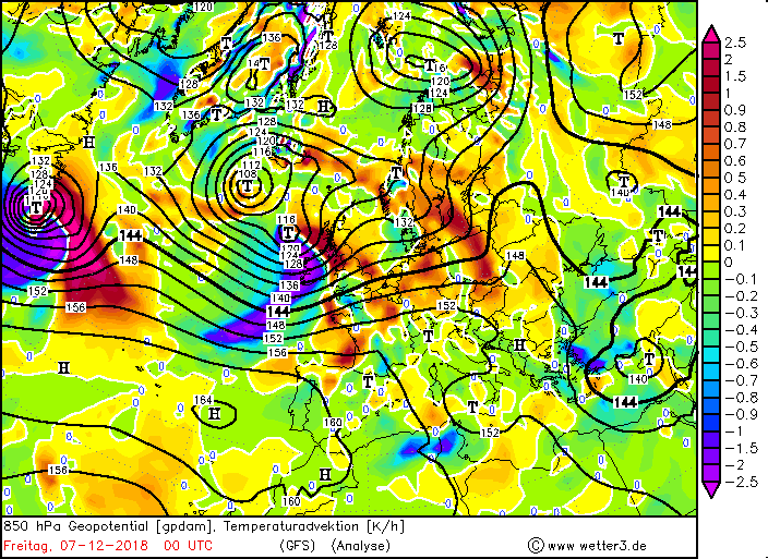
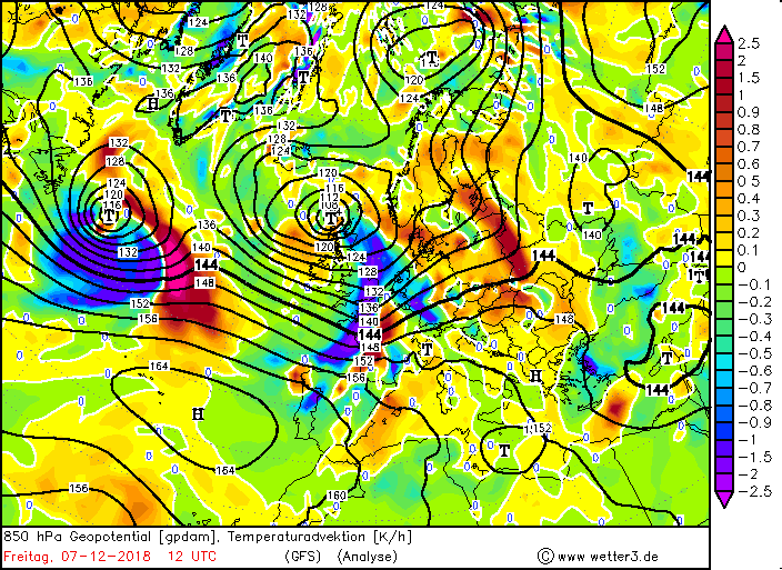
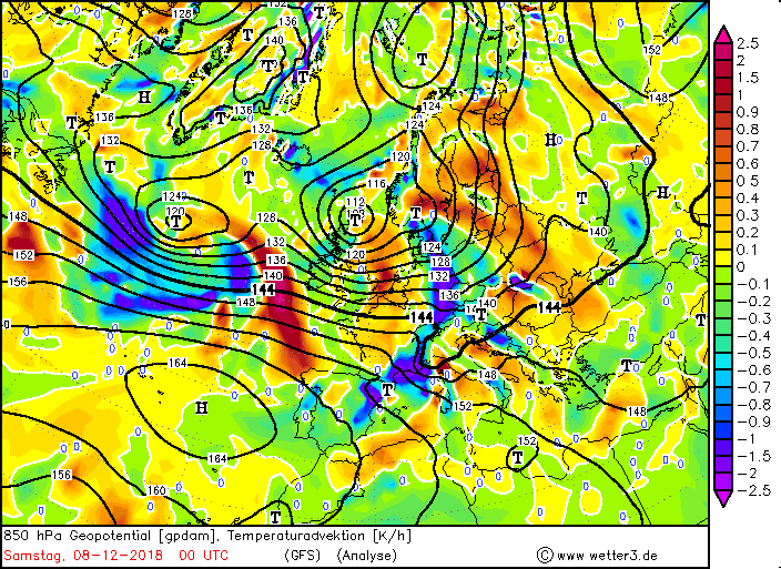
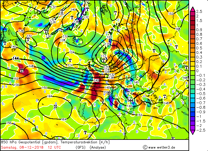
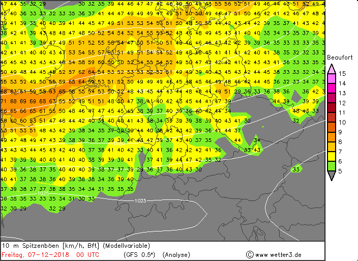
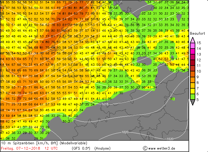
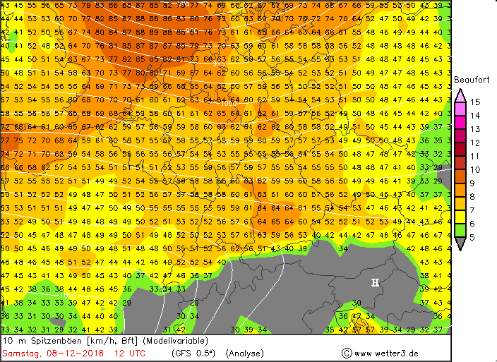
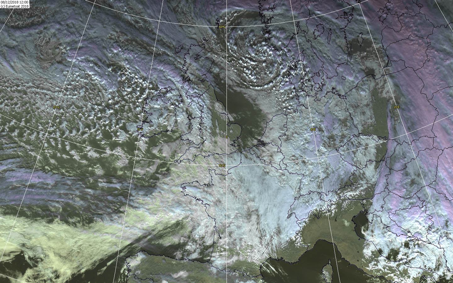
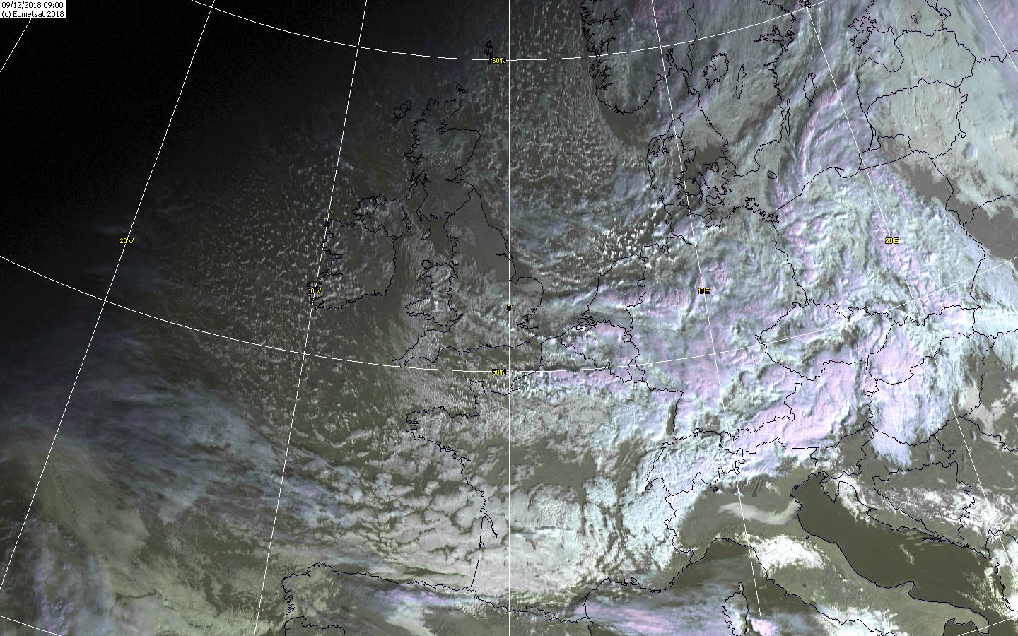
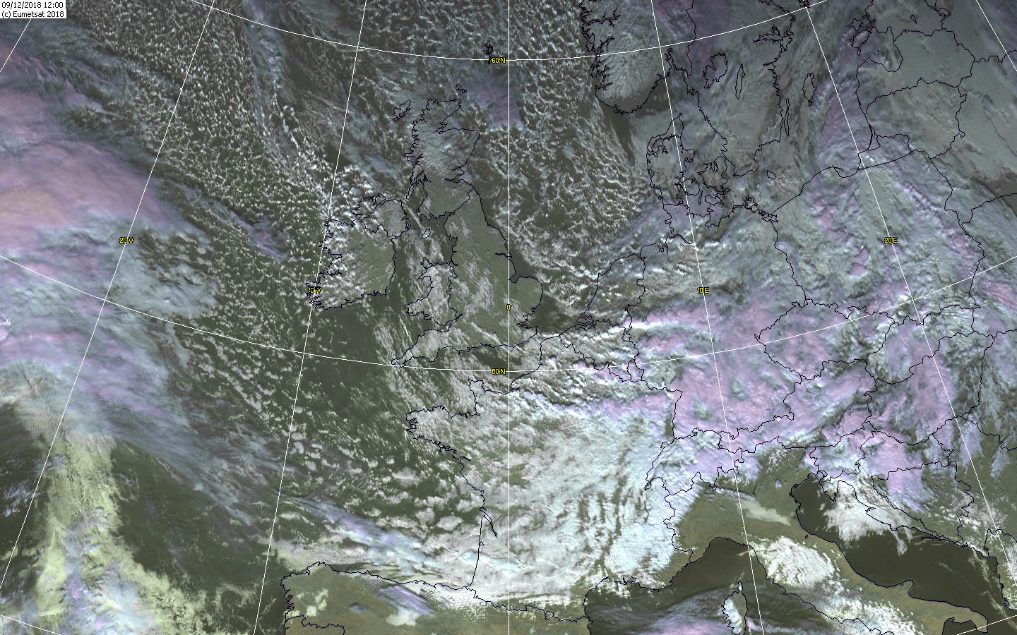
Low LUANA heralded a wet and especially mild weather situation in Germany on 06.12.2018. MARIELOU, the mother low of MARIELOU II was still on the Atlantic during this time and was only a wave disturbance. But until 07.12. she moved swiftly to the west and developed by her favorable Location in the jet stream to a storm. MARIELOU strengthened quickly and its core pressure dropped to 965 hPa! On the satellite pictures MARIELOU showed up as Storybook low. The cold front extends over France to Spain and reached Germany in the early evening. Impressive is also the postfrontal weather, which stretched across the Atlantic, as well as Ireland and the UK. The center took over the position of the controlling central low over Great Britain and in the course of the 07.12. a daughter low developed at the cold front of MARIELOUs, which was called MARIELOU II. However, these low-pressure areas were slow, as high ECKARD still partially blocked the way to the east. The front system of MARIELOU I reached Germany in the afternoon of 07.12. and brought stormy to gale-force gusts and precipitation. The strongest gust was recorded on the Feldberg (Black Forest) at 122 kph and on the Brocken at 126 kph (Source: Meteociel). In the warm air sector very mild temperatures due to the southwest winds were advected. Partly the thermometer climbed to about 13°C, as for example at Neuostheim (BW). Within the precipitation of the cold front there were some showers and thunderstorms, which reached the west of Germany around 16:00 CET. Also in the UK, MARIELOU I registered gale-force gusts. The strongest gusts (143 kph, Source: Meteociel) were measured here southwest of the low pressure center in the morning hours in the north of Great Britain. Southwest of MARIELOU I created a shortwave trough that eventually became MARIELOU II. The frontal system of MARIELOU II did not reach Germany until the late evening of the following day. The windmaxima were in the middle and in the south of Germany and reached this region from the night of Saturday to Sunday. However, the wind was refreshing throughout Germany due to the strong pressure gradient. Also on Sunday it remains windy to stormy all over Germany. With the fronts also new precipitation reached Germany mainly as stratiform rain. Occasionally, there were showers and thunderstorms when the backside weather spread to Germany. In higher areas and above all in the Alps, there was heavy snowfall due to the cold front. The temperatures remained mild in the rest of the country at 9°C. The center of MARIELOU II moved north over the North Sea to Germany. Although the storm maximum was already drawn over Germany, it remained stormy on Sunday. In the early morning were on Feldberg and Brocken Gale gusts recorded at 157 kph or 126 kph. The stations Deuselbach and Weinbiet (Rhineland-Palatinate) recorded storms with 113 kph and 119 kph respectively. Also on the Zugspitze was also measured a gale wind with 144 kph wind speed. (Source: Meteociel). Sturmtief MARIELOU II was already above the Gulf of Bothnia at this time. Germany was therefore under the influence of the back of the trough. The wind turned to the northwest and now a colder and drier air mass flowed in. In exposed locations, there was still danger of gale gusts. In the lowlands, the wind dropped largely, only in Rhineland-Palatinate and parts of Baden-Wuerttemberg and Bavaria remained stormy. All over the country, showers and thunderstorms were still possible, which were also stronger in the south than in the north.
Text: MG 02. Januar 2019 |
|||||||||||||||||||||||||||||||||||||||