Wednesday, 21 October 2020, 10:15 CEST
|

|
|
|
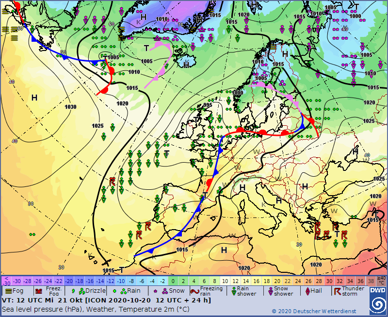
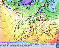
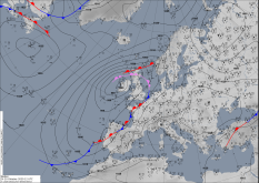
Sea level pressure and fronts, 21.10., 12 UTC
Data Source: DWD
|
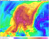
Satellite image (VIS), 20.10. 06 UTC
Data Source: Wokingham
|
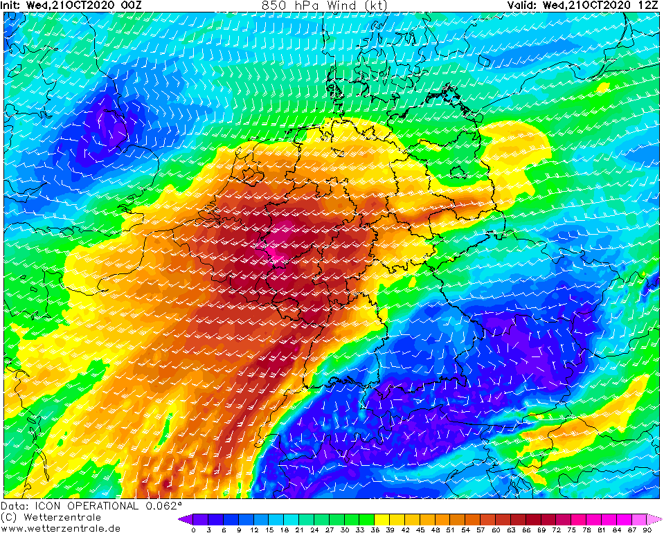
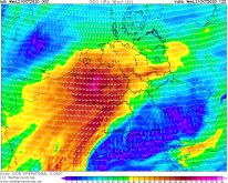
850 hPa Wind Central Europe, 21.10., 12 UTC
Data Source: Wetterzentrale
|
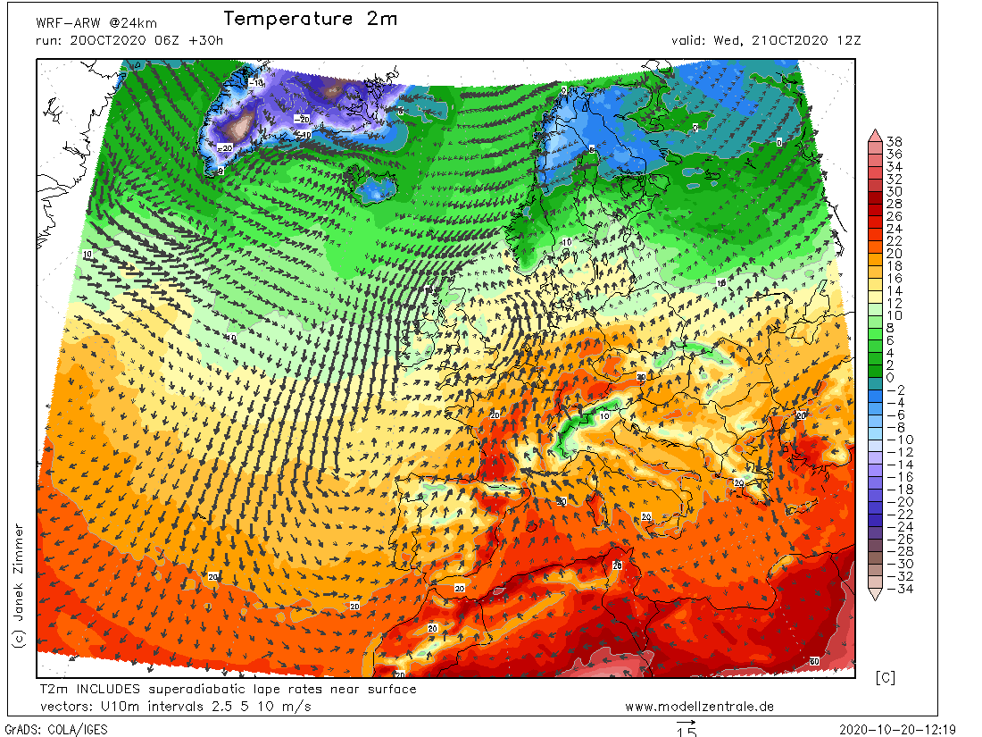
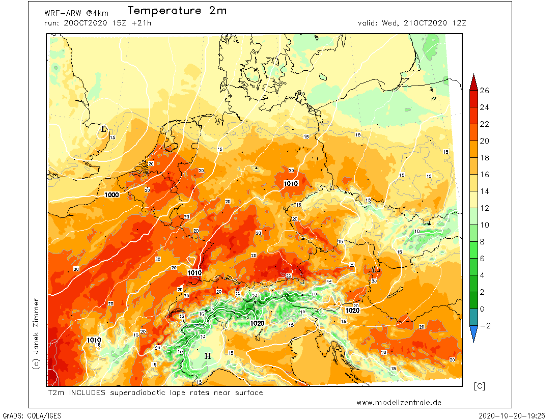
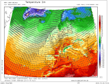
2m Temperature Europe, 21.10., 12 UTC
Data Source: Modellzentrale
|
Storm Low
Central Europe
Issued: Wednesday, 21 October 2020, 10:15 CEST
Low IMKA has weakened in the past few hours. The marginal low JADRANKA continues to cause gusts of wind in Central Europe around 130 km/h. In addition,
the foehn along the Alps and the Pyrenees is making itself noticeable by temperatures around 26 degrees and gusts over 120 km/h.
20.-22.10.2020
Low IMKA weakened last night and its core is still over Ireland and the UK. Therfore marginal low JADRANKA caused gale gusts in Spain and France in the last hours.
In Spain, gusts of up to 135 km/h were registered on the peaks of the Pyrenees. In addition, foehn effects, which can also be seen on the satellite images, are
becoming apparent. On the southwest side of the Pyrenees the air masses are accumulating and partly dense clouds and rain are appearing. On the northeast side,
however, there are less or no clouds and due to the warm downdraft, temperatures have already risen to over 26 degrees tonight. In France, in connection with
JADRANKA, gusts of over 120 km/h were also registered, such as in Bagneres-de-Luchon (621m) at 139 km/h or on Mont Aigoual at 144 km/h.
The storm field of JADRANKA is currently over eastern and northeastern France and the BeNeLux countries with wind speeds of around 120 km/h. The storm field will
reach the northwest and west of Germany in the next few hours and will weaken only slightly. JADRANKA's core is shifting further northeast across the English Channel
and the North Sea. Along the Alps there is also the foehn, which was already noticeable tonight. The measuring station Oberriet (lower Rhine Valley) recorded
temperatures of 6 degrees last night at 9 pm, but at 7 am this morning it was already 18 degrees. The first gusts with hurricane-force were already registered
in Uri's Reuss valley. A good foehn indicator is for example also the measuring station Kastenbahn in Brülisau (1794m) (Gale gusts with 146 km/h). The measuring
station on the 2500m high Säntis (near Brülisau), however, shows only around 35 km/h.
Expected today along the edge of the Alps are up to 26 degrees. But also in the southwest and west of Baden-Württemberg summer temperatures of around 25 degrees are
expected in connection with the strong warm air advection by JADRANKA.
Tuesday, 20 October 2020, 20:15 CEST
|

|
|
|
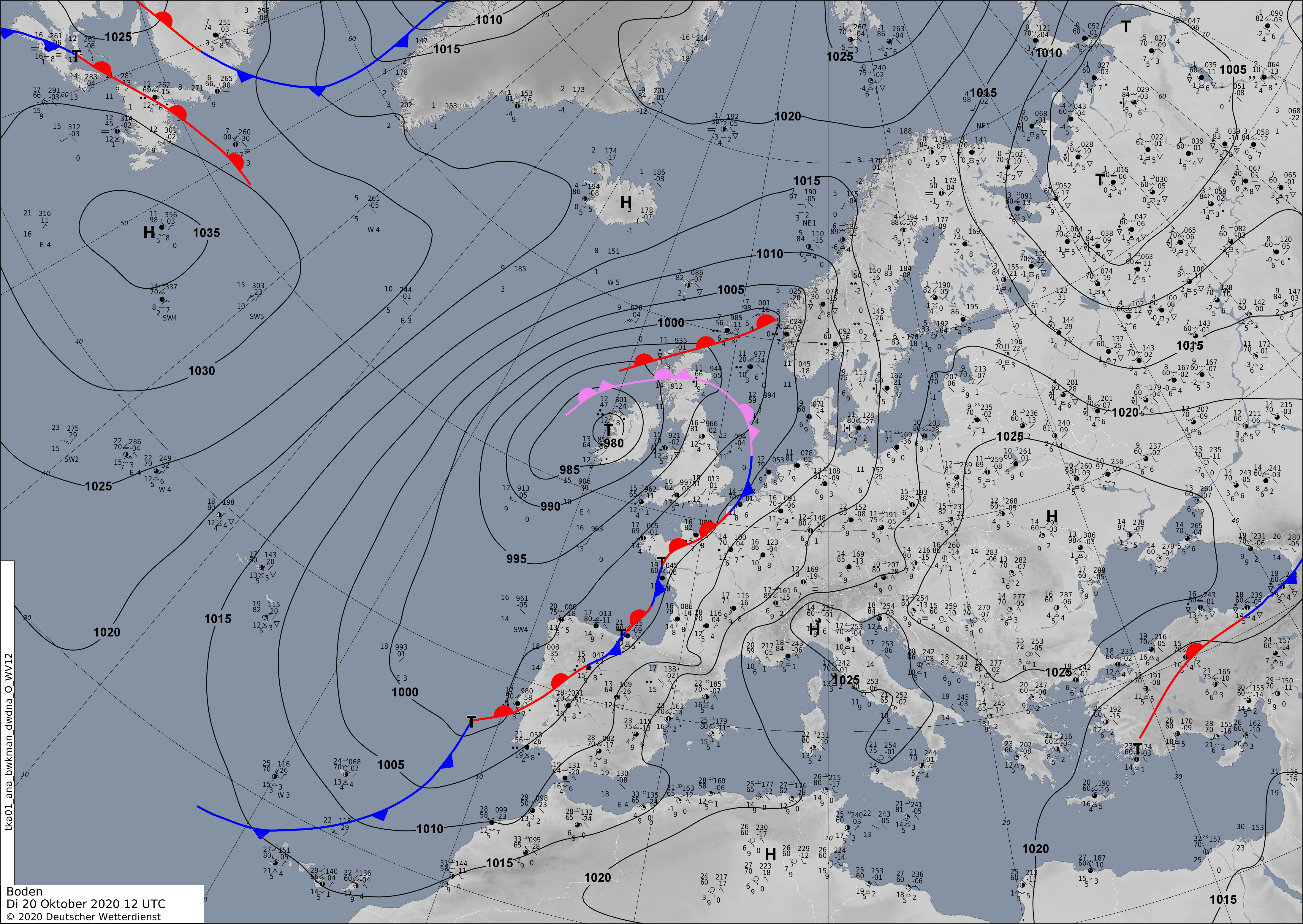
Sea level pressure and fronts, 20.10., 12 UTC
Data Source: DWD
|
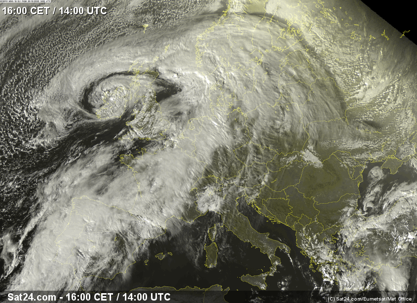
Satellite image (VIS), 20.10. 14 UTC
Data Source: Sat24.com
|
850 hPa Wind France, 21.10., 03 UTC
Data Source: Wetterzentrale
|
2m Temperature, 21.10., 12 UTC
Data Source: Modellzentrale
|
Storm Low
Central Europe
Issued: Tuesday, 20 October 2020, 20:15 CEST
Storm low IMKA is causing wind speeds of around 100 km/h in Ireland and Great Britain. During the night from Wednesday, storm low JADRANKA, a marginal low of IMKA,
provides wind speeds between 130 km/h and 150 km/h over Central Europe. In addition, temperatures in southern and southwestern Germany rise to a summery 25 degrees
Celsius due to the foehn and warm air advection.
20.-22.10.2020
After High OTMAR provided calm weather on the weekend, two storm lows are approaching from the Atlantic. The storm low IMKA is impressively shown on the satellite
images. Its core is currently over Ireland, where it is causing gusts of around 100 km/h. However, the core pressure is already beginning to rise in the next few
hours and IMKA's storm field is weakening rapidly. It takes on the role of the central low and shifts only slightly until tomorrow. However, a wave disturbance is
forming along the frontal system, which develops into another storm low in the night to Wednesday. This marginal low is called JADRANKA and will shift across the
Bay of Biscay and the English Channel to the North Sea by Wednesday noon. Its storm field will cover France, the BeNeLux countries and Germany. The highest wind
speeds will be reached in the area of the strongest isobaric pressure. Tonight, wind speeds of over 150 km/h are expected on the west coast of France in exposed
locations. On Wednesday morning this storm field will move over northern France and the BeNeLux countries, on Wednesday afternoon over the North Sea and northern
Germany. However, the storm field weakens on its way to the northeast and reaches a strength of only about 120 km/h.
A second storm field develops over eastern France on Wednesday morning, which then spreads to the southwest of Germany and reaches wind speeds of around 130 km/h.
In the further course of the day, the storm field then spreads over the whole of Germany, although weakening to about 80 km/h in exposed locations
(at lower altitudes around 50 km/h). Only the extreme south of Baden-Württemberg and the southeast of Bavaria remain weak in the wind. The two storm lows not only
bring stormy winds for Central Europe, but also unusually warm temperatures for October. Due to strong warm air advection from the southwest, temperatures in
southwestern Germany may rise to a summery 26 degrees Celsius. Low JADRANKA causes a foehn situation in the Alps, which also raises the temperatures at the
edge of the Alps to summery 25 degrees.
Issued: October 20, 2020, 20:15 CEST
MG
Issued: October 21, 2020, 10:15 CEST
MG
|