Monday, 24 August 2020, 19:30 CEST
Windstorm
Central Europe, Great Britain
Issued: Monday, 24 August 2020, 19:30 CEST
Summer storm KIRSTEN reaches Central Europe and Great Britain on Tuesday and brings stormy, along the coasts hurricane-like gusts.
Wind speeds of up to 140 km/h can be reached.
24.-26.08.2020
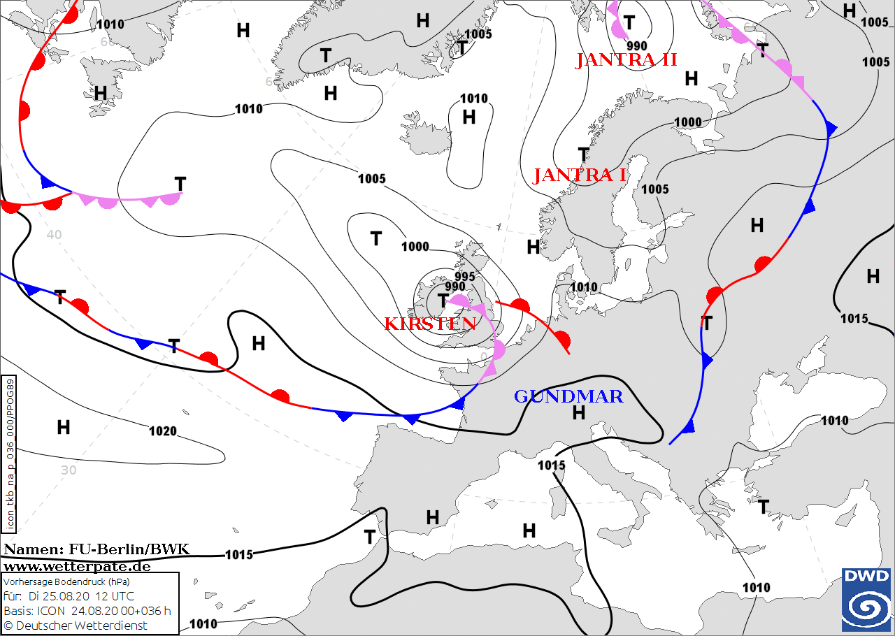
Europe expects the first summer storm low of the year on Tuesday. After the hot summer temperatures of recent weeks, the weather is now becoming more volatile and,
above all, much cooler and windier. In the night from Tuesday, the currently prevailing ridge will flatten out and Central Europe will enter the sphere of influence
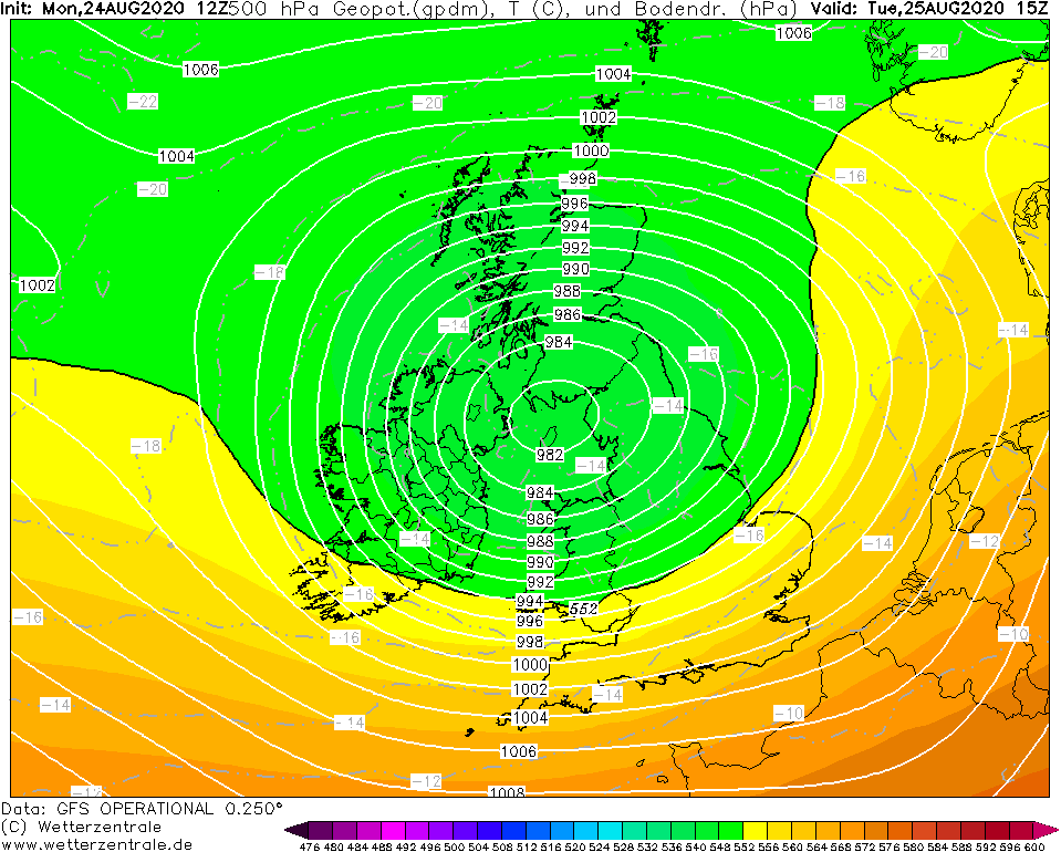
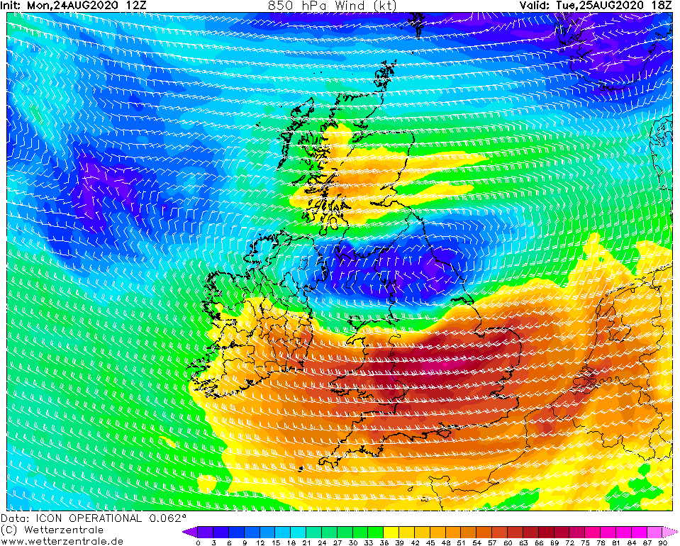
of a short-wave trough/ a marginal low. The core of the depression moves over Northern Ireland, later over Wales and Northern England, the main storm field is located
south to southwest of the storm depression core. The storm field will reach the west of England tomorrow morning and bring gusts of up to 100 km/h. Towards the
afternoon, the air pressure in the core decreases and the air pressure gradient increases. Peak wind speeds of up to 140 km/h can be reached.
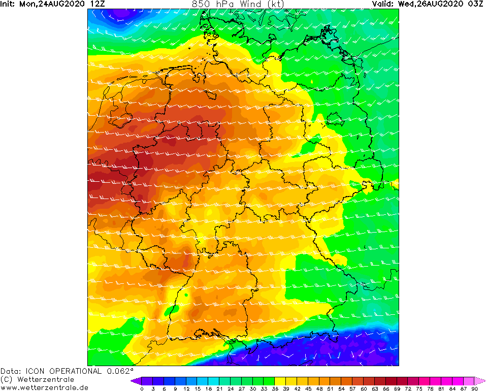
The core of KIRSTEN moves further east across Ireland and Great Britain across the North Sea to Denmark. The pressure in the center rises slightly again and the air
pressure gradient decreases, which also weakens the storm field. In Denmark, as well as in the northern parts of Germany and the BeNeLux countries, gusts of around
120 km/h are expected on Wednesday. At lower altitudes, wind speeds of around 50 km/h are expected.
The core pressure drops rapidly over the next few hours and will reach its minimum tomorrow morning at about 982hPa.
The rapid drop in pressure and the pressure minimum is favored by the advantageous location at the front of a jet stream. In addition, KIRSTEN has characteristics
of a Shapiro-Keyser cyclone (warm core, bent-back warm front, cold front in the core area hardly detectable, see pseudopot. temperature). However, it remains to be
seen whether the sting-jet typical of Shapiro-Keyser cyclones will develop.
However, the summer storm should not be underestimated. Due to the drought that still prevails in many parts of the countries (especially in Germany),
the trees and their wood are also extremely dry, which increases the danger of breaking branches or trunks. In addition, the trees are still fully leafy and
thus offer the wind a larger attack surface.
Issued: August 24, 2020, 19:30 CEST
MG
|