Tuesday, 07 July 2020, 12:00 CEST
|

|
|
|
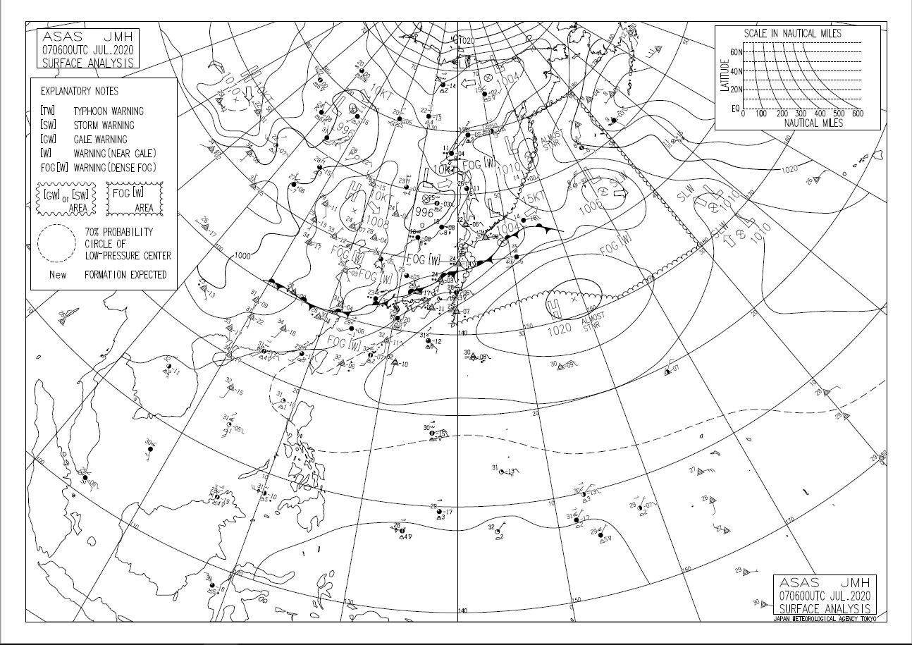
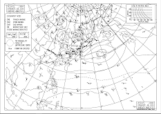
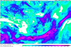
Sea level pressure and fronts, 07.07., 06 UTC
Image Credit: JMA
|
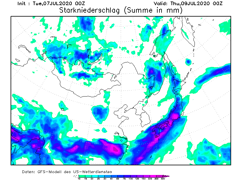
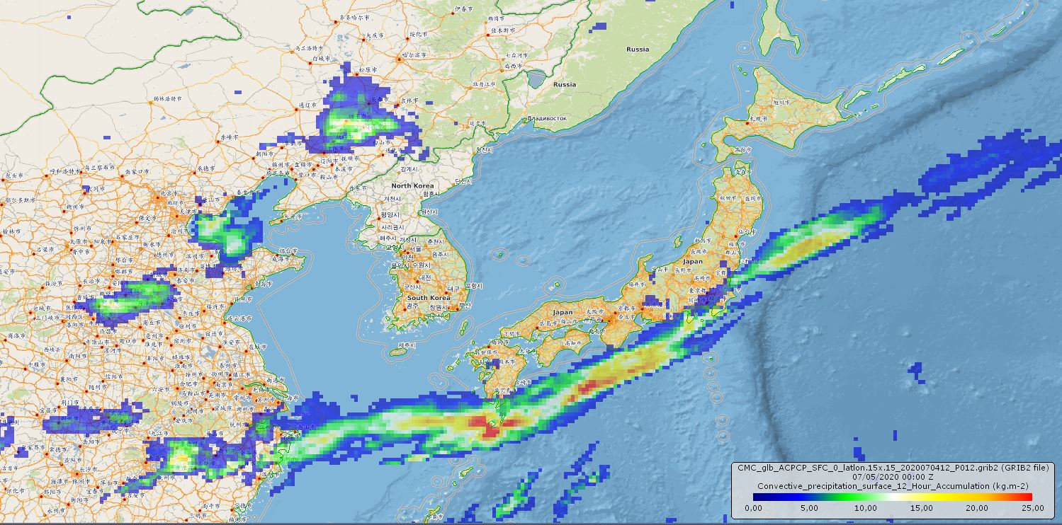
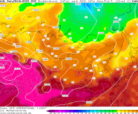
48 hour precipitaion, 09.07., 00Z
Image Credit: GFS / Wettergefahren-Frühwarnung
|
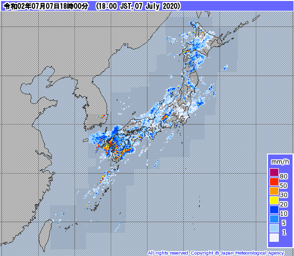
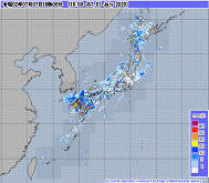
Precipitation radar Japan, 07.07., 09 UTC
Image Credit: JMA
|
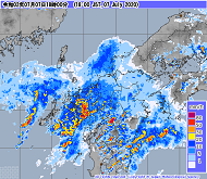
Precipitation radar Kyushu, 07.07., 09 UTC
Image Credit: JMA
|
Heavy precipitation
Japan
Issued: Tuesday, 07 July 2020, 12:00 CEST
Japanese monsoon season continues with heavy precipitation in the south and south-west of Japan. Almost stationary high pressure system in western pacific directs
humid air towards the island group and creates directional convergence.
04.-09.07.2020
There is continuing heavy monsoon rainfall in Japan. Together with the peak of this year's monsoon season, an almost stationary high pressure
area on the northeastern edge of the Philippine Sea also directs warm humid air to Japan. This air is forced to rise, partly by the orography
of Japan, but also by the cold air prevailing in the north. This results in precipitation intensities of up to 80 mm/h and daily precipitation
of up to 200 mm. Due to the variable orography, large local differences can occur. There is a danger of overflowing rivers, floods and landslides.
Sunday, 05 July 2020, 13:00 CEST
|
|
|
|
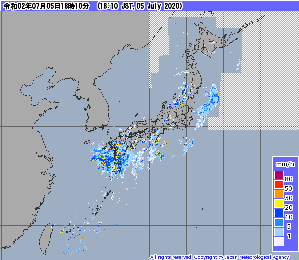
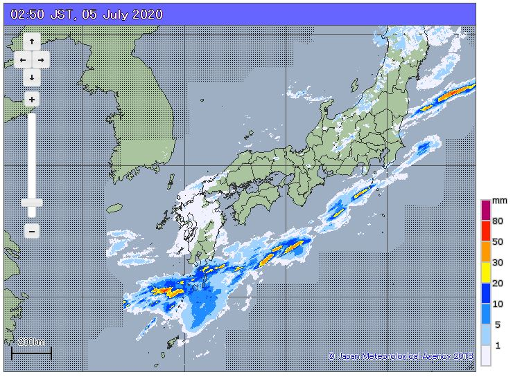
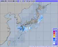
Precipitation radar Japan, 06.07., 18:10 JST
Image Credit: JMA
|
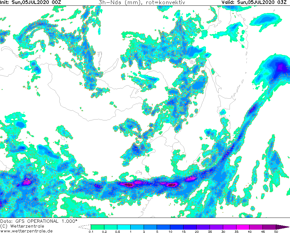
3 hour precipitaion, 05.07 03Z
Image Credit: Wetterzentrale
|
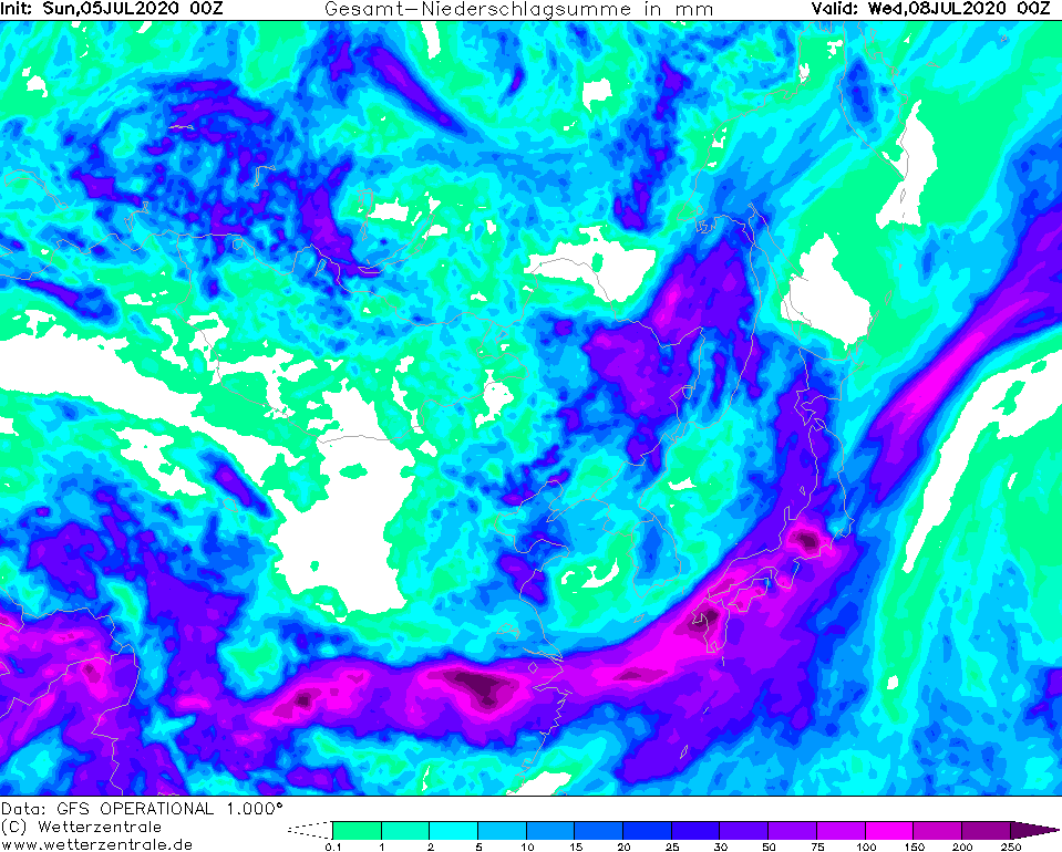
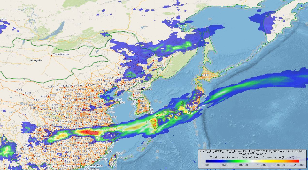
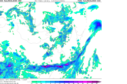
72 h precipitation, 08.07., 00 UTC
Image Credit: Wetterzentrale
|
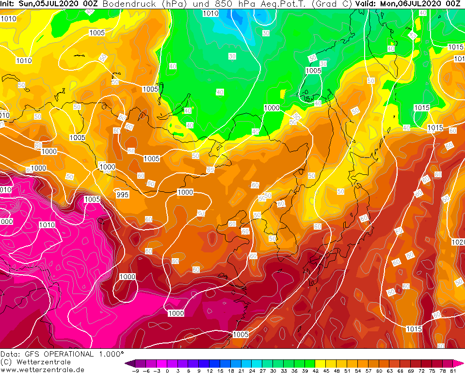
Pseudopotential temperature, 06.07., 00 UTC
Image Credit: Wetterzentrale
|
Heavy precipitation
Japan
Issued: Sunday, 05 July 2020, 13:00 CEST
Strong convective precipitation due to the southeast asian monsoon lead to severe floodings! Over 250 mm in the next three days in South Japanese!
04.-09.07.2020
A strong air mass boundary which extends from South Japanese to the eurasian continent seperate warm and moist air from the southern Pacific and indian Ocean and cooler and dry air from the northern part
of Asia. In this area occur convective cells in form of thunderstorms with heavy precipitation. In the southern part of Japanese there were intensive precipitation events in the last
days with amounts up to 150 mm per day. This events caused severe floodings with damages in the infrastructure and more than 18 deaths.
In the next three days there will be locally accumulated precipitation amounts up to 300 mm. The special orography and the convective precipitation will cause enormous differences in small areas.
That means that the danger of severe floodings and landslides are still very high over the next day. The main affected areas will be the provinces of Kumamoto
and Kagoshima on the southwest island Kyushu.
Saturday, 04 July 2020, 21:00 CEST
Heavy precipitation
Japan
Issued: Saturday, 04 July 2020, 21:00 CEST
In the southern coastal and mountainous areas of Japan there is abundant monsoon rainfall of up to 150 mm per day.
The consequences are floods and landslides.
04.-09.07.2020
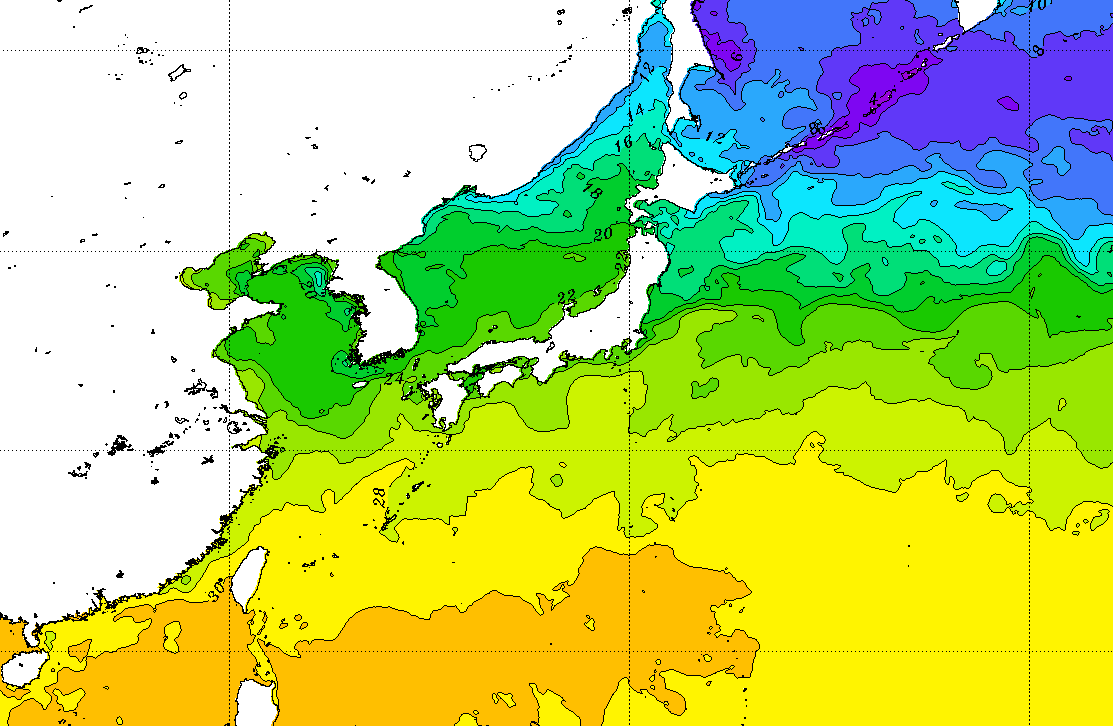
The Indian monsoon and partly and also the African monsoon is generally often discussed. However, a strong meridional
gradient in sea surface temperature at the current time of year also allows a monsoon in the south of Japan. This is a
period of about four to six weeks, which coincides with the tropical monsoon season in Japan. Due to the collision of
cold winds from the polar region and the subtropical, humid and very warm air from the South Pacific, Japan is situated
right in the monsoon zone. Furthermore, in the northern branch of the Pacific subtropical anticyclone, stronger precipitation
areas can be transported from the Asian mainland to Japan.
Due to monsoon effects there will be abundant and intensive precipitation of up to 150 mm per day in the coming days, especially
in the south of Japan. Until Monday evening up to 300 mm can fall. Due to the special orography of Japan, local differences can be tremendous.
There is a danger of floods and landslides. Even though monsoons are often associated with strong winds, the wind speeds that occur are
negligible in terms of potential danger.
Issued: July 04, 2020, 21:00 CEST
FS
Issued: July 05, 2020, 13:00 CEST
NB
Issued: July 07, 2020, 12:00 CEST
FS
|