Saturday, 14 December 2019, 08:30 CET
|
|
|
|
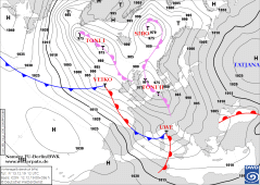
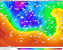
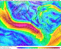
Sea level pressure and fronts, 15.12., 00 UTC
Image Credit: DWD
|
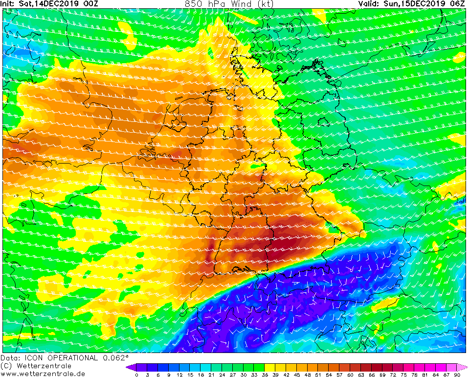
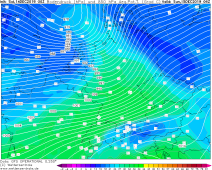
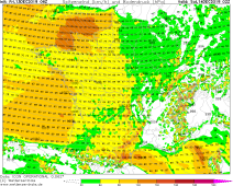
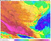
850 hPa Wind., 15.12., 06 UTC
Image Credit: Wetterzentrale
|
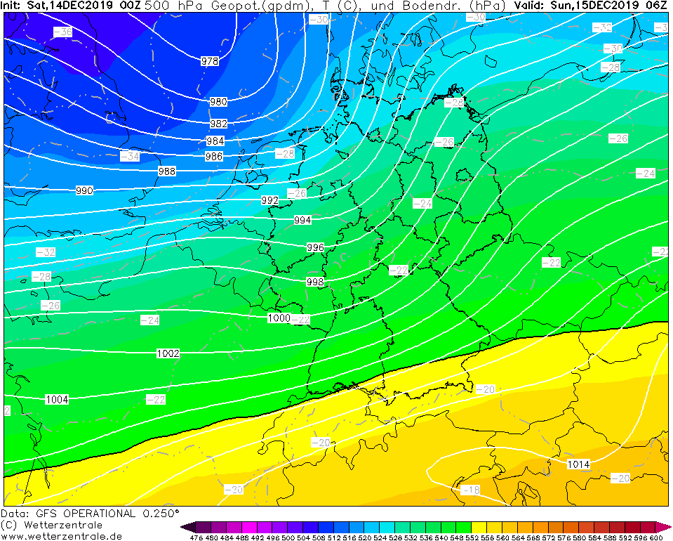
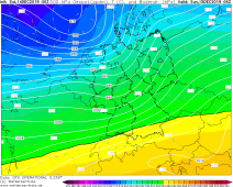
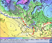
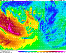
500 hPa Geopotential, 15.12., 06 UTC
Image Credit: Wetterzentrale
|
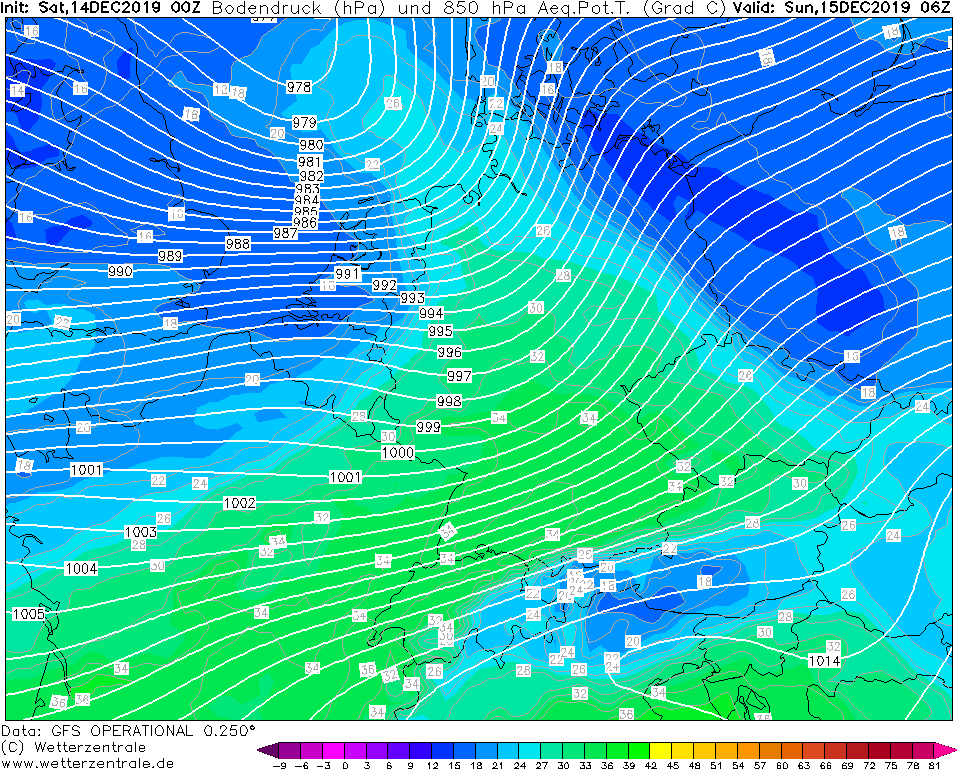
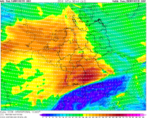
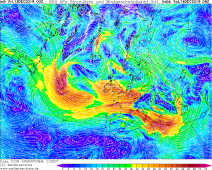
850 hpa pseudopot. temperature, 15.12., 06 UTC
Image Credit: Wetterzentrale
|
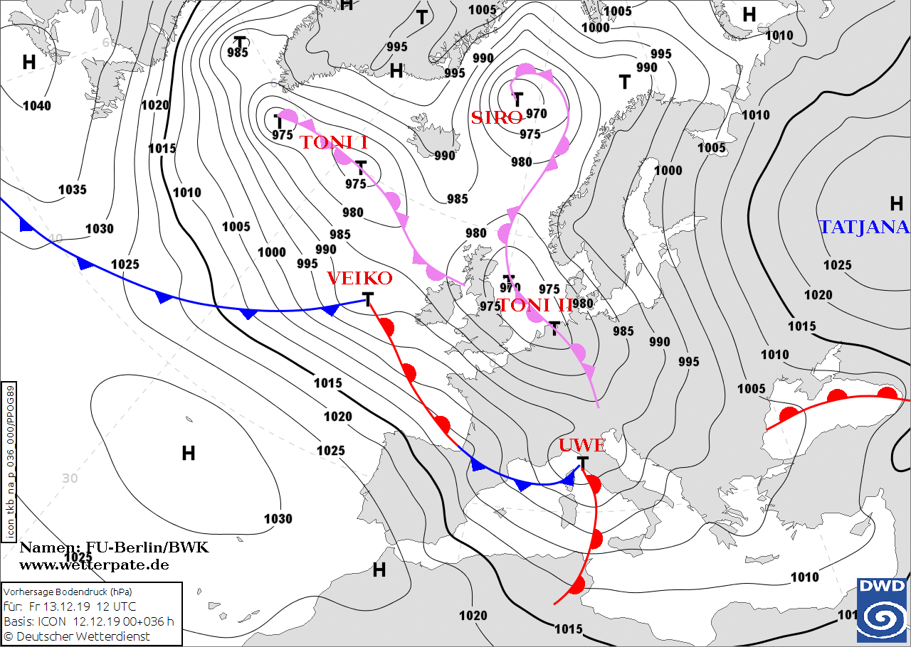
Winterstorm VEIKO and UWE
Central Europe, Italy, Greece
Issued: Saturday, 14 December 2019, 08:30 CET
Low VEIKO and UWE are still responsible for unstable and stormy weather today. There are gusts of about 60 km/h, in exposed areas about 130 km/h. There is
still the danger of flooding due to accumulated precipitation..
11.-15.12 2019
Low VEIKO's core moved last night across the North Sea and Denmark and caused hurricane-like gusts. On the backside, the air pressure gradient remains high,
which means that it stays stormy in Germany and Great Britain. In the night to Sunday a new storm low will reach Central Europe and again will cause gusts of
about 140 kph. This will affect France and the South/Southeast of Germany. Calmer weather is not expected until Monday. Then, only in the southeast of France it
remains stormy.
Low UWE also causes stormy and rainy weather in the Mediterranean region. Thunderstorms can continue to occur in Greece, and gale-force winds can occur nearby.
In course of the coming days the snowfall line rises above 1500m in the coming days as temperatures rise into an unusually mild range due to the strong warm air
advection. In the tailbacks of the Southern Alps and the Black Forest, as well as in Greece, flooding can occur locally during prolonged rainfall.
The flooding can be intensified by melting the snow covers within the alps and the Black Forest. Storm surges continue to occur on the coasts due to strong winds.
Due to the persistent storm situation, traffic disruptions must be expected in the affected regions, as well as delays and cancellations in public transport.
Friday, 13 December 2019, 11:30 CET
|
|
|
|
Sea level pressure and fronts, 13.12., 12 UTC
Image Credit: DWD
|
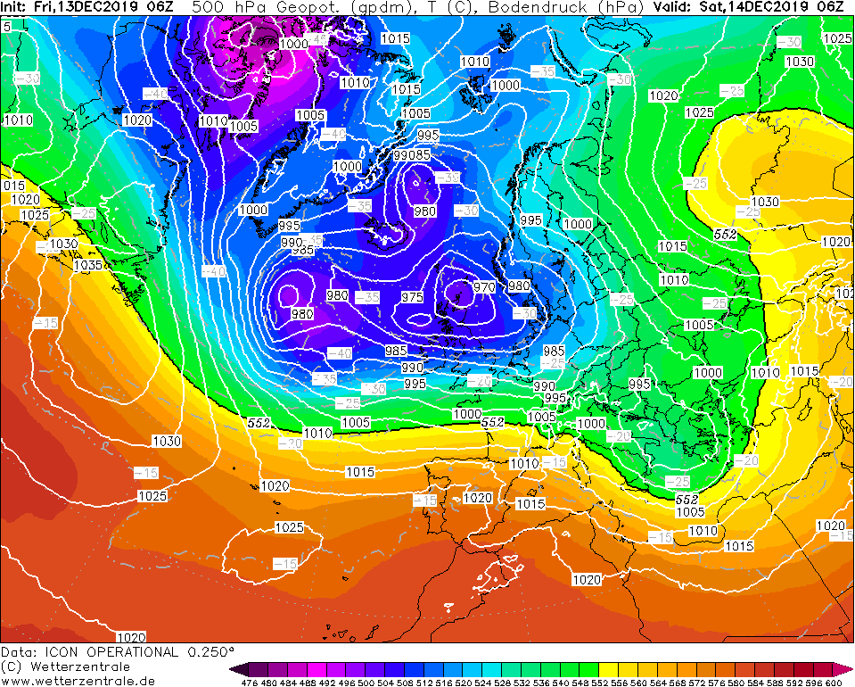
500 hPa Geopot., 14.12., 06 UTC
Image Credit: Wetterzentrale
|
850 hPa Streamlines, 14.12., 06 UTC
Image Credit: Wetterzentrale
|
Wind gusts, 14.12., 02 UTC
Image Credit: Wetterzentrale
|
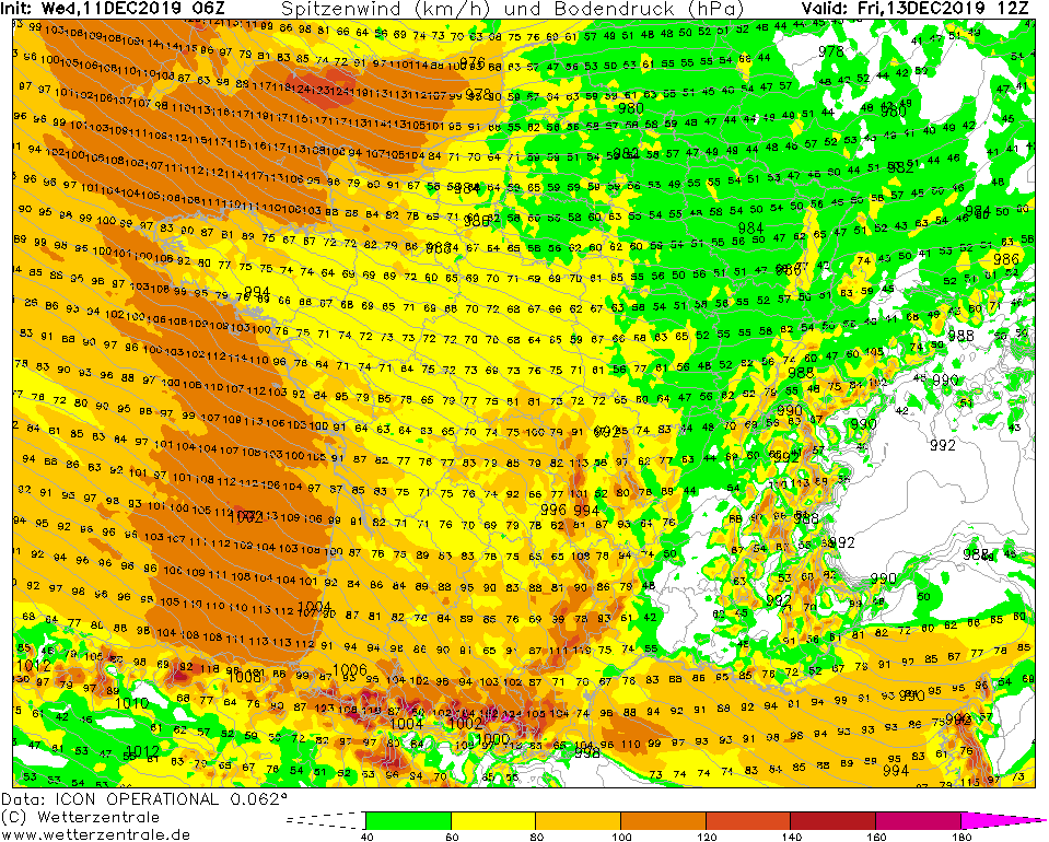
Winterstorm VEIKO
Central Europe
Issued: Friday, 13 December 2019, 11:30 CET
In the coming days winterstorm VEIKO will reach Europe. These will bring gusts of around 130 kph in
France, Italy, the Benelux countries and Germany. In addition, up to 50 mm precipitation is predicted, especially in the Black Forest and Odenwald.
11.-15.12 2019
The currently strong frontal zone, which stretches from the central North Atlantic to Northwest Africa, will change in the coming days, leading to a change in the general weather situation.
Currently, low VEIKO is located over the western North Sea with a core pressure of 975 hPa. A occlusion front last night has provided snow in West Germany.
This morning there was a few millimetres of fresh snow even at low altitudes. On the way to the east VEIKO intensifies a bit, so that the pressure gradient intensifies again.
In the night from Friday to Saturday the main storm field reaches the north of France, as well as the Benelux countries. In the night until tomorrow morning gusts of up to 120 kph
will occur. Peak gusts of over 130 kph are also possible in exposed locations. In the morning hours of Saturday, the gusts are expected in northwest Germany. Tomorrow, Saturday,
the storm field will have Germany firmly under control. During the whole day, gusts of up to 100 kph can occur. At higher altitudes, especially on the Brocken and in southwest
Germany, gusts up to 120 kph are also possible.
In addition to the storm, heavy precipitation in the form of snow, sleet and rain is predicted, especially in the west and southwest of Germany. By tomorrow evening,
precipitation of up to 75 mm can fall, especially in the Black Forest and Odenwald (congestion effect). In the course of the day, the snowfall line rises to over 1000 m.
Due to the storm, a storm surge must be expected on the coasts. In addition, road and rail traffic is expected to be impaired by Saturday.
Trees can be uprooted and houses damaged. Freezing rain can set in tomorrow morning, which will ensure frozen roads.
Thursday, 12 December 2019, 11:30 CET
|
|
|
|
Sea level pressure and fronts, 13.12., 12 UTC
Image Credit: DWD
|
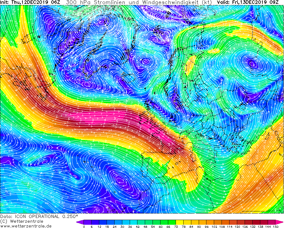
300 hPa Streamlines, Europe, 13.12., 09 UTC
Image Credit: Wetterzentrale
|
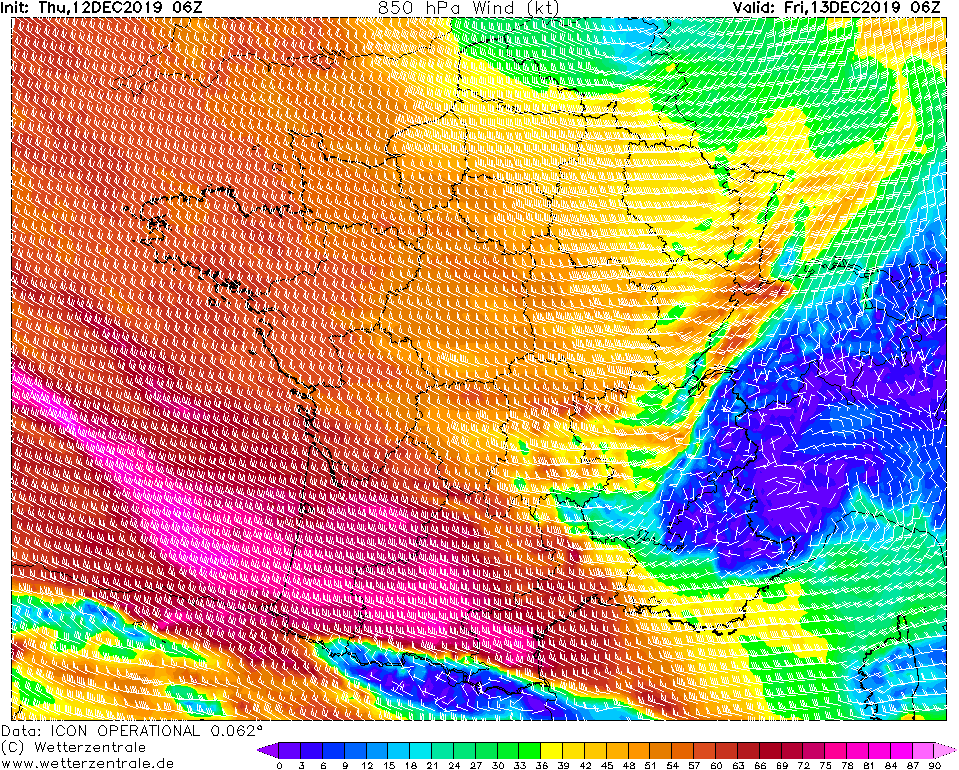
850 hPa Wind gusts, France, 13.12., 06 UTC
Image Credit: Wetterzentrale
|
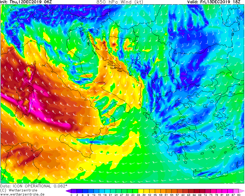
850 hPa Wind gusts, Italy, 13.12., 18 UTC
Image Credit: Wetterzentrale
|
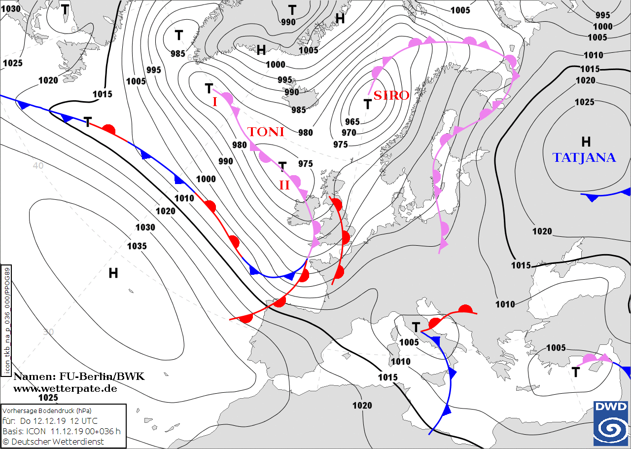
Winterstorm TONI II
Central Europe, Italy
Issued: Thursday, 12 December 2019, 11:30 CET
In the coming days several winterstorms will reach Europe. These will bring gusts of around 140 kph, as well as storm surges and torrential precipitation.
France, Italy, the Benelux countries, Germany and Great Britain are particularly affected.
11.-15.12 2019
A large and powerful jet stream stretches almost horizontally across the Atlantic. On the front side of the jet stream there are several fast running low-pressure
areas heading for Europe. Due to the favourable position at the front of the jet stream, they quickly develop into storm lows, which produce hurricane like gusts.
One of them and the cold front of low SIRO hit Great Britain yesterday and brought gusts of 143 kph.
But the low TONI is already forming over the North Atlantic. During the course of the day, this low develops a fast moving edge low (TONI II). TONI II is a so-called
fast runner. It has a fast displacement speed and is therefore difficult to predict. The track is therefore still uncertain and also the areas where the strongest
wind maxima will occur.
Low TONI II will reach France and Great Britain tonight. In both countries, especially on the coasts and in exposed locations, gusts of around 130 kph must be
expected, locally also 140 kph. The strongest wind maxima are currently calculated by the models in the southwest of France. Gusts of about 160 kph have to be
calculated there.
On Friday another still nameless low splits off from low TONI II and crosses the Mediterranean Sea. In the northeast of Spain as well as on the islands
Sardinia and Corsica gusts of about 140 kph have to be expected. In addition, thunderstorms must be expected which can also produce gusts of around 140 kph.
Meanwhile, over the Atlantic in the Jetstream again a high-speed low is formed which quickly moves to the east and on Saturday night it will hit France and Great
Britain. In the north of France and on the coasts of Great Britain, gusts of around 120 kph must be expected, locally also around 140 kph. This low will also reach
Germany and gusts of around 130 kph must be expected here as well.
In addition to gale gusts, these winterstorms bring a lot of precipitation in form of snow, sleet or even freezing rain to Germany. The West and Southwest are
particularly affected. Snow and sleet can be expected as early as Friday morning.
Due to the extremely strong winds, storm surges and floods must be expected on the coasts. The long-lasting precipitation in the Black Forest and the Pyrenees leads to accumulated precipitation.
In addition, the strong winds can break branches or uproot trees. Damage to the infrastructure as well as disruptions in road traffic must be expected. Delays and breakdowns can occur. If snow or freezing rain sets in, black ice must be expected.
Wednesday, 11 December 2019, 13:00 CET
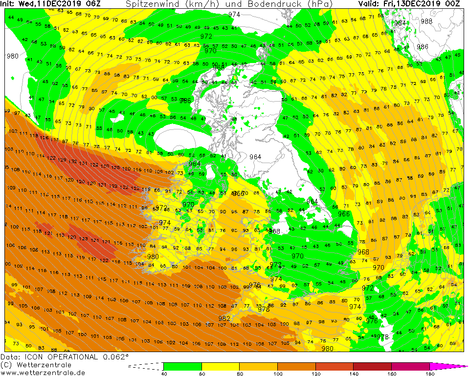
Winter storm TONI II
Great Britain, France, Benelux countries
Issued: Wednesday, 11 December 2019, 13:00 CET
In the next few days, Tief TONI II will be pulling across Great Britain and causing storms of up to 150 kph
in Great Britain, France and the Benelux countries.
02.-04.12 2019
The jet stream is currently blowing particularly strongly south of Greenland with wind velocities of up to 360 kph.
Since the jet stream blows in a straight line from west to east in this area, so-called fast runners can form. This
will also happen in the coming days. From the low-pressure area over the Atlantic, the fast runner TONI II forms,
which can develop rapidly within a short time. Wind speeds of up to 150 kph are already expected in Great Britain
today. Tomorrow, the West of England and Wales will be particularly affected. However, stormy gusts are also
possible in the mainland. Gusts of up to 150 kph must be expected. On Thursday evening and in the night on
Friday TONI II moves further to the east, so that then also the French coast and the Benelux countries will
be affected. In this area gusts of up to 120 kph occur, in exposed locations there are also strong gusts possible.
Due to the storm, damage to the infrastructure must be expected. Trees can be uprooted and road and rail traffic
can be impaired.
Issued: December 11, 2019, 12:00 CET
CL
Issued: December 12, 2019, 11:30 CET
MG
Issued: December 13, 2019, 11:30 CET
CL
Issued: December 14, 2019, 08:30 CET
MG
|