Tuesday, 12 November 2019, 09:00 CET
|
|
|
|
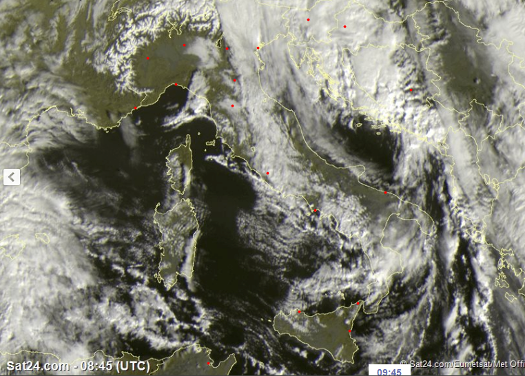
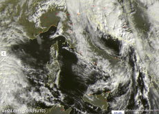
Satellite Images (visible), November 13
Image Credit: Sat24
|
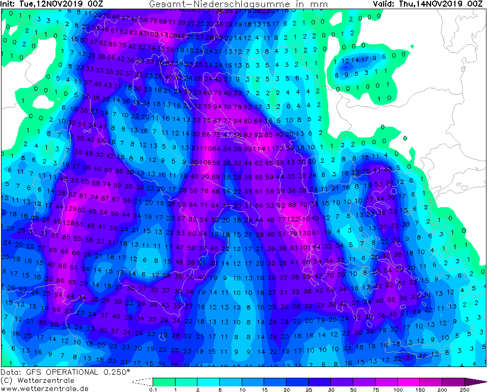
24h Accumulated precipitaion till November 14, 00 UTC
Image Credit: Wetterzentrale
|
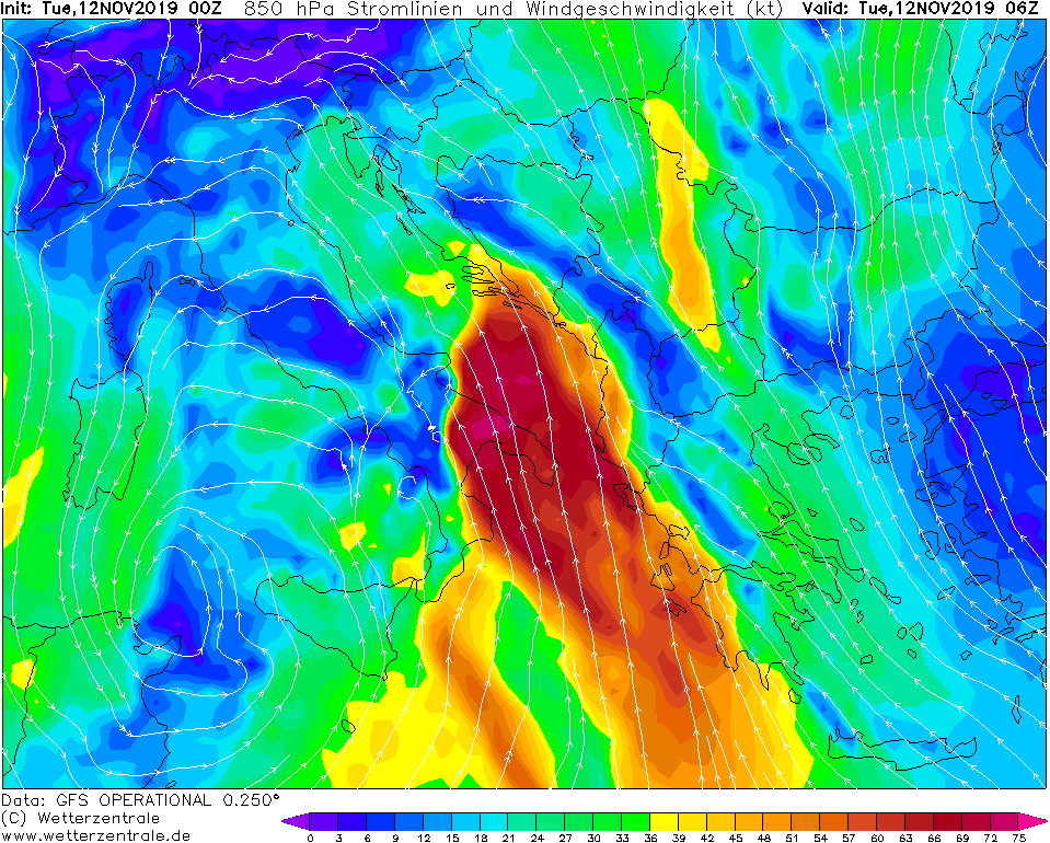
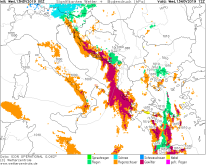
Significant Weather, November 13, 12 UTC
Image Credit: Wetterzentrale
|
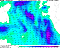
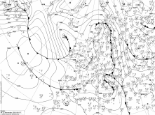
Sea level pressure November 13, 06 UTC
Image Credit: Wetter3
|
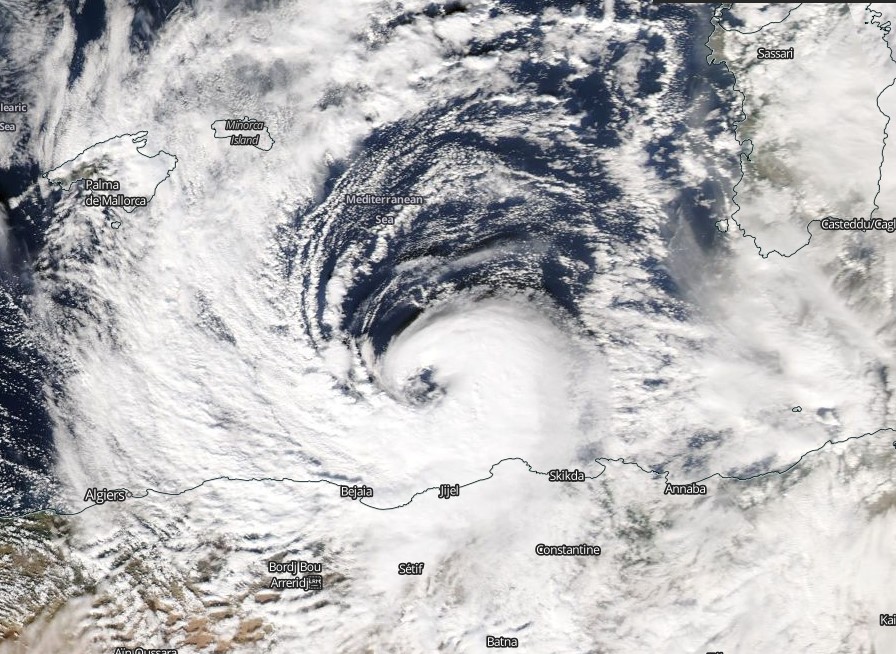
Medicane TRUDY
Italy, Balkan, Adriatic Sea
Issued: Wednesday, 13 November 2019, 09:15 CET
TRUDY's core is currently located above the Adriatic Sea. The Squall Line over the Balkans is still active and brought heavy rain. Until Thursday,
rainfall of up to 90 mm can be expected on the coasts of the Balkan region.
12 Nov - 14 Nov 2019
TRUDY is located with its core above the Adriatic Sea and has already begun to dissolve. Frontal structures can only be seen on the thunderstorm front over the
Balkans, the eye has disappeared when the Medicane moved over land. The core pressure has now risen to 996 hPa and will continue to rise in the next few hours.
In Italy, rainfall of 96mm (Roma Fiumicino) has accumulated.
In the Balkan regions, thunderstorms, gale gusts, storm surges and floods continue to be expected. Further rainfall of up to 90 mm may be expected by Thursday.
The front will have weakened by Thursday. The air pressure gradient will fan out, which will also reduce wind speeds. TRUDY is heading northeast around the Alps
and will dissipate. But already a new low is heading for the Mediterranean Sea and will cause thunderstorms again next weekend.
Tuesday, 12 November 2019, 09:00 CET
Medicane TRUDY
Italy, Balkan, Adriatic Sea
Issued: Tuesday, 12 November 2019, 09:00 CET
The Medicane TRUDY is located on the Mediterranean Sea southwest of Italy. A squall line has developed over Italy and the Balkans. By Wednesday evening
TRUDY will increase in strength. Wind speeds of 135 kph and rainfalls of more than 130 mm in 48h are expected.
12 Nov - 14 Nov 2019
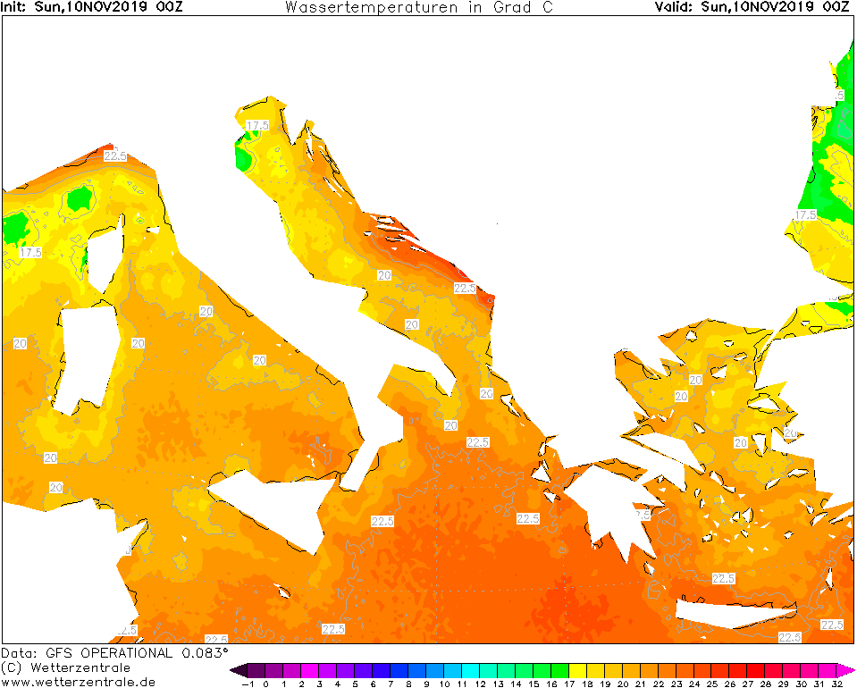
The Medicane TRUDY developed on Monday from the cut off low DETLEF. The cut off low crossed the Mediterranean Sea from the north and developed into a Medicane off
the coast of Tunisia yesterday morning due to the still high water temperatures (around 22.5 degrees).
At the moment its centre is still located above the Mediterranean southwest of Sicily. It is preceded by a squall line that causes thunderstorms in Italy
and over the Balkans. In the coming days, the cut off low will again connect with the pronounced trough over Central and Northern Europe and shift to the northeast.
The centre moves west past Sicily across the Tyrrhenian Sea and the pressure drops to 986 hPa. The air pressure gradient increases strongly, which leads to high
wind speeds over the south of Italy and the Adriatic Sea. Gusts of about 130 kph are expected.
The center shifts far to the northeast until Wednesday and moves across central Italy and the Adriatic Sea, until it gets into the blockade of the Alps and it
comes to severe accumulated precipitation. At the Alps as well as the Balkan coast precipitation amounts of up to 130mm are expected until Thursday, locally higher
precipitation amounts can come together. At higher altitudes it falls as snow.
Issued: November 12, 2019, 09:00 CET
MG
Issued: November 13, 2019, 09:15 CET
MG
|