Friday, 11 October 2019, 14:00 CET
Super Typhoon HAGIBIS
Japan
Issued: Friday, 11 October 2019, 14:00 CET
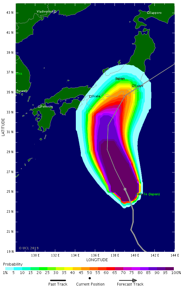
HAGIBIS turns north-northeast and approaches the Japanese main islands. Gusts up to 185 kph in Shikoku and Honshu, on the northern Izu islands up to 200 kph.
Waves up to 15 m and precipitation up to 100 mm/3h.
11 Oct - 13 Oct 2019
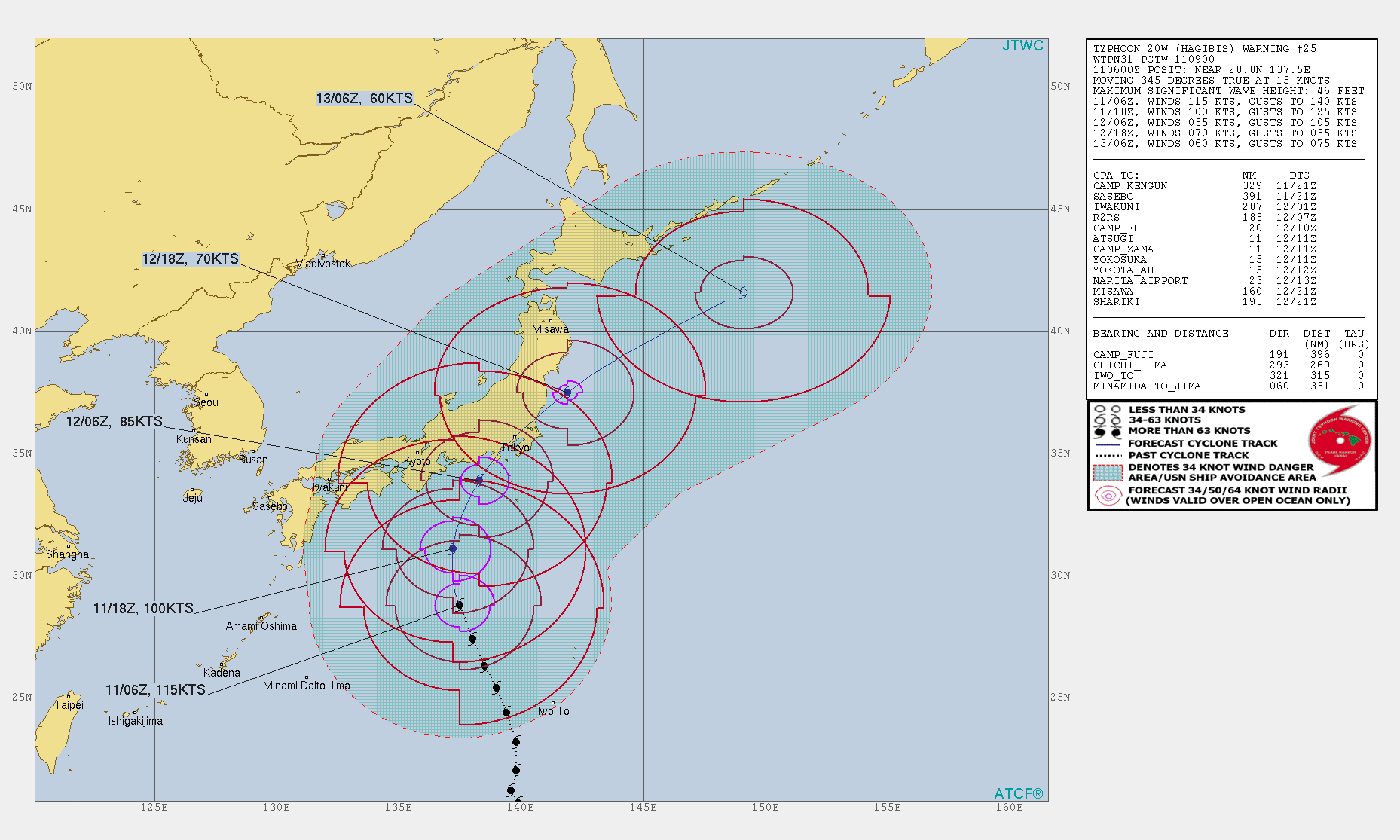
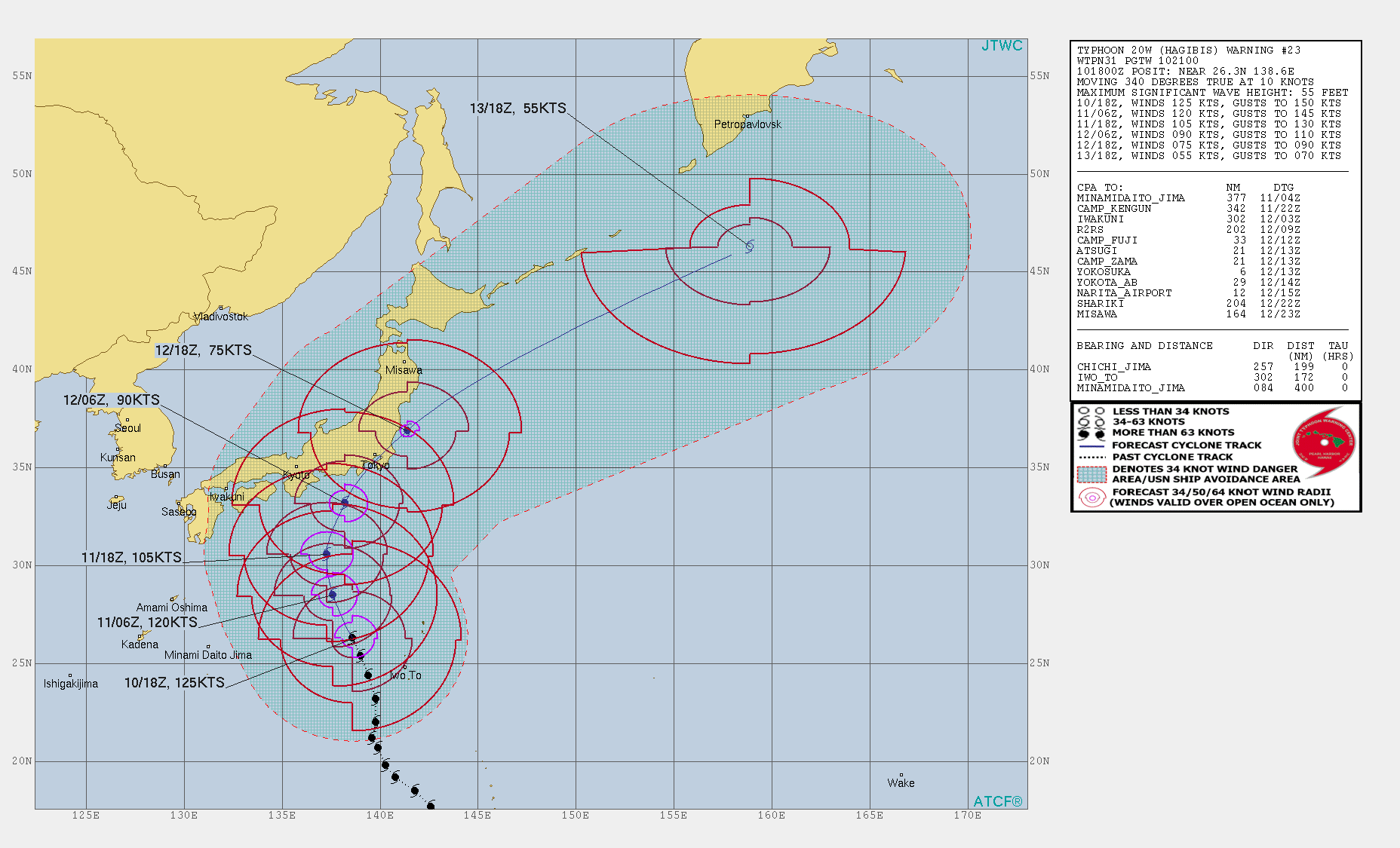
Typhoon HAGIBIS is currently located about 300 km west southwest of Torishima Island. The system moves with about 27 kph in a northerly direction. With sustained
mean winds of 215 kph and a core pressure of 925 hPa the typhoon belongs to category 3.
Due to the enormous size of the tropical system, the first rainbands are already reaching the south coast of the Japanese main island Shikoku. With a Gale wind
radius of 800 km, the first effects of the storm gusts may already be noticed.
The tropical storm will make landfall tomorrow, Saturday, at about 12 UTC in the eastern part of Suruga Bay. At about 12 UTC, the eye of the storm will pass about 40 km
northwest of Tokyo. Wind speeds of 90 kph and gusts of up to 175 kph must be expected in the metropolis. In the Bay of Tokyo, waves of up to 8 m in height and a
storm surge must be expected.
Especially in Shikoku and Honshu there is a hazard of heavy rainfall of up to 100 mm/3h and resulting landslides. On the south coast of Japan and on the Izu Islands swell of up to 15 m height must be expected.
Friday, 11 October 2019, 00:00 CET
Super Typhoon HAGIBIS
Japan
Issued: Friday, 11 October 2019, 00:00 CET
Ex Super Typhoon HAGIBIS will make landfall on Saturday about 120 km southwest of Tokyo. Gusts up to 185 kph, waves up to 15 m and rain up to 100 mm/3h
expected for the southern coasts of Shikoku und Honshu.
11 Oct - 13 Oct 2019
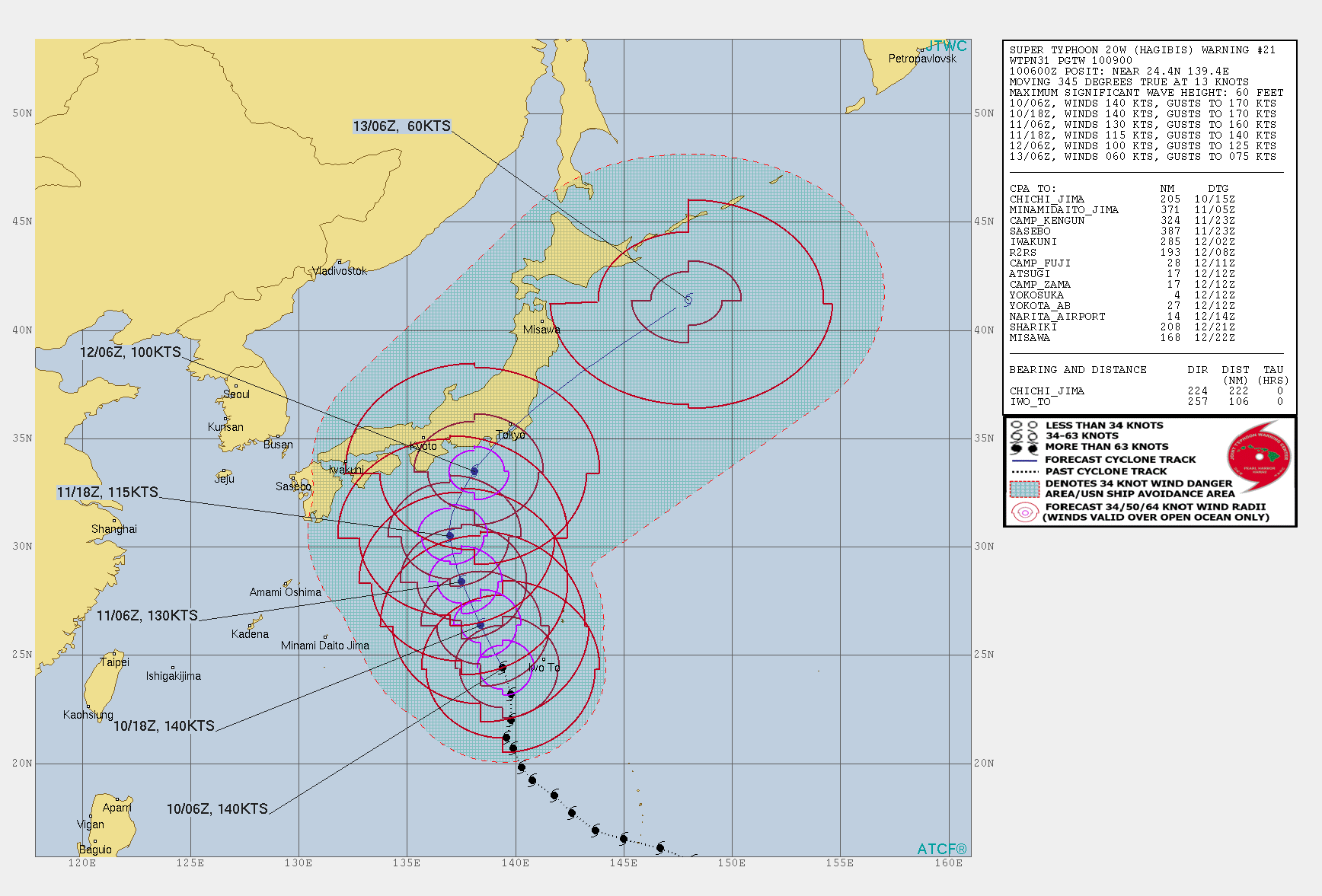
Typhoon HAGIBIS is currently located 400 km west of the island of Ogasawara and is moving north-northwest at a displacement speed of 18 kph. With sustained
mean winds of 230 kph and gusts of up to 275 kph, the typhoon currently belongs to the upper end of category 3.
According to current predictions, the system retains its north-northwest trajectory for a few hours before turning to a north-northeast direction. With a
slight but continuous weakening, the system approaches the Japanese main islands and is expected to reach land at 12 UTC on Saturday, 12 October. The landfall
is expected in the Suruga Bay area. At this time HAGIBIS is expected to still have wind speeds of 160 kph and gusts of up to 190 kph.
In addition to hurricane-like winds and waves of up to 15 m in height, HAGIBIS is particularly dangerous due to abundant precipitation. In the vicinity of
mountains floods and landslides may easily occur.
Two games of the 2019 Rugby World Cup in Japan have already been cancelled. The qualifying session for the Formula 1 Grand Prix of Suzuka on Saturday will
probably have to be postponed.
Thursday, 10 October 2019, 21:30 CET
|
|
|
|
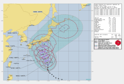
HAGIBIS trajectory, 10.10., 12 UTC
Image Credit: JTWC
|
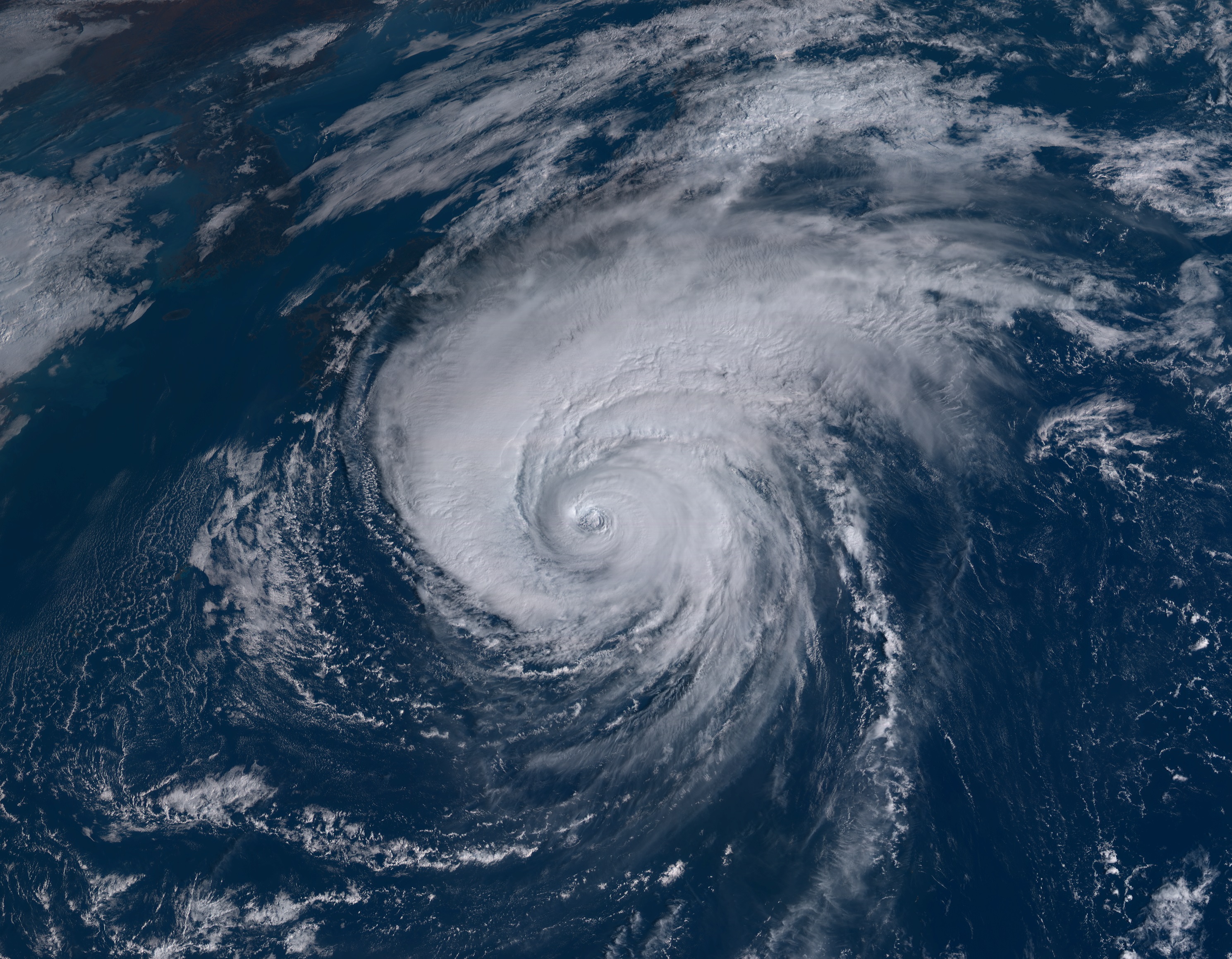
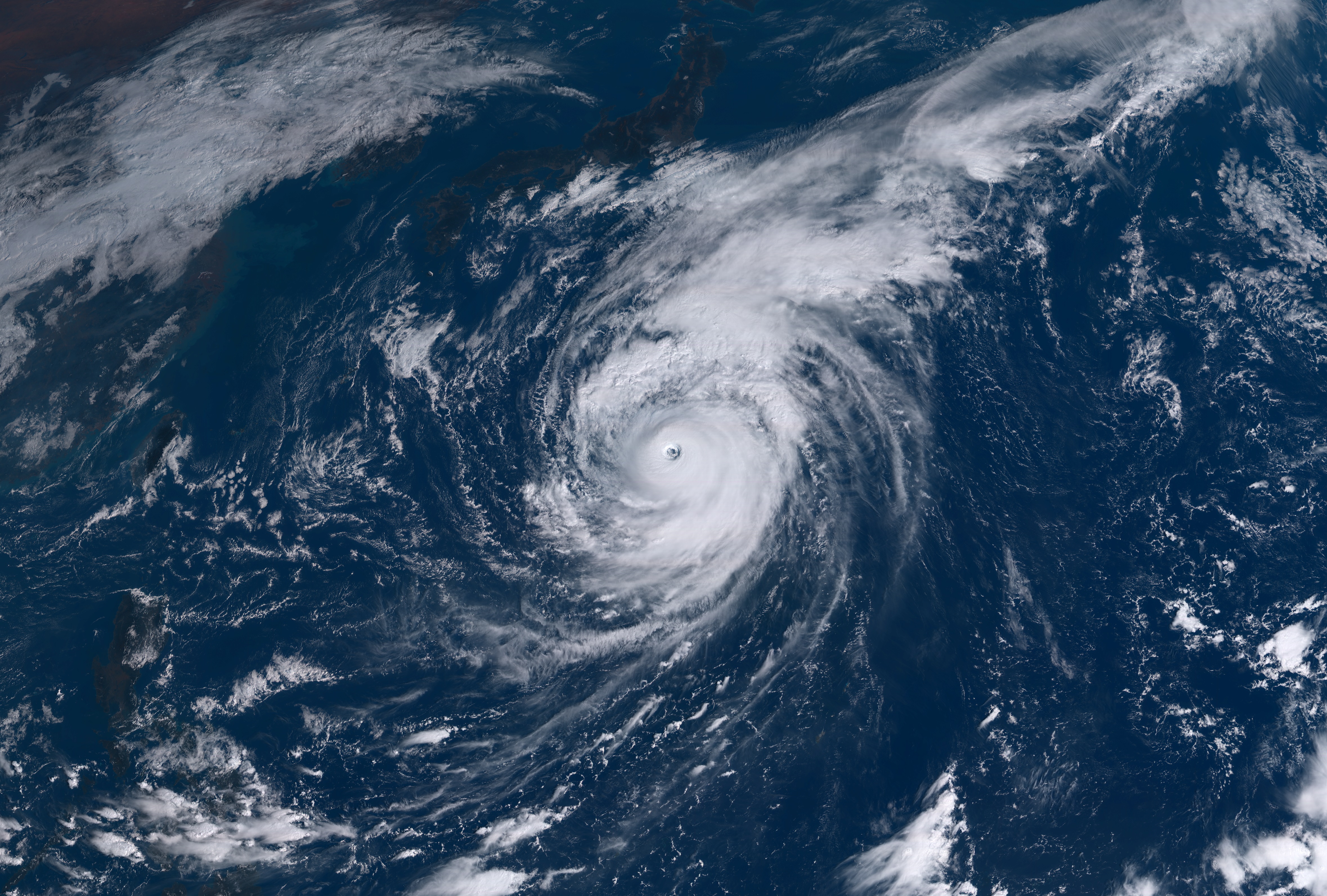
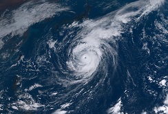
Satellite image (visible), 10.10., 12 UTC
Image Credit: Himawiri-8 NICT
|
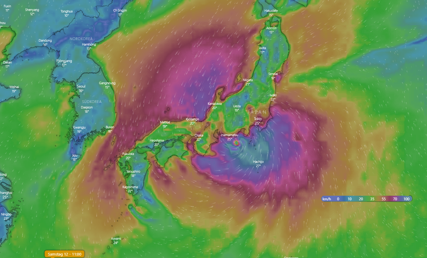
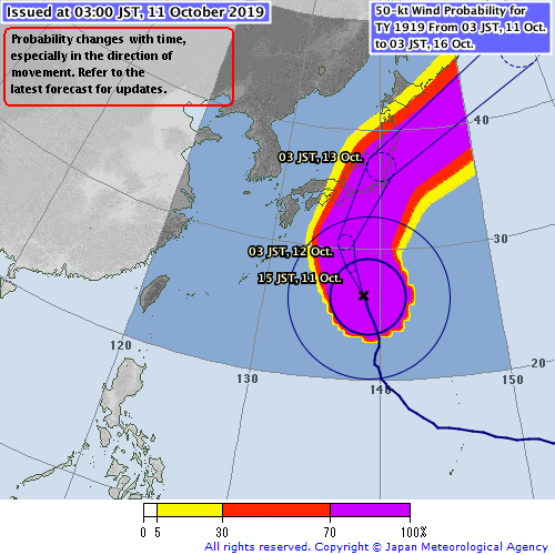
Wind Probabilities Cat 1
or above, 12.10., 12 UTC
Image Credit: TSR
|
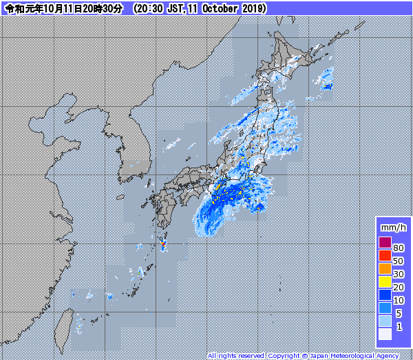
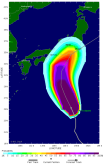
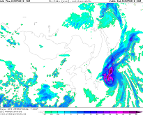
3 h precipitation(forecast), 12.10., 09 UTC
Image Credit: Wetterzentrale
|
Super Typhoon HAGIBIS
Japan
Issued: Thursday, 10 October 2019, 21:30 CET
Super Taifun HAGIBIS is currently classified in the highest category. HAGIBIS is expected to hit the coast near
the capital Tokyo on Saturday afternoon with wind speeds of up to 185 kph.
10 Oct - 12 Oct 2019
Super Typhoon HAGIBIS developed extremely fast compared to other typhoons. Within 24 hours it rapidly evolved
from a tropical storm with 97 kph to a category 5 super Typhoon with wind speeds up to 257 kph. This rapid
development can only be observed very rarely. NOAA's Hurricane Research Department only lists one
Northwest Pacific typhoon (Super Typhoon FORREST in 1983) that developed so rapidly. The number one in
the western hemisphere is Hurricane PATRICIA in 2015 (193 kph intensification within 24 hours) and
Hurricane WILMA in 2005 (177 kph intensification within 24 hours).
But now to super Typhoon HAGABIS:
As already mentioned above, it developed rapidly and had a core pressure
of 915 hPa last Monday. HAGIBIS is the fourth typhoon in the world to reach the highest category this year.
The predicted HAGIBIS train line makes a right turn off the coast of Japan and the typhoon is expected to
hit the coast off the capital Tokyo on Saturday afternoon. As the current situation shows, the metropolis
will not be hit directly, but it can still change the train path in the next few days. Due to the still
low wind shear (20 kph) and the still quite warm water temperatures (approx 29 °C), HAGIBIS is getting
weaker very slowly on its way to the coast in Japan. According to current calculations, it will hit the
Japanese coast not far from Tokyo with wind speeds of up to 185 kph (Cat. 3).
The typhoon will cause flooding, and Tokyo could also be affected. Landslides, storm damage and power
cuts are also possible. Since the Formula 1 race will take place in Suzuka this weekend, there could
also be delays and disruptions there.
Issued: October 10, 2019, 21:30 CET
CL
Issued: October 11, 2019, 00:00 CET
FS
Issued: October 11, 2019, 14:00 CET
FS
|