Wednesday, 02 October 2019, 12:00 CET
Hurricane LORENZO
Azores
Issued: Wednesday, 02 October 2019, 12:00 CET
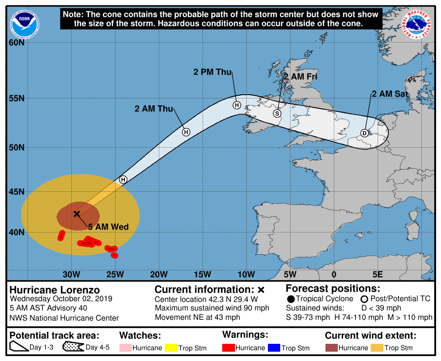
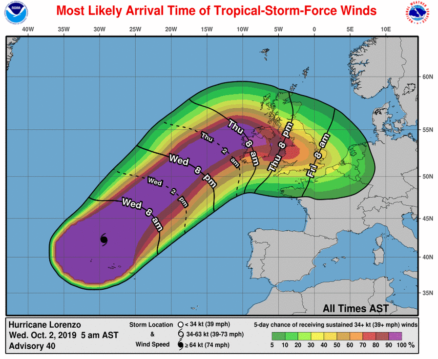
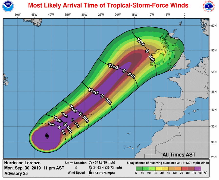
LORENZO has reached the Azores and provides meand winds up to 150 kph and swell up to 20 m. Hurricane-force winds very likely at the west coast of Ireland on Thursday.
30 Sep -02 Oct 2019
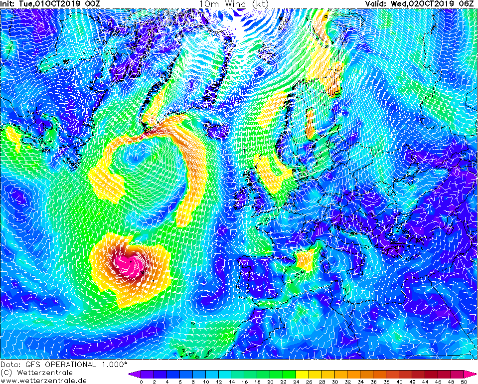
Hurricane LORENZO is currently located about 300 km northeast of Flores, the most western Azores Island. Mean winds are still reaching up to 150 kph, gusts even up to
190 kph. LORENZOs core pressure ist still 960 hPa.
The system moves with a very high displacement speed of 69 kph to the Northeast.
The system continues to weaken only slowly, but is expanding its geometrical size rapidly. Averaged over all four quadrants, LORENZO has a hurricane-force wind radius of
200 km, making it the most expansive Atlantic
hurricane since LUIS in 1995.
Measured by wind forces, LORENZO remains a hurricane (mean wind greater than 64 kt) until the late evening hours of 03 September. At this time it will be located about 54
degrees north latitude and just off the west coast of Ireland.
On Thursday, the west coast of Ireland is likely to experience wind speeds of around 95 kph and peak gusts of up to 140 kph. There are also waves of up to 15 m height and
total precipitation of up to 50 mm in Northern Ireland and Scotland.
Tuesday, 01 October 2019, 10:45 CET
Hurricane LORENZO
Azores
Issued: Tuesday, 01 October 2019, 10:45 CET
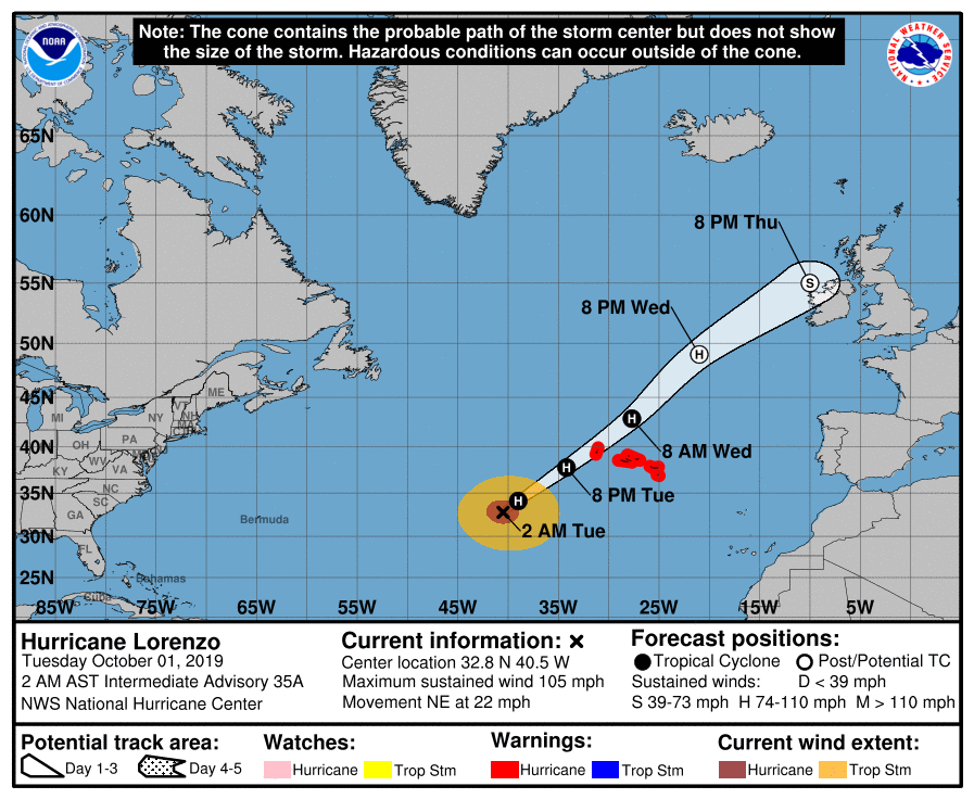
Hurricane LORENZO has maintained its intensity and picked up speed heading towards the azores. Winds up to 155 kph, precipitation up to 200 mm/12h and waves up to 20 m are to be expected.
30 Sep -02 Oct 2019
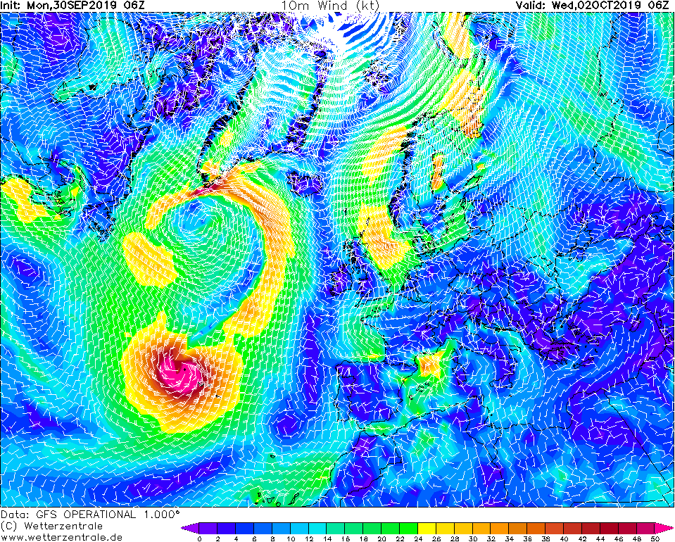
Hurricane LORENZO is currently located about 1000 km southwest of Flores, the most western Azores Island. The maximum wind speeds are 165 kph, in gusts up to 205 kph. LORENZOs core
pressure is 956 hPa. The system is currently moving at a high displacement speed of 35 kph in a northeasterly direction.
According to current calculations, the hurricane will pass nearly 100 km west of Flores on Wednesday at 06 UTC. The westernmost island of the Azores is therefore within the radius of
the maximum wind speeds. Until this date the system will not weaken significantly. Wind speeds of 160 kph must be expected, in gusts up to 200 kph. In addition, waves of 15 m and
occasionally up to 20 m can be expected.
The strongest precipitation and thunderstorms are limited to the northwestern quadrant of the hurricane. Nevertheless, in Flores rainfall of up to 200 mm can be expected in 12 hours.
LORENZO is expected to remain a hurricane until Thursday, 03 October. It is likely that he will pass 45 degrees north as a hurricane.
Monday, 30 September 2019, 18:00 CET
Hurricane LORENZO
Azores
Issued: Monday, 30 September 2019, 18:00 CET
Category 2 Hurricane LORENZO is heading towards the Azores. On Wednesday, wind speeds of 160 kph and precipitation of up to 200 mm/12h are expected.
30 Sep -02 Oct 2019
Hurricane LORENZO developed from an organised convection on 24 September. In recent days, it has strengthened up to category 5, which it reached
on September 28. It became the most easterly Category 5 hurricane in the Atlantic since the beginning of weather recording. LORENZO reached the
highest hurricane strength at 45°W, the previous record holder was Hurricane Hugo (1989) with 54.6°W.
Hurricane LORENZO is currently located about 1650 km west southwest of the Azores. The maximum wind speeds are 165 kph, in gusts up to 205 kph. It
is now classified as category 2 hurricane. The system moves at a speed of 24 kph in a north-northeast direction. The core pressure is 962 hPa.
According to current forecasts, LORENZO is expected to pass near Flores, the westernmost Azores island, in the morning of 03 September. Especially
in the western islands of the Azores wind speeds of up to 135 kph have to be expected. In Gusts, peaks of up to 160 kph are possible. In addition,
precipitation can reach up to 200 mm/12h. Floods and landslides are to be expected.
LORENZO will then move further north with high displacement speed and impact the east coast of Ireland as an extratropic storm low.
Issued: September 30, 2019, 18:00 CET
FS
Issued: October 01, 2019, 10:45 CET
FS
Issued: October 02, 2019, 12:00 CET
FS
|