Monday, 30 September 2019, 09:00 CET

|
|
|
|
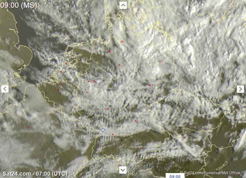
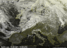
Satellite image (visible), 29.09., 07 UTC
Image Credit: Sat24
|
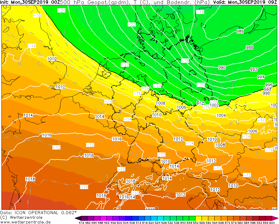
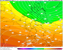
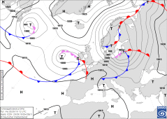
500 hPa Geopotential and Sea level pressure, 30.09., 09 UTC
Image Credit: Wetterzentrale
|
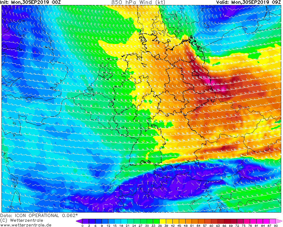
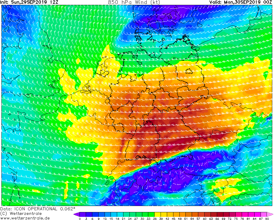
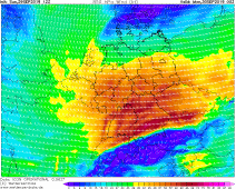
850 hPa Wind, 30.09., 09 UTC
Image Credit: Wetterzentrale
|
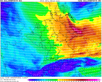
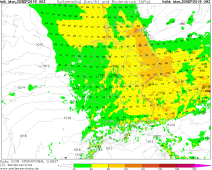
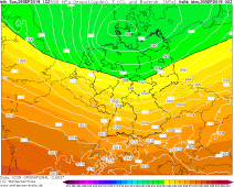
Gusts, 30.09., 09 UTC
Image Credit: Wetterzentrale
|
Storm - Warning
Europe, Germany
Issued: Monday, 30 September 2019, 09:00 CET
MORTIMER is the first autumn storm in Germany. Last night gusts up to 146 kph (Black Forest, Feldberg/ BW) were registered. In the north-east of Germany,
gale gusts of up to 150 kph must be expected till noon.
29-30 September 2019
MORTIMER is shifting further east. Its centre is currently located above the Baltic Sea. At the southwest flank a wind maximum is formed by the strong air
pressure gradient, which stretches over Lower Saxony and Sachen-Anhalt and extends in the further course also over Mecklenburg-Western Pomerania, Brandenburg and
Berlin.
In the other parts of the country, a strong to stiff wind must continue to be expected. On the satellite images, the strong wind can , especially be seen as
leewave clouds along the mountains. In northern Germany, showers and thunderstorms can also occur today. Stormy gusts must still be expected in their vicinity.
In the rest of the country and after the passage of the front it remains windy on the exposed sites with about 50-60 kph.
In addition, road and rail transport will continue to be affected by disruptions. The risk of falling trees or branches is increased as the drought of 2018
and 2019 has dried up the trees. After that, most of them are still full of leaves, which gives the wind a larger area to attack.
Sunday, 29 September 2019, 19:00 CET
|
|
|
|
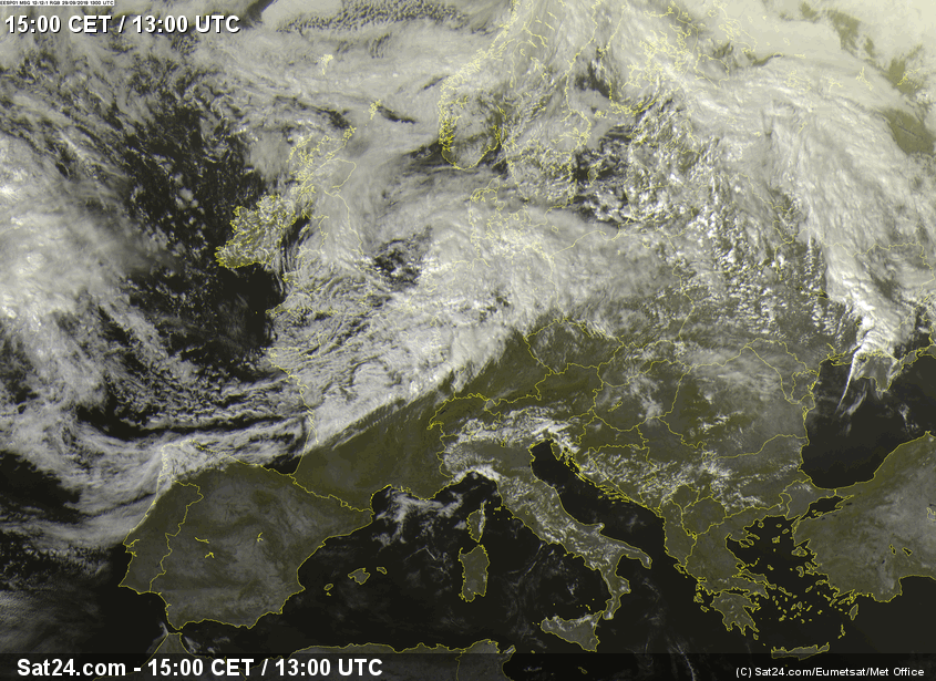
Satellite image (visible), 29.09., 13 UTC
Image Credit: Sat24
|
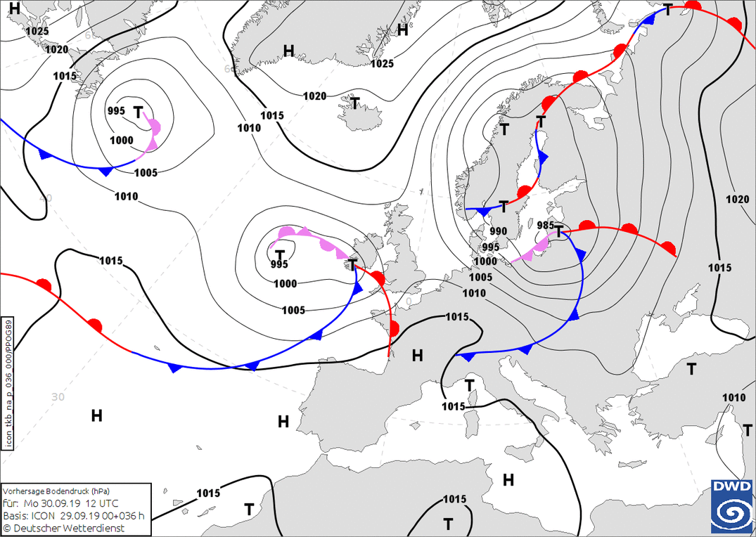
Sea level pressure and fronts, 30.09., 12 UTC
Image Credit: DWD
|
850 hPa Wind, 30.09., 00 UTC
Image Credit: Wetterzentrale
|
500 hPa Geopotential and Sea level pressure, 30.09., 00 UTC
Image Credit: Wetterzentrale
|
Storm - Warning
Europe, Germany
Issued: Sunday, 29 September 2019, 19:00 CET
The first autumn storm of the year reaches Germany. Gusts of up to 150 kph are expected. The strongest gusts are expected on Monday night in Baden-Württemberg and
Bavaria, as well as on Monday morning in the north-east of Germany.
29-30 September 2019
Windstorm MORTIMER is the first autumn storm of the year. It was already impressively announced yesterday in the visible satellite image. Already this
morning stormy gusts were registered in the west and north of Germany. In the north there were thunderstorms whose gusts also reached storm strength.
The south still profited from an intermediate high, whereby the low pressure influence will intersperse itself up to the evening and also into the night.
The strongest gusts are expected above all in the south and middle of Germany. Until late in the evening, storm and hurricane-force gusts of up to 120 kph are to be
expected on exposed locations. In the second half of the night, a second wind maximum is expected to extend over southern Bavaria. Stormy gusts up to 140 kph are
possible. Only in northern Germany the wind remains somewhat weaker at just under 60 kph. According to the latest model calculations, the centre of MORTIMER does
not reach Germany and is heading east via Denmark.
On Monday, MORTIMER will quickly shift to the east. On its southwest flank a narrow, further wind maximum forms in the early morning with hurricane-like gusts of
up to 150 kph. This extends over Lower Saxony and Saxony-Anhalt and will shift over Mecklenburg-Vorpommern and Brandenburg, Berlin and Saxony until noon.
In the rest of the country and after the passage of the front it remains windy on the exposed sites with about 50-60 kph.
In addition, road and rail transport will be affected by disruptions. The risk of falling trees or branches is increased as the drought of 2018 and 2019
has dried up the trees. After that, most of them are still full of leaves, which gives the wind a larger area to attack.
Issued: Sep 29, 2019, 19:00 CET
MG
Issued: Sep 30, 2019, 09:00 CET
MG
|