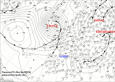
Friday, 15 March 2019, 12:30 CET
|
|
|
|
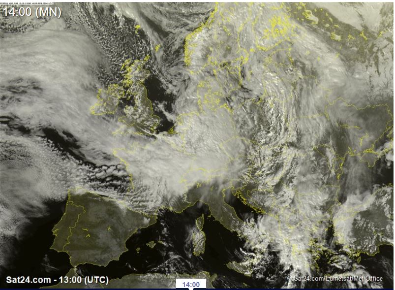
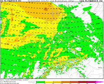
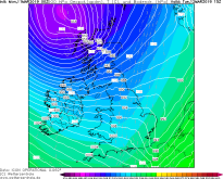
Satellite image (visible), 15.03., 10 UTC
Image Credit: Sat24
|
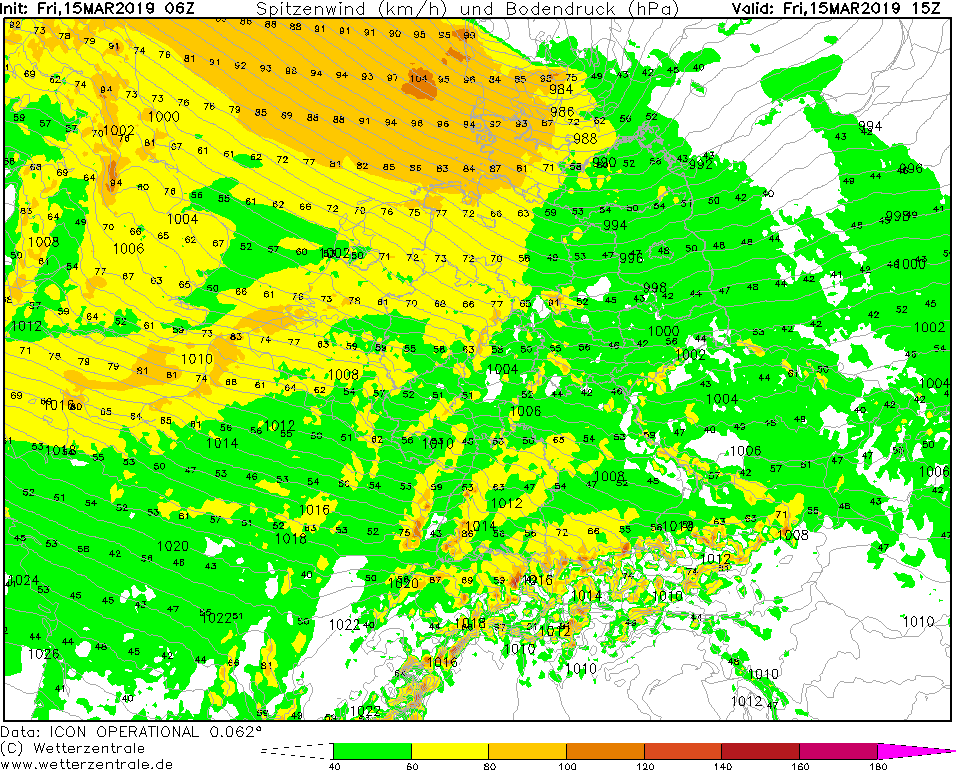
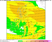
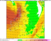
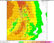
Wind gusts (CE), 15.03., 15 UTC
Image Credit: Wetterzentrale
|
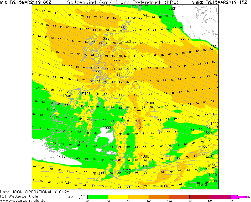
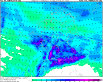
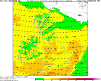
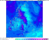
Wind gusts (GB), 15.03., 15 UTC
Image Credit: Wetterzentrale
|
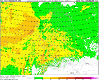
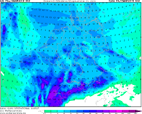
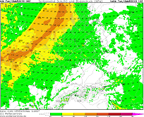
18 h precipitation, 16.03., 00 UTC
Image Credit: Wetterzentrale
|
Storm - Warning
Central Europe, Great Britain
Issued: Friday, 15 March 2019, 12:30 CET
High horizontal pressure gradients between low GEBHARD II, low HEINZ and the typical Azores high leat to mean wind up 65 kph to and gusts up to 105 kph.
09-15 March 2019
Low pressure area HEINZ is currently (15 March, 12 UTC) over Denmark and moves with a speed of approx. 65 kph in an easterly direction. The core pressure is about 980 hPa.
On the southwestern flank of HEINZ there are average wind speeds of up to 65 kph and gusts of up to 105 kph. The strongest winds are expected in the morning
and at noon in Great Britain, in the afternoon also in Northern Germany and Denmark. The western to northwestern winds cause the water levels on the Elbe
to rise slightly. In St. Pauli (Hamburg) the tide is expected to reach 1.5 m above mean high tide this evening.
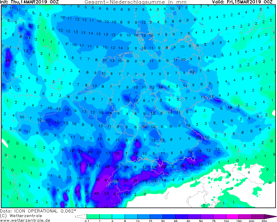
In southern Germany low HEINZ does not appear by strong wind, but by significant precipitation. More than 30 mm/24h are expected in
Baden Württemberg and Bavaria , in the Black Forest and the Northern Alps up to 75 mm/24h are possible.
Thursday, 14 March 2019, 15:30 CET

|
|
|
|
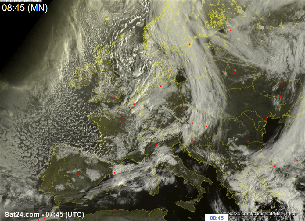
Satellite image (visible), 14.03., 13 UTC
Image Credit: Sat24
|
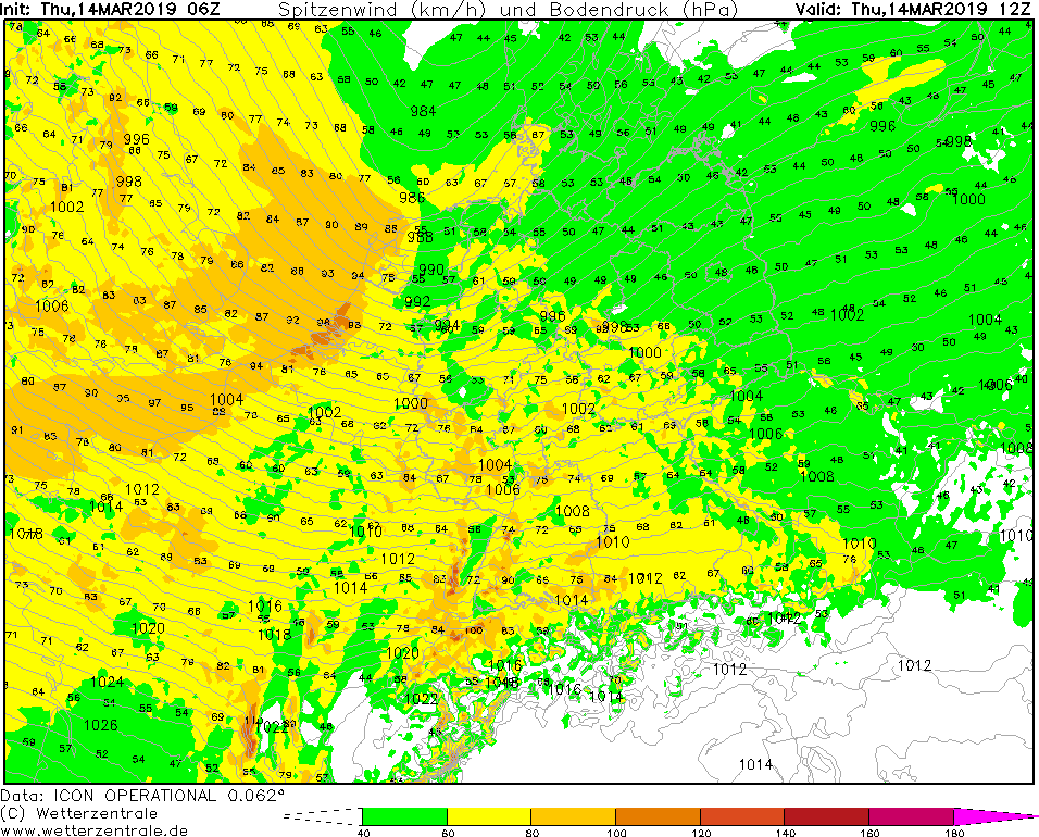
Wind gusts (CE), 14.03., 12 UTC
Image Credit: Wetterzentrale
|
Wind gusts (GB), 14.03., 09 UTC
Image Credit: Wetterzentrale
|
24 h precipitation, 15.03., 00 UTC
Image Credit: Wetterzentrale
|
Storm - Warning
Central Europe, Great Britain
Issued: Thursday, 14 March 2019, 15:30 CET
High horizontal pressure gradients between low FRANZ II, low GEBHARD and the typical Azores high leat to mean wind up 65 kph to and gusts up to 110 kph.
09-15 March 2019
Low pressure area GEBHARD is currently located next to Island, FRANZ II between Denmark and Norway. A horizontal pressure gradient of up to 5 hPa /100km
has developed between the low pressure areas and the Azores high. This leads to wind speeds of up to 65 kph and gusts of up to 110 kph. The strongest
winds are expected at the Dutch North Sea coast. Gusts of up to 90 kph are also possible in Germany and Great Britain, and even more in exposed locations.
As in the past days, precipitation occurs especially on the western slopes of mountains. On Thursday, locally up to 50 mm in 24 hours are possible.
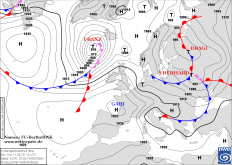
Wednesday, 13 March 2019, 09:00 CET
|

|
|

|
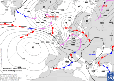
Soil pressure and fronts, 13.03., 12 UTC
Image Credit: FU Berlin
|
Satellite image (visible), 12.03., 07:45 UTC
Image Credit: Sat24
|
Wind gusts (CE), 13.03., 12 UTC
Image Credit: Wetterzentrale
|
Geopot. and soil pressure, 13.03., 15 UTC
Image Credit: Wetterzentrale
|
Storm - Warning
Central Europe
Issued: Wednesday, 13 March 2019, 09:00 CET
Low pressure area FRANZ reaches Central Europe with gusts up to 120 kph, in exposed locations up to 140 kph.
09-15 March 2019
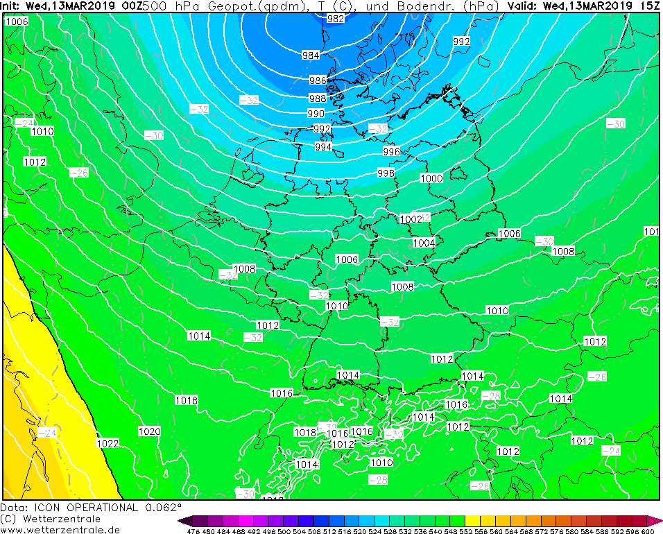
Today, the storm low FRANZ dominates the weather in Central Europe. Over the North Sea, a second centre
(core pressure of 985 hPa) has formed overnight, leading to an intensification of the windsitutaion,
especially in the northwest of Germany. Unstable cold air of up to -33 °C at a height of 5 km causes particularly
strong gusts of wind up to 120 kph and in exposed locations up to 140 kph. Numerous short but strong rain
showers and short sleet thunderstorms are possible.
A new front system of the GEBHARD storm low has already developed near Iceland. Besides wind this storm low
will cause a lot of precipitation in Central Europe in the next days. The unstable and windy weather will
therefore continue in the coming days, only at the weekend the weather situation will gradually calm down.
Tuesday, 12 March 2019, 11:15 CET
|

|
|
|
Soil pressure and fronts, 12.03., 00 UTC
Image Credit: FU Berlin
|
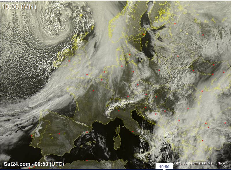
Satellite image (visible), 12.03., 09:50 UTC
Image Credit: Sat24
|
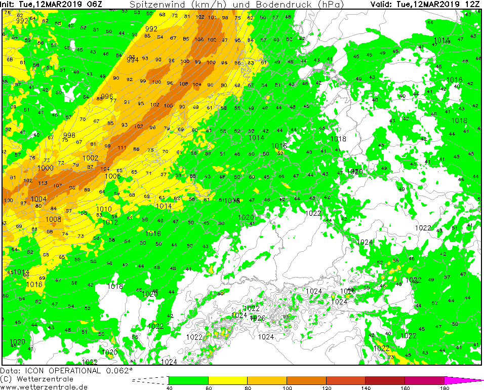
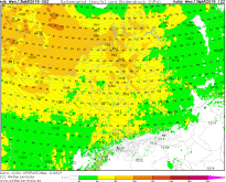
Wind gusts (CE), 12.03., 12 UTC
Image Credit: Wetterzentrale
|
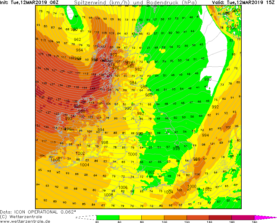
Wind gusts (GB), 12.03., 15 UTC
Image Credit: Wetterzentrale
|
Storm - Warning
Great Britain, Ireland, Central Europe
Issued: Tuesday, 12 March 2019, 11:15 CET
Low pressure area FRANZ reaches Great Britain with gusts up to 150 kph and Central Europe with gusts up to 100 kph.
09-15 March 2019
Low pressure area FRANZ has intensified by 30 hPa within 24 hours. With a core pressure of 960 hPa, the centre hits the north
coast of Scotland on Tuesday evening. With a horizontal pressure gradient of up to 10 hPa/100km, FRANZ provides hurricane
gusts of up to 160 kph, and even more on the open sea.
The highest wind speeds are expected at the northwest coast of Ireland and the west coast of Scotland. The waves can reach
altitudes of up to 13 metres. In the inland the wind speeds are slightly lower. Nevertheless in Ireland and Scotland storm
gusts of up to 120 kph have to be taken into account. On Tuesday evening gusts of up to 100 kph are also expected in England.
Due to the high reaching cold air behind the cold front, there is a danger of snow showers and thunderstorms, especially in Scotland.
At the North Sea coast of the European mainland already on Tuesday storm gusts of to 100 kph may occur.
On Wednesday hurricane-like gusts are to be expected also in central and north Germany.
Monday, 11 March 2019, 10:00 CET
|
|
|
|
Soil pressure and fronts, 11.03., 12 UTC
Image Credit: FU Berlin
|
Geopot. and soil pressure, 12.03., 15 UTC
Image Credit: Wetterzentrale
|
Wind gusts (GB), 12.03., 00 UTC
Image Credit: Wetterzentrale
|
48 h precipitation, 13.03., 00 UTC
Image Credit: Wetterzentrale
|
Storm - Warning
Great Britain, Ireland,
Issued: Monday, 11 March 2019, 10:00 CET
In a sequence of low pressure areas now low FRANZ follows .
09-15 March 2019
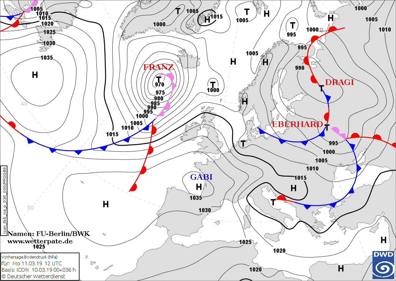
After the passage of Tief EBERHARD the next storm low FRANZ follows. Today, the low is moving from the west across
the north of Great Britain. At a core pressure of 958 hPa the pressure gradient increases during the course of
the day and especially in the evening wind gusts of up to 120 kph are expected, in exposed locations gusts of
up to 140 kph are also expected. FRANZ provides a horizontal pressure gradient of over 5 hPa/100km. With the
passage of the cold front in the night from Monday to Tuesday strong precipitation is expected again in this
area. So 30 mm of precipitation can fall within 3 hours.
Damage to buildings and the infrastructure may occur due to the storm. In addition, trees may be uprooted and
rail and air traffic may be affected. The precipitation may cause minor flooding.
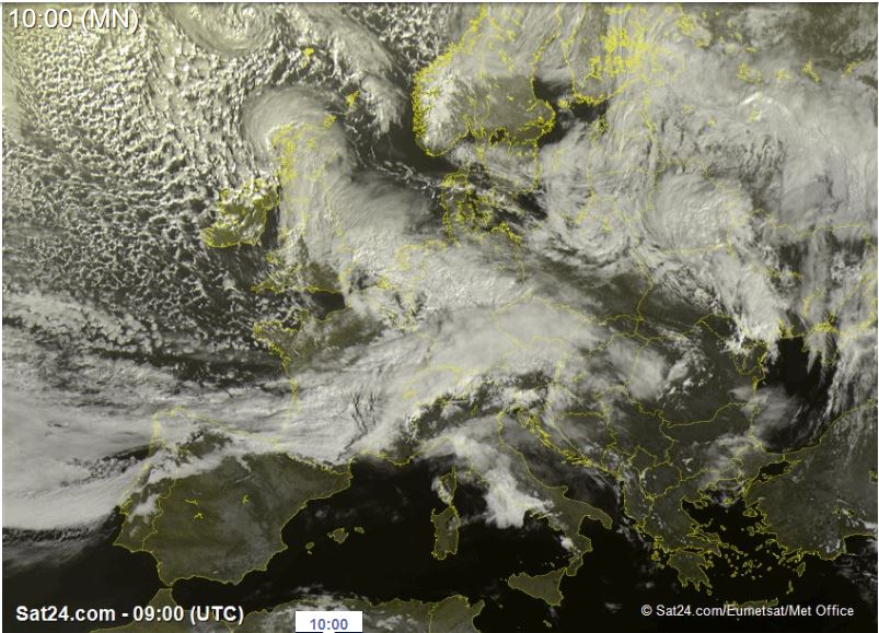
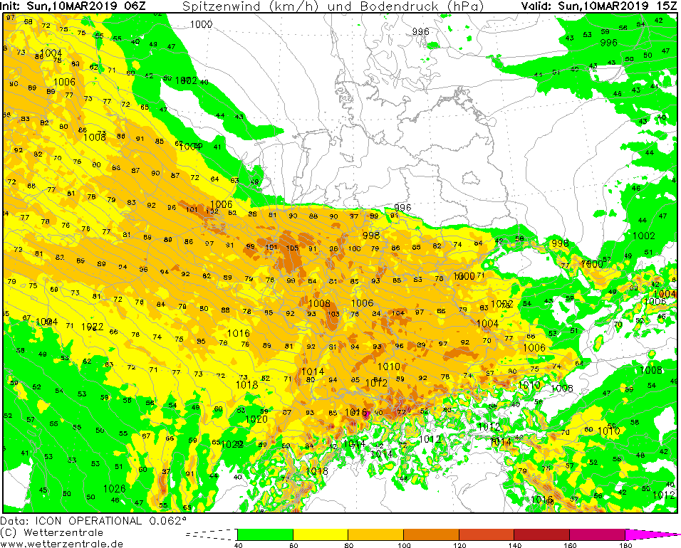
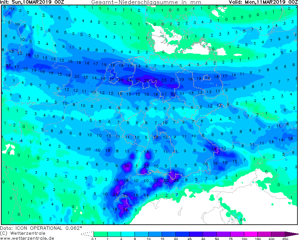
Sunday, 10 March 2019, 12:15 CET
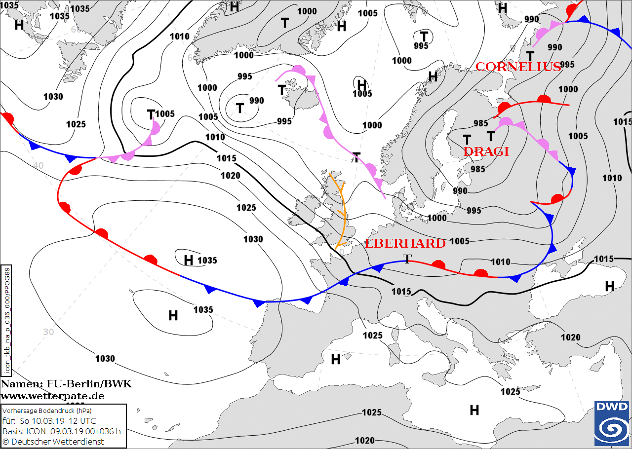
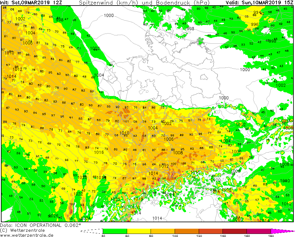
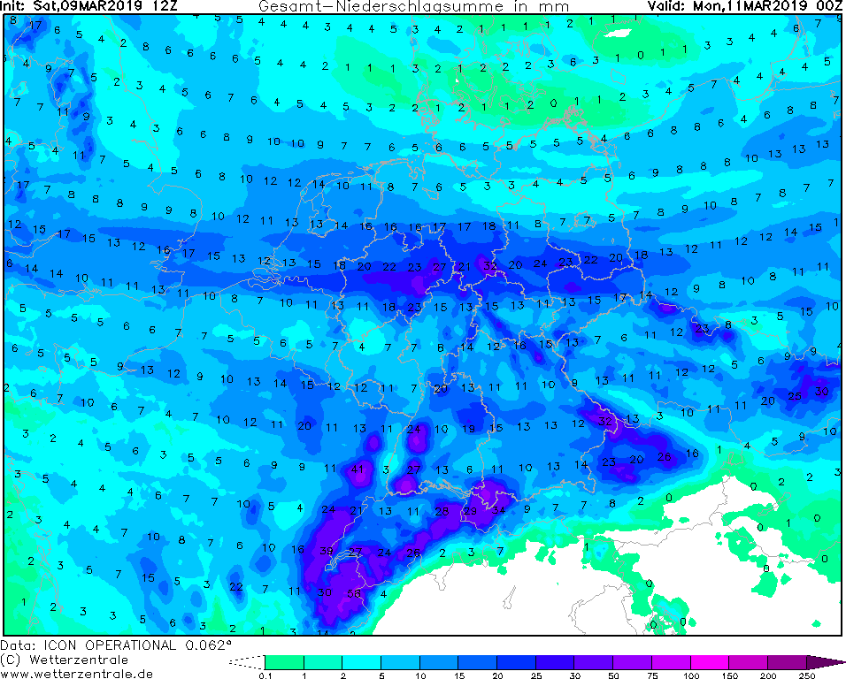
Storm - Warning
Great Britain, Ireland, Central Europe
Issued: Sunday, 10 March 2019, 12:15 CET
In a sequence of low pressure areas the fast-runner low EBERHARD follows on Sunday.
09-15 March 2019
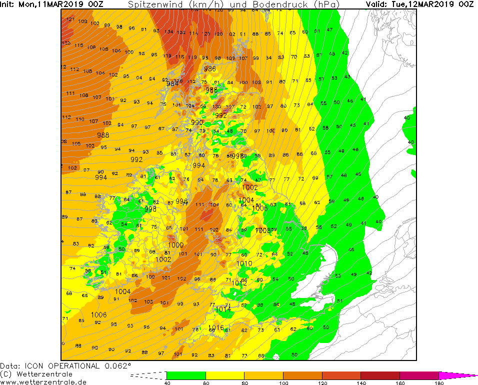
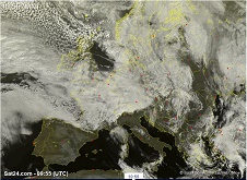
Low pressure area EBERHARD reaches the European mainland on Sunday morning.
With still very high displacement speed it is currently (10 March 12 UTC) above Lower Saxony.
From there it continues in the direction of Poland and then Belarus.
The strongest gusts are expected in Germany at 15 UTC. Widespread, gusts of up to 110 kph are possible,
in the Eifel even up to 120 kph. In the late Sunday evening the wind decreases.
In the north of Germany the wind does not play a role, but rain up to 30 mm in 24 hours has to be taken into account.
In the south, especially on the upwind side of mountains, up to 50 mm/24h are possible. Even organized thunderstorms
may occur due to strong upwinds and significant vertical wind shear.
In England, Belgium and the Netherlands, hurricane-like gusts will also occur.
EBERHARD will reach its highest wind speeds on the Dutch North Sea coast. Gusts of up to 140 kph are possible here.
Saturday, 9 March 2019, 20:30 CET
Storm - Warning
Great Britain, Ireland, Central Europe
Issued: Saturday, 9 March 2019, 20:30 CET
In a sequence of low pressure areas the fast-runner low EBERHARD follows on Sunday.
09-15 March 2019
At present (09 March, 18 UTC) EBERHARD is located about 700 km west of Plymouth (GB). With a displacement speed of approx. 80 kph,
the centre will be above the south of Great Britain on early Sunday morning. Only 6 hours later it will already enter the Ruhr area.
In the south of Germany EBERHARD provides a horizontal pressure gradient of over 5 hPa/100km.
In the southern Germany, average wind speeds of up to 60 kph are expected on Sunday. In Baden Württemberg, Bavaria, North
Rhine-Westphalia, Rhineland-Palatinate and in the Saarland, gusts of up to 100 kph are to be expected.
Mountains are likely to cause orographic precipitation. In the Black Forest, on the Brocken and in the Sauerland,
locally up to 50 mm of precipitation can occur on Sunday.
Also in Ireland and in the south of Great Britain storm gusts of up to 90 kph have to be taken into account.
Issued: Mar 09, 2019, 20:30 CET
FS
Issued: Mar 10, 2019, 12:15 CET
FS
Issued: Mar 11, 2019, 10:00 CET
CL
Issued: Mar 12, 2019, 11:15 CET
FS
Issued: Mar 13, 2019, 09:00 CET
CL
Issued: Mar 14, 2019, 15:30 CET
FS
Issued: Mar 15, 2019, 12:30 CET
FS
|