|
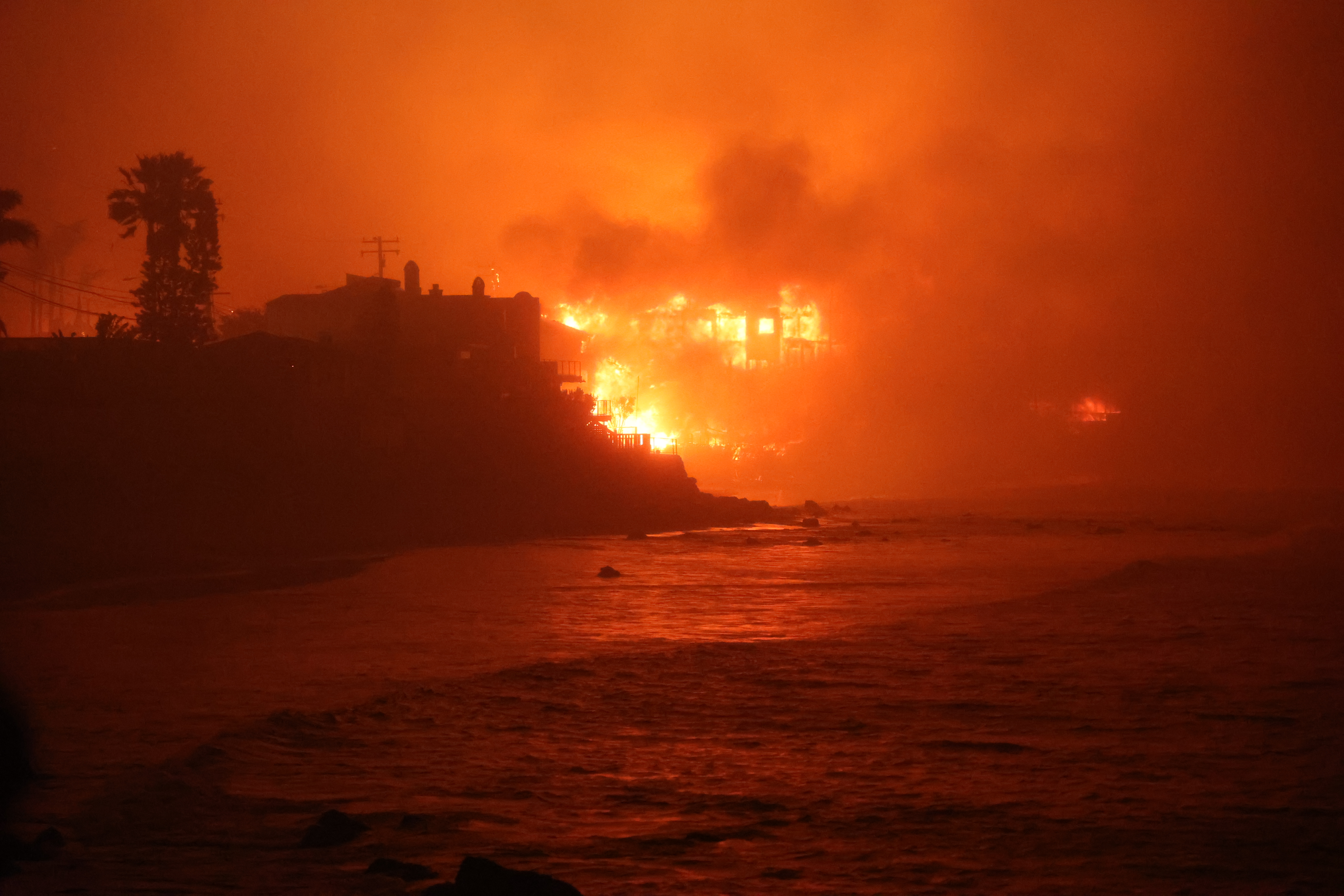
Multiple large wildfires burnt more than 200 km2 in the Los Angeles Metropolitan area in January 2025. The two largest fires, the Palisades and Eaton Fires, both ignited on January 07, 2025, destroyed thousands of structures due to their proximity to residential areas. In total more than 18,000 structures have been directly affected by the fires. The blazes are the most expensive wildfires in Californian history.
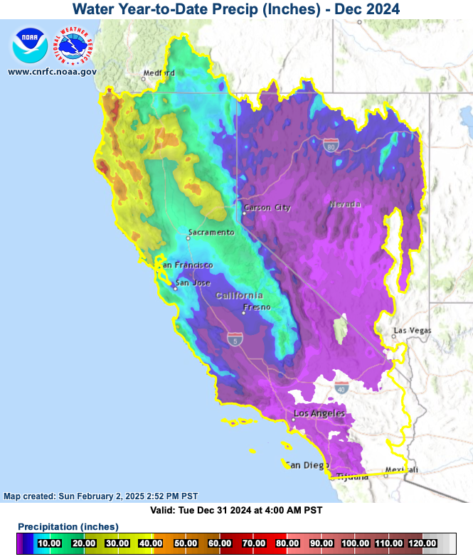
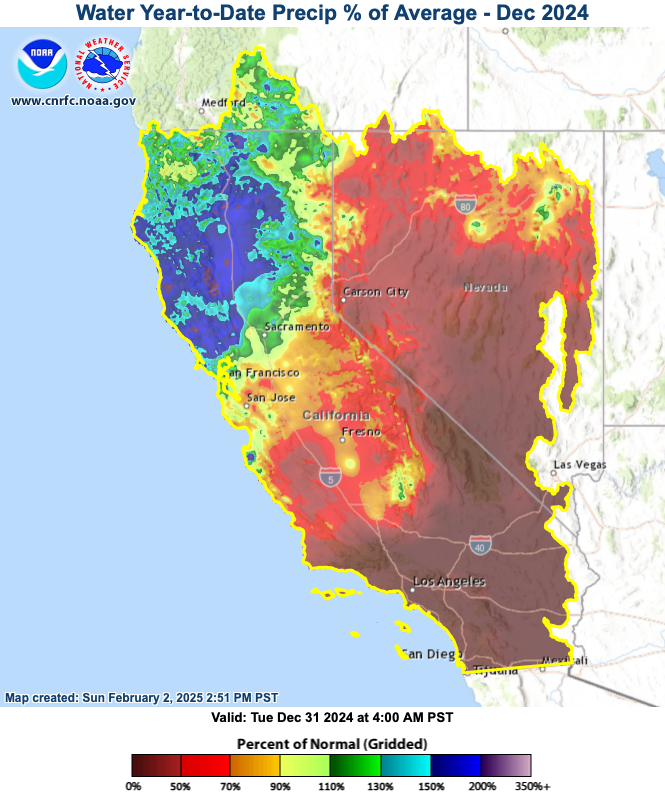
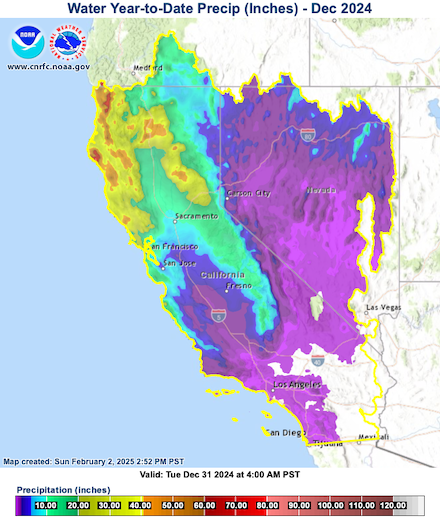
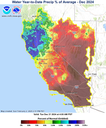
In the months preceding the outbreak of the wildfires in Southern California, only sparse precipitation was observed. While in the summer months, Southern California hardly receives any precipitation in the climatological mean, the start of the water year (starting October 01, 2024) was particularly dry in Southern California. The accumulated precipitation over California since October 01, 2024, shows a distinct north-south gradient. In the north, the precipitation totals were close to the climatological mean before the outbreak of the wildfires. In the southern part of the state, the precipitation totals were much below the climatological mean. Many areas received little to no precipitation since October 01, 2024.
|
Accumulated precipitation over California (left) and percent of average precipitation (right) since the start of the water year (starting October 01, 2024) until December 31, 2024, source:
CNRFC
|
 |
 |
As a result, the fire season in Southern California extended into January 2025. Besides the favorable seasonal precipitation development, the high precipitation totals of the previous years also led to a large vegetation build-up which fueled the recent fires. In the winter of 2022/23, a parade of atmospheric rivers built up the largest snowpack in California in years. In August 2023, Hurricane HILLARY brought unusual summer rains to Southern California. In some parts of the Inland Empire and Imperial Valley, the precipitation related to Hurricane HILLARY surpassed the annual mean precipitation totals. In the last winter, an atmospheric river brought record-breaking precipitation to Southern California. While these heavy precipitation events elevated California out of a decade-long drought, the moist soils largely prevented the last two fire seasons. Due to these circumstances, a significant vegetation build-up was observed over California. These turned into abundant fuel for the recent wildfires after a drought this winter.
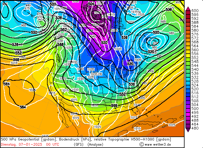
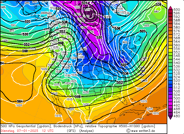
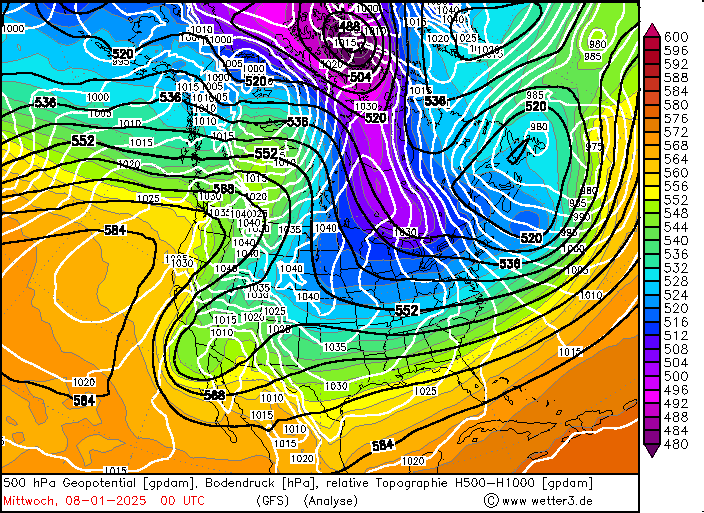
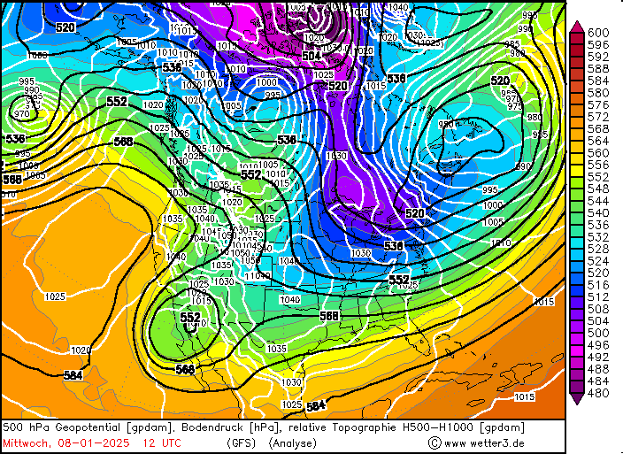
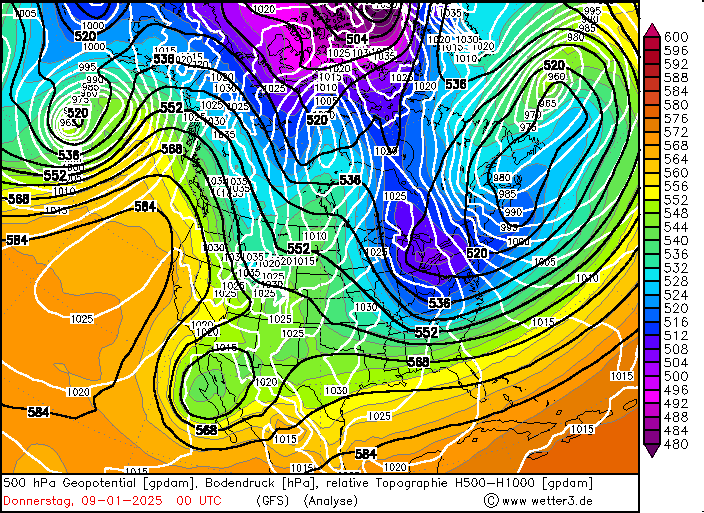
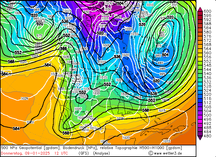
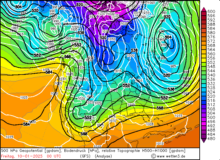
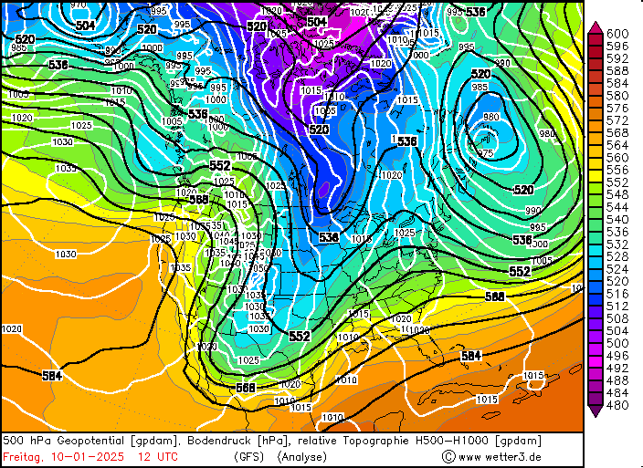
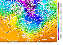
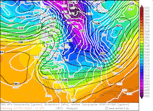
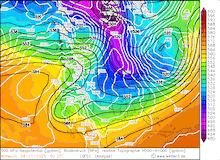
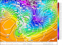
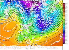
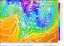
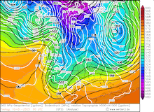
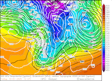
Early in 2025, a large ridge matured over the western half of the US and the Eastern Pacific. By January 06, 2025, the ridge axis tilted eastwards. Over the Western US, a trough undermined the ridge. With that, a sharp geopotential gradient developed across California. At lower elevations, a high-pressure ridge over the Great Basin induced a low-level synoptic low around the ridge. In combination with a low over the Baja California, a northeasterly synoptic-scale flow was induced over the Desert Southwest. In Southern California, this synoptic setup can induce Santa Ana winds in the Los Angeles metropolitan area. Channeled by the deep canyons in the surrounding mountains, hurricane-force winds developed. In the San Gabriel Mountains, a peak wind gust of 161 kph was measured at Mount Lukens Truck Trail.
|
Development of the 500 hPa geopotential, 1000 hPa to 500 hPa thickness, and sea-surface pressure over North America, 07.01.2025 00 UTC - 10.01.2025 12 UTC, source:
wetter3.de
|
 |
 |
 |
 |
 |
 |
 |
 |
While high wind speeds alone can create dangerous fire conditions, the extreme dryness of the air masses can elevate the fire conditions to critical levels. Due to the dry-adiabatic descent, the air masses during Santa Ana winds can dry out to an extreme degree. On January 08, 2025, at 23 UTC, the measuring site at Santa Monica Airport recorded an ambient temperature of 22.2 °C. At the same time, the dewpoint at the station was only -40.6 °C. This led to a relative humidity of less than 1 %. This extreme dryness of the air masses dries the vegetation further. Once a fire is light, the combination of extreme dryness and high wind speeds leads to the rapid expansion of wildfires. The wind has multiple impacts on the fire. First, due to the high winds and turbulence, aircraft cannot be deployed to combat the fire. Secondly, the high winds can transport hot embers across large distances. These can ignite further fires aiding the rapid expansion of a wildfire. Additionally, the hilly terrain around Los Angeles with its steep inclines helps the fire to spread even faster across the hills and canyons around the city.
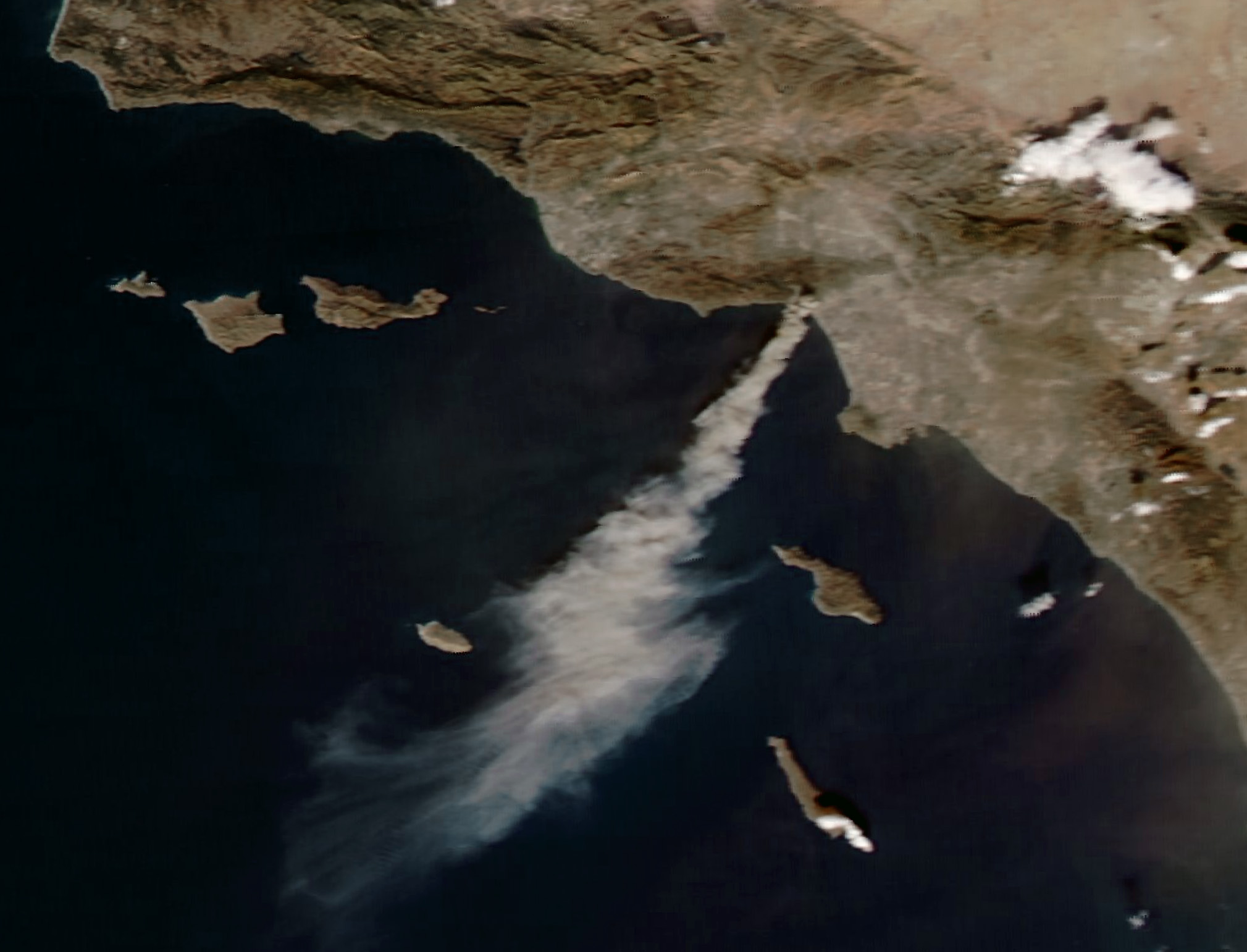
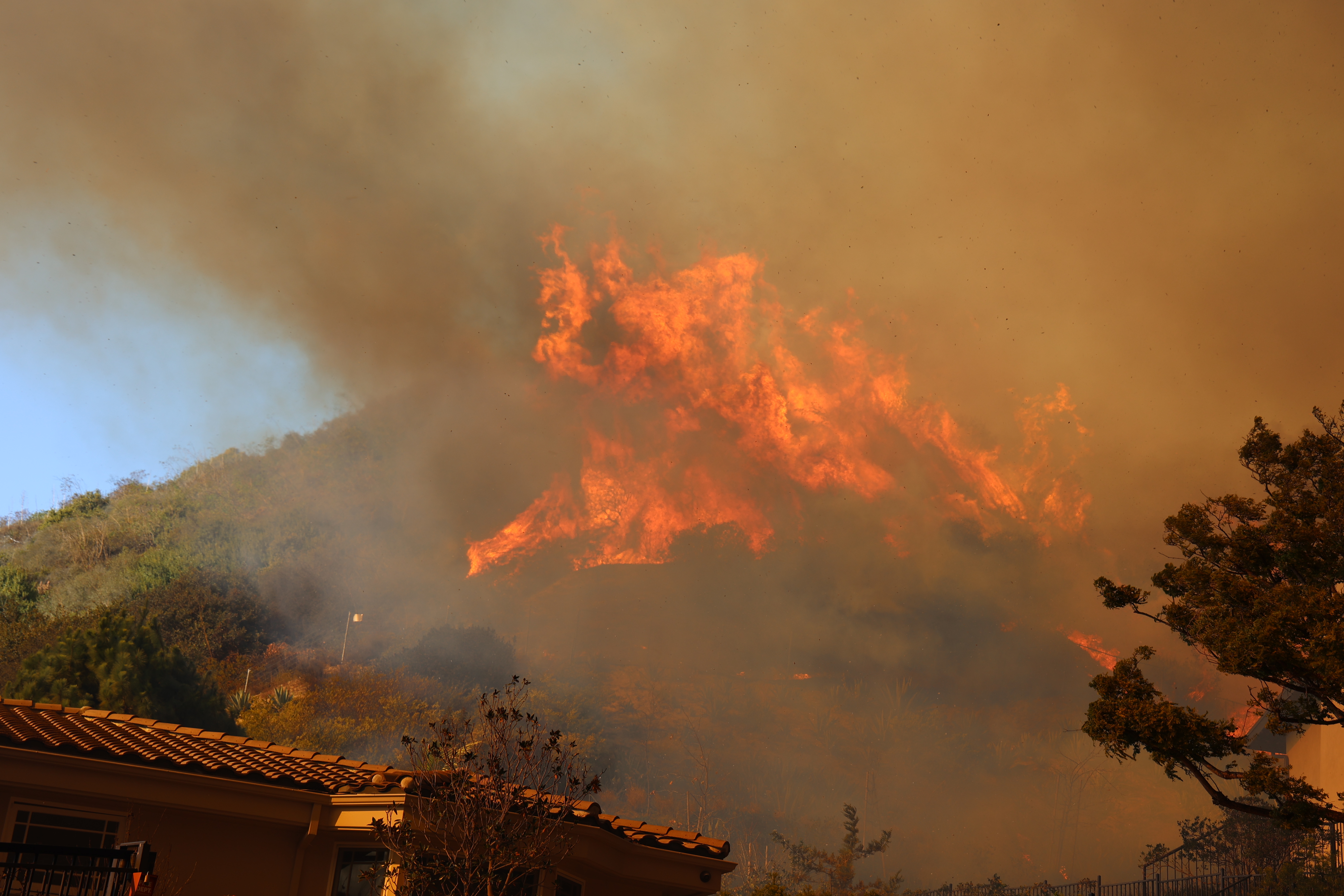
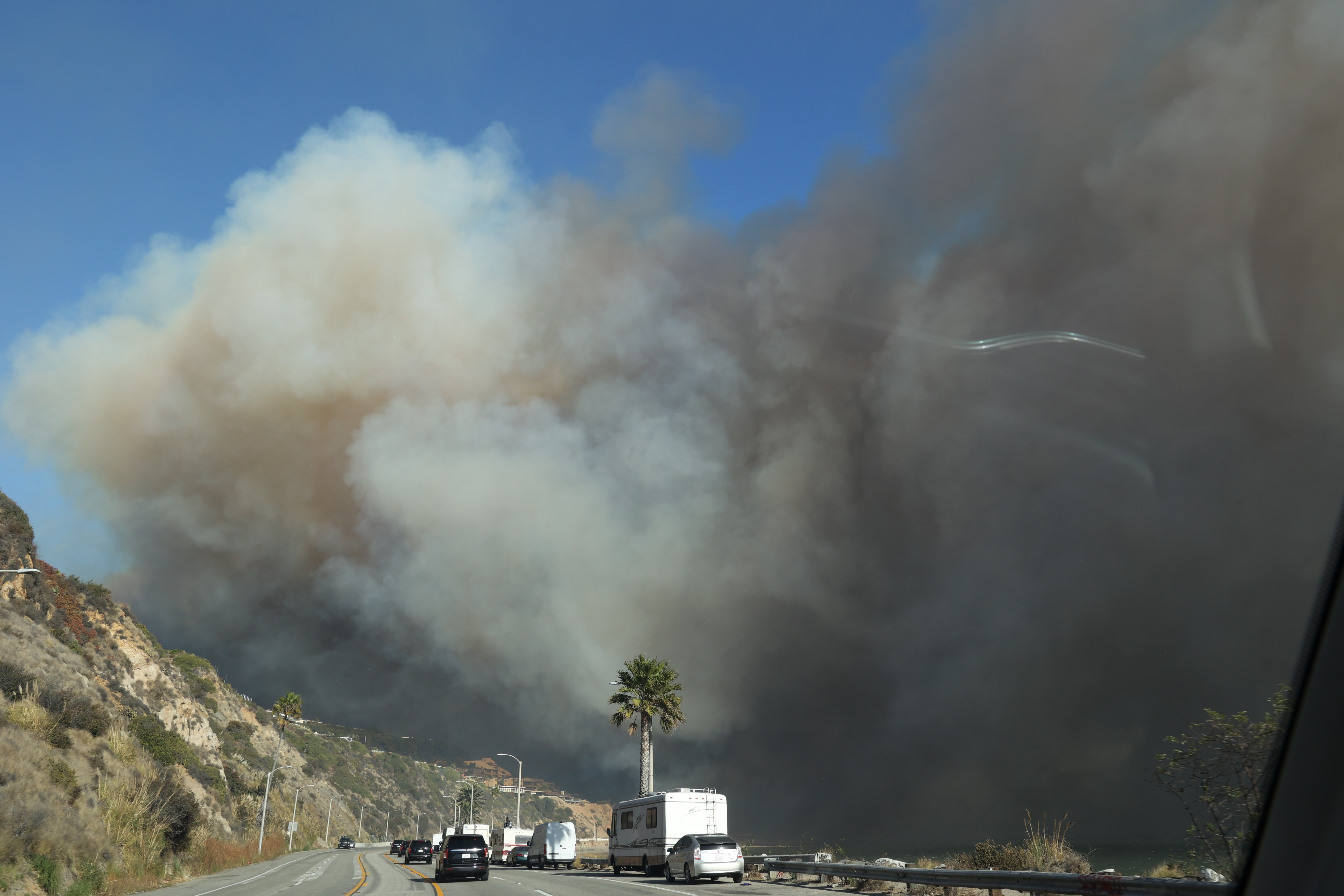
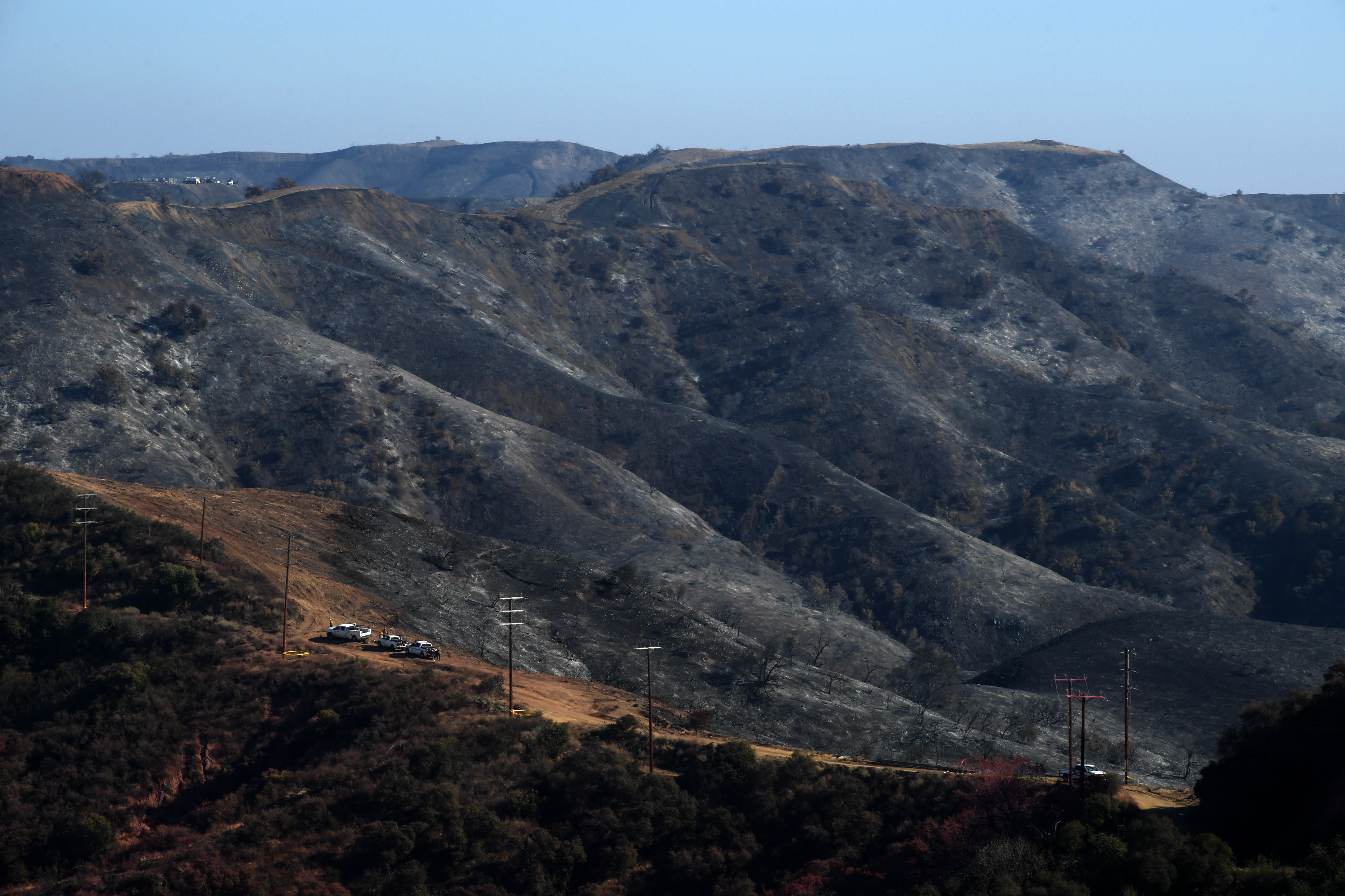
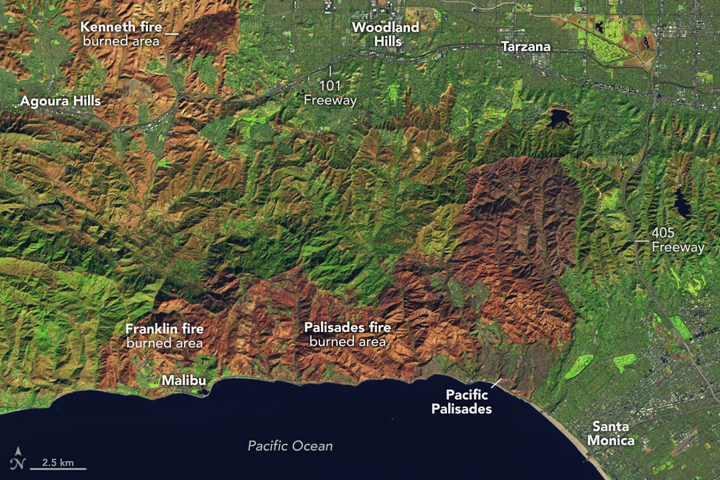
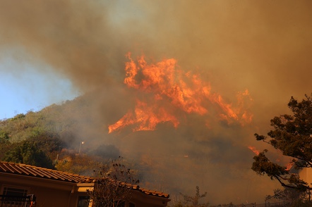
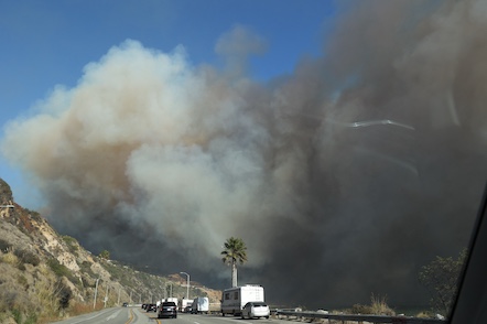
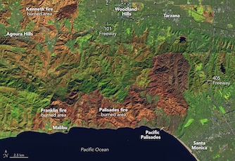
On January 07, 2025, multiple fires ignited within the metropolitan area of Los Angeles. The two largest and most damaging fires during the recent wildfire outbreak started burning on that day. The Palisades Fire ignited in the coastal community of Pacific Palisades just outside of Santa Monica in the Santa Ynez Mountains. The fire devastated the community of Pacific Palisades. The Palisades Fire alone burned an area of nearly 100 km2. The fire reached Malibu in the west and spread east towards Beverly Hills. Most of the burnt area by the fire is in the Santa Monica Mountains. In the first days of the fire, the fire could spread eastwards towards the Beverly Hills. Here, the fire affected dozens of mansions belonging to celebrities. As a result, the damages related to the Palisades Fire may make the fire one of the costliest natural disasters in US history due to the extremely high property prices in the affected areas. After the Santa Ana subsided, increased firefighting efforts helped contain the fire. Nevertheless, the Palisades Fire was only fully contained by January 31, 2025. Nearly 8,000 structures were directly impacted by the blaze. The Palisades Fire was accompanied by multiple other fires igniting both on January 07 and January 08, 2025, in the metropolitan area of Los Angeles. This includes minor fires burning inside the city limits of Los Angeles.
|
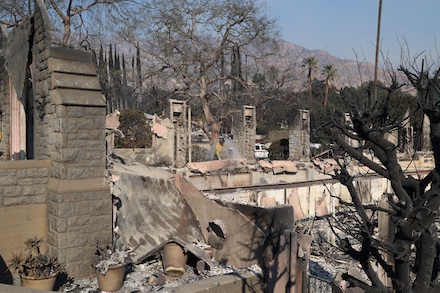
Images of the Palisades Fire burning near Santa Monica. Palisades Fire burning in the Santa Monica Mountains (upper left), smoke coming of the Palisades Fire (upper right) both on taken on 07.01.2025, source:
CALFire. Burnt landscape after the Palisades Fire, 18.01.2025 (lower left), and destroyed homes in Pacific Palisades due to the Palisades Fire, 15.01.2025 (lower right), source:
California National Guard
|
 |
 |
 |
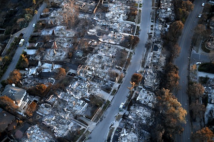 |
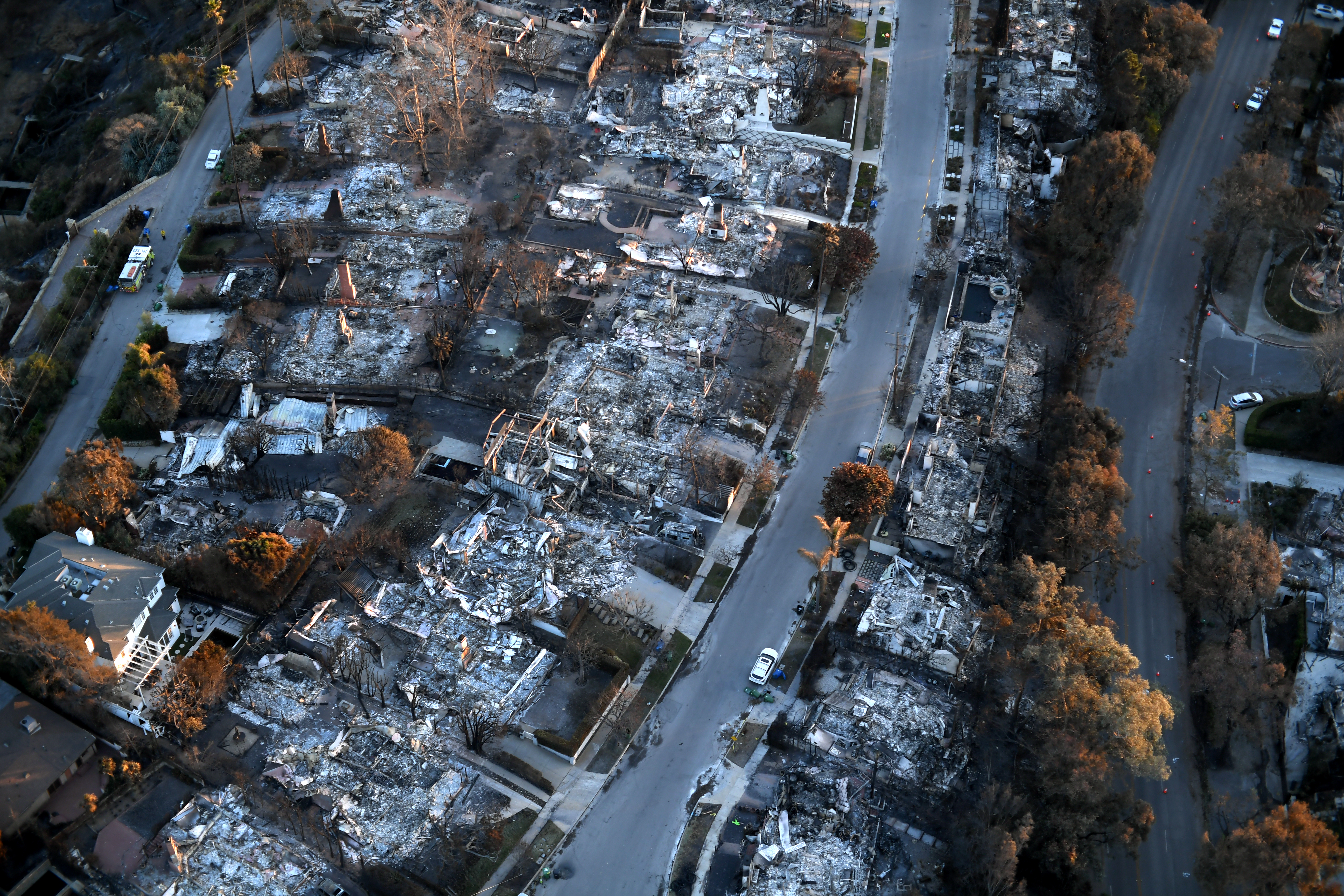
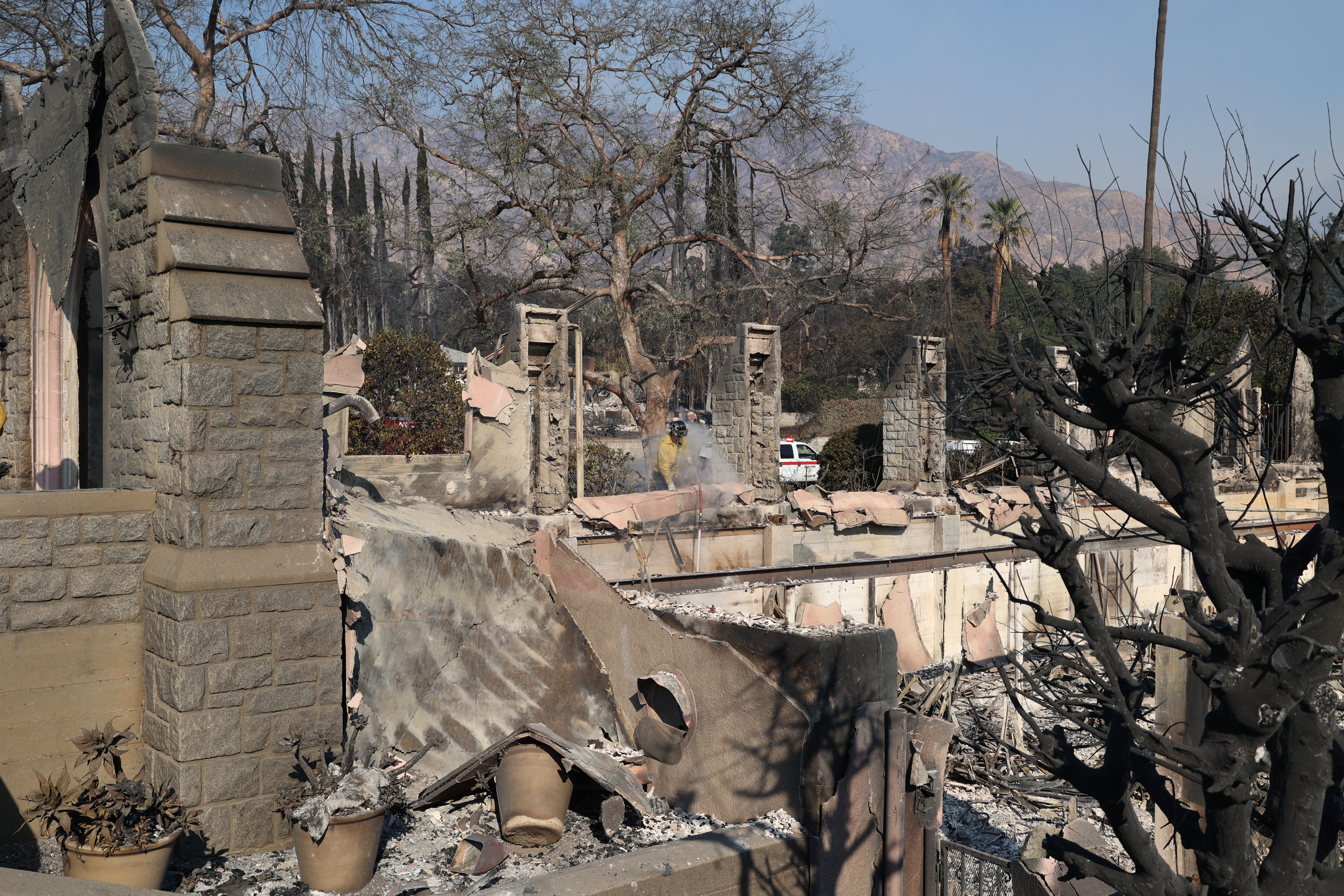
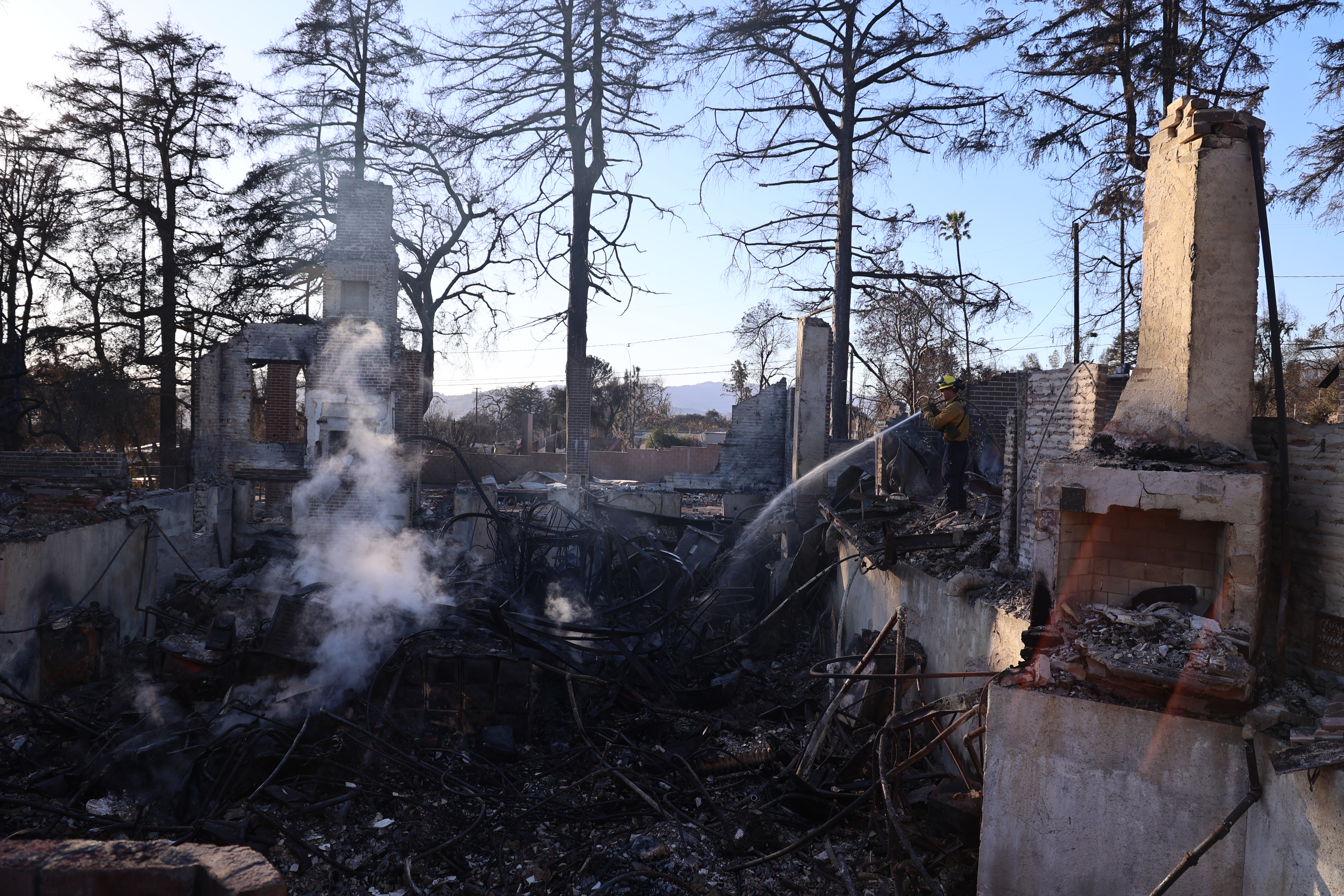
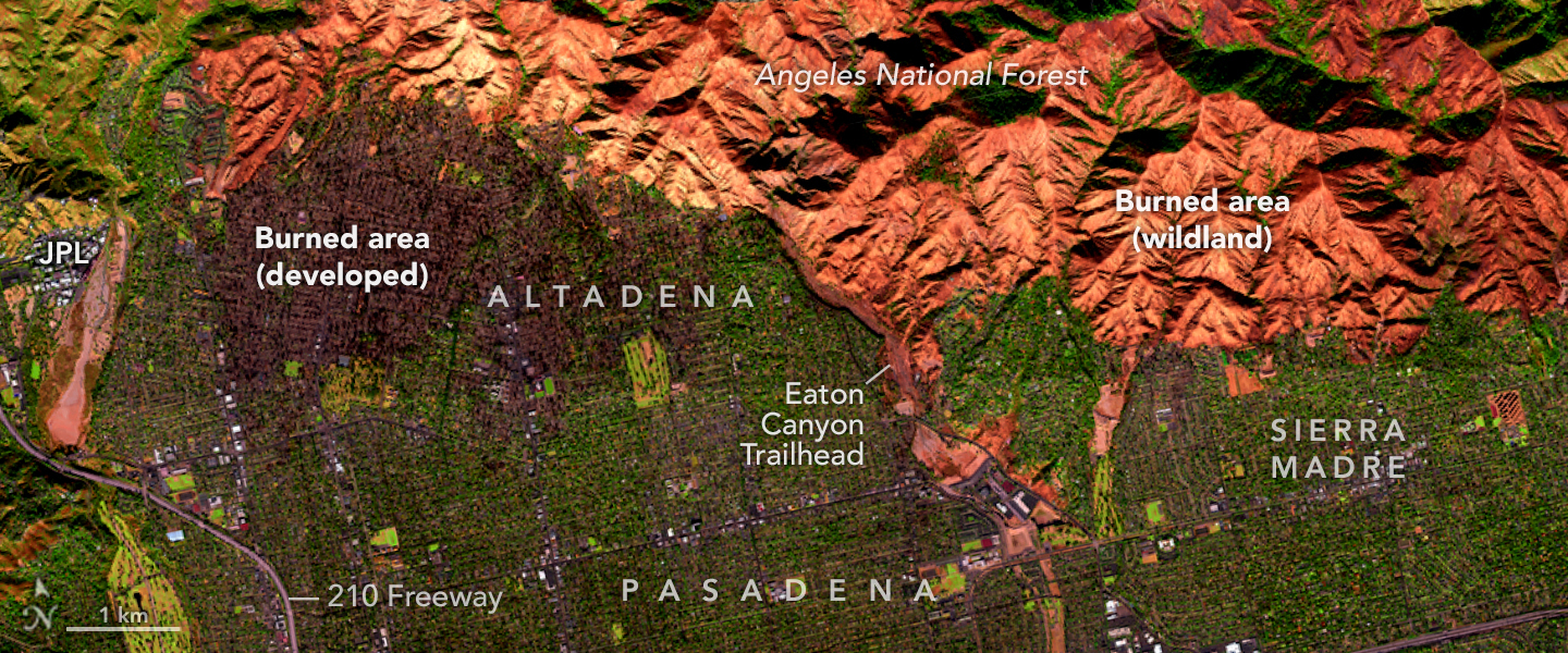
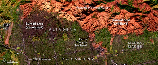
The second large fire, the Eaton Fire, ignited across the Los Angeles metropolitan area near San Gabriel Peak. The Eaton Fire quickly spread through the San Gabriel Mountains and reached the city of Altadena. As in the case of the Palisades Fire, the cause of the Eaton Fire remains under investigation. Major parts of Altadena north of Woodbury Road were devastated by the fire. In this part of Altadena, many buildings are from the 1920s and 30s. Over 10,000 structures were directly affected by the fire. This includes around 5,000 single-family homes that were destroyed by the Eaton Fire. Further east, parts of Sierra Madre were also affected by the fire, though damages were not as severe as in Altadena. Compared to the Palisades Fire, the damages due to the Eaton Fire are expected to be lower as the fire affected mostly middle-class neighborhoods. The Eaton Fire was fully contained by January 31, 2025. The fire burnt an area of 56 km2.
|
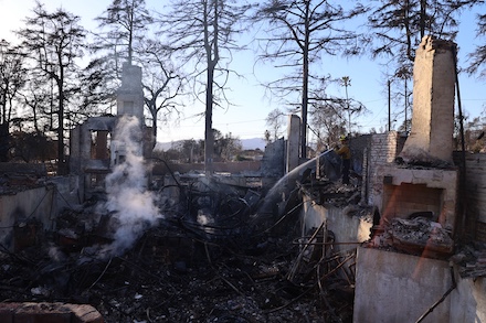
Destroyed homes burnt down by the Eaton Fire, source:
CALFire
|
 |
 |
On January 22 and 23, 2025, the synoptic set-up over the Western US once again induced Santa Ana winds over Southern California. Near Castaic Lake, the Hughes Fire ignited on January 22, 2025. In just one hour, the fire burnt an area of around 20 km2. By morning on January 23, 2025, the fire had burnt an area of roughly 40 km2. The rapid spread of the fire was once again caused by strong Santa Ana winds. The fire was fully contained by January 30, 2025. Although evacuation orders were placed for Castaic, no major damages to structures occurred. On January 23, 2025, another large wildfire developed in the Otay Mountain Wilderness close to the US-Mexican border. Fully contained by January 30, 2025, the fire burnt an area of around 20 km2.
|
Accumulated precipitation over California, 25.01.2025 12 UTC - 01.02.2025 12 UTC, source:
CNRFC
|
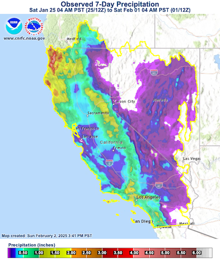 |
By January 26, an elongated trough stretched across California. South of the trough, moist air masses were advected into Southern California. These air masses led to the first significant precipitation over Southern California since the last winter. In the mountain ranges surrounding the Los Angeles metropolitan area, precipitation totals of more than 25 mm were observed during the storm. This precipitation aided firefighting efforts in containing the remaining active wildfires in Southern California. Only after these rains, evacuation orders for the Palisades Fire were lifted for residents only. Further, these rains also ended the active period of wildfire season over Southern California.
|
Satellite analysis of the burnt areas due to Palisades Fire near Santa Monica, 14.01.2025 (left) and burnt areas of the Eaton Fire in Altadena and Sierra Madre, 11.01.2025 (right), source: NASA Earthobservatory
|
 |
 |
In total, the recent blazes in Southern California burnt a total area of around 233 km2. At least 27 people fell victim to the fires. Due to the proximity to the Los Angeles metropolitan area, over 200,000 people were placed under evacuation orders because of the different fires. Both the Palisades and Eaton Fires did significant damage. More than 18,000 structures were directly affected by the fires. The towns of Malibu and Pacific Palisades were severely damaged by the Palisades Fire. The Eaton Fire devastated parts of Altadena and Sierra Madre. As the Palisades Fire also affected parts of Beverly Hills, the damages related to the fires are estimated to be above 100 billion €. The fires also sparked political discussions in the US related to fire prevention and safety.
Text: KG
February 02, 2025
|