|
Between a prominent ridge over Eastern Europe and a trough over the Eastern North Atlantic, warm and moist air masses lead to repeated heavy precipitation events in Central Europe. During the most significant event, 24 h precipitation totals of up to 153.1 mm in Mersch, LU were measured. Due to dry weather preceding the event, no severe river flooding was observed.
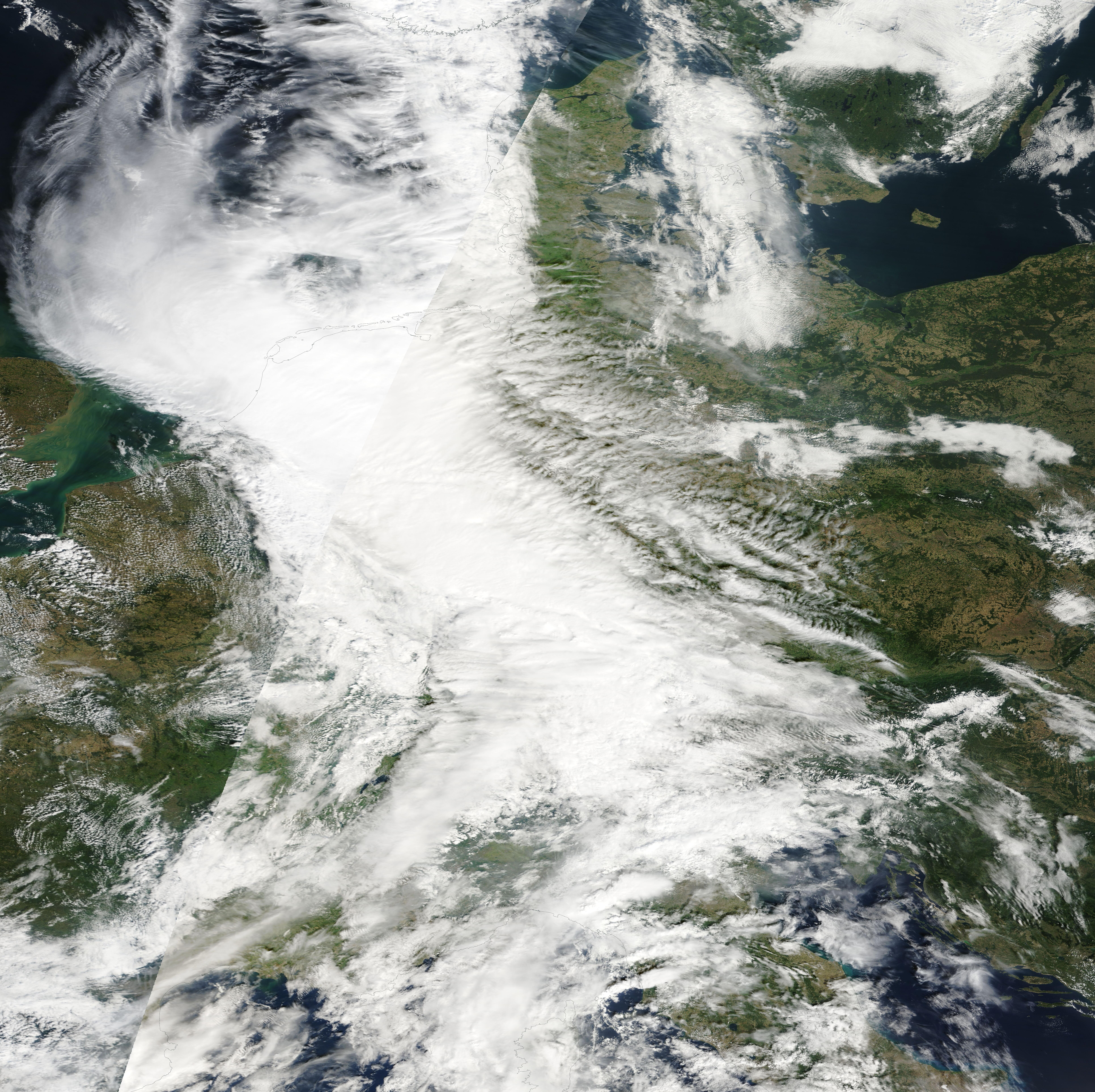
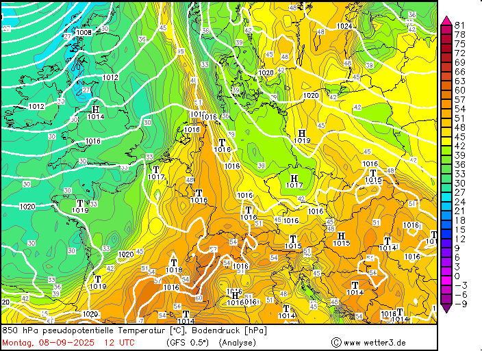
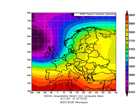
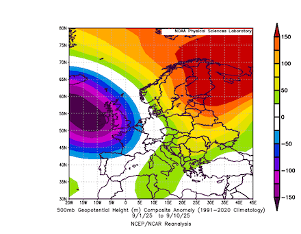
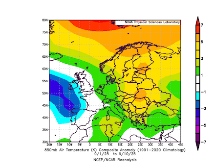
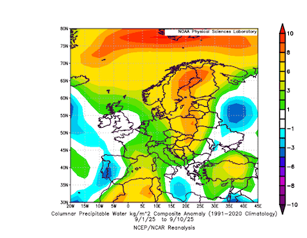
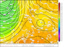
By the end of summer 2025, the weather pattern across Europe was dominated by a large ridge in the east and a large trough to the west of the continent. Central Europe was in the intermediate zone between the two pressure systems. As such, southwesterly winds dominated the weather pattern across Central Europe for the first decade of September 2025. With these southwesterly winds, warm and moist air masses were advected into Central Europe. A broad area of above-average precipitable water values can be seen extending from North Africa across Europe into the Arctic. In this synoptic set-up, multiple heavy precipitation events impacted different parts of Central Europe.
|
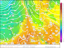
11-day mean 500 hPa geopotential (upper left), 500 hPa geopotential anomaly (upper right), 850 hPa temperature anomaly (lower left), and precipitable water anomaly (lower right) over Europe, 01.09.2025 - 10.09.2025, source:
PSL NOAA
|
 |
 |
 |
 |
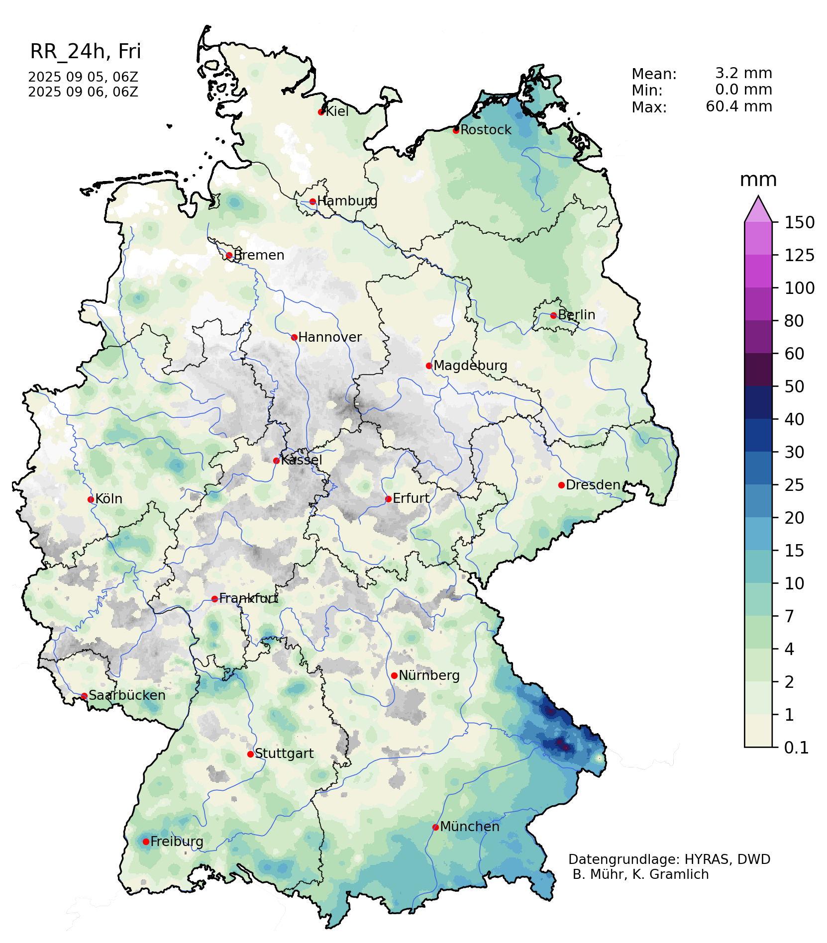
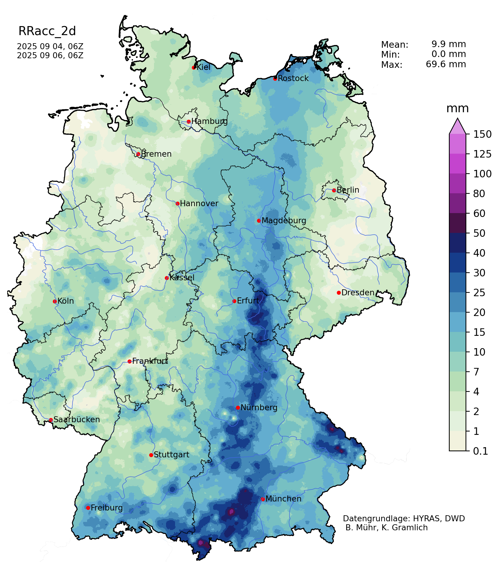
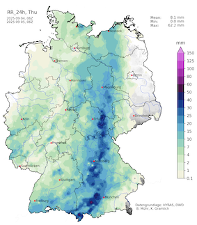
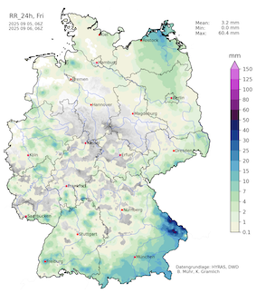
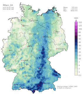
On September 04, 2025, strong thunderstorms brought heavy rains to Southern Germany with a focus on Southern Bavaria. Aside from torrential downpours and high winds, locally large hail with diameters of up 3 cm was observed near the Northern Alps. From September 04 to September 05, 2025, heavy rains spread northwards into Thuringia and Saxony. As the event occurred around 06 UTC, both the daily precipitation totals for September 04 and September 05, 2025, show local maxima of more than 50 mm.
|
Daily precipitation totals over Germany, 04.09.2025 (left), 05.09.2025 (middle), and 2-day precipitation totals, 04.09.2025 - 05.09.2025 (right), source:
Wettergefahren-Frühwarnung
|
 |
 |
 |
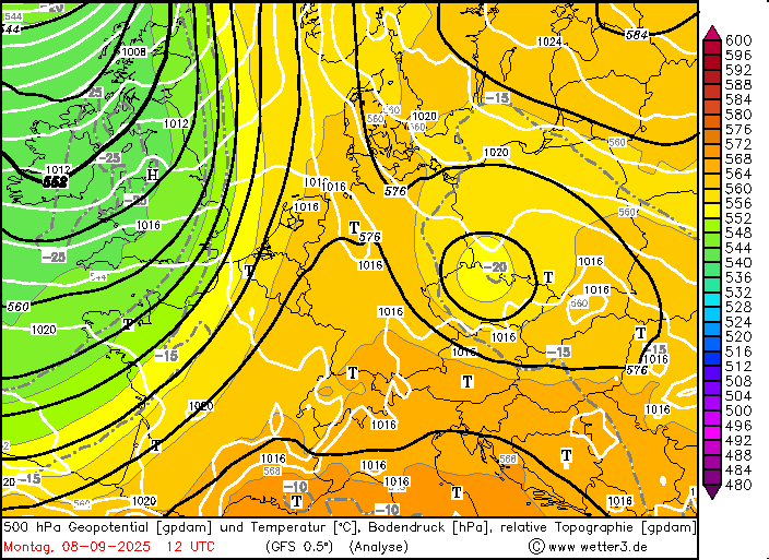
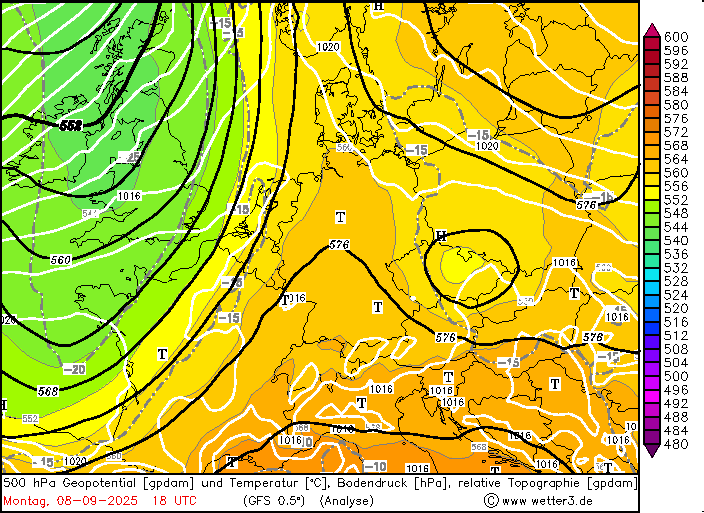
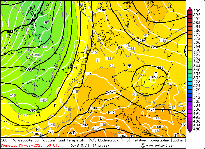
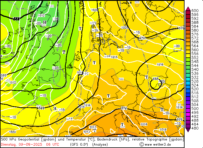
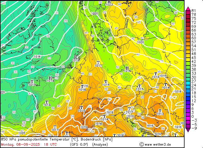
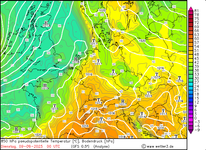
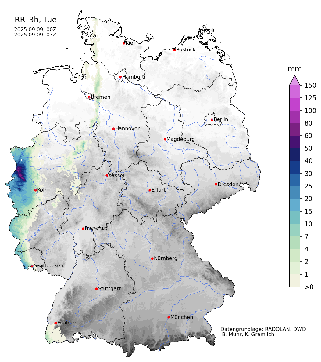
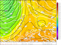
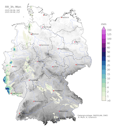
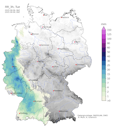
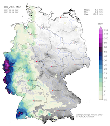
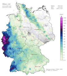
On September 08, 2025, the cold front of low Walter approached Central Europe. Ahead of the cold front, a warm and very moist air mass was situated. In combination with diurnal insolation, an unstable air mass formed over Western Germany and neighboring regions to the west. By evening, strong thunderstorms formed as the approaching cold front provided the necessary lift to tap into the reservoir of atmospheric instability. Due to the unseasonably moist air mass, these thunderstorms produced torrential downpours. In the evening hours of September 08, 2025, the focal point of these thunderstorms was situated above Central Luxembourg. Hourly precipitation totals of more than 50 mm were measured. In the adjacent Eifel mountains, an hourly precipitation rate of 57.5 mm was recorded at Winterspelt, RP. Within a few hours, the capital region of Luxembourg received precipitation totals of more than 100 mm. By morning, a daily precipitation total of 153.1 mm was observed at Mersch, LU, just north of the capital region. Both to the east and to the west of this narrow band of torrential rains, the daily precipitation totals quickly diminished to around 30&thsinp;mm.
|
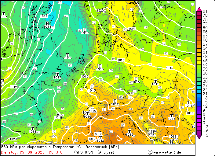
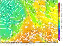
Development of the 500 hPa geopotential, 1000 hPa to 500 hPa thickness, and sea-surface pressure over Central Europe (upper row) and 850 hPa pseudo-potential temperature and sea-surface pressure over Central Europe (lower row), 08.09.2025 12 UTC - 09.09.2025 06 UTC, source:
wetter3.de
|
 |
 |
 |
 |
 |
 |
 |
 |
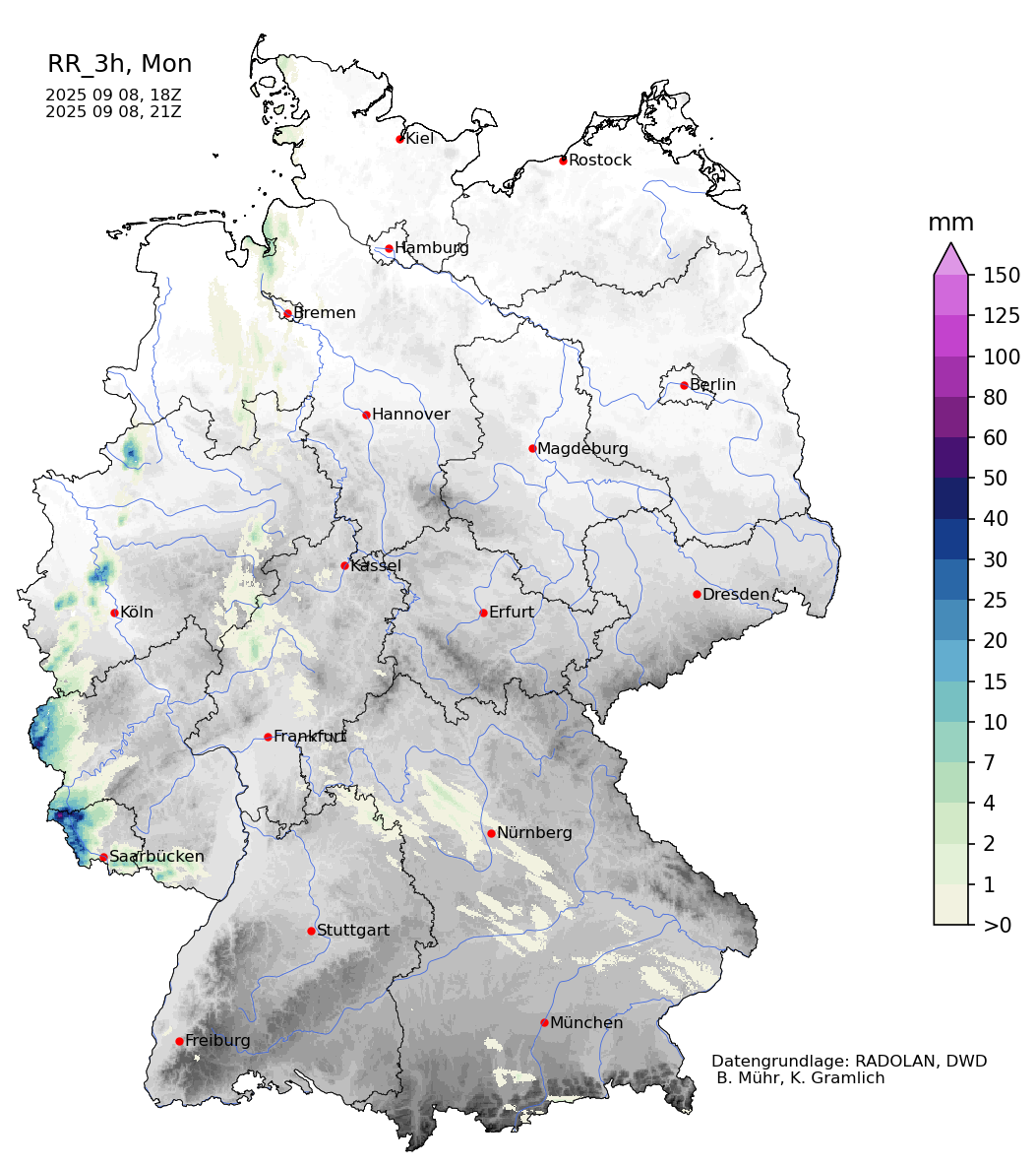
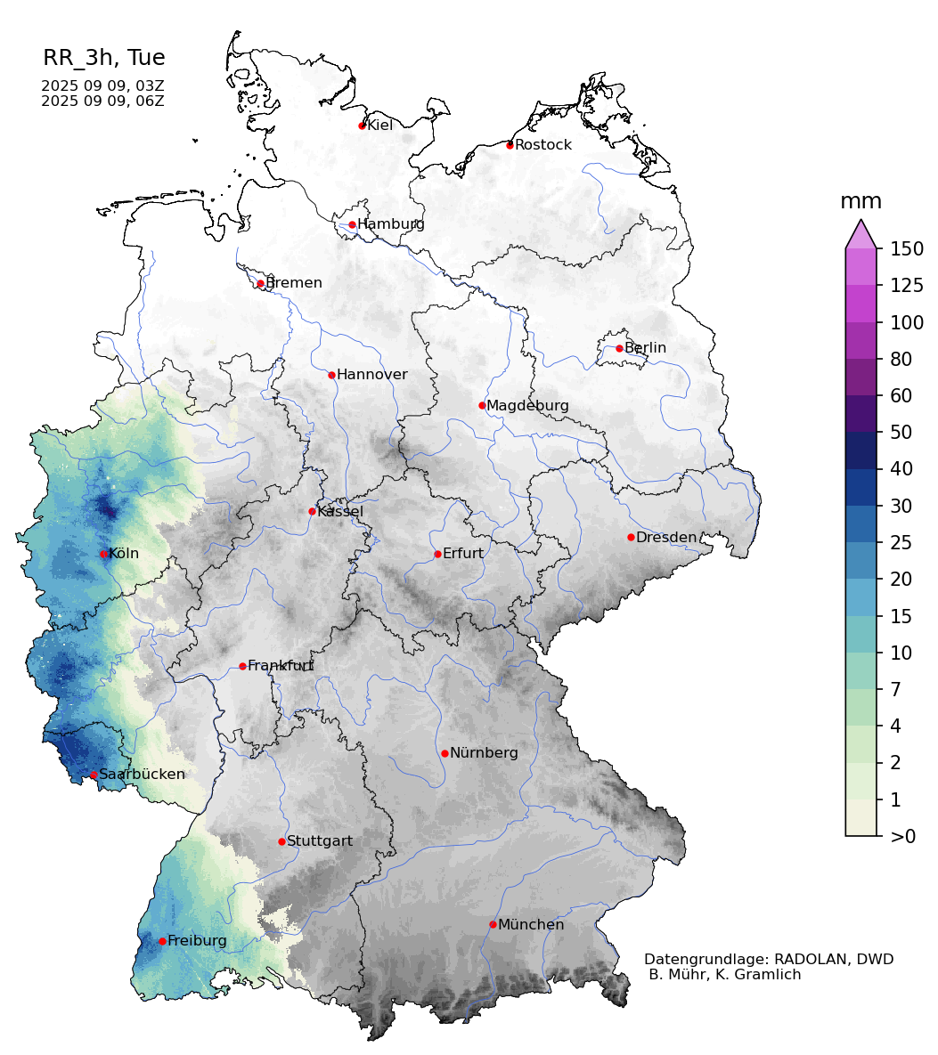
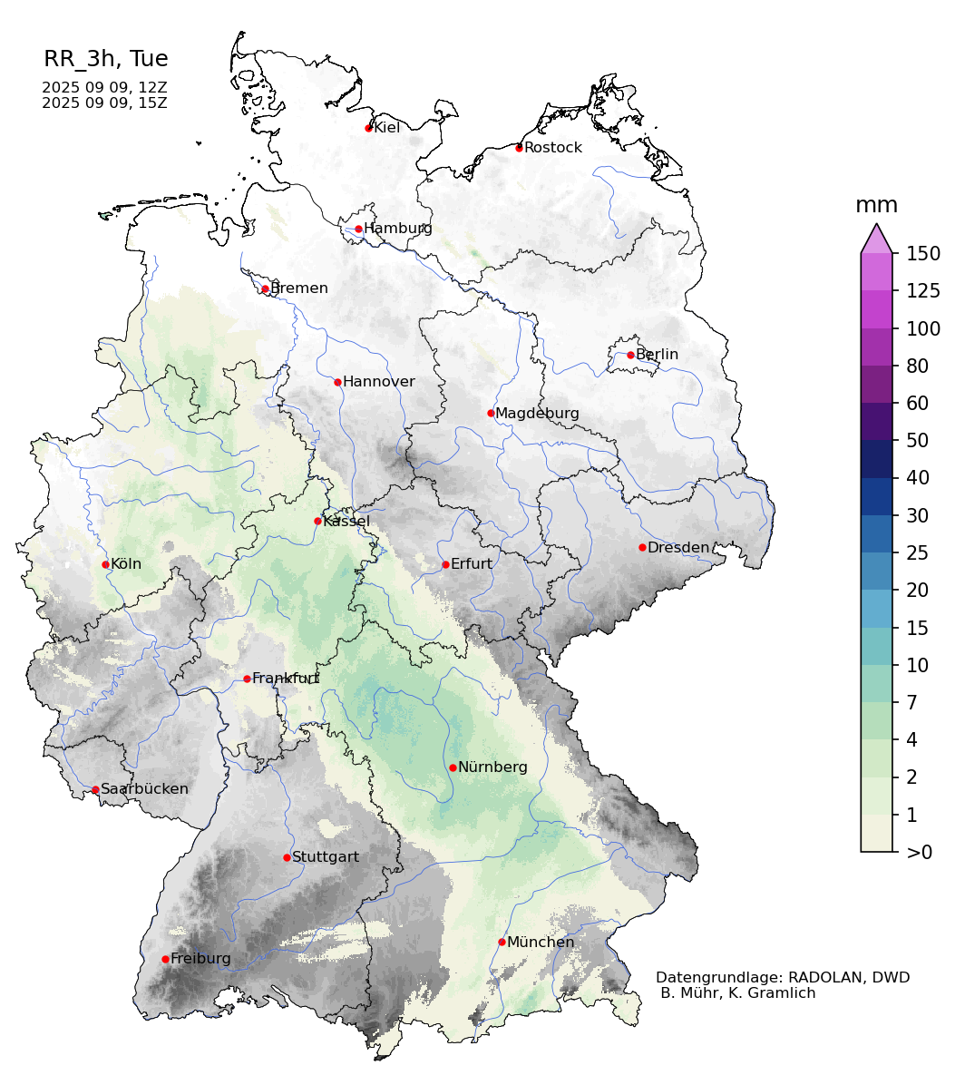
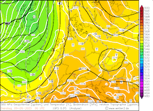
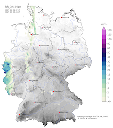
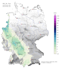
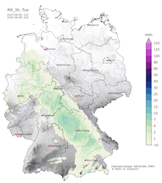
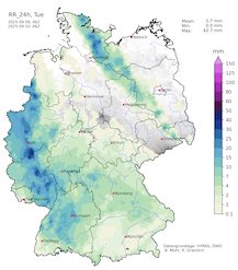
In the second half of the night, the focal point of the heavy rains shifted northwards into North Rhine-Westphalia. In the northern parts of the watershed of the Erft River, heavy rains started impacting an area between Aachen, NW, and Mönchengladbach, NW. At peak intensity, this area also received hourly precipitation rates of more than 50 mm after midnight. By morning, precipitation totals accumulated up to 134.0 mm in Bedburg. These second precipitation maxima over North Rhine-Westphalia were caused by a frontal wave developing along the cold front of low Walter.
|
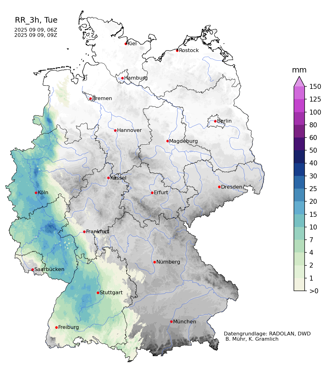
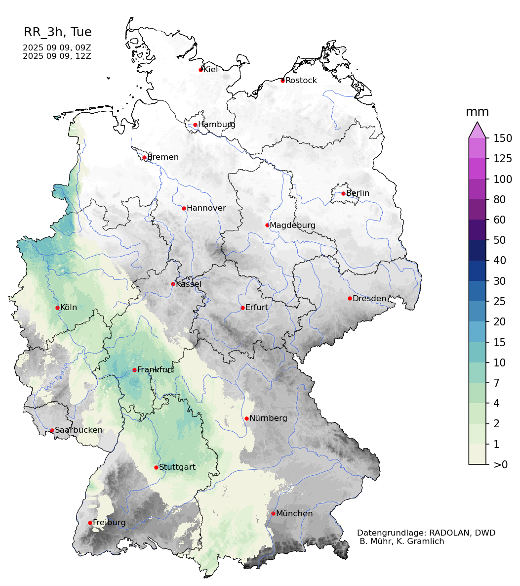
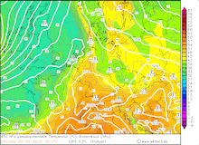
3-hourly radar-indicated precipitation totals over Germany, 08.09.2025 18 UTC - 09.09.2025 18 UTC, source:
Wettergefahren-Frühwarnung
|
 |
 |
 |
 |
 |
 |
 |
 |
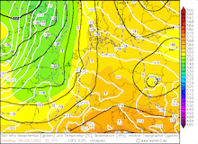
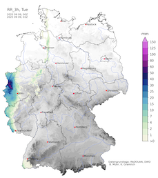
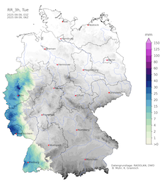
The severity of the event is underlined by the fact that most of the precipitation, both in Central Luxembourg and in North Rhine-Westphalia, fell in less than 12 h. In the northern part of the watershed of the Erft River, the recurrence frequency of these torrential rains was more than 100 years. Assuming the weather station at Bedburg is representative of the surrounding area, a detailed analysis of the occurrence frequency of these downpours further outlines the severity of this event. For the 4, 6, and 12-hour precipitation totals, the 100-year threshold was about half of the actual amount that fell in the night to September 09, 2025. For all respective time periods, the 100-year recurrence threshold was significantly exceeded at the measuring site in Bedburg.
|
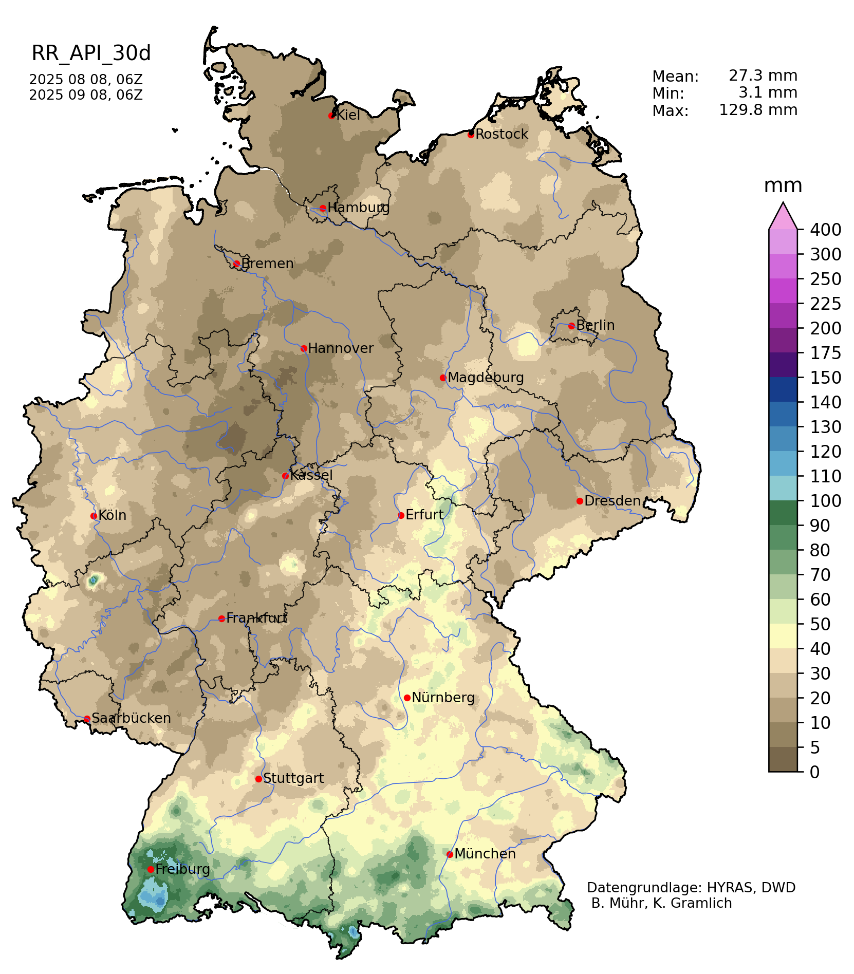
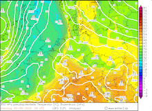
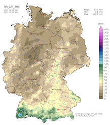
30-day API over Germany, 07.09.2025 (left), daily precipitation totals over Germany, 08.09.2025 (center left) and 09.09.2025 (center right), and 2-day precipitation totals over Germany, 08.09.2025 - 09.09.2025, source:
Wettergefahren-Frühwarnung
|
 |
 |
 |
 |
At peak intensity, these torrential rains reached similar intensities to those observed on July 14, 2021, before the devastating flooding along the Ahr River. In this event, the daily precipitation totals also reached more than 150 mm. Though multiple key factors prevented a repeat of the devastating flooding. First, the widespread precipitation totals were significantly lower. Secondly, the conditions were much drier than in July 2021. For most of August 2025, no precipitation was observed across the western parts of Central Europe. For this reason, the soils were far from saturated in comparison to July 2021. Additionally, the focal point of these rains was in an area with less relief energy. Lastly, the affected watersheds were not draining through as narrow a valley as the Ahr valley.
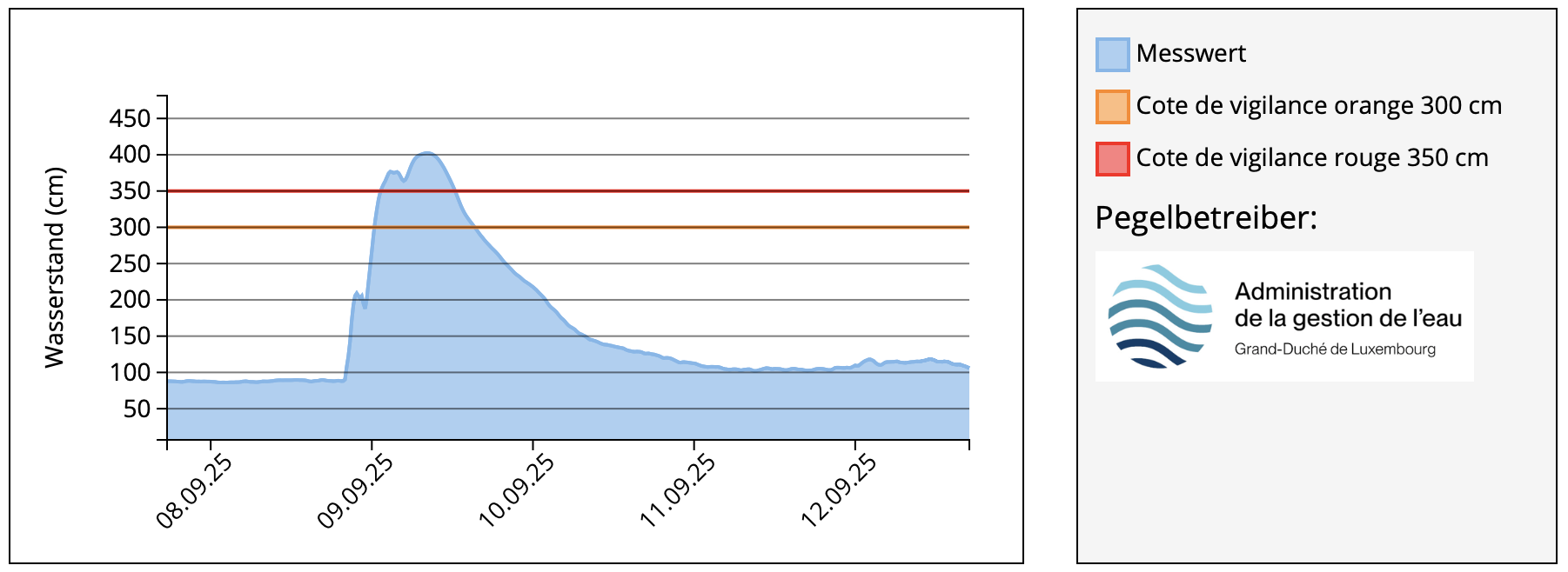
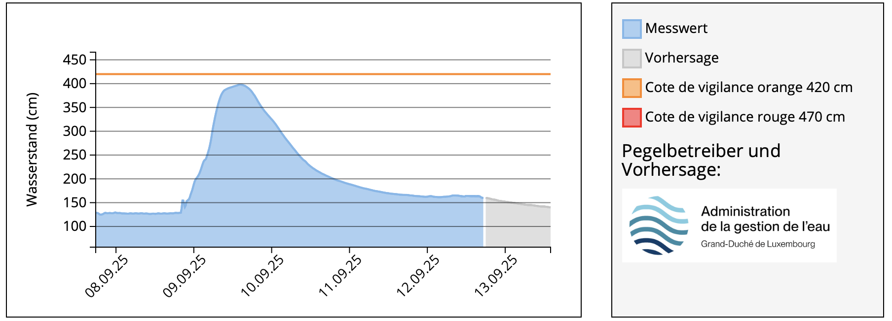
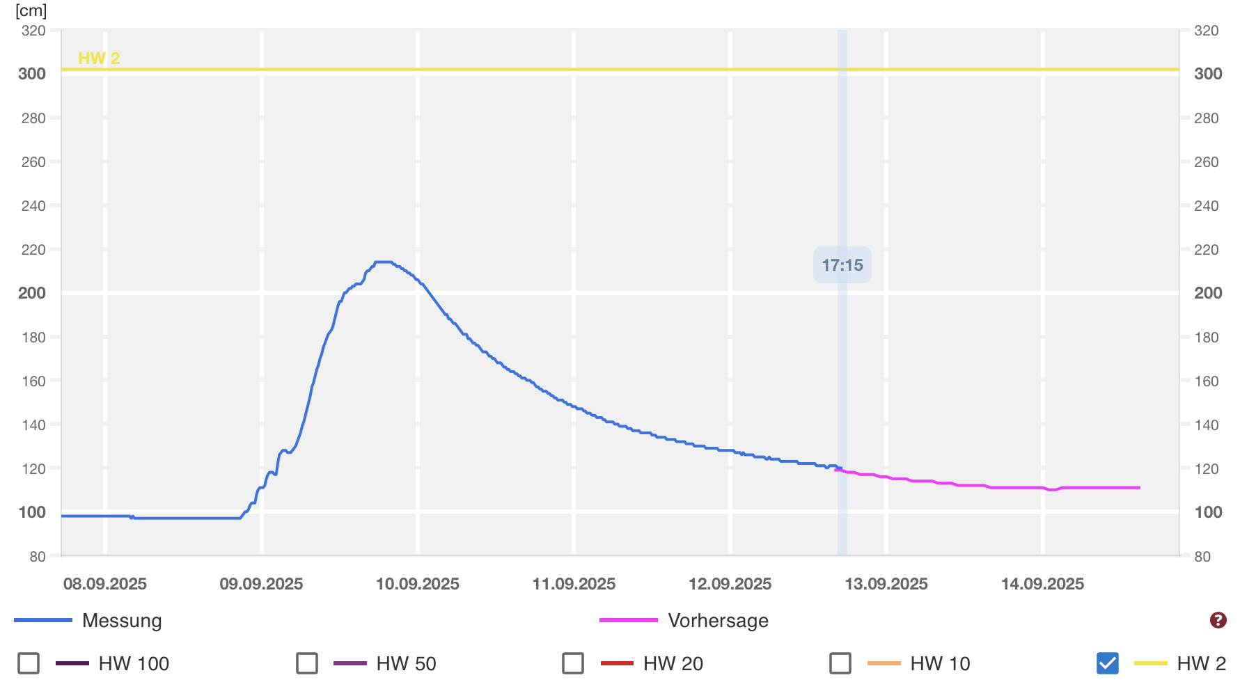
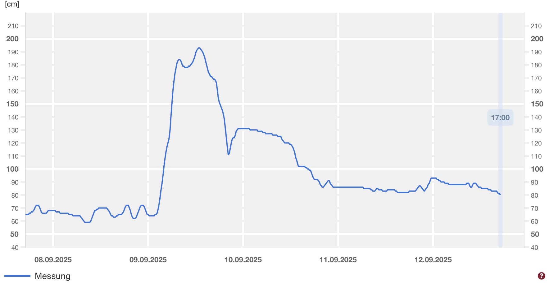
Nevertheless, the heavy rains led to quickly rising water levels along many rivers in the affected area. In Luxembourg, the Alzette River quickly rose due to the heavy rains and flooded its banks. Due to the below-average precipitation this year, the flood crested below a 2-year flood. Similarly, the Erft River also quickly rose on September 09, 2025. Still, no major flooding occurred along the river. Due to the flatter terrain of the area, water pooled in residential areas because of the heavy rains. Most affected was the town of Bedburg, where the highest precipitation totals were registered.
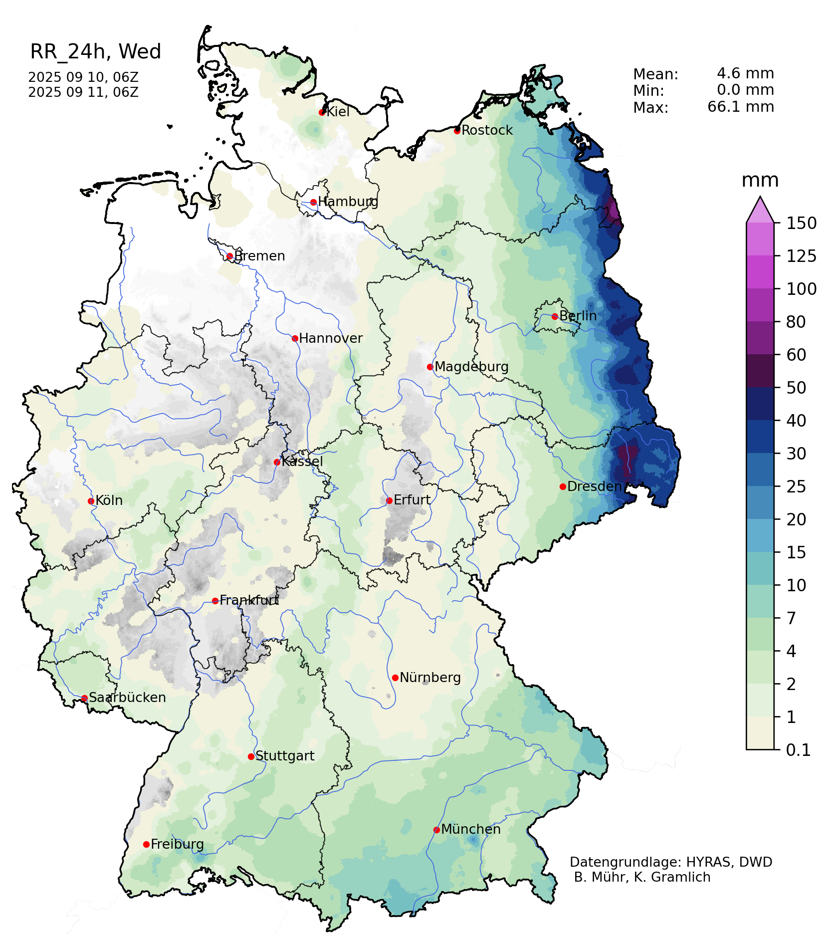
On September 10, 2025, another round of heavy rains impacted Central Europe. Another surface low had reached Northern Scotland. Ahead of the surface low, warm air masses once again reached Central Europe. Along the Oder River, heavy rains were observed. Widespread precipitation totals of 30 to 50 mm were registered. Along southward-facing flanks of the Giant Mountains, daily precipitation totals of up to 86.4 mm were measured.
Text: KG
September 13, 2025
|