|
A large outbreak of Arctic air masses induced a severe cold snap over the US and Southern Canada east of the Rocky Mountains. Temperatures dropped as low as -42.2 °C in Fraser Flats, CO. Along the US Gulf Coast, a major blizzard brought record-breaking snowfall to many places on January 20 and January 21, 2025.
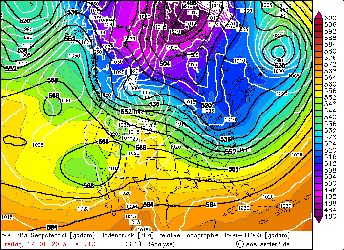
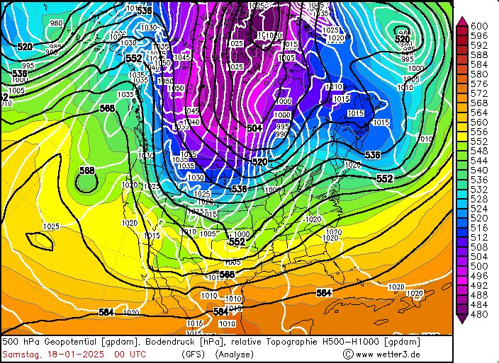
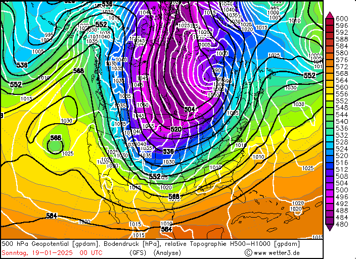
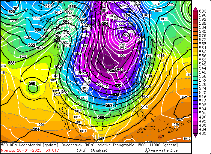
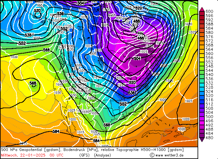
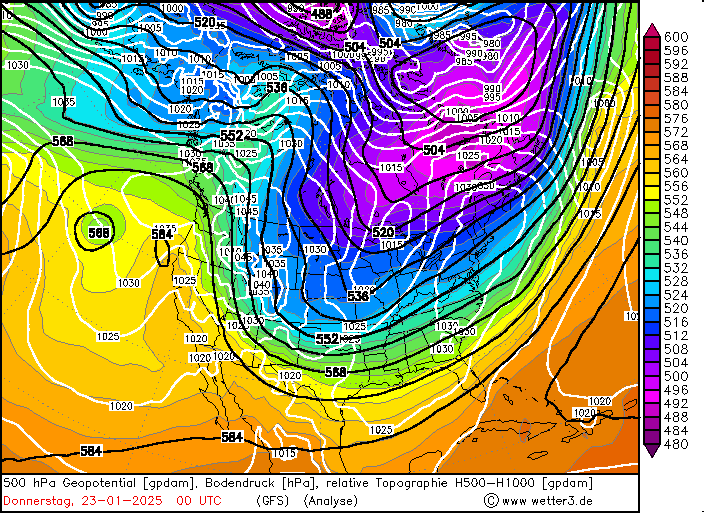
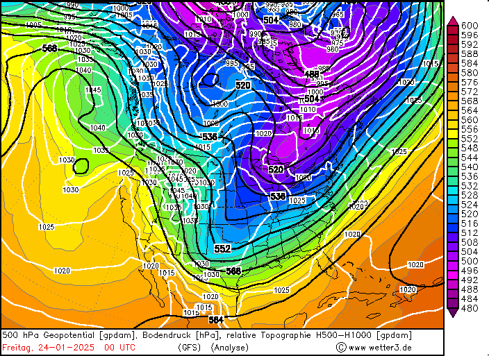
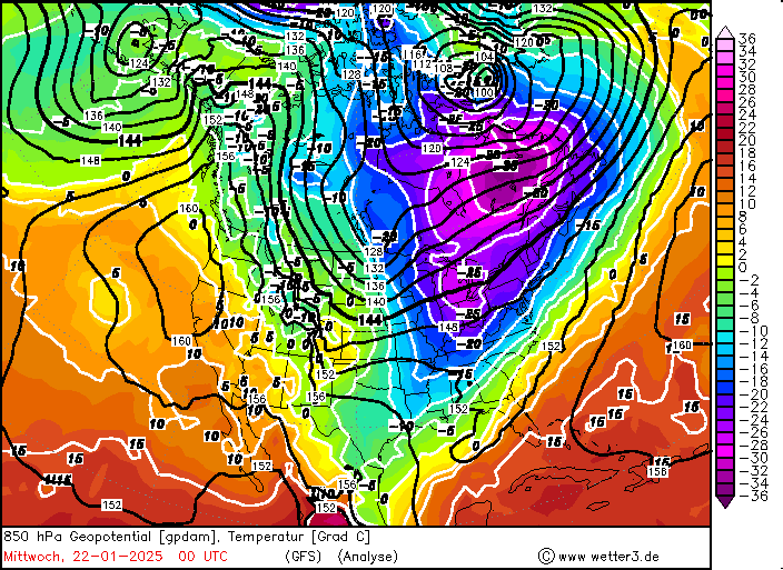
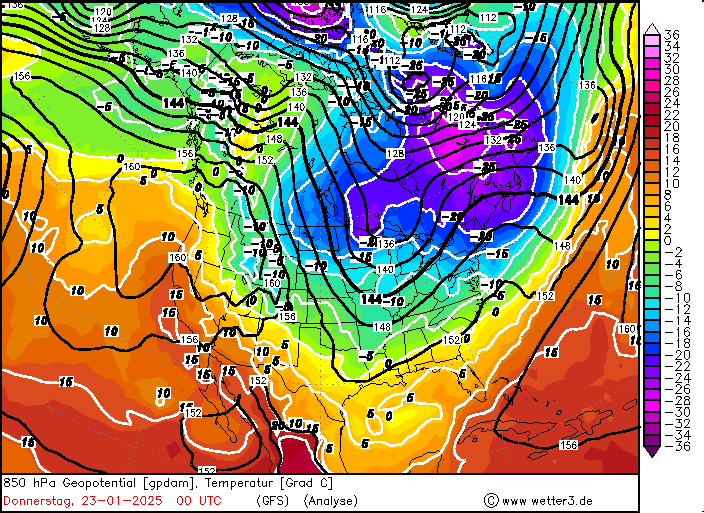
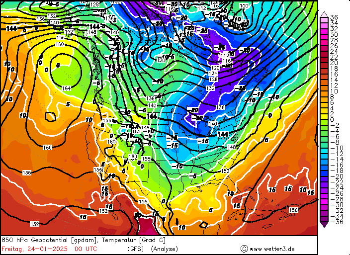
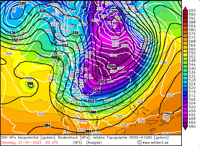
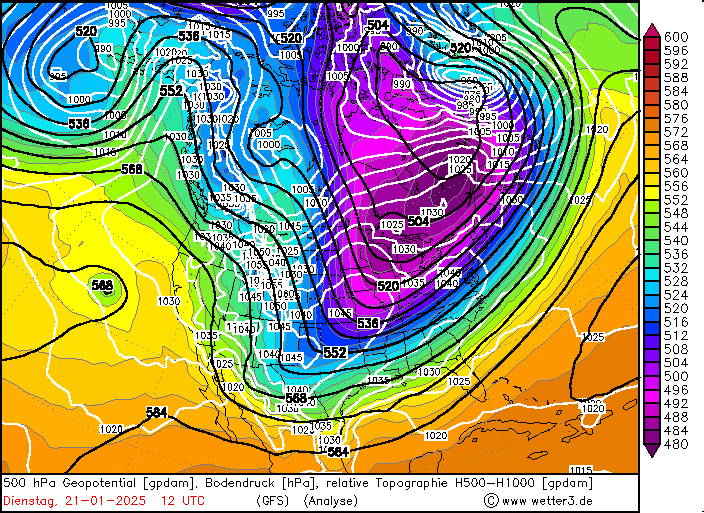
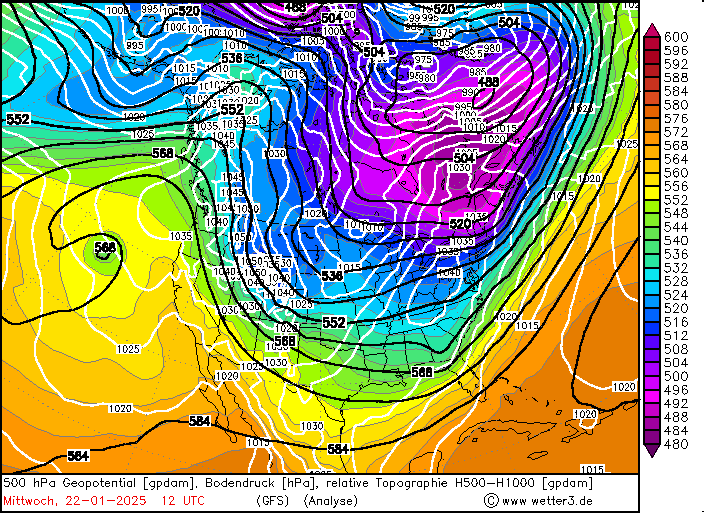
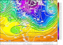
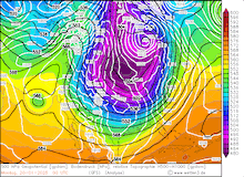
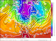
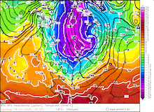
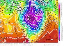
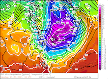
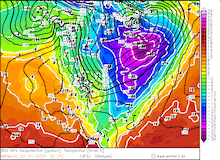
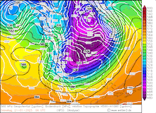
The first half of January 2025 featured persistent troughs over the North American Continent east of the Rocky Mountains. By January 16, 2025, a trough had shifted particularly far eastwards. Behind the trough, a small low-pressure system developed along the US-Canadian border by January 17, 2025. The low quickly moved eastwards along the said border. On the backside of said low-pressure system, very cold air masses of Arctic origin were advected southwards. In the upper troposphere, a strong trough developed at whose leading edge the low-pressure system was located.
|
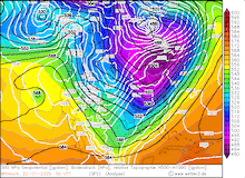
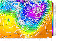
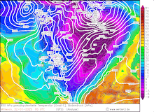
Daily development of the 500 hPa geopotential, 1000 hPa to 500 hPa thickness, and sea-surface pressure over North America, 17.01.2025 00 UTC - 24.01.2025 00 UTC, source:
wetter3.de
|
 |
 |
 |
 |
 |
 |
 |
 |
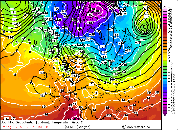
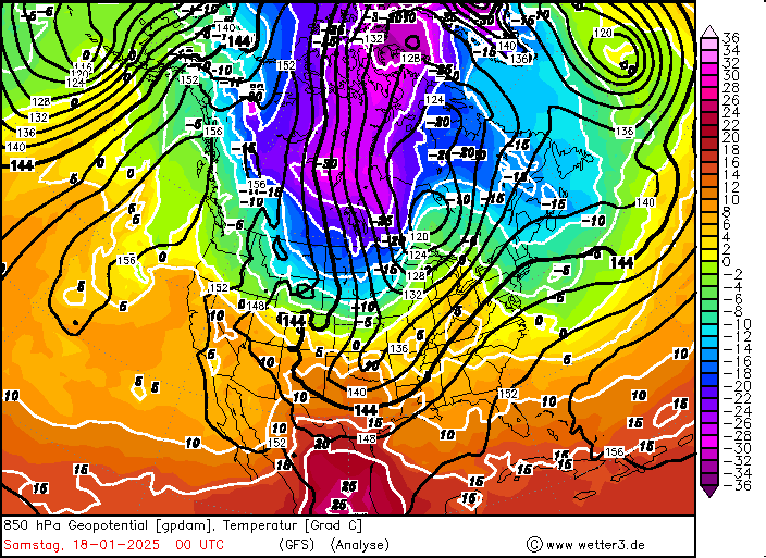
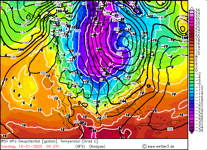
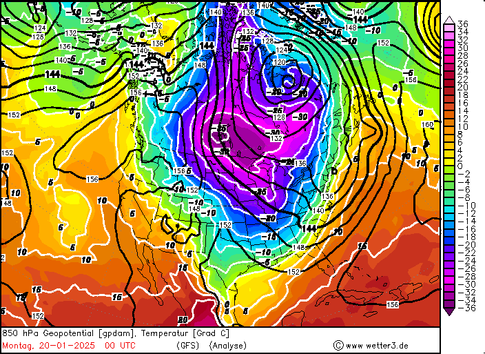
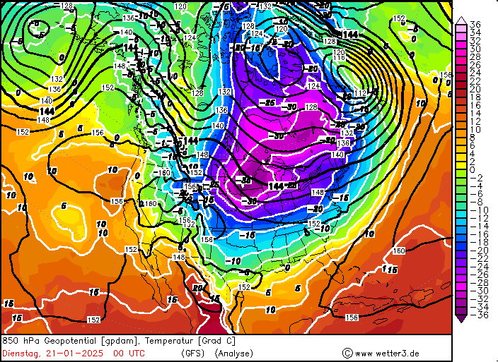
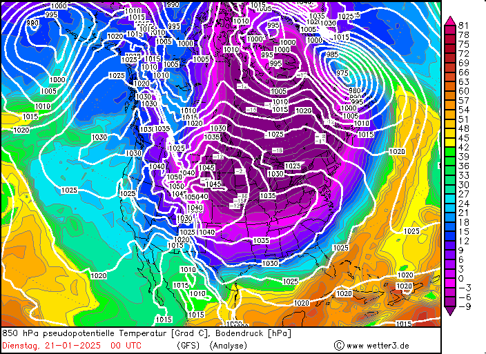
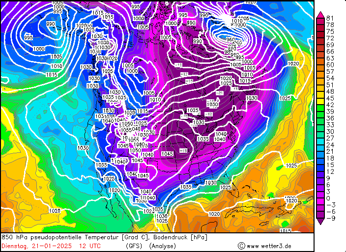
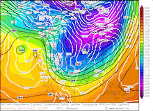
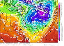
By January 18, 2025, very cold air masses were advected across the US-Canadian border. At 850 hPa, the temperature dropped to below -30 °C by January 19, 2025, over the Northern Plains. Many locations in the Northern Plains recorded daily minimum temperatures below -30 °C. By January 20, 2025, a blob of particularly cold air masses was advected southwards. At the center of the cold blob, the 850 hPa temperature dropped to below -35 °C. The temperatures on January 20, 2025, often failed to climb above -20 °C over the Northern Plains. The cold air masses could also penetrate the high mountain valleys of the Eastern Rocky Mountains. In some high-alpine valleys, extreme cold was observed. The coldest temperature during the cold snap was observed at Fraser Flats, CO on January 21, 2025, with a low temperature of -42.2 °C.
|
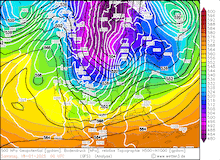
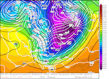
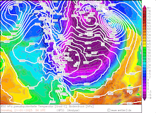
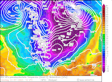
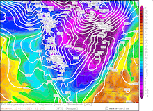
Daily development of the 850 hPa geopotential and temperature over North America, 17.01.2025 00 UTC - 24.01.2025 00 UTC, source:
wetter3.de
|
 |
 |
 |
 |
 |
 |
 |
 |
At Bismarck, ND, the lowest observed temperature during the cold snap was -28,9 °C on January 20, 2025. On average, the minimum temperature in January is -31.0 °C. This highlights that although the recent cold snap featured severe cold across the Northern Plains, the temperatures were far from record-breaking in this area. For reference, the absolute minimum temperature measured in Bismarck is -43 °C. The severity of the cold snap was exacerbated by high winds. Both in the Rocky Mountains as well as the Northern Plains, extremely low wind chill temperatures were observed. Multiple measuring sites recorded minimum wind chill values below -50 °C. In the Northern Plains, the high winds led to blowing snow which created treacherous travelling conditions.
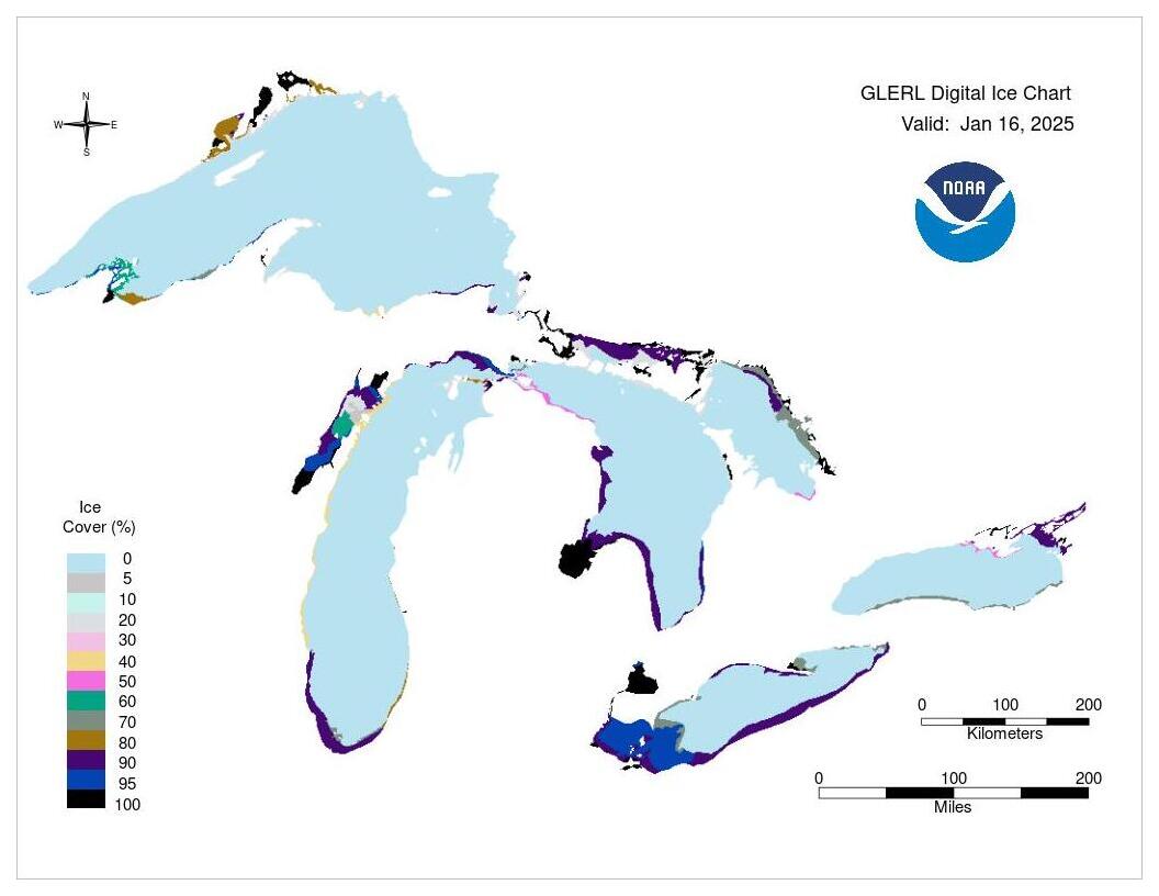
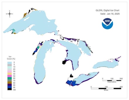
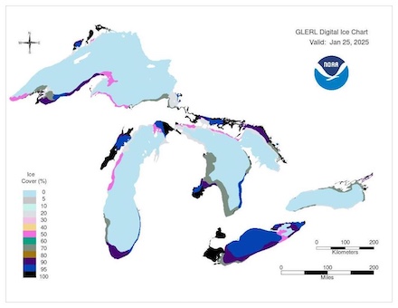
On January 19, 2025, a small low-pressure system developed along the US Gulf Coast. The low-pressure system moved swiftly along the East Coast, bringing the East Coast multiple centimeters of fresh snow accumulations. Along the Appalachians, fresh snow accumulations of up to 41 cm near Thomas, WV were observed. At times heavy snow, created poor traveling conditions in the East Coast Megalopolis (stretching from DC to Boston). Behind the low-pressure system, the very cold air masses could shift eastwards across the Mid-Atlantic and New England states. Minimum temperatures below -20 °C were observed as far southwards as Kentucky on January 22, 2025. In the New England states, temperatures dropped below -30 °C. Due to the severe cold, a significant portion of the Great Lakes froze over in a few days. Between January 17 and January 25, 2025, most of Lake Erie froze over. The overall ice coverage of the Great Lakes has sharply increased to around 20 %. This leaves the overall ice coverage of the Great Lakes close to the climatological average. Nevertheless, the current ice coverage is already larger than the maximum ice coverage observed in the previous two winter seasons.
|
Ice coverage of the Great Lakes before the cold snap on January 16, 2025 (left), and after the cold snap on January 25, 2025 (right), showing substantial increase of the ice coverage, source:
NOAA GLERL
|
 |
 |
Daily maximum temperatures on January 21, 2025, often remained around -15 °C in the Northeastern US, including parts of Pennsylvania. In Washington DC, the severe cold impacted the inauguration of President Trump. In the Northern Plains, the temperatures quickly rose on January 21, 2025. Many measuring sites in the Dakotas recorded 24 h temperature increases of more than 20 K. Due to the very cold conditions previously, the temperatures at most measuring sites remained below 0 °C.
|
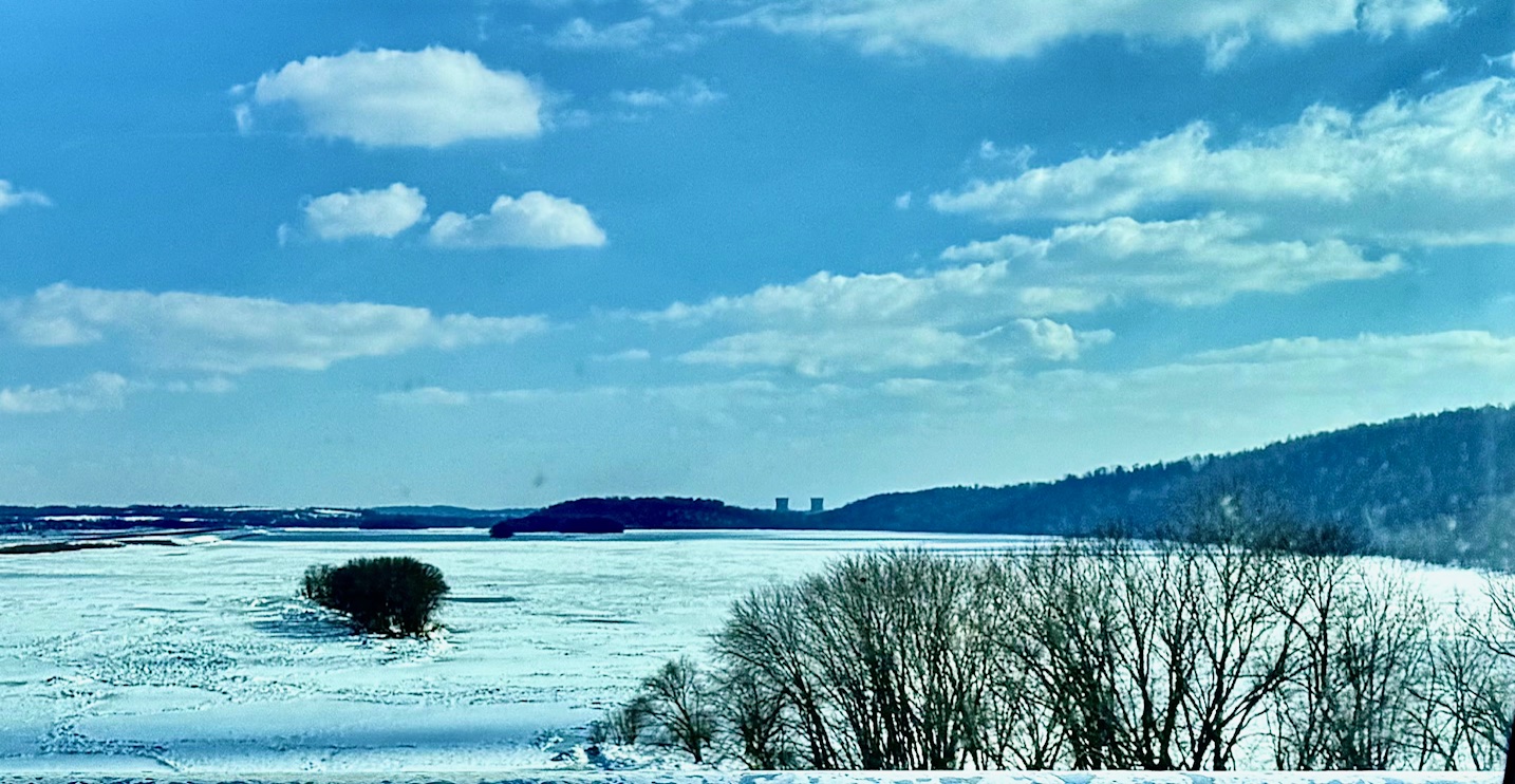
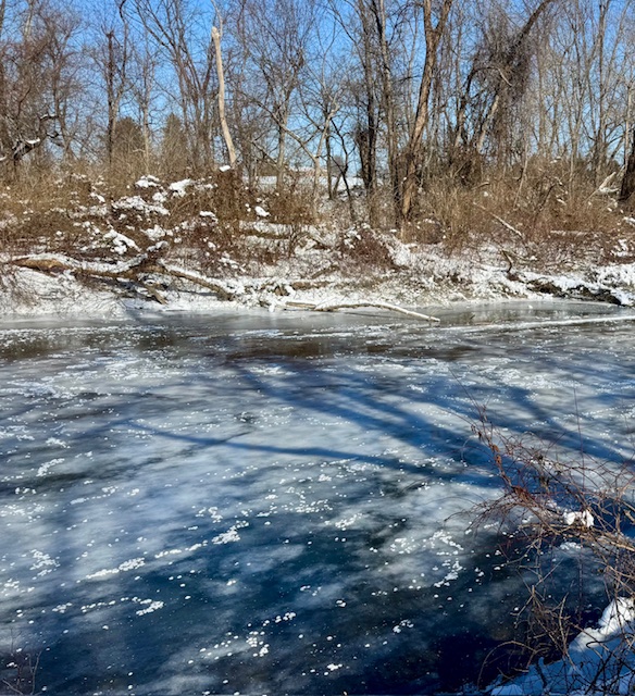
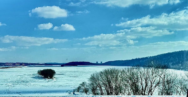
Frozen Susquehanna River near Harrisburg, PA (left) and frozen Yellow Breaches Creek near Boiling Springs, PA (right). The creek is fed by spring water with a year-round temperatures of around 14 °C, source: C. McKelvey
|
 |
 |
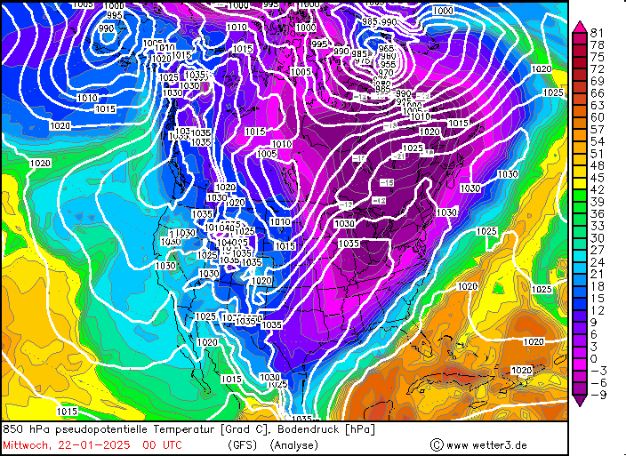
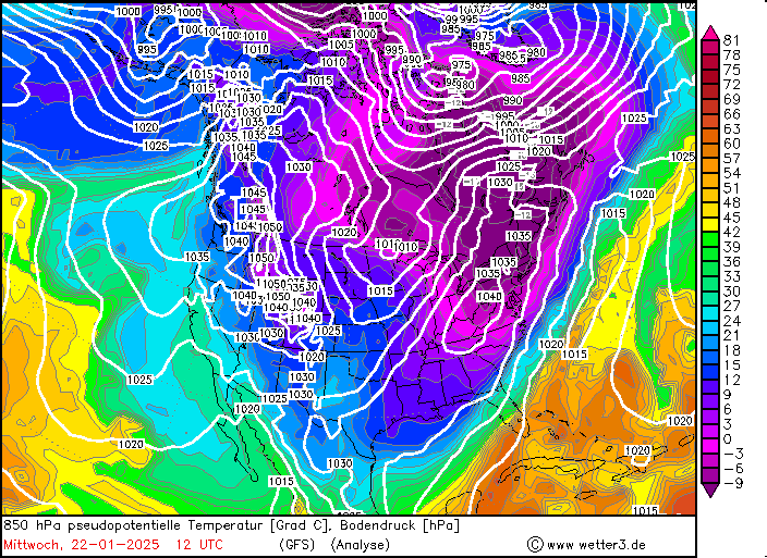
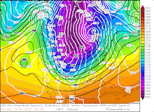
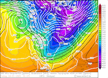
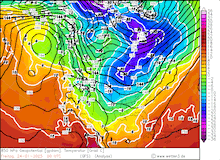
As mentioned, the severe cold across the Northern US was notable albeit not extreme. By January 20, 2025, the cold air masses reached the Gulf States. Near the US Gulf Coast, the cold front stalled and formed a very sharp air mass boundary with the tropical air masses over the Gulf of Mexico. At 850 hPa, pseudo-potential temperature gradients of nearly 60 K were observed along the Northern Gulf of Mexico. The air mass boundary induced heavy precipitation which impacted the US Gulf Coast from Huston, TX in the west to the Florida Panhandle in the east.
|
Development of the 500 hPa geopotential, 1000 hPa to 500 hPa thickness, and sea-surface pressure over North America (upper row), and the development of the 850 hPa pseudo-potential temperature and sea-surface pressure North America (lower row), 21.01.2025 00 UTC - 22.01.2025 12 UTC, source:
wetter3.de
|
 |
 |
 |
 |
 |
 |
 |
 |
Along the cold side of the air mass boundary, heavy snow was observed on January 21, 2025. On that day, a blizzard warning by the National Weather Service was issued for the Gulf Coast of Louisiana. This was the southernmost blizzard warning ever issued in the US. Heavy snow occurred along the US Gulf Coast including metropolitan areas of Huston, New Orleans, Lafayette, Tallahassee, and Jacksonville. Many areas along the Gulf of Mexico received fresh snow accumulations between 15 to 30 cm. In New Orleans, fresh snow accumulations of up to 25 cm occurred. Similar extreme winter weather has not occurred in these regions in more than a century. Blizzards with rivaling intensities along the US Gulf Coast occurred in 1895 and 1899. Until today, the only sub-zero (<0 °F) temperature ever recorded in Florida was measured during the Great Blizzard of 1899.
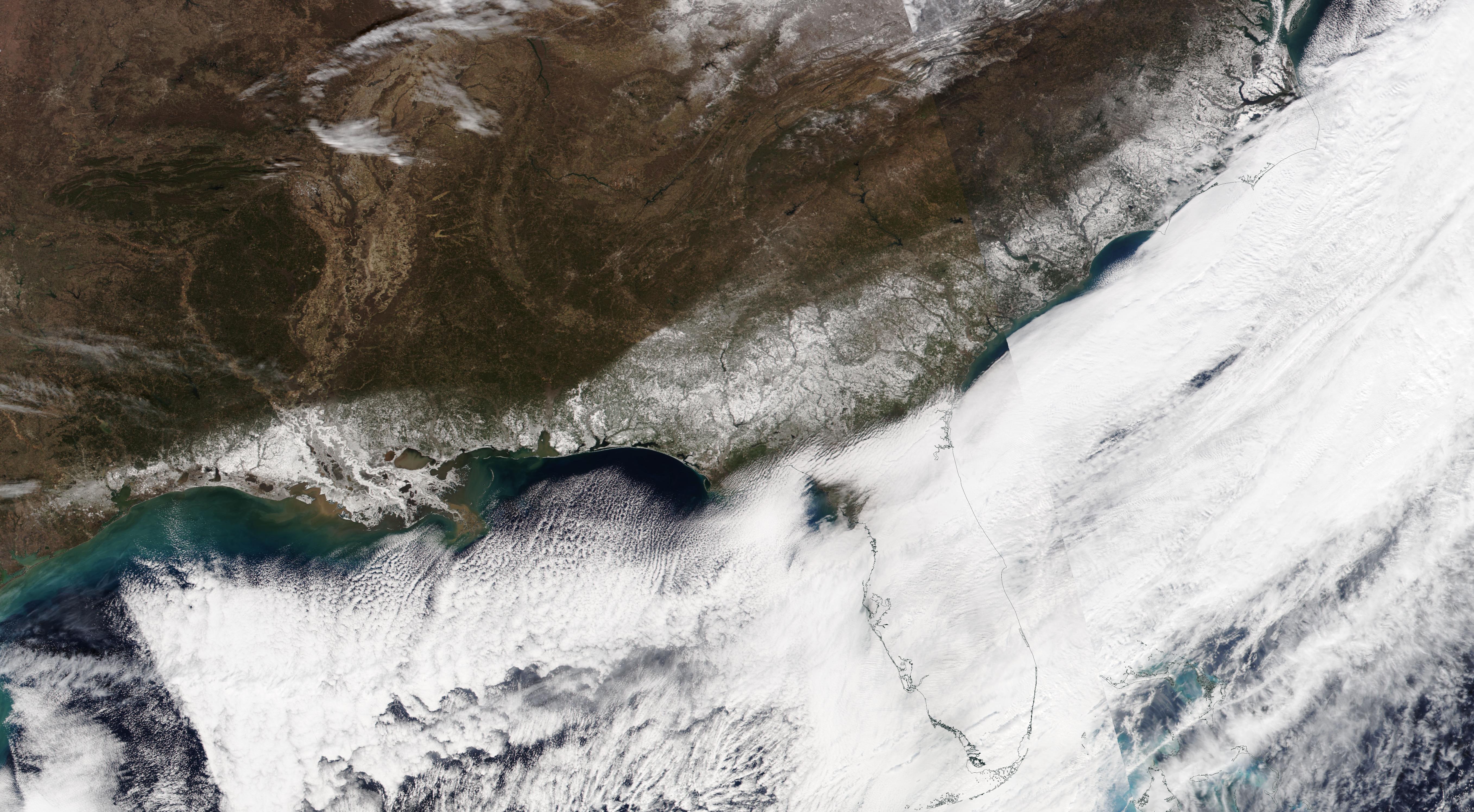
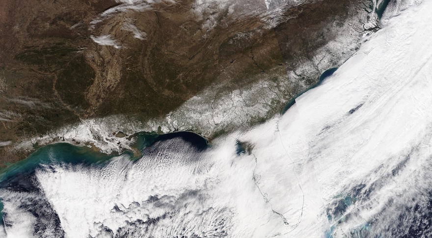
In the western part of the Florida Panhandle, fresh snow accumulations of more than 20 cm were measured. From the Great Blizzard of 1895, the record snow depth in Florida was 10 cm. At Milton, FL, the current blizzard shattered the state-wide snow record with a fresh snow accumulation of 25 cm. Coincidently, the previous record was also set in Milton. Along the Peninsula, snow occurred as far south as Gainesville. Satellite imagery from January 22, 2025, shows a large part of the US Gulf Coast buried in snow. The heavy snow created catastrophic traveling conditions along all roadways in the affected areas. Hundreds of miles of Interstates remained closed for multiple days as stranded vehicles and snow had to be cleared off the highways. Furthermore, tens of thousands of customers were without electricity in the affected areas, and hundreds of flights were canceled.
Satellite imagery of the US Gulf Coast and Mid Atlantic showing the rare snow coverage after the historic blizzard of 2025. Note the cloud streets over the Gulf of Mexico indicating
the advection of very cold air masses over the warm waters of the Gulf of Mexico, source:
NASA Worldview
|
 |
Behind the blizzard, over the fresh snow cover extremely low temperatures were observed along the US Gulf Coast. At many locations, the temperature along the Gulf of Mexico dropped to below -10 °C. In Louisiana, particularly low temperatures were measured on January 22, 2025. With temperatures dropping as low as -16.7 °C at New Iberia, LA, many towns recorded new records for the lowest temperatures. This includes Lafayette, LA with a minimum temperature of -15.6 °C. Baton Rouge, LA, and Lake Charles, LA recorded new monthly lows of -15 °C. In the Florida Panhandle, multiple nights with lows below -10 °C were measured. Hard frost was observed for multiple nights in the days after the Blizzard. On January 25, 2025, temperatures below -5 °C were measured south of Gainesville. Frost also occurred just north of Tampa Bay, highlighting the severity of the cold wave across Florida.
|
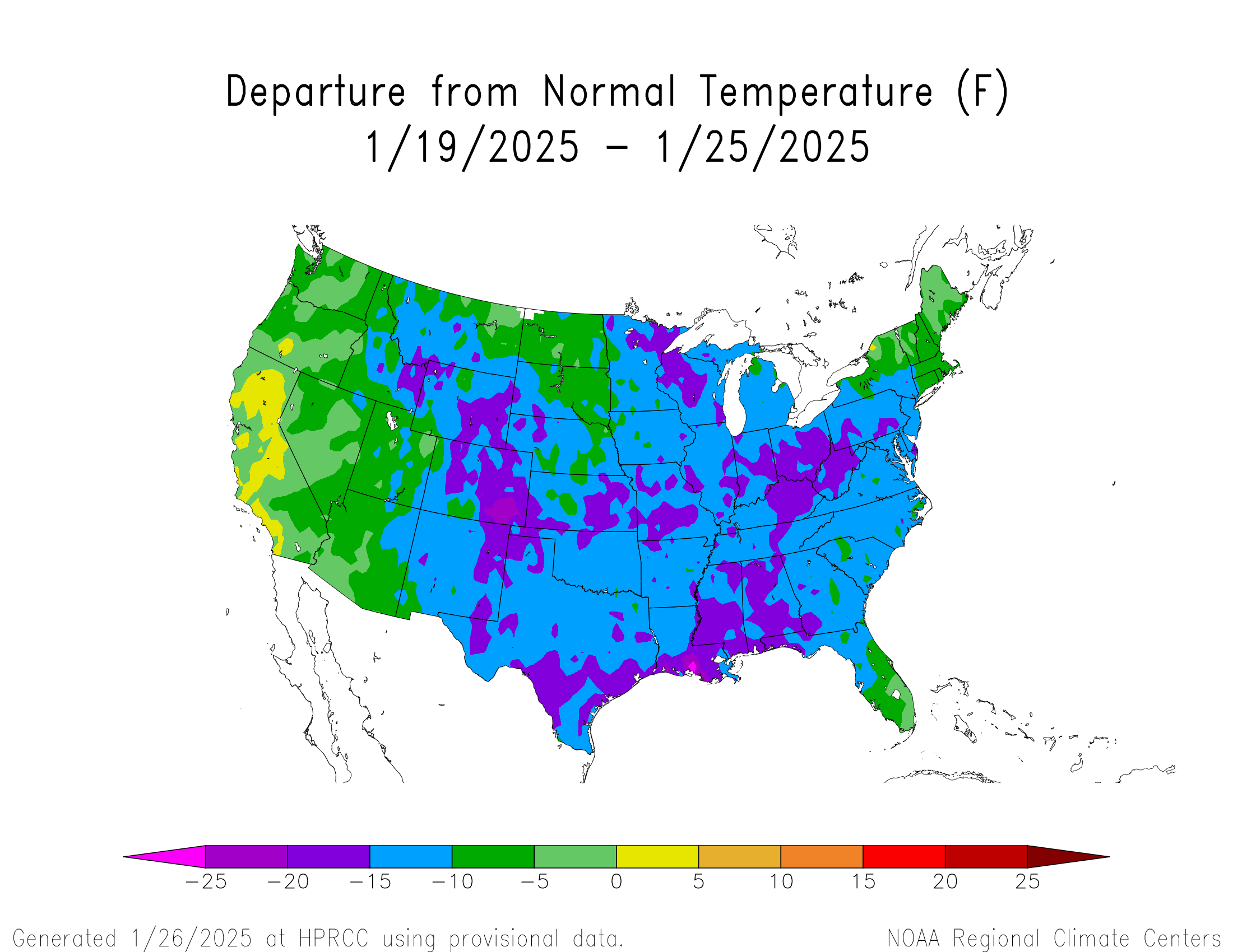
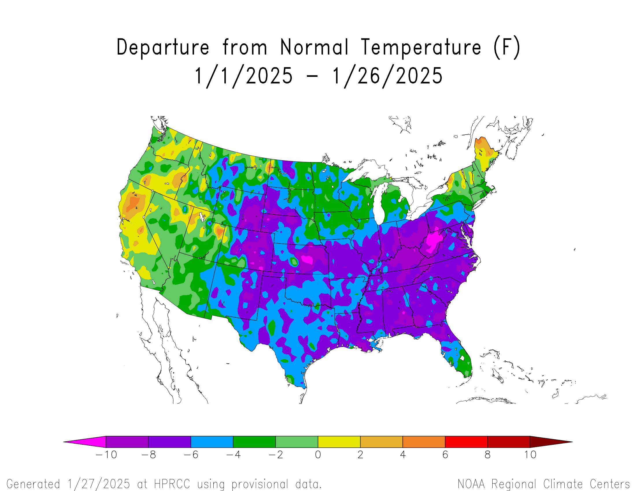
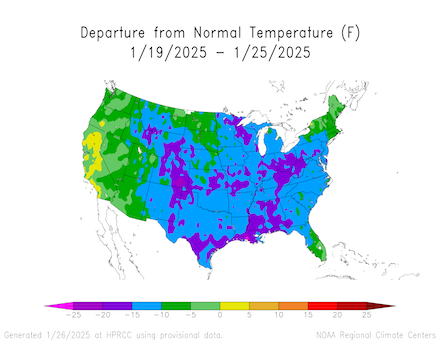
Weekely temperature deviations over the US from January 19 to January 25, 2025 (left), and monthly temperature devation for January 2025 up until Janaury 26, 2025 (right), source:
NOAA HPRCC
|
 |
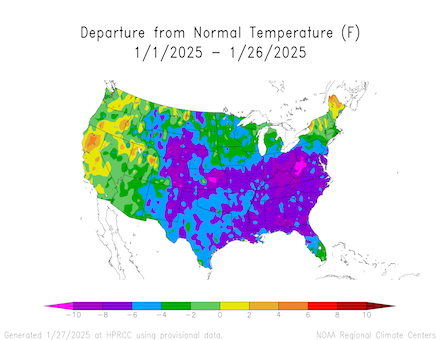 |
The recent cold snap and historic blizzard along the US Gulf Coast marks the climax of a below-average January in terms of temperature across the US. With more than three-quarters of the month, the temperature deviations east of the Rocky Mountains remain negative. Especially in the Appalachian, the negative temperature deviations are the largest, often more than 3 K below average. Just last September, the Southern Appalachians were devastated by Hurricane HELENE. By winter, people in the affected areas still resided in provisional shelters. These regions are particularly vulnerable to harsh winter conditions. In West Virginia, the negative temperature deviations are the largest. For much of the state, January 2025 has been more than 5 K too cold up until January 26, 2025.
Text: KG
January 28, 2025
|