|
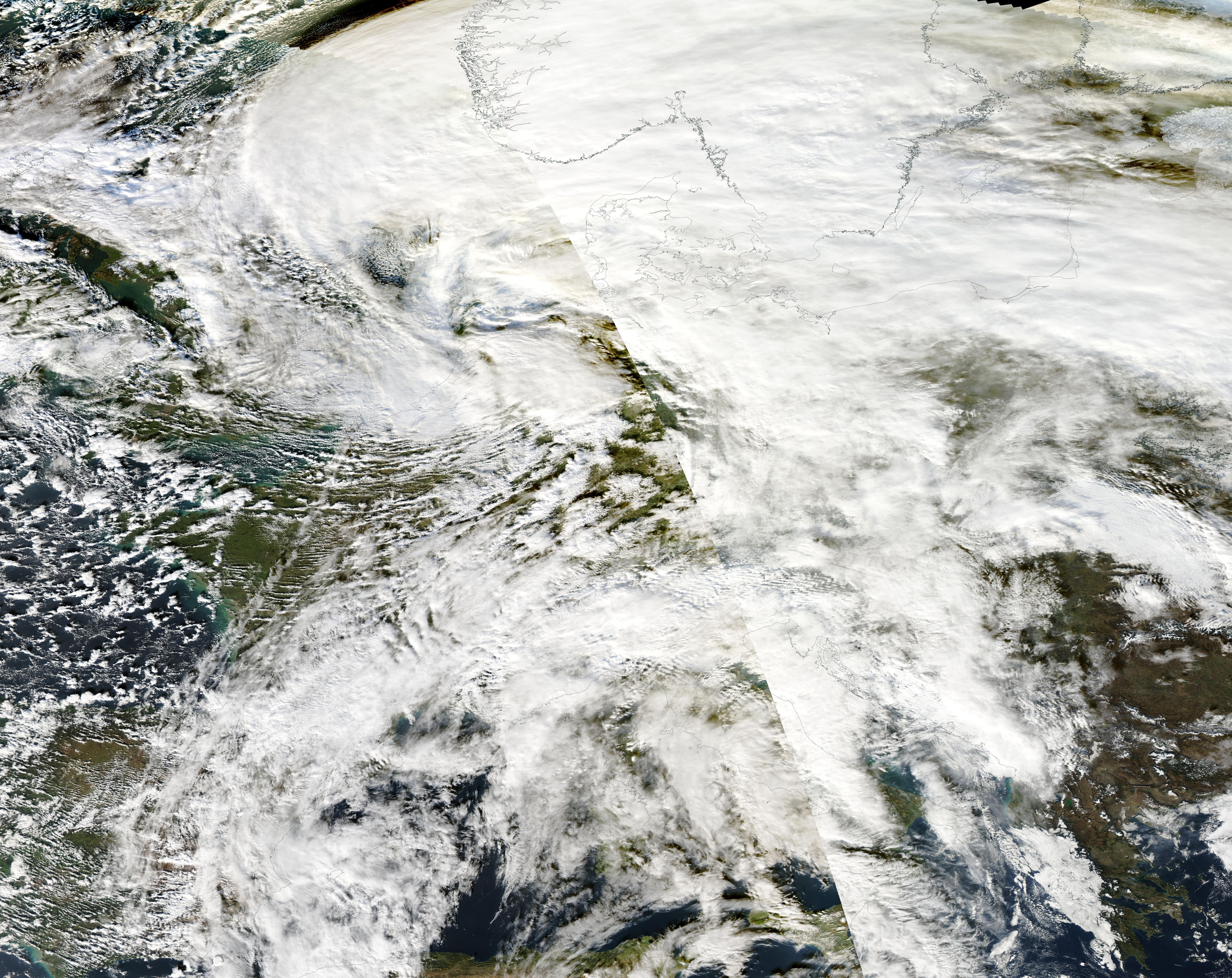
The low-pressure systems Bernd and Charly brought the full mix of winter weather to Central Europe within a few days. Initially, the warm front of low Bernd brought freezing rain to large parts of Germany on January 05, 2025. In the warm sector of low Bernd, record-breaking temperatures and high winds were observed over Western Germany on January 06, 2025. Low Charly brought large fresh snow accumulations to Central Germany on January 08 and 09, 2025.
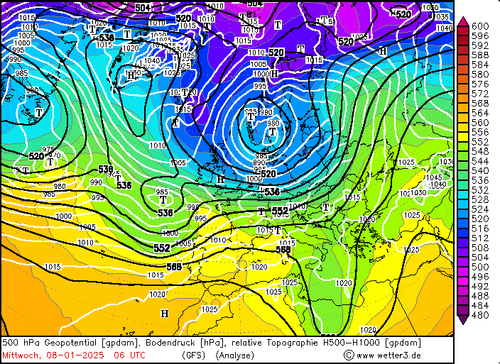
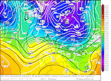
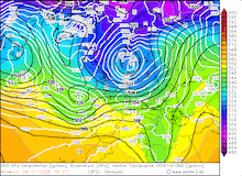
In the first week of January 2025, an active zonal pattern developed over the Northern Atlantic. Two major low-pressure systems moved across Europe. These brought the full mix of wintery weather over Central Europe. Low Bernd approached Europe on January 05, 2025. As low Bernd moved northeastwards across the British Isles, very mild air masses were advected into Continental Europe. A distinct warm front formed as cool air masses were present over Central Europe. The warm front of low Bernd moved across Germany on January 05, 2025. Initially, moderate snowfall was observed. Many lower-elevation stations in Western Germany recorded their first snow cover for the current winter season. Fresh snow accumulations reached a few centimeters.
|
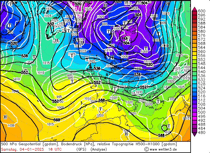
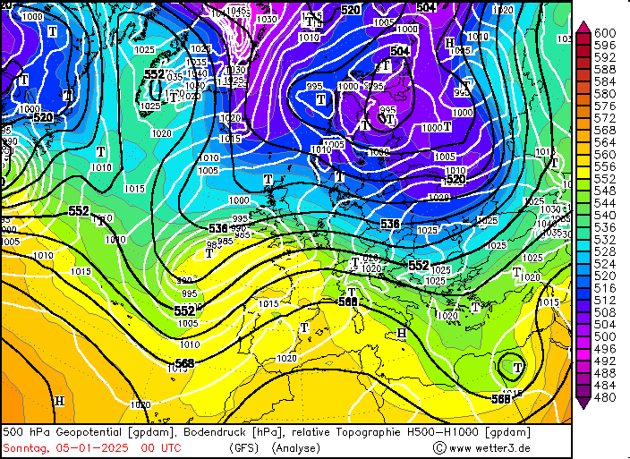
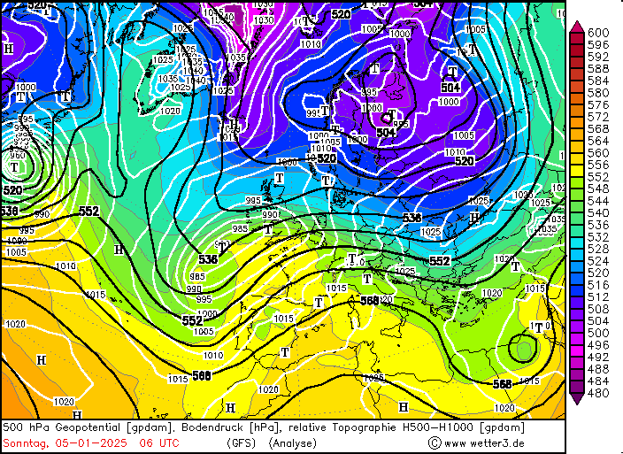
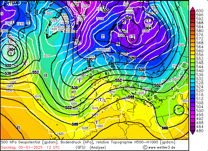
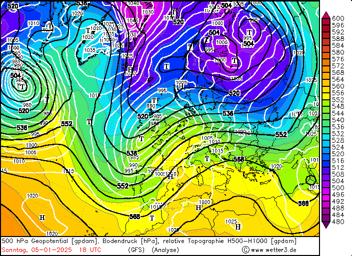
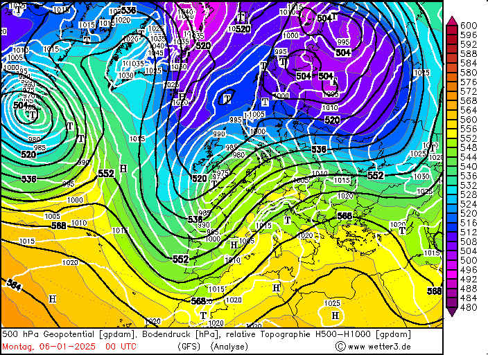
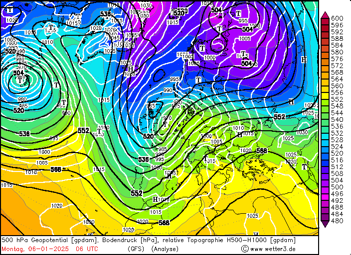
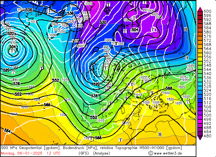
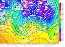
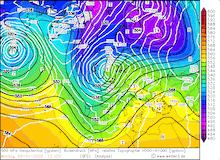
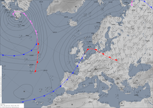
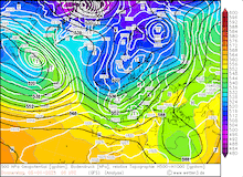
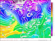
Development of the 500 hPa geopotential, 1000 hPa to 500 hPa thickness, and sea-surface pressure over Europe, 04.01.2025 18 UTC - 06.01.2025 12 UTC, source:
wetter3.de
|
 |
 |
 |
 |
 |
 |
 |
 |
As is the case with warm fronts, the mild air masses first penetrate northeastwards at higher elevations. It took some time until the mild air masses could reach lower elevations. Along the Southern Black Forest, this process was captured very well. Atop the Feldberg mountain, the 2 m temperature rose above freezing at 00 UTC on January 05, 2025. While at Freiburg in the Upper Rhine Valley, the 2 m-temperature remained at around the freezing mark until 03 UTC. With the intrusion of milder air masses, the precipitation falling along the warm front quickly turned into rain. Due to the prevalent cold air masses at the surface, the rain froze upon reaching the surface. Therefore, freezing rain was observed in large parts of Germany as the warm front moved across the country.
|
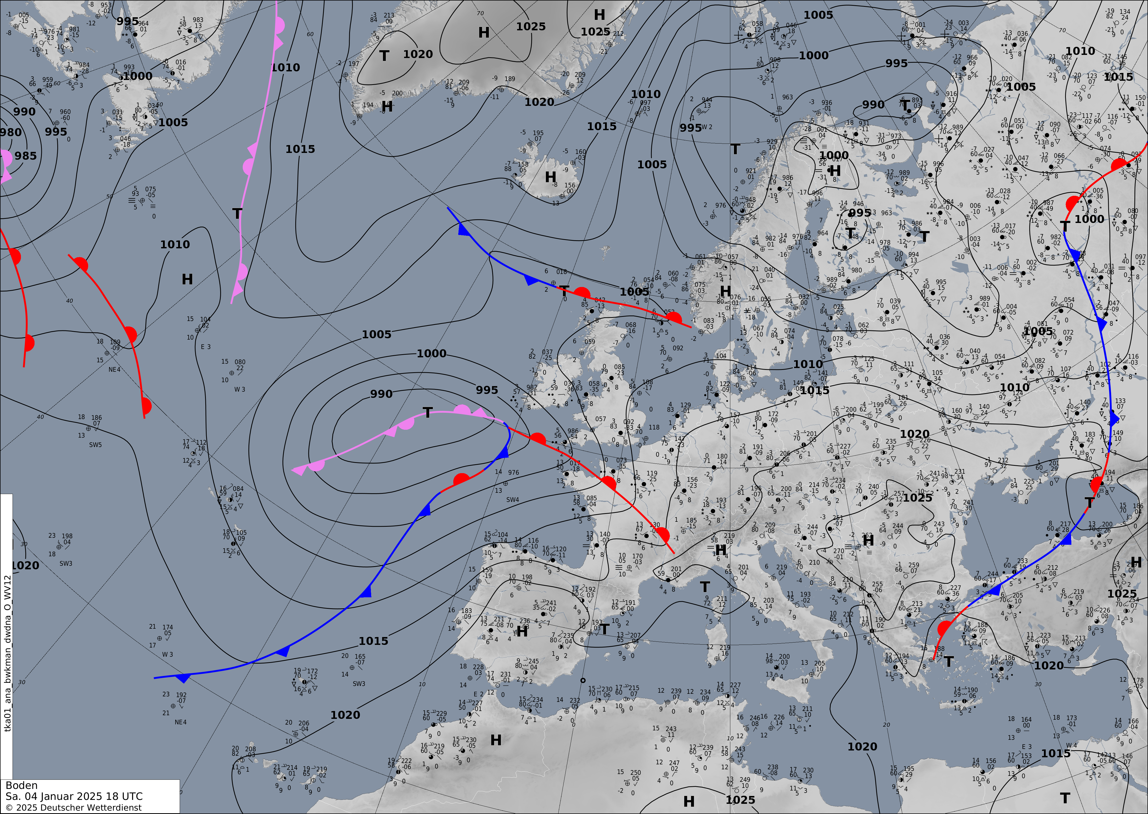
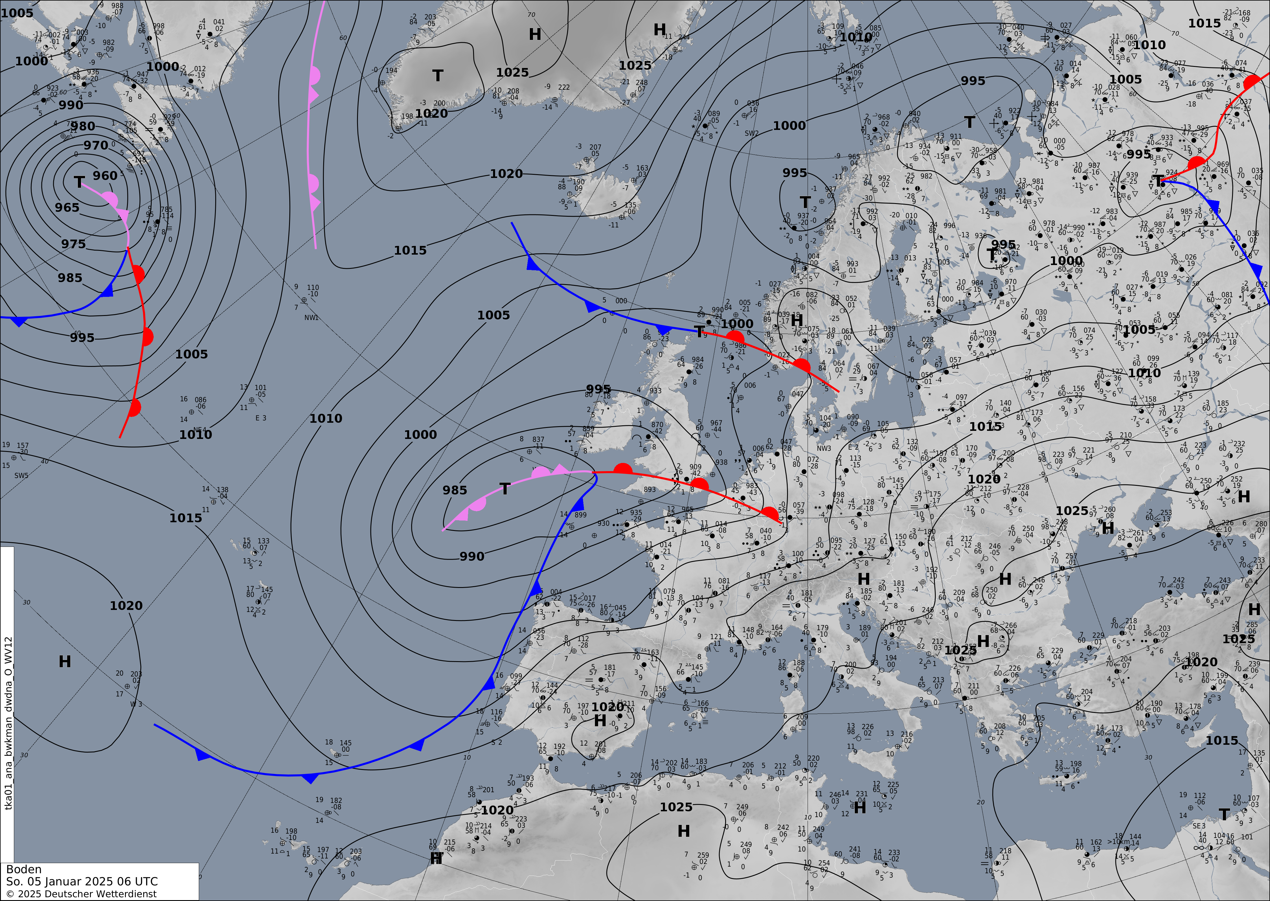
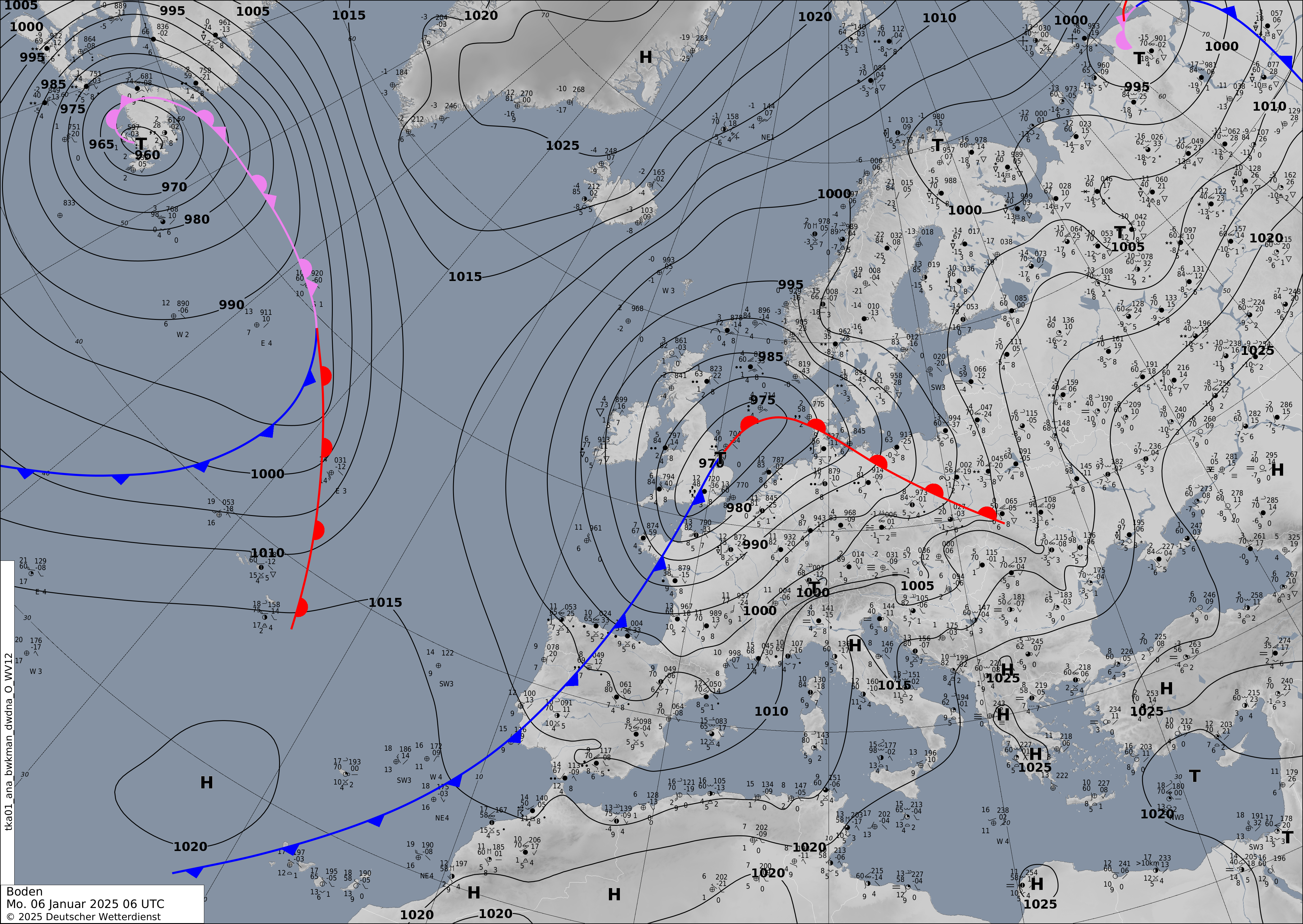
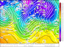
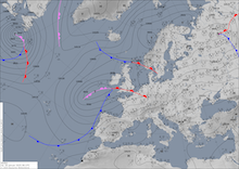
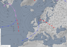
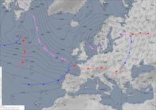
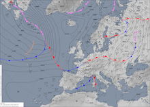
Development of the analyzed surface fronts and mean sea level pressure over Europe, 04.01.2025 18 UTC - 06.01.2025 06 UTC, source:
DWD
|
 |
 |
 |
 |
The surface analysis shows the progression of the warm front across Germany on January 05, 2025. By 12 UTC, the warm front reached the central part of Germany. In the hilly terrain of Central Germany, some valleys saw prolonged periods of freezing rain as the mild air masses could not penetrate these valleys. In Rhineland-Palatine, the Nahe and Ahr Valleys highlighted these temperature discrepancies very well. At Bad Neuenahr-Ahrweiler in the Ahr Valley, the 2 m temperature rose to more than 10 °C at 12 UTC on January 05, 2025. At Bad Kreuznach in the Nahe Valley, the 10 °C mark was only surpassed 22 h later at 10 UTC on January 06, 2025. In the evening hours of January 05, 2025, the warm front reached Eastern Germany. Due to the snow and freezing rain, treacherous traveling conditions were reported. At Frankfurt Airport, 150 flights were canceled due to the wintery weather. However, the period of freezing rain was most often rather short because the intruding warm air masses quickly thawed the grounds.
|
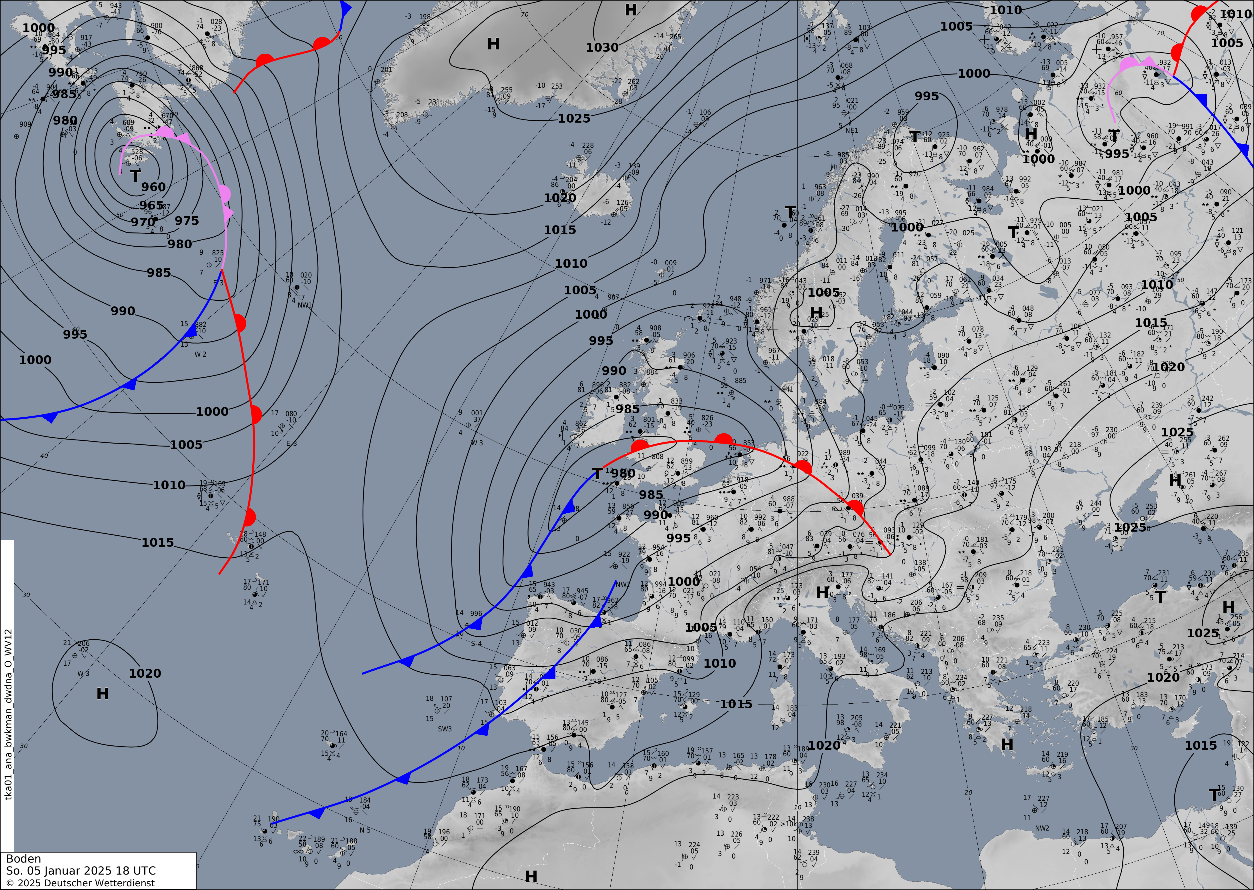
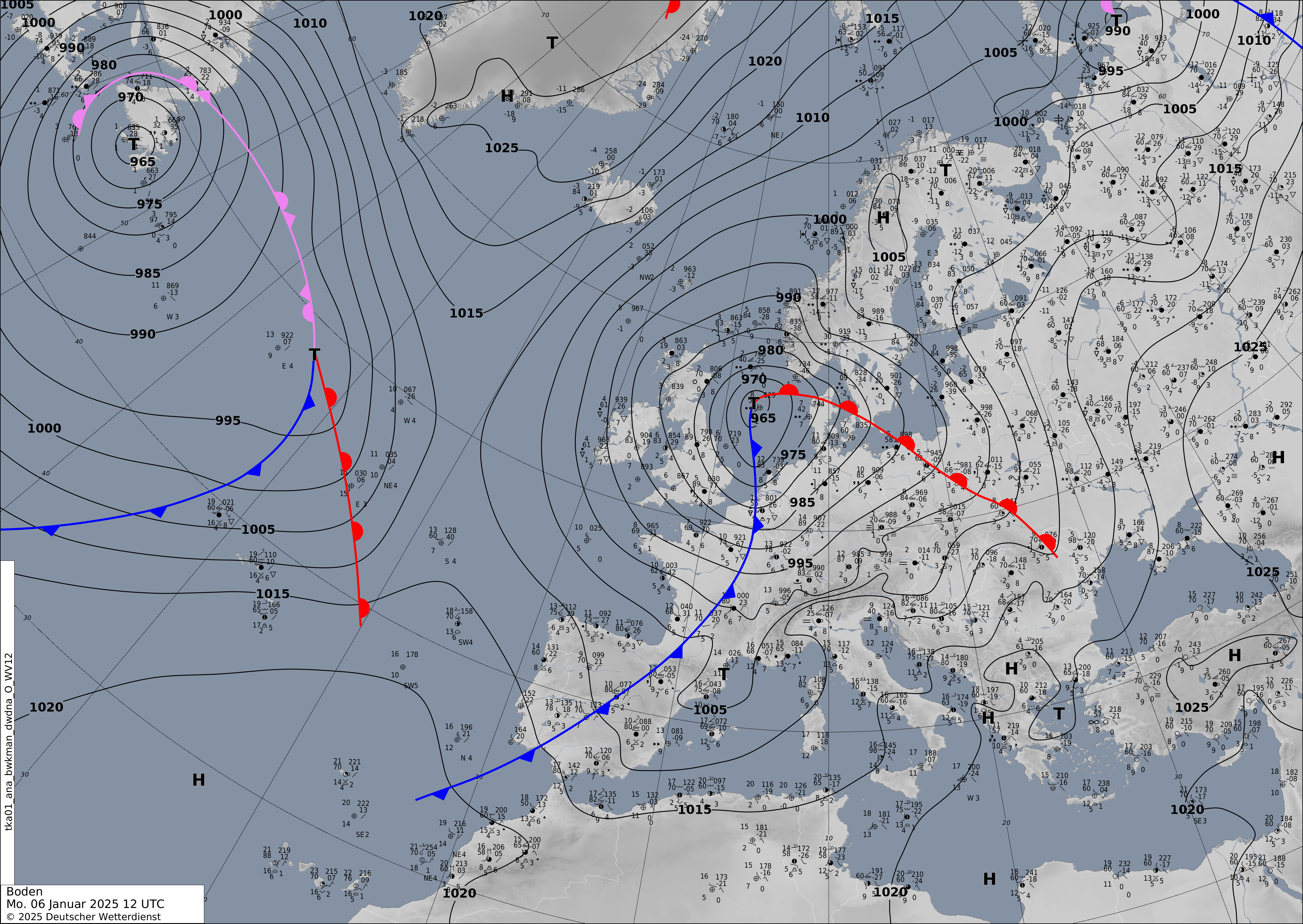
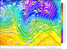
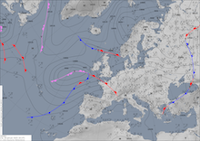
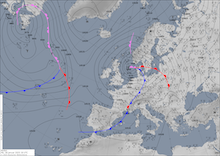
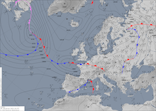
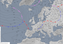
Development of the analyzed surface fronts and mean sea level pressure over Europe, 06.01.2025 06 UTC - 07.01.2025 00 UTC, source:
DWD
|
 |
 |
 |
 |
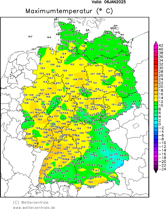
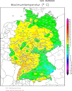
On January 06, 2025, the warm front of low Bernd had passed over Germany. In the warm sector of low Bernd, the temperatures on January 06, 2025, reached record-breaking levels. Dozens of records were set. At Rheinstetten, a new monthly record was set for the day-time maximum temperature at 17.1 °C. At Kaiserslautern, a temperature of 15.0 °C was recorded. This surpassed the old record for the highest temperature in the first decade of January. Record keeping at the station began 103 years ago. At Göttingen, a new monthly record was set with 14.5 °C. Temperature recording here began 93 years ago.
|
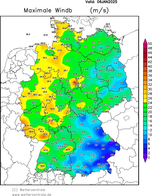
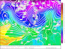
2 m maximum temperature (left) and maximum wind gusts (right) over Germany on January 06, 2025, source:
wetterzentrale
|
 |
 |
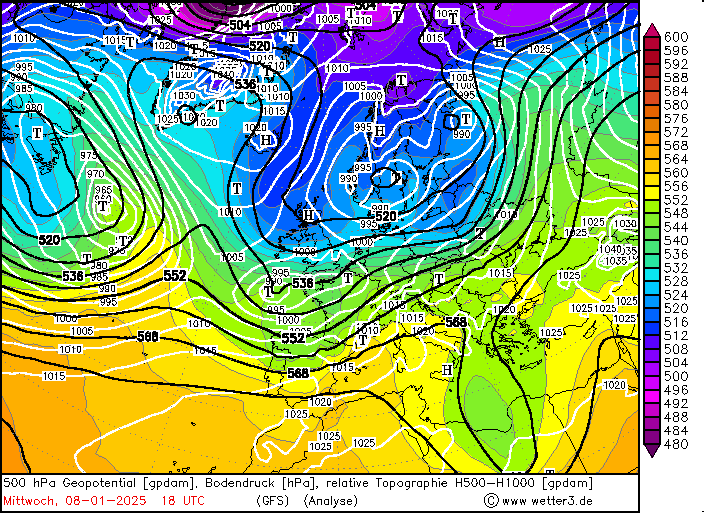
In the afternoon hours of January 06, 2025, the cold front of low Bernd moved across Central Europe. With the cold front, very high winds were observed over Central Europe. Over France, wind gusts of more than 100 kph occurred in the Grand Est. Near Reims, wind gusts of up to 117 kph were recorded. At Trier, a wind gust of 111.2 UTC was measured. In the evening hours, the storm reached Northern Germany. At the lighthouse at Kiel, a wind gust of 126.0 kph was recorded. Atop the Brocken Mountain, the highest wind speed was measured with 159.8 kph. On January 07, 2025, low Bernd brought gale-force winds to Southern Sweden.
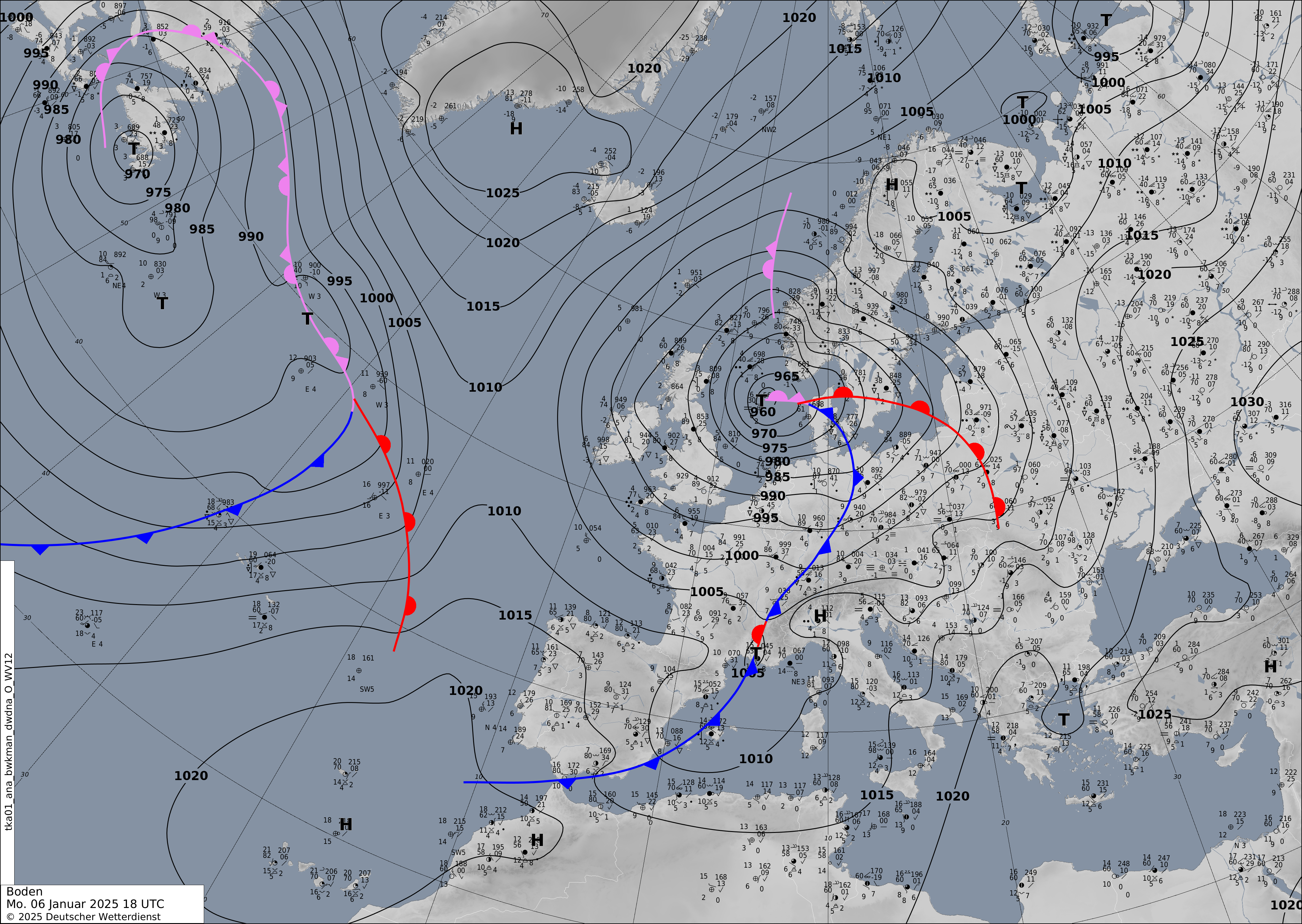
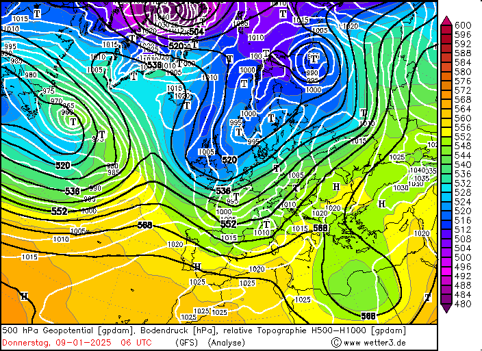
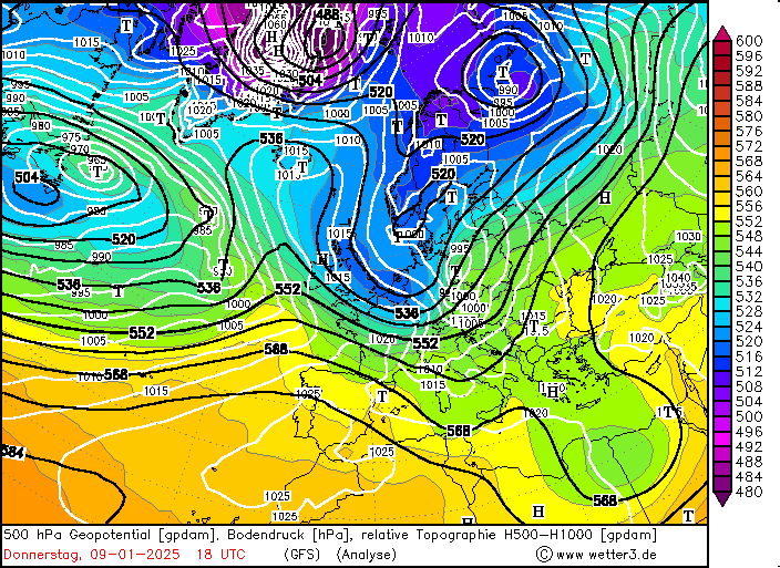
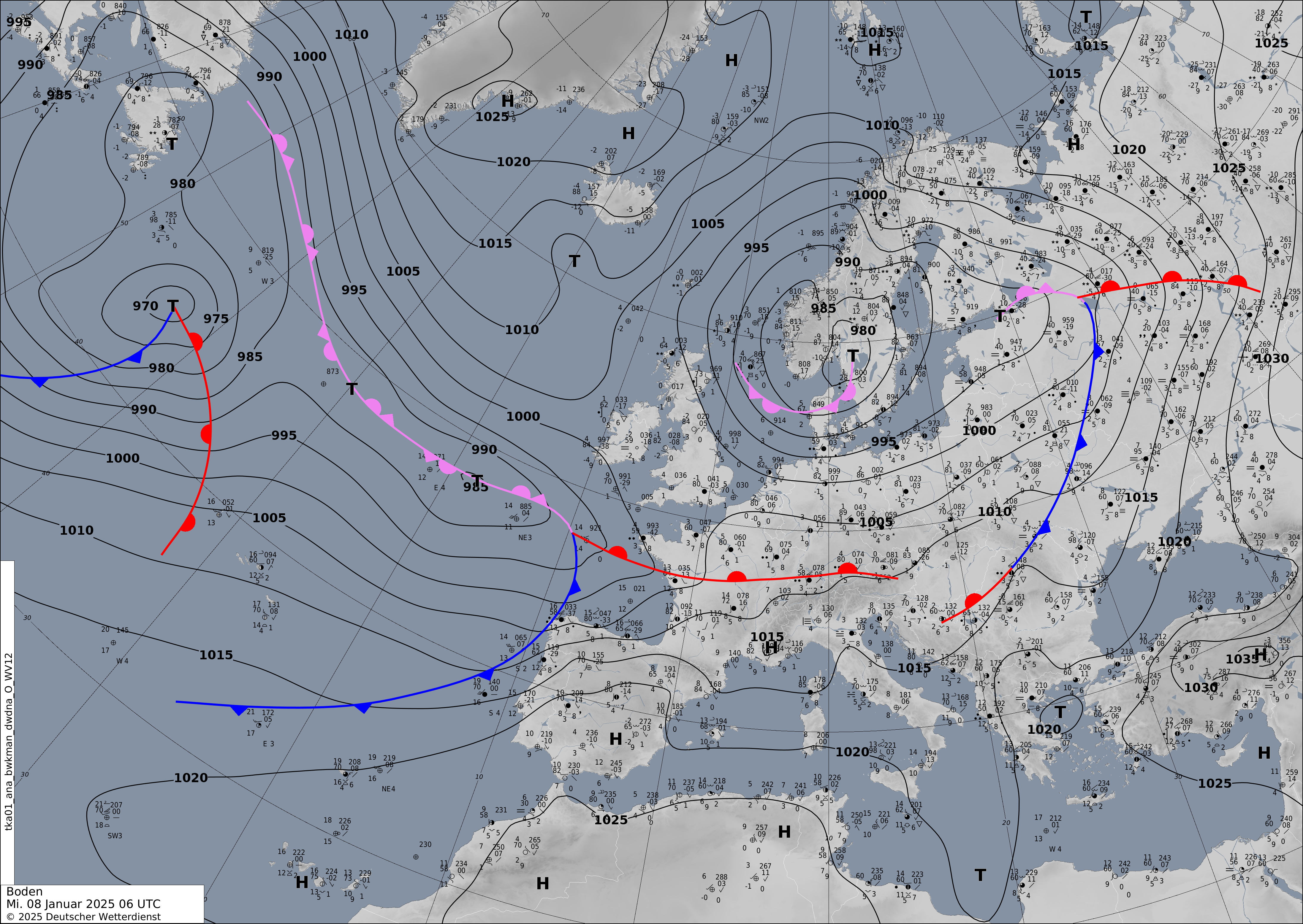
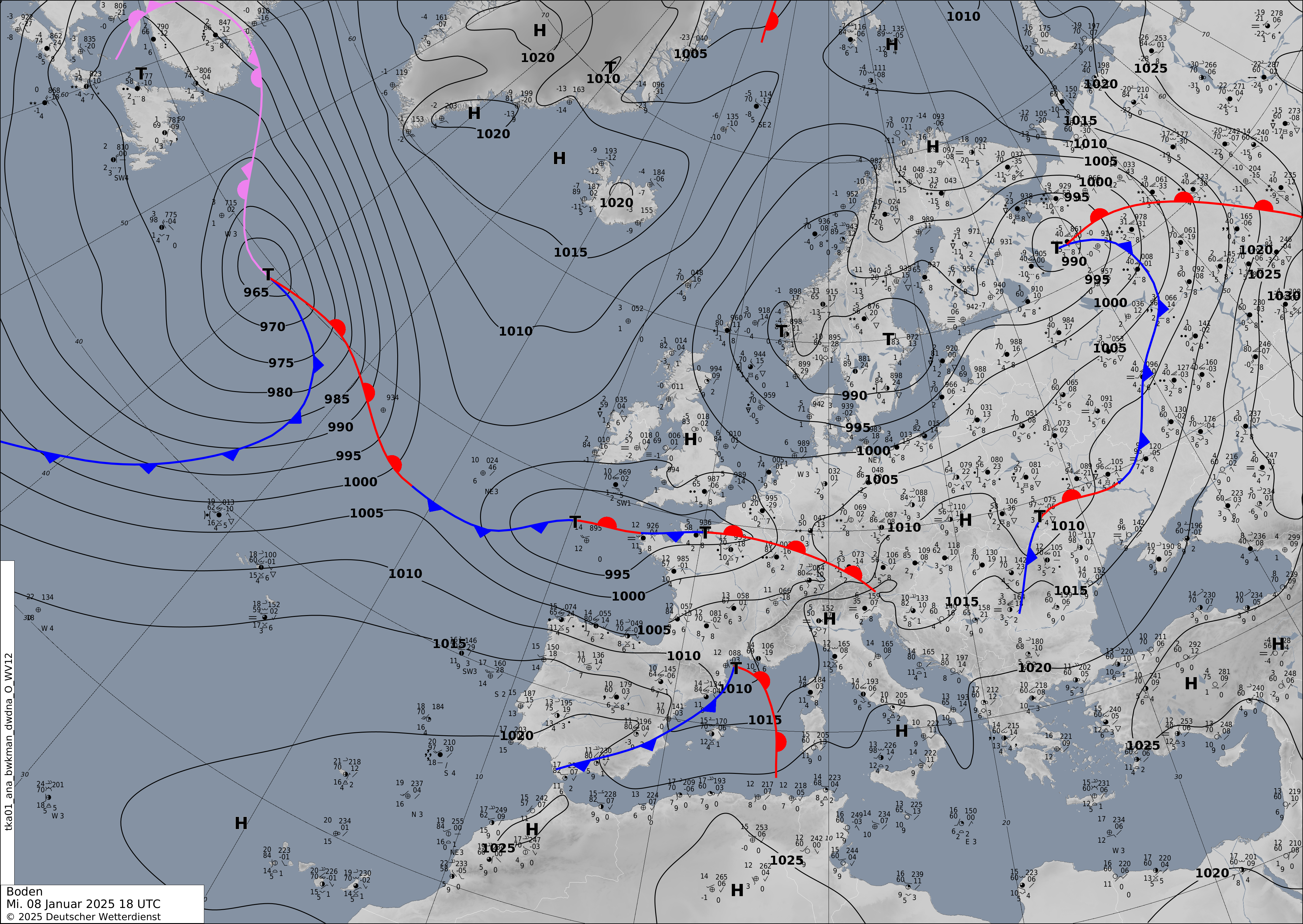
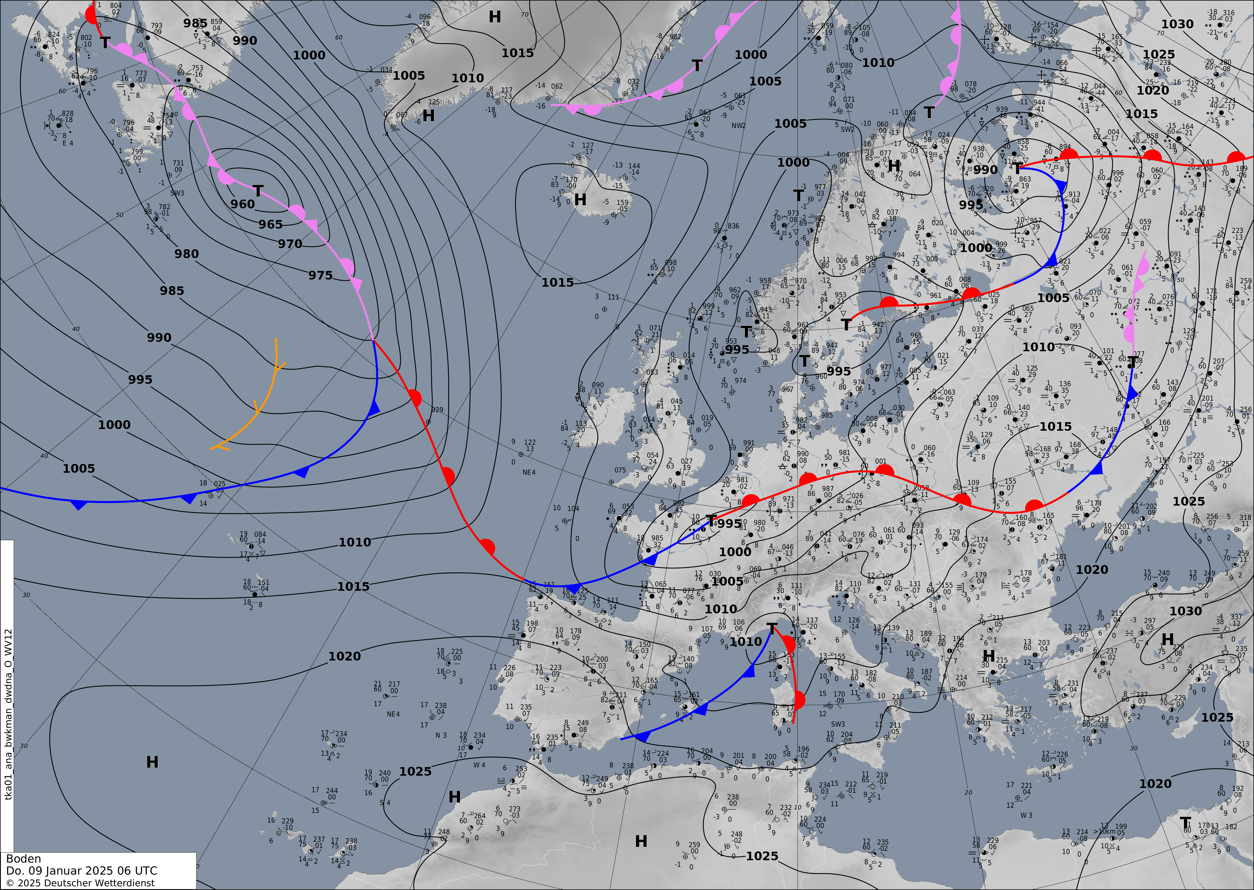
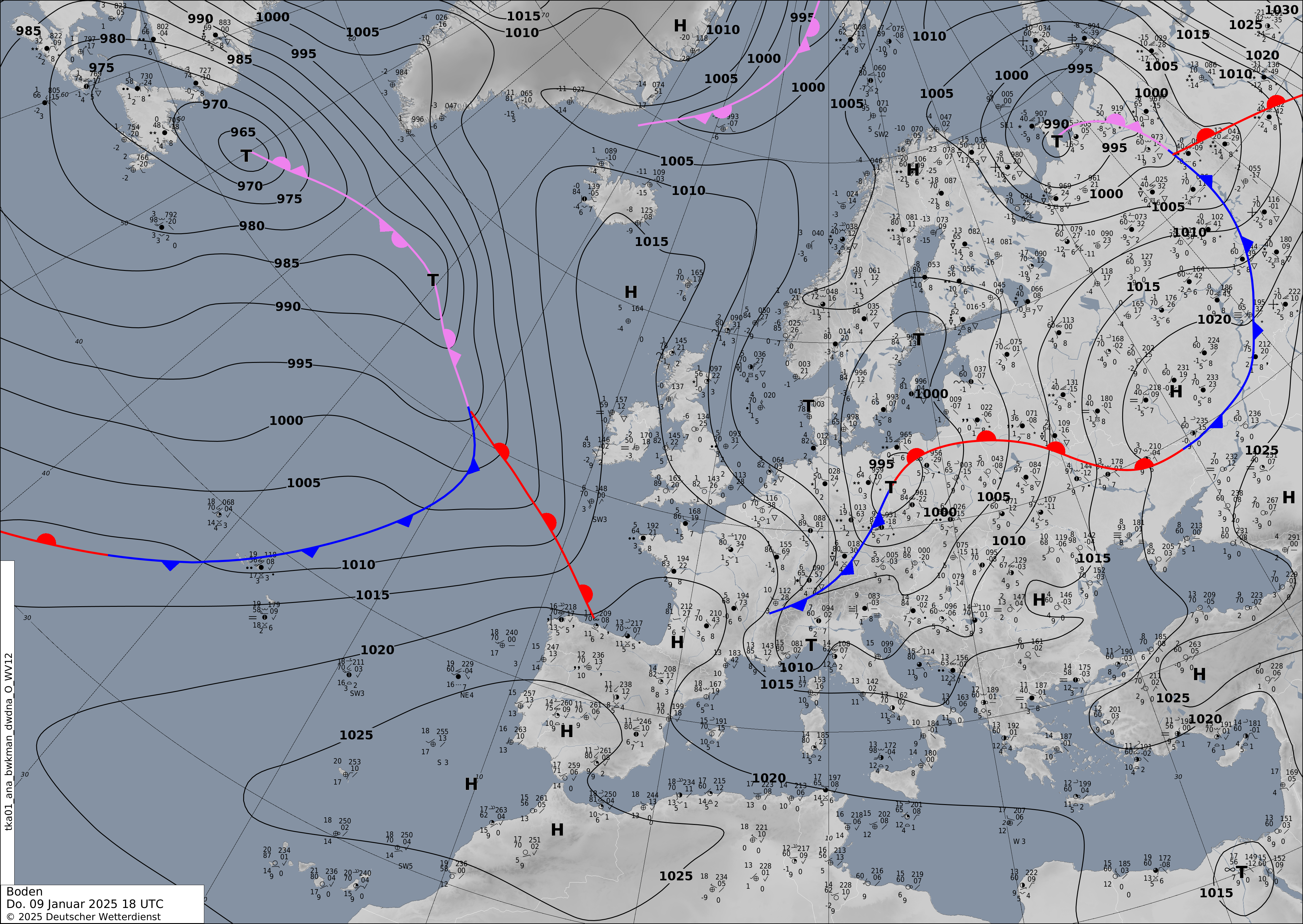
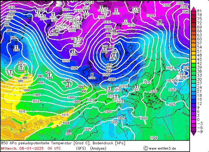
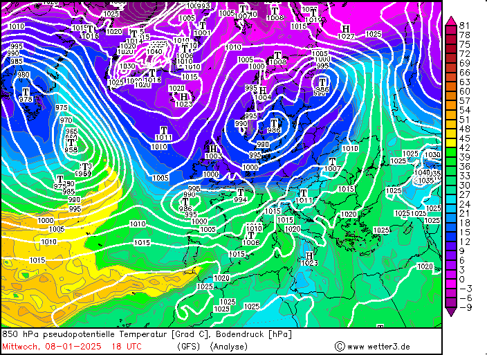
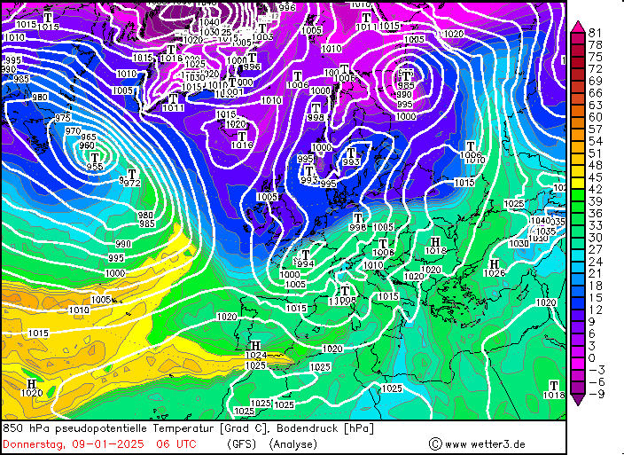
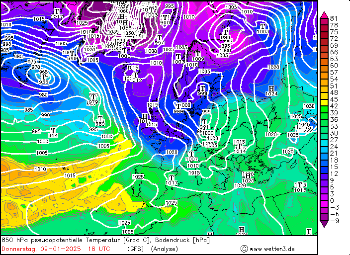
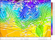
On January 07, 2025, the weather situation over Central Europe calmed down. Over the Atlantic, low Charly was already approaching Europe. With low Charly, a distinct air mass boundary formed over Central Europe. The synoptic set-up was somewhat like the air mass boundary in January 2024. However, this air mass boundary was less impactful than the one last year. On January 08, 2025, the warm front of low Charly moved Germany. The warm front began to stall over the southern part of North Rhine-Westphalia. At lower elevations, the warm air masses could once again not penetrate as far as at upper elevations. As a result, the surface temperature boundary was far less pronounced than at upper elevations. Over Northern Rhineland-Palatine, the precipitation turned into rain in the night from January 08 to 09, 2025 but the temperatures remained only slightly above the freezing mark.
|
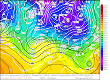
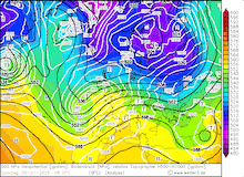
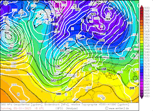
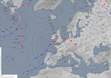
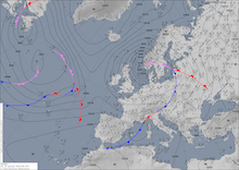
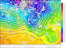
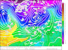
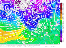
Development of the 500 hPa geopotential, 1000 hPa to 500 hPa thickness, and sea-surface pressure over Europe, 08.01.2025 06 UTC - 09.01.2025 18 UTC, source:
wetter3.de (upper row). Development of the analyzed surface fronts and mean sea level pressure over Europe, 08.01.2025 06 UTC - 09.01.2025 18 UTC, source:
DWD (middle row). Development of the pseudo-potential temperature over Europe, 08.01.2025 06 UTC - 09.01.2025 18 UTC, source:
wetter3.de (lower row).
|
 |
 |
 |
 |
 |
 |
 |
 |
 |
 |
 |
 |
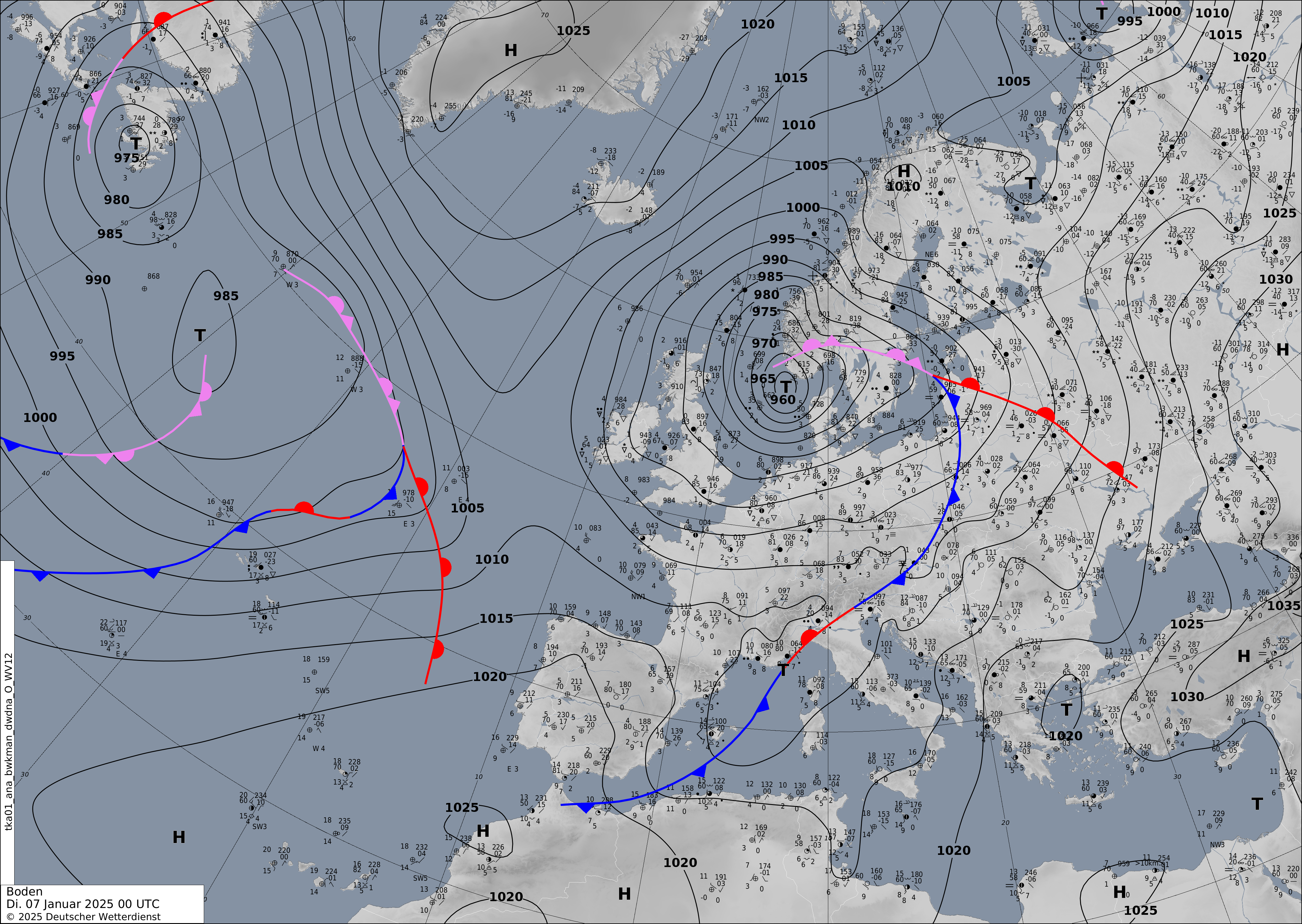
Compared to the air mass boundary last January, freezing rain was only a minor concern. On January 09, 2025, the cold front of low Charly began to move southwards. In a band stretching from the English Channel over the Sauerlands Mountains into Berlin, heavy snow was observed. Fresh snow accumulation reached nearly 30 cm in the Sauerland and Harz Mountains. Due to the heavy snow, traveling conditions deteriorated. Over Rhineland-Palatine, the cold front of low Charly brought fresh snow accumulations of around 5 cm as the cold air moved southwards. Further south, the cold front of low Charly brought only rain to lower elevations. South of the Danube River, high winds with gale-force gusts occurred during the passage of the cold front.
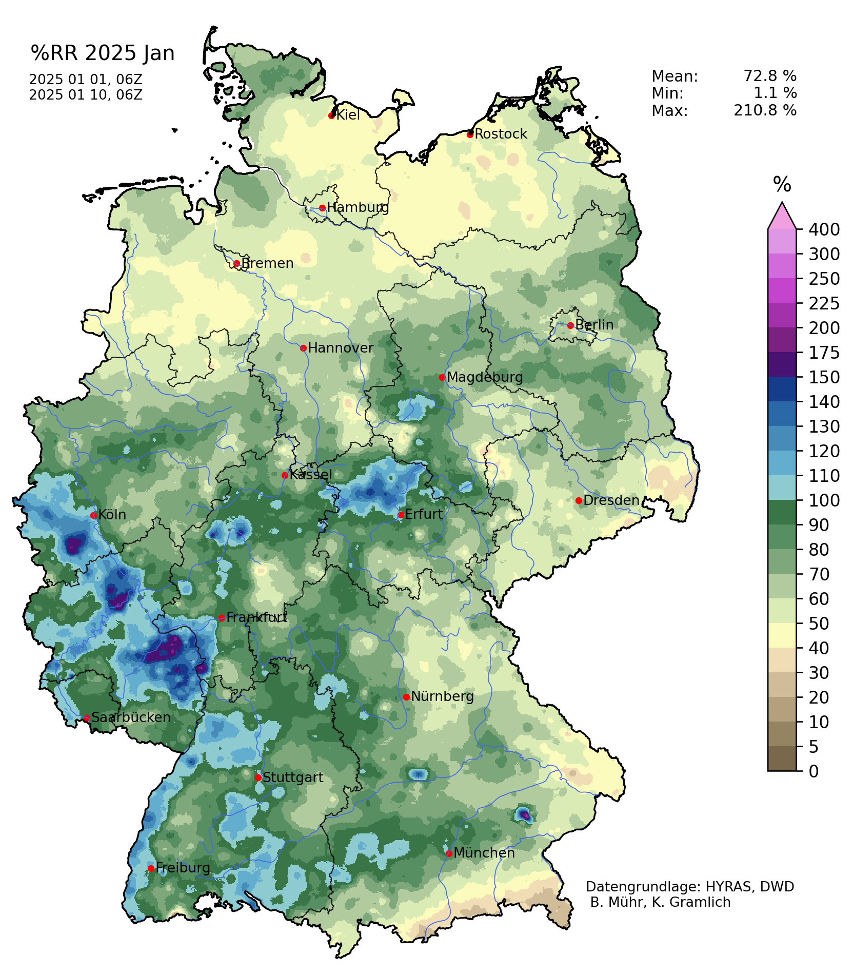
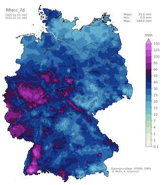
7-day precipitation totals over Germany, 03.01.2025 06 UTC - 10.01.2025 06 UTC (left) and percentage of the monthly precipitation over Germany,
until 10.01.2025 06 UTC (right), source:
Wettergefahren Frühwarnung
|
 |
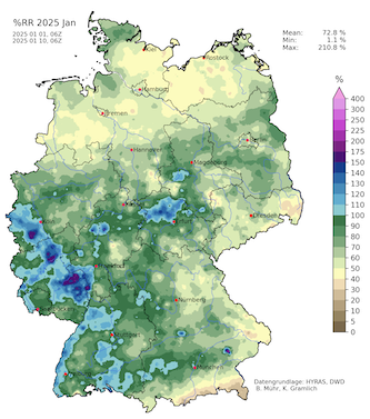 |
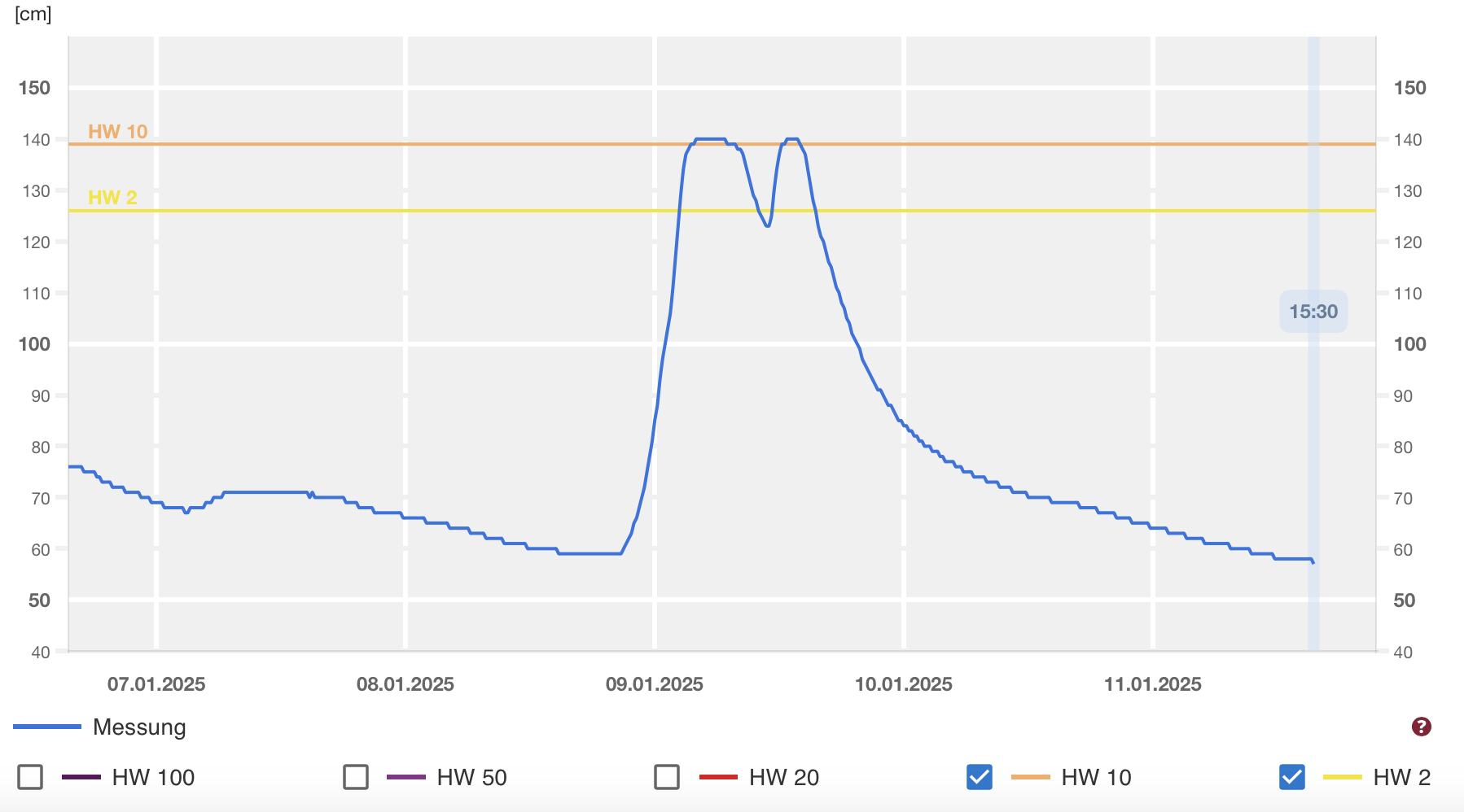
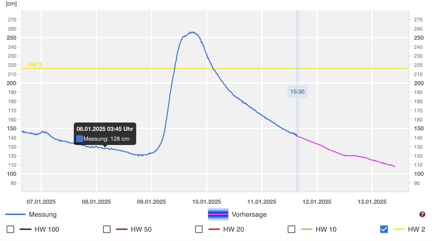
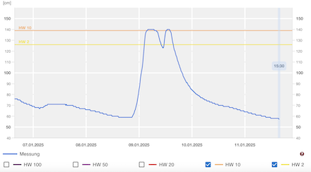
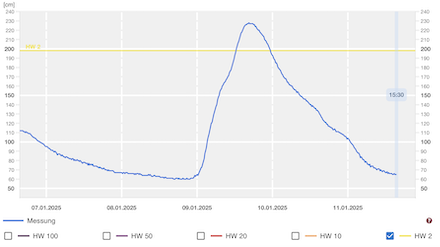
Both low Bernd and Charly brought at times heavy precipitation to the western half of Germany. Especially in the lee of Western Germany, many stations received more precipitation in the first decade of January than typically accumulates in the entire month. As a result, the river levels of many rivers in Western Germany quickly rose. Especially in Rhineland-Palatine minor flooding occurred. Many rivers reached 2-year flooding stages. In the Eifel Mountains, some creeks surpassed the 10-year flooding threshold due to the combination of snow melt and heavy rain.
|
River flooding along creeks in the Eifel Mountains reaching a 10-year flood at the Nims at Giesdorf (left) and a 2-year flood at the Kyll at Gerolstein (right), source:
Hochwasser RLP
|
 |
 |
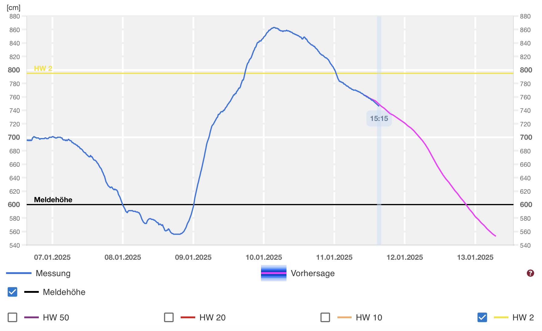
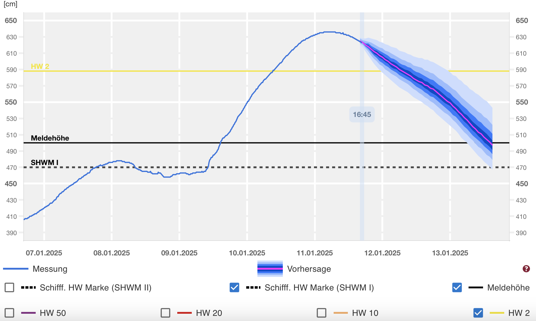
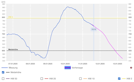
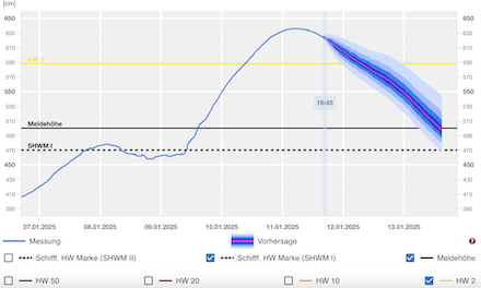
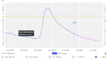
Along the major waterways, a 2-year flood developed. At Trier, the Moselle River reached a water level of 863 cm on January 10, 2025. Along the Middle Rhine Gorge, a 2-year flood developed due to the high inflow of the feeder rivers into the Rhine River. At Koblenz, a river level of 636 cm was measured on January 11, 2025, well above the 2-year flood threshold. Down to Cologne, the Rhine River reached minor flooding stage. Due to the high river levels, quaysides were inundated. Nevertheless, no major damages occurred.
|
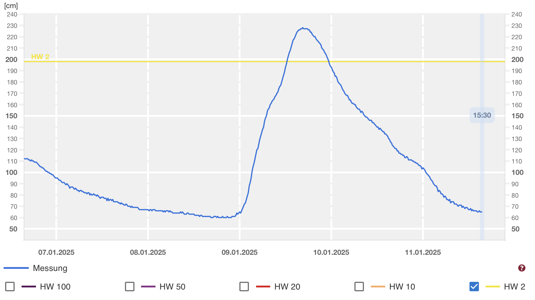
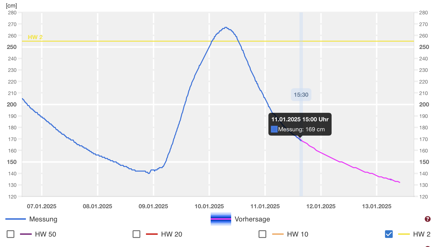
River flooding along major river in Rhineland-Palatine reaching all 2-year flooding stages, measured at Trier along the Moselle River (upper left), at Koblenz along the Rhine River (upper right), at Dietersheim along the Nahe River (lower left), and at Altenahr along the Ahr River (lower right), source:
Hochwasser RLP
|
 |
 |
 |
 |
As much colder airmasses were advected into Central Europe behind low Charly, the snow cover in the Sauerland Mountains is not expected to thaw out quickly. As a result, the river flood along the Lower Rhine flattened.
Text: KG
January 11, 2025
|