|
A distinct airmass boundary brought heavy snowfall and icing to Central Europe on January 17, 2024, and January 18, 2024. Along the Ahr and Sieg Rivers, fresh snow accumulations of more than 25 cm were observed. South of the airmass boundary, persistent freezing rain was observed with ice accumulations of locally more than 1 cm.
A weak cold wave had been affecting Central Europe in the second and third week of January, bringing a few days of sub-zero daytime maximum temperatures. At nighttime hard freezes between -10 and -15 °C were observed, with the lowest temperature at lower elevations being observed at Leutkirch-Herlazhofen, BY with -19.5 °C on January 20, 2024.
|
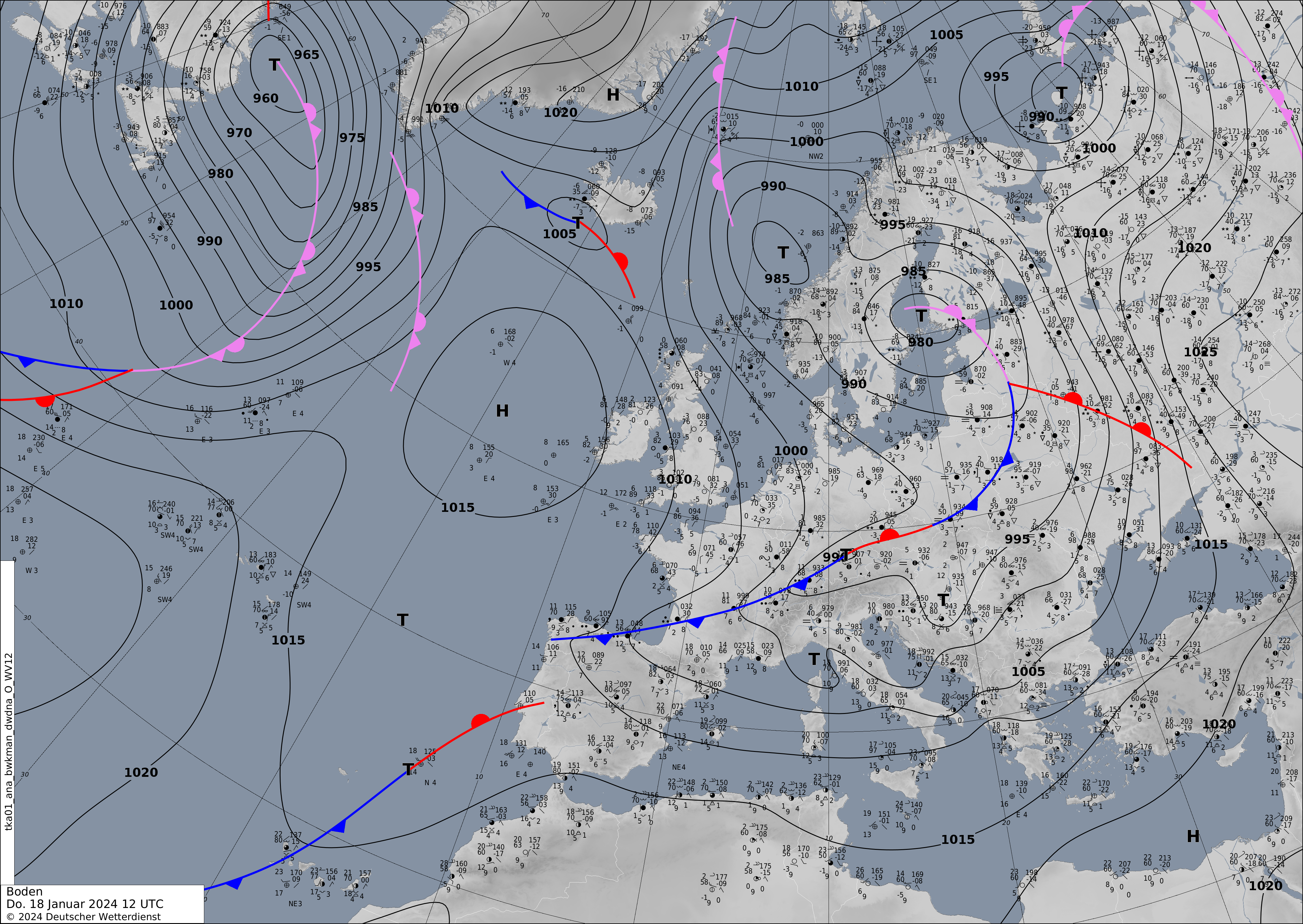
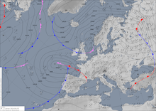
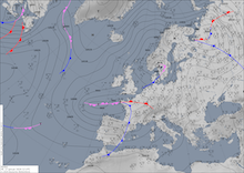
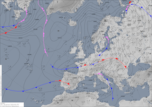
500 hPa Geopotential and sea surface pressure (upper row), 850 hPan pseudo-potential temperature and sea surface pressure (middle row), source:
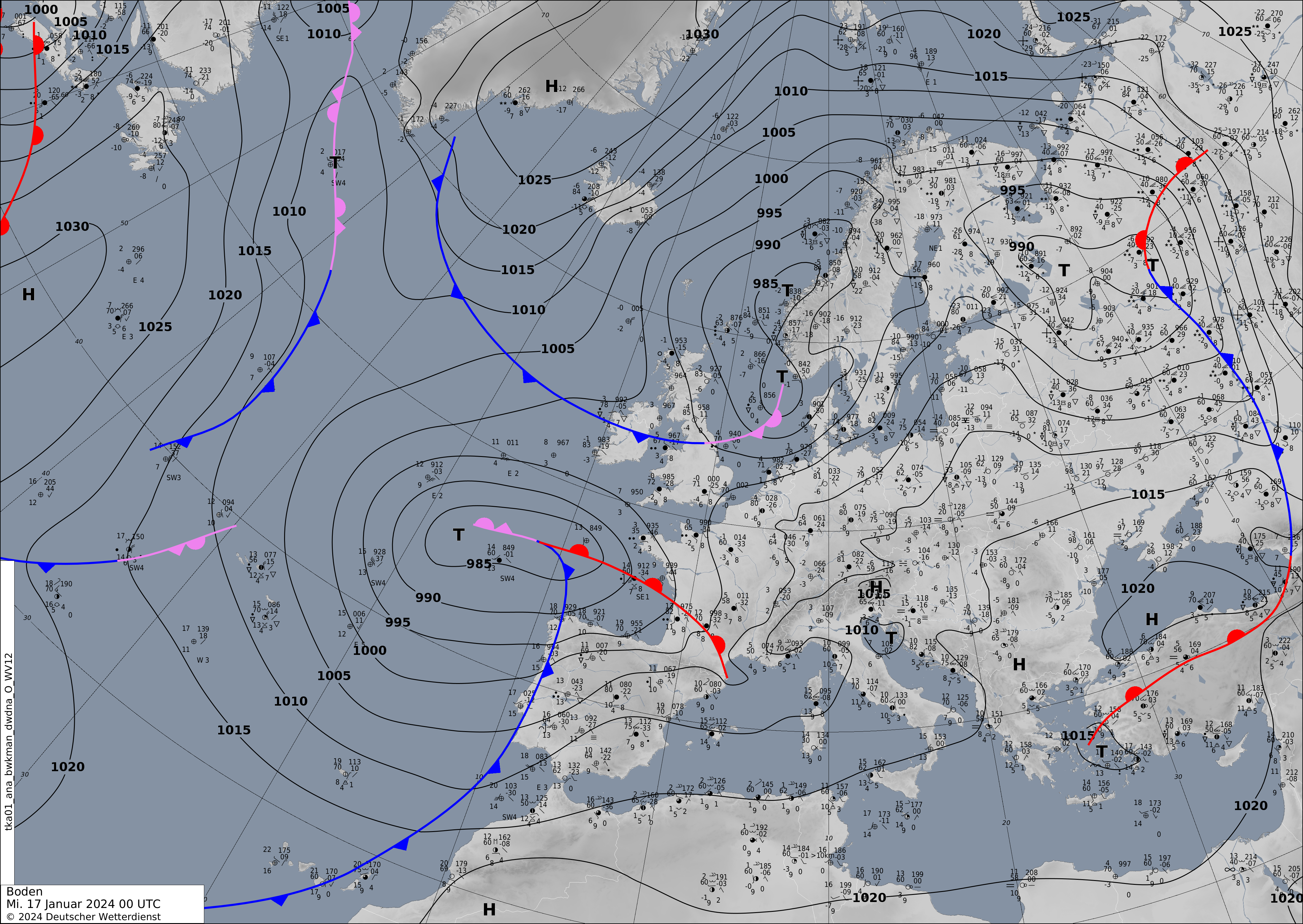
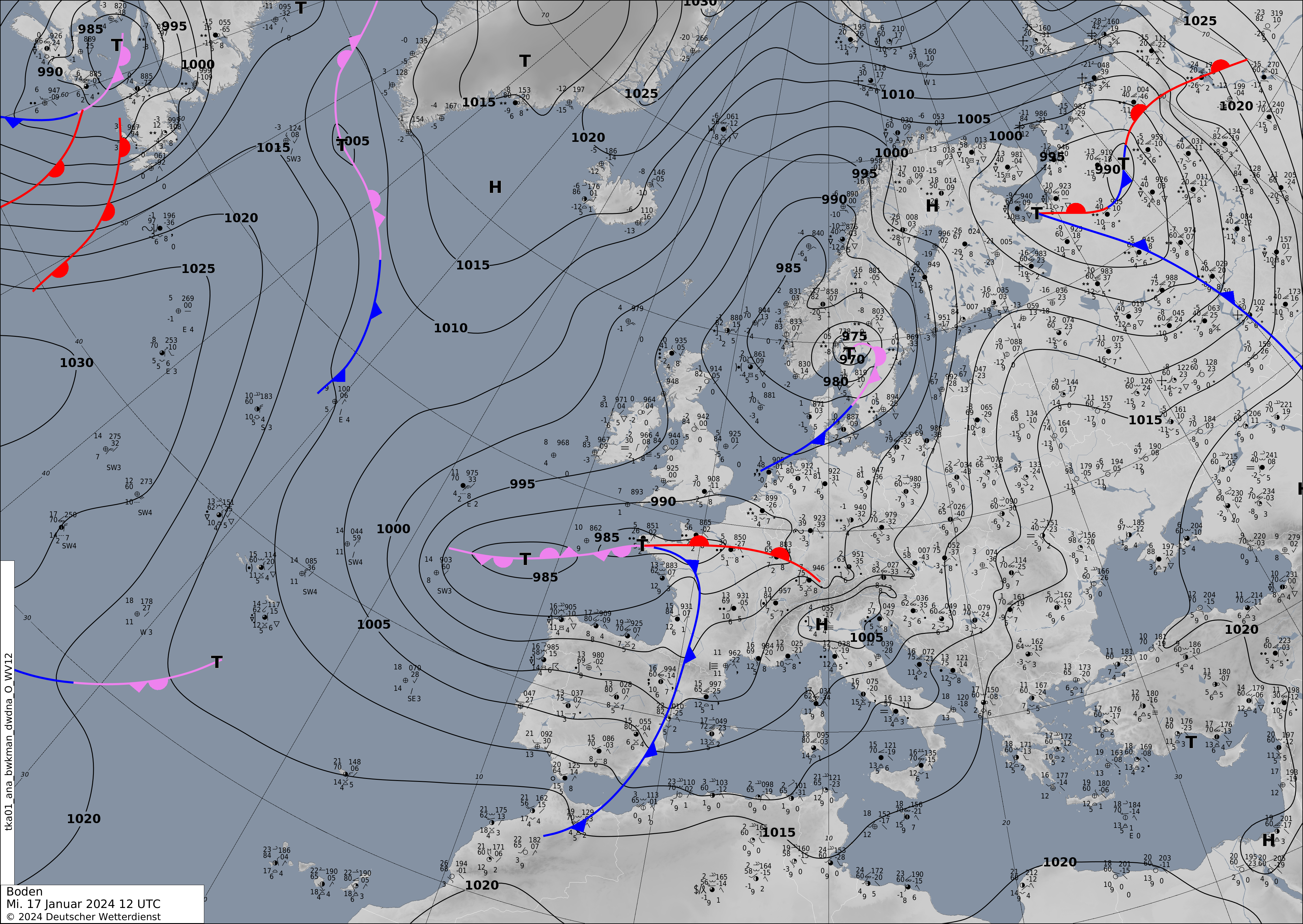
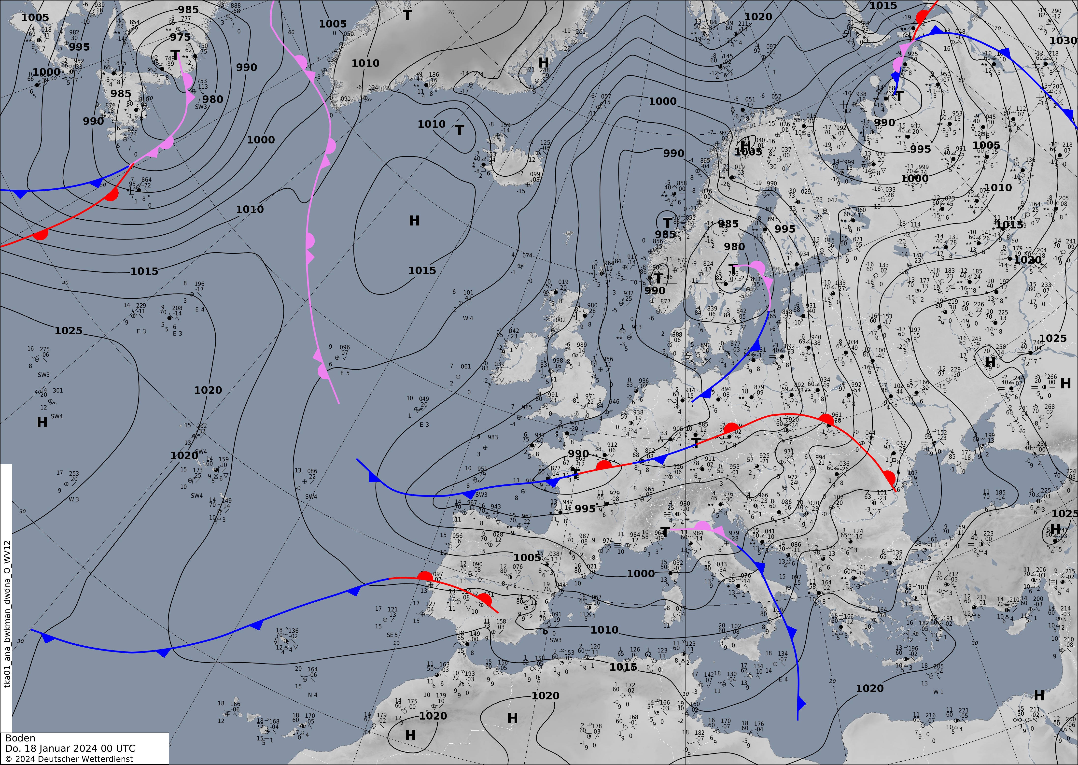
wetter3 (both), and sea surface pressure with the analyzed fronts over Europe (lower row), 17.01.2024 00 UTC - 18.01.2024 12 UTC, source:
DWD
|
 |
 |
 |
 |
 |
 |
 |
 |
 |
 |
 |
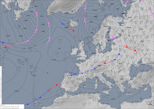 |
On Tuesday, January 16, 2024, a shallow surface low developed over the Bay of Biscay. On the night of January 17, 2024, the surface low moved northeastwards expanding into Central Europe. Ahead of the surface low, warm airmasses were advected northwards into Central Europe. Over Germany, these airmasses of subtropical origin met the cool and dry airmass residing over Central Europe, forming a distinct airmass boundary with temperature gradients in 850 hPa of up to 10 K. On January 17, 2024, the warm airmasses could advance northwards, reaching as far north as the line spanning from the Eifel Mountains, over Koblenz and Fulda to Thuringia.
|
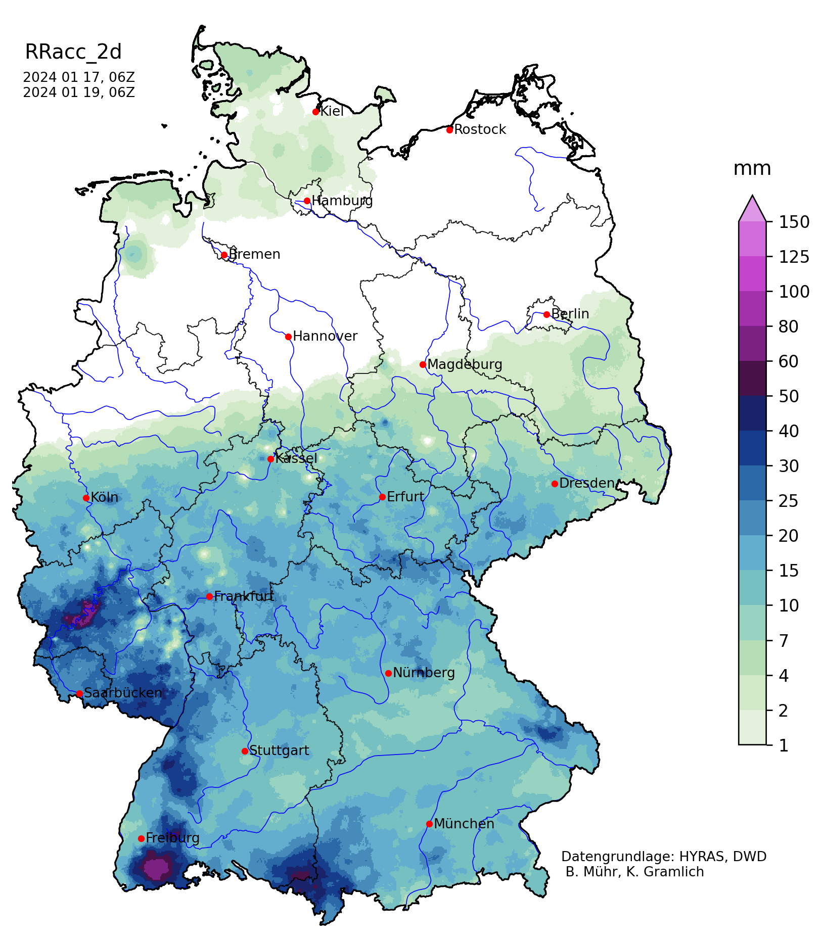
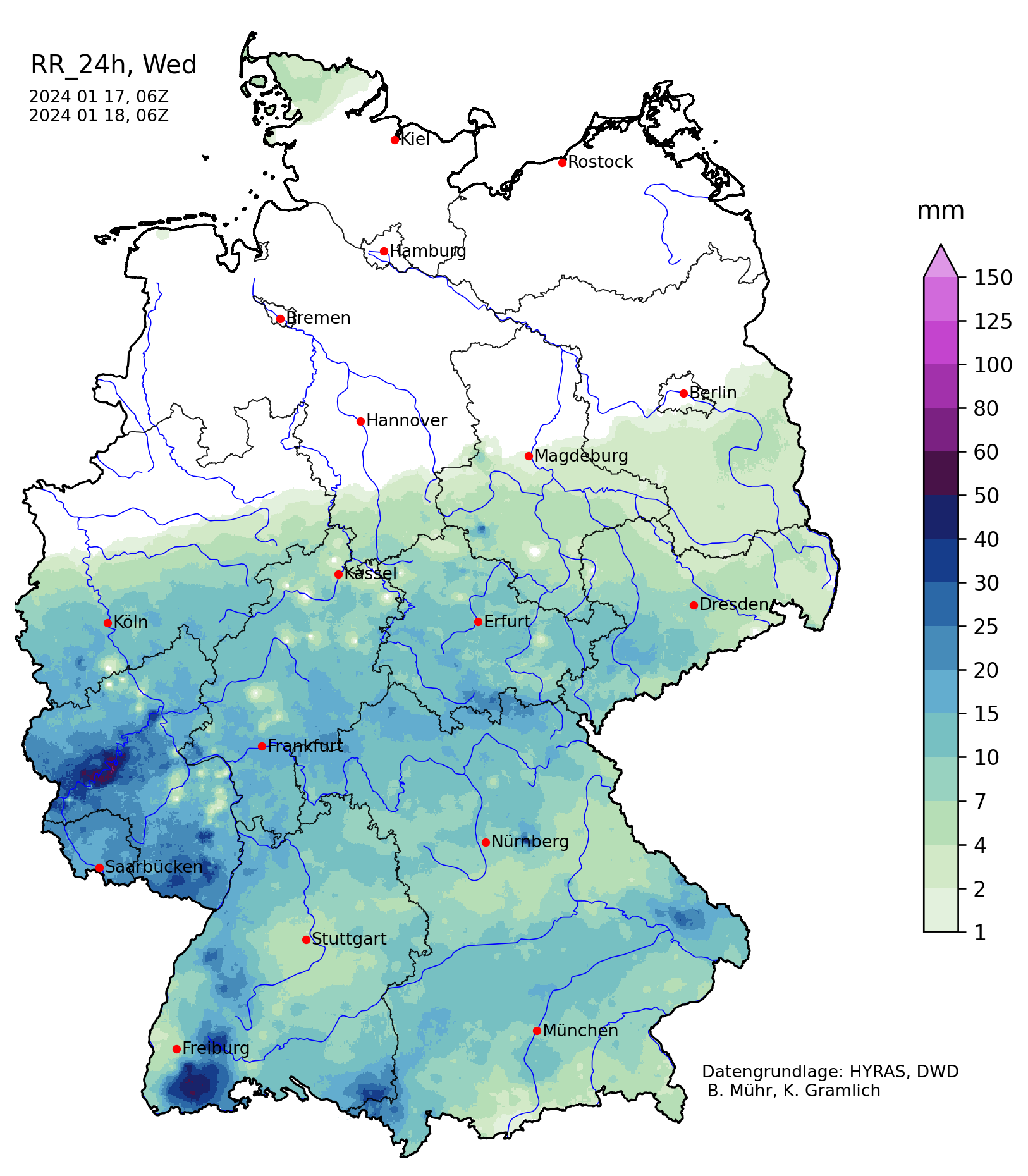
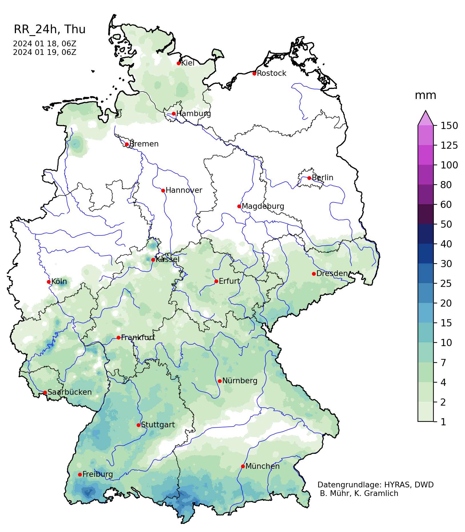
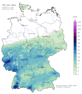
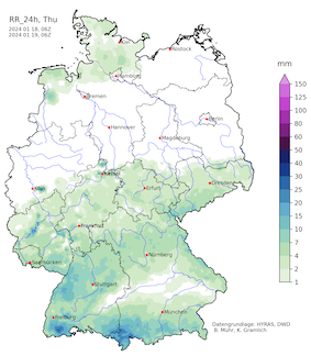
48 h precipitation, 17.01.2024 06 UTC - 19.01.2024 06 UTC (left), 24 h precipitation, 17.01.2024 06 UTC - 18.01.2024 06 UTC (middle), and 24 h precipitation, 18.01.2024 06 UTC - 19.01.2024 06 UTC (right) over Germany, source:
DWD, Visualization: K. Gramlich
|
 |
 |
 |
At different altitudes, the subtropical airmass could advance further northwards. Especially between 925 and 850 hPa, the warm airmass could penetrate furthest northwards. Atmospheric soundings from the afternoon of January 17, 2024, show an extreme temperature inversion near the surface close to the airmass boundary. Near the surface, the near-freezing temperatures could persist north of a line from Mannheim to Saarbrücken. South of the line from Mannheim to Saarbrücken, the warm airmasses could penetrate through to the surface, with the surface temperatures reaching nearly 15 °C. Above this shallow freezing layer, the subtropical airmass led to a temperature increase in 925 hPa to more than 10 °C. In this subtropical airmass, the freezing layer rose to up to 3000 m.
|
Freezing rain and ice coating at Eggenstein-Leopoldshafen, 17.01.2024 12 UTC, source: F. Siegmann
|
 |
 |
This broad layer of plus-zero temperatures led to the melting of all precipitation in this region. Near the surface, the melted rain could freeze again upon impact to the surface. Especially, in the central part of Rhineland-Palatine persistent freezing rain was observed as the airmass boundary remained nearly stationary over the central part of Germany. North of the line of the Ahr and Sieg River, the warm airmasses could not penetrate further for the precipitation to melt. As a result, persistent snowfall was observed even at lowest elevations. Within a 24 h period, fresh snow accumulations of more than 20 cm were observed, which is fairly uncommon in this region of Germany at low elevations. The highest snow totals were observed in the Rothaar Mountains with snow depths of up to 34 cm at Netphen, HE.
|
Deep snow and ice accumulation in the region around Koblenz, 19.01.2024, source: K. Gramlich
|
 |
 |
 |
 |
On January 18, 2024, the airmass boundary pushed slowly southward. In a corridor from the Eifel mountains to Mannheim, fresh snow accumulations of around 10 cm were observed within a few hours. Combined with the freezing rain of the previous day, the heavy snowfall caused treacherous traveling conditions. Many roads were unable to be plowed from the snow due to substantial ice cover underneath. Along major north-south connections, traffic came to a complete hold as the roads became impassible through the hilly terrain of Central Germany. Snow accumulations were significantly lower south of Mannheim.
With the snow cover persisting until January 22, 2024, an unusually wintery weather episode caught large parts of the Rhine Valley, which is otherwise renowned for very limited snow cover in the winter months. Due to clear weather in the days following the event, a rare snow belt over Central Europe could be observed on satellite imagery, stretching along the coast of Northern France along the English Channel into Central Germany and further east into Poland and Czechia.
Text: KG
January 28, 2024
|