|
An episode of unusually wintery weather impacted large parts of Europe in the third week of November 2024. Most notably, the low-pressure system Renate brought abundant snowfall to a large stretch in Central Europe, reaching from the Bretagne into Bavaria with fresh snow accumulations of more than 20 cm at lower elevations.
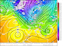
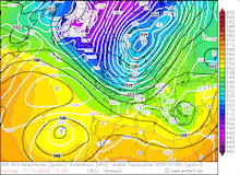
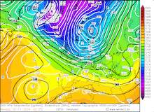
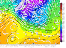
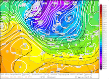
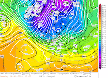
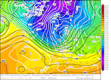
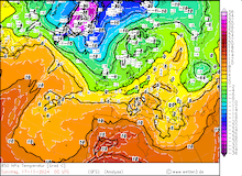
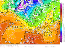
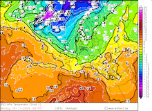
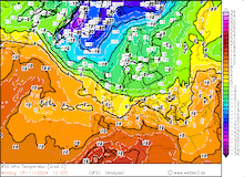
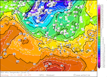
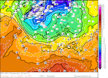
In the first half of November 2024, the weather in Europe was dominated by strong ridges. By mid-November, a significant outbreak of Arctic airmasses over the North Atlantic led to the development of a strong low-pressure system over Scandinavia. At the back side of said low-pressure system, cold airmasses could reach far southwards into Continental Europe. By November 17, 2024, the 850 hPa temperatures dropped below the freezing mark. On November 18, 2024, a secondary low-pressure development occurred over the Northern Atlantic.
|
Development of the 500 hPa geopotential, 1000 hPa to 500 hPa thickness, and sea-surface pressure over Europe, 17.11.2024 00 UTC - 20.11.2024 12 UTC, source:
wetter3.de
|
 |
 |
 |
 |
 |
 |
 |
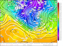 |
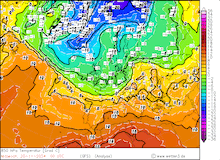
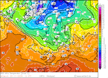
Initially, NWP models suggested that the low Quiteria could develop into a major winter storm. As forecasted, the low rapidly deepened as it moved across the British Isles and into Central Europe on November 18 and 19, 2024. On November 20, 2024, the core pressure of low Quiteria dropped below 970 hPa over the Baltic Sea. Even though the core pressure of the low-pressure system was remarkably low, no major windstorm occurred over Central Europe. Unlike most winter storms, coastal areas along the North and Baltic Sea did not record the highest wind gusts. This was due to the southerly track of low Quiteria which moved across the Northern German Lowlands. Near the center of the low Quiteria, the combination of the approaching cold airmasses and heavy precipitation created a narrow stretch of heavy snowfall. Throughout November 19, 2024, fresh snow accumulations of up to 5 cm were observed.
|
Development of the 850 hPa temperature over Europe, 17.11.2024 00 UTC - 20.11.2024 12 UTC, source:
wetter3.de
|
 |
 |
 |
 |
 |
 |
 |
 |
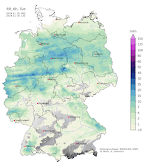
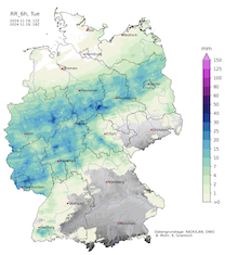
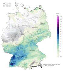
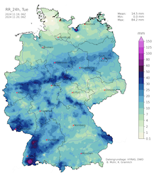
South of the low-pressure system, a strong cold front developed. Throughout the day, the cold front moved southeastwards across Germany. With the cold front, a distinct wind maximum was observed. At lower elevations, wind gusts of 80 kph were reported. At higher elevations, hurricane-force wind gusts were observed. At the Brocken Mountain in Northern Germany, a wind gust of 143 kph was recorded. Further east, the observatory at the Schneekoppe mountain in the Giant Mountains recorded a peak wind gust of 168.5 kph. Besides the high winds, heavy precipitation occurred over Germany. Daily precipitation totals reached up to 88.9 mm in the Southern Black Forest at Utzenfeld, BW.
|
6-hourly precipitation totals over Germany showing the development of the cold front of low Quiteria on November 19, 2024, 06 - 12 UTC (left), 12 - 18 UTC (center left), 18 - 00 UTC (center right), and daily precipitation total on November 20, 2024 (right), source:
Wettergefahren-Frühwarnung
|
 |
 |
 |
 |
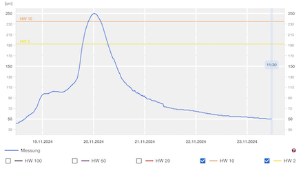
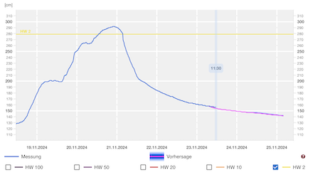
Due to the heavy rains of low Quiteria, the river levels of minor rivers in Rhineland-Palatine and North Rhine-Westphalia quickly rose. In the Palatine Forest, the Auerbach River at the measuring gauge Oberauerbach reached a 10-year flood early on November 20, 2024. The region already experienced a 100-year flood in May after heavy rains dumped more than 100 mm in 24 h. Behind the cold front of low Quiteria, the very cold air masses created an unstable environment in which repeated showers could form. These showers brought at times heavy snowfall. Along northwestwards-facing flanks, fresh snow accumulations of up to 20 cm were observed at elevations above 500 m. In Northern Germany, a particularly strong shower street moved onshore from the North Sea on November 22, 2024. These showers created treacherous traveling conditions along the A7 corridor south of Flensburg, SH. Within a few hours, fresh snow accumulations of up to 15 cm were reported at Schleswig, SH.
|
River level of the Auerbach River at Oberauerbach (left) and the Schwarzbach River at Contwig (right), source:
Hochwasser RLP
|
 |
 |
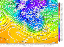
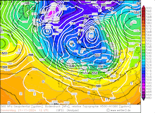
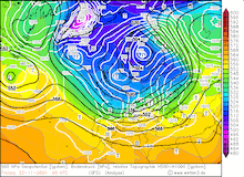
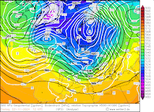
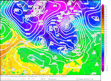
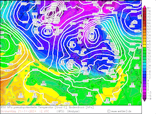
Behind the cold front of low Quiteria, the snow line dropped to elevations of around 500 m. Due to the advection of very cold air masses over the Northern Atlantic, another secondary low-pressure system developed at the boundary between polar and subtropical air masses. Along the boundary, an 850 hPa temperature gradient of up to 15 K matured over the Northern Atlantic. Along said boundary, low Renate quickly moved eastwards into Central Europe. Here, the low brought unusually and unseasonably strong snow accumulations to large parts of France, Germany, and Switzerland. Even at low elevations, significant fresh snow accumulations of 20 cm occurred within a few hours.
|
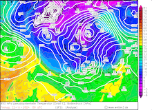
Development of the 500 hPa geopotential, 1000 hPa to 500 hPa thickness, and sea-surface pressure (upper row) and the development of the 850 hPa pseudo-potential temperature and sea-surface pressure (lower row) over Europe, 21.11.2024 00 UTC - 22.11.2024 12 UTC, source:
wetter3.de
|
 |
 |
 |
 |
 |
 |
 |
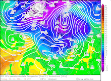 |
Most often, the warm front of a low-pressure system leads to a substantial increase in the snow line behind the warm front. For low Renate, the weaker development rate meant that the intensity of the low was much lower. As a result, the warm front of low Renate could not clear the near-surface cold air masses. With unseasonably cool 850 hPa temperatures of -7 °C, most of the precipitation of low Renate could precipitate as snow. On November 21, 2024, heavy snowfall was observed in a stretch from Rennes over Paris into the Vogese Mountains. In the afternoon hours, the northern suburbs of Paris reported snow depths of up to 20 cm.
|
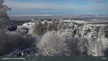
Snow-covered Upper Rhine valley seen from the Schauinsland Mountain, 23.11.2024 10:45 UTC (left) and snow-covered Allgäu seen from the Grünten Mountain, 22.11.2024 09:15 UTC (right), source:
Feratel AG
|
 |
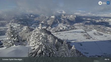 |
In the evening hours, the heavy snowfall of low Renate shifted eastwards into the southernmost part of Germany and the Western Alps. During the evening, hourly fresh snow accumulations of multiple centimeters were reported. By the morning of November 22, 2024, weather stations along the Upper Rhine reported snow depths of more than 20 cm. Near Basel, snow depths of up to 28 cm were observed at Riehen. Some measuring sites reported their highest daily fresh snow accumulation recorded in November. Further east in the Allgäu, fresh snow accumulations of more than 30 cm were observed. In the Western Alps, daily fresh snow accumulations of up to 50 cm were reported.
Due to the abundant fresh snow accumulations, treacherous traveling conditions impacted the southernmost of Germany and Switzerland. With a strong low-pressure system over the Atlantic, a large swell of subtropical airmasses quickly ended the wintery weather episode in Central Europe on November 23, 2024.
Text: KG
November 24, 2024
|


