|
Multiple low-pressure systems induced heavy precipitation over Germany. Low Katinka brought the heaviest precipitation to parts of Western Germany, with 24 h precipitation totals of more than 100 mm. The heavy rains led to severe flooding along the Saar River and rivers feeding into the Saar River. At Fremersdorf, the worst flooding since 1947 was observed.
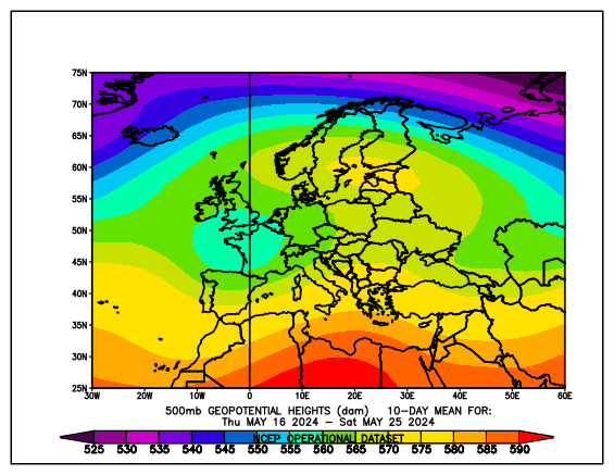
After a very wet start to the year, especially in the western half of Germany, the first half of May continued that trend in the western half of Germany. In large areas of Rhineland-Palatine and Saarland, a large fraction of the average monthly precipitation was observed in the first half of the month. By the end of the first decade in May, a distinct omega weather pattern developed. The Ascension Day weekend was dominated by warm and fair weather conditions as the ridge of the Omega pattern was situated over Central Europe.
|
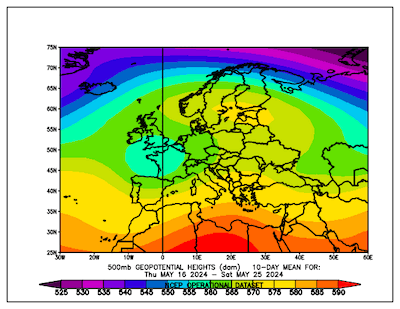
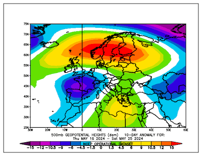
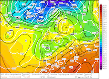
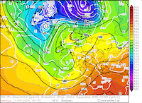
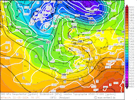
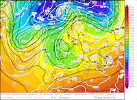
Averaged 500 hPa geopotential (left) and 500 hPa geopotential anomaly (right) over Europe, 16.05.2024 - 25.05.2024, source:
PSL NOAA
|
 |
 |
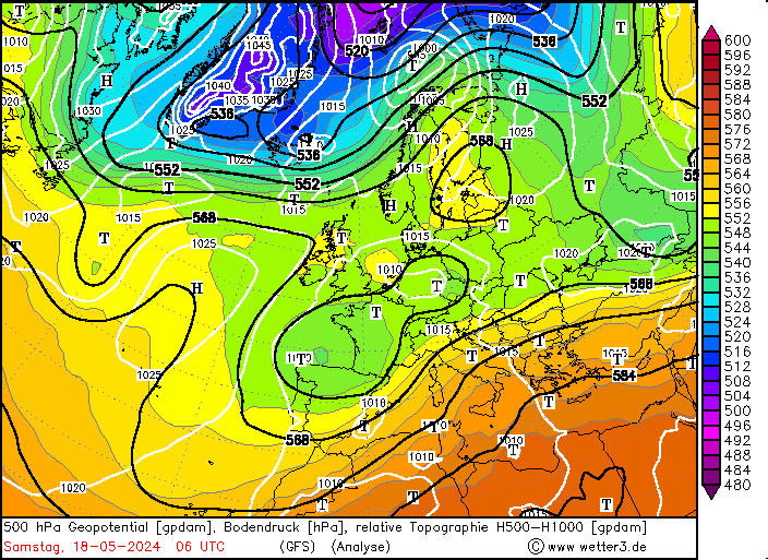
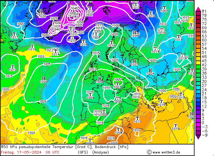
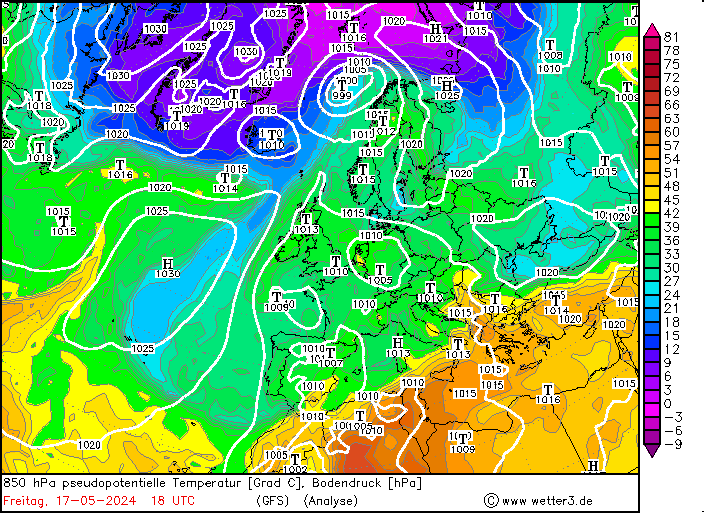
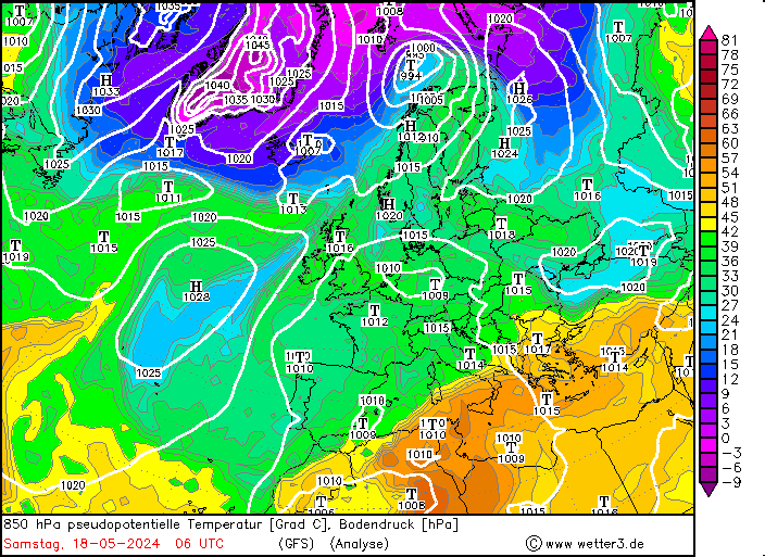
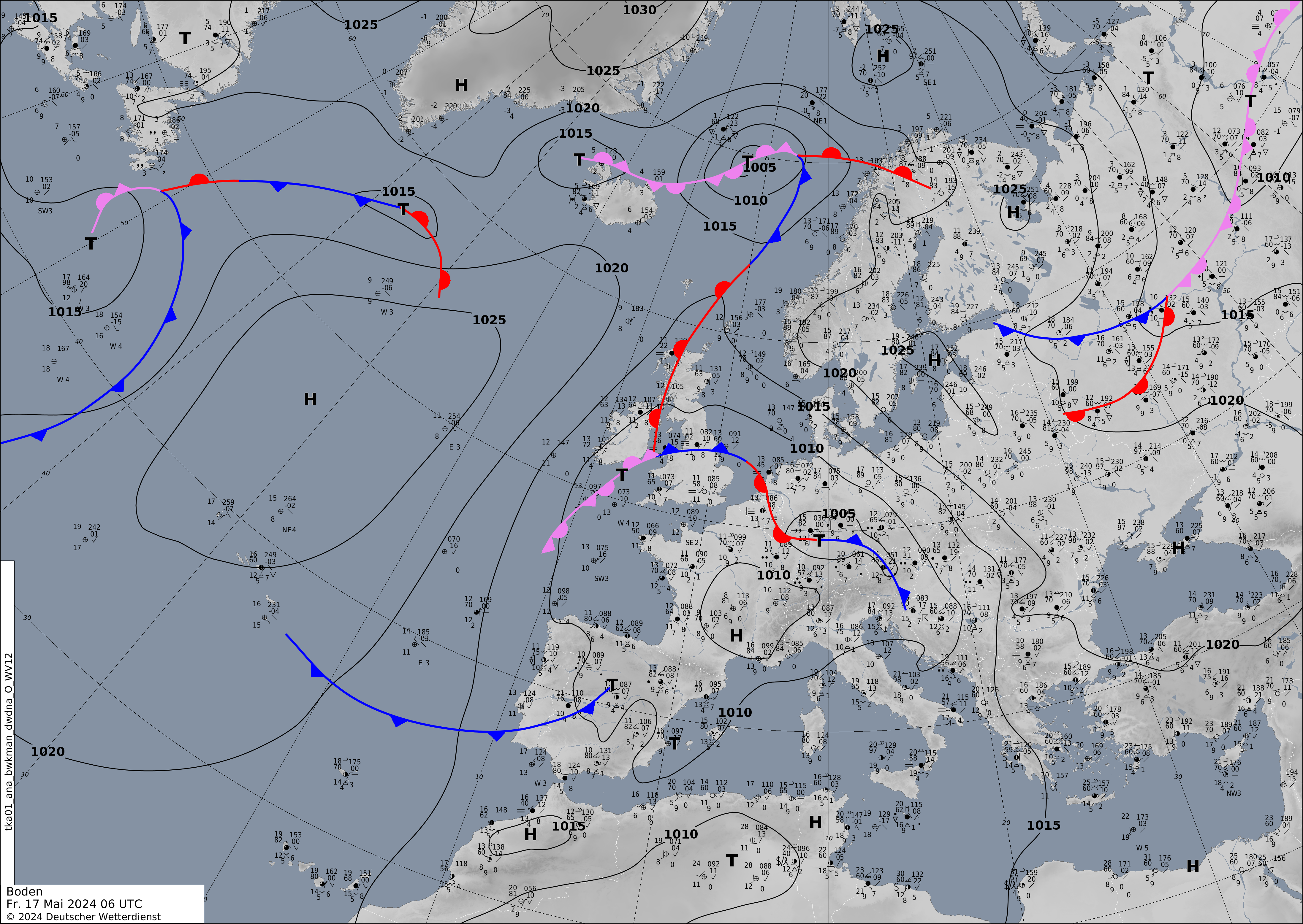
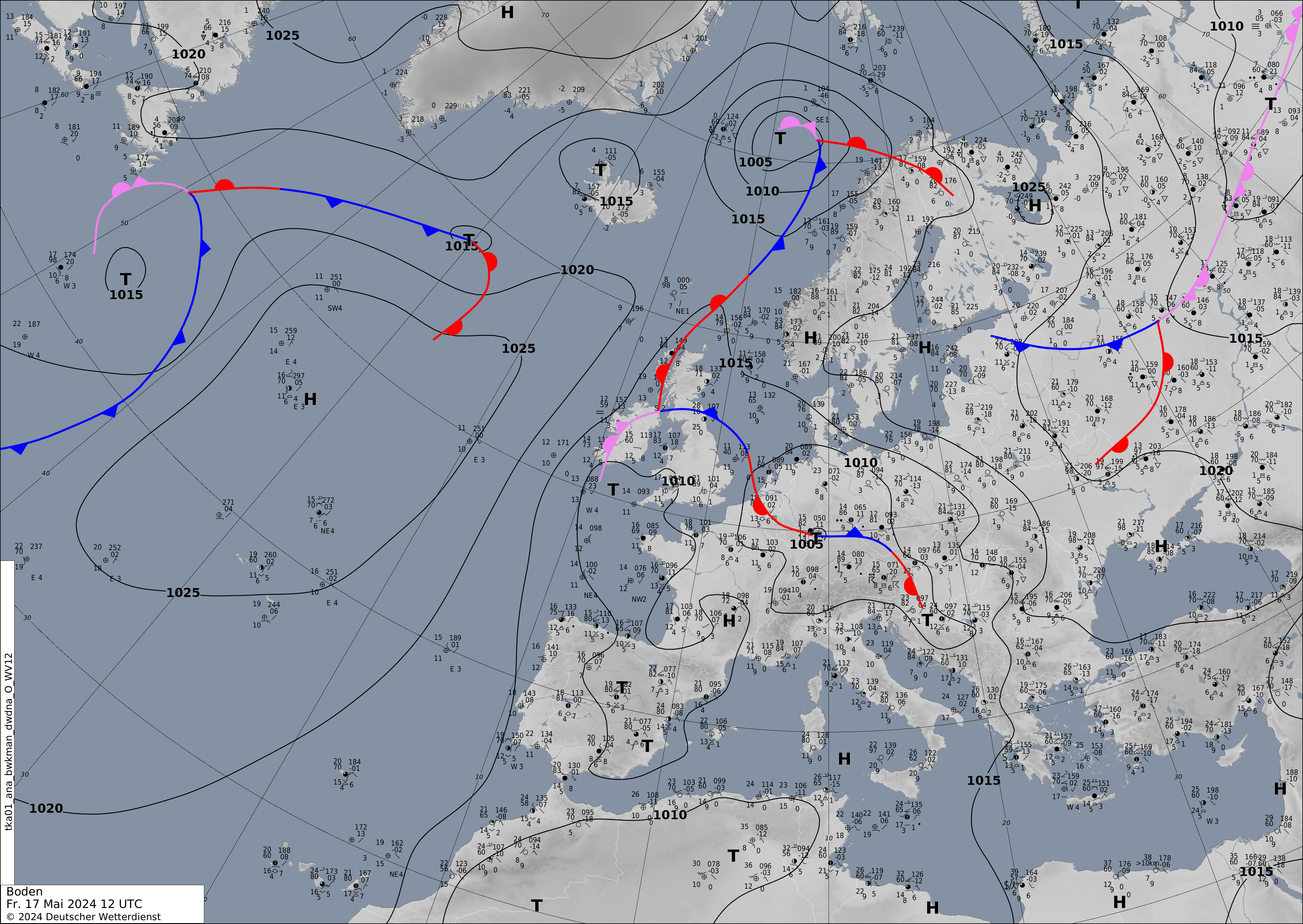
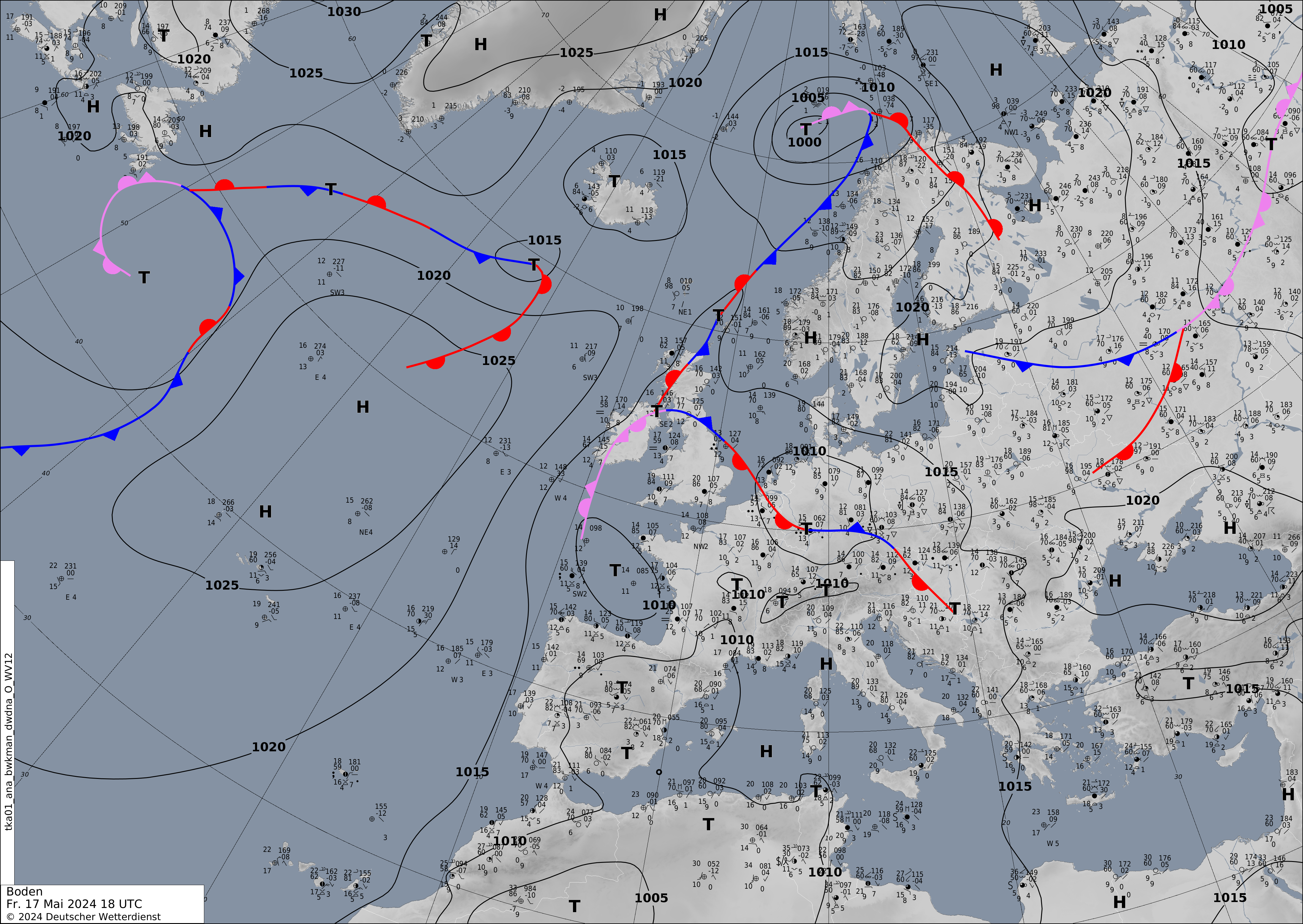
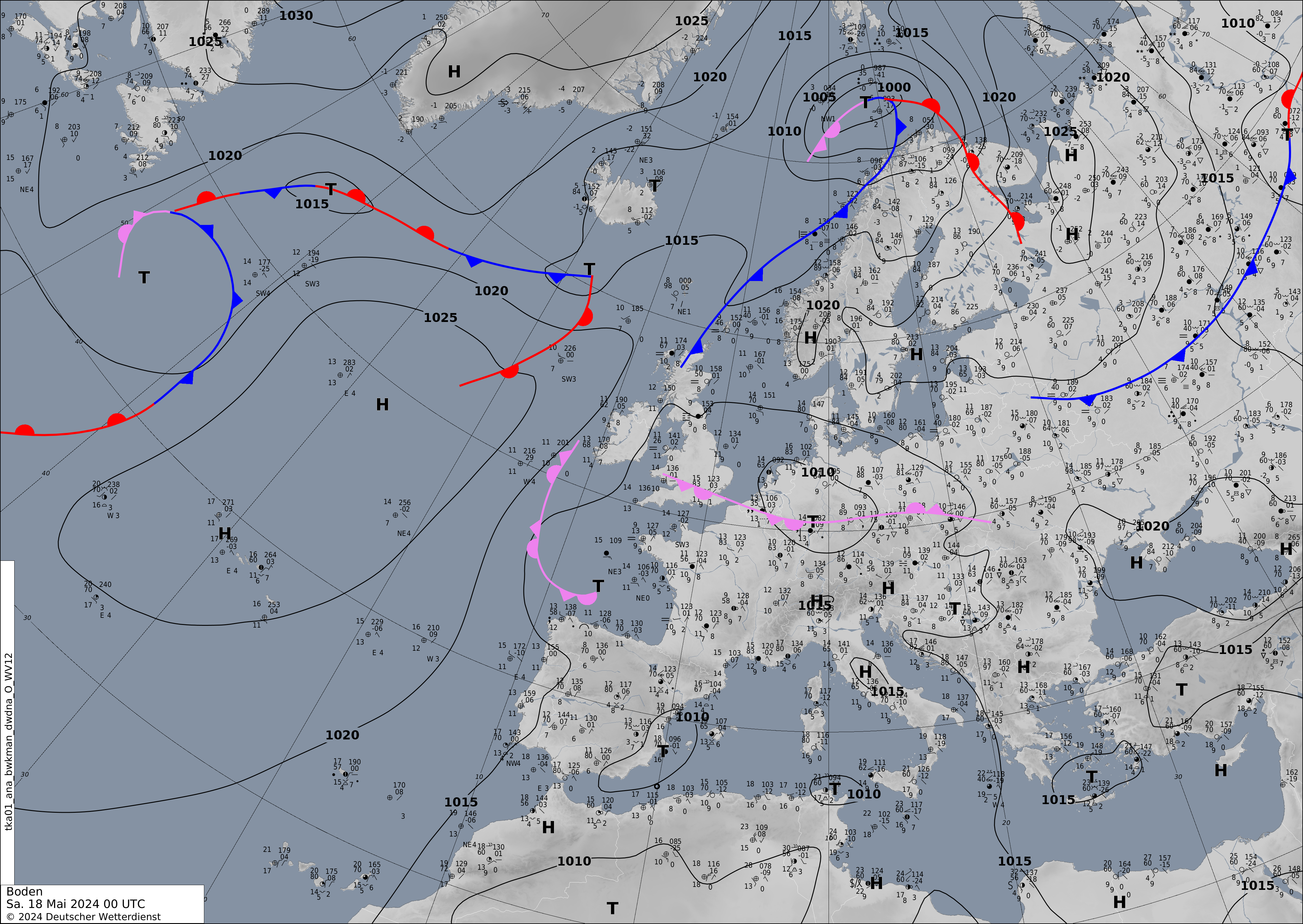
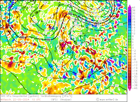
After the weekend, the entire weather pattern shifted eastwards, resulting in a synoptic situation with the westerly trough being situated over the British Isles and the ridge being located over Eastern Europe. Ahead of the trough over the British Isles, warm and moist air masses were advected into Central Europe. Since May 17, 2024, multiple low-pressure systems developed over Southern Germany downstream off the Alps, slowly moving northwards on different trajectories over the central part of Germany.
|
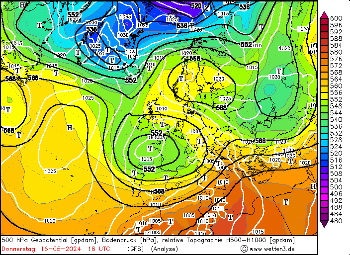
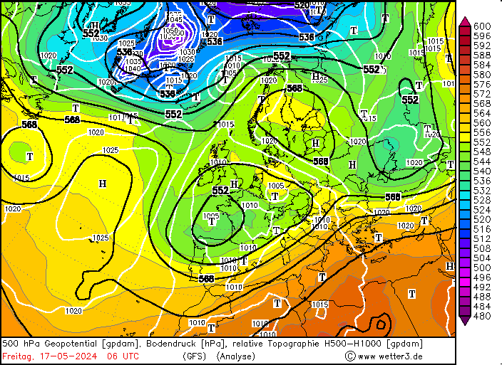
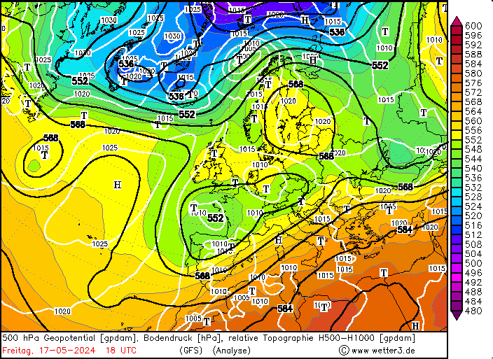
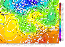
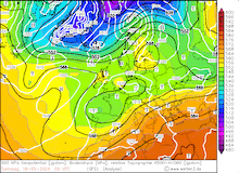
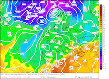
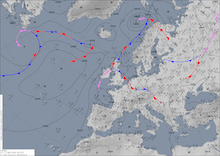
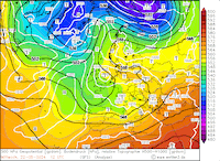
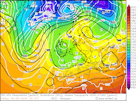
500 hPa geopotential and mean sea level pressure (upper row), 850 hPa pseudo-potential temperature (middle row) over Europe, 16.05.2024 18 UTC - 18.05.2024 06 UTC, , source:
wetter3.de
and mean sea level pressure and analyzed fronts over Europe (lower row), 17.05.2024 06 UTC - 18.05.2024 00 UTC, source:
DWD
|
 |
 |
 |
 |
 |
 |
 |
 |
 |
 |
 |
 |
On May 16, 2024, the conditions ahead of the trough over the British Isles were favorable for severe convective activity to develop over Southern Germany. Especially over the Swabian Jura, which is notorious for its severe convective activity, strong thunderstorms developed. Near the city of Reutlingen, a particularly strong cell developed, bringing large hail and larger hail accumulations. The largest hailstones had diameters of more than 3 cm, resulting in damage to crops.
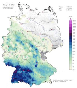
In the night from May 16, 2024, to May 17, 2024, the surface low Katinka developed north of the Alps. From there, the surface low slowly moved northwards across the state of Baden-Württemberg. From these thunderstorms which developed in the afternoon hours of May 16, 2024, combined with the mid-level lifting induced by the developing surface low, a broad area of heavy continuous rains developed. Together with the surface low, these rains slowly moved northwestwards across Southern Germany. By late evening on May 16, 2024, these rains reached the city of Karlsruhe. Until 06 UTC, more than 50 mm of rain was observed in the city.
|
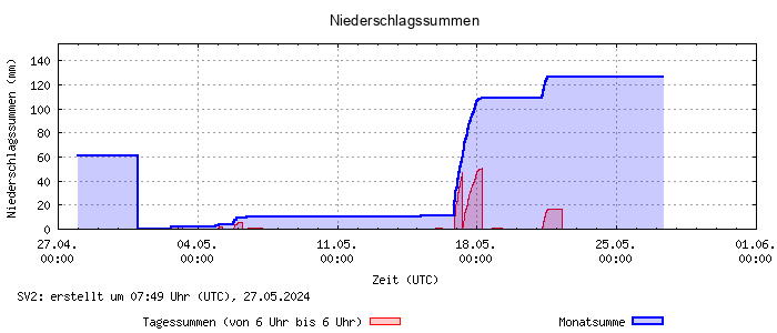
Daily precipitation totals at the weather station atop of the physics high-rise building at the KIT South Campus in Karlsruhe, 27.04.2024 - 27.05.2024, source:
IMK-TRO
|
 |
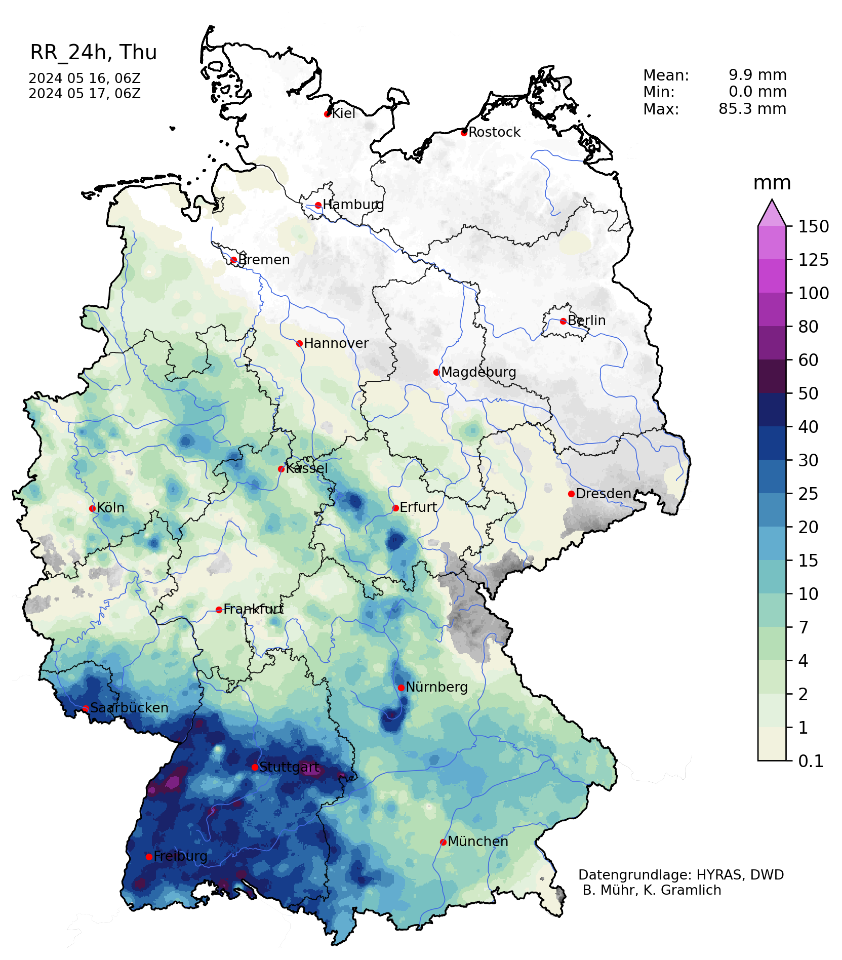
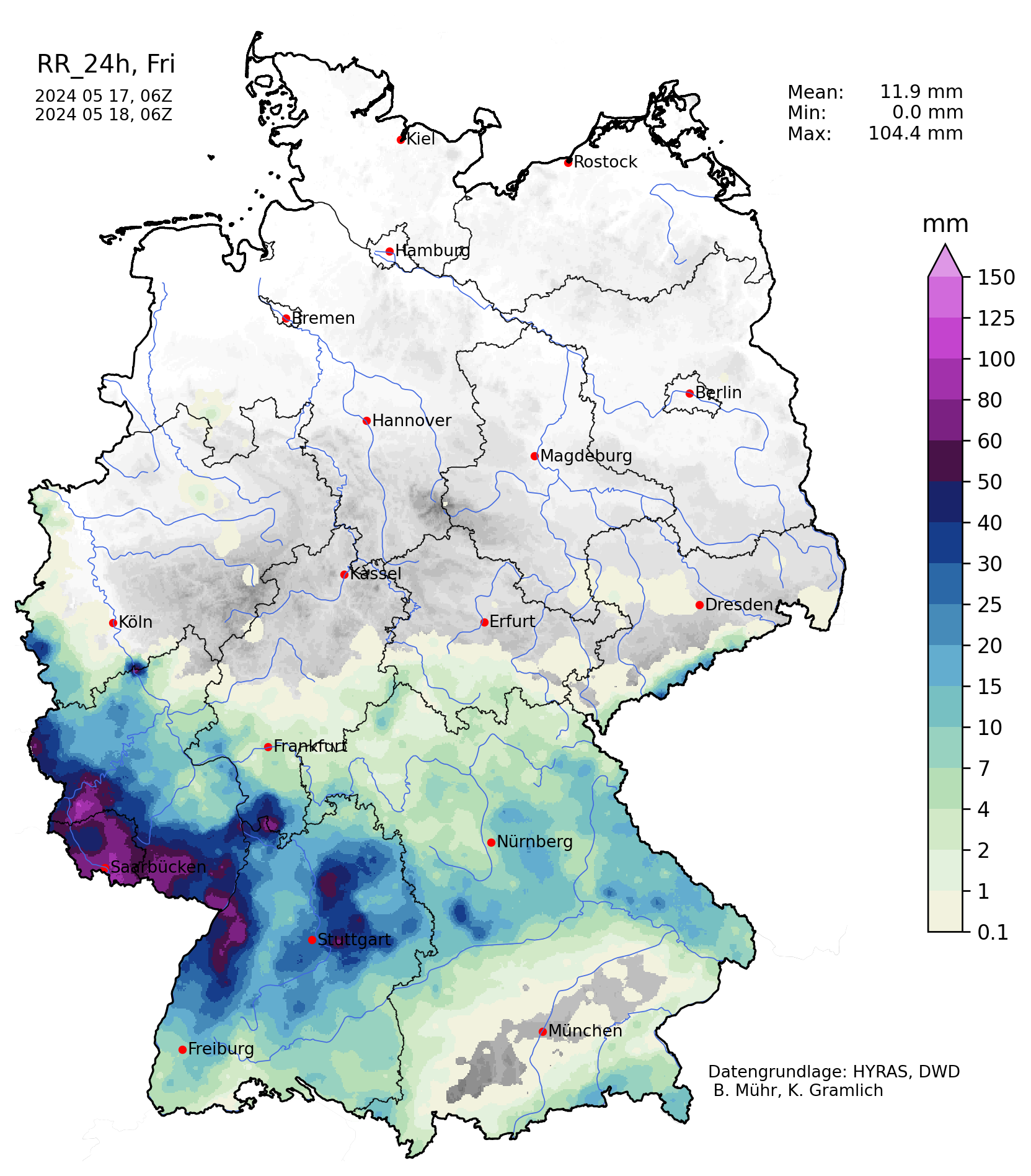
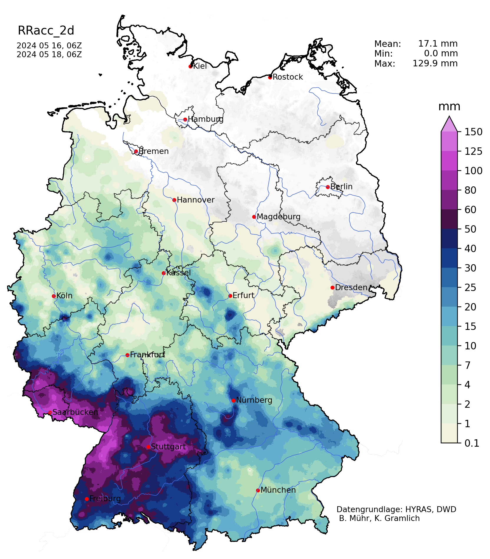
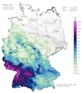
Early on May 17, 2024, the pressure minimum of surface low Katinka shifted into Rhineland-Palatine. South of the pressure minimum, the heaviest rains were observed in the state of Saarland and the Palatine region as well as the neighboring regions across the French border. In said region throughout the day, hourly precipitation rates of more than 7 mm were observed. Within a 24 h-period, widespread precipitation totals of more than 100 mm were observed. As the rains occurred, throughout the night and continued the next day, the daily precipitation totals were not as high, because the deadline for the daily precipitation of a day is 06 UTC on the following day. The highest accumulation on May 16, 2024, and May 17, 2024, combined was observed in the Southern Palatine region at town Schweix with a 48 h-precipitation total of 119.6 mm.
|
Accumlated over Germany on 16.05.2024 (left), 17.05.2024 (middle) and 2-day accumulated precipitation over Germany, 17.05.2024 (right), source:
Wettergefahren-Frühwarnung
|
 |
 |
 |
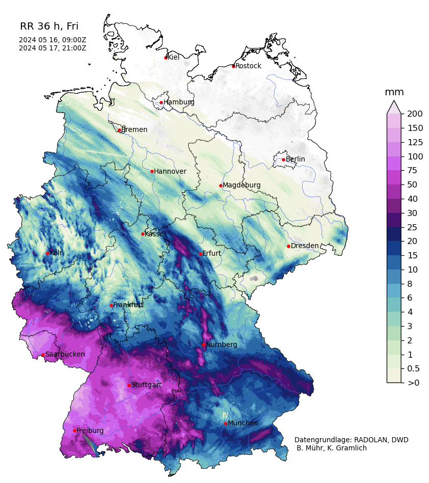
As a result of the very wet weather conditions leading up to the heavy rains induced by low Katinka, the soils in the western half of Germany were already close to saturation. This meant that most of the precipitation quickly found its way into smaller streams in this hilly terrain of Western Germany. By midday, May 17, 2024, the river levels of many minor rivers in the state of Saarland and the Palatine region quickly rose as the heavy rains continued. By the afternoon of May 17, 2024, some minor rivers in the Southern Palatine region already reached 100-year flood levels. As a result, widespread residential flooding was observed. By evening, the precipitation rates slowly decreased, and the radar-indicated 36 h-precipitation totals of more than 100 mm were observed.
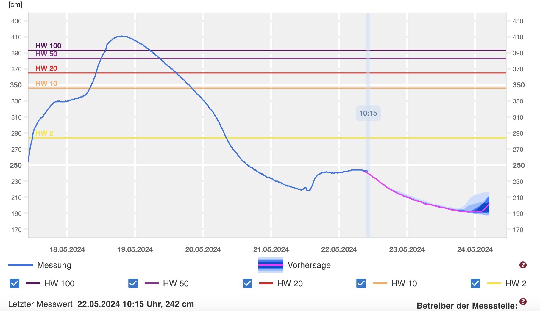
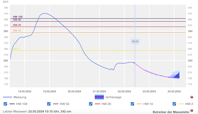
By 04 UTC, the rains in the state of Saarland and the Palatine finally ended. Along the rivers in the region, the water levels further rose as all the precipitation drained from the hilly terrain in the region. The most severe flooding was observed along the rivers Schwarzbach, Hornbach, and Auerbach in the Southern Palatine region. Along all these rivers the 100-year flood marks were surpassed by a considerable margin, albeit measuring errors may have occurred in times of exceptional river discharge. Widespread residential flooding was observed as the normally small creeks swollen to raging rivers.
|
River level of the Schwarzbach River at Contwig (upper left), Schwarzbach River at Thaleischweiler 2 (upper right), Hornbach River at Althornbach 2 (lower left), and Auerbach River at Oberauerbach (lower right), all seeing severe flooding, 17.05.2024 - 24.05.2024, source:
Hochwasser RLP
|
 |
 |
 |
 |
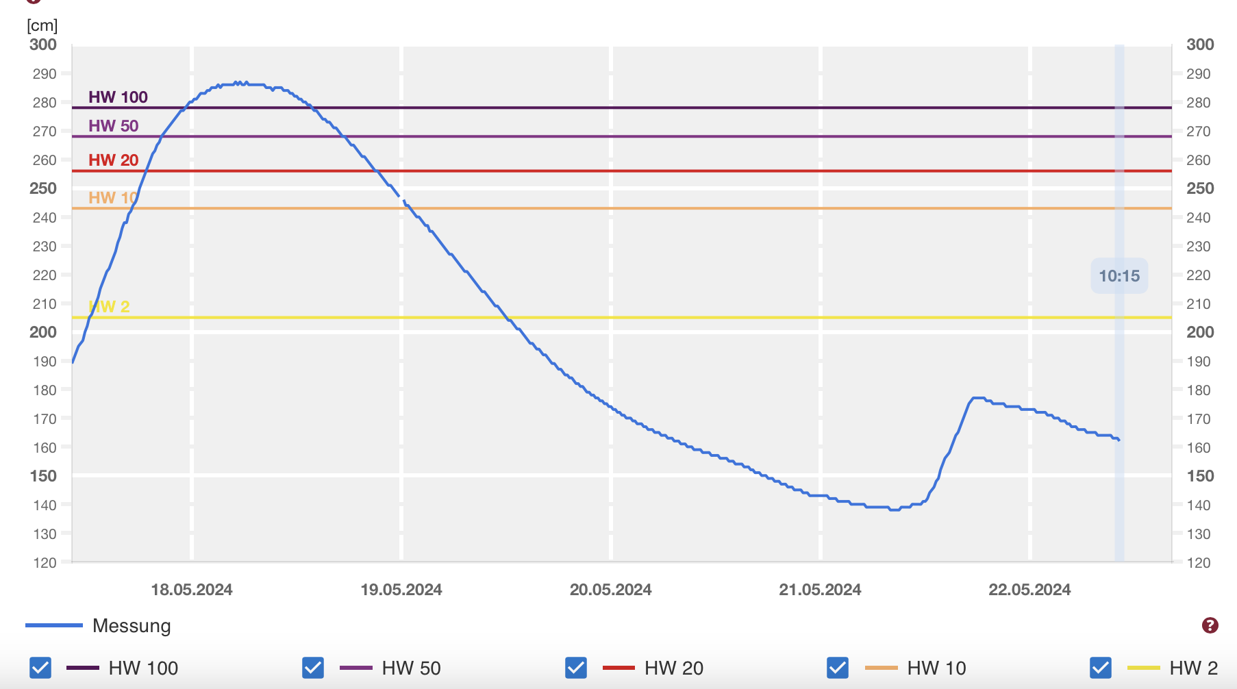
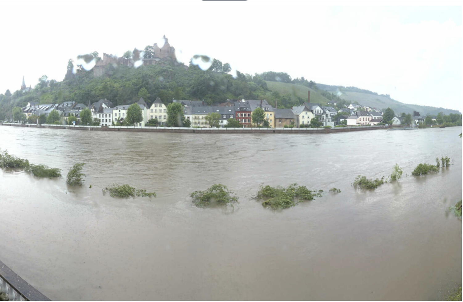
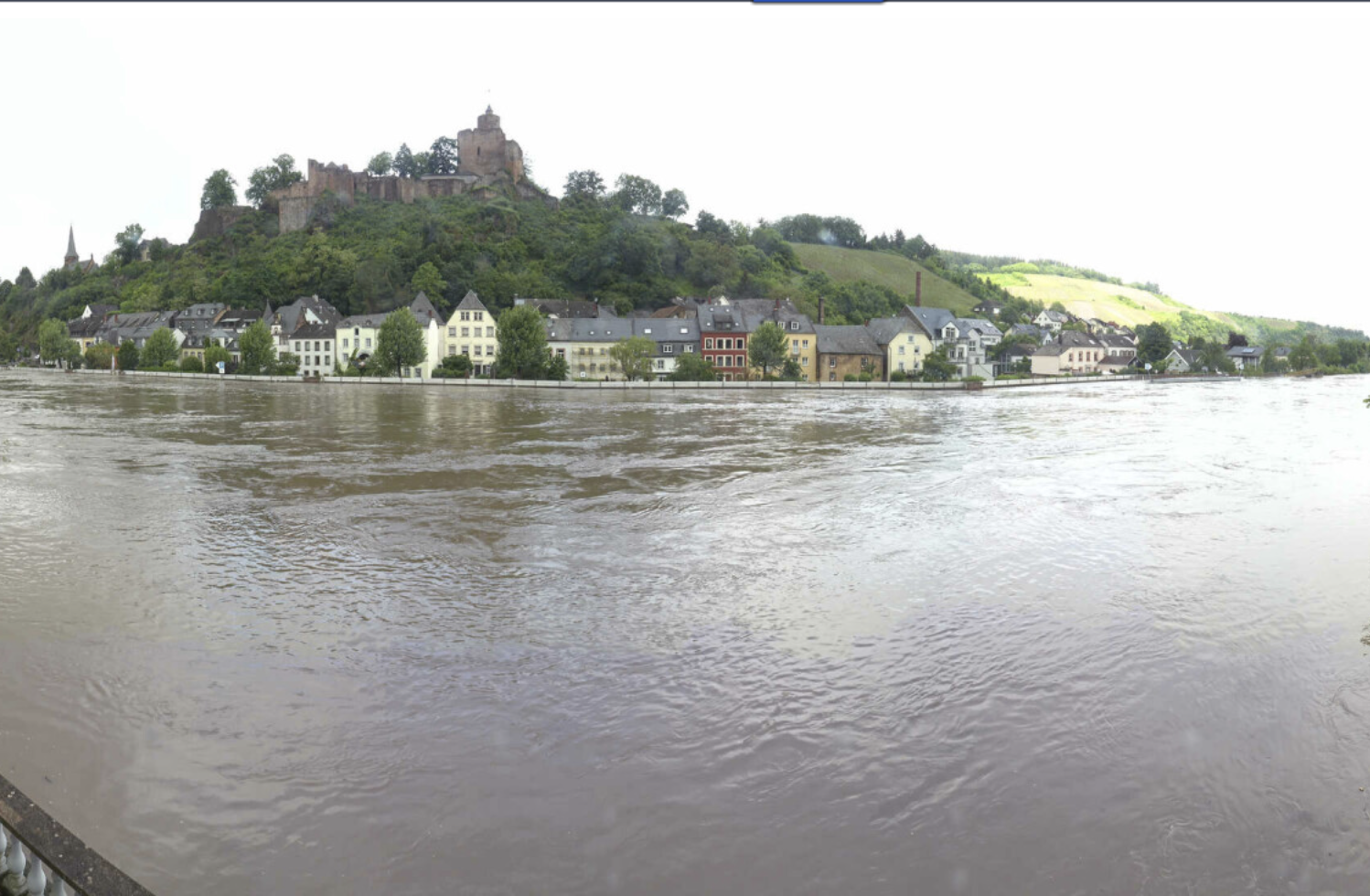
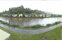
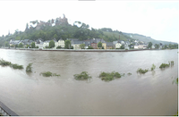
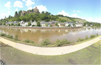
These rivers drain into the Saar, leading to severe river flooding in the Saar River. In Saarbrücken, the Saar River flooded the express highway close to the Saar River. A webcam along the Saar River captured how the Saar quickly rose on May 17, 2024, and flooding the river banks on May 18, 2024. Only on May 20, 2024, the Saar River at Saarburg was back below its banks.
Webcam pictures of the Saar River at Saarburg, 17.05.2024 12:15 UTC (left), 18.05.2024 11:00 UTC (middle left), 19.05.2024 12:00 UTC (middle right),
and 20.05.2024 12:45 UTC (right), source:
Feratel
|
 |
 |
 |
 |
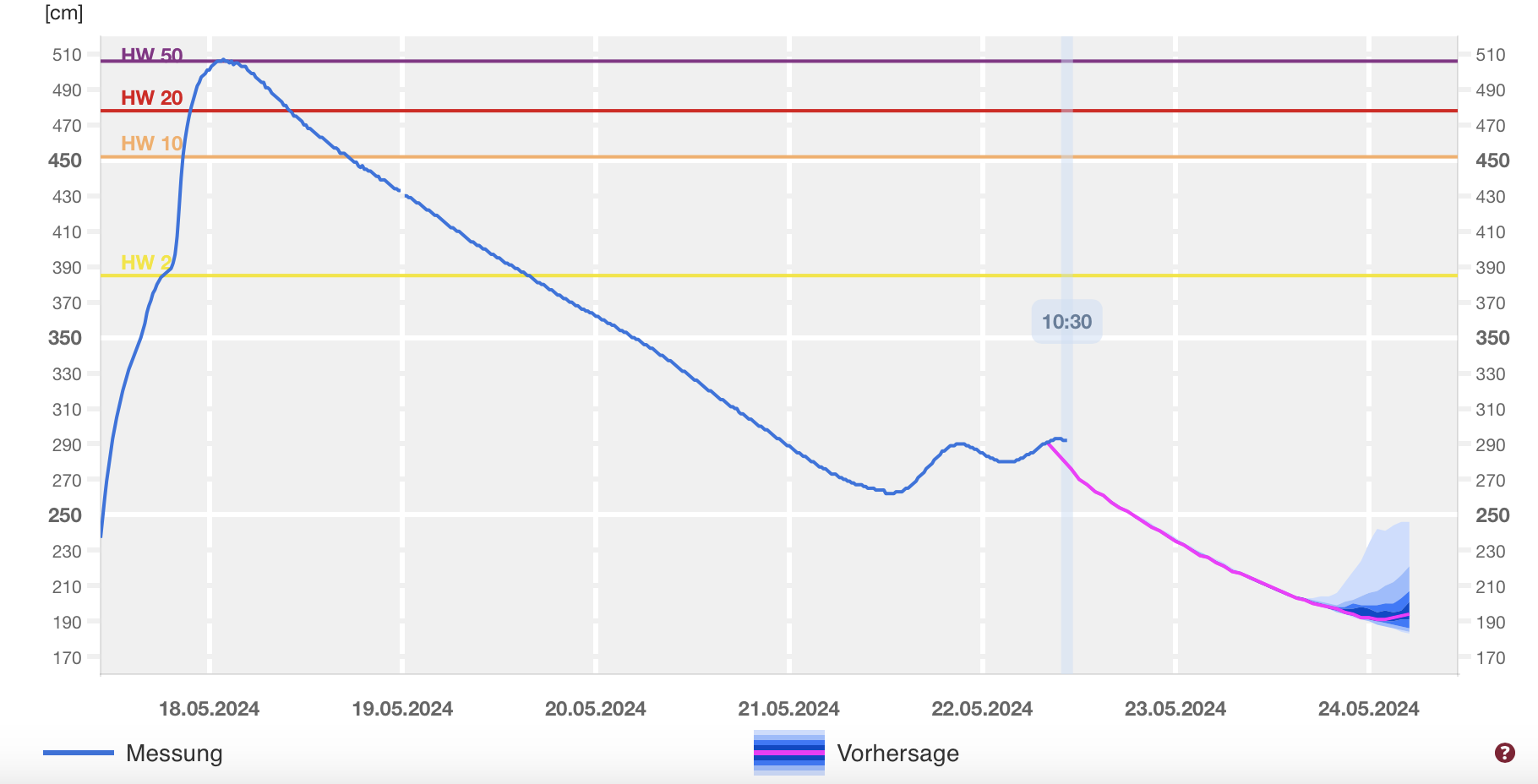
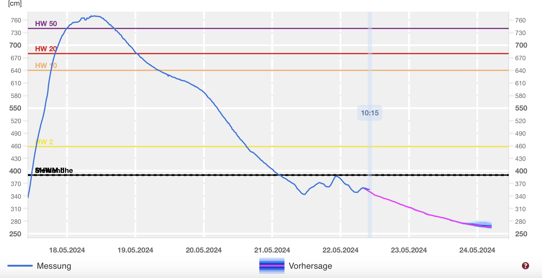
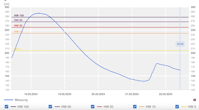
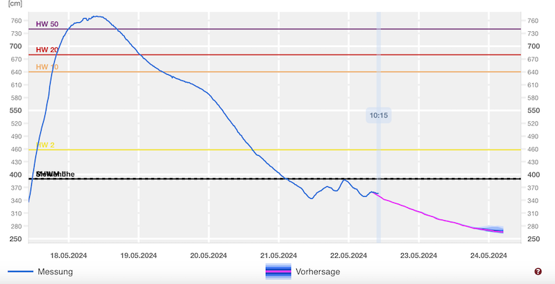
Further downstream, the river levels of the Saar River rose to dangerous heights as the Prims River discharged into the Saar River, draining large parts of the eastern half of the state of Saarland. With a river level of 770 cm at Fremersdorf, the highest river level of the Saar River since 1947 was observed. 26 cm higher than during the severe flooding event of December 1993.
|
River level of the Saar River at Fremersdorf with the highest river levels since 1947, 17.05.2024 - 24.05.2024, source:
Hochwasser RLP
|
 |
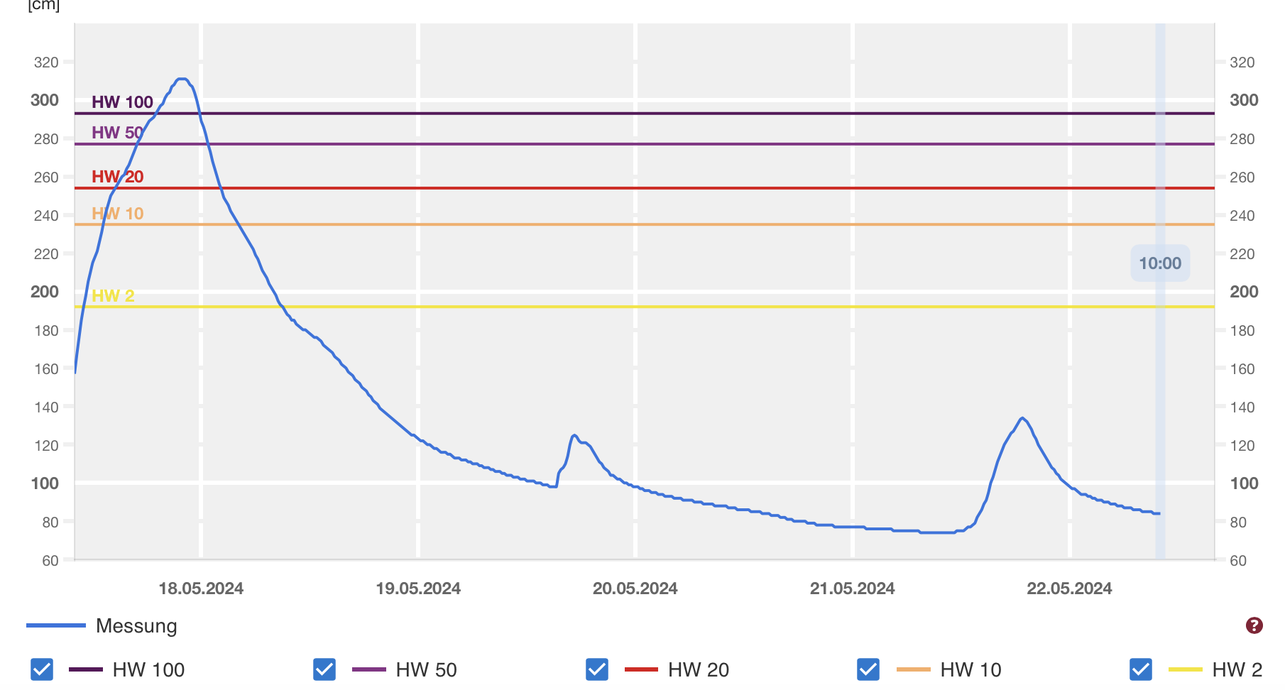
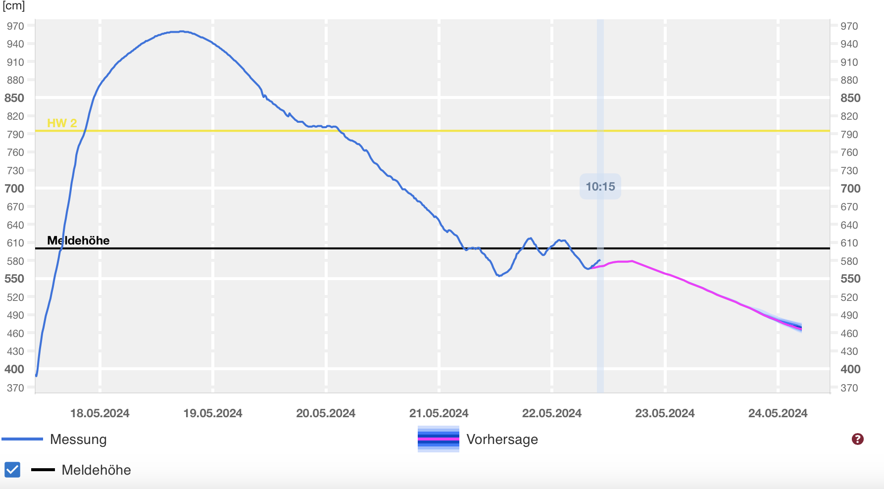
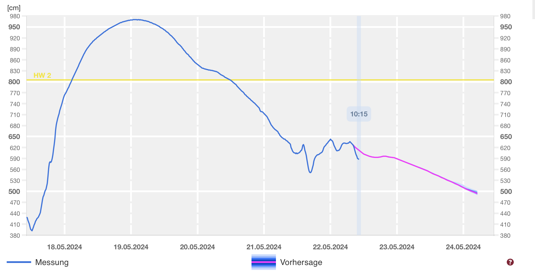
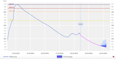
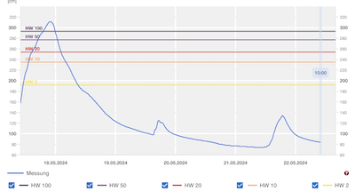
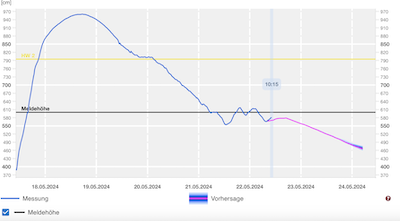
Along the Moselle River, a rare summer flood occurred, because of the heavy rains in France and the Saar River discharging into the Moselle River. Normally, most river flooding events occur during winter when a combination of heavy winter rains and snow melt cause high surface runoff. At the city of Trier, the Moselle reached more than 950 cm, below the 10-year-flood mark. Nevertheless, the river flooded many towns along the riverbanks during the Pentecost weekend on May 19, 2024, and May 20, 2024.
|
River level of the Moselle River at Trier (left) and at Zeltingen (right), 17.05.2024 - 24.05.2024, source:
Hochwasser RLP
|
 |
 |
As most of the surface-off from the heavy rains of low Katinka discharged into the Moselle River, at the mouth of the Moselle River, the discharge of Rhine and Moselle River were of similar magnitude. Under normal river flooding conditions, the discharge of the Rhine River in Koblenz is much higher than the discharge of the Moselle River. As a result, the Moselle River is normally backed up by the Rhine River. During this flooding event, however, the strong flow of the Moselle River could discharge freely its rust-brown water into the Rhine River. Pictures at the mouth of the Moselle River show how the rust-brown water from the Moselle River mixes with the dark-brown water of the Rhine River.
High river discharge of the Moselle River at Koblenz (left) and mixing of the waters of the Moselle (rust-brown) and Rhine River (dark brown) (right), 19.05.2024,
source:
K. Gramlich
|
 |
 |
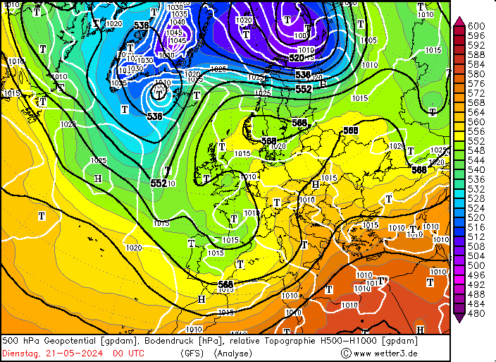
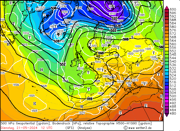
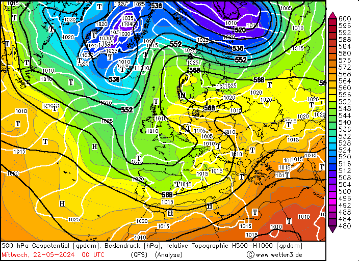
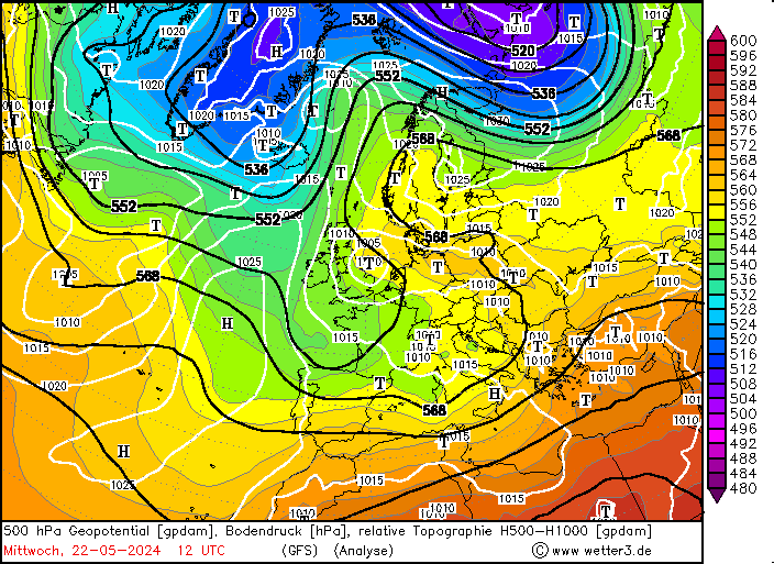
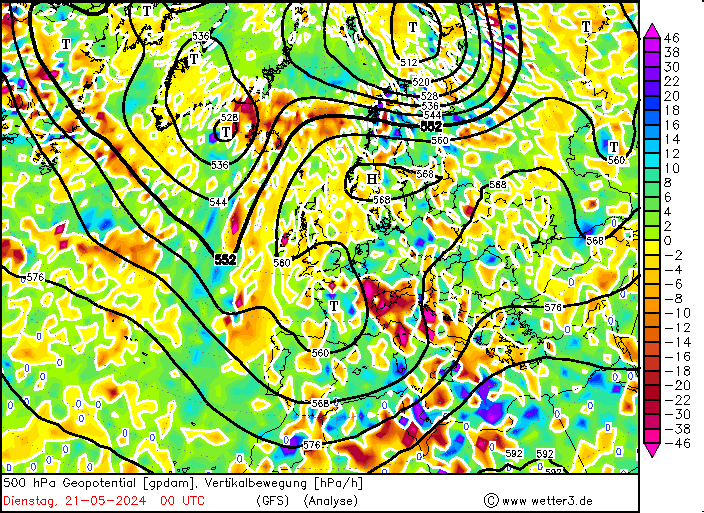
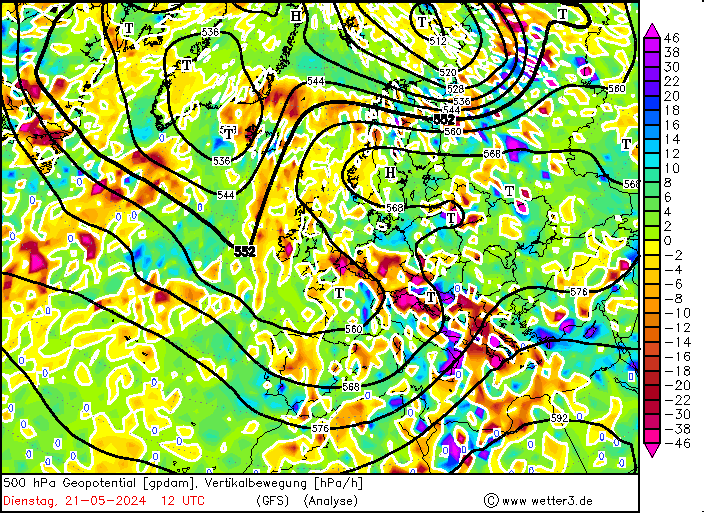
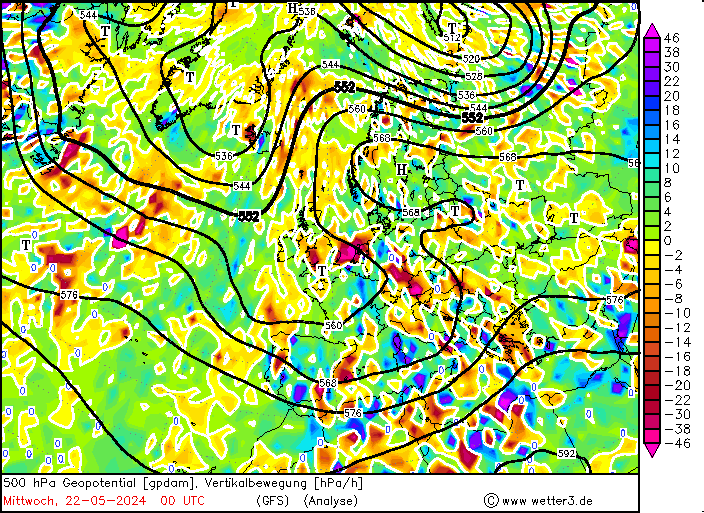
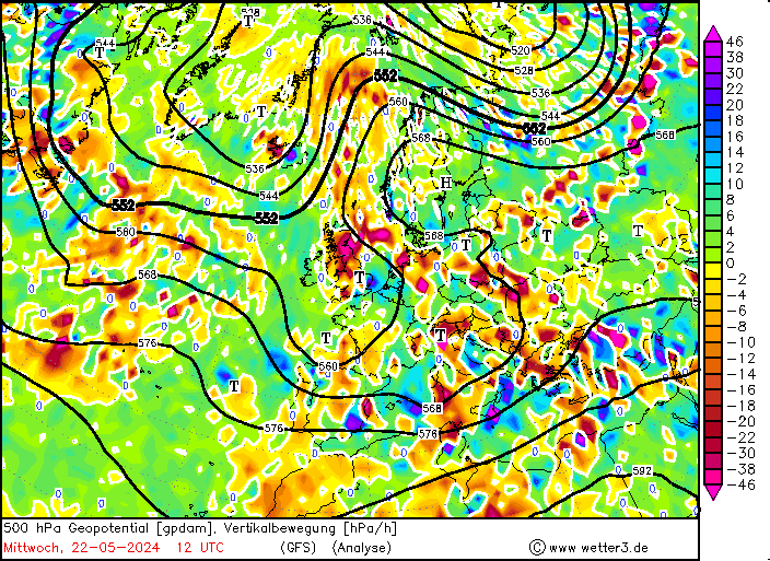
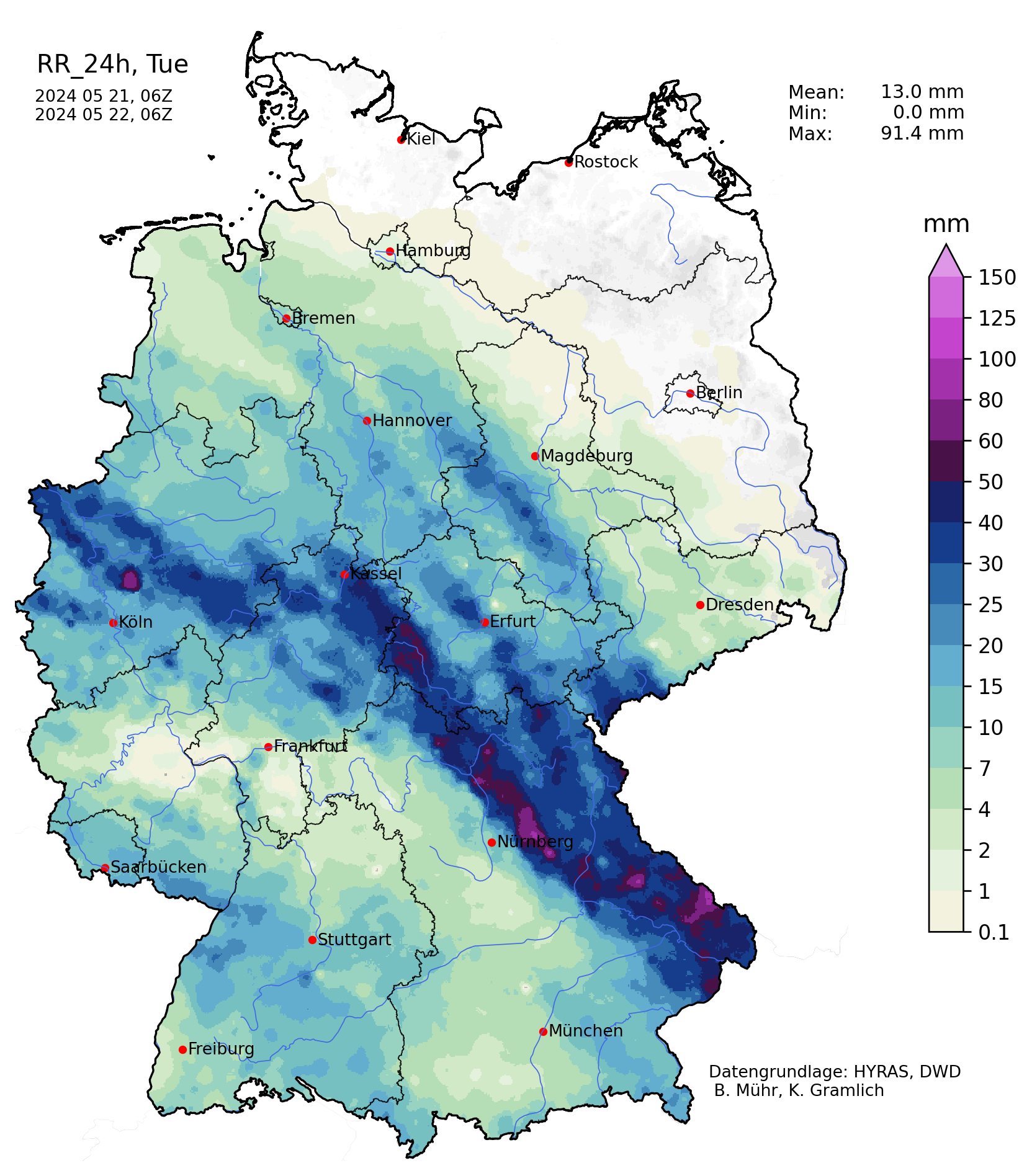
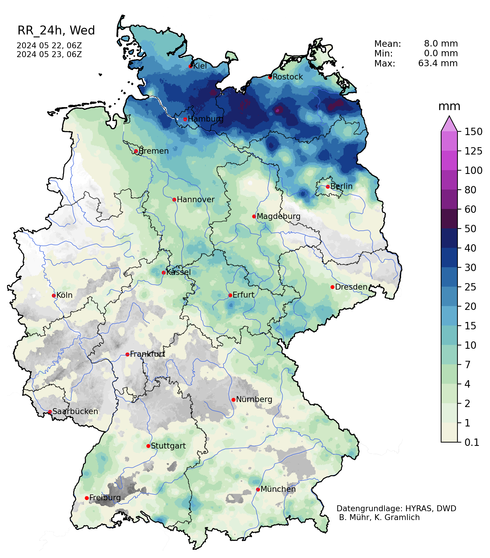
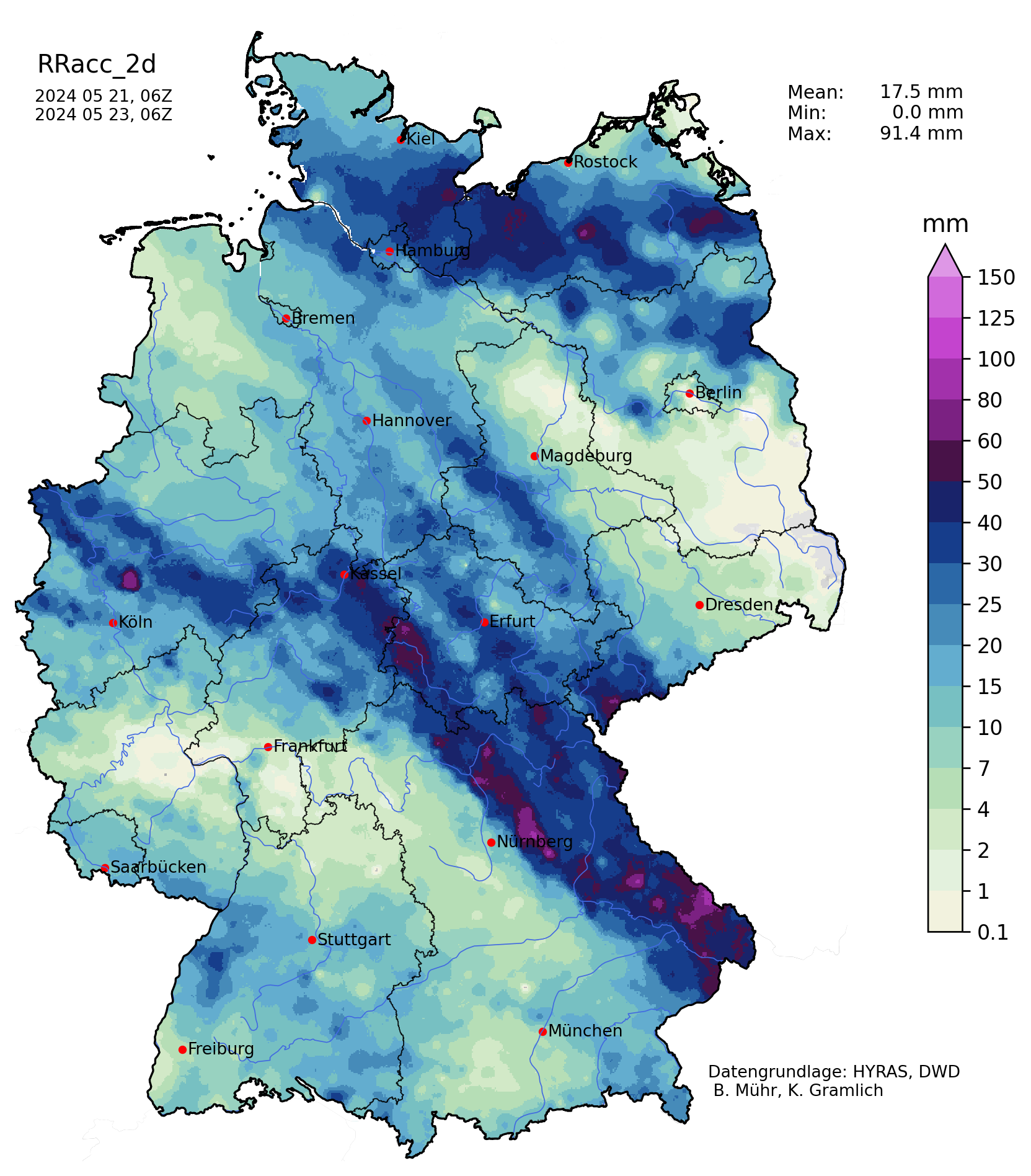
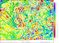
On May 20, 2024, another trough over the British Isles neared Central Europe. Over Southern Germany, another surface low developed during evening hours. On the night of May 21, 2024, the surface low moved northwards into the central part of Germany. The location of the surface low ahead of the trough over the British Isles provided mid-level lifting over Germany. This environment was favorable for strong thunderstorms to form. Throughout the night to May 22, 2024, the convective activity continued forming a precipitation band of heavy rains stretching from the Bavarian Forest into North Rhine-Westphalia.
|
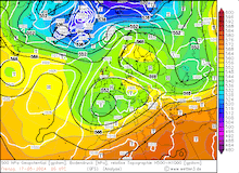
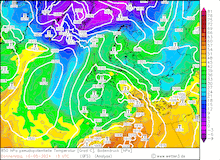
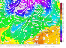
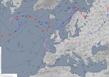
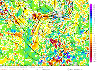
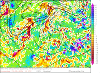
500 hPa geopotential and mean sea level pressure (upper row) and 500 hPa vertical velocity and geopotential (lower row) over Europe, 21.05.2024 00 UTC - 22.05.2024 12 UTC, , source:
wetter3.de
|
 |
 |
 |
 |
 |
 |
 |
 |
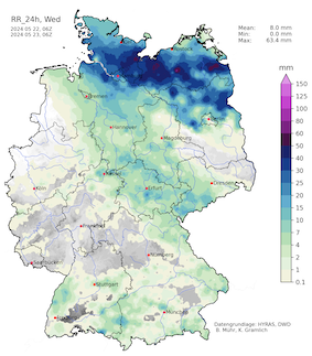
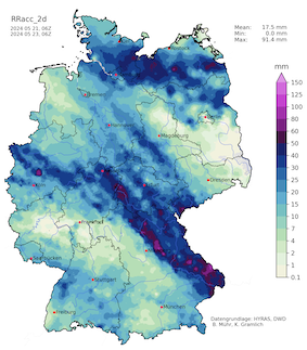
Especially at the southern end of the precipitation band, daily precipitation totals of up to 91.4 mm were observed in the vicinity of Nuremberg. Localized flash flooding was observed because of the heavy precipitation. On the following day, May 23, 2024, widespread convective activity was observed in the eastern half of Germany. Contrary to the western half of Germany, here the month of May had been exceptionally dry, with many weather stations observing less than 5 mm of rain in the first 20 days of May 2024.
|
Accumlated over Germany on 21.05.2024 (left), 22.05.2024 (middle) and 2-day accumulated precipitation over Germany, 22.05.2024 (right), source:
Wettergefahren-Frühwarnung
|
 |
 |
 |
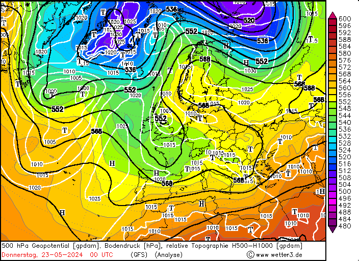
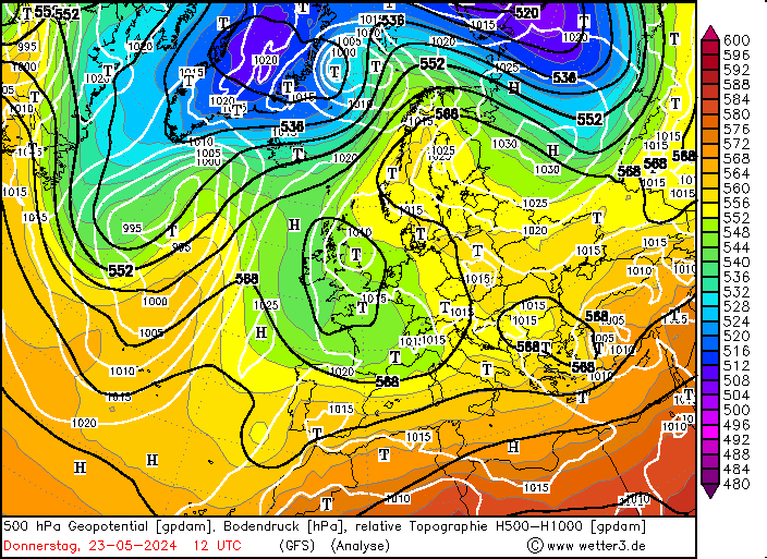
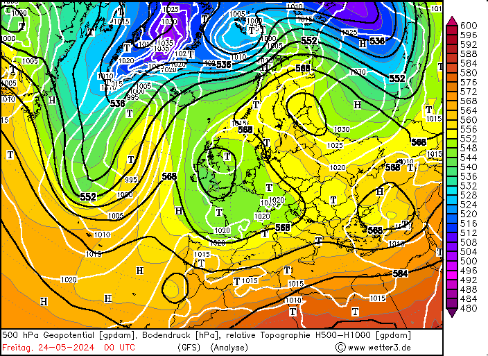
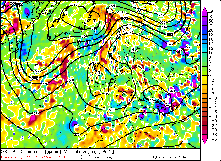
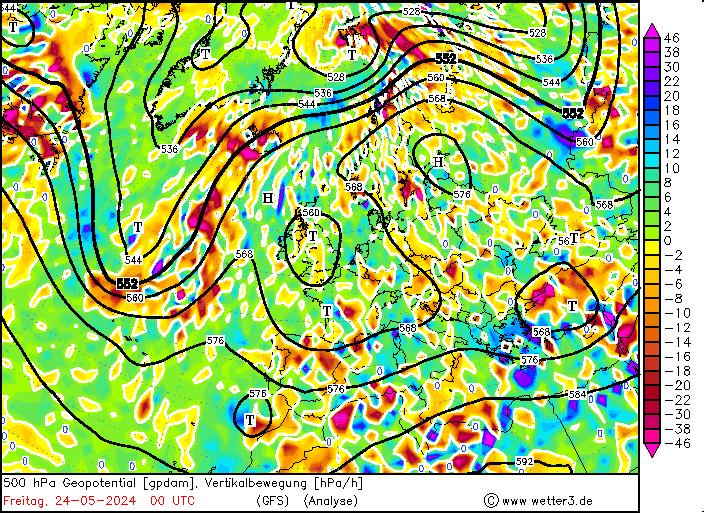
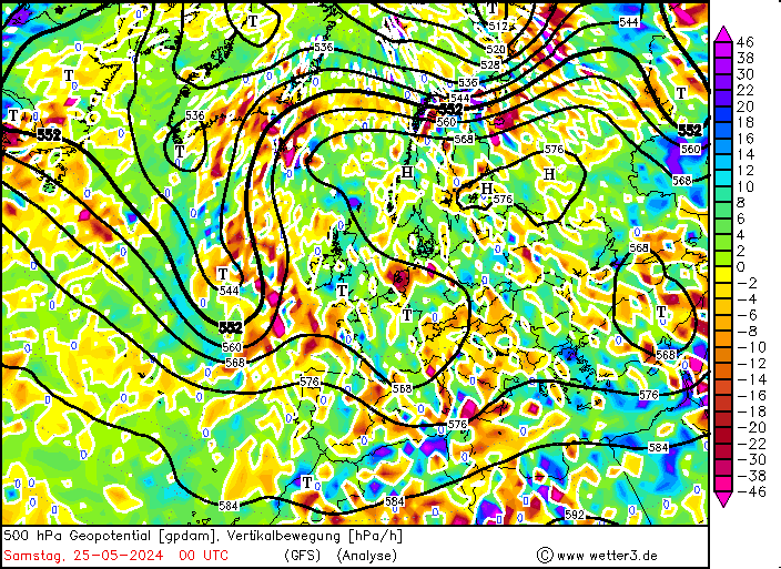
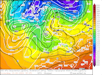
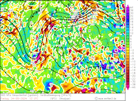
On May 23, 2024, a third low-pressure system developed over Southern Germany under similar synoptic conditions. Yet again, the surface low was located ahead of a trough over the British Isles and slowly moved northwards across the central part of Germany. Once again, convective activity was initiated by the mid-level lift provided by the synoptic conditions.
|
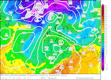
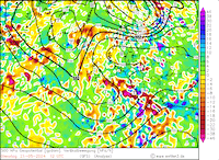
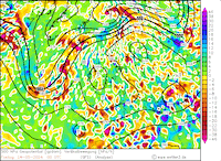
500 hPa geopotential and mean sea level pressure (upper row) and 500 hPa vertical velocity and geopotential (lower row) over Europe, 23.05.2024 12 UTC - 25.05.2024 00 UTC, , source:
wetter3.de
|
 |
 |
 |
 |
 |
 |
 |
 |
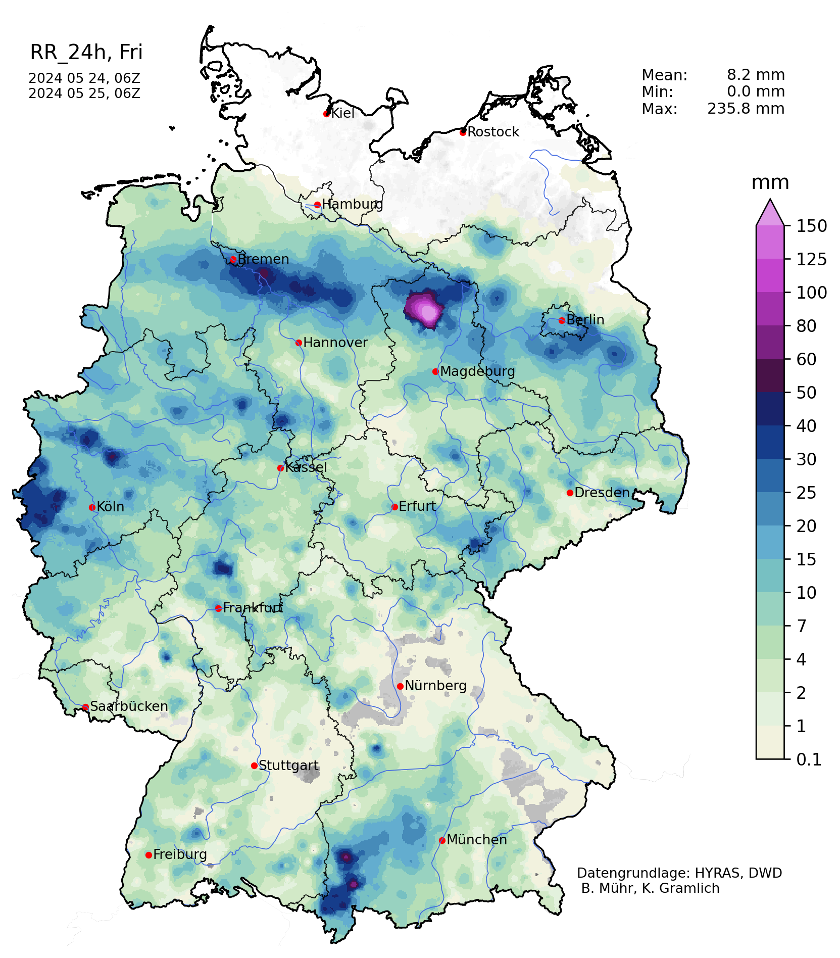
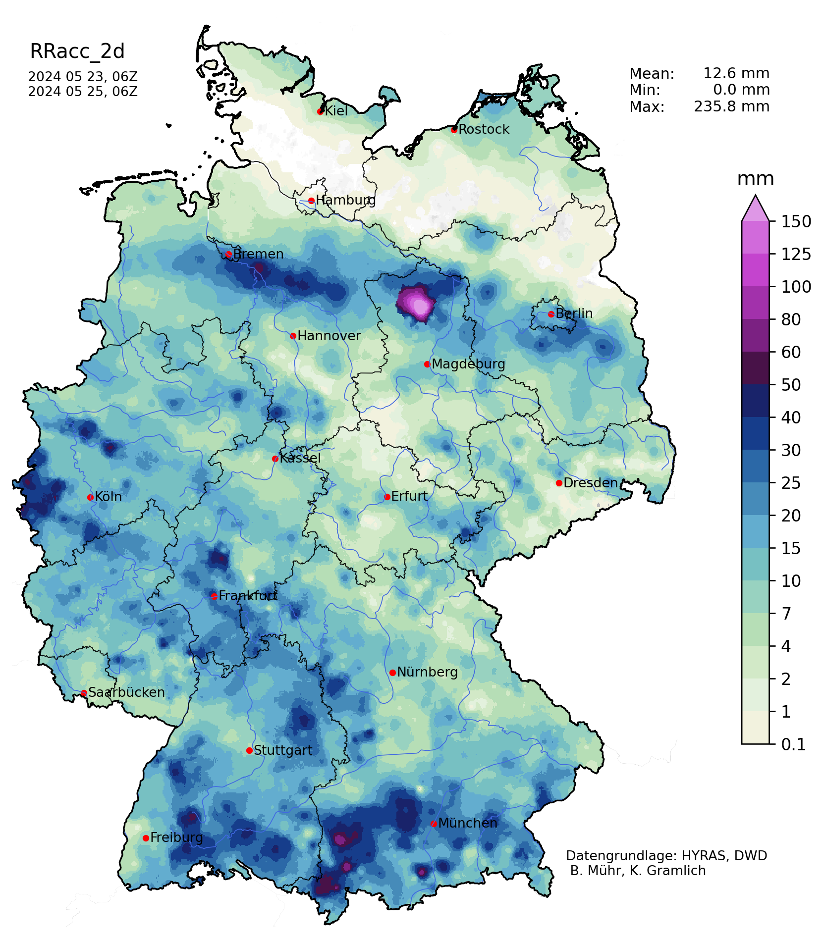
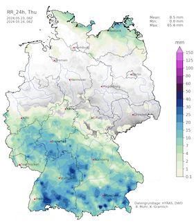
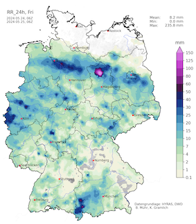
From the thunderstorms that developed in the afternoon hours of May 23, 2024, in the northern part of Switzerland, a broad mesoscale precipitation complex formed over the southern part of Baden-Württemberg. On the night of May 24, 2024, the precipitation complex moved slowly northwestwards. By day, the complex moved over Frankfort, Koblenz, and Aachen across the German-Dutch border. Once again widespread precipitation totals of more 30 mm were observed.
|
Accumlated over Germany on 23.05.2024 (left), 24.05.2024 (middle) and 2-day accumulated precipitation over Germany, 24.05.2024 (right), source:
Wettergefahren-Frühwarnung
|
 |
 |
 |
Further east where moist and warm air masses were destabilized by daytime heating, strong thunderstorms were observed, bringing heavy downpours. Though, the precipitation here was far less widespread than in the western half of Germany.
It must be noted that on every day during this event, showers and thunderstorms occurred over Germany, causing localized flash flooding and bringing mudslides. First estimations by insurance companies suggest that the flooding damages to residential buildings and infrastructure in the state of Saarland and the Palatine region are in the magnitude of 200 million €.
Text: KG
May 27, 2024
|