|
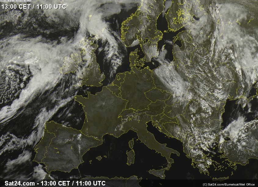
The historical heat wave over Central Europe ended with heavy showers and thunderstorms. Precipitation exceeded 100 mm/24h.
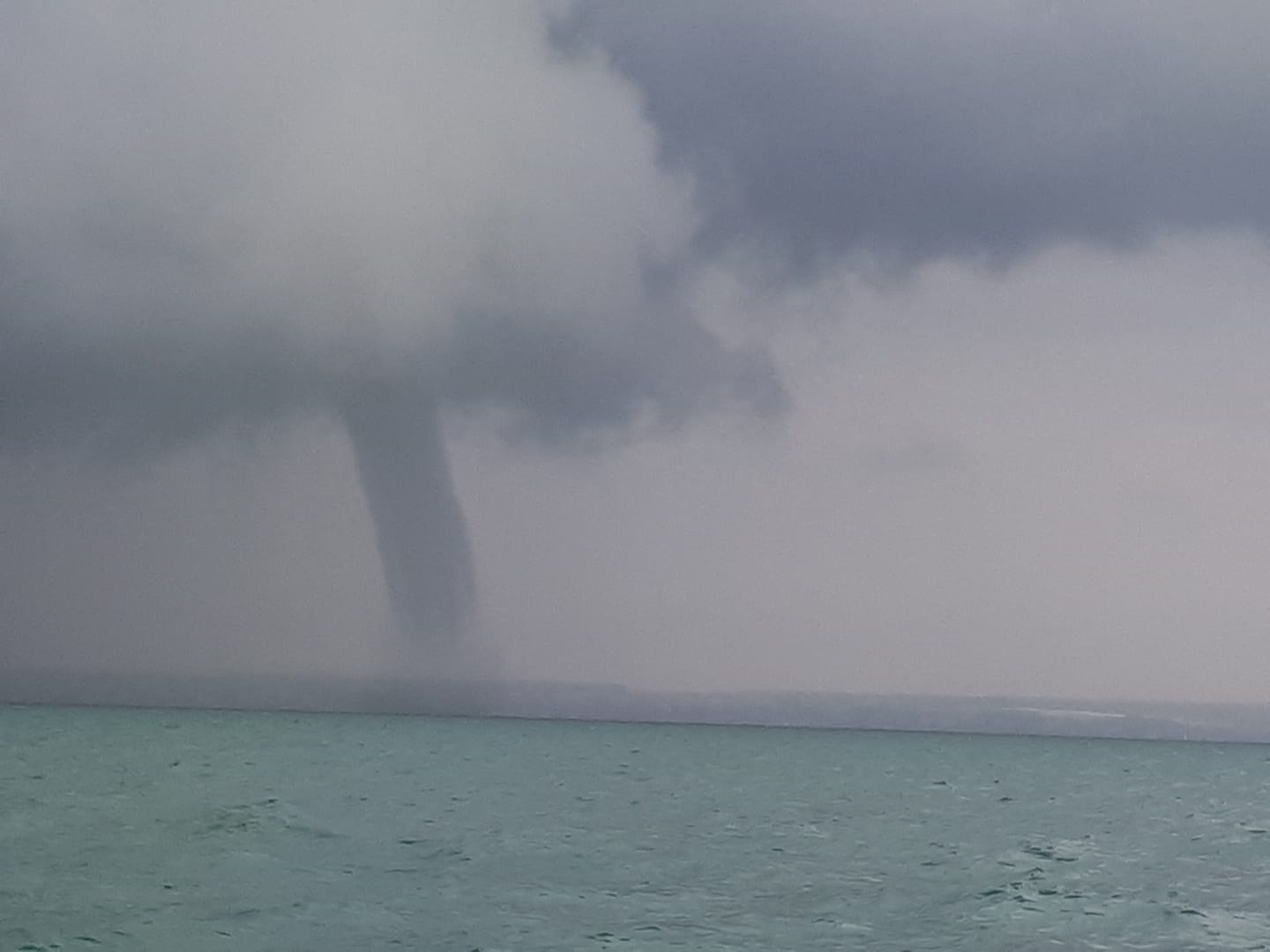
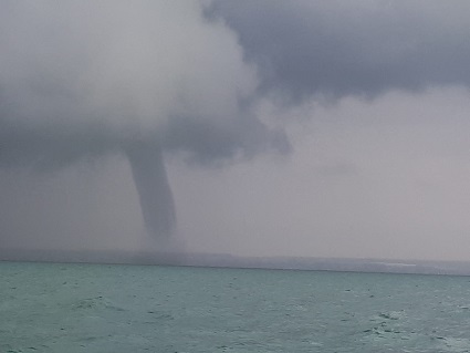
A tornado was observed over Lake Constance.
Development of the thunderstorms
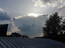
Although the atmospheric conditions were far away from ideal, the extreme heat on the ground caused isolated
heat thunderstorms on Wednesday and Thursday. On Wednesday, they formed in Belgium and France, where
temperatures were at their highest and the trough to the west was already providing minimal uplift
effects. Showers and thunderstorms, favoured by the orographic uplift, also occurred on the southern
margin of the Alps. The hardly changed synoptic situation revealed a similar picture on Thursday.
|
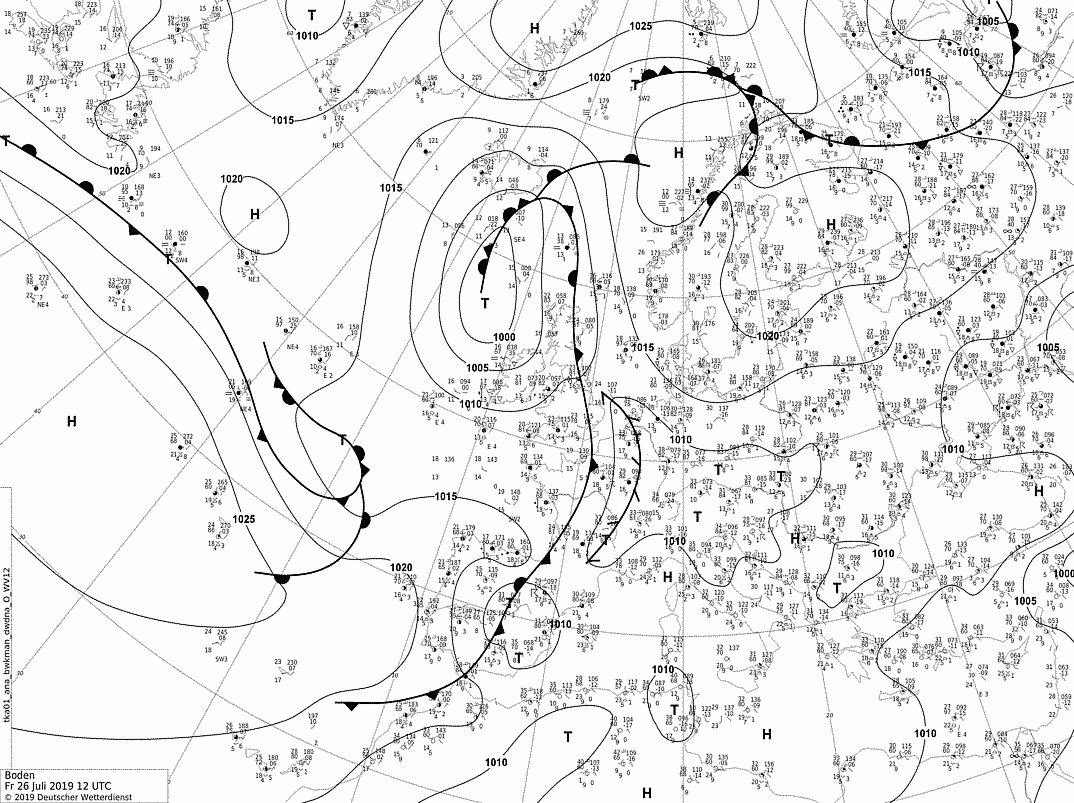
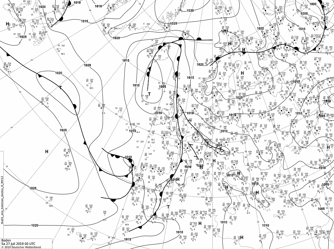
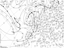
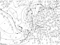
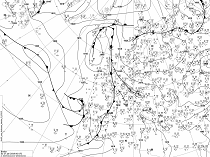
Soil level pressure and fronts, 26 July 06 UTC until 27 July 00 UTC, 2019:
DWD
|
 |
 |
 |
 |
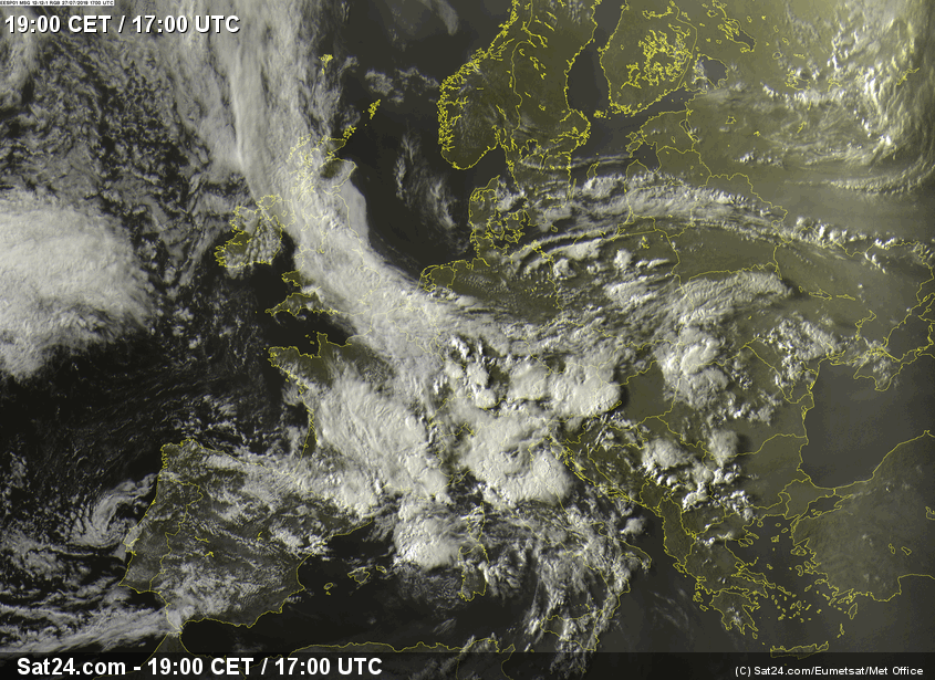
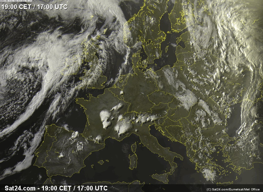
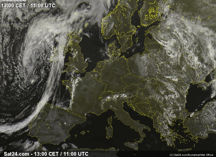
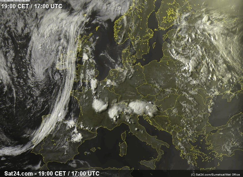
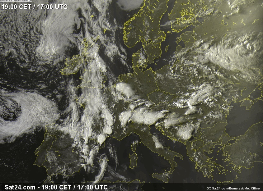
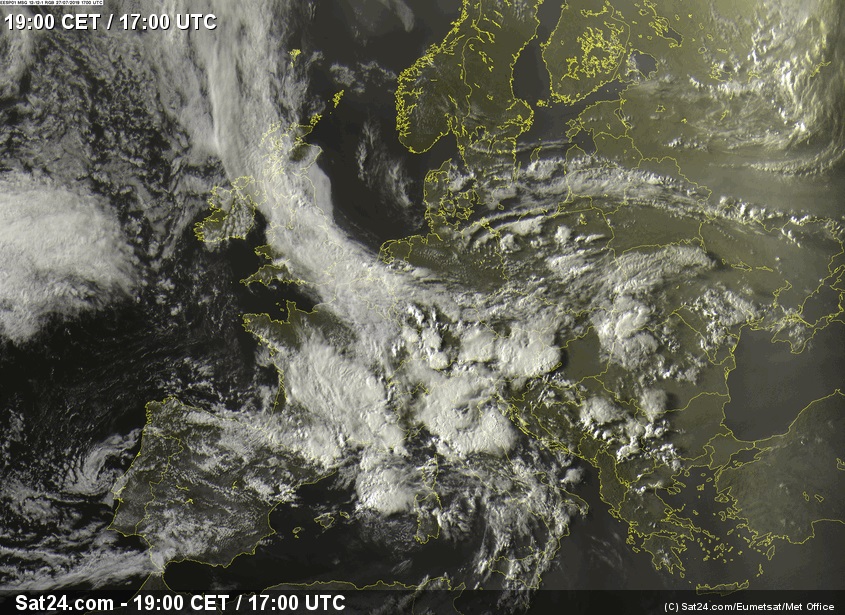
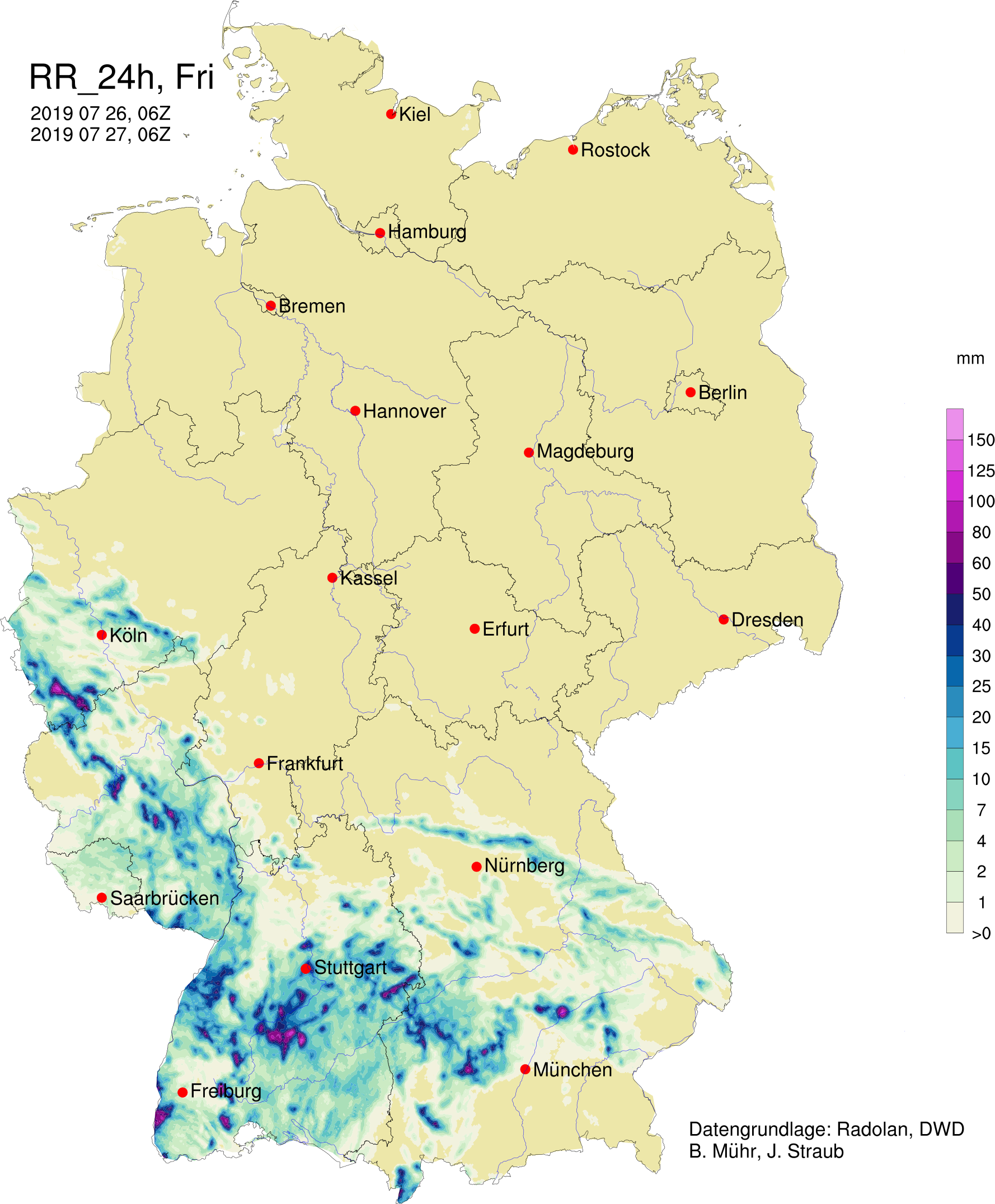
On Friday, the western part of Central Europe was affected by the trough approaching from the Atlantic. Due
to the advection of humid air masses from the southwest, with height increasing vorticity advection and the
formation of a convergence line on the ground, strong convection occurred in France, Belgium, Italy and also
in the south and west of Germany. Remarkable was the enormous height of the cloud base (about 3000m), which
was caused by the large spread, i.e. the difference between dew point and temperature.
|
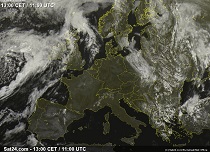
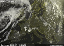
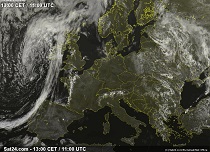
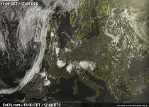
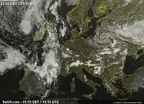
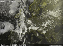
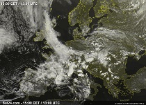
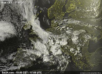
Satellite image (visible) of Central Europe, 24-27 July, 2019:
Sat24
|
 |
 |
 |
 |
 |
 |
 |
 |
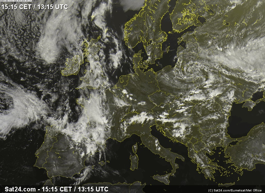
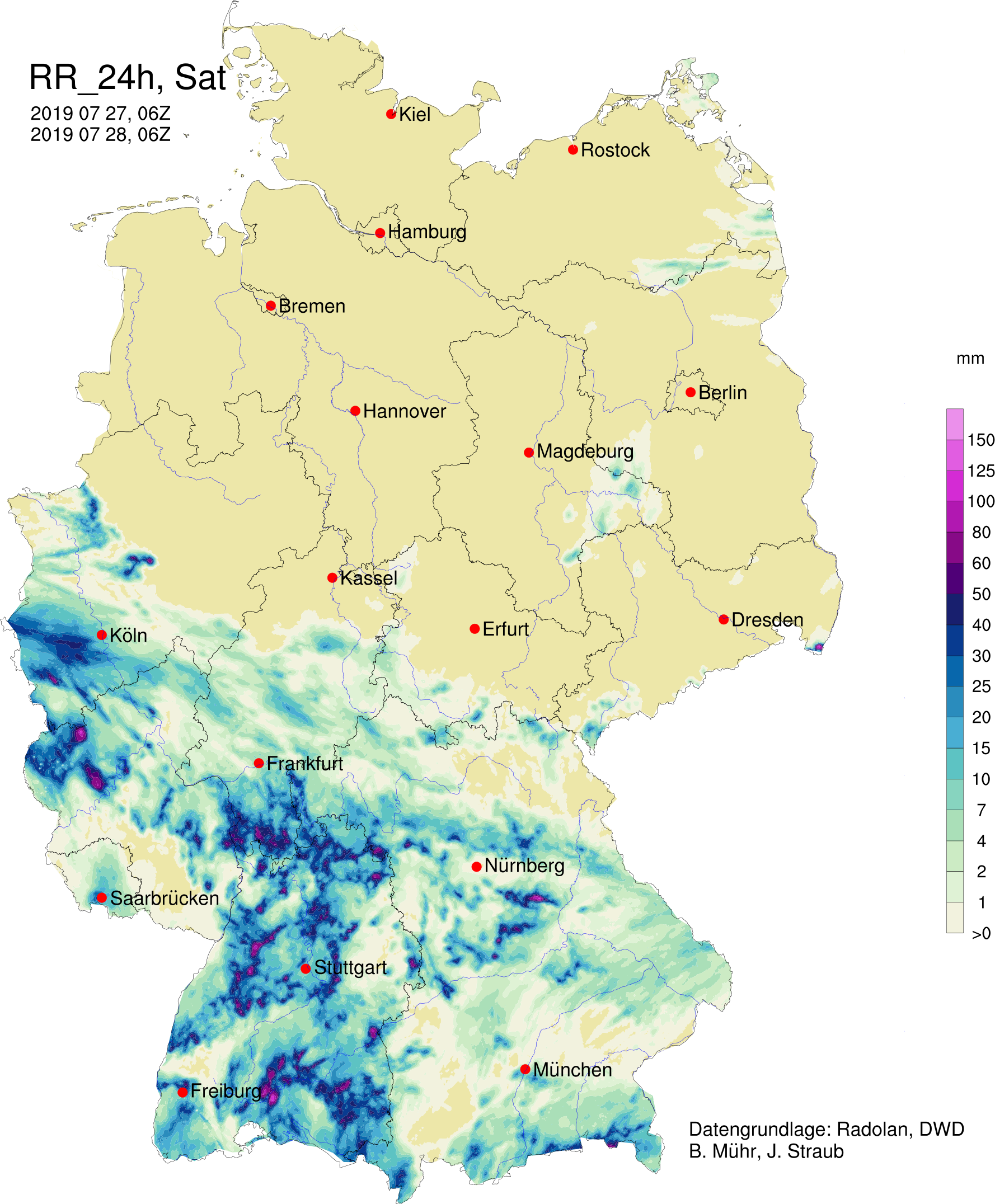
On Saturday the trough moved further east. The trough axis was located about Iceland and the Pyrenees. While
on the ground there were still temperatures of more than 30°C, the 850 hPa - temperature had cooled down from
25°C to about 15°C, in the west of France even to 10°C. The 500 hPa geopotential had decreased from 576 gpdam
to 566 gpdam.
This led to widespread showers and thunderstorms throughout Central Europe. Thunderstorms also formed in eastern
countries such as Poland, the Czech Republic and Hungary.
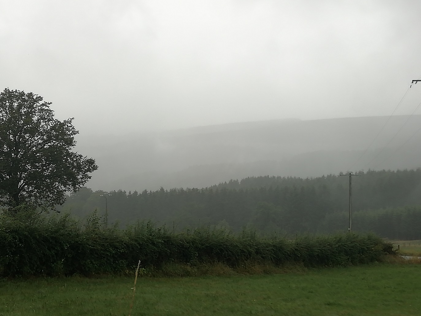
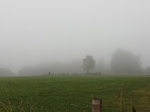
In the western part of Central Europe the weather was completely different than in the previous days. Due to
the cooling and the humidity supply, dew point and temperature were almost identical. The cloud base
reached the ground level in some areas.
|
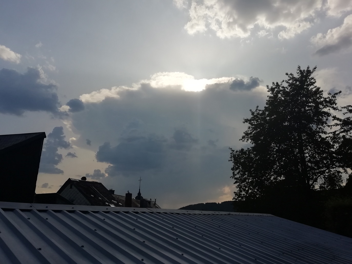
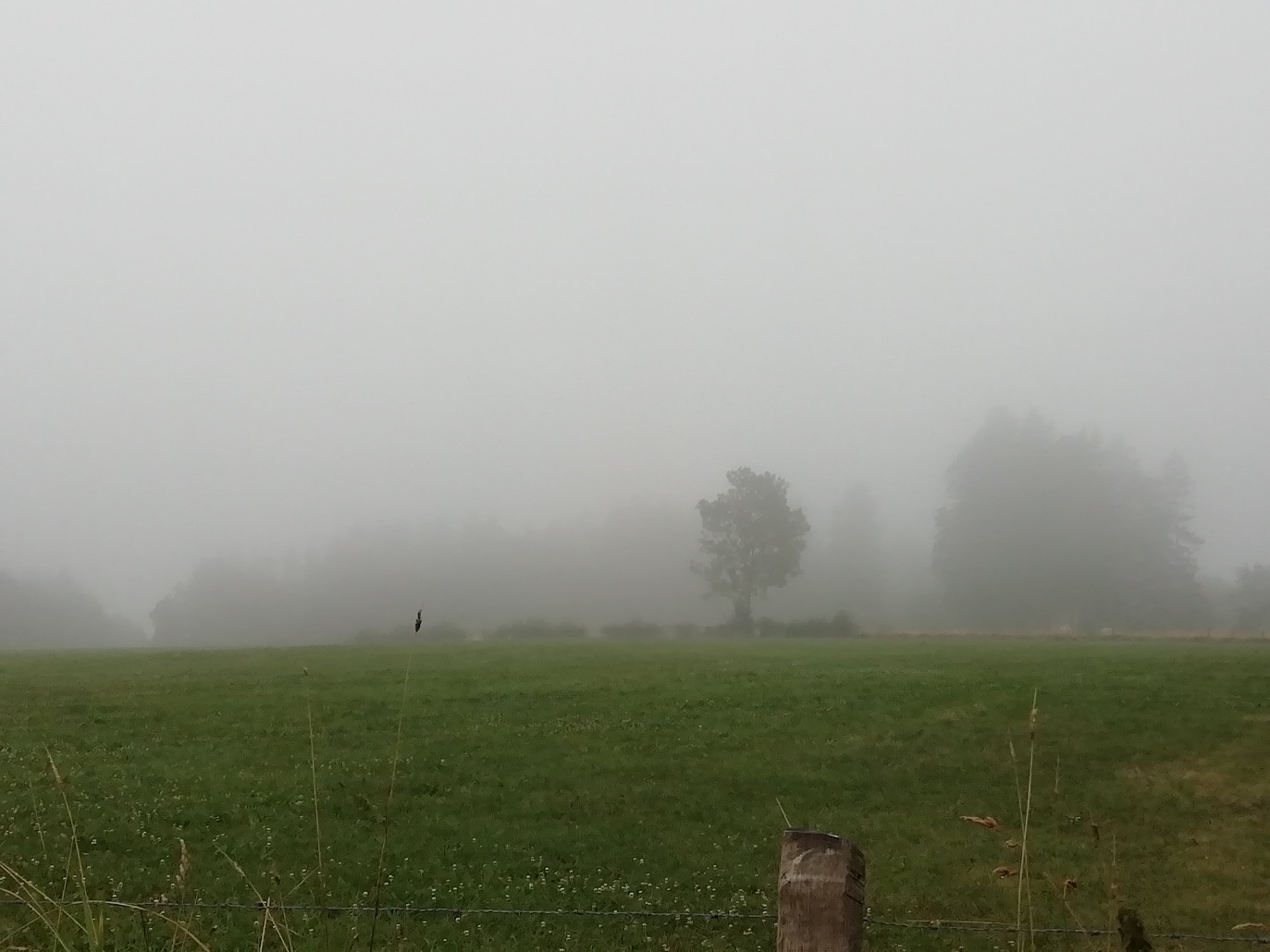
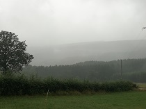
Isolated Thunderstorm seen from Malmedy (BE, 24.07.) , Lenticularis Cloud with Cumulus top seen from Burnenville
(BE, 26.07.), reduced visibility and low cloud base in Pont (ca. 500 m above sea level, BE, 27.07. and 28.07.). Source: Fabian Siegmann
|
 |
 |
 |
 |
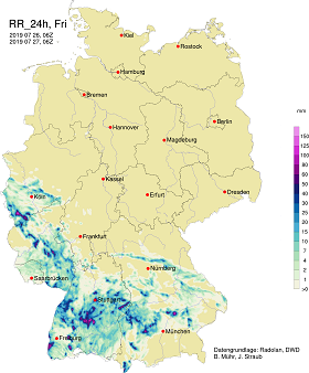
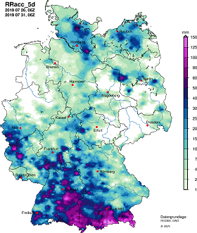
Due to the large amount of precipitable water in the atmosphere and the almost non-existent displacement speed
of the thunderstorm cells, enormous amounts of rain were generated locally. On Friday the German maximum was
reached at Hechingen with a daily precipitation of 61.1 mm. On Saturday, several stations in Baden Württemberg,
Rhineland-Palatinate and North Rhine-Westphalia registered daily precipitations of more than 50 mm. The station
in Wittlich provided the maximum with 92.5 mm. On Sunday several stations reported even more than 100 mm precipitation,
among them the station Bad Urach (100.1 mm) in Baden Württemberg and ten stations in Bavaria. The station in
Kreuth-Glashütte reported the highest daily precipitation with 138.9 mm.
The 24 h race in Spa-Francorchamps (BE) had to be interrupted on Sunday between 06 and 12 CEST due to heavy rainfall.
|
24h rainfall amount from , 27 July 06 UTC and 28 July 06 UTC, 120h rainfall amount from July 31, 06 UTC, source:
DWD and
Wettergefahren Frühwarnung
|
 |
 |
 |
Epiphenomenon
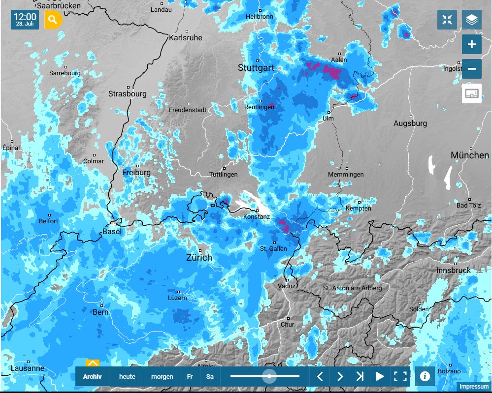
On Sunday, 28 July, a tornado was sighted over Lake Constance at 12:40 CEST between Friedrichshafen (DE) and Romandshorn (CH).
The lack of a supercell and the hardly existing vertical wind shear exclude a mesocyclic tornado.
Instead, it is reasonable to assume that it was a non-mesocyclic tornado. These are caused by the dispersion of horizontal wind
shear (e.g. in the area of a front like on Sunday) into single vortices with a vertical axis of rotation. These vortices are stretched
and intensified by convective upwinds (conservation of angular momentum) and can form a tornado reaching up to the cloud base.
These tornadoes often form in cold air above warm water, as this ensures strong instability in the lowest atmospheric layers.
|
Non-mesocyclonal tornado over Lake Constance, next to Friedrichshafen, Rain radar on 28.07., 10 UTC
source: Christiane Solleder and
Wetteronline
|
 |
 |
data source: Christiane Solleder
Text: FS
August 01, 2019
|