|
Tuesday, December 23, 2025, 10:00 UTC
Issued: Tuesday, December 23, 2025, 10:00 UTC
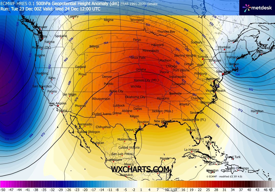
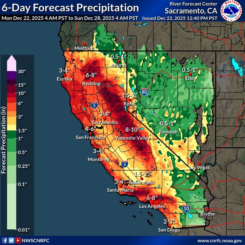
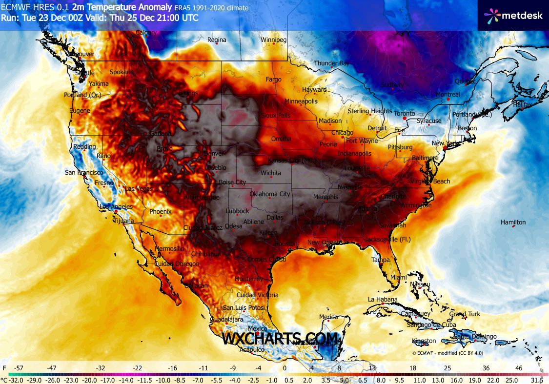
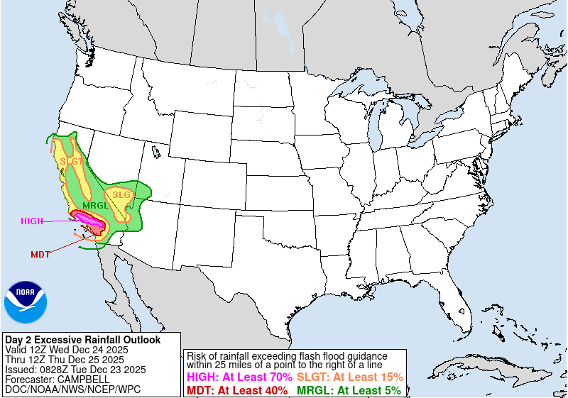
A potent atmospheric river will bring abundant precipitation to the Western US over the Christmas period. 5-day precipitation totals of more than 250 mm are likely in the mountain ranges of California. Over the Midwest, a strong subtropical ridge will lead to well-above average temperatures. In the Great Plains, the warmest Christmas Day on record may be observed.
An active Pacific jet stream pattern is currently affecting North America. A large trough is located off the west coast of the US. Ahead of said trough, a potent atmospheric river has developed, bringing moist air masses to the Western US. In the past few days, heavy rains have already impacted California. In parts of the Sierra Nevada, precipitation totals of more than 500 mm have already been observed in the past 72 h. Throughout the Christmas season, another powerful storm is expected to impact California. Along westward-facing flanks of the Coastal Mountain ranges and the Sierra Nevada, 5-day precipitation totals well above 250 mm are likely.
Tuesday, December 23, 2025, 10:00 UTC KG |