Wednesday, July 02, 2025, 08:00 UTC
|
|
|
|
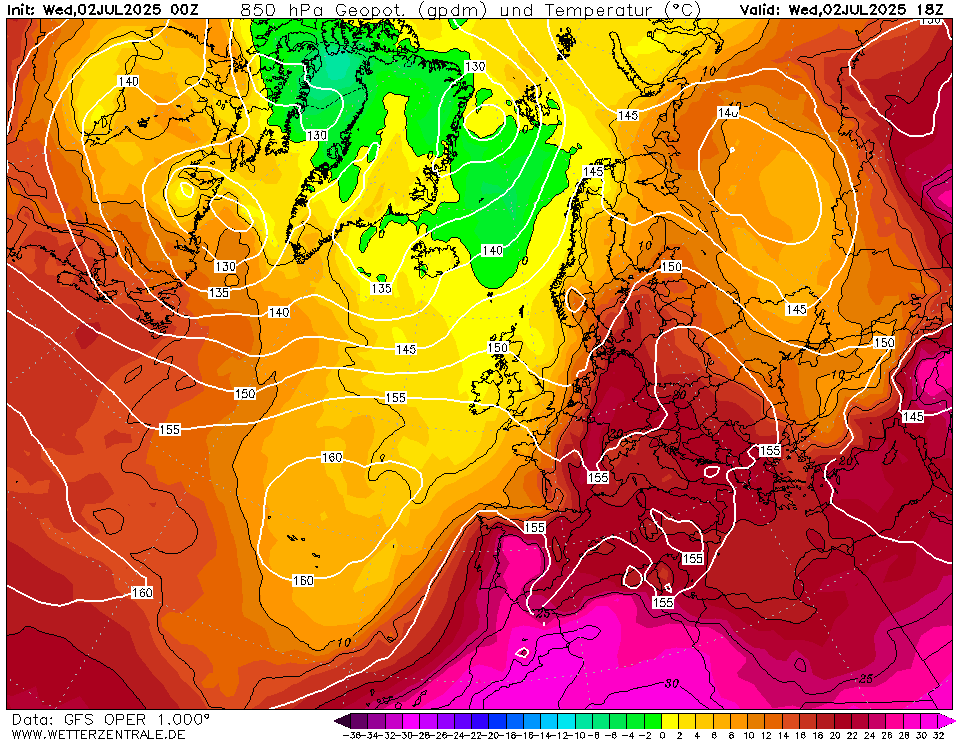
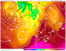
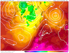
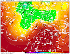
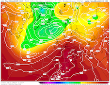
850 hPa temperature and geopotential
over Europe,
02.07 18 UTC
Source: wetterzentrale
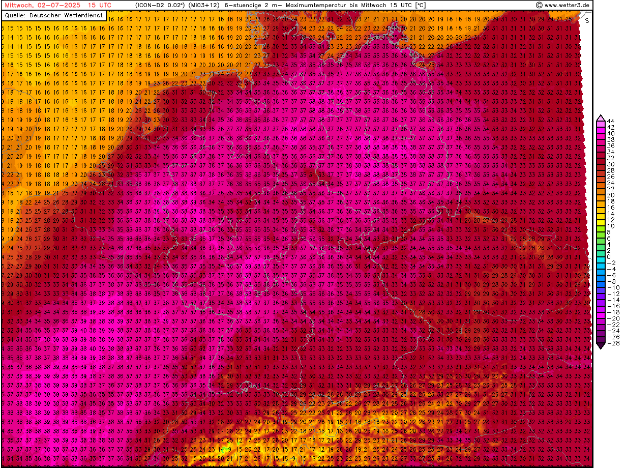
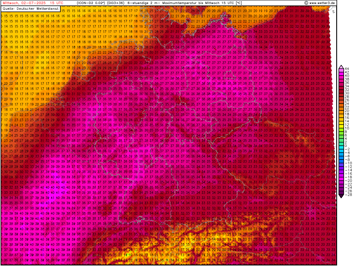
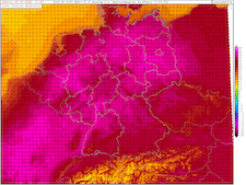
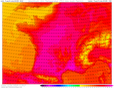
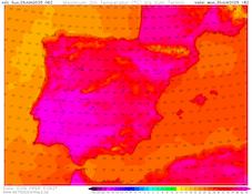
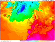
| 2 m maximum temperature over Germany,
02.07 15 UTC
Source: wetter3
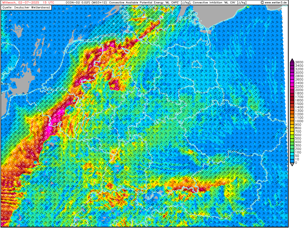
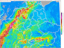
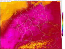
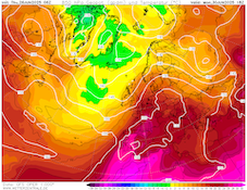
| Mixed-layer CAPE and CIN over Germany,
02.07 18 UTC
Source: wetter3
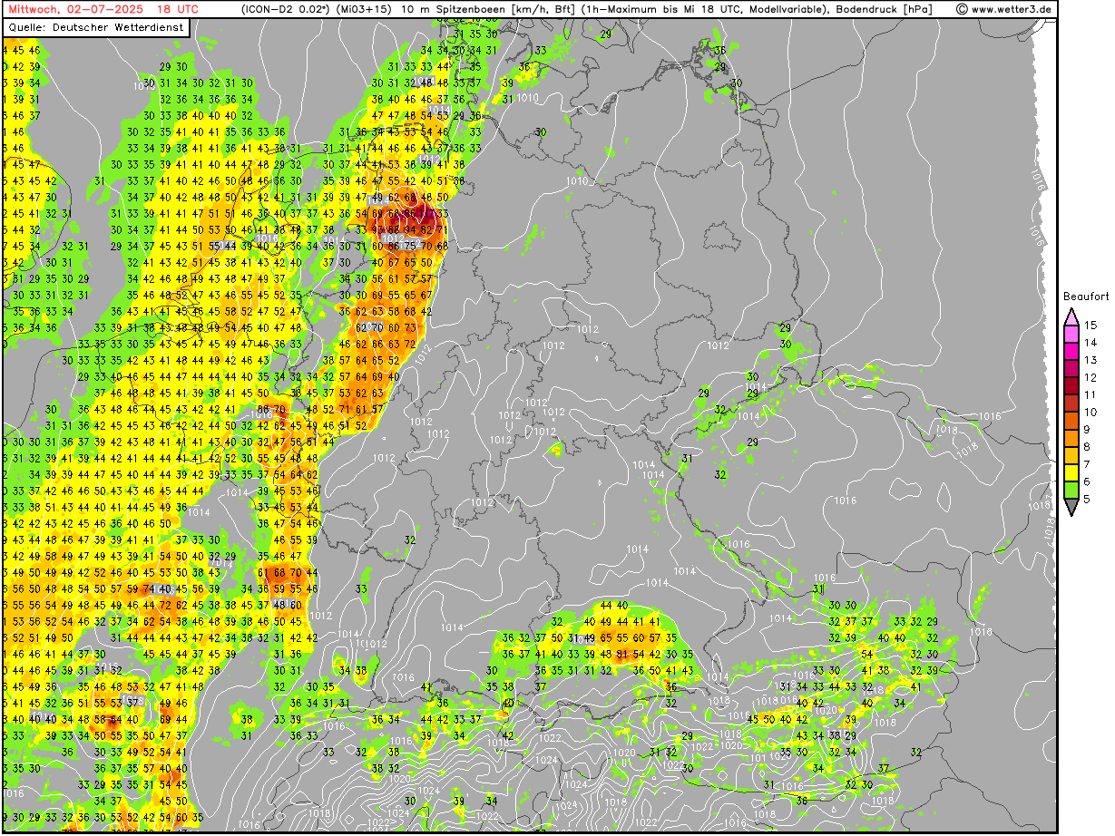
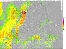
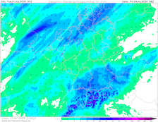
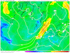
| 10 m peak wind gusts over Germany,
04.07 18 UTC
Source: wetter3
|
Heat wave, severe thunderstorms
Western and Central Europe
Issued: Wednesday, July 02, 2025, 08:00 UTC
The peak of the intense heat wave over Central Europe is expected today, July 02, 2025. Along the Rhine River as well as in Eastern Germany, temperatures of up to 39 °C are possible. Locally, temperatures may approach the 40 °C mark. In the evening and nighttime hours, a cold front will induce severe convective activity over the northwestern parts of Central Europe. During the passage of these storms, violent convective downdrafts are possible.
02.07.2025
A trough over the British Isles is increasing its impact on the weather across Central Europe. Ahead of the trough, very warm air masses are advected into Central Europe. 850 hPa temperatures are expected to reach well above the 20 °C mark. As a result, strenuous heat is expected across much of Central Europe today, July 02, 2025. Along the Rhine River as well as in Eastern Germany, maximum temperatures of 39 °C are forecasted. Isolated locations may see temperatures approaching the 40 °C mark if conditions are right. In metropolitan areas, heat stress levels are further elevated by very high overnight lows. In the past night, temperatures often remained above 20 °C. In Essen, the overnight minimum temperature dropped only to 25.0 °C.
In the afternoon and nighttime hours, the cold front of the trough over the British Isles will be approaching Central Europe. Along the cold front, severe thunderstorms will develop. In the afternoon, convection will be initialized in an area between Northern France and the Netherlands. Convection will likely quickly cluster into a squall line. Depending on the degree of convection organization, violent convective downdrafts must be expected during the passage of the squall line. Especially in the northwestern parts of Germany, the risk of convective downdrafts with gusts over 100 kph is high. In the afternoon hours, DCAPE values will reach more than 1000 J/kg. This gives the potential for the formation of strong cold pools. Additionally, large hail may occur in the afternoon hours. Embedded supercells elevate potential risks from these thunderstorms further. Isolated wind gusts of 120 kph seem feasible at present time.
On Thursday, July 03, 2025, the cold front will have reached Southern Germany. Close to the Alps, severe convective activity may be observed before the passage of the front. Behind the cold front, temperatures will drop to seasonal values.
Tuesday, July 01, 2025, 08:00 UTC
|
|
|
|
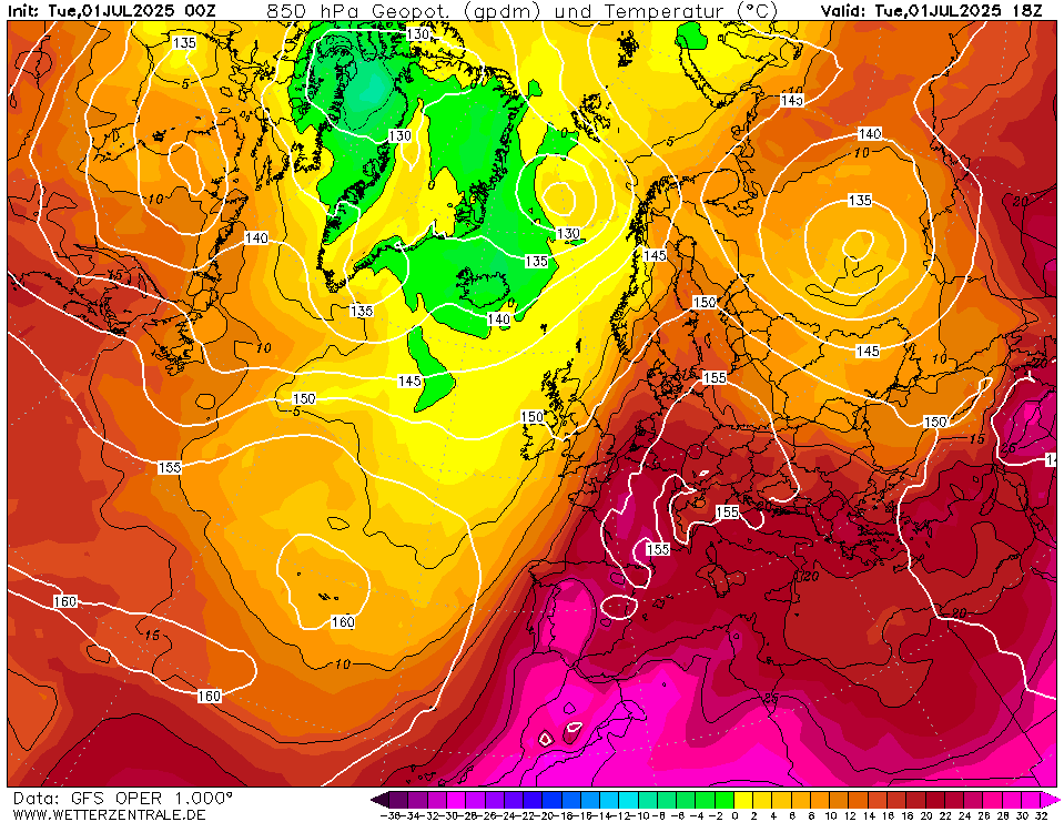
850 hPa temperature and geopotential
over Europe,
01.07 18 UTC
Source: wetterzentrale
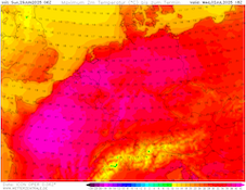
| 2 m maximum temperature over
France,
01.07 18 UTC
Source: wetterzentrale
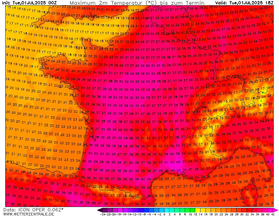
| 2 m maximum temperature over Germany,
02.07 18 UTC
Source: wetter3
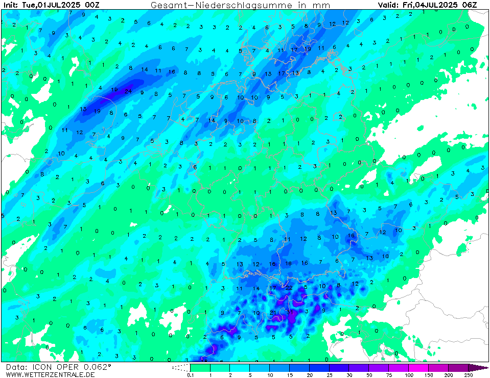
| Accumulated precipitation over Central Europe
until 04.07 06 UTC
Source: wetterzentrale
|
Heat wave, thunderstorms
Western and Central Europe
Issued: Tuesday, July 01, 2025, 08:00 UTC
An intense heat wave is reaching its peak over France and Central Europe today, July 01 and Wednesday, July 02, 2025. Temperatures of up to 40 °C are expected over France. On Wednesday, maximum temperatures may reach 39 °C along the Rhine Valley. By Thursday, July 03, 2025, a cold front of a trough over the British Isles will bring colder air masses.
01.07.2025
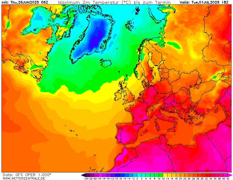
The current heat wave, which has been impacting Western and Central Europe since late June 2025, has already brought record-breaking heat to the Iberian Peninsula. At El Granado, a maximum temperature of 46 °C has been recorded on June 28, 2025. This broke the Spanish June temperature record by 1 K. Previously, this record was held by Cordoba with a temperature of 45 °C recorded on June 26, 1965. With the presence of a trough over the Eastern North Atlantic, the warmest air mass is advected northeastwards across France and Central Europe.
850 hPa temperatures will be reaching more than 20 °C over France and Central Europe. As a result, strenuous heat is expected. Over France, the peak of the current heat wave is expected for today, July 01, 2025. Temperatures may reach more than 40 °C in interior parts of France. On Wednesday, July 02, 2025, the center of the heatwave is expected to shift further eastwards into Central Europe. In parts of Eastern France and along the Rhine Valley, temperatures of up to 39 °C are possible. In Germany, there is a lower risk of temperatures reaching the 40 °C mark. Especially along the Lower Rhine Plain and Ruhr River, very high heat stress levels are expected. This is due to very high overnight low temperatures. In the Rhein-Ruhr metropolitan area, overnight low temperatures in the night to Wednesday may only drop slightly below 25 °C. Maximum temperatures on Wednesday remain uncertain due to a varying degree of convective activity in the NWP models.
Already yesterday, June 30, 2025, severe convective storms occurred within the Alps. Locally, hourly precipitation rates of up to 100 mm have been observed. Today, convection will be more widespread across Southern Germany. Again, localized heavy downpours with hourly precipitation rates of more than 30 mm are possible. On Wednesday afternoon, convective activity will be initialized across Northern France, stretching into Northern Germany. The formation of mesoscale convective clusters is possible. On Thursday, July 03, 2025, the cold front of the trough will reach Central Europe. Ahead of the front, temperatures may once again rise to 35 °C over Southern and Eastern Germany, depending on the arrival time of the front. Along the front, severe convective activity may occur. Presently, NWP models tend to suggest weaker convective signals along the cold front.
Sunday, June 29, 2025, 13:00 UTC
|
|
|
|
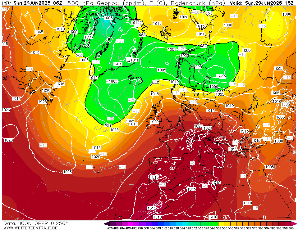
500 hPa geopotential and sea surface pressure
over Europe,
29.06 18 UTC
Source: wetterzentrale
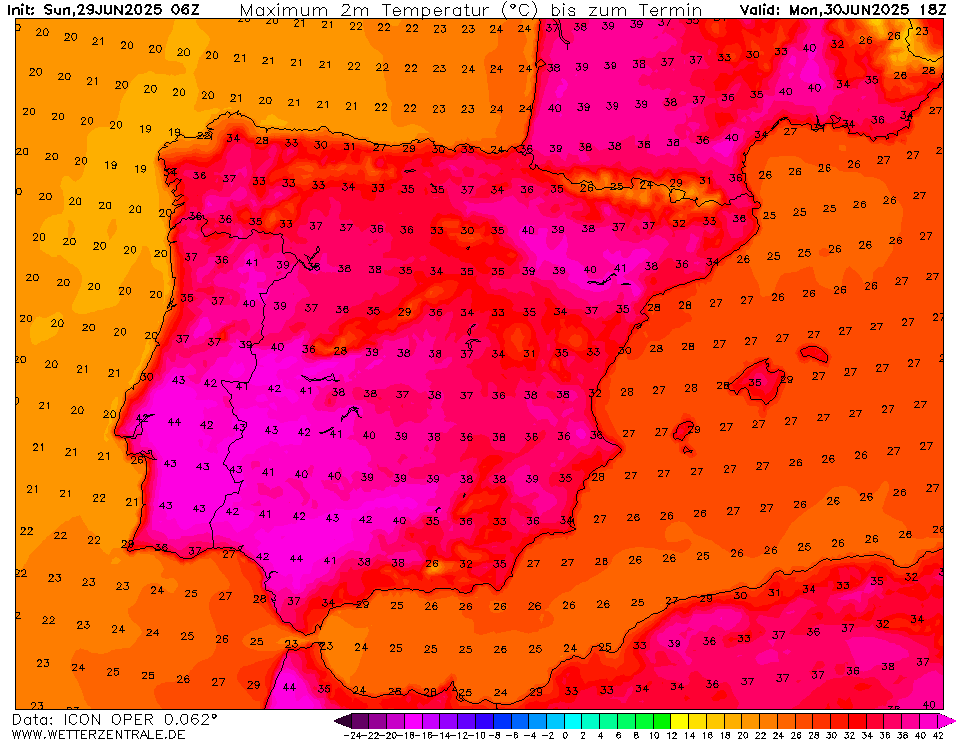
| 2 m maximum temperature over
the Iberian Peninsula,
30.06 18 UTC
Source: wetterzentrale
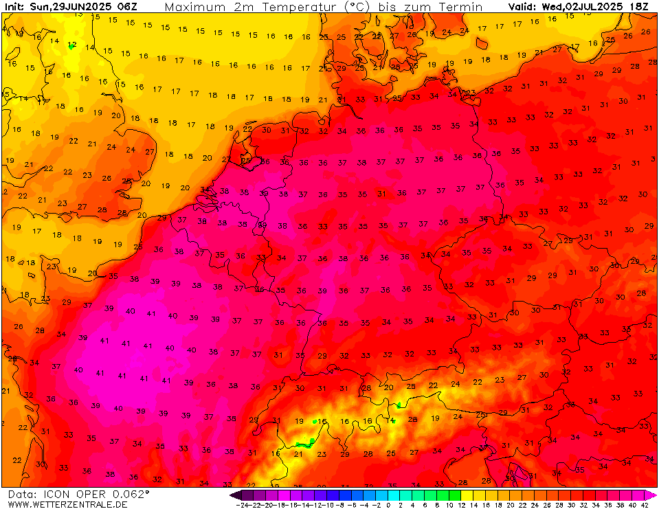
| 2 m maximum temperature over Central Europe,
02.07 18 UTC
Source: wetterzentrale
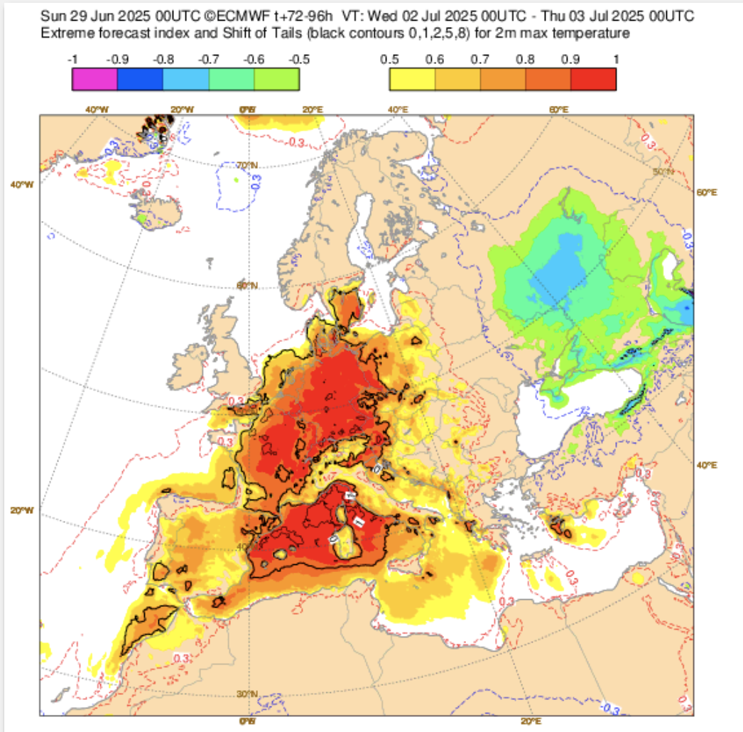
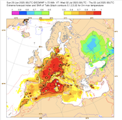
| EFI and SOT Index for the
2 m maximum temperature for 02.07
over Europe
Source: ECMWF
|
Heat wave
Western and Central Europe
Issued: Sunday, June 29, 2025, 13:00 UTC
An intense heat wave is continuing to impact Western and Central Europe. Over the Iberian Peninsula, extreme heat with temperatures of up 45 °C is forecasted until Wednesday, July 02, 2025. Over France, temperatures of more than 40 °C must be expected from Monday, June 30, 2025, to Wednesday, July 02, 2025. Over Germany, the highest temperatures are forecasted for Wednesday with maxima approaching the 40 °C mark.
29.06.2025
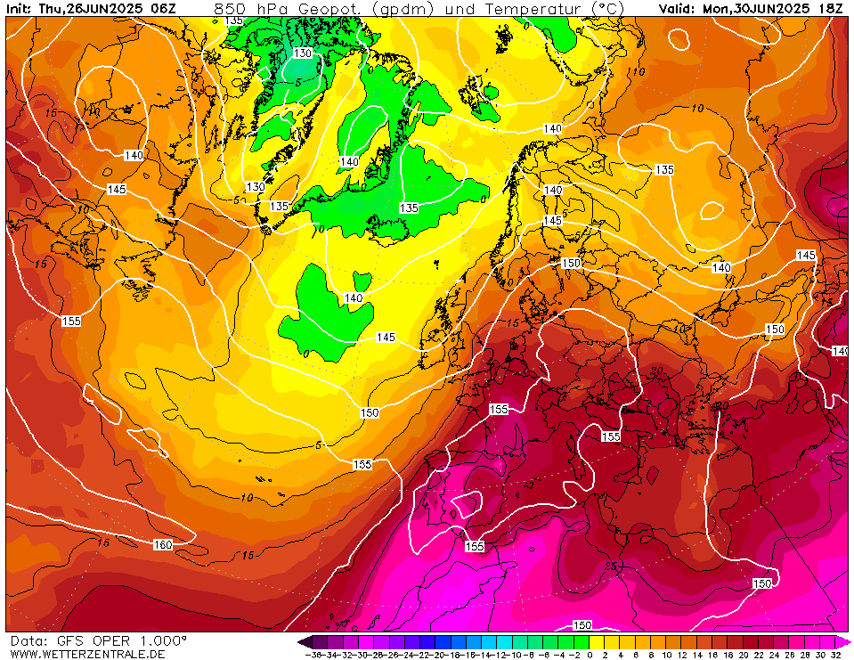
A large ridge has expanded across Europe. With the ridge, extremely warm air masses can penetrate far northeastwards across Europe. 850 hPa temperatures of more than 20 °C are measured over Europe. As a result, extreme heat is impacting large parts of Western and Central Europe. Beginning today, June 29, 2025, temperatures of more than 40 °C are forecasted across the southern parts of the Iberian Peninsula. Locally, maximum temperatures of up to 45 °C are possible. Over France, from Monday, June 30, 2025, to Wednesday, July 02, 2025, maximum temperatures of more than 40 °C are likely. On Wednesday, temperatures of up to 42 °C may be measured in Paris, close to the record of 42.6 °C measured in July 2019.
Over Germany, the heat wave is expected to last until Thursday, July 03, 2025. From Monday onwards, temperatures of more than 35 °C are expected along the Upper Rhine Valley. Over Western Germany, the most intense heat is forecasted for Tuesday, July 01, 2025, and Wednesday. July 02, 2025. Over Eastern Germany, the highest temperatures are forecast for Thursday. Both on Wednesday and Thursday, temperatures of up to 39 °C may occur. There is the potential for temperatures of 40 °C or more along the Rhine Valley. This would be the earliest 40+ °C reading in Germany. At present time, the earliest reading of a 40+ °C temperature occurred at Kitzingen, BY with 40.3 °C on July 05, 2015. The ensemble data currently does not give the potential that the temperature records from the late-July heatwave in 2019 will be surpassed. Nevertheless, high overnight low temperatures in metropolitan areas will lead to elevated heat stress levels. Often temperatures will not drop below 20 °C in metropolitan areas of Southern Germany until Friday, July 04, 2025.
Already by Monday, the strong diurnal insolation will give the potential for local convection to form along the Alps and over Southern Germany. By Wednesday, a trough over the British Isles will start to increase its impact on the weather over Western and Central Europe. Colder air masses will reach Central Europe by Thursday. The time that which these colder air masses reach certain parts of Central Europe remains uncertain. Additionally, the strength of thunderstorms forming along this cold front remains highly uncertain.
Thursday, June 26, 2025, 14:30 UTC
|
|
|
|
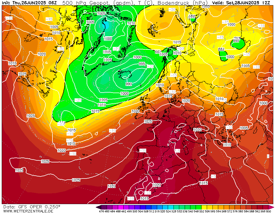
500 hPa geopotential and sea surface pressure
over Europe,
28.06 12 UTC
Source: wetterzentrale
| 850 hPa temperature and geopotential
over Europe,
30.06 18 UTC
Source: wetterzentrale
| 2 m maximum temperature over Europe,
01.07 18 UTC
Source: wetterzentrale
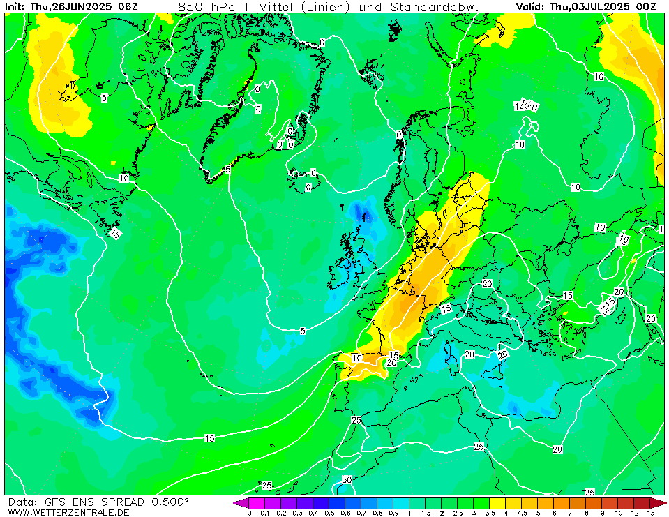
| 850 hPa temperature spread and geopotential
over Europe,
03.07 00 UTC
Source: wetterzentrale
|
Heat wave
Western and Central Europe
Issued: Thursday, June 26, 2025, 14:30 UTC
A major heat wave is forecasted to impact Western and Central Europe until the first weekend of July 2025. Temperatures are likely to remain well above average for an extended time. Over Western Europe, maximum temperatures of more than 40 °C may occur on separate occasions. In Central Europe, temperatures of more than 35 °C are likely in the first days of July 2025.
26.06.2025
The synoptic set-up over Europe in late June 2025 is dominated by a strong low-pressure system south of Iceland and a high-pressure ridge extending from the Azores into Central Europe. In such a synoptic set-up, very warm air masses can penetrate across the European Continent. Advected from the Sahara, a blob of hot air masses will move along the ridge, expanding across Western and Central Europe. 850 hPa temperatures within this blob are likely to surpass 25 °C. Over the Iberian Peninsula, a stretch of exceptionally hot weather will commence on Saturday, June 28, 2025. Temperatures as hot as 45 °C may occur in the southern parts of the peninsula from June 30, 2025, to July 03, 2025.
With the ridge expanding into Central Europe over the weekend, the hot air masses can advance into France. The 40 °C mark has already been surpassed here yesterday, June 25, 2025, with a maximum temperature of 41.5 °C at Ceret. Until June 28, 2025, temperatures will drop slightly. Nevertheless, maximum temperatures will remain above the 30 °C mark in large parts of France. From June 29, 2025, to July 03, 2025, the hottest temperatures of the approaching heat wave are forecasted to impact France. In Southern and Central France, maximum temperatures may reach more than 40 °C for multiple days during that period.
Over Central Europe, maximum temperatures will likely remain above the 30 °C from Saturday, June 28, 2025, to next week’s Thursday, July 03, 2025. The highest temperatures will impact the Upper Rhine Valley. In this region, daily maximum temperatures of more than 35 °C are forecasted from June 29, 2025, to July 03, 2025. Currently, NWP models suggest that the peak of the heatwave in Central Europe may occur on June 30 and July 01, 2025. Temperatures of more than 37 °C are forecasted in Western Germany. Outlier solutions in the ensembles for Western Germany show the potential for temperatures close to the 40 °C mark early next week. Heat stress levels will be elevated additionally in metropolitan areas of high overnight low temperatures. Especially in the bigger cities of Southern Germany, minimum temperatures of more than 20 °C are likely.
In the first days of July 2025, a trough over the British Isles will impact the weather across Western and Central Europe. Signals of some convective activity are already present in coarse global NWP models by early next week. Due to the long lead time, NWP output remains uncertain, but ensembles tend to converge to a solution with colder airmasses reaching Western Europe by July 02, 2025, and Central Europe by July 03, 2025. With this transition to cooler airmasses, enhanced convective activity may occur. Though the degree of both the cooling and the convective activity remains unclear at present.
Wednesday, July 02, 2025, 08:00 UTC
KG
Tuesday, July 01, 2025, 08:00 UTC
KG
Sunday, June 29, 2025, 13:00 UTC
KG
Thursday, June 26, 2025, 14:30 UTC
KG
|