|
A potent atmospheric river brought abundant precipitation to California during the Christmas season. Flash flooding and significant fresh snow accumulations at upper elevations were recorded across the state. Over the Midwest, a powerful system brought unseasonal warmth for most of the Eastern US. In the Southern Plains, the warmest Christmas Day on record was observed.
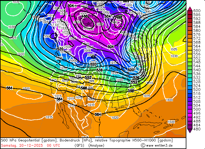
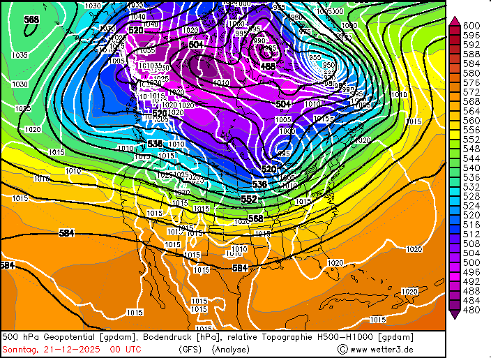
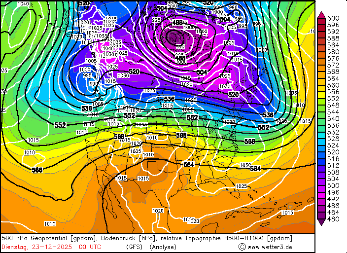
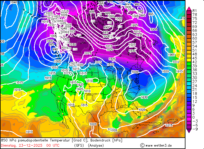
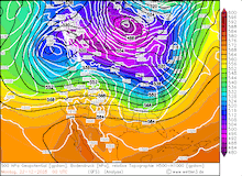
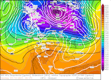
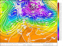
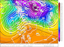
A complex synoptic set-up dominated the Christmas season over North America. Before the Christmas season, the general synoptic pattern over North America was zonally aligned. Bitterly cold air masses resided over far Northwestern Canada due to an unseasonably strong ridge over the Bering Sea. In the Yukon territory, extreme cold led to new temperature records. In Braeburn, preliminary temperature records indicate a minimum temperature of -55.7 °C on December 23, 2025. Such bitterly cold temperatures rival the winter cold in far eastern Siberia. If this temperature recording is to be confirmed, the measurement site will have recorded the coldest temperature in Canada in the month of December since 1975.
|
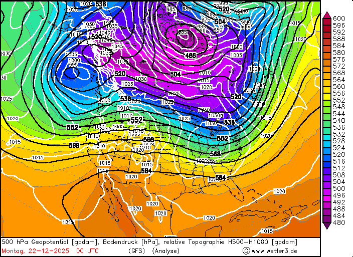
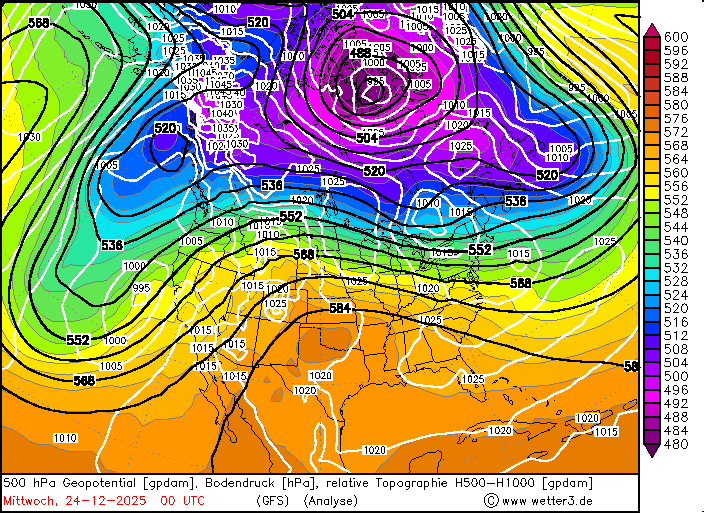
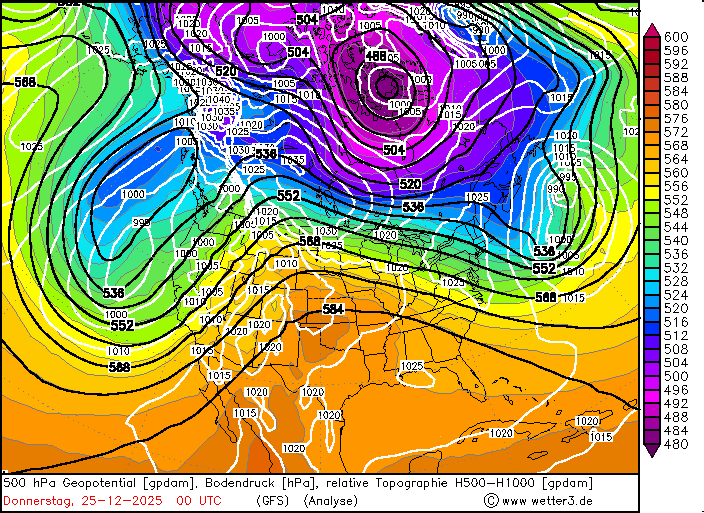
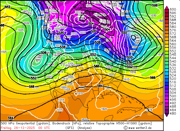
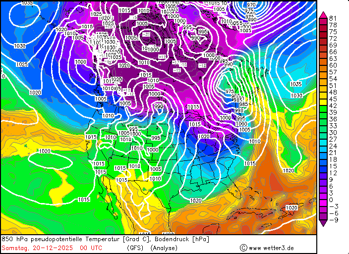
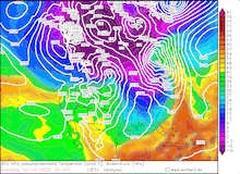
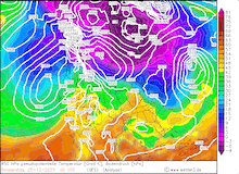
Daily development of the 500 hPa geopotential, 1000 hPa to 500 hPa thickness, and sea-surface pressure over North America, 20.12.2025 00 UTC - 27.12.2025 12 UTC, source:
wetter3.de
|
 |
 |
 |
 |
 |
 |
 |
 |
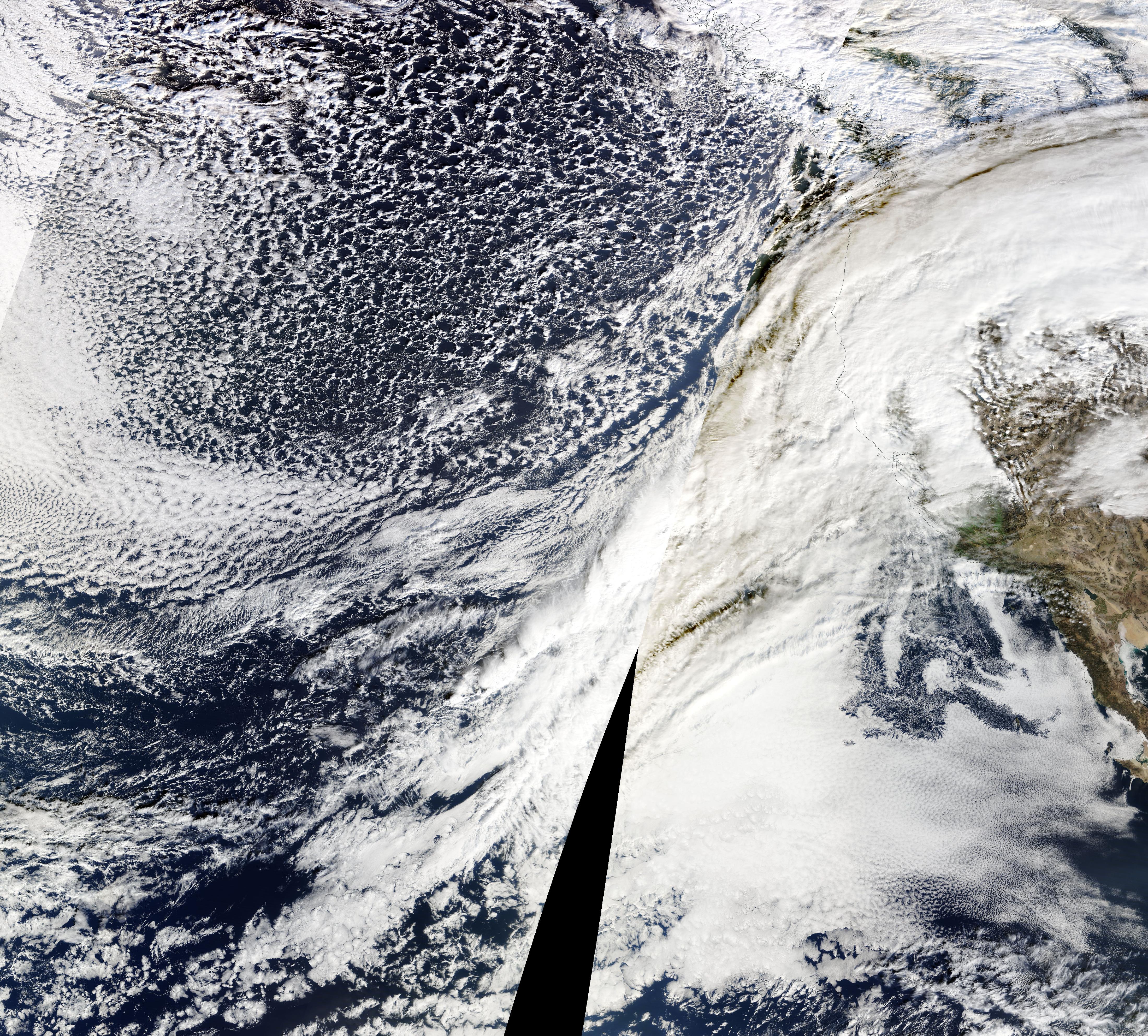
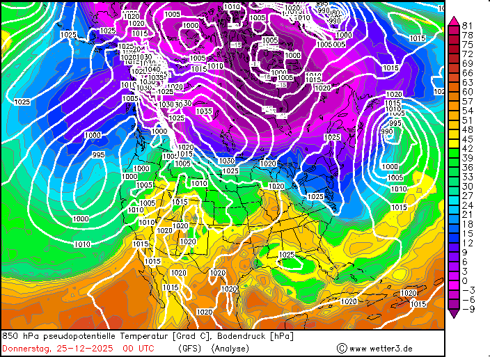
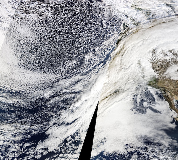
Further south, the zonally aligned flow implied above-average temperatures for much of the US east of the Rocky Mountains. Along the West Coast, the zonally aligned flow brought warm and very moist air masses across the Pacific. Commonly, this coherent atmospheric river is referred to as the pineapple express. Reason heretofore is the fact that this coherent air flow is often associated with a distinct cloud band, which most often originates in the vicinity of the Hawaiian Archipelago and stretches all the way to the west coast of the US.
|
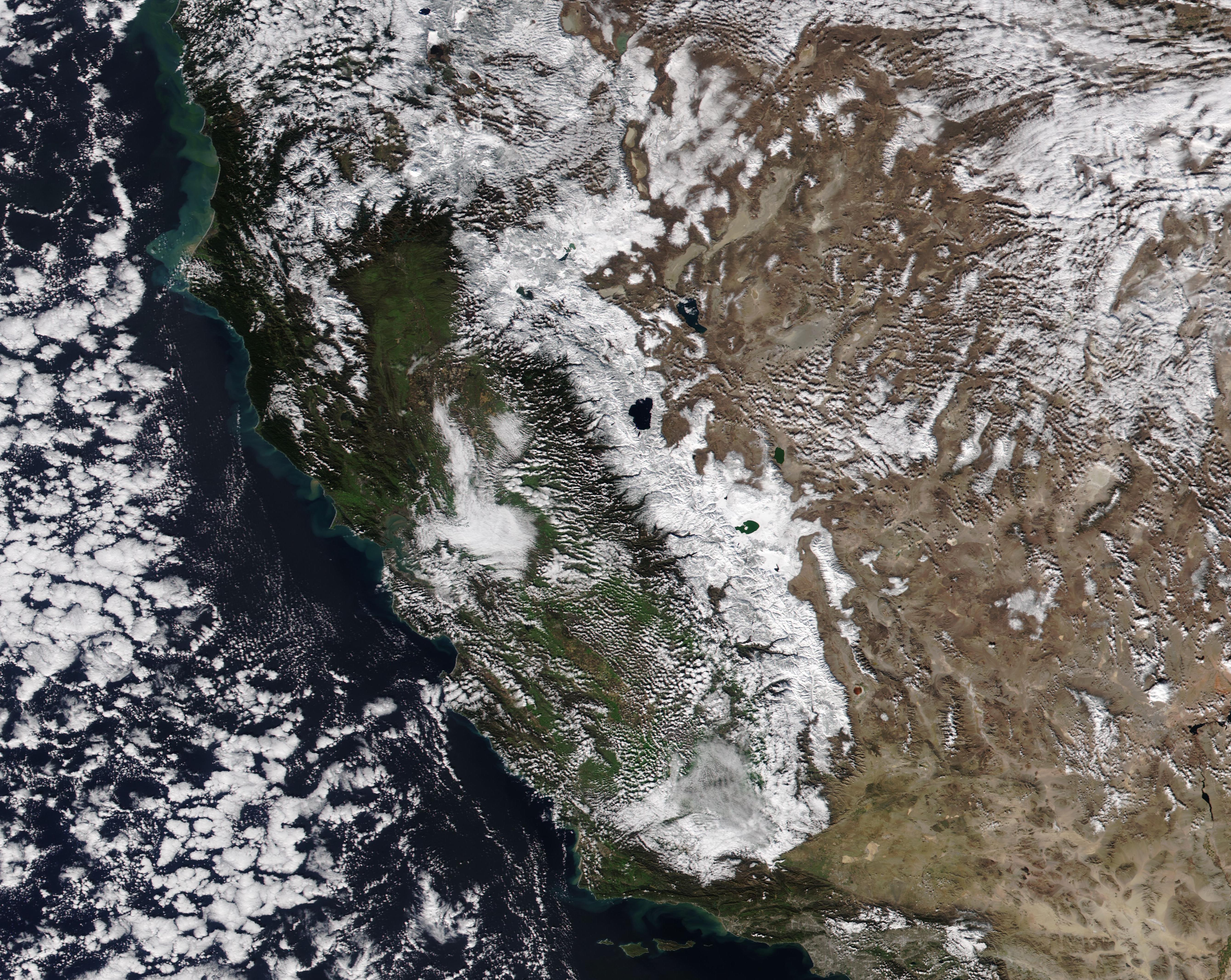
Visible satellite imagery of an atmospheric river streching towards the Western US, 21.12.2025, source:
NASA Worldview
|
 |
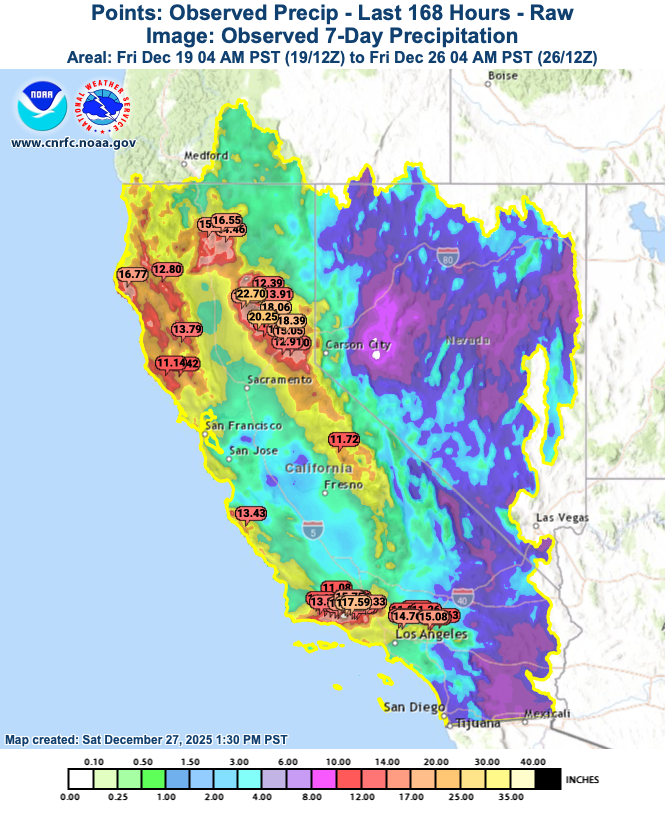
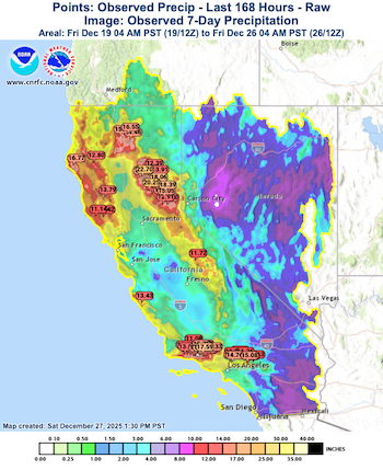
Heavy rains started to impact Northern California on December 21, 2025. Along westward-facing flanks of the Coastal mountain ranges and the Sierra Nevada in Northern California, storm-total precipitation locally reached more than 250 mm. Warm air masses led to an unseasonably high snow line across the Sierra Nevada, which in turn fostered a very low snow ratio of the precipitation. Subsequently, very large run-off was observed, causing river flooding in the northern parts of the Central Valley.
|
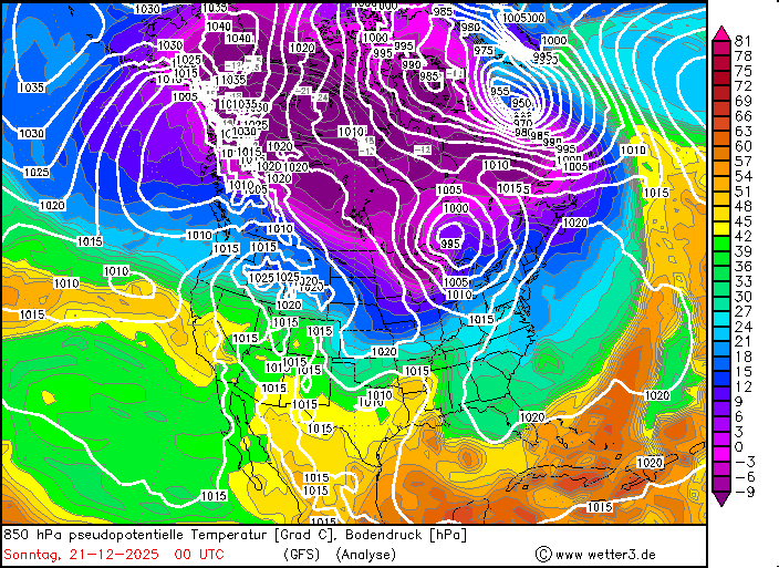
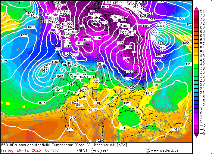
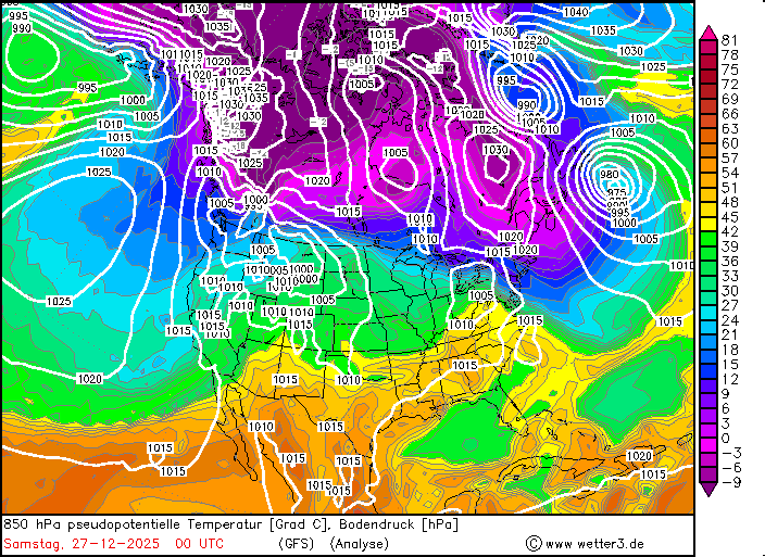
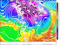
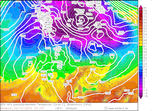
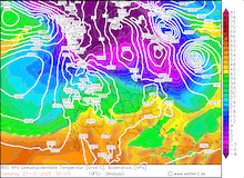
Daily development of the 850 hPa pseudo-potential temperature and sea-surface pressure over North America, 20.12.2025 00 UTC - 27.12.2025 12 UTC, source:
wetter3.de
|
 |
 |
 |
 |
 |
 |
 |
 |
By December 23, 2025, a trough moved over the Eastern North Pacific, leading to a more meridional flow pattern over North America. Subsequently, colder air masses impacted California, which in turn caused the snow levels to sink across the Sierra Nevada. At the same time, the more meridionally flow pattern allowed a subtropical ridge to extend across the Midwest. Unseasonably warm air masses impacted the Eastern US. In the Southern Plains, the warmest temperatures on record were observed on Christmas Day. In Northern Texas and Western Oklahoma, temperatures peaked at more than 30 °C on Christmas Day. Childress, TX recorded a maximum temperature of 30.6 °C. As far north as South Dakota, temperatures peaked above the 20 °C mark on Christmas Day.
7-day precipitation totals over California with measurement sites
highlighted that recorded a 7-day precipitation total of more than 250 mm,
19.12.2025 - 26.12.2025, source:
CNRFC
|
 |
Along the West Coast, a very potent low-pressure system impacted the state of California on December 24, 2025. Heavy precipitation was recorded across California, with the highest precipitation rates again along westward-facing flanks of the mountain ranges in the state. Enhanced shear by the upper-level trough facilitated the development of severe thunderstorms. Multiple tornado warnings were issued both on December 24 and 25, 2025. Notably, a tornado warning was issued for the city of Los Angeles for a weak EF0 tornado in the city.
3-day precipitation totals across the Los Angeles metropolitan area with
measurement sites highlighted that recorded a 3-day precipitation total of
more than 250 mm, 24.12.2025 - 26.12.2025, source:
CNRFC
|
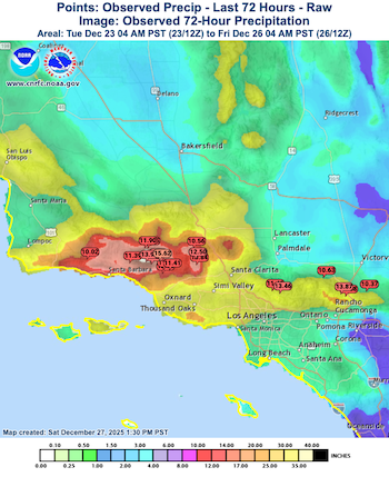 |
The lower snow line in the Sierra Nevada led to blizzard conditions with local hourly fresh snow accumulations of up to 10 cm accompanied by hurricane-force wind gusts. The amplifying meridional structure of the synoptic set-up over California caused the atmospheric river to develop a strong northerly component. Subsequently, the heaviest precipitation focused on the coastal mountain ranges around the Los Angeles metropolitan area. The highest precipitation totals were observed in the San Rafael Mountains near Santa Barbara. 72 h precipitation totals reached up to 411.7 mm at Nordhoff Ridge. Radar-indicated precipitation totals suggest that locally more than 500 mm of precipitation fell over the Christmas Season, with gridpoint-wise extrema of more than 700 mm in the San Rafael Mountains. Large parts of the Los Angeles metropolitan area recorded 3-day precipitation totals of 50 to 150 mm. In combination with one of the wettest November months on record, the heavy rains over the Christmas period pushed the water year precipitation totals close to the annual average. At Santa Barbara, 99 % of the average annual precipitation has been recorded since the start of the water year.
|
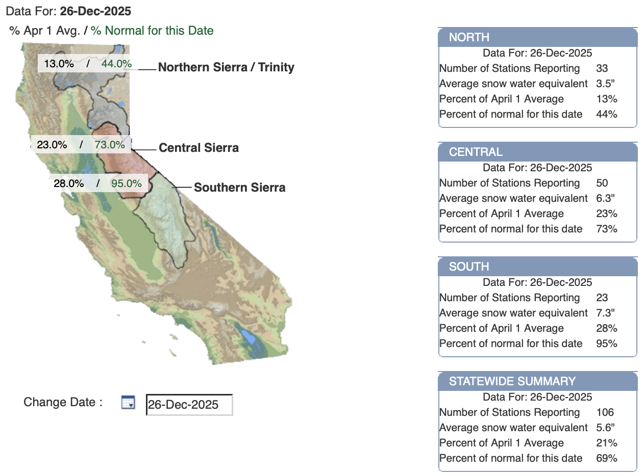
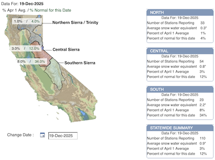
Snowpack conditions across the Sierra Nevada as indicated by the 7-day change of the snow water equivalent across the Sierra Nevada before the winter storms on 19.12.2025 (left) and after the passage of the powerful winter storm on 26.12.2025 (right), source:
CDEC
|
 |
 |
The heavy rains led to flash flooding in the densely populated metro area. Throughout the Christmas season, at least four people were killed by flash flooding in the entire state, along with significant damage to properties and businesses. 7-day precipitation totals in California peaked at 577.3 mm at Stirling City north of Donner Pass along the I-80 corridor. In the Sierra Nevada, multiple meters of fresh snow accumulation were observed. The substantial fresh snow accumulations pushed the snowpack in the Sierra Nevada close to the seasonal-to-date average after a very rainy start to the winter season. In addition, the heavy precipitation may elevate the entire state of California from drought conditions. This would mark the first occurrence of a completely drought-free state of California since 2011.
Text: KG
December 29, 2025
|