|
The first significant winter storm of the coming winter season 2025/26 has impacted Western and Central Europe in the third October decade. Storm Joshua (int. Benjamin) brought hurricane-force winds to both the French Atlantic Coast and the French coast along the English Channel. Wind gusts peaked at 161 kph at Fécamp along the English Channel on October 23, 2025.
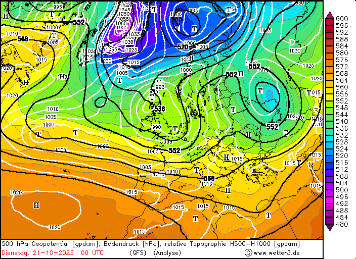
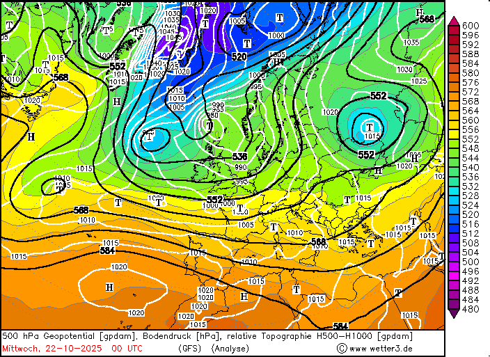
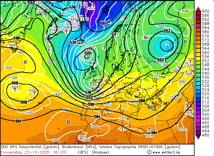
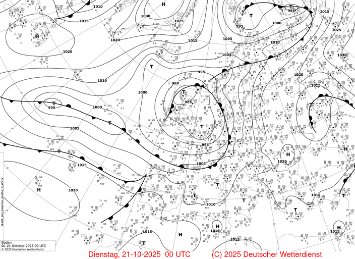
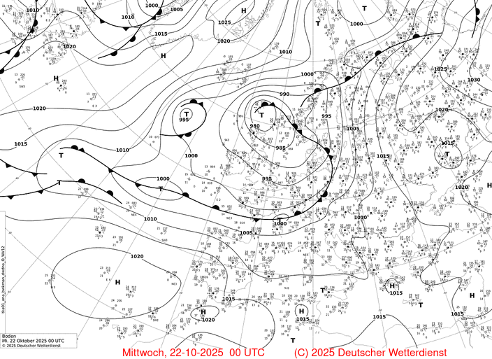
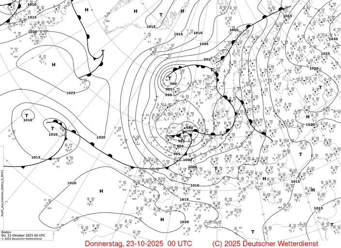
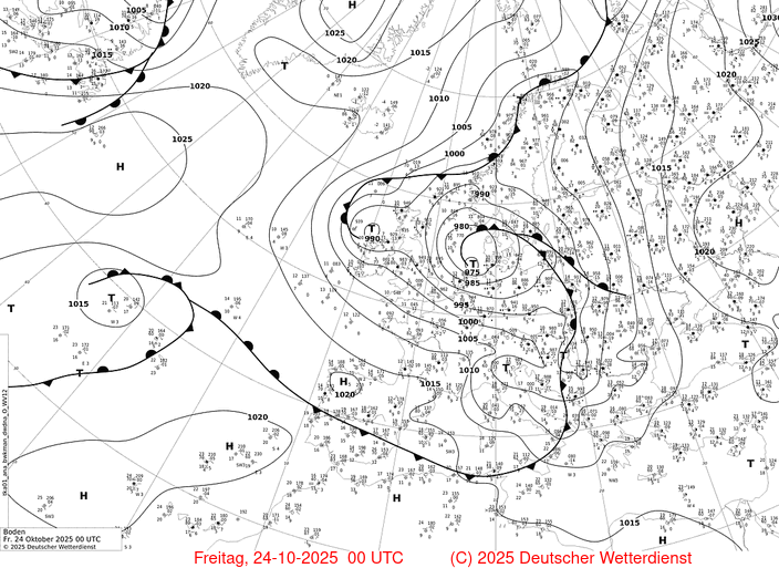
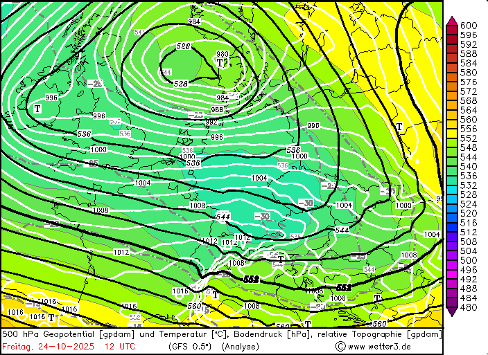
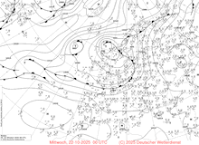
A strong surge of Arctic air masses reached the North Atlantic at the beginning of the third decade of October 2025. This led to the formation of a strong central cyclone located over the British Isles. In the western periphery of the central low, a secondary cyclogenesis commenced on October 21, 2025, south of Iceland. The secondary low deepened as it moved cyclonically around the central low to the southeast. On October 22, 2025, the central pressure of the secondary low remained constant as it approached Southern England. Late on October 22, 2025, the low Joshua began to increase its deepening rate. On the night of October 22, 2025, the cyclone explosively deepened as it moved along the English Channel.
|
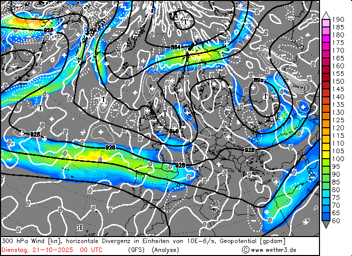
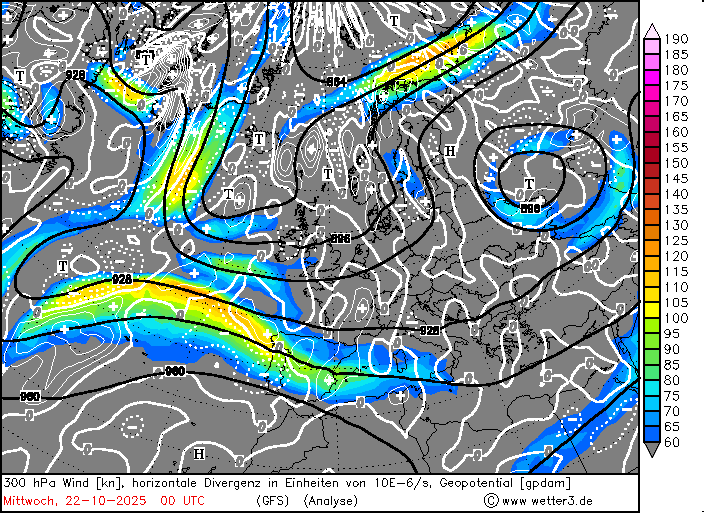
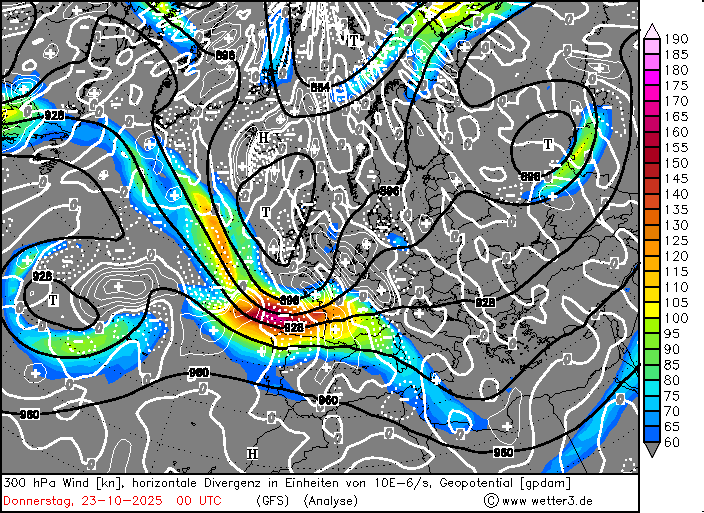
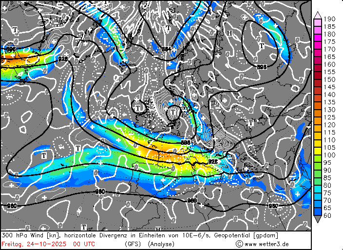
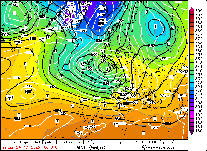
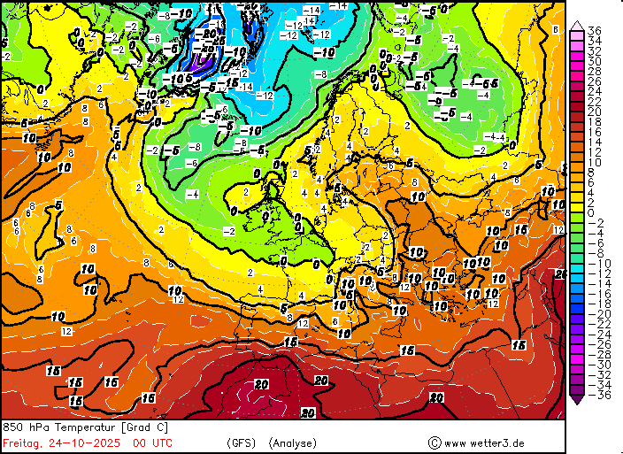
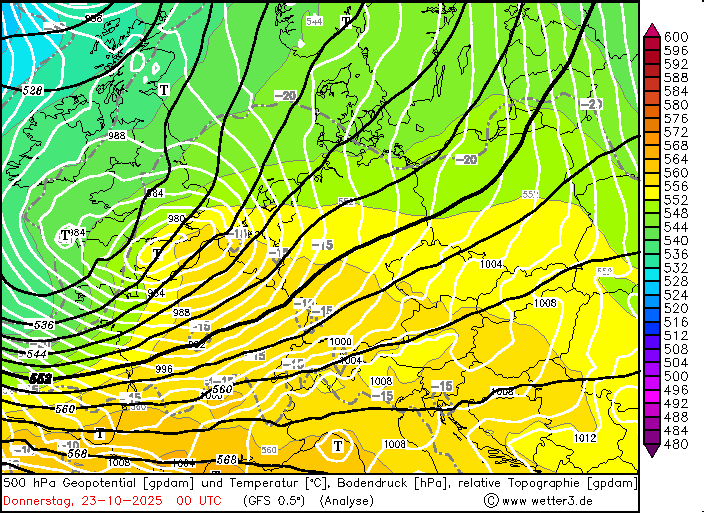
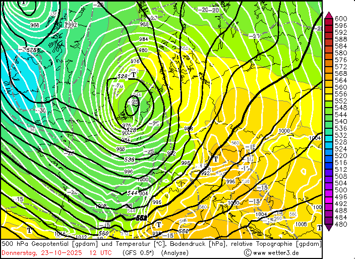
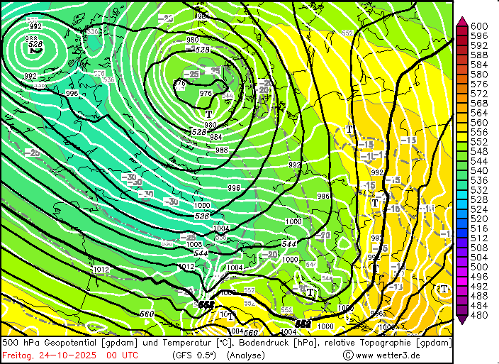
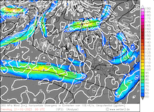
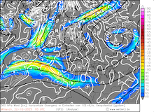
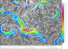
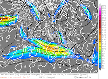
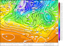
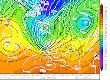
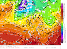
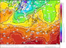
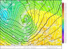
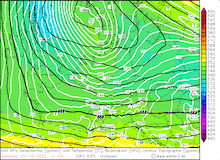
Daily development of the 300 hPa wind and divergence (first row), 500 hPa geopotential, 1000 hPa to 500 hPa thickness, and sea-surface pressure (second row), 850 hPa temperature (third row), and sea-surface pressure and analyzed fronts (fourth row) over Europe, 21.10.2025 00 UTC - 24.10.2025 00y UTC, source:
wetter3.de
|
 |
 |
 |
 |
 |
 |
 |
 |
 |
 |
 |
 |
 |
 |
 |
 |
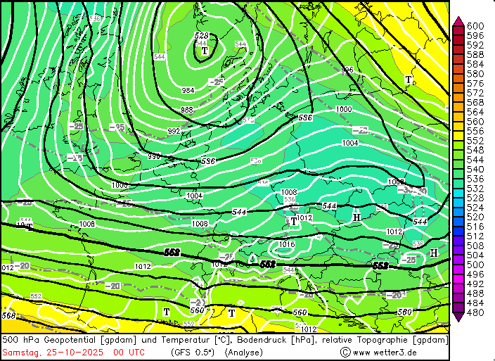
The explosive deepening of Storm Joshua occurred in the time frame where the surface low was located beneath a short jet streak spanning from the Central Northern Atlantic into Western France. Storm Joshua was located beneath the left exit region of the jet streak at the tip of the trough over the North Atlantic. This relative position to the jet streak features strong upper-level divergence that fueled the explosive deepening of Storm Joshua. Within a 12 h period, the central pressure of Storm Joshua decreased from 984 hPa on October 22, 2025, 18 UTC to 970 hPa on October 23, 2025, 06 UTC. Afterwards, the deepening of Storm Joshua subsided as it moved away from the upper-level jet streak. Behind Storm Joshua, a short-wave ridge exacerbated the horizontal pressure gradient along the back side of the low-pressure system. Early on October 25, 2025, Storm Joshua emerged from the Northern German lowlands to the North Sea.
|
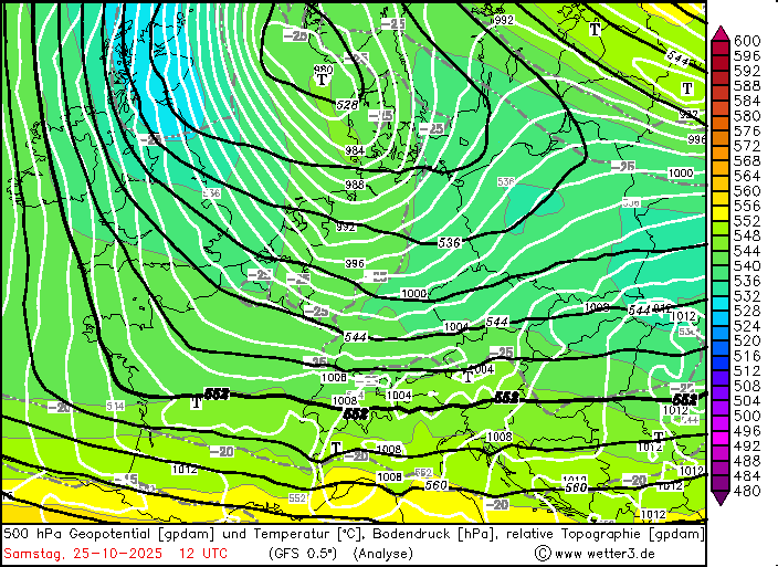
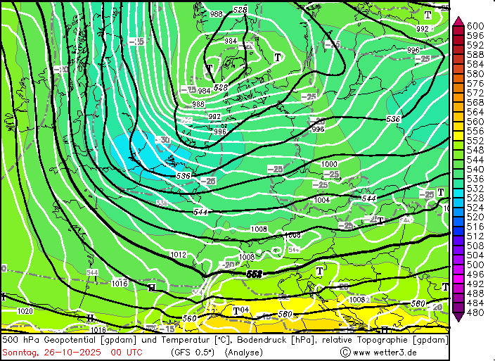
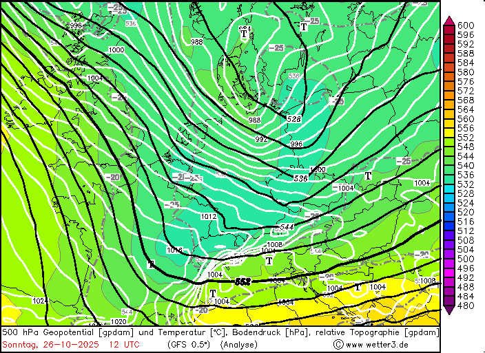
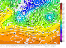
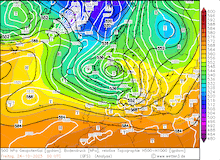
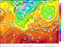
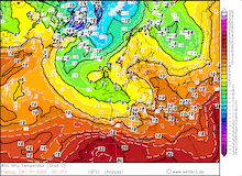
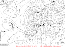
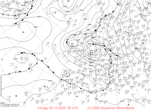
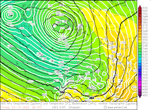
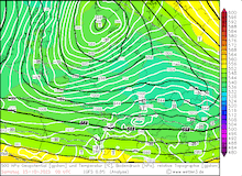
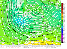
Development of the 500 hPa geopotential, 1000 hPa to 500 hPa thickness, and sea-surface pressure over Central Europe, 23.10.2025 00 UTC - 26.10.2025 12 UTC, source:
wetter3.de
|
 |
 |
 |
 |
 |
 |
 |
 |
On October 25, 2025, a mesoscale low-pressure system developed over Northern England. It is both valid to assume that this low-pressure system was a second secondary cyclogenesis or a tertiary cyclogenesis. Nevertheless, this mesoscale low-pressure system conserved sharp pressure gradients and thus high winds over Central Europe. In addition, the low-pressure system brought unseasonably cold air masses into Central Europe.
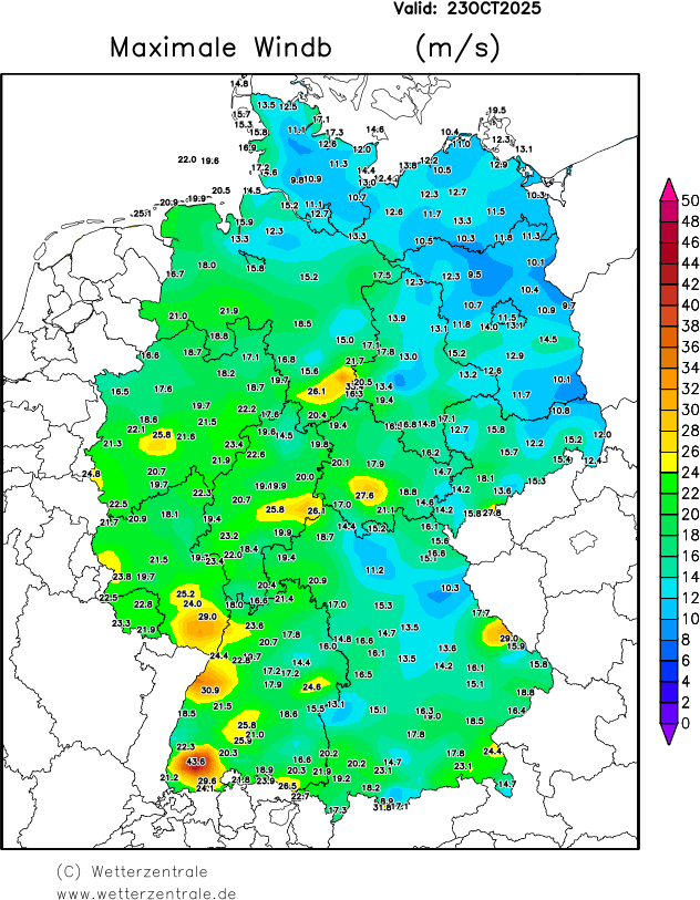
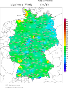
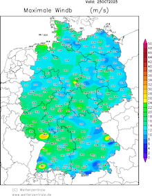
Due to the sharp pressure gradient on the western flank of Storm Joshua, hurricane-force winds were observed along both the French Atlantic Coast and the French coast along the English Channel. At exposed locations along the coast, wind gusts reached more than 120 kph on October 23, 2025. At Fécamp along the English Channel, wind gusts reached up to 161 kph. Behind the cold front of Storm Joshua, wind gusts reached up to 100 kph over Northeastern France, the Benelux states, and Western Germany. In the afternoon and evening hours, the cold jet wrapped around the cyclone center with the heavily occluded warm front. On the back side of the cyclone, high winds started to impact the North Sea. Along the shore of the Netherlands and Northern Germany, wind gusts reached up to 120 kph.
|
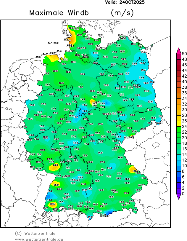
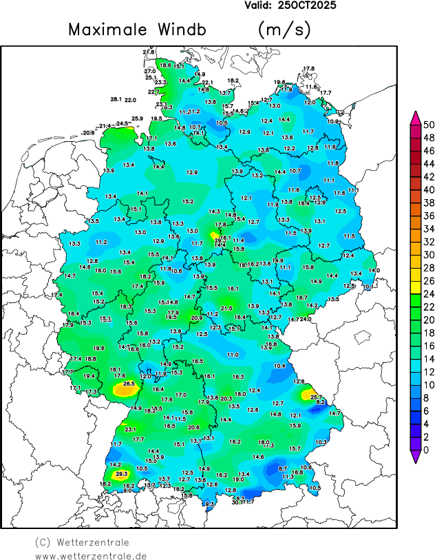
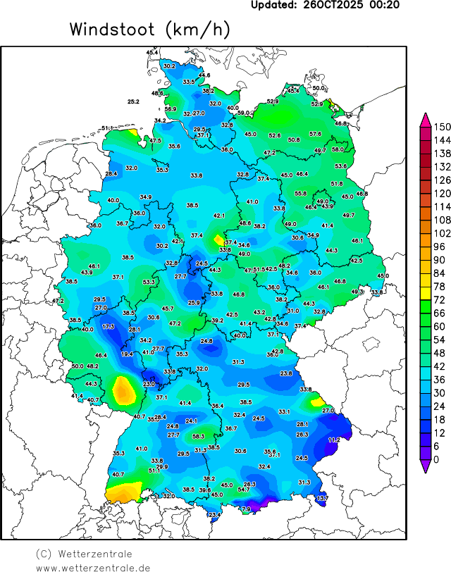
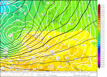
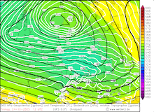
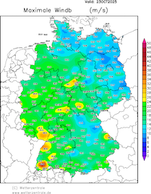
Daily maximum 10 m wind gusts over Germany, 23.10.2025 - 26.10.2025, source:
wetterzentrale
|
 |
 |
 |
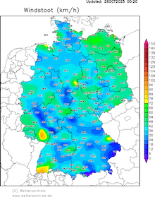 |
Due to the slow movement of Storm Joshua over the North Sea, high winds impacted Northern Germany for more than 24 h. Wind gusts peaked only in the afternoon hours of October 24, 2025, in far northern Germany. Due to the tertiary cyclogenesis, wind speeds remained above gale force levels until October 26, 2025.
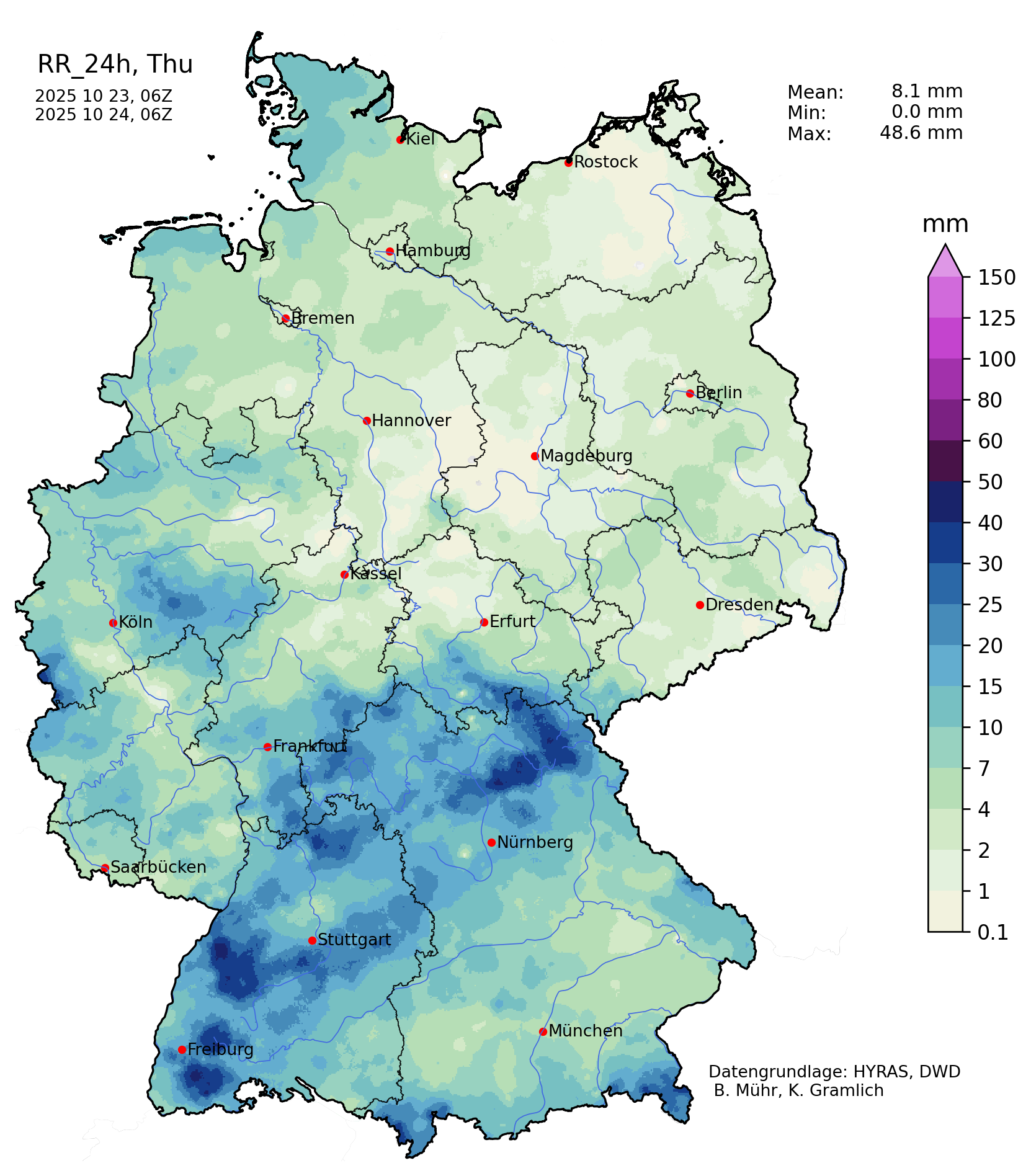
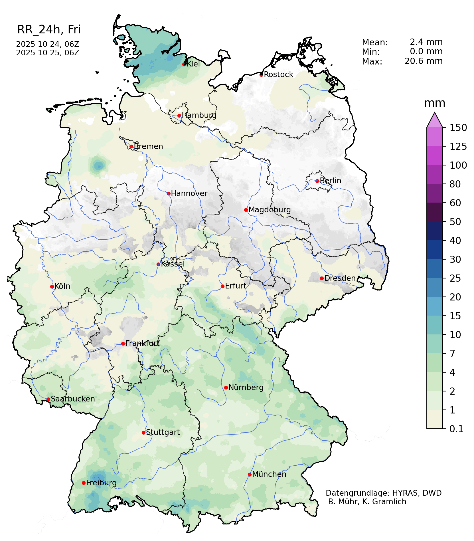
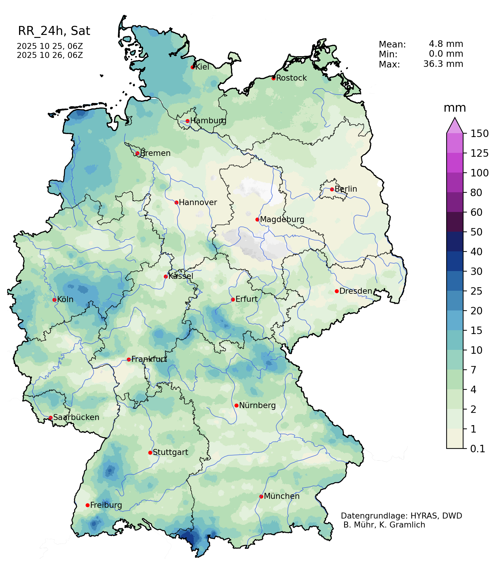
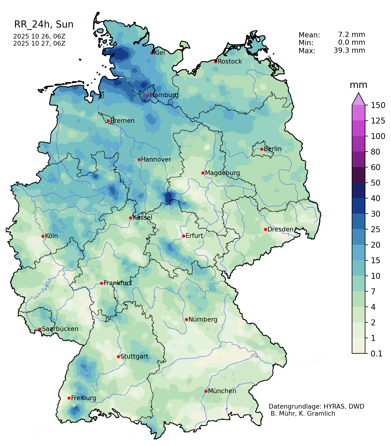
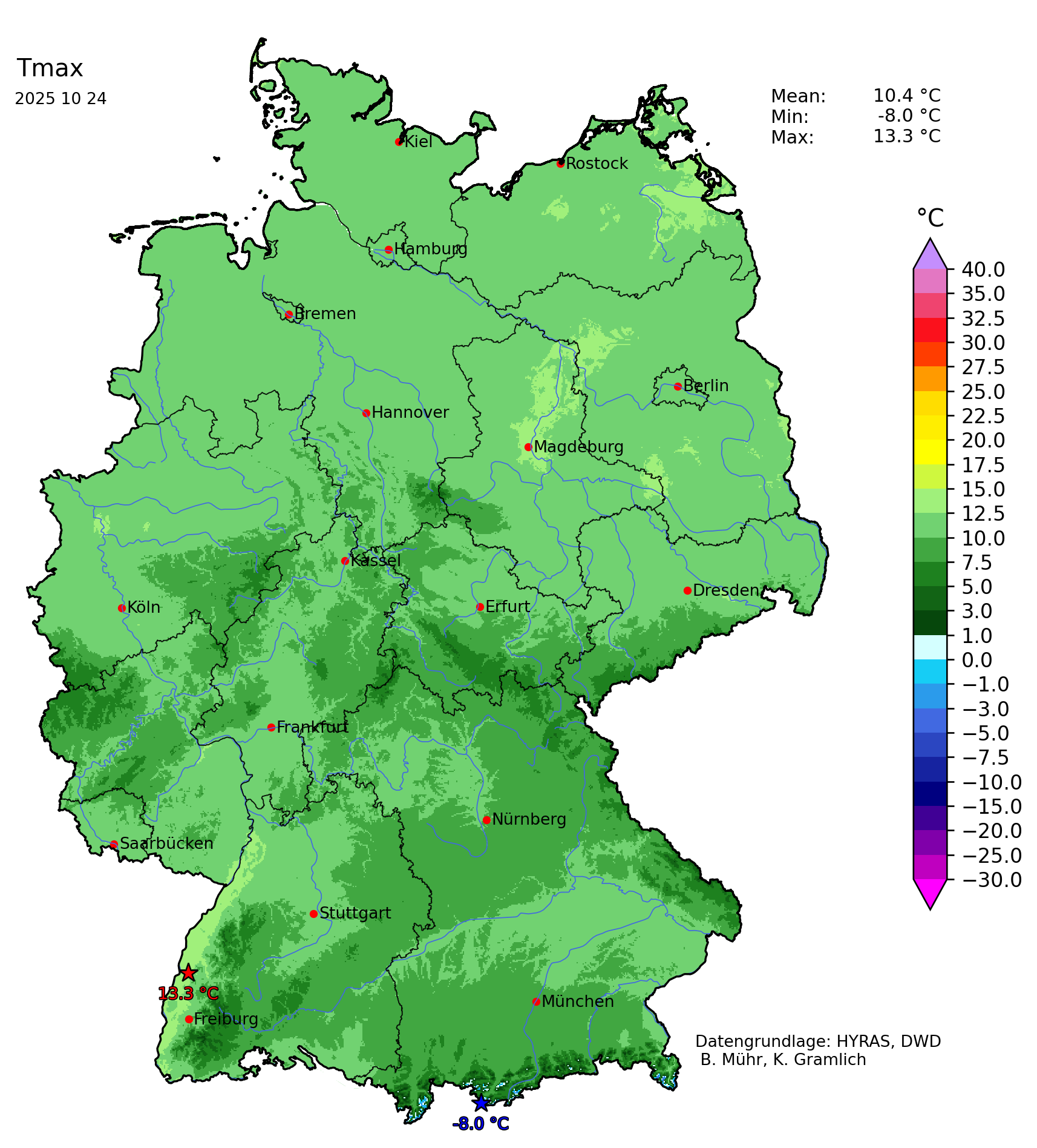
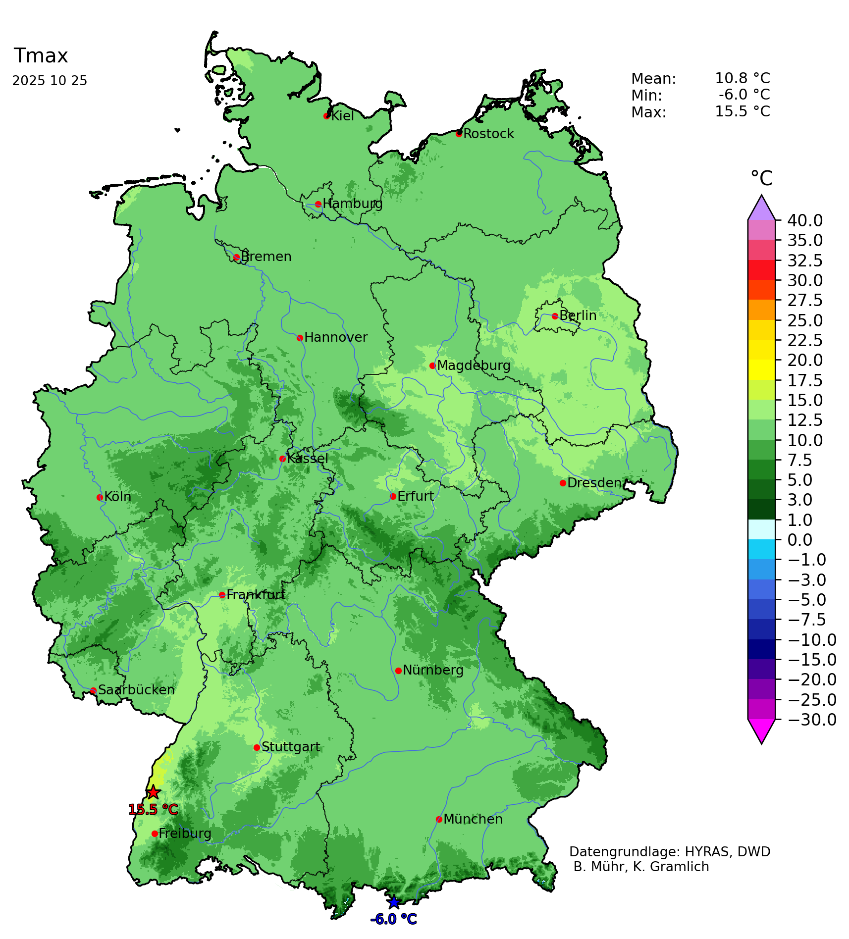
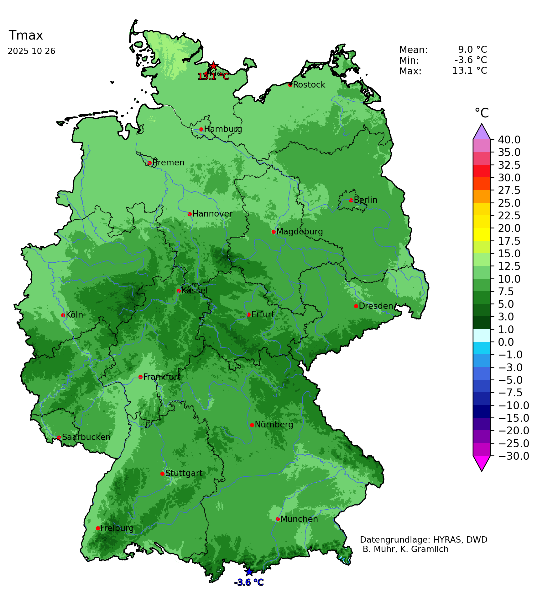
Storm Joshua also brought Central Europe heavy rain. Especially along western-facing mountain flanks, precipitation totals reached more than 100 mm in the Black Forest. Behind Storm Benjamin, very cool air masses for late-October reached Central Europe. 850 hPa temperatures fell to -2 °C. Subsequently, the snow line dropped significantly. In the Alps and the Black Forest, the first snow of the coming winter season accumulated at elevations above 1200 m. In the Alps, local fresh snow accumulations reached up to 20 cm on October 24, 2025. With the tertiary cyclogenesis, an even colder air mass reached Central Europe on October 26, 2025.
On October 26, 2025, a strong mesoscale precipitation system moved across Germany. The combination of heavy precipitation and a cold air mass led to dramatically falling snow lines. Along the Central German Mountain ranges, the snow line dropped to below 600 m. In the Harz mountains, multiple centimeters of fresh snow accumulated at elevations as low as 600 m. At times, snowflakes reached down elevations of only 400 m, leading to an early winter surprise. In total, Storm Joshua was a powerful extratropical cyclone that led to only minor travel disruptions. The unfavorable track across the English Channel with a lot of surface friction likely prevented an even more powerful cyclone from forming.
Text: KG
October 27, 2025
|