|
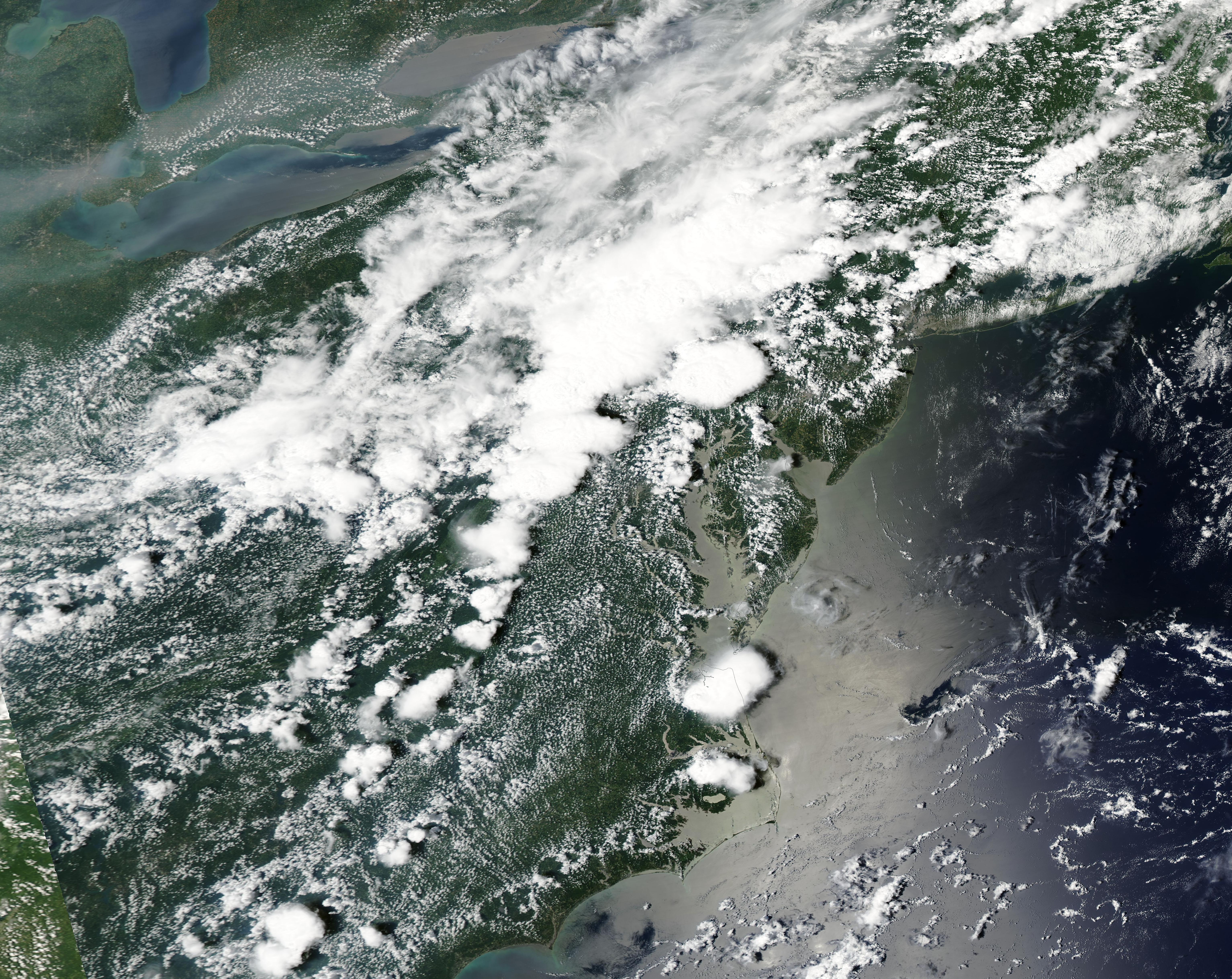
Strong thunderstorms caused flash flooding along the US East Coast, leaving at least 2 people dead. Flash flooding affected mainly the US states of Pennsylvania and New Jersey. In New York City, a torrential downpour brought a near record-breaking hourly precipitation total of 51 mm, leading to flash flooding in the city, including flooded subway stations.
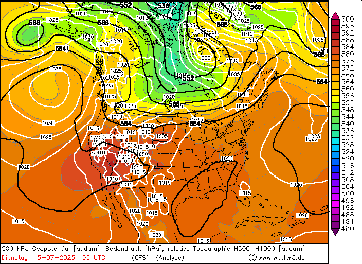
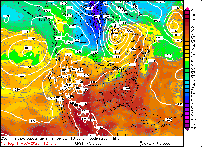
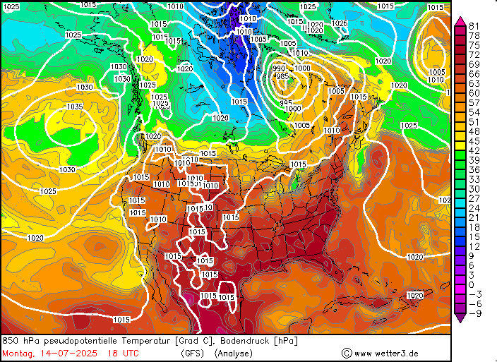
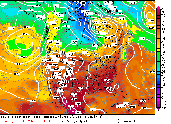
Ahead of a large trough over Canada, very warm and moist air masses could advance northwards along the US Atlantic Coast towards New England. After a spring with slight precipitation deficits along the US East Coast, the summer months have shown average precipitation activity. In July, the Mid-Atlantic Coast sees highs typically above 30 °C with high dewpoints often reaching more than 20 °C. With favorable upper-atmospheric synoptic conditions, this provides the meteorological environment for daily convective activity. This was observed since early July 2025 with nearly daily convective activity over the northeastern parts of the US.
|
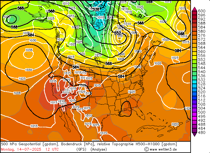
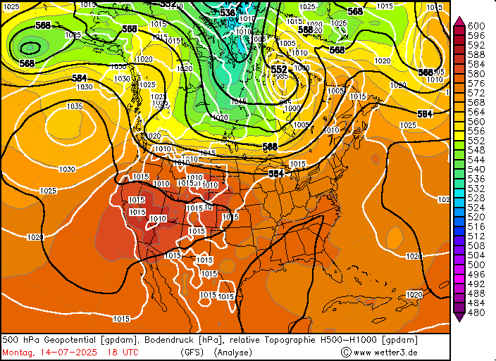
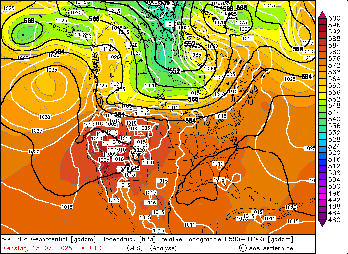
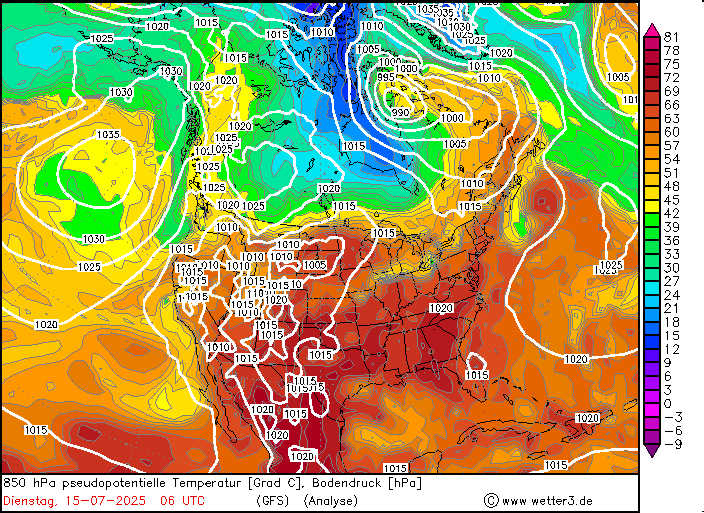
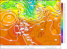
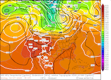
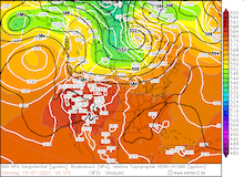
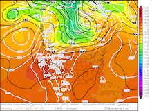
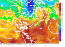
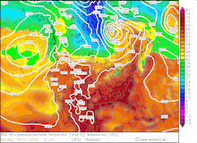
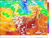
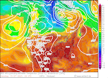
Development of the 500 hPa geopotential, 1000 hPa to 500 hPa thickness, and sea-surface pressure over North America (upper row) and 850 hPa pseudo-potential temperature and sea-surface pressure over North America (lower row), 14.07.2025 12 UTC - 15.07.2025 06 UTC, source:
wetter3.de
|
 |
 |
 |
 |
 |
 |
 |
 |
Ahead of the flash flood-inducing event on July 14 and 15, 2025, temperatures were at an elevated level compared to the climatological for the mid of July. On July 13, 2025, both Allentown, PA, and Reading, PA set daily records for the highest overnight minimum temperature, recording an overnight minimum temperature of 23.9 °C and 24.4 °C, respectively. On July 14, 2025, a short-wave trough moved across the northeastern parts of the US. With the short-wave trough, the environment along the US Mid-Atlantic Coast became very favorable for thunderstorms to occur. By afternoon on July 14, 2025, multiple severe thunderstorms had developed along the I-95 corridor.
|
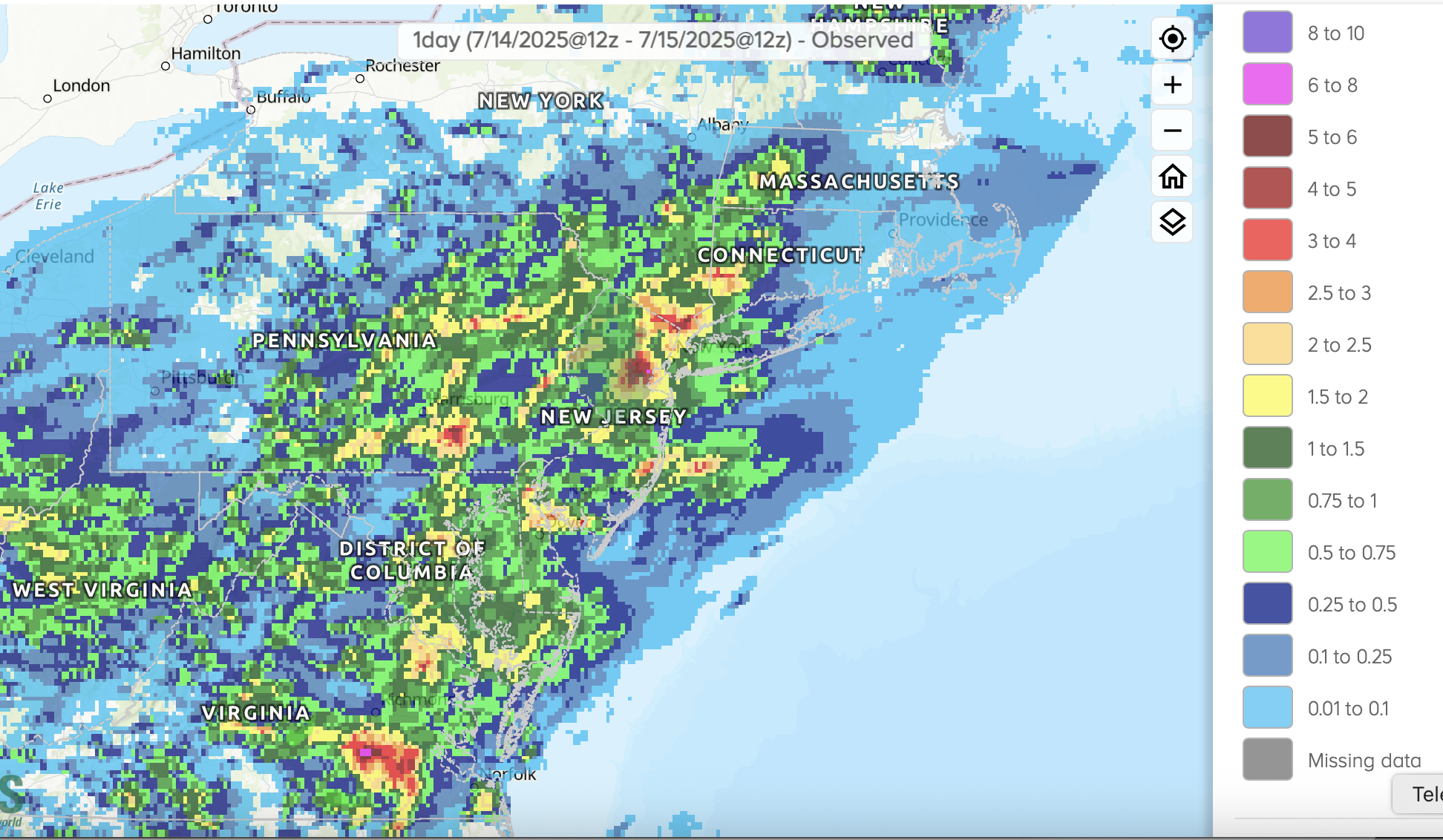
1-day precipitation totals along the US East Coast, 14.07.2025 12 UTC - 15.07.2025 12 UTC, source:
Water NOAA
|
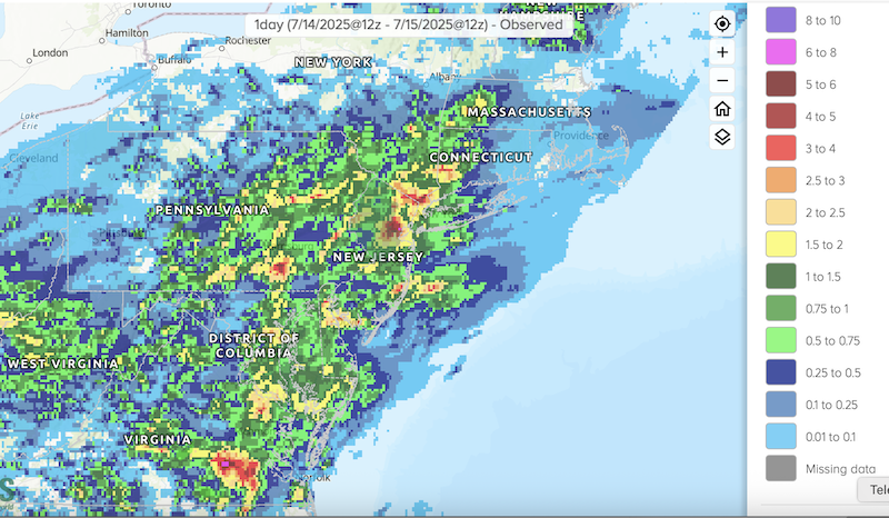 |
By evening, a severe thunderstorm impacted New York City. In the hour from 23 UTC to 00 UTC on July 14, 2025, heavy rains reached the city. Within this hour, a record-breaking hourly precipitation total of 51 mm was recorded. This was the second-highest hourly precipitation total observed in the city. Due to this torrential downpour, strong flash flooding was reported throughout the city. Parts of the subway system were flooded by the heavy rains. To the west of New York City, heavy rains caused flash flooding in New Jersey. The town of Plainfield, NJ, was affected by a dangerous flash flood. Two people were killed by the rapidly rising water levels in the town. This comes just one week after another deadly flash flood, which affected the area around Plainfield in early July. Further south along the US East Coast, flash flooding was also observed in parts of Virginia and Maryland. In the coming days, thunderstorm activity will continue along the US East Coast, giving rise again to the potential for localized flash flooding.
Text: KG
July 16, 2025
|