|
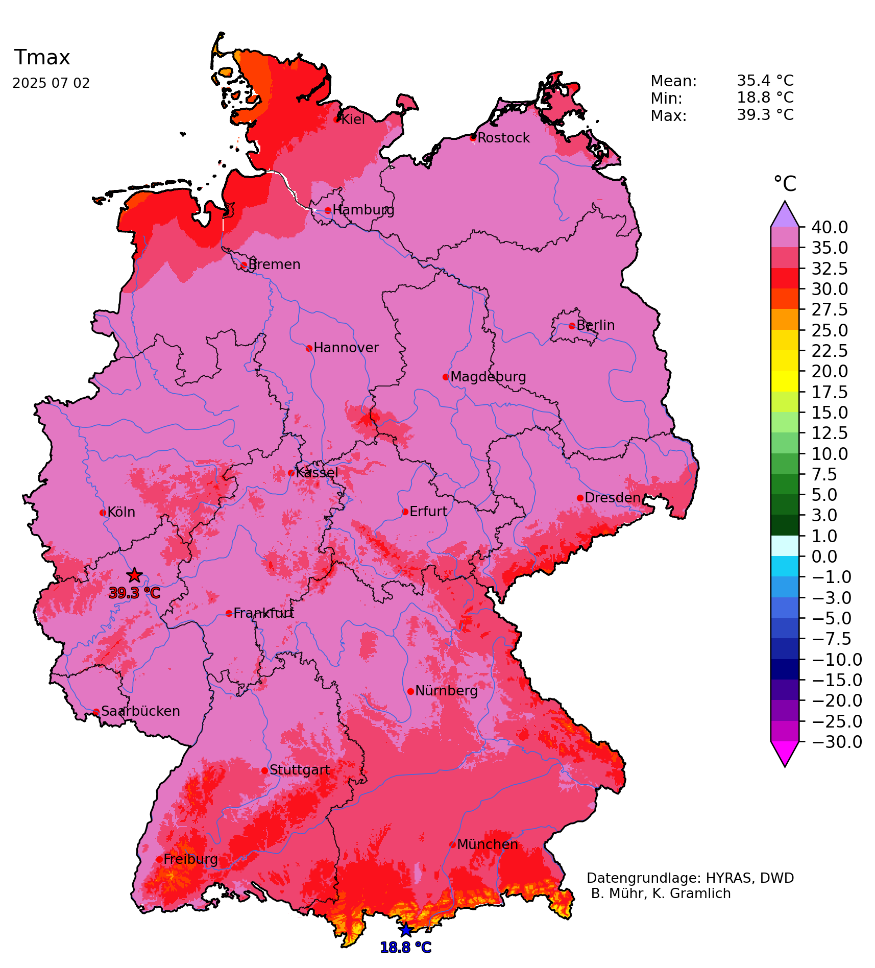
An intense heat wave has impacted much of Western and Central Europe in late June and early July 2025. Both in Portugal and in Spain, new records for the highest temperature observed in the month of June were set. Temperatures reached 46 °C for the first time in June in both countries on the Iberian Peninsula. In Germany, the highest temperature was observed at Andernach, RP on July 02, 2025, with a maximum of 39.3 °C.
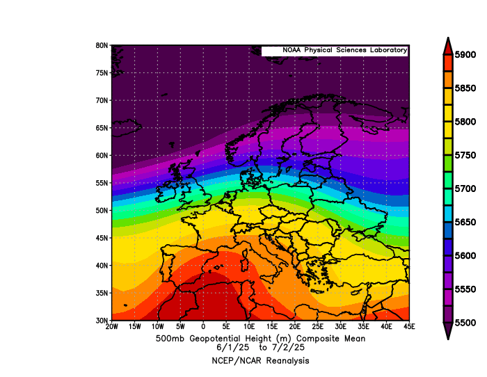
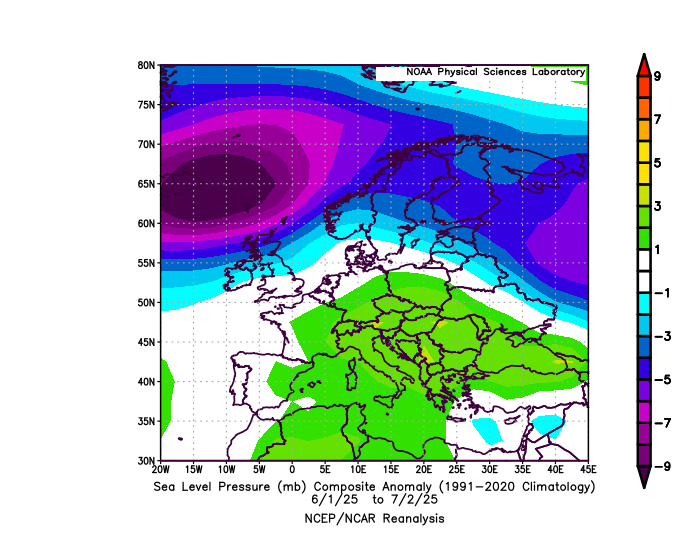
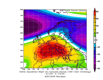
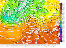
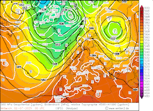
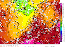
Much of the year 2025 in Europe has been dominated by unusually strong ridges, leading to significant precipitation deficits mostly in the central parts of the continent. Ridges over Western or Central Europe occurred at an abnormally high frequency since the beginning of the year. Since the beginning of the summer of 2025, strong positive geopotential anomalies have developed over the Mediterranean. The mean geopotential in this period shows the tendency for a ridge extending from Northern Africa into Central Europe. This general synoptic set-up led to elevated 850 hPa temperatures over the Iberian Peninsula and France. 850 hPa temperature anomalies reached more than 4 K since June 01, 2025. Additionally, the mean sea level pressure shows positive anomalies around the Mediterranean in the same period.
|
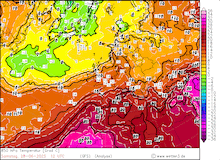
Mean 500 hPa geopotential (upper left), 500 hPa geopotential anomaly (upper right), 850 hPa temperature anomaly (lower left), and mean sea level pressure (lower right) over Europe, 01.06.2025 - 02.07.2025, source:
PSL NOAA
|
 |
 |
 |
 |
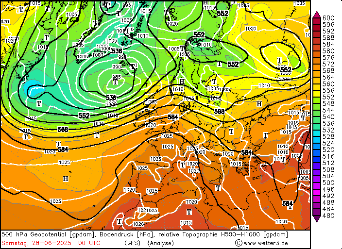
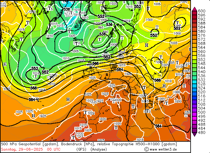
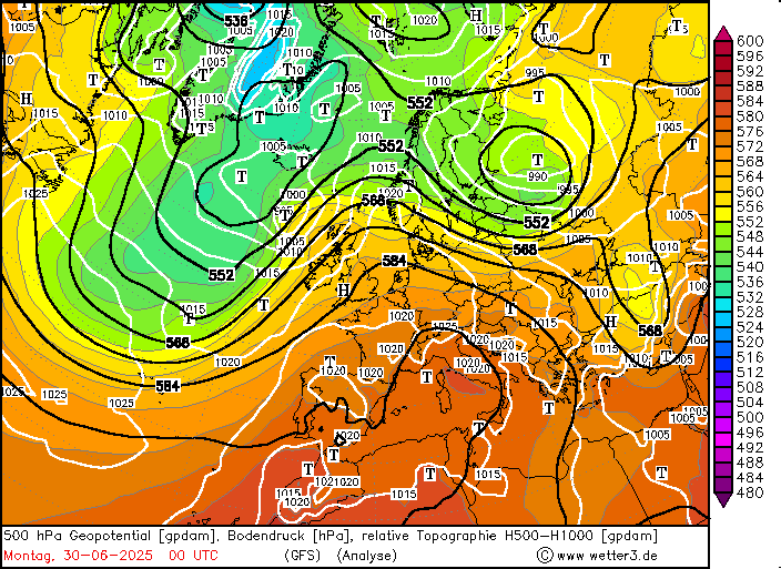
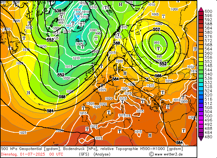
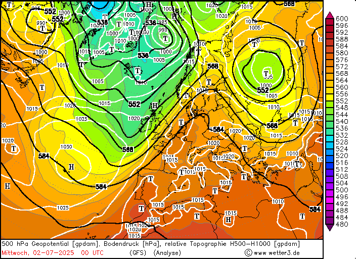
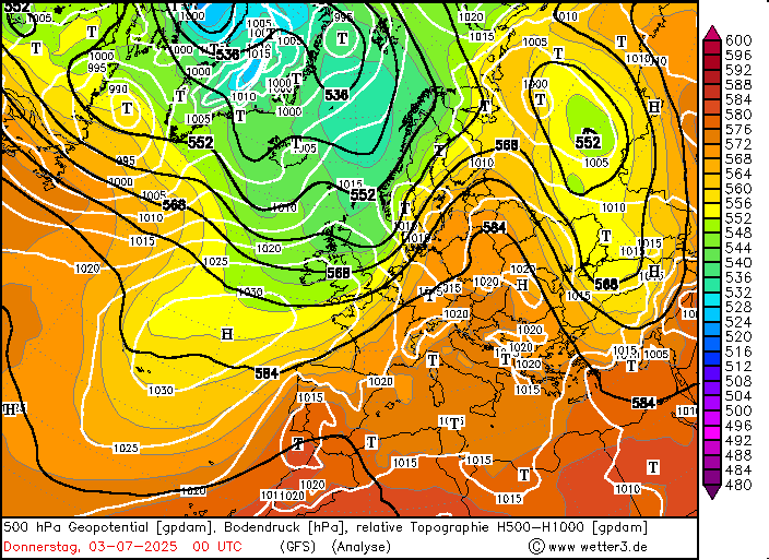
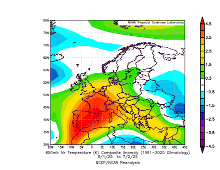
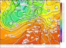
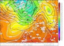
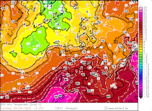
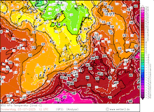
By late June 2025, the synoptic set-up featured a strong zonal pattern over the Northern Atlantic. Over Europe, the current showed more meridional tendencies. From a trough over Iceland, a cut-off low formed off the coast of the Iberian Peninsula. This cut-off low was subsequently reintegrated into the main westerly current by June 27, 2025. Behind the trough, a large ridge expanded from North Africa. With this ridge, abnormally hot air masses could penetrate northwards. Over the Iberian Peninsula, 850 hPa temperatures reached over 25 °C. In the following days, a large outbreak of Arctic air masses over the North Atlantic led to the formation of a large trough. This trough amplified the wave pattern over Europe. This allowed the ridge over the Iberian Peninsula to expand far northeastwards across Europe.
|
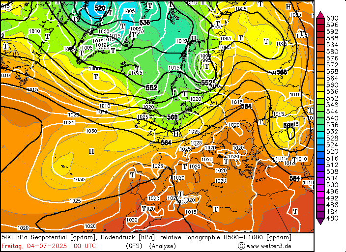
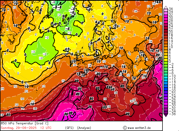
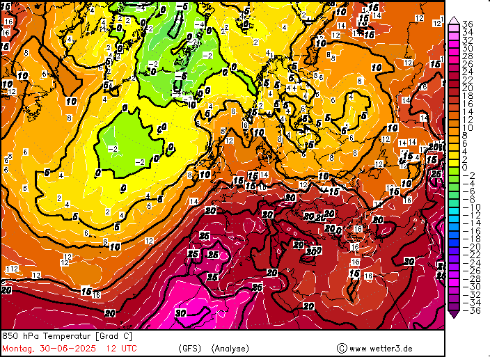
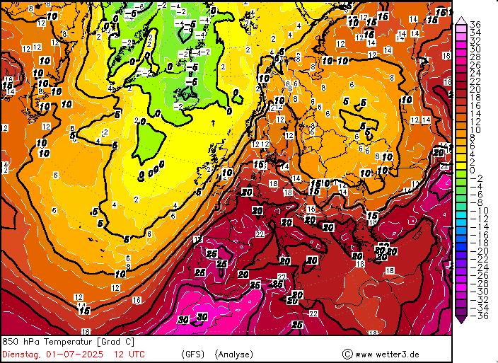
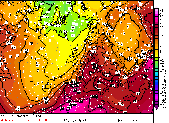
Daily development of the 500 hPa geopotential, 1000 hPa to 500 hPa thickness, and sea-surface pressure over Europe, 27.06.2025 00 UTC - 04.07.2025 00 UTC, source:
wetter3.de
|
 |
 |
 |
 |
 |
 |
 |
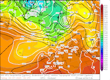 |
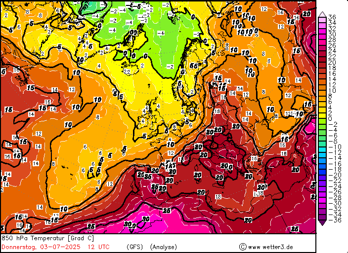
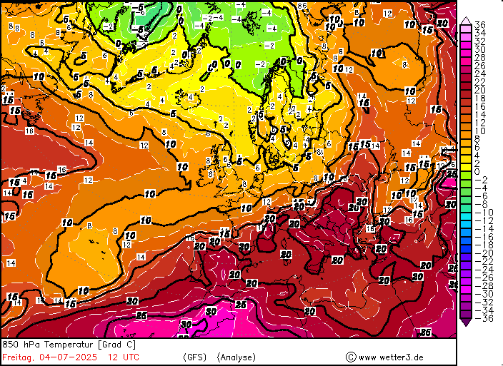
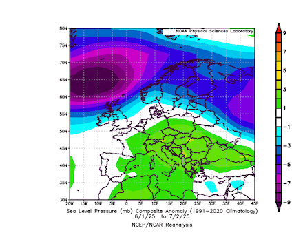
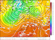
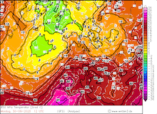
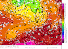
850 hPa temperatures reached more than 20 °C in France. By July 01, 2025, the ridge over Europe had expanded into the Polar Ocean. With a trough over the Eastern North Atlantic, the geopotential gradient over Europe increased sharply. This increased the advection of very warm air masses into Central Europe. Over Germany, 850 hPa temperatures reached more than 20 °C on July 01 and 02, 2025. By July 03, 2025, the main trough moved over the British Isles. Colder air masses made it into Central Europe by July 04, 2025.
|
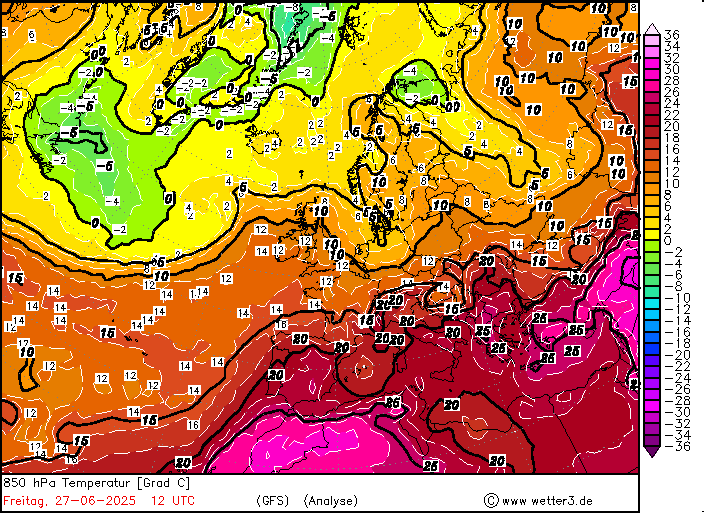
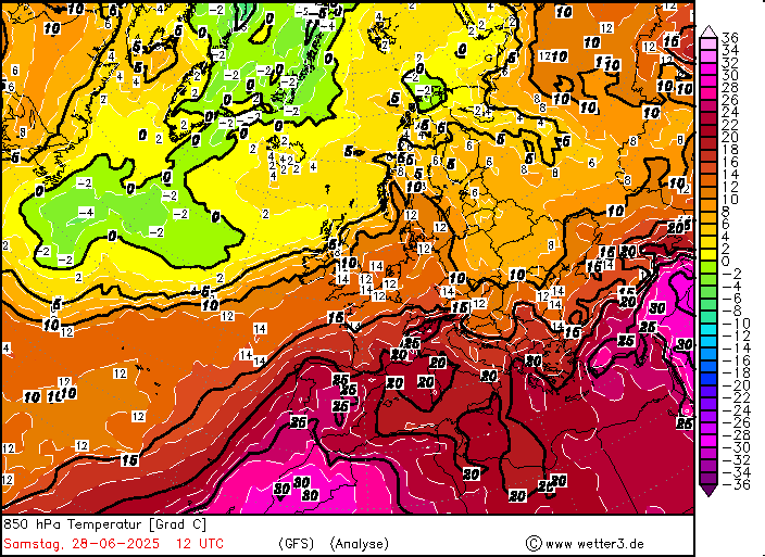
Daily development of the 850 hPa temperature over Europe, 27.06.2025 12 UTC - 04.07.2025 12 UTC, source:
wetter3.de
|
 |
 |
 |
 |
 |
 |
 |
 |
The highest temperatures during this heat wave were observed over the Iberian Peninsula. By late June 2025, temperatures reached far above the 40 °C mark across the southern part of the peninsula. Both in Spain and in Portugal, the national temperature records for June were broken. In Portugal, a maximum temperature of 46.6 °C was observed at Mora on June 29, 2025. This elevated the national temperature by 1.7 K, which was set on June 17, 2017. On June 28, 2025, the national temperature record for June for Spain was increased by 0.8 K as the measuring site in El Granado measured a temperature of 46.0 °C. From June 27 to July 04, 2025, temperatures reached more than 40 °C on each day over the Iberian Peninsula. As the current grew more meridional, the hot air masses reached France. From June 28 to July 02, 2025, temperatures peaked above the 40 °C mark on each day over France. Multiple measuring sites observed maximum temperatures of up to 42 °C in France. The southern half of Britain was also affected by high temperatures on June 30 and July 01, 2025. In London’s St. James Park, a maximum temperature of 34.5 °C was recorded on July 01, 2025.
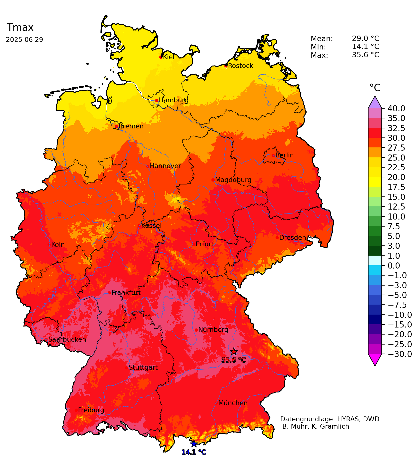
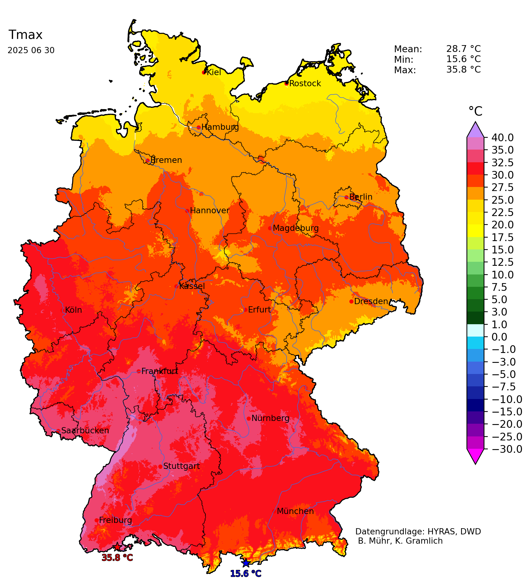
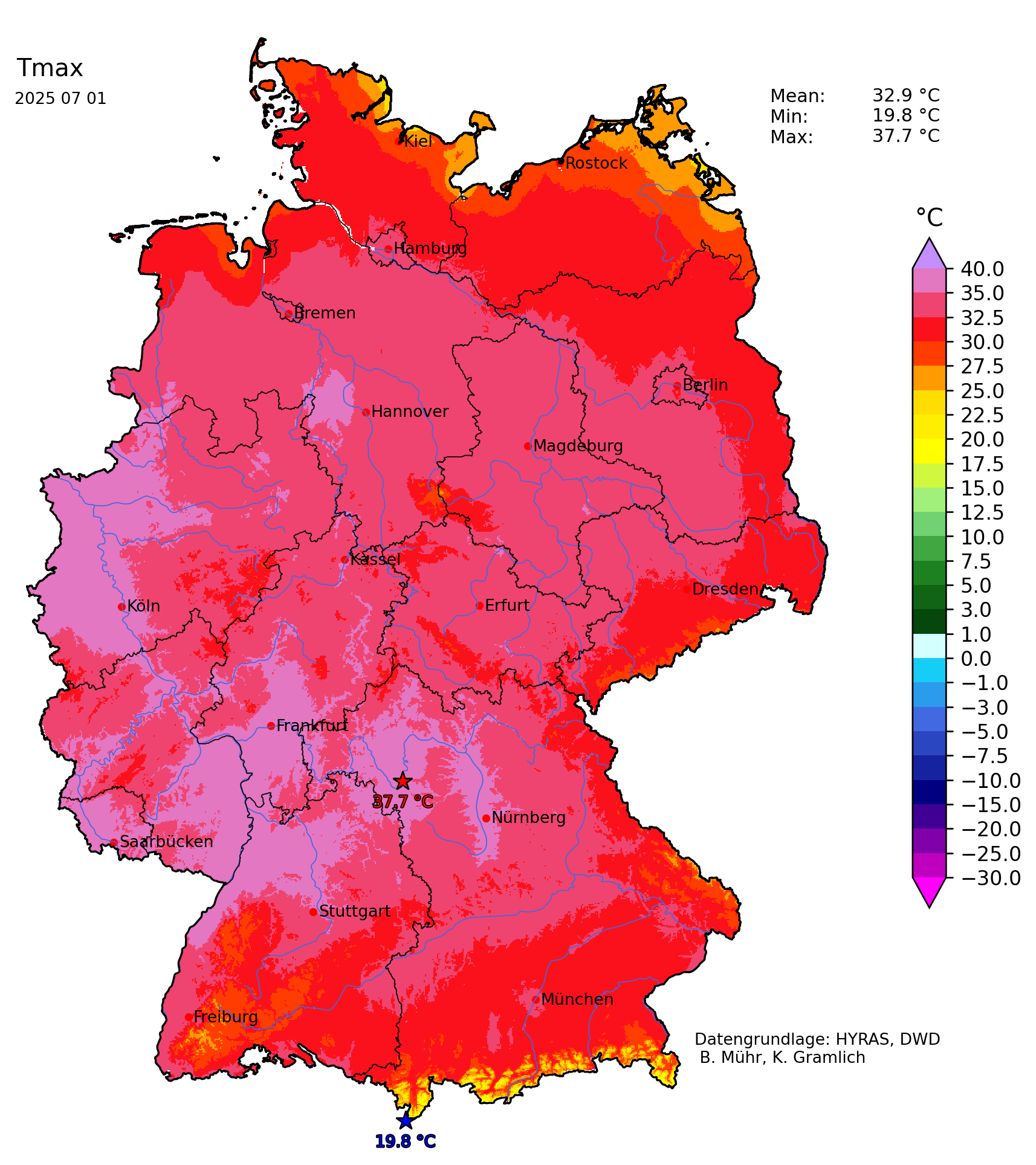
From June 29 to July 02, 2025, temperatures over Germany reached more than 35 °C. On average, the highest temperatures in Germany were observed along the Upper Rhine Valley in the southwestern part of Germany. The peak of the heat wave in Germany occurred on July 01 and 02, 2025. On July 01, 2025, severe heat was confined to the western half of Germany with temperatures of up to 37.8 °C at Kitzingen, BY. On July 02, 2025, severe heat spread into Eastern Germany as well. Along the Rhine River, afternoon temperatures reached their highest values. At Andernach, RP, a maximum temperature of 39.3 °C was measured.
Additionally, nearly a dozen measuring sites recorded new all-time temperature records in Germany. Notably, this list contains five stations with records going back at least 30 years. Bad Berleburg, NW measured a maximum of 34.0 °C (+0.4 K), beating the record from August 12, 2003 (records since December 1986). Hiddensee-Vitte, MV reached a maximum temperature of 35.2 °C (+0.2 K), surpassing the record from July 10, 2010 (records since April 1931). Barth, MV measured a temperature of 35.7 °C (+0.5 K), beating the record from July 21, 1992 (records since January 1947). Bochum, MV reached a maximum of 37.4 °C (+0.1 K), surpassing the record from August 07, 2018 (records since January 1940). Klitzschen bei Torgau, SN measured a maximum temperature of 38.5 °C (+0.3 K), beating the record from June 19, 2022 (records since October 1994). Further, around another dozen monthly temperature records for July were broken on July 02, 2025.
|
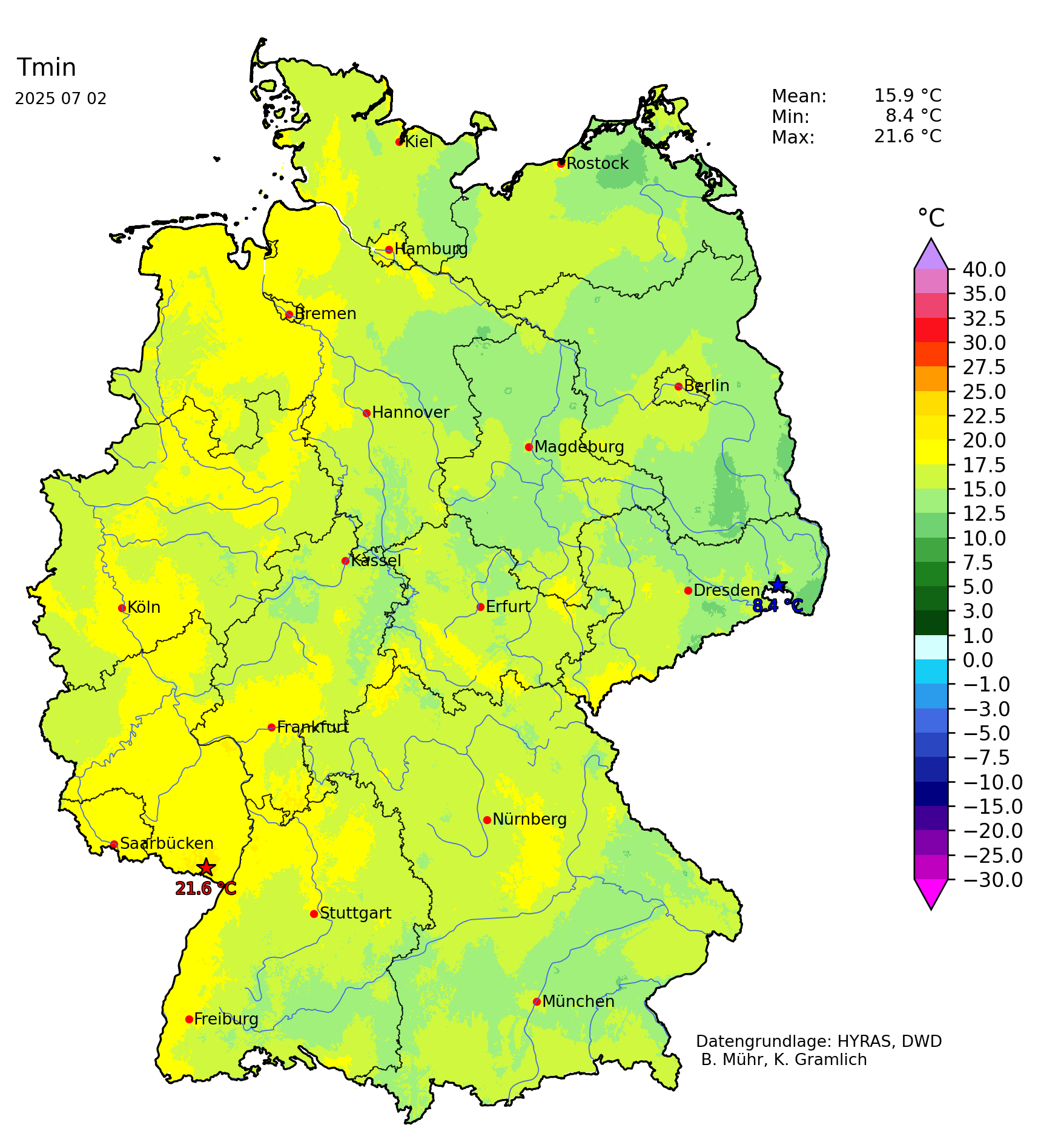
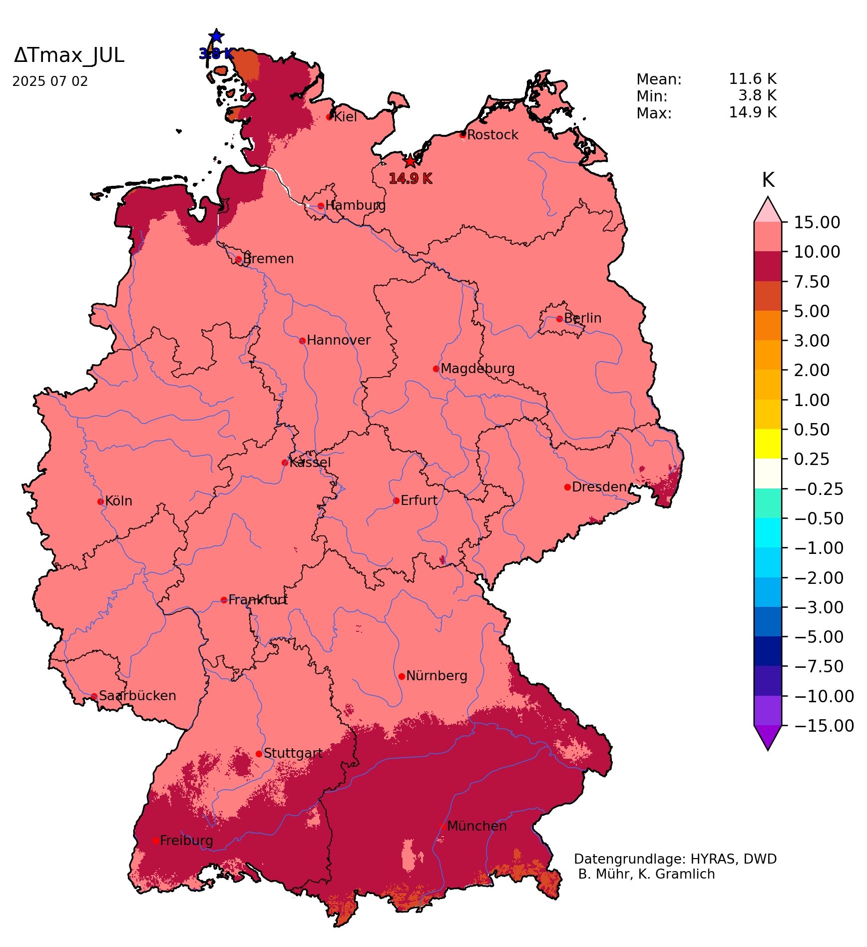
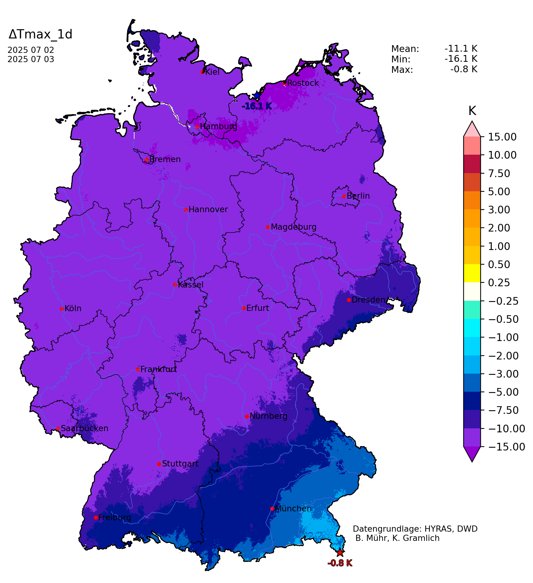
Daily minimum temperature (left), daily maximum temperature deviation on July 02, 2025 (middle), and 1-day maximum temperature change on July 03, 2025 (right), over Germany, source:
Wettergefahren-Frühwarnung
|
 |
 |
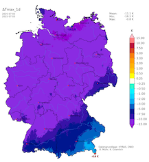 |
Heat stress levels were elevated significantly on July 02, 2025, due to very high overnight low temperatures. In the Rhein-Ruhr metropolitan area, temperatures remained well above the 20 °C mark during the night to July 02, 2025. At Essen, NW, a nocturnal minimum temperature of 25.0 °C was recorded in the night from July 01 to July 02, 2025. By July 03, 2025, much colder air masses reached Germany. In most parts of the country, daytime maximum temperatures dropped by more than 10 K.
|
30 min lightning strikes over Central Europe, 02.07.2025 11 UTC - 04.07.2025 00 UTC, source:
Blitzortung
|
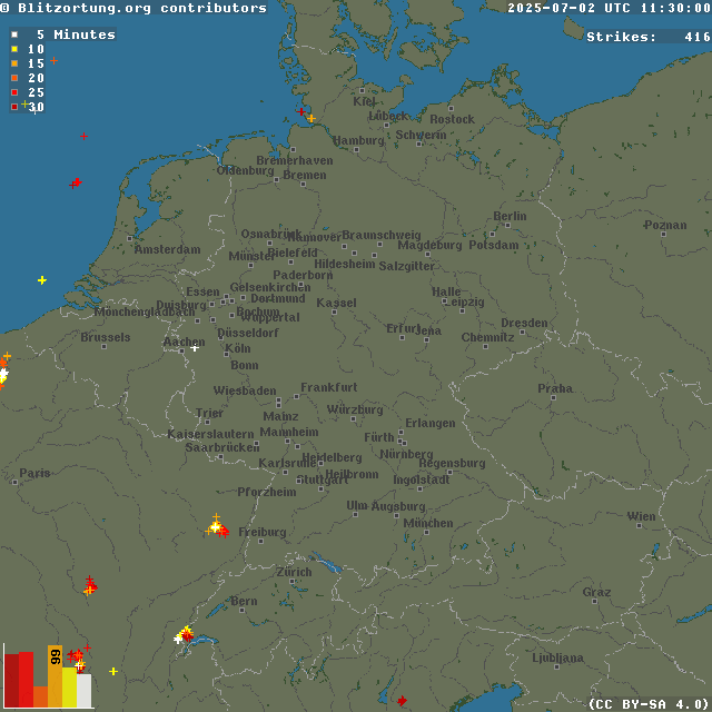 |
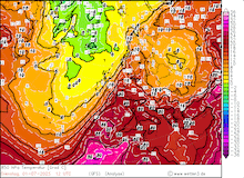
On July 02, 2025, the approaching trough over the British Isles brought a favorable synoptic set-up for severe convection to occur over Northern France, Belgium, the Netherlands, and the northwestern parts of Germany. By afternoon, large-scale convective activity had developed over the area, preventing higher daily maximum temperatures. Along the cold front of the trough, a sharp temperature gradient developed. This strong temperature gradient led to widespread high wind speeds with gusts reaching more than 80 kph. These high winds spread southeastwards across Germany. Additionally, the thunderstorms developed in an environment favorable for severe convective downdrafts to occur with DCAPE values of around 1000 J/kg ahead of the cold front. Locally, severe convective downdrafts of more than 100 kph were observed over the affected areas. Due to the foliage of the trees, these winds led to significant damage.
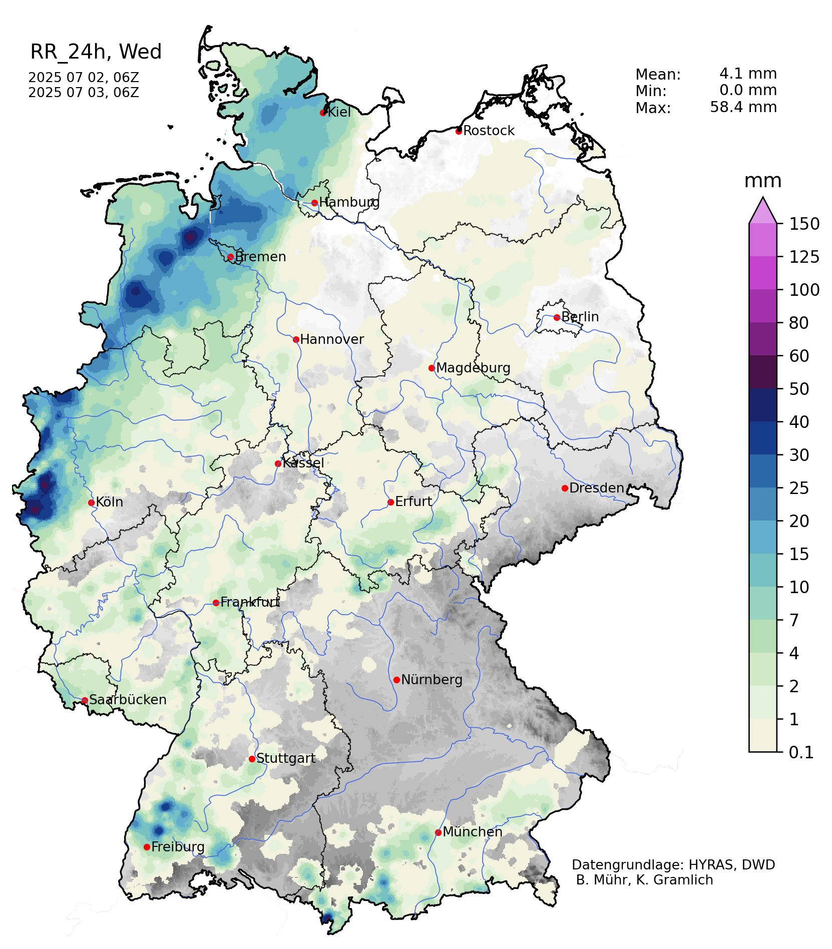
A supercell near Emden, NI, brought large hail with hailstones larger than 3 cm. At Eschweiler-Kinzweiler, NW, a daily precipitation total of 58.8 mm was measured on July 02, 2025. On July 03, 2025, the colder air masses reached the Northern Alps. Close to the Alps, locally severe convection developed on that day. Heavy downpours occurred as the thunderstorms moved eastwards along the Danube Plain ahead of the colder air masses. Due to the drought conditions persisting in much of Central Europe, forest fires have ignited during the heat wave.
|
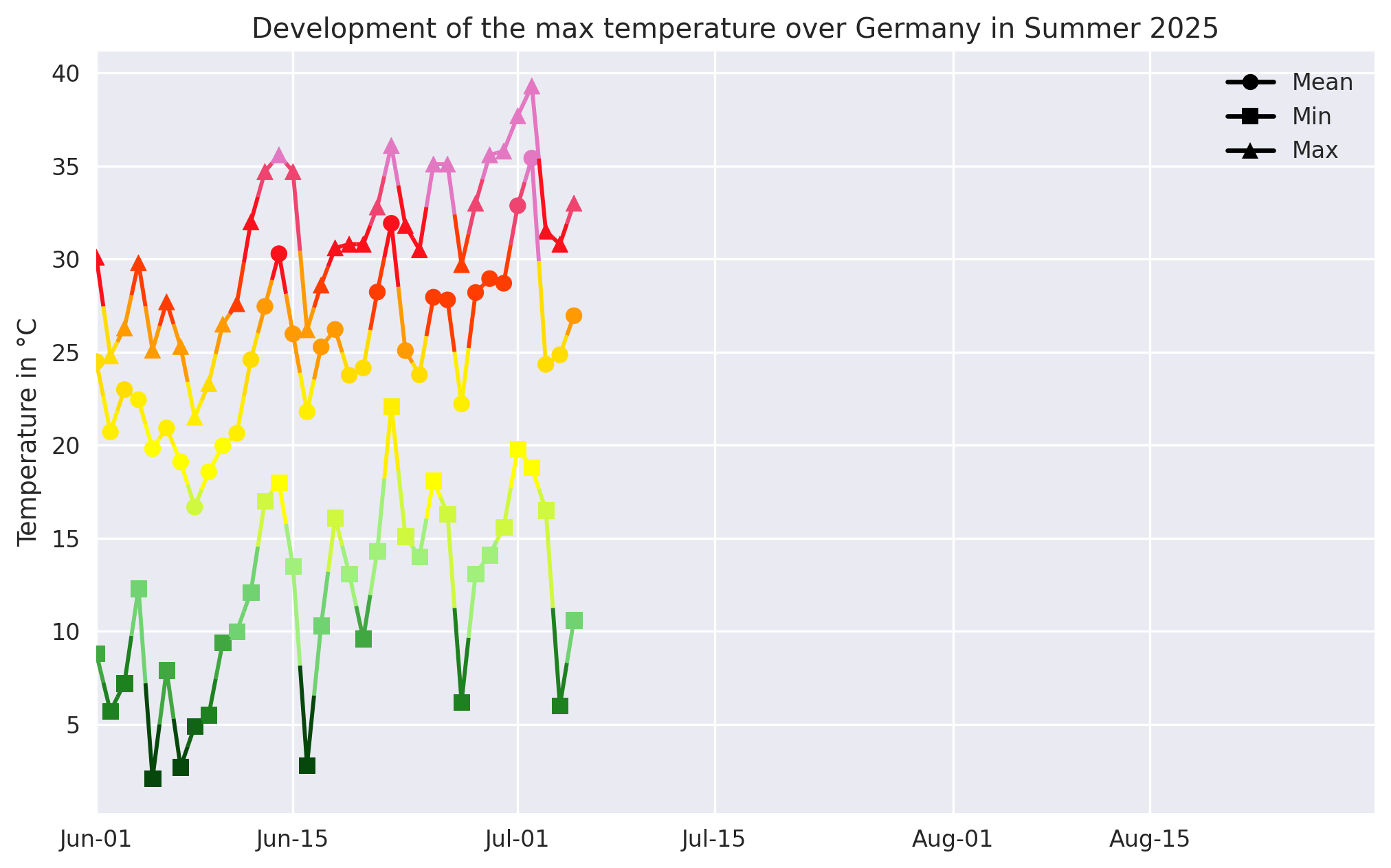
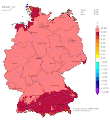
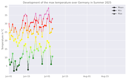
Time series of the maximum temperature (left) and the maximum temperature deviation (right) over Germany in summer 2025, source:
Wettergefahren-Frühwarnung
|
 |
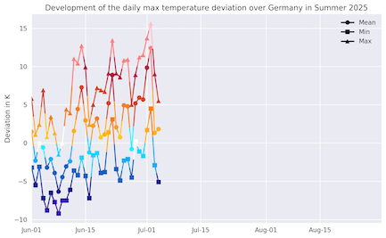 |
The recent heat wave was intense and long-lasting in Western and Central Europe. Daily temperature deviations reached more than 10 K. Since mid-June 2025, maximum temperatures in Germany reached 30 °C on nearly every day. With a mean temperature of 18.3 °C, June 2025 was the seventh warmest on record in Germany with a temperature deviation of 2.0 K. After a short interlude in the second week of July 2025, the sub-seasonal temperature forecasts for Europe hint at well-above-average temperatures for most of July and early August 2025. The medium-range NWP forecasts for Europe already show the potential for another major heat wave in the third week of July 2025.
Text: KG
July 06, 2025
|