|
Hurricane ERICK was the earliest major hurricane to make landfall along either coast of Mexico, with its landfall southeast of Acapulco on June 19, 2025. After a cycle of rapid intensification, Hurricane ERICK reached category 4 with maximum sustained winds of 230 kph and a minimum central pressure of 939 hPa. Upon landfall, the tropical cyclone brought high winds and strong downpours.
The tropical disturbance that would eventually mature into Hurricane ERICK formed around 400 km south of the coast of Guatemala on June 16, 2025. In the following 24 h, the system showed only very weak development as it moved on a northwesterly trajectory towards Southern Mexico. By June 18, 2025, the tropical cyclone had organized into a medium-strength tropical storm. Nearing the coast of Mexico, the tropical cyclone entered an environment very favorable for the intensification of the system.
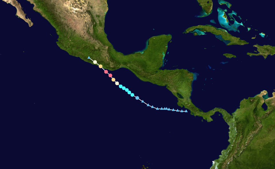
Track and intensity of Hurricane ERICK (left), source:
NASA,
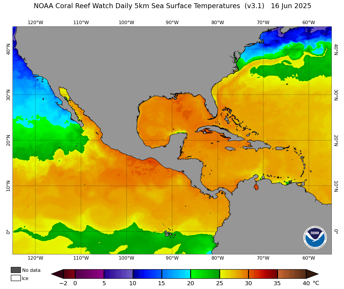
SST over the Eastern Tropical Pacific and Western Tropical Atlantic Ocean, 16.06.2025 (middle), and SST anomalies
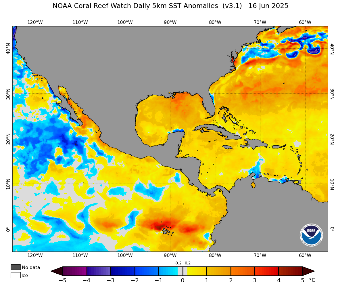
over the Eastern Tropical Pacific and Western Tropical Atlantic Ocean, 16.06.2025 (right), source:
NOAA Coralreefwatch
|
 |
 |
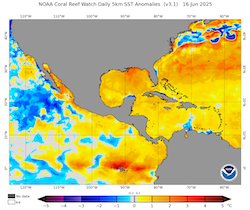 |
The Pacific Ocean south of the coast of Mexico showed above-average sea surface temperatures (SSTs), which gave the tropical storm an abnormally large energy reservoir to tap into. Additionally, the atmospheric conditions with low shear in the environment of the tropical cyclone were favorable for the intensification of the system. Due to the overlap of favorable oceanic and atmospheric conditions around the Tropical Cyclone ERICK, the intensification rate of the tropical cyclone increased significantly. Within a 24 h period from June 18, 2025, 06 UTC and June 19, 2025, 06 UTC, the tropical cyclone underwent a cycle of explosive rapid intensification. In these 24 h, the sustained winds of Major Hurricane ERICK increased by 135 kph/24 h from 95 kph to 230 kph. In the same period, the central pressure of the cyclone dropped by 59 hPa/24 h from 998 hPa to 939 hPa. This makes the rapid intensification cycle of Hurricane ERICK one of the most violent rapid intensifications observed over the Eastern Pacific.
|
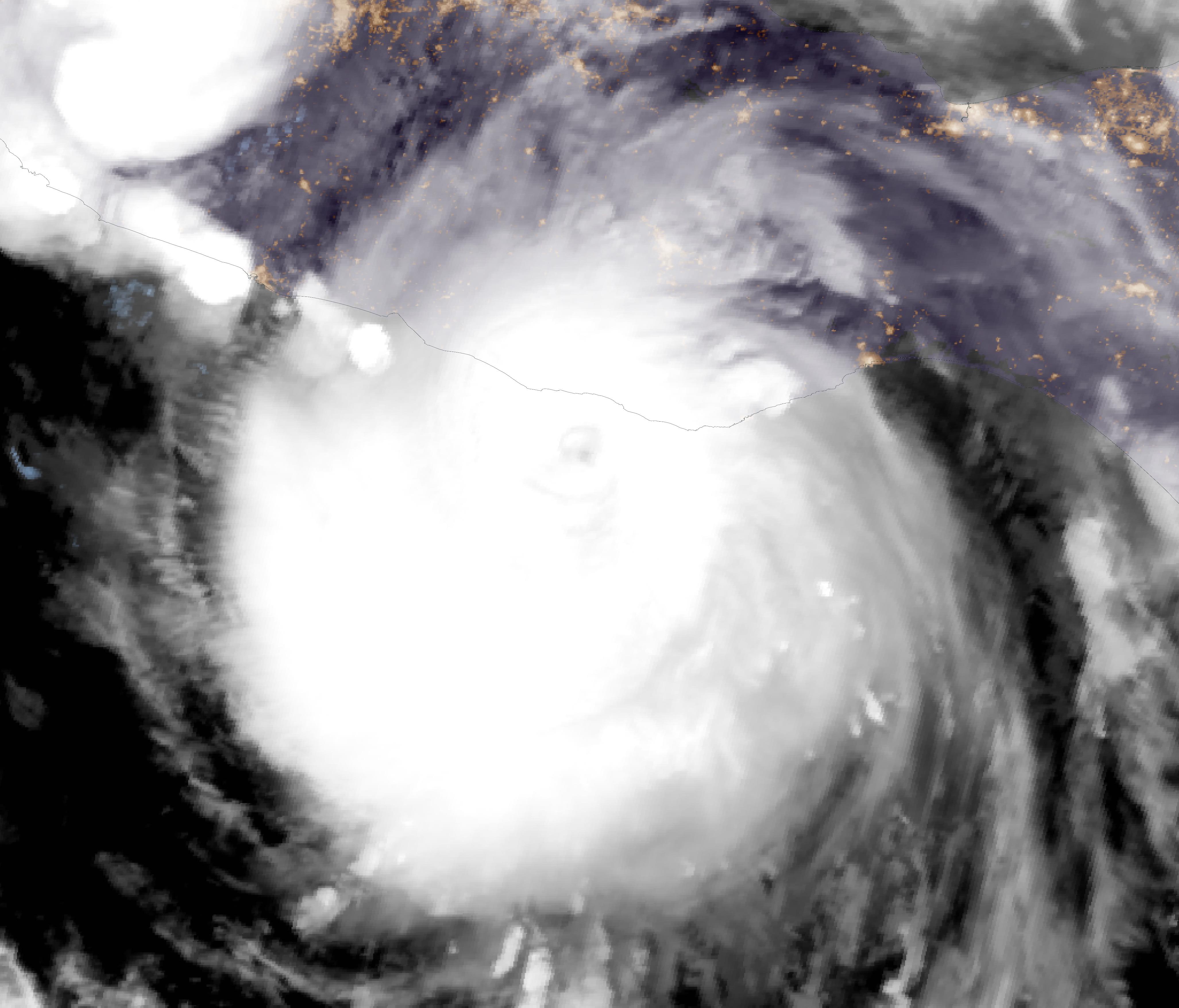
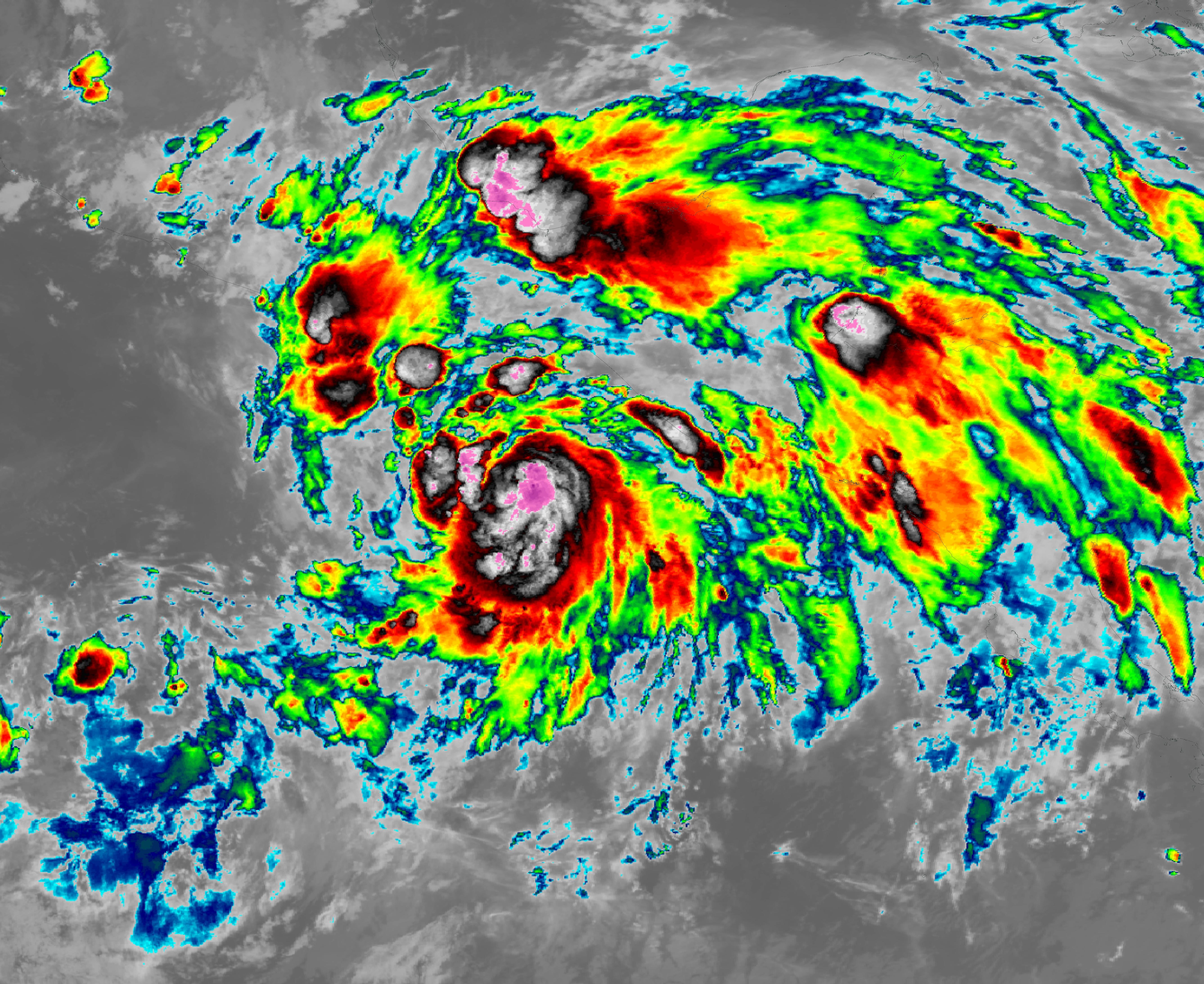
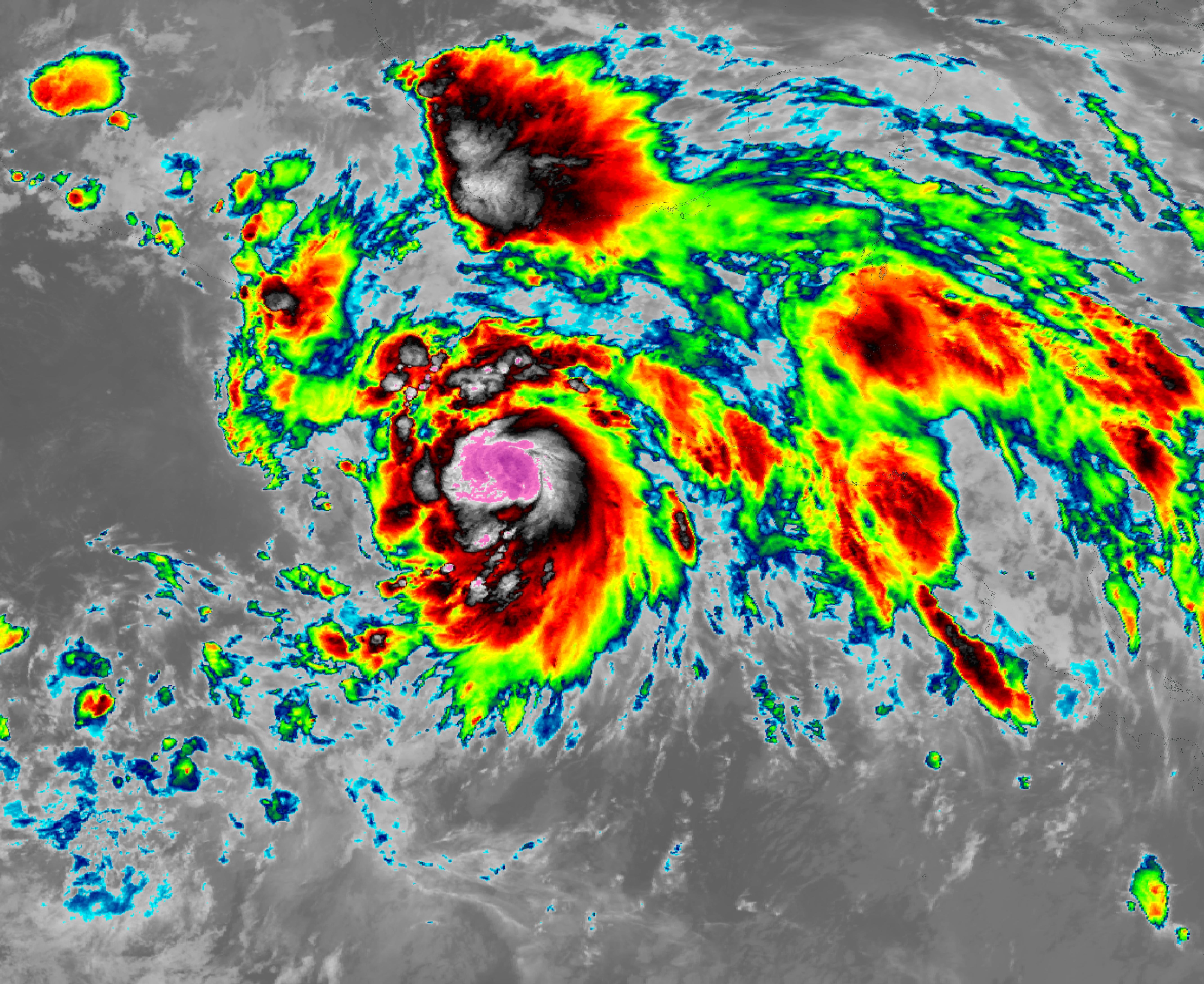
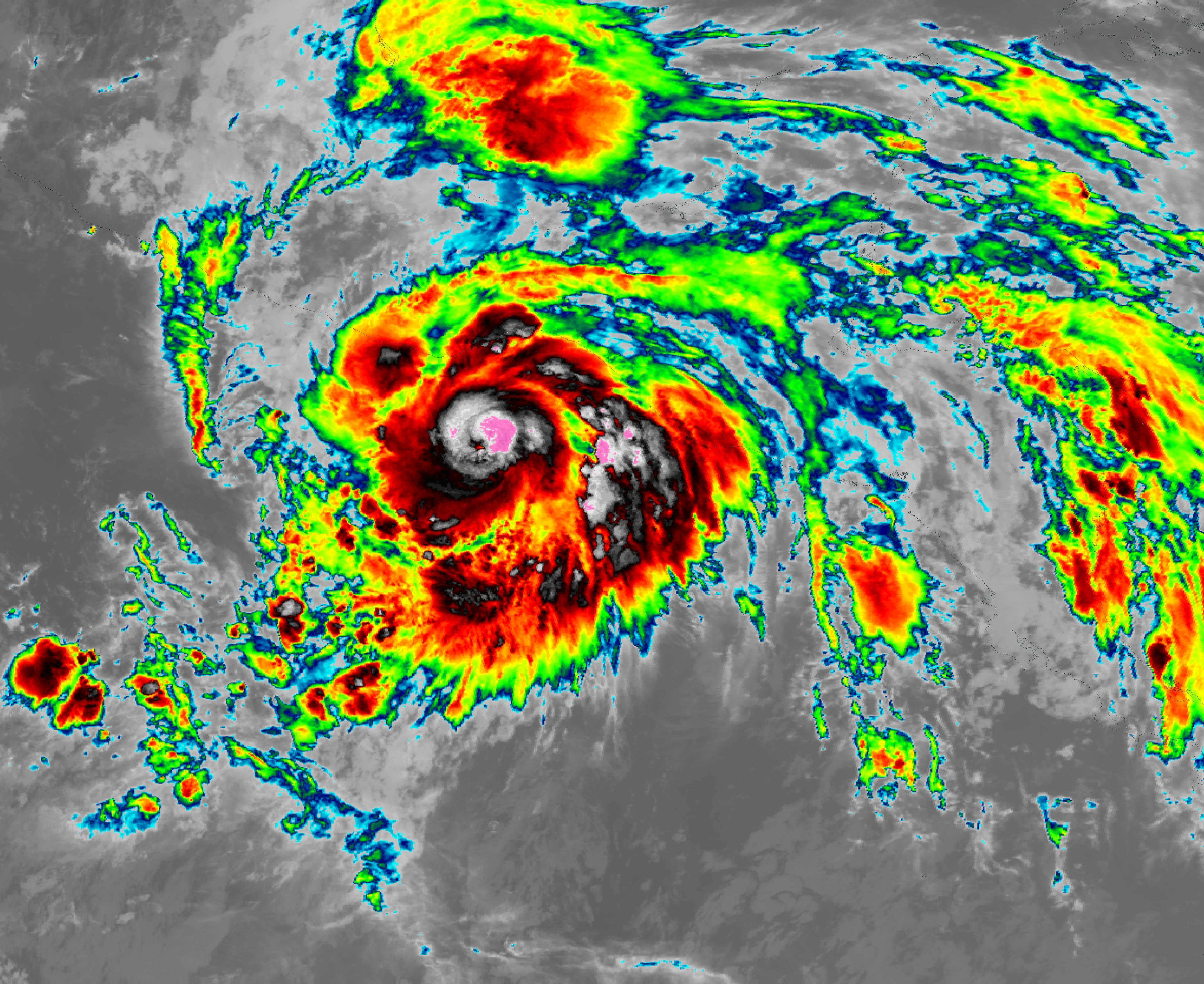
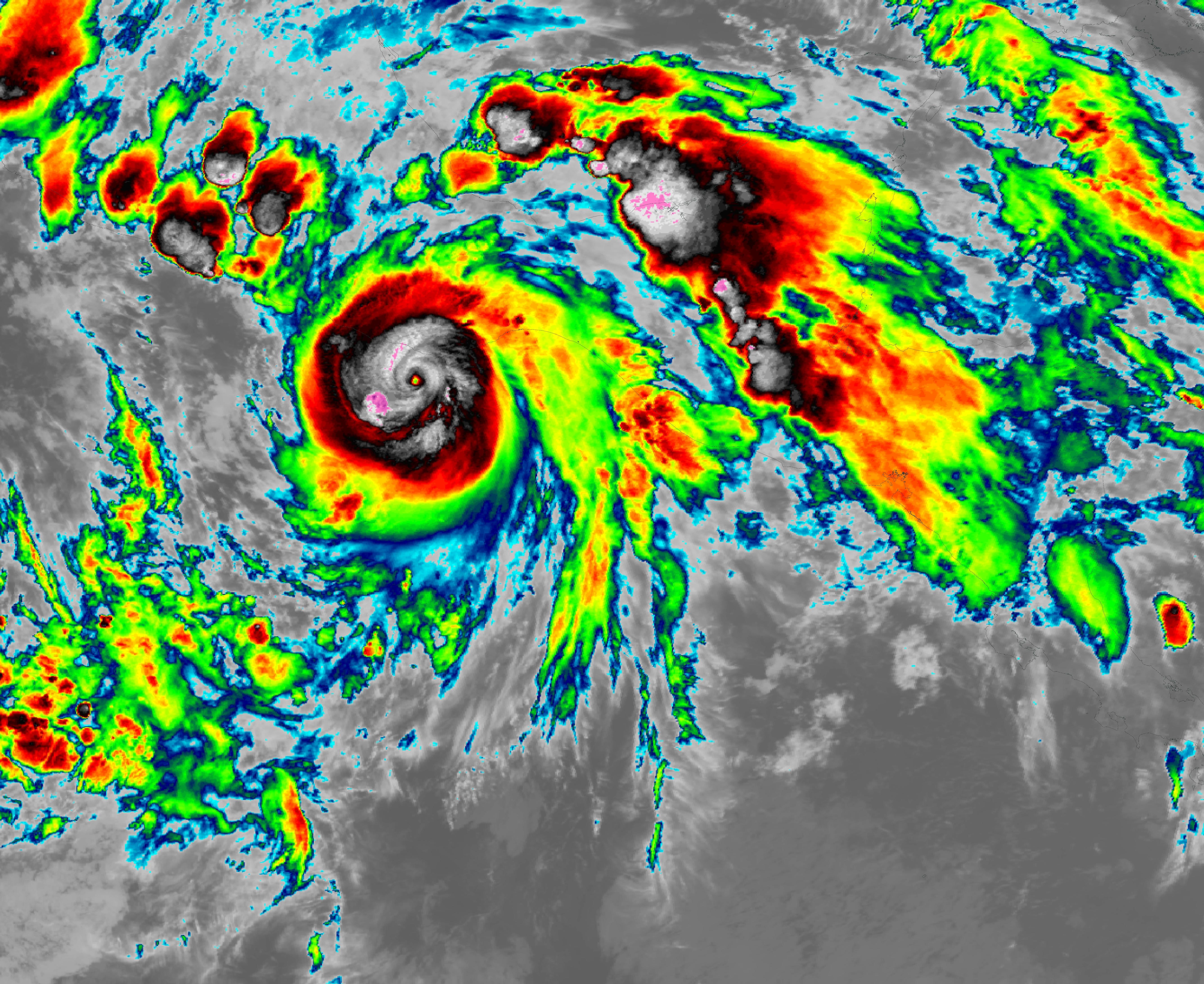
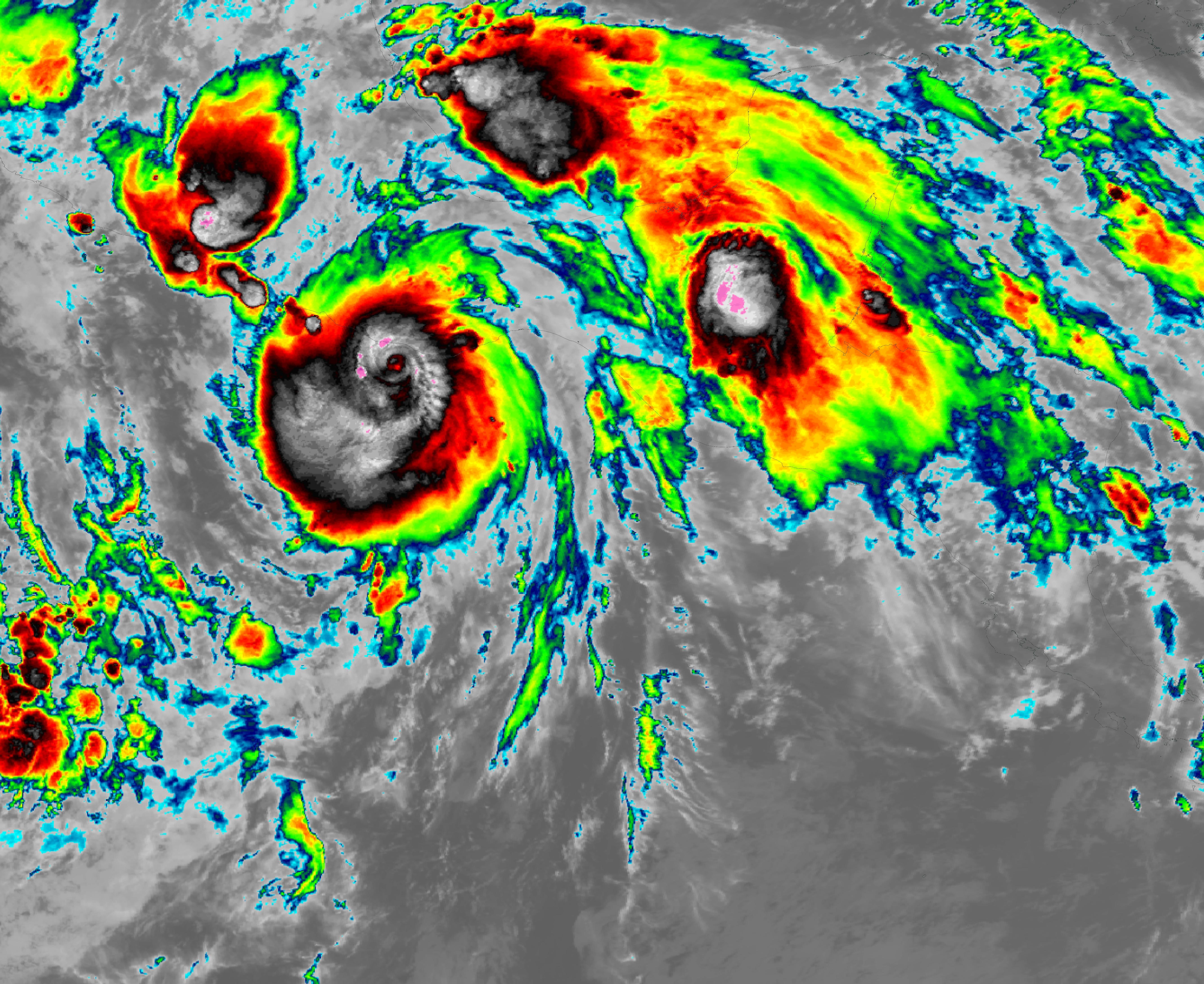
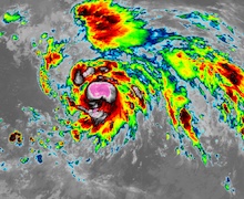
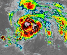
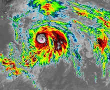
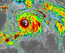
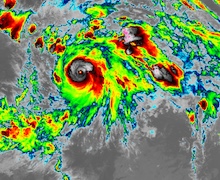
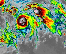
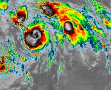
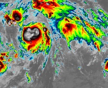
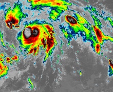
Three hourly infrared satellite imagery of Hurricane ERICK showing the rapid intensification from a tropical storm to a category 4 hurricane, 18.06.2025 06 UTC - 19.06.2025 15 UTC, source:
NASA Worldview
|
 |
 |
 |
 |
 |
 |
 |
 |
 |
 |
 |
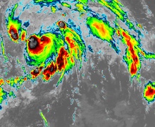 |
The three-hourly satellite imagery shows how tropical cyclone ERICK swiftly intensified from a tropical cyclone into a major hurricane within less than 24 h. The satellite imagery also reveals that the rapid intensification cycle of Hurricane ERICK included an eye wall replacement cycle early on June 19, 2025, shortly decreasing the strength of the cyclone. By 06 UTC on June 19, 2025, Hurricane ERICK reached its peak strength with sustained winds of up to 230 kph and a central pressure of 939 hPa. Continuing on its northwesterly trajectory, the hurricane made landfall 16 km east of Punta Maldonado at 12 UTC on June 19, 2025, with sustained winds of 200 kph.
Upon landfall, Hurricane ERICK brought high winds and heavy downpours to parts of Southern-Central Mexico. Over land, the tropical cyclone quickly weakened. Only 9 h after landfall, tropical cyclone ERICK lost hurricane strength. By June 20, 2025, the system completely dissipated over the state of Guerrero. The states of Oaxaca and Guerrero were most affected by Hurricane ERICK. Precipitation totals of more than 250 mm were observed during the passage of Hurricane ERICK. Along the path of the cyclone, more than 250,000 customers were left without power due to downed power lines. Overall, damages are limited as the core of the hurricane only affected a loosely populated stretch of the Pacific coast. Nevertheless, Hurricane ERICK set the record for the earliest major hurricane to make landfall in Mexico either from the Pacific or the Atlantic Ocean. Before Hurricane ERICK, the earliest Major Pacific Hurricane to make landfall in Mexico was Major Hurricane KIKO on August 26, 1989. Additionally, the rapid intensification of Hurricane ERICK was one of the most violent observed over the Eastern Pacific. Further, the Eastern Pacific Hurricane Season 2025 set the record for the earliest fifth named storm of the season, beating the 2021 season by 7 days, which held the record with the formation of Hurricane ENRIQUE on June 25, 2021.
Text: KG
June 24, 2025
|