|
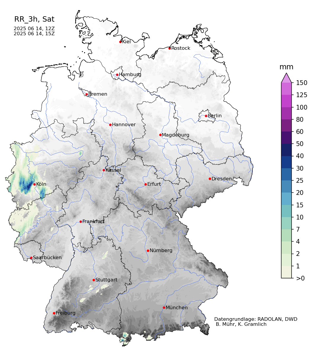
The first heat wave of the summer season of 2025 impacted Western and Central Europe in the second decade of June 2025. Despite occurring in the first quarter of the summer, daytime maximum temperatures reached far above the 30 °C mark. From June 14 to June 15, 2025, a trough over the British Isles induced locally severe convective activity with heavy downpours with daily precipitation totals of up to 95.7 mm.
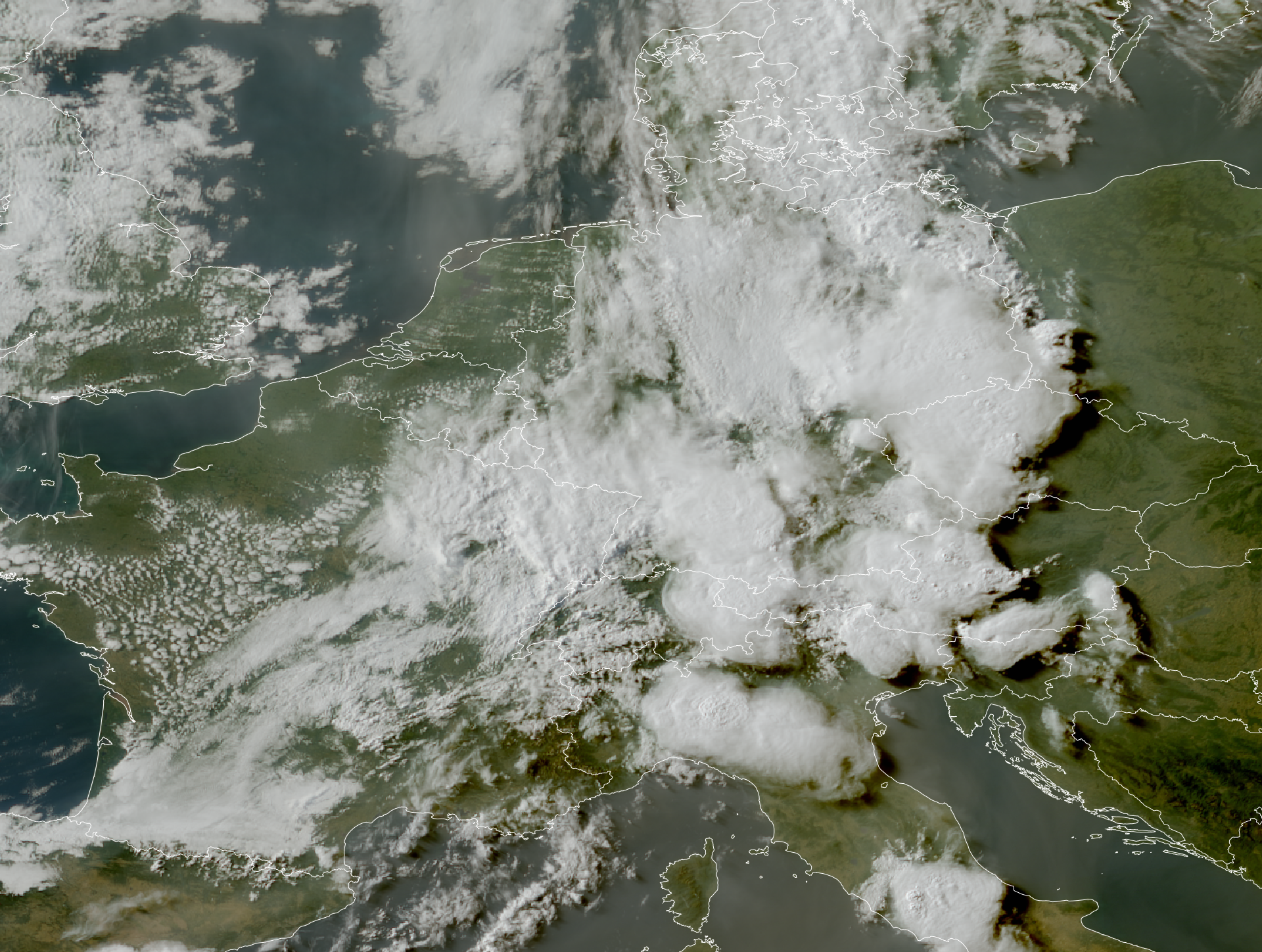
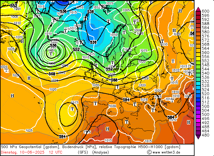
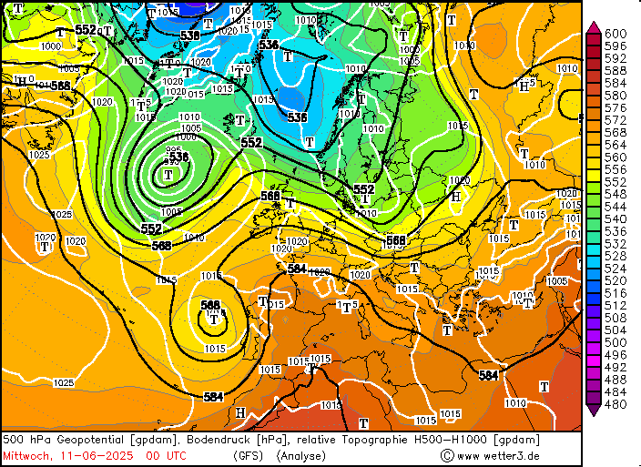
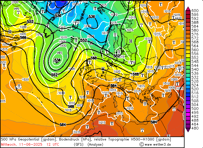
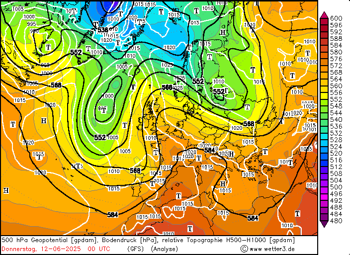
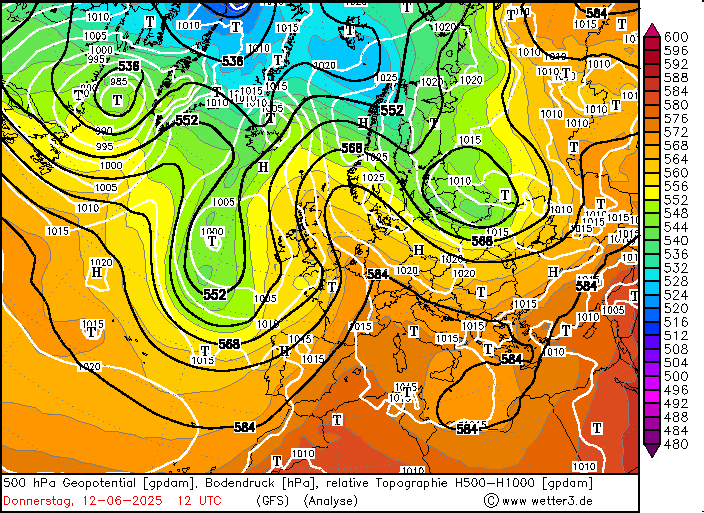
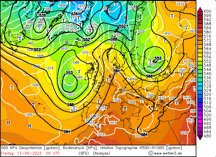
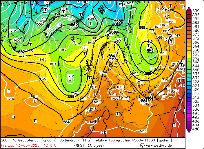
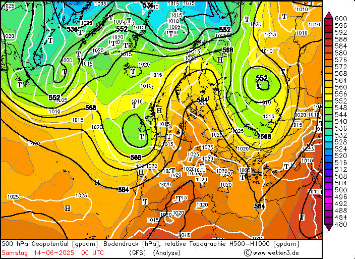
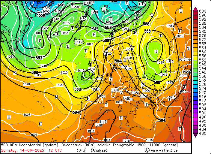
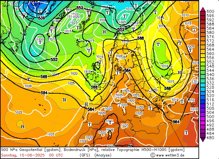
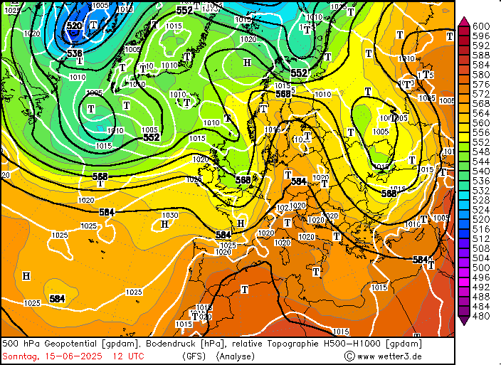
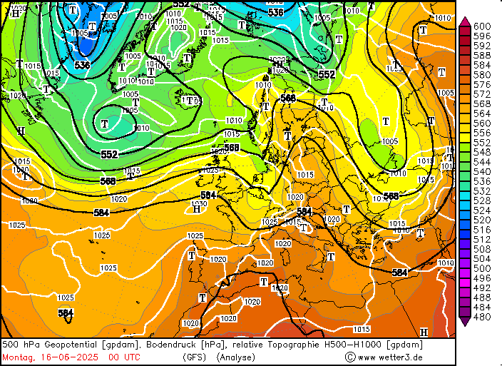
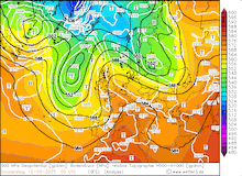
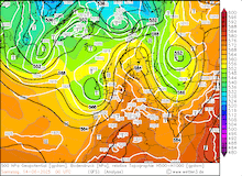
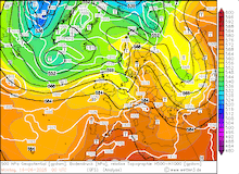
The beginning of June 2025 brought a short spell of widespread precipitation to parts of Western and Central Europe after a spring with near-record precipitation deficits. By June 12, 2025, an outbreak of Arctic airmasses over the Northern Atlantic led to a strong southward expansion of a trough west of the European Continent. With this development, the highly meridional flow pattern developed over Europe. For the first time this summer, a near-textbook example of an omega-shaped weather pattern developed. A large ridge expanded northwards from the Mediterranean across Central Europe. Along both flanks of the ridge, two large troughs were located over Western Russia and the Eastern North Atlantic forming an omega-shaped structure of the 500 hPa geopotential in the atmosphere.
|
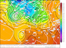
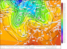
Development of the 500 hPa geopotential, 1000 hPa to 500 hPa thickness, and sea-surface pressure over Europe, 10.06.2025 12 UTC - 16.06.2025 00 UTC, source:
wetter3.de
|
 |
 |
 |
 |
 |
 |
 |
 |
 |
 |
 |
 |
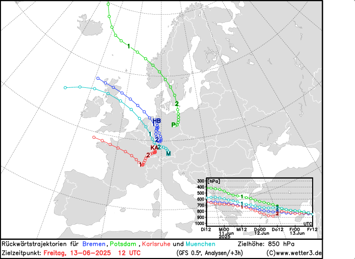
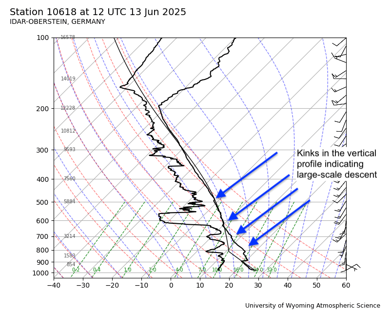
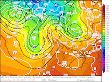
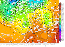
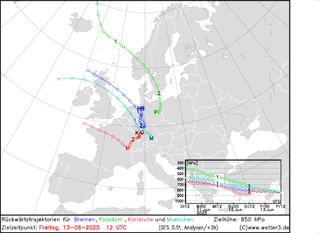
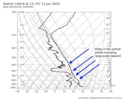
With this synoptic set-up, very warm air masses with 850 hPa temperatures of more than 20 °C could penetrate far northwards across Western and Central Europe. Backward trajectories for lower-tropospheric air parcels reveal a common characteristic of such omega-shaped heat wave patterns. In these synoptic conditions, backward trajectories show a strong descent of the air parcels that originate from areas west of the targeted area. Furthermore, the atmospheric soundings during the heat wave show another characteristic feature. Besides comparatively small lapse rates, the atmospheric soundings show multiple minor kinks in the vertical temperature profile. In combination with the synoptic set-up, these kinks are likely caused by large-scale descent inside the ridge.
|
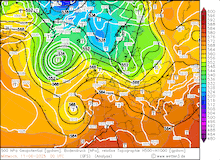
Backwards trajectory for 850 hPa air parcels over Germany, 13.06.2025 12 UTC (left), source:
wetter3.de,
and upper-atmospheric sounding at Idar-Oberstein showing signal of large-scale descent (right), 13.06.2025 12 UTC, source:
University of Wyoming
|
 |
 |
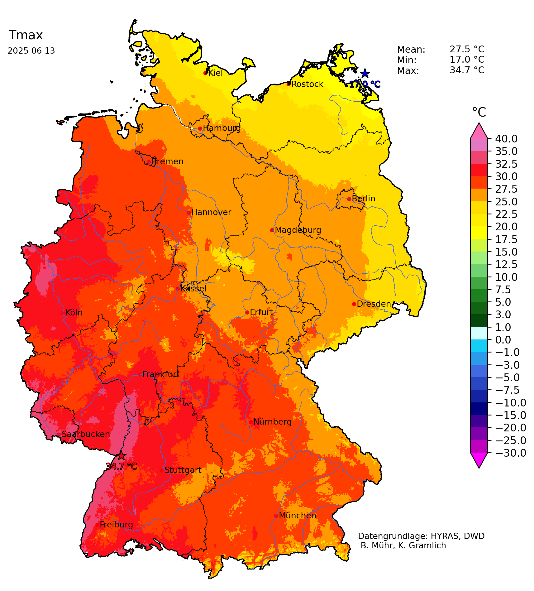
Over France, abnormally high maximum temperatures were already recorded on June 10, 2025. In parts of Southern France, the temperatures rose above 35 °C. On June 11, 2025, a high temperature of 38 °C was recorded at Nimes. Due to the trough over the Eastern Atlantic moving eastwards, the center of the heat wave shifted eastwards into Central Europe. On June 13, 2025, temperatures reached more than 30 °C in Western Germany. Over Central France, the maximum temperatures of more than 35 °C were observed. At Pruniers, temperatures peaked at 38.1 °C.
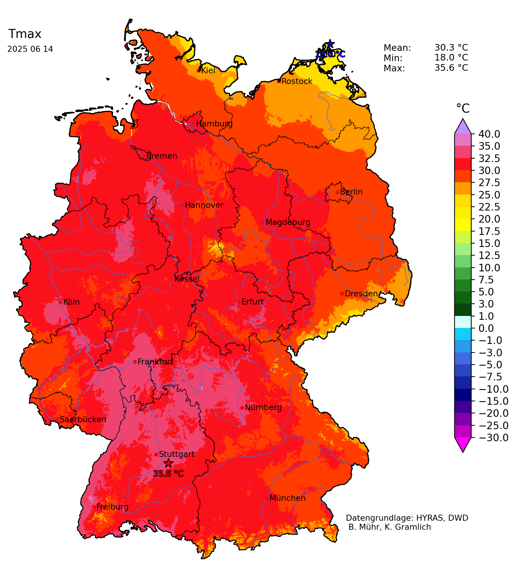
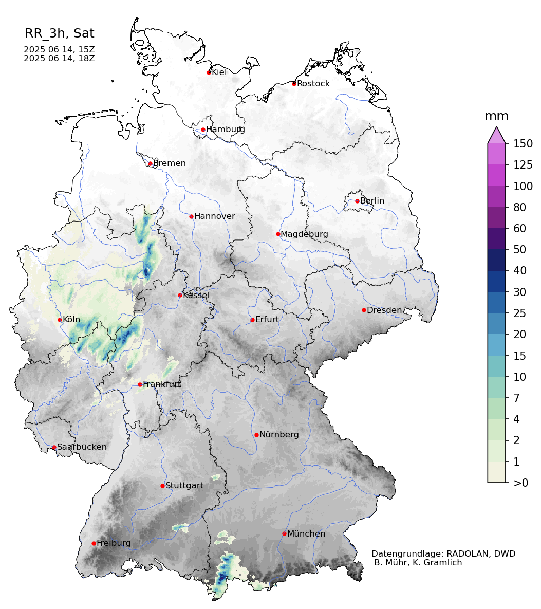
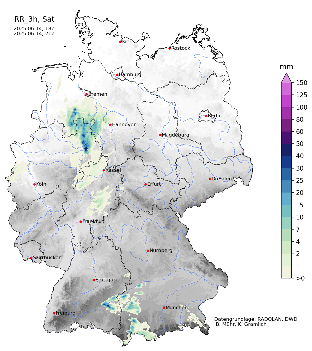
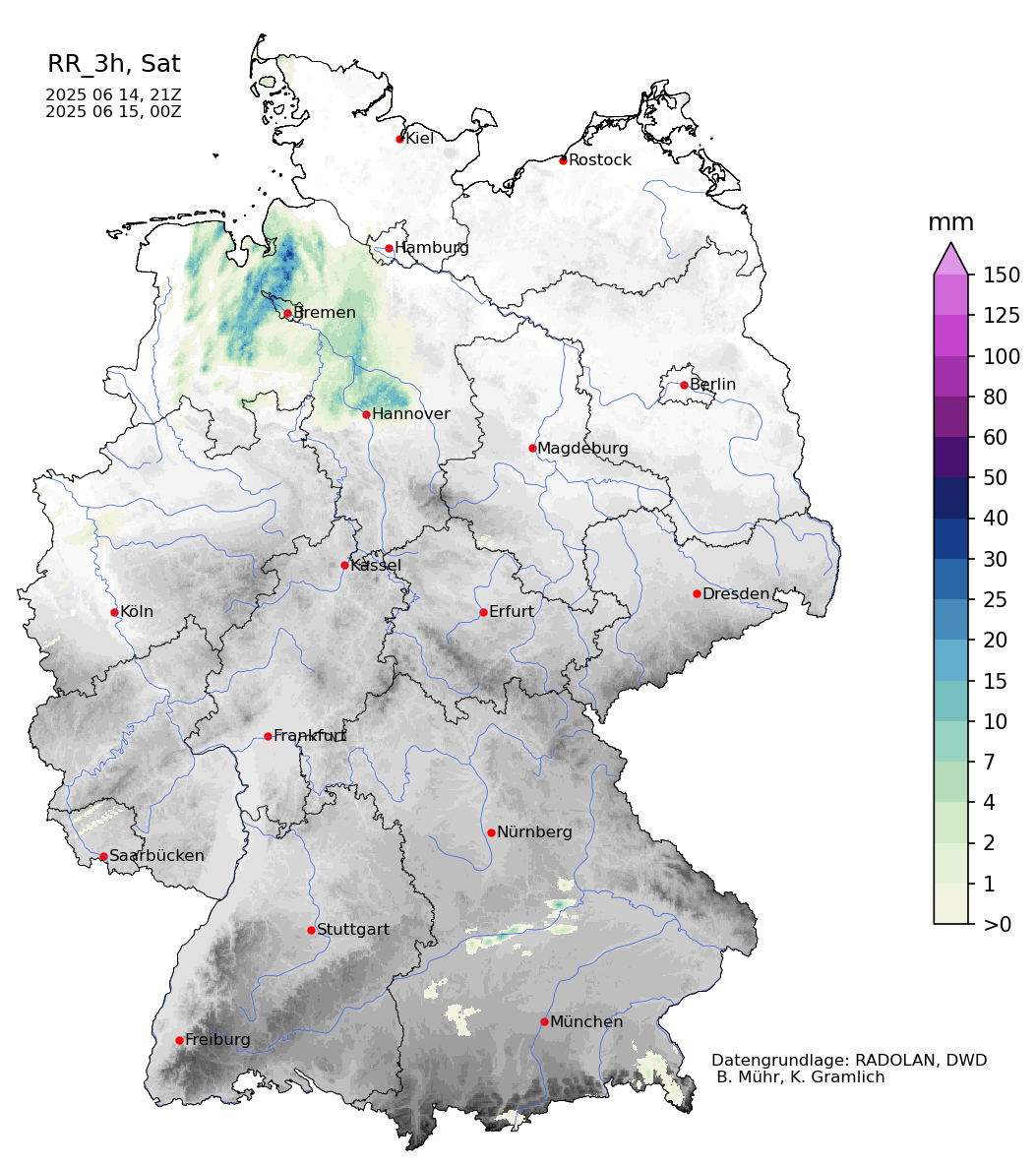
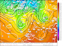
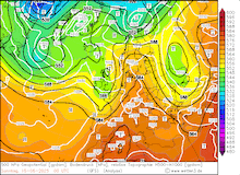
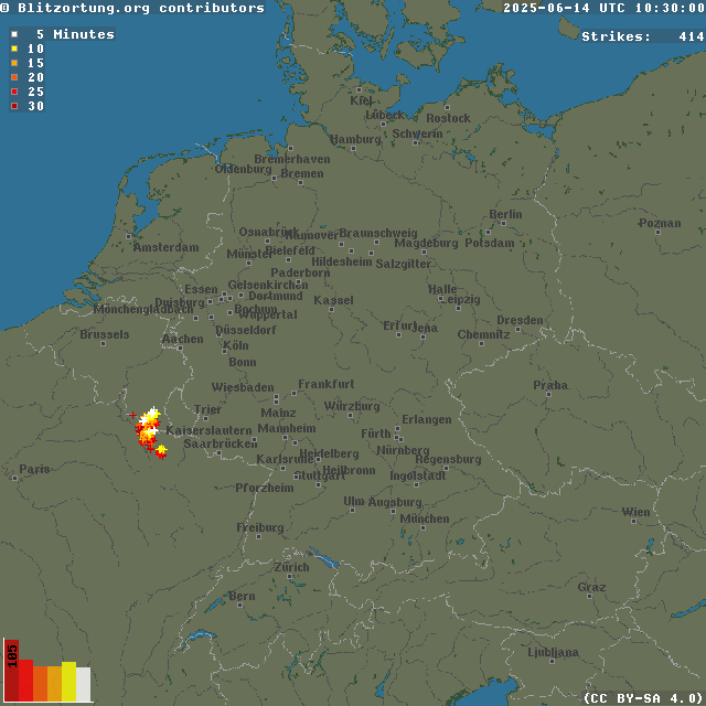
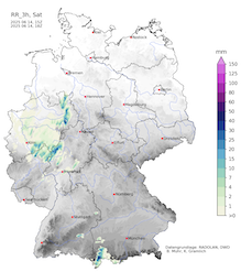
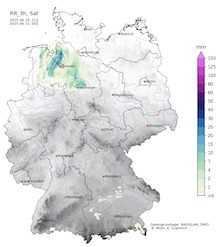
With the western trough reaching the British Isles, the area of highest temperatures shifted further eastward on June 14, 2025. In Germany, temperatures of more than 35 °C were measured for the first time this summer. With 35.5 °C, the measuring site at Kitzingen, BY recorded the highest temperature in Germany thus far this summer. With the approaching trough, moister air masses reached Central Europe. This raised dewpoints close to the 20 °C mark and therefore elevated heat stress levels. Additionally, the synoptic setup became favorable for convection to occur. Developing from single-cell convection in the afternoon hours, multiple large convective cells formed in the evening hours of June 14, 2025. The thunderstorms brought heavy downpours with hourly precipitation rates of up to 50 mm/h and locally large hail. Near Altenbecken, NW, a suspected tornado formed by 17 UTC.
|
30 min lightning strikes over Central Europe, 14.06.2025 10 UTC - 16.06.2025 02 UTC, source:
Blitzortung
|
 |
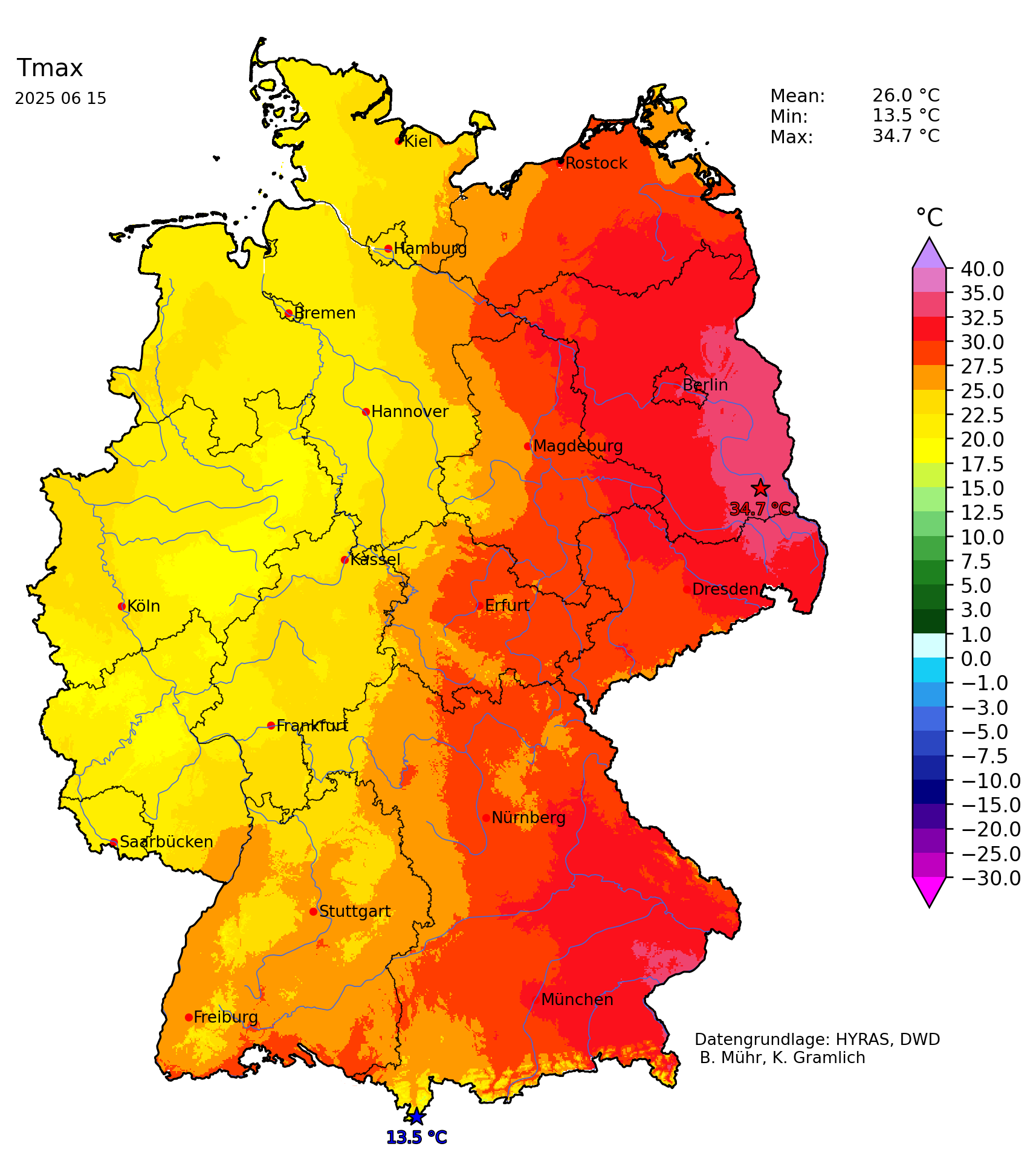
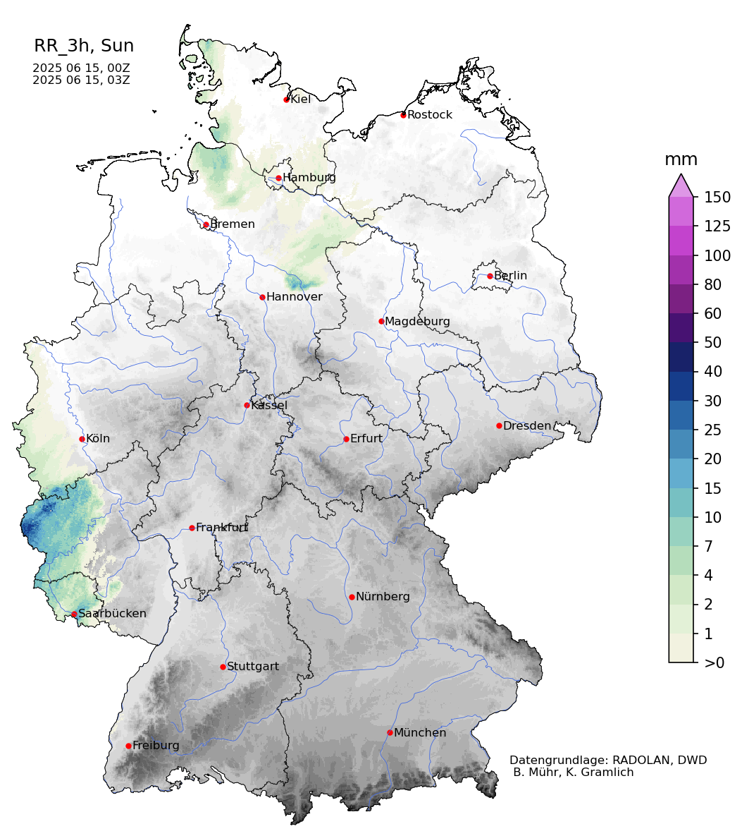
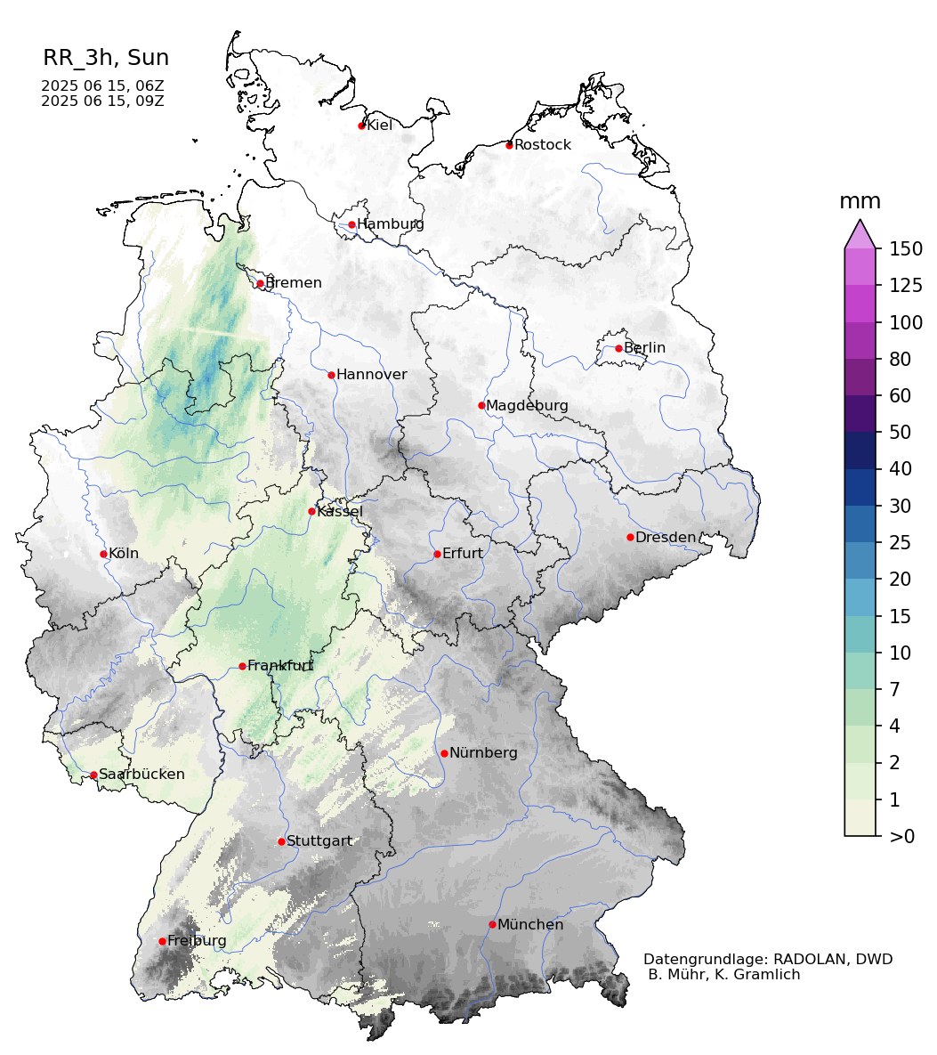
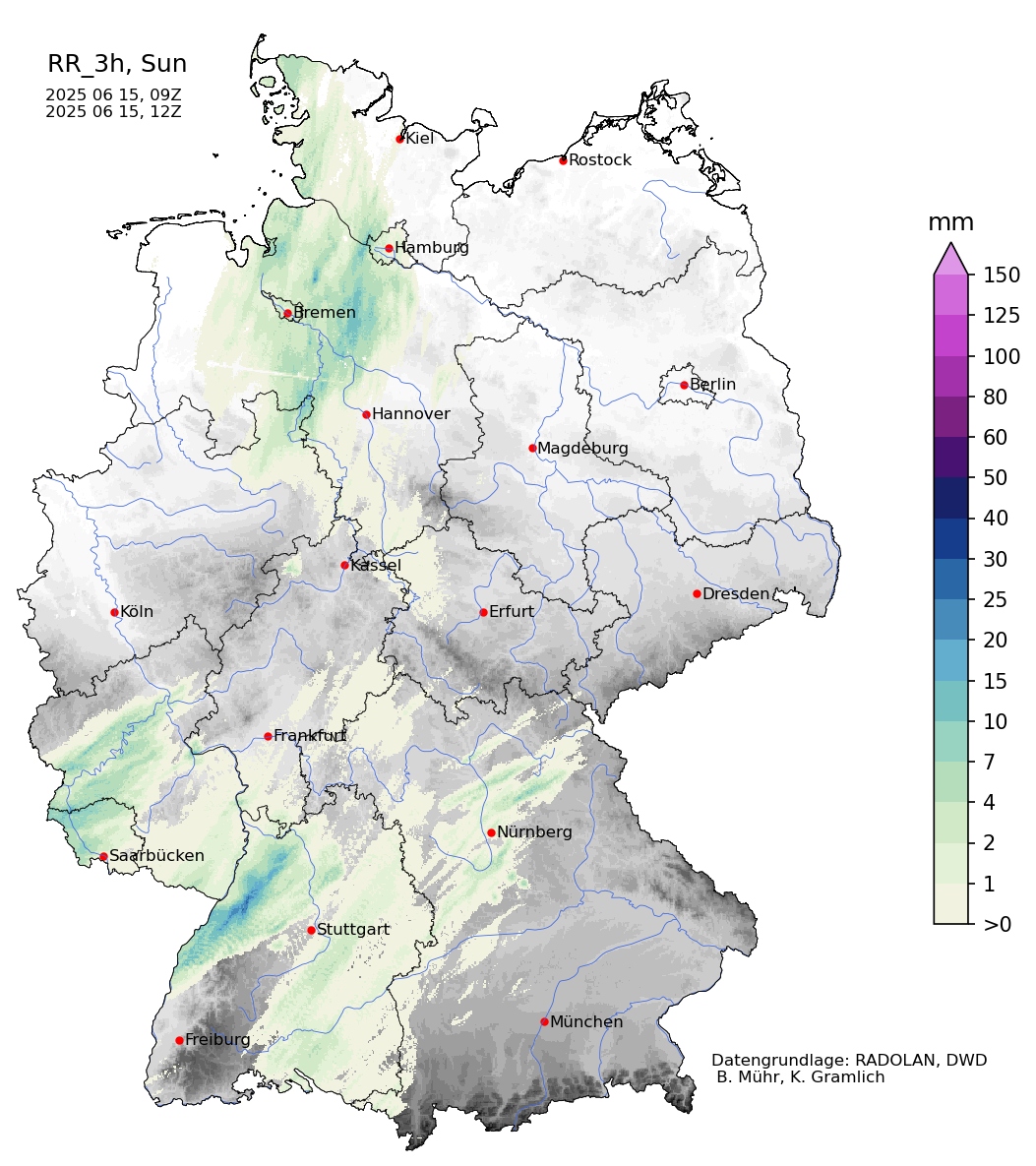
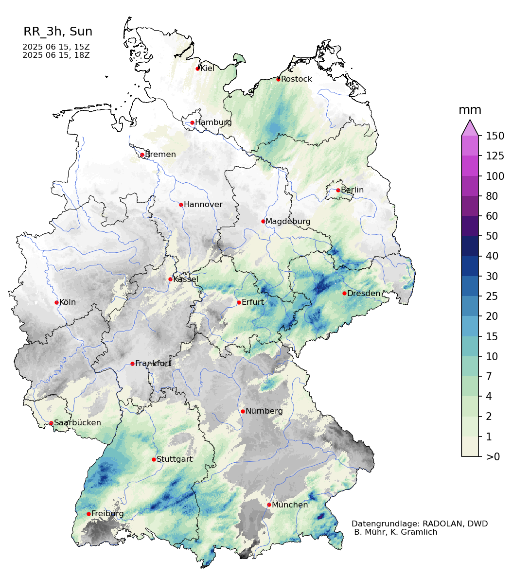
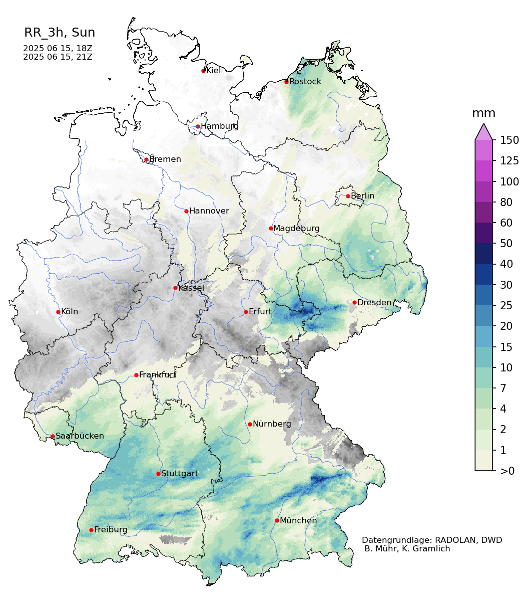
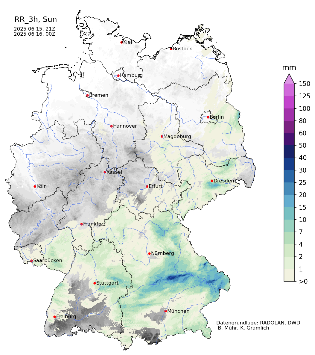
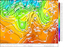
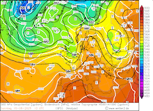
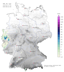
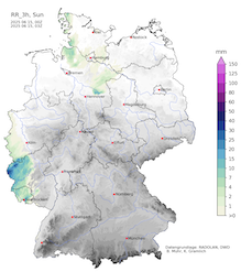
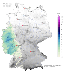
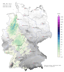
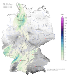
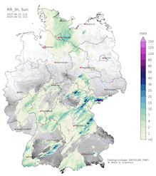
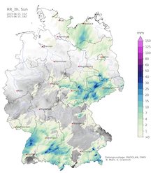
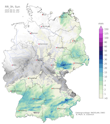
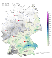
On June 15, 2025, convective activity dominated the weather across Central Europe. Ahead of the cold front of the trough over the British Isles, temperatures once again rose to up to 34 °C along the Oder River. Over Central Europe, the thunderstorms brought locally heavy downpours. Between the Central Vosges Mountains and the Central Black Forest, daily precipitation reached more than 50 mm with a peak of 86.5 mm/24 h at Selestat. North of the Ore Mountains, multiple severe thunderstorms formed throughout June 15, 2025, leading to precipitation totals of up to 95.7 mm at Aue, SN. Behind the cold front, temperatures dropped by around 10 K to seasonal values.
|
Development of the 3 h precipitation totals over Germany, 14.06.2025 12 UTC - 16.06.2025 00 UTC, source:
Wettergefahren-Frühwarnung
|
 |
 |
 |
 |
 |
 |
 |
 |
 |
 |
 |
 |
Behind the trough, a large ridge from Northern Africa could once again expand across Western and Central Europe leading to above-average temperatures. Maximum temperatures quickly rebound to values of more than 30 °C.
Text: KG
June 20, 2025
|