

|
|
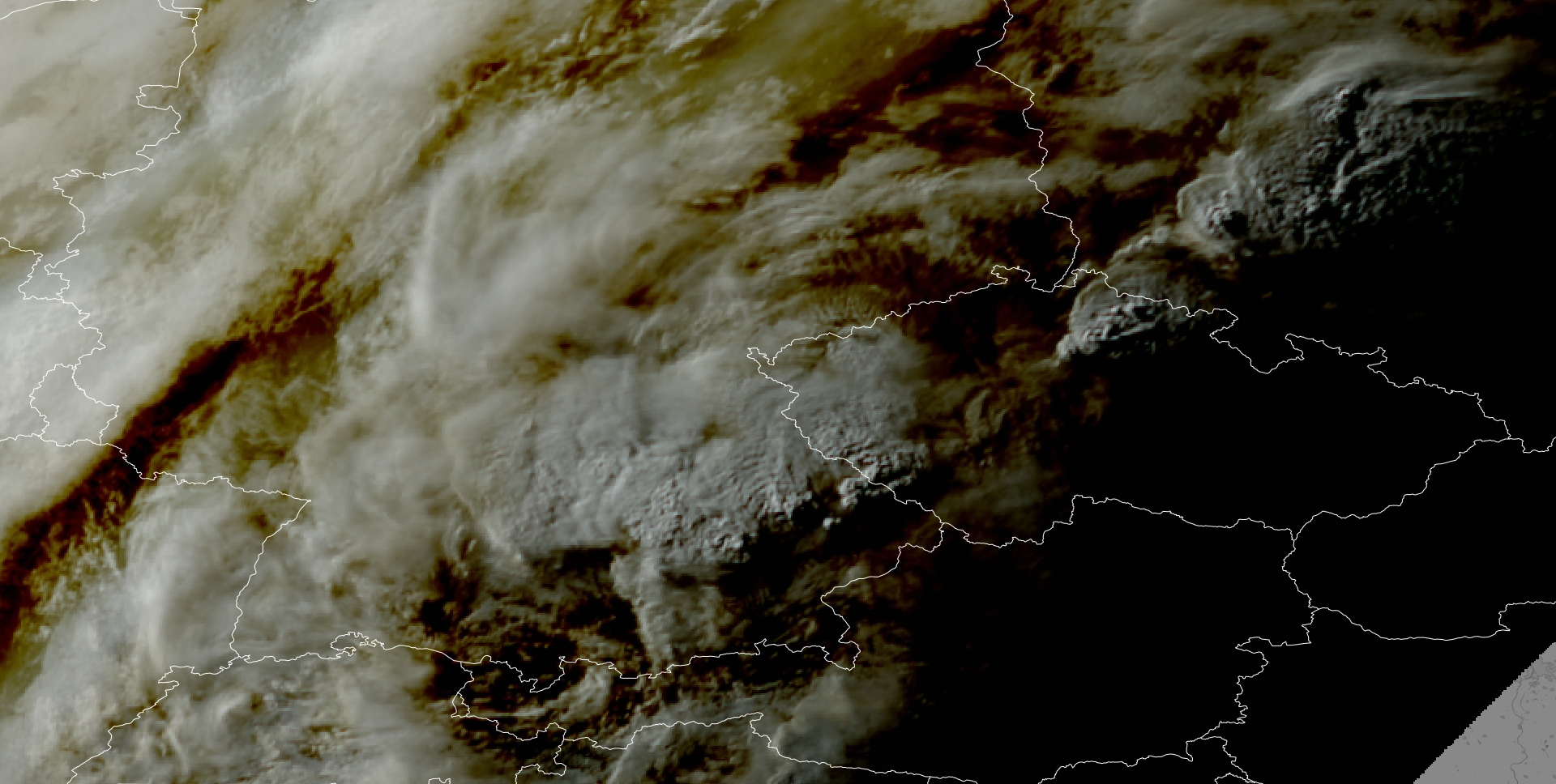
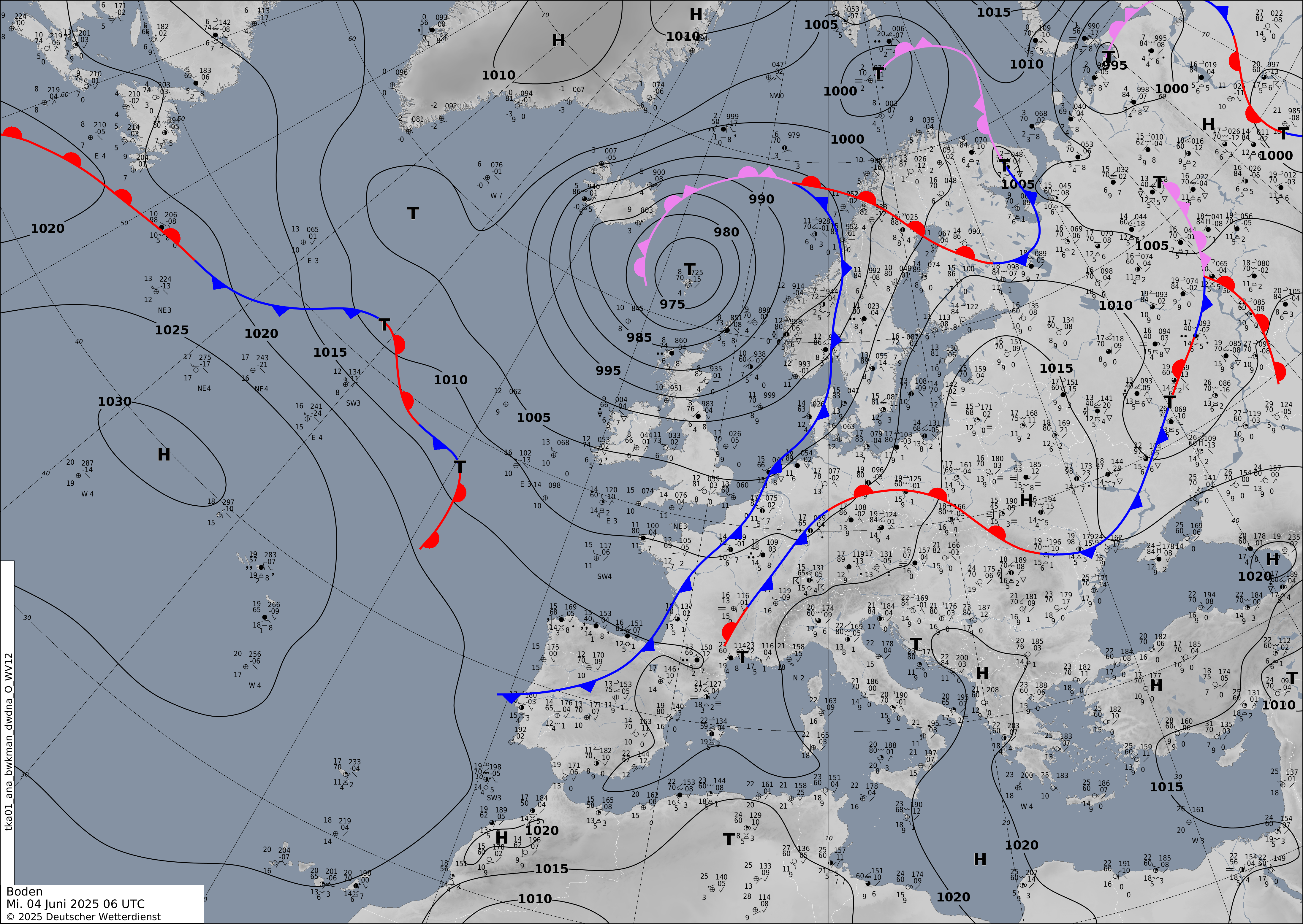
By 16 UTC, multiple strong cells quickly developed into supercells between Augsburg and Munich. One of the supercells directly affected the northern parts of the metropolitan area of Munich. Reports of heavy downpours, strong winds, and large hail were received from the city. The supercell also affected the football game of the German and Portuguese National teams in Munich. Further west, the squall line impacted the city of Ulm with high winds and heavy downpours.
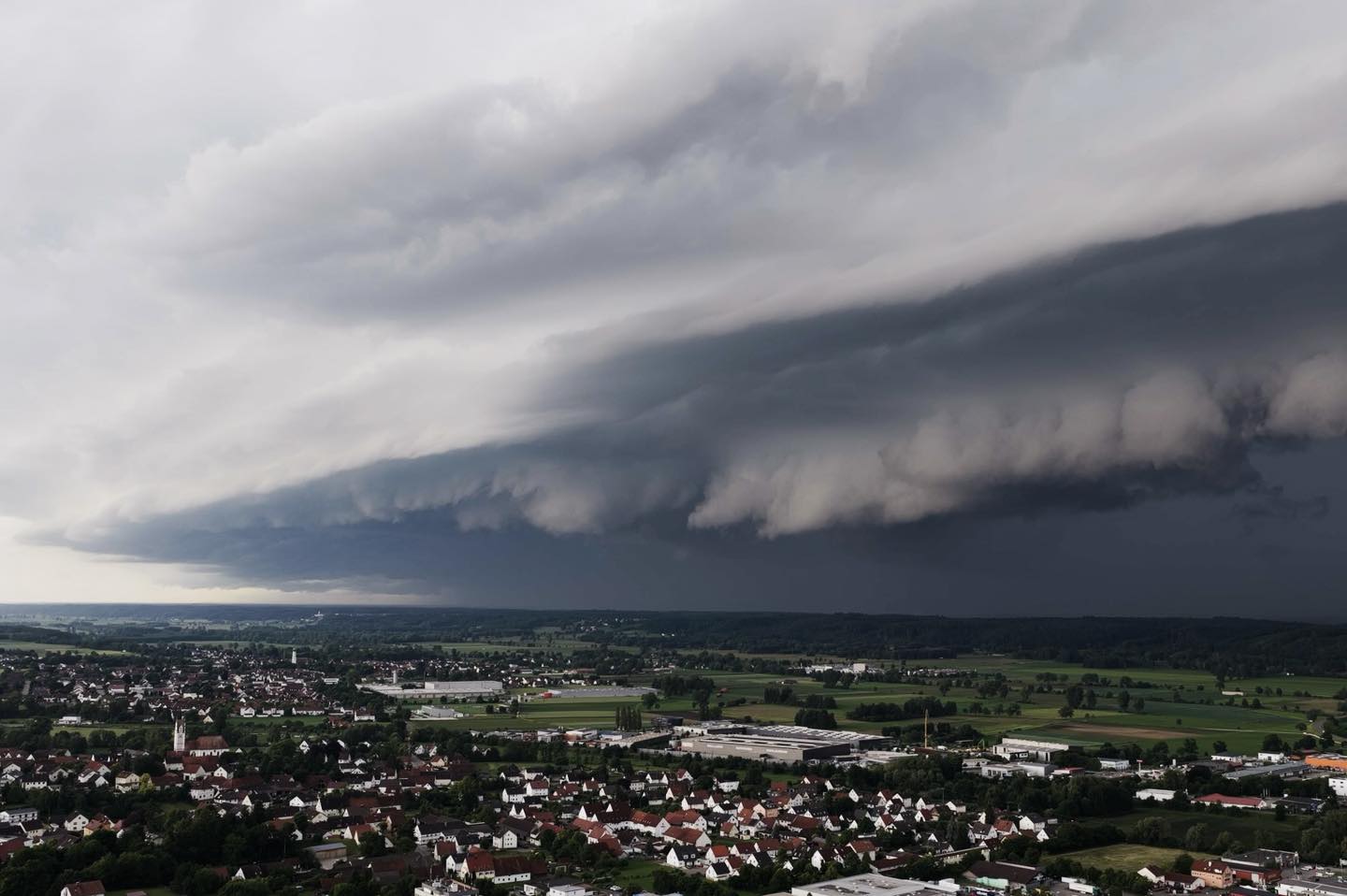
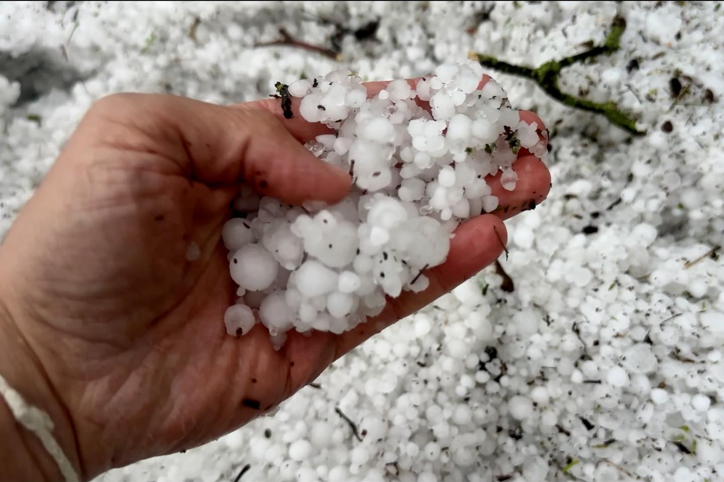
| Approaching squall line near Ulm (left) and hail accumulation near Ulm (right), 04.06.2025, source: Marco Kaschuba | |||
 |
 |
||
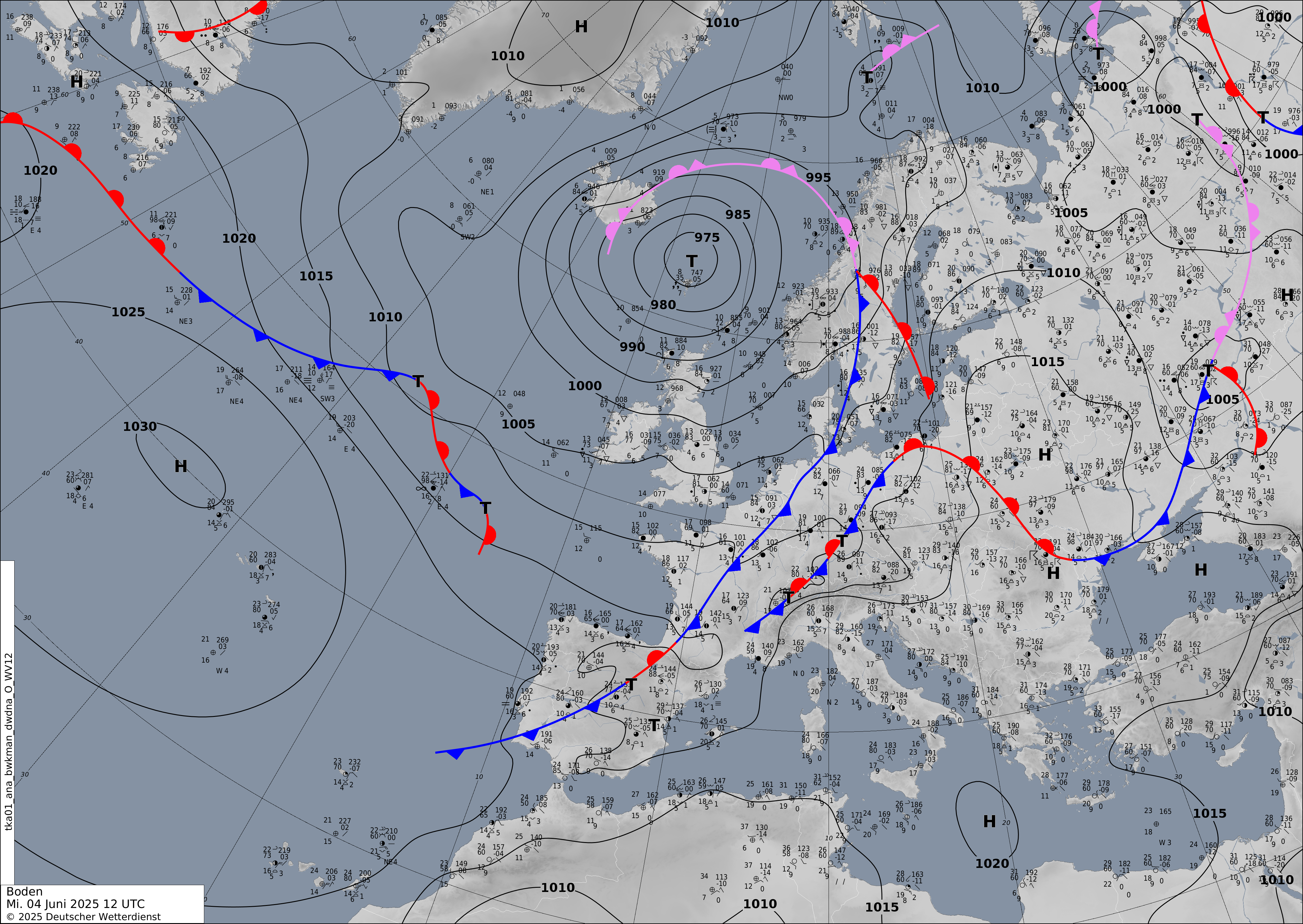
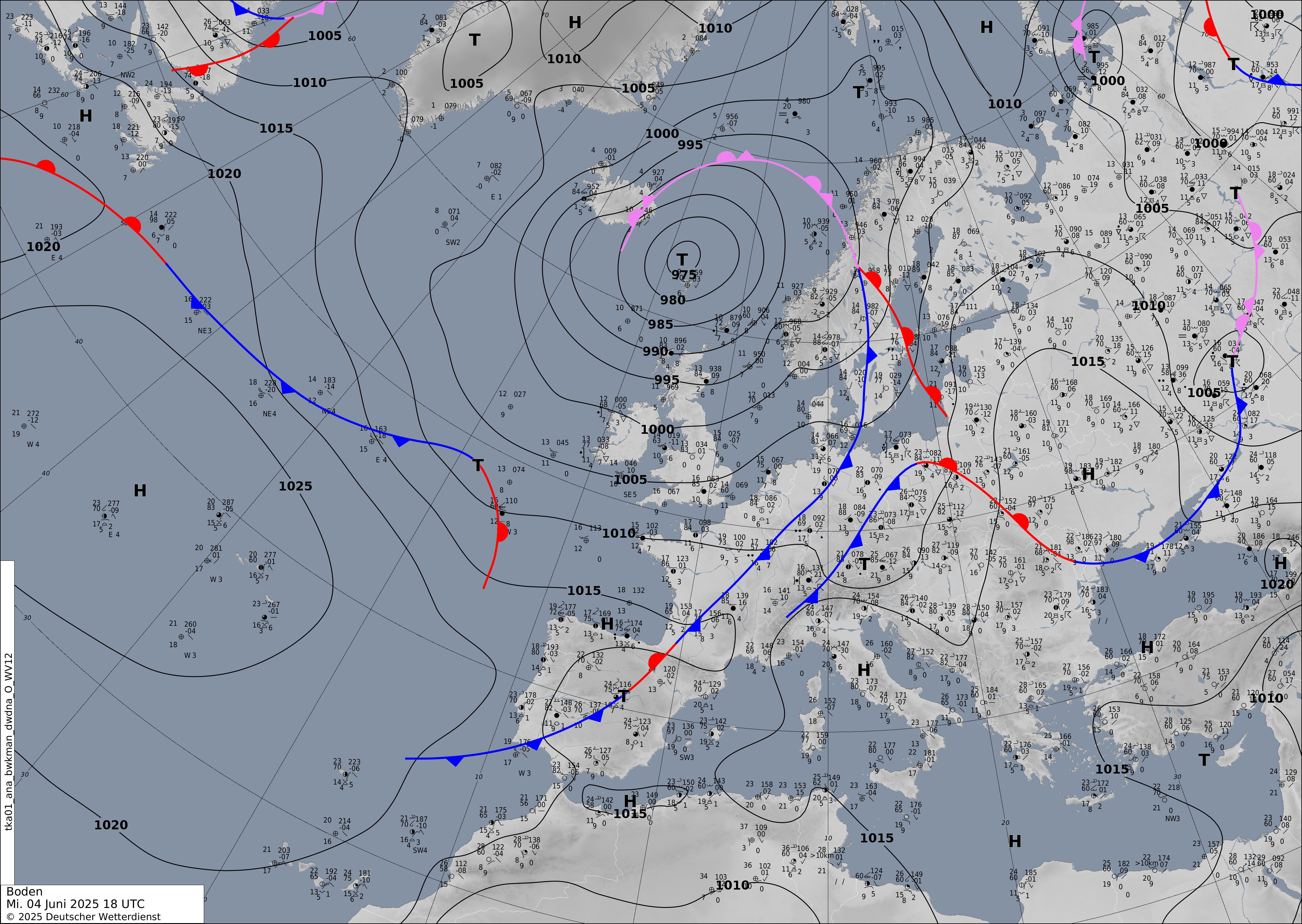
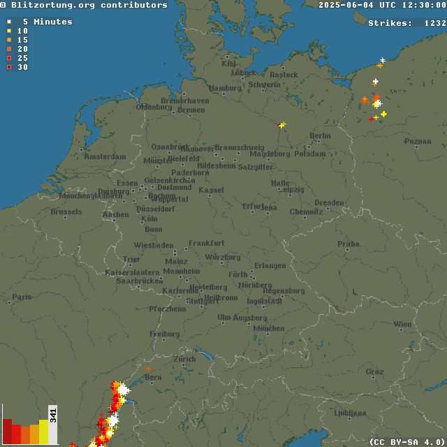
By 18 UTC, three strong supercells moved northeastwards across the Danube Plain. Approaching the Bavarian Forest, the increased orographic lift aided the formation of a large mesoscale convective system (MCS). The transition turned the low-precipitation supercells into a broad complex of heavy convective precipitation with embedded strong convective activity in the southeastern part of the MCS. Along the leading edge of the MCS, a squall-line developed over the central parts of Czechia. The squall line impacted Prague bringing heavy downpours and high winds. By 00 UTC on June 05, 2025, the MCS reached Southwestern Poland. In the second half of the night, the MCS dissipated over Central Poland.
| 30 min lightning strikes over Central Europe, 04.06.2025 12 UTC - 05.06.2025 02 UTC, source: Blitzortung | |||
 |
|||
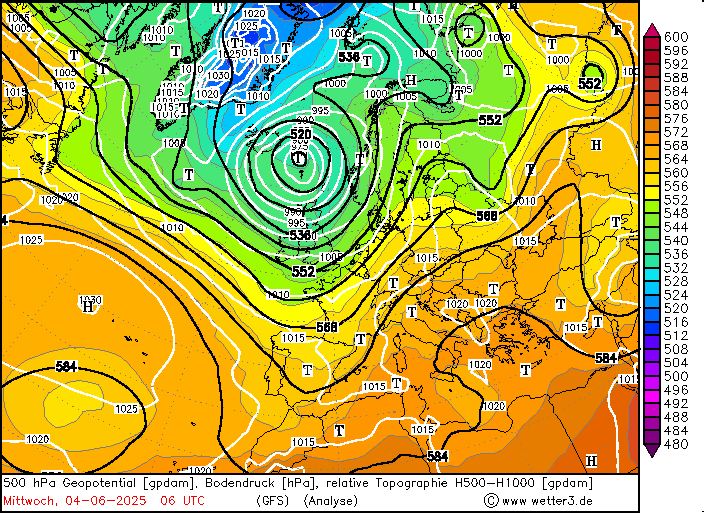
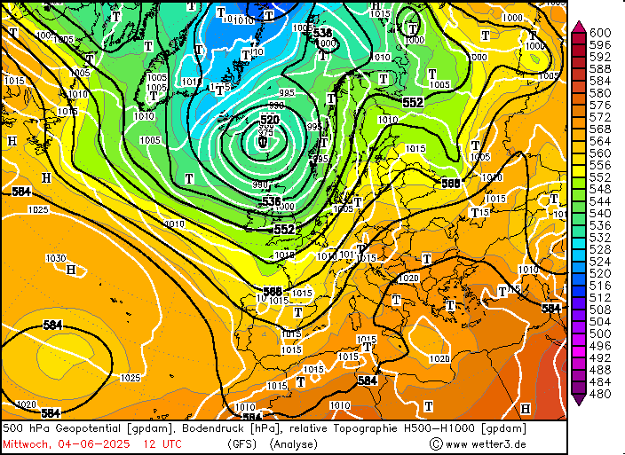
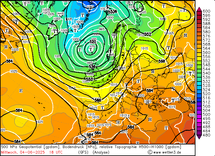
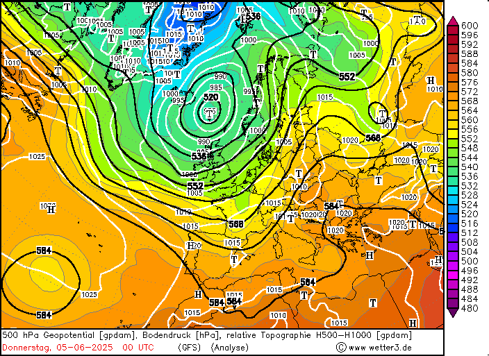
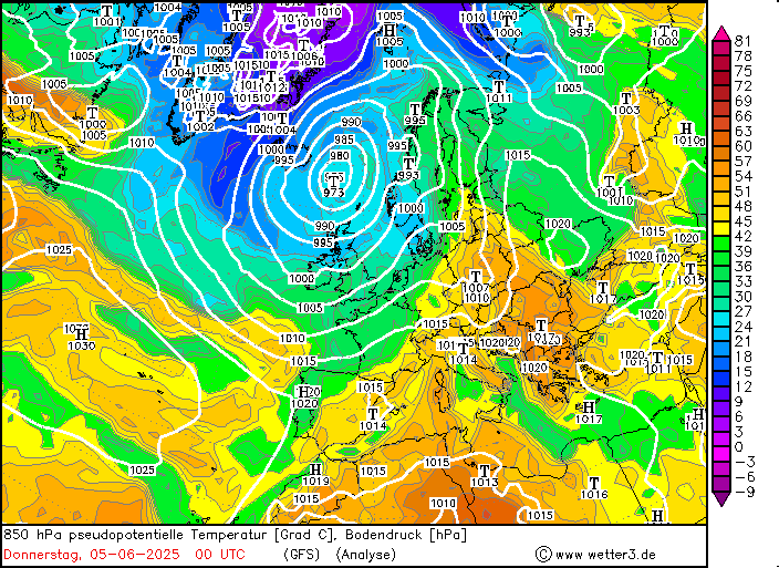
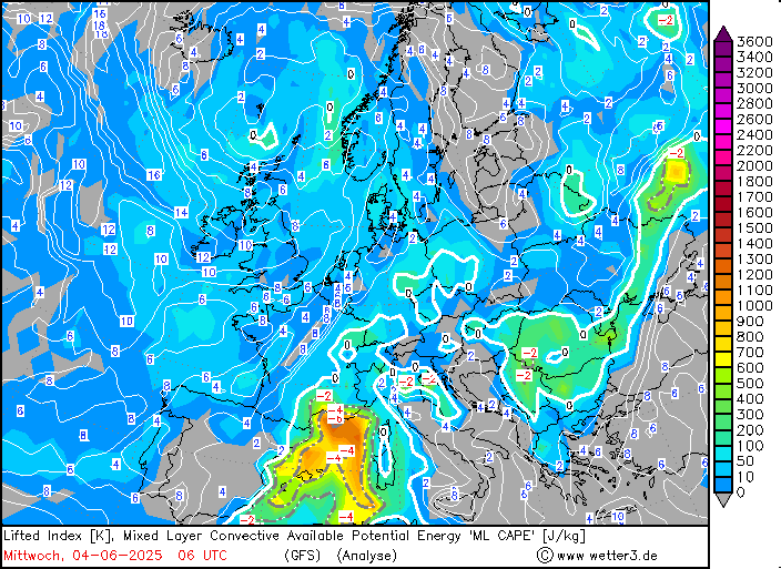
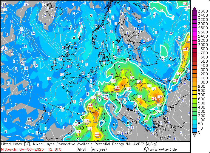
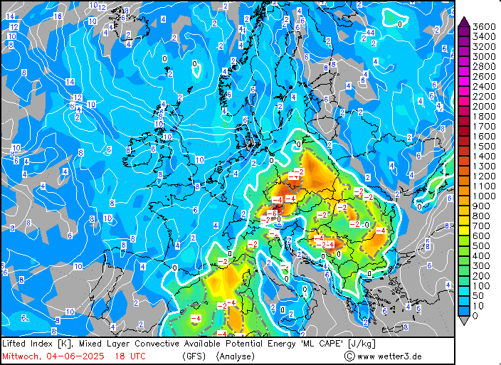
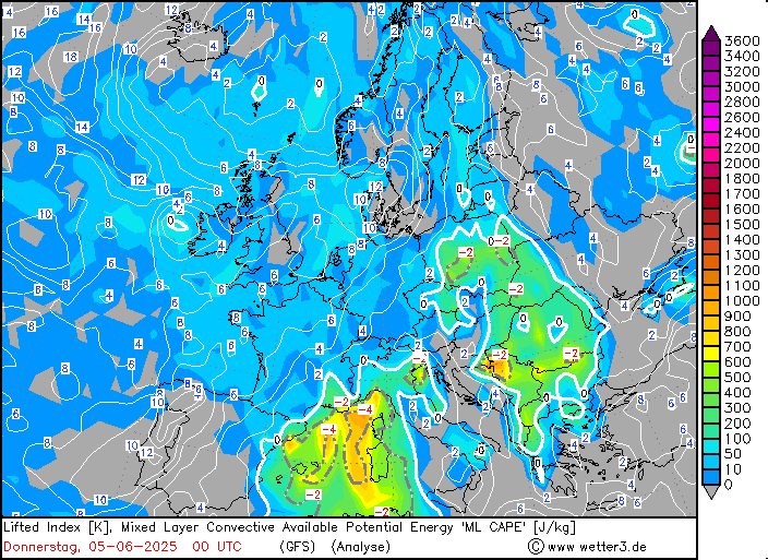
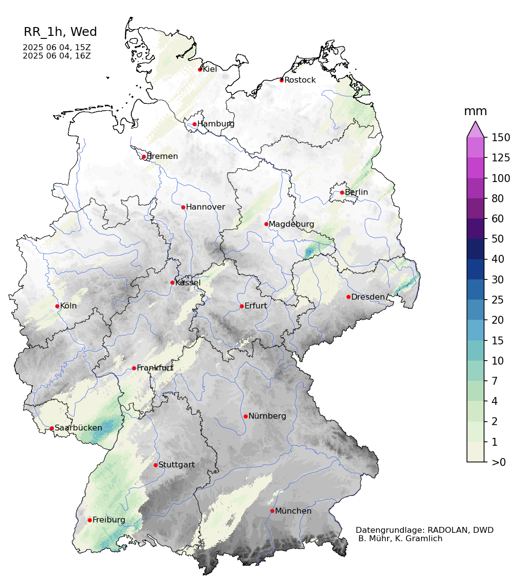
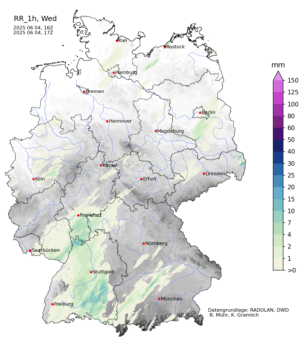
High-resolved regional NWP forecasts preceding the event showed the potential for more violent convective activity over Southern Bavaria. The forecasted overlap of high shear and very large CAPE was crucially not realized. For the most potent scenario suggested by the NWP models, the convective activity over the Danube Plain would have been capped until the convection related to the nearing cold front approached. The intermediate scenario was also not realized. In this scenario, convective activity along the Danube Plain would have been initialized by cold pool outflow of the aging convection related to the cold front. In the realized scenario over Southern Germany, the approaching cold front induced mid-tropospheric lift, which led to the formation of a precipitation field west of Munich. This precipitation field deprived the atmosphere of significant CAPE amounts and therefore decreased the maximum potential of the convective activity over Southern Germany. As this precipitation reached more eastwards, strong convective activity started to occur.
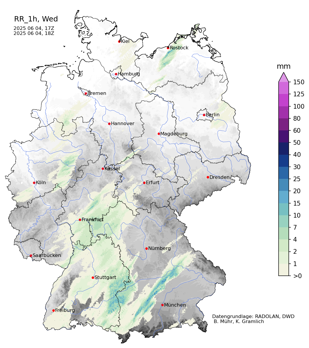
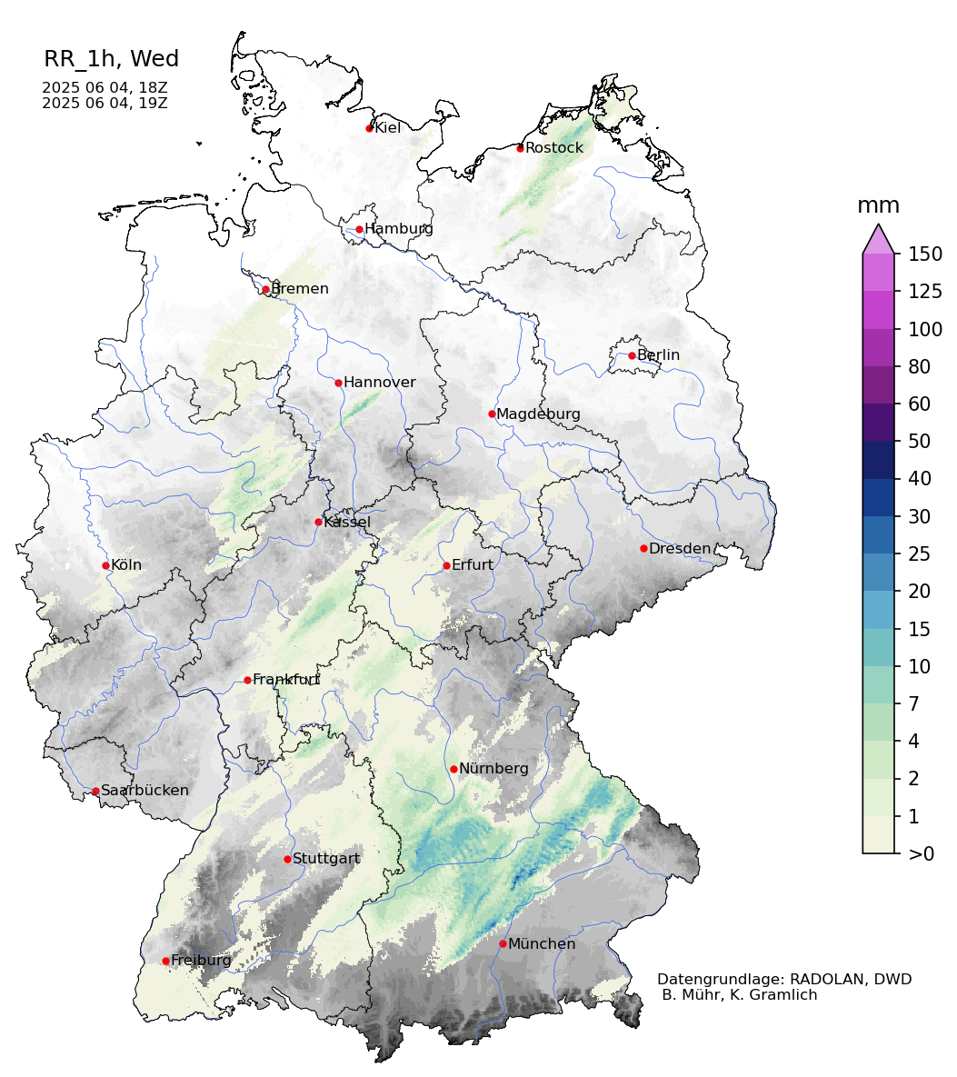
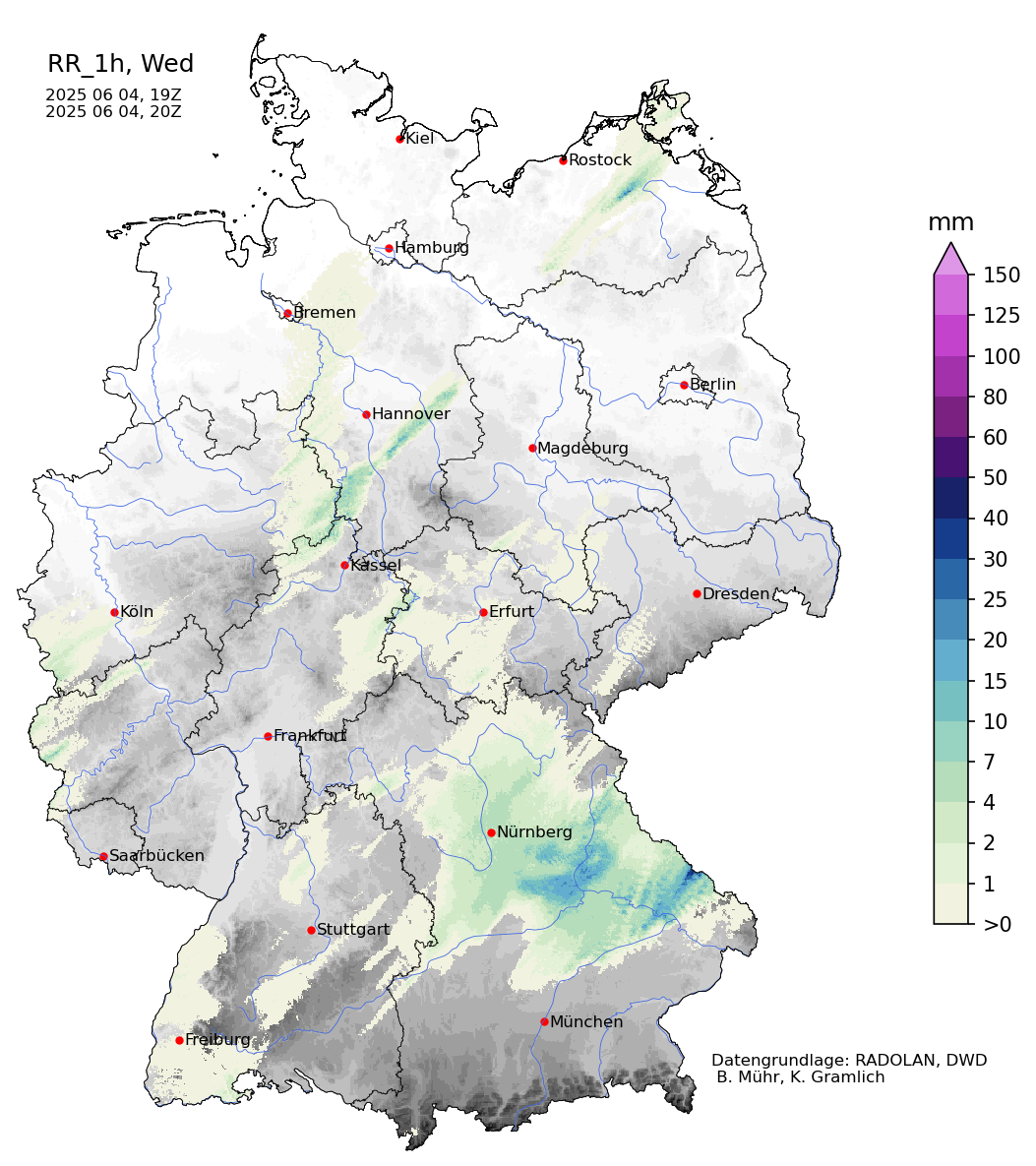
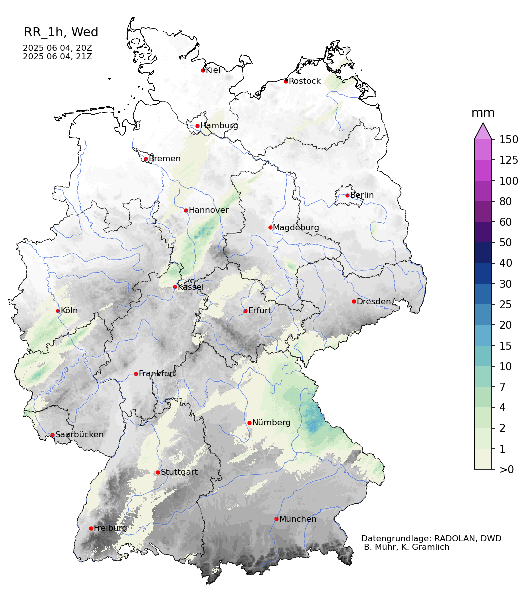
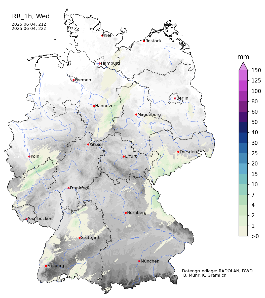
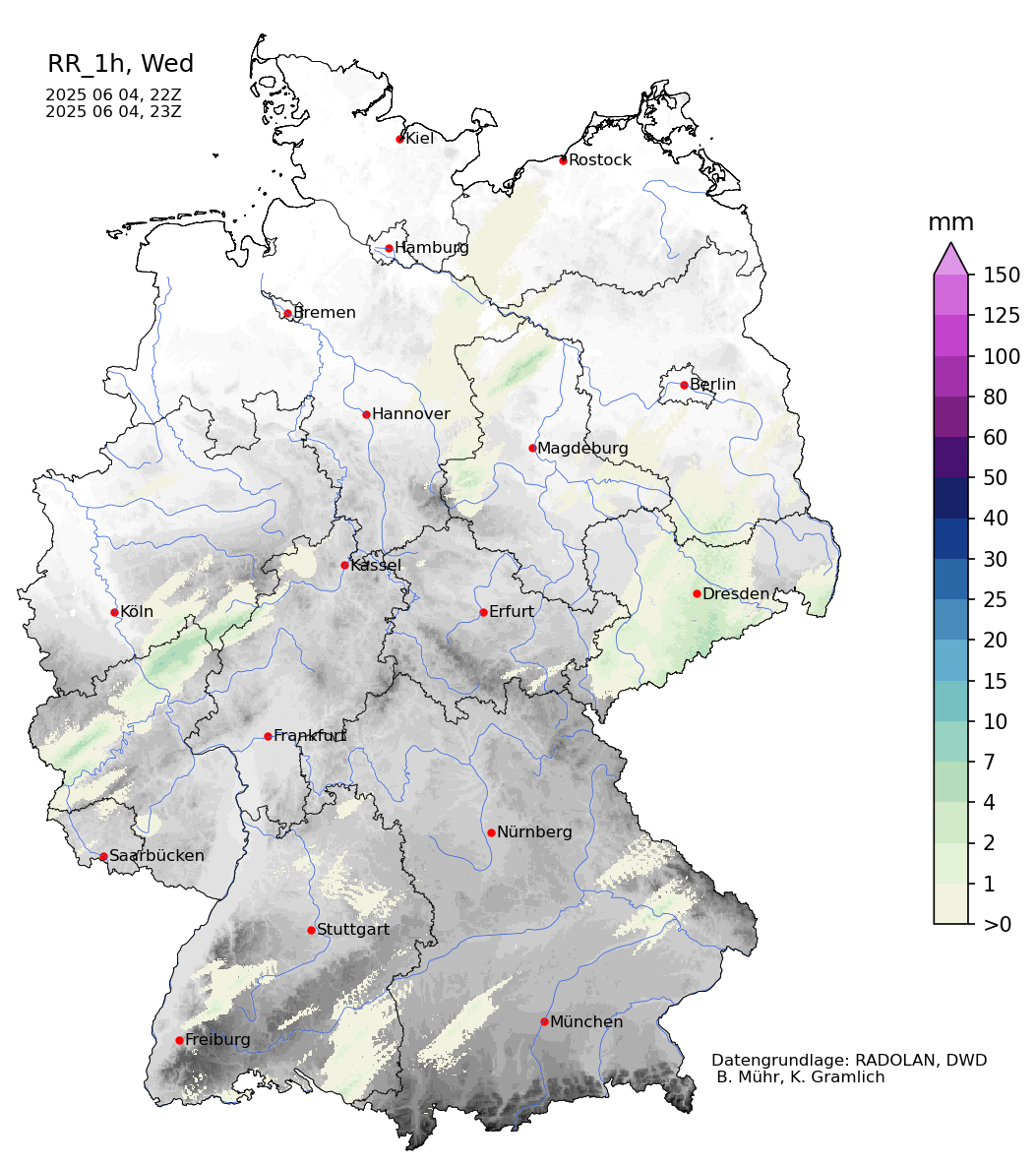
| Hourly radar-indicated precipitation totals over Germany, 04.06.2025 15 UTC - 23 UTC, source: Wettergefahren-Frühwarnung | |||
 |
 |
 |
 |
 |
 |
 |
 |
This can be taken as one potential hypothesis as to why the observed convective impacts were weaker than initially expected. Nevertheless, the supercells brought heavy downpours with precipitation totals of more than 30 mm, stormy winds with gusts of more than 100 kph, and large hail with diameters of up to 3 cm. Most affected was an area between Munich and Regensburg where multiple supercells formed.
Text: KG
June 05, 2025
