|
An elongated trough over Western Europe brought heavy precipitation to the Southern Alps. From April 14 to April 16, 2025, parts of Northern Italy and Southern Switzerland received more than 250 mm of precipitation. At elevations above 2000 cm, significant fresh snow accumulations of more than 100 cm were measured.
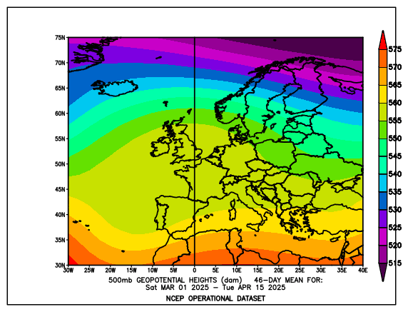
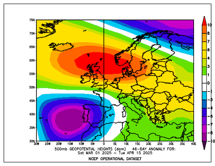
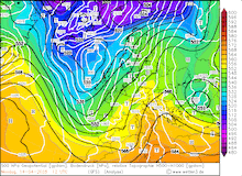
After a very wet year 2024, 2025 has brought limited precipitation to much of Central Europe. In March 2025, the precipitation totals across the European Continent showed abundant precipitation across the Iberian Peninsula while most of Central Europe received only little precipitation. The first half of April was once again dominated by large ridges across Continental Europe. Since early Spring, the 500 hPa geopotential anomaly over Europe has been dominated by a large dipole structure over the western half of the continent. Stretching from Greenland into Russia, a large positive anomaly impacted most of Europe with a maximum positive anomaly over the North Sea. West of the Iberian Peninsula, a large negative anomaly is located.
|
Mean 500 hPa geopotential (left) and 500 hPa geopotential anomaly (right) over Europe in the period from 01.03.2025 - 15.04.2025, source:
PSL NOAA
|
 |
 |
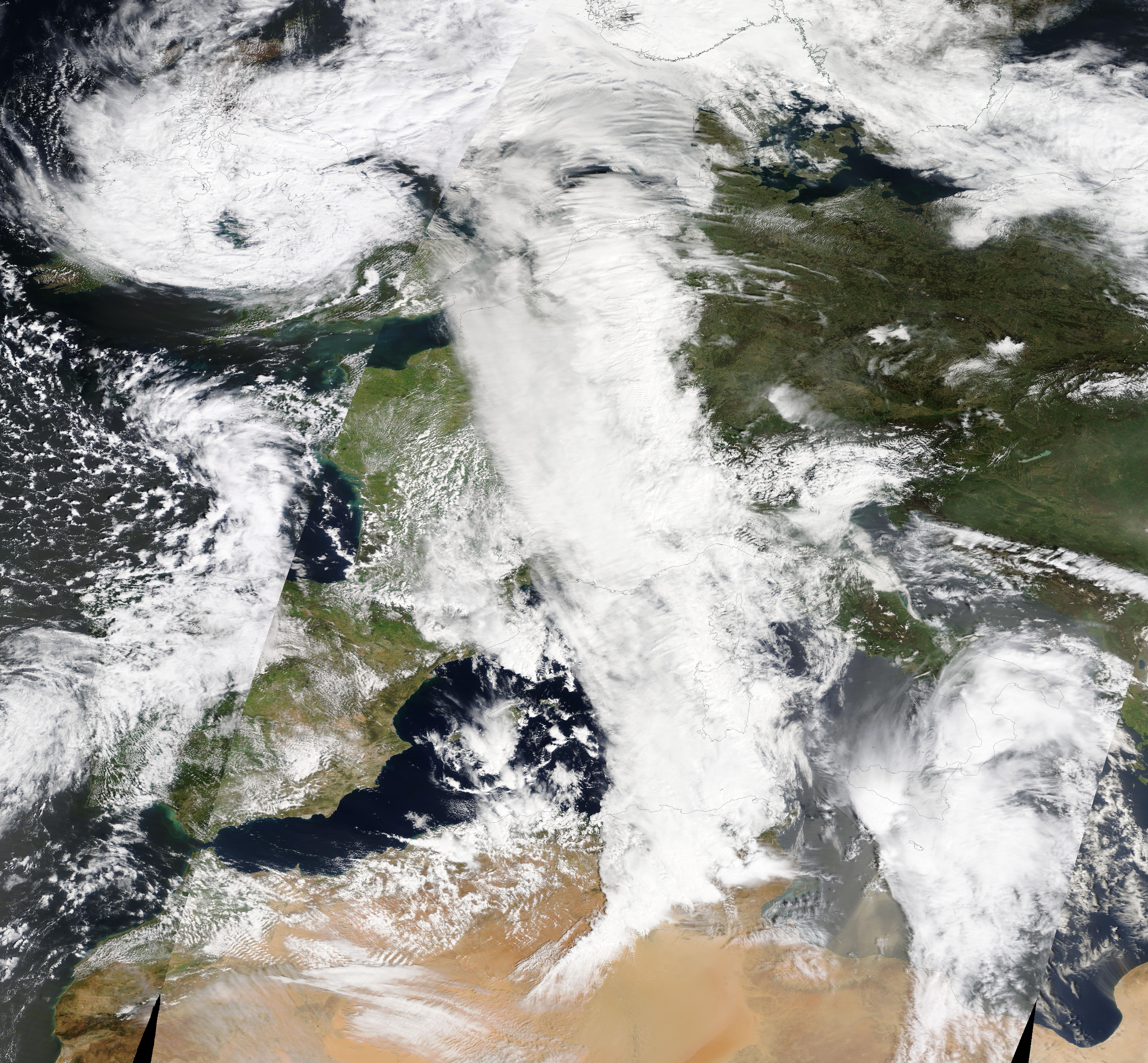
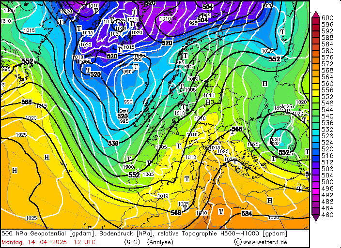
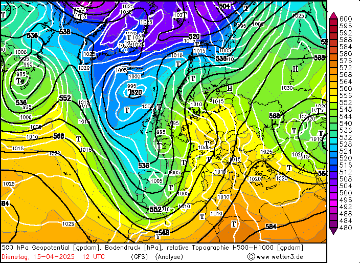
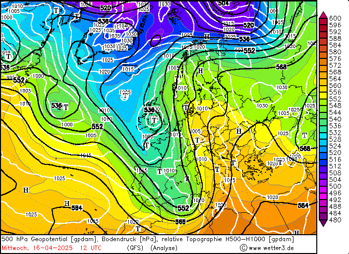
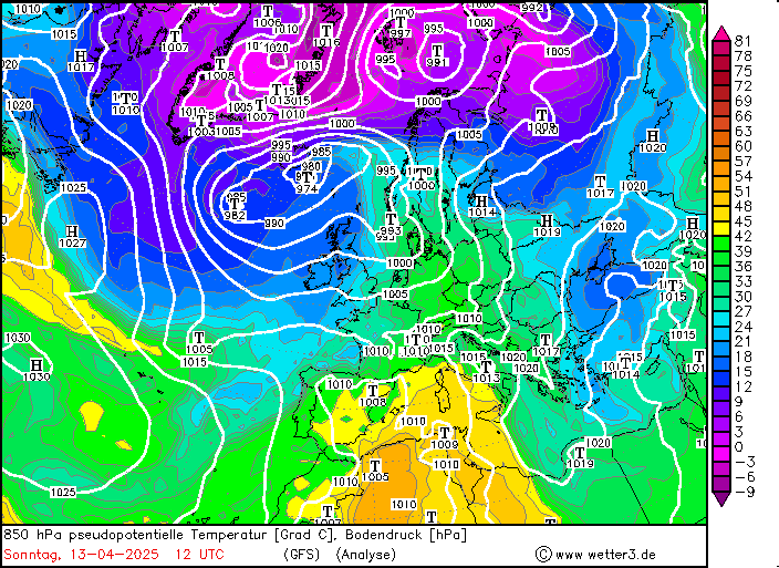
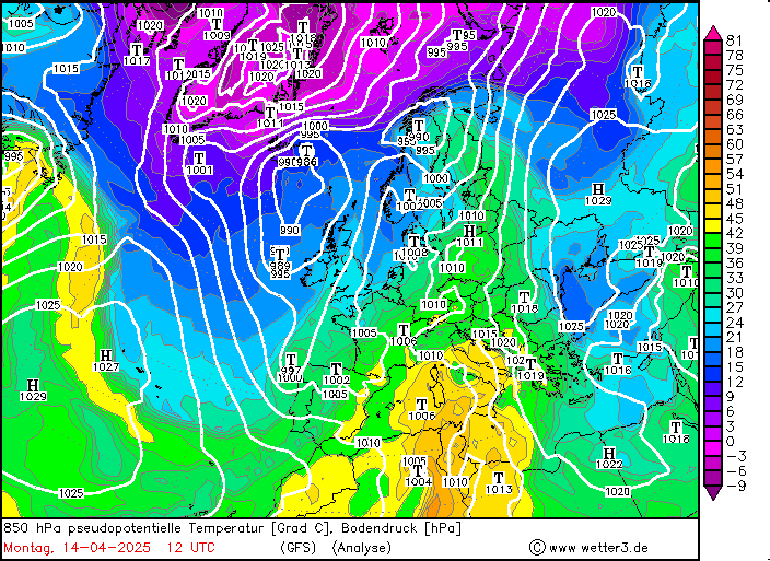
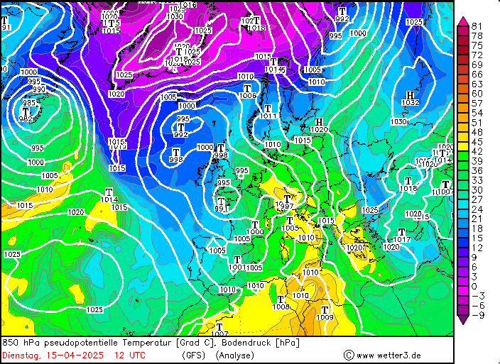
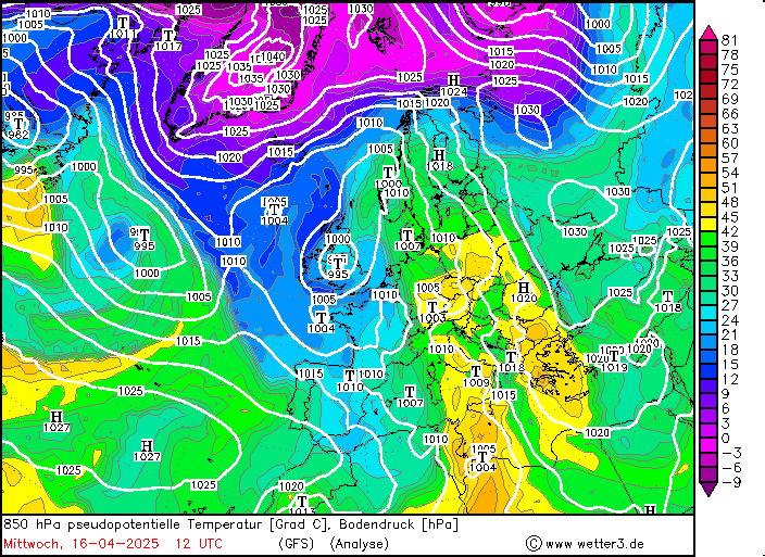
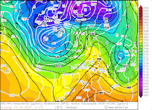
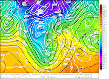
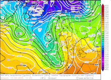
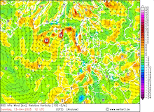
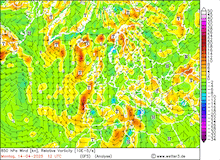
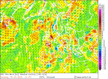
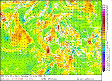
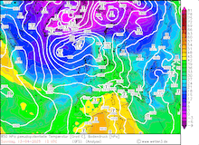
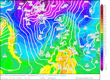
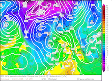
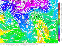
In the days preceding the event, a large omega-shaped weather pattern resided over Europe. The western trough of said weather pattern stretched far southwards across the Iberian Peninsula. At the eastern flank of the trough, very warm and moist air masses were advected northwards across the Mediterranean Sea. During the event, a coherent band of high pseudo-potential temperatures in the lower atmosphere can be seen stretching from North Africa into the Alps. Reaching the orographic barrier of the Southern Alps, the air masses were lifted. This strong lifting process allowed the formation of strong bands of continuous heavy precipitation. Locally embedded thunderstorms increased precipitation totals further.
|
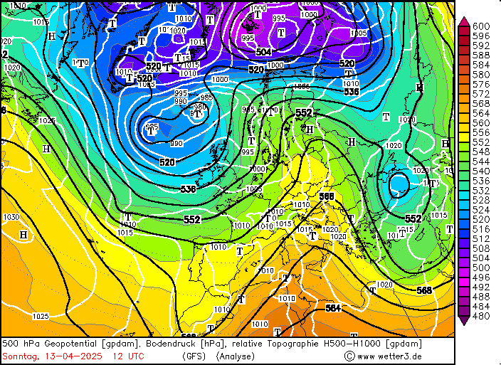
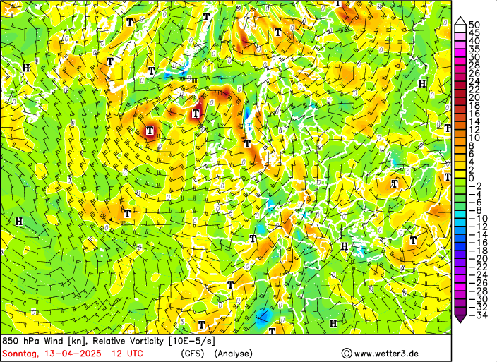
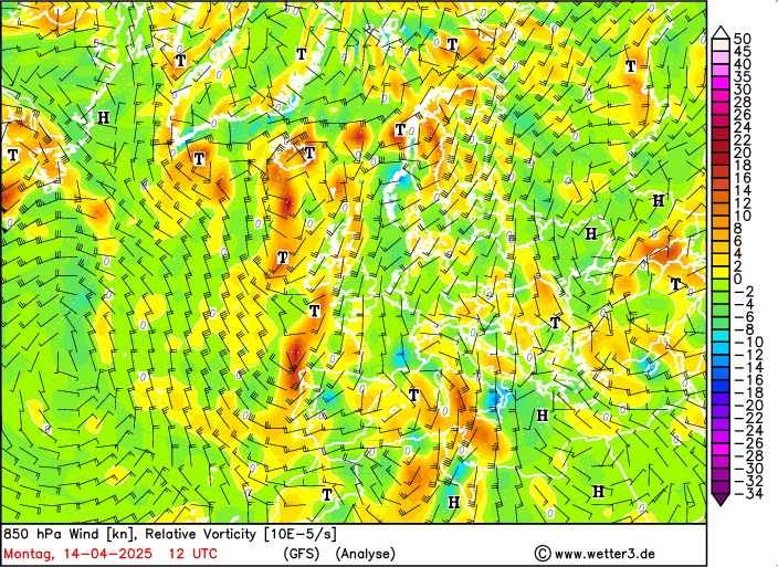
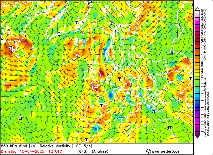
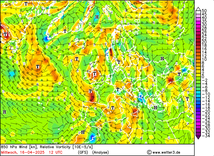
Daily development of the 500 hPa geopotential, 1000 hPa to 500 hPa thickness, and sea-surface pressure (upper row), 850 hPa wind speed and relative vorticity (middle row), and 850 hPa pseudo-potential temperature and sea-surface pressure over Europe, 13.04.2025 12 UTC - 16.04.2025 12 UTC, source:
wetter3.de
|
 |
 |
 |
 |
 |
 |
 |
 |
 |
 |
 |
 |
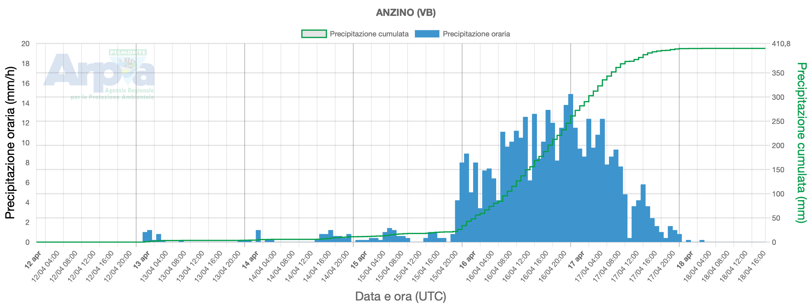
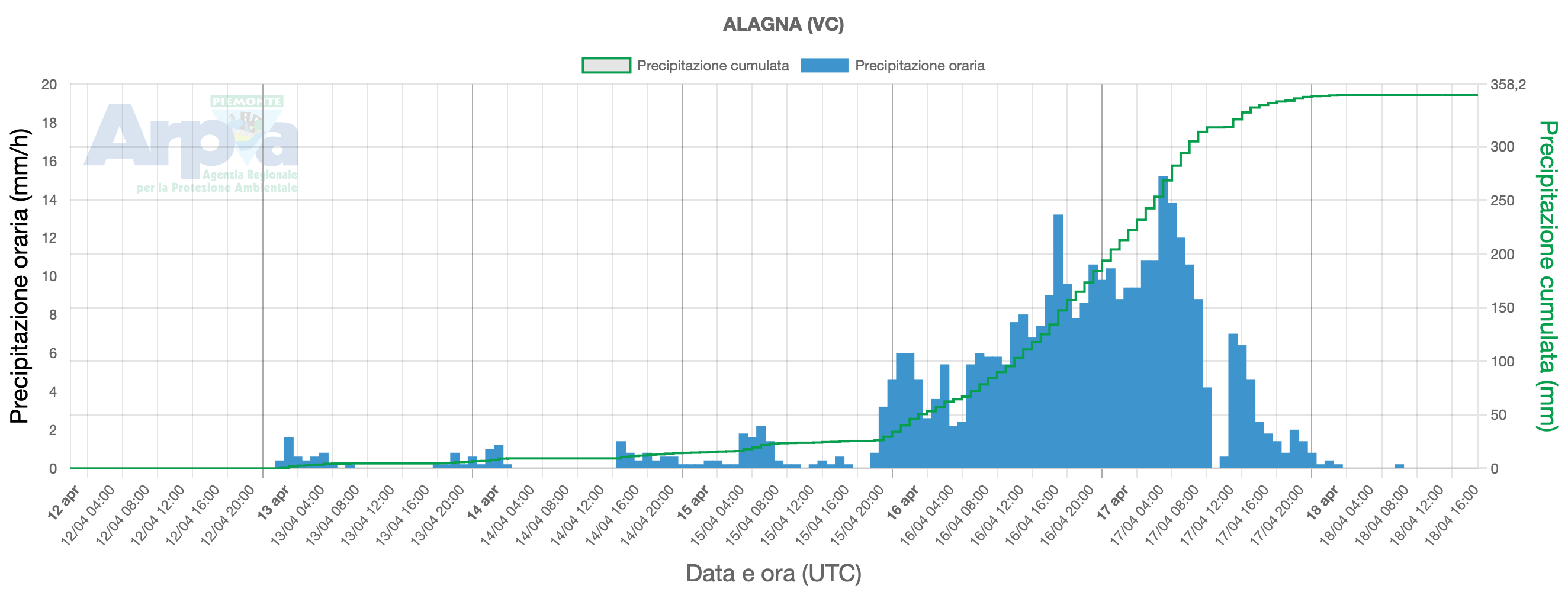
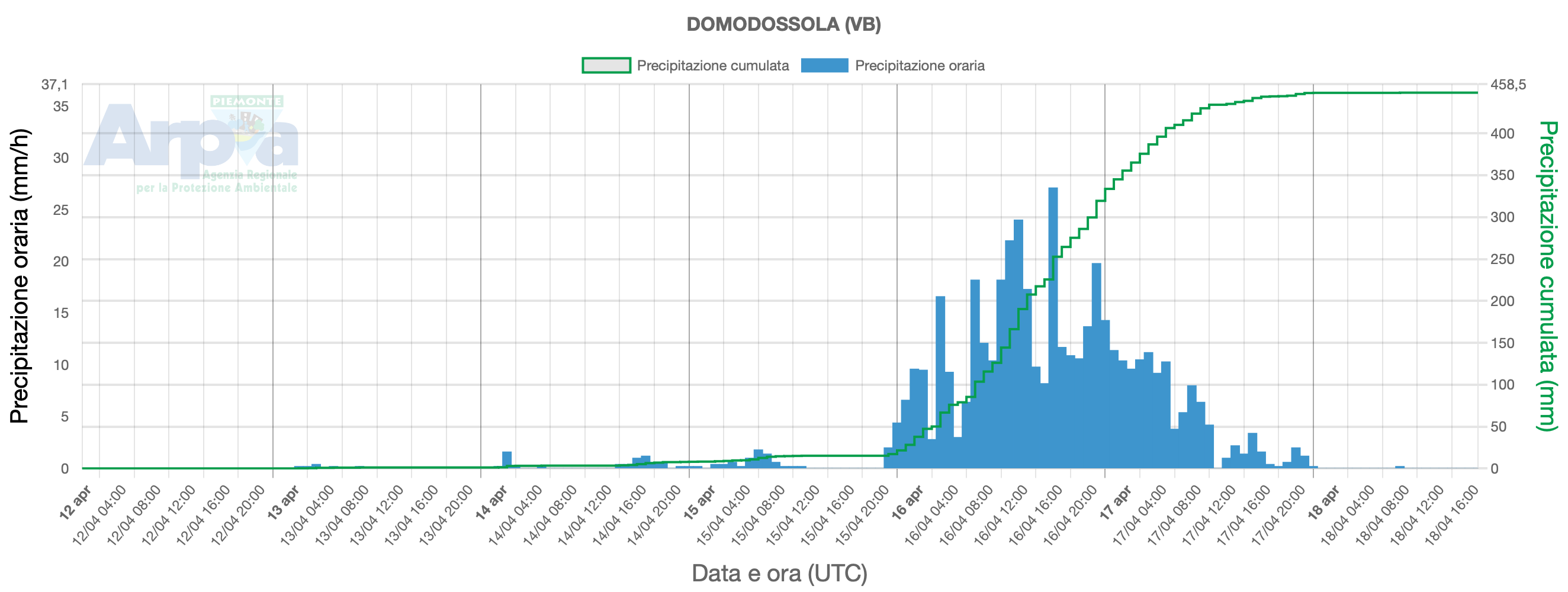
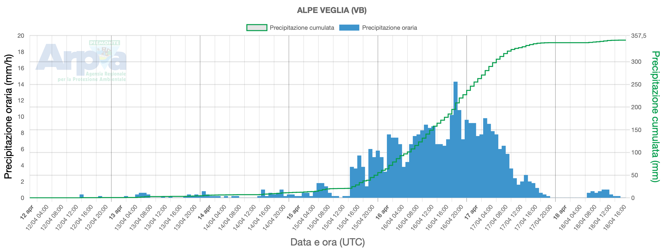
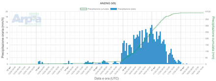
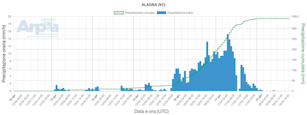
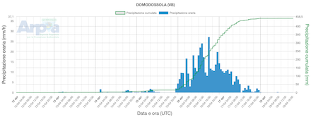
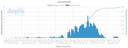
On April 14, 2025, heavy precipitation started to impact Northern Italy. On the following day April 15, 2025, the precipitation rates along the Southern Alps increased sharply. Many stations in the Valais Alps reported daily precipitation totals of more than 100 mm. In the northernmost parts of the Piermont, the daily precipitation totals were particularly strong due to the combination of strong orographic lift and embedded convective activity. Multiple measuring sites recorded daily precipitation totals of more than 300 mm/24 h. The highest daily precipitation totals were recorded at the measuring site at Camparient-Valdilana, IT with 408.2 mm.
|
Development of the 7-day accumulated precipitation totals at selected measuring sites in the northern part of the Piermont region at Anzino (upper left), Alagna (upper right), Domodossola (lower left), and Alpe Veglia (lower right), source:
ARPA Piermont
|
 |
 |
 |
 |
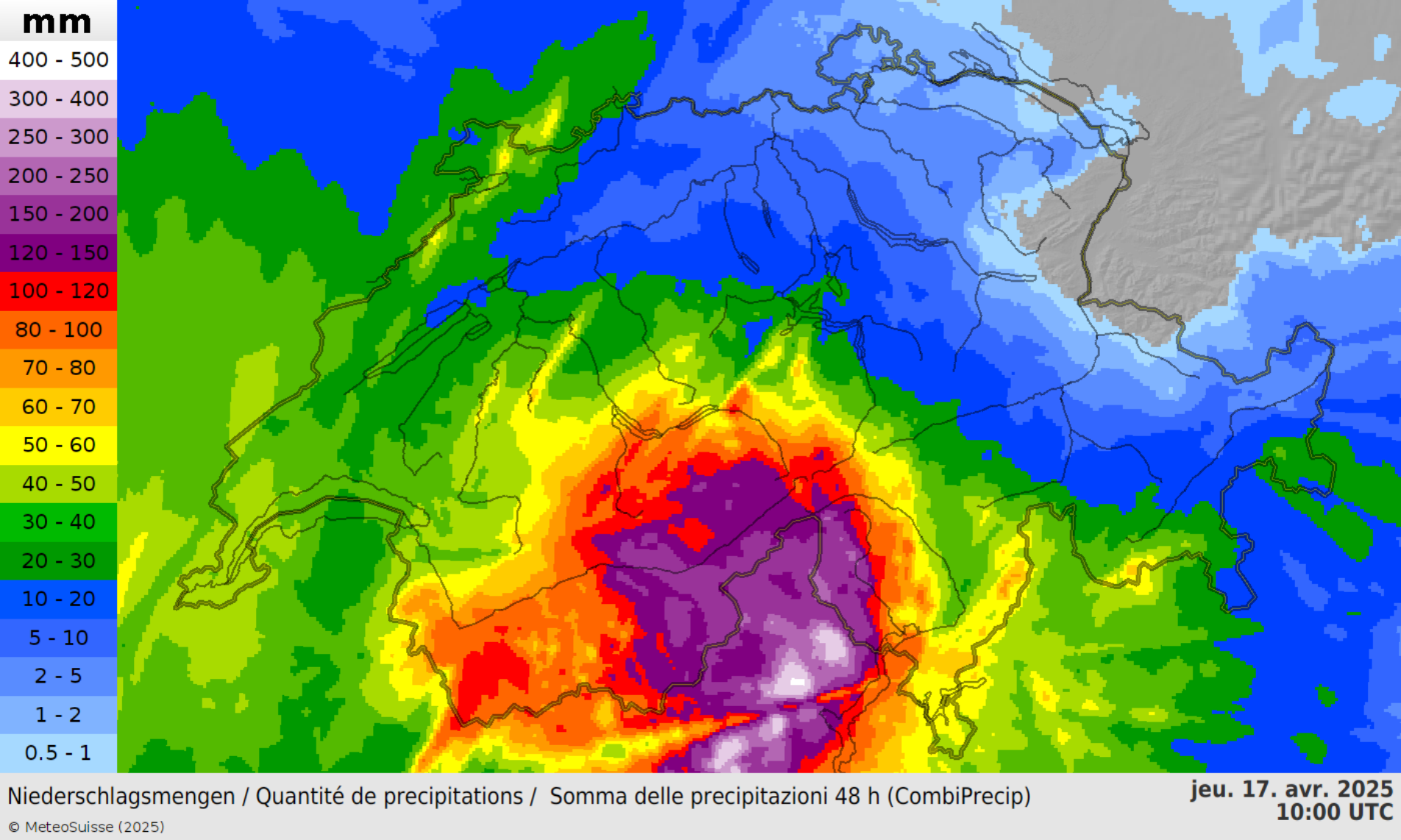
Further north within the main chain of the Alps in Switzerland, daily precipitation reached more than 100 mm. On April 16, 2025, the intensity of the precipitation reduced. Nevertheless, many measuring sites in Northern Italy recorded daily precipitation totals between 50 to 100 mm. Within a 72 h period, many measuring sites in the northern part of the Piermont and the adjacent Valais recorded precipitation totals of more than 250 mm. Radar-indicated precipitation totals suggest 72 h precipitation accumulations of more than 500 mm south of the Swiss-Italian border in the northernmost parts of the Piermont.
|
2-day radar-indicated precipitation totals over Switzerland, 17.04.2025 08 UTC, source:
MeteoSchweiz
|
 |
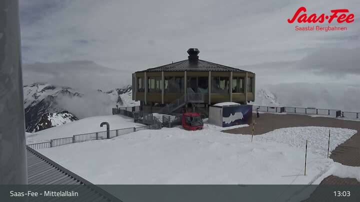
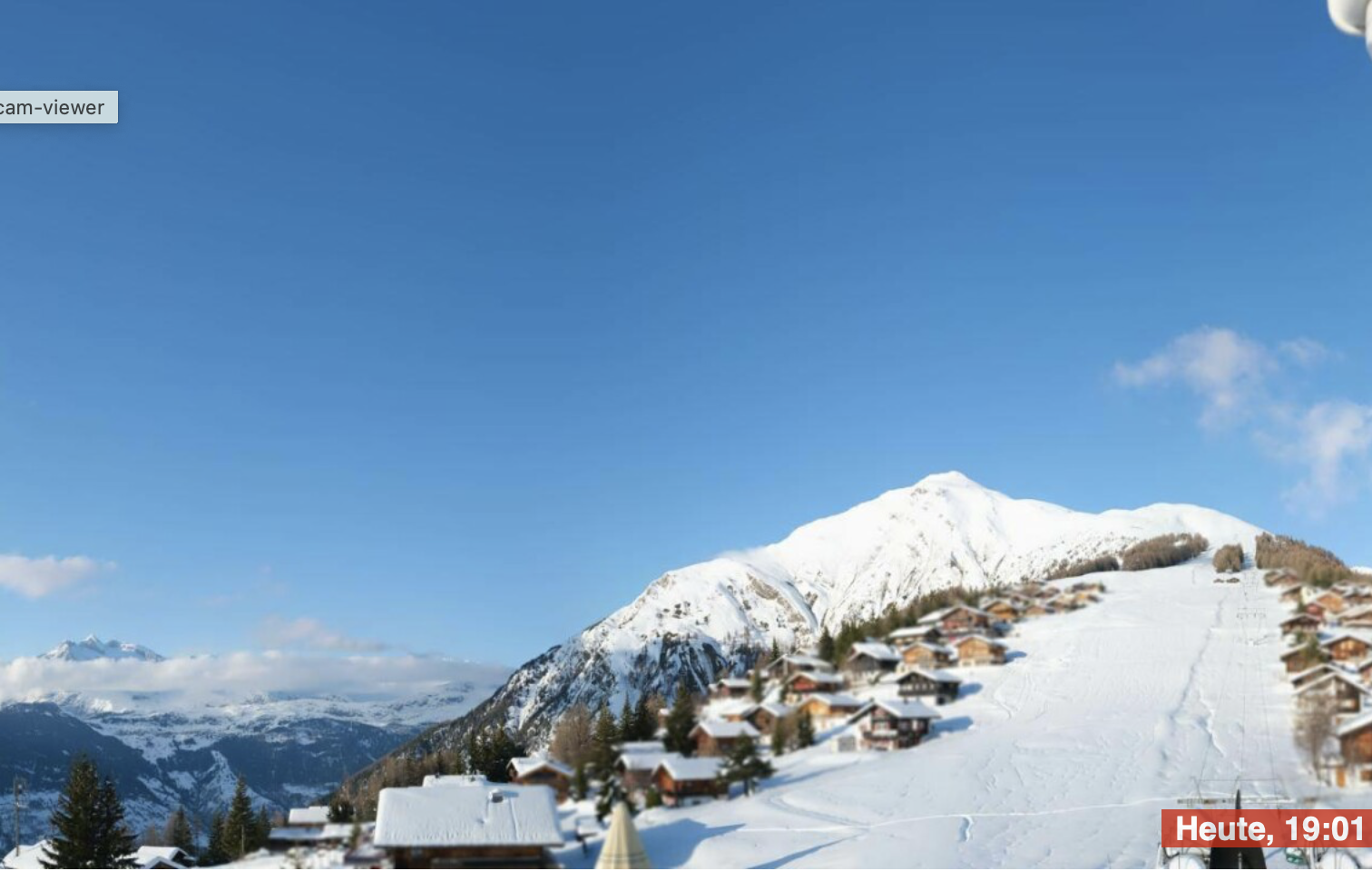
Up in the high-alpine territory of the Valais Alps, the heavy precipitation led to significant fresh snow accumulations of more than 100 cm above 2000 m. Many high-alpine villages in the Valais were severely impacted by the extreme snowfall. High-altitude towns like Zermatt received 55 cm of fresh snow accumulation within a single day on April 16, 2025. With a single-day fresh snow accumulation of 58 cm, Montana broke the April record for the highest single-day fresh snow accumulation. Similarly, Adelboden broke its April record for the highest single-day fresh snow accumulation with 52 cm on April 16, 2025.
|
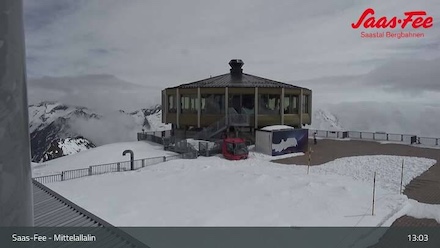
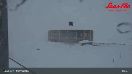
Snow depths change in the Valais Alps before the event on April 14, 2025, and after the event on April 20, 2025 and April 18, 2025 respectively, at Saas-Fee (upper row), source:
Feratel and at Rosswald (lower row), source:
MeteoSchweiz-Roundshot
|
 |
 |
 |
 |
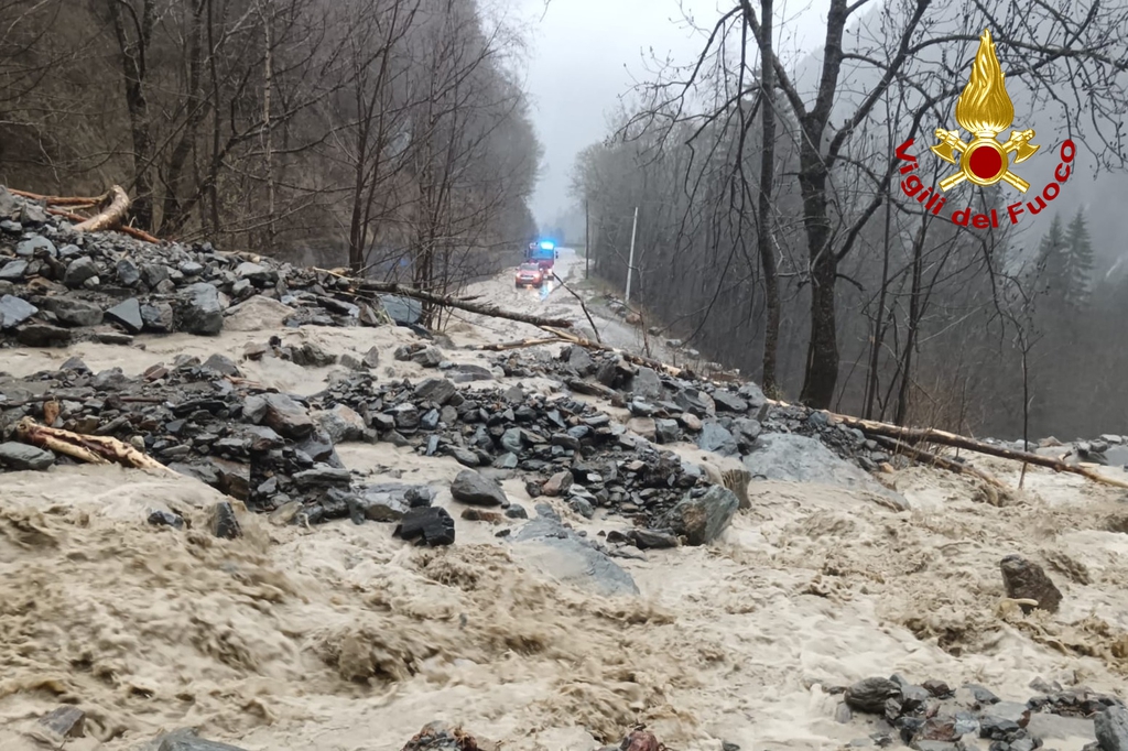
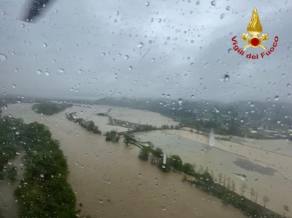
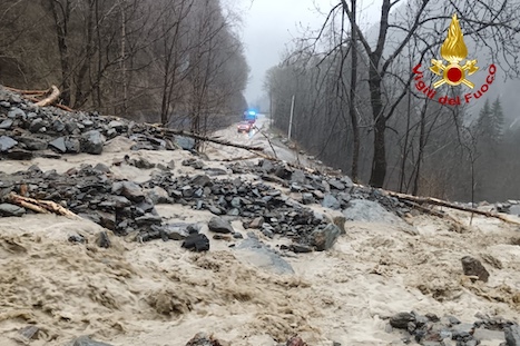
Adelboden also broke its all-time daily precipitation record with 95 mm of precipitation on April 16, 2025. The return period of such large daily precipitation totals is within 50 to 100 years in the region. While a significant part of the precipitation in the Valais region accumulated in the form of snow, most of the precipitation in the northern part of the Piermont fell in liquid form. As a result, heavy flooding occurred. Furthermore, rock- and mudslides were reported from the Piermont.
|
Aftermath of the heavy rains in the Piermont including rockslides and river flooding, source:
Vigili del Fuoco
|
 |
 |
Thousands of customers were left without electricity both in Italy and in Switzerland in the aftermath of the event. In Switzerland, mostly high-alpine towns were affected by power outages due to the large fresh snow accumulations.
Text: KG
April 22, 2025
|