|
A cut-off low over the Iberian Peninsula brought torrential rains to parts of Spain due to stationary convective activity. In the metropolitan area around Valencia, rain accumulations of more than 600 mm led to a devastating flash flood along the Magro River, Poyo Ravine, and Turio River, leaving more than 217 people dead.
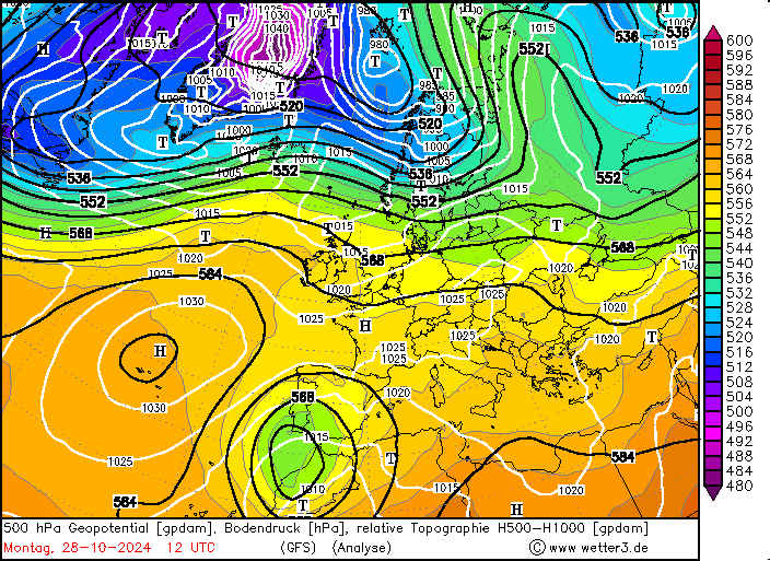
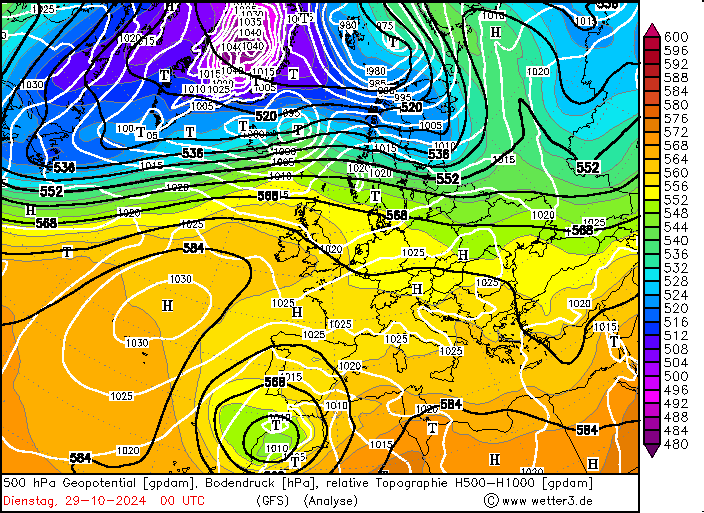
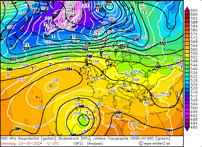
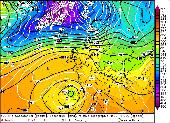
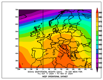
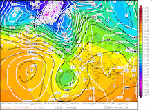
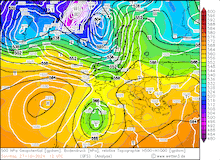
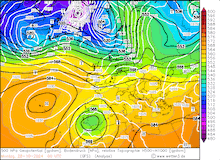
After the passage of ex-hurricane KIRK, a major weather pattern change occurred over Europe in the second half of October 2024. A strong ridge formed over the central part of the Continent and diverted most of the extratropical cyclonic activity far northwards into Scandinavia. By October 23, 2024, a strong outburst of polar airmasses reached the Northern Atlantic Ocean off the coast of Newfoundland. This triggered the formation of a strong trough which quickly approached the European Continent in the following days. Upon reaching the British Isles, a secondary trough formed at the southern tip of the main trough on October 26, 2024.
|
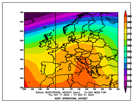
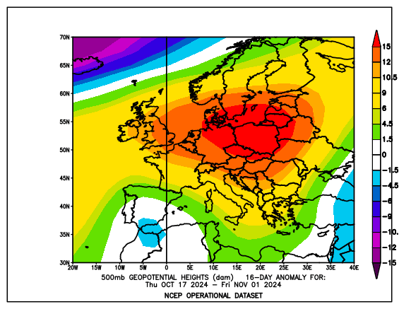
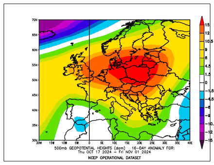
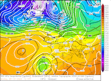
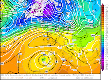
Mean 500 hPa geopotential (left) and 500 hPa geopotential anomaly (right) over Europe in the period from 17.10.2024 - 01.11.2024, source:
PSL NOAA
|
 |
 |
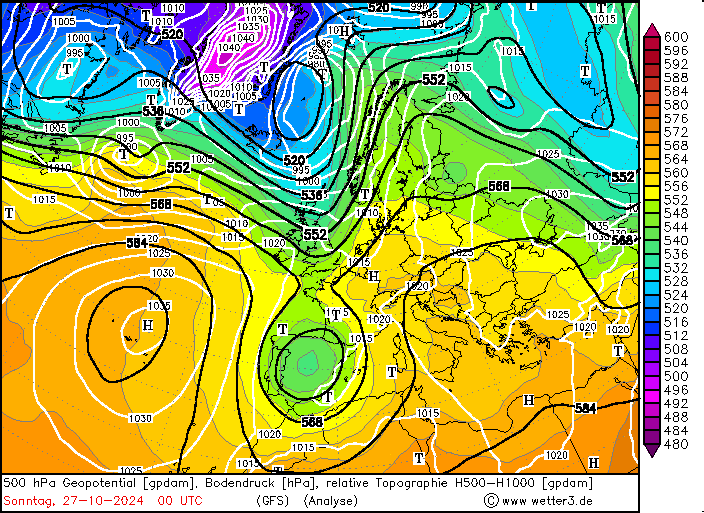
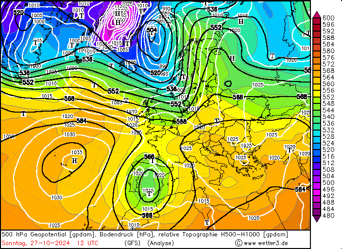
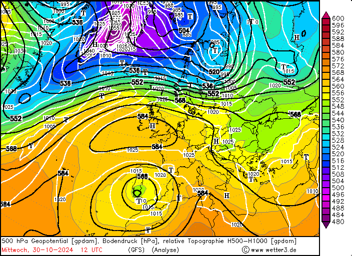
The secondary trough then could expand far southwards as the ridge residing over Central Europe blocked the trough from moving further eastwards. As the trough expanded southwards over the Iberian Peninsula on October 27, 2024, cold upper-tropospheric airmasses reached the Iberian Peninsula. In combination with the still very warm Mediterranean Sea, this synoptic set-up gave the potential for very large precipitation totals as the cut-off low meandered slowly over the Iberian Peninsula. The slowly moving cut-off induced nearly stationary lower-tropospheric winds, which continuously advected warm and moist air masses into the Iberian Peninsula. Onshore, these airmasses reached the coastal mountain ranges along the Mediterranean. The orographic lift forced the air masses to rise. In combination with an unstable atmosphere, vigorous convection could develop.
|
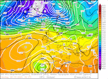
Development of the 500 hPa geopotential, 1000 hPa to 500 hPa thickness, and sea-surface pressure over Europe, 27.10.2024 00 UTC - 30.10.2024 12 UTC, source:
wetter3.de
|
 |
 |
 |
 |
 |
 |
 |
 |
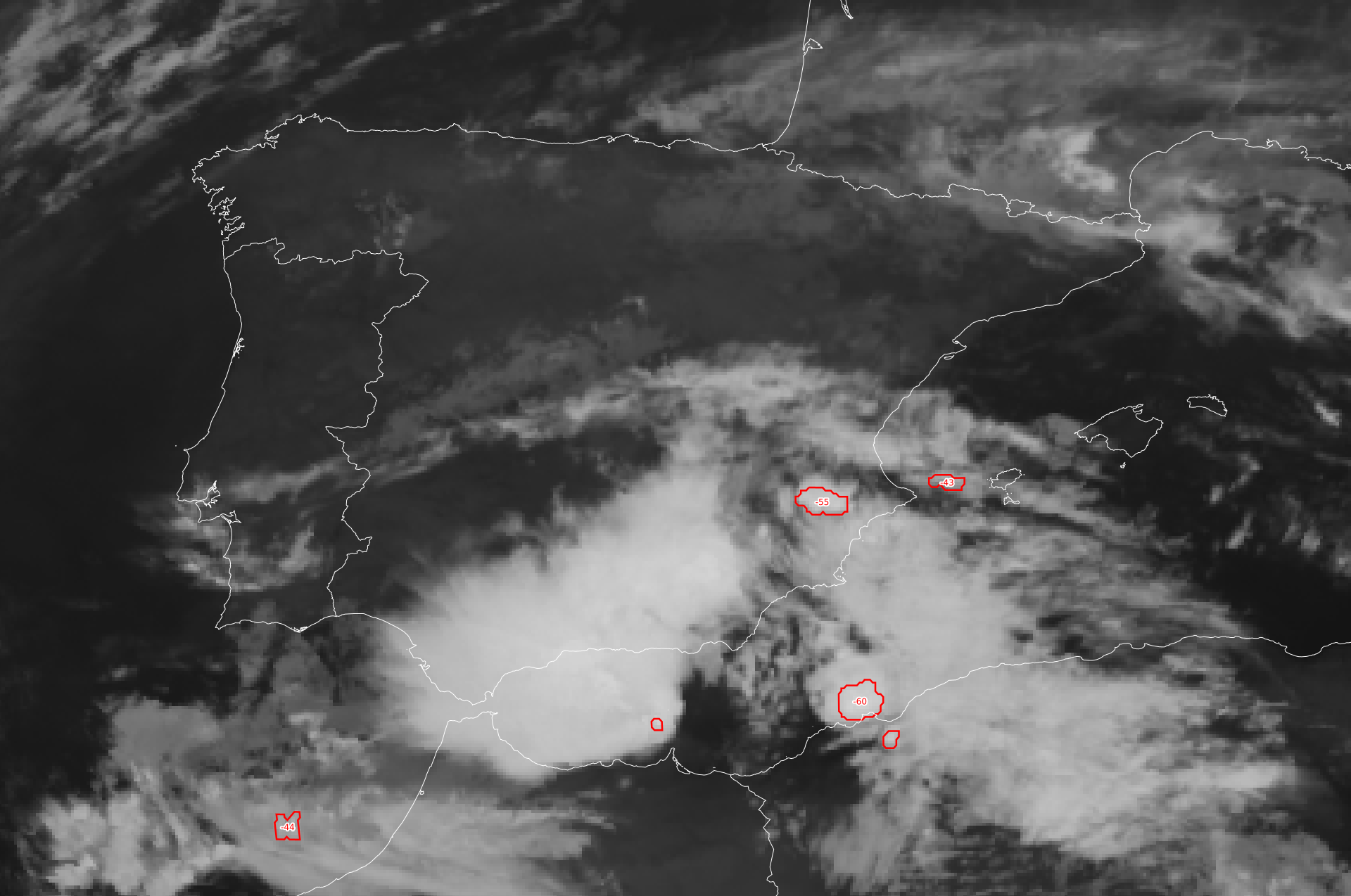
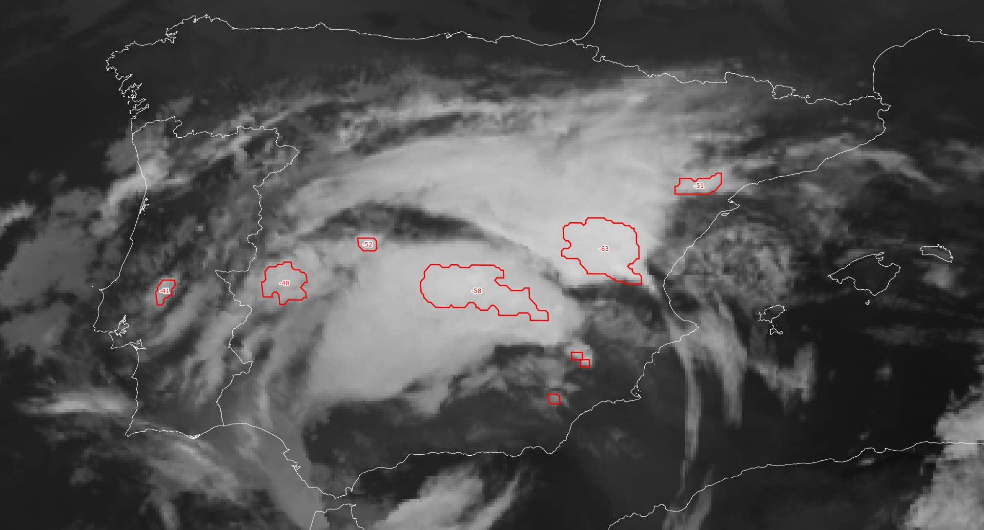
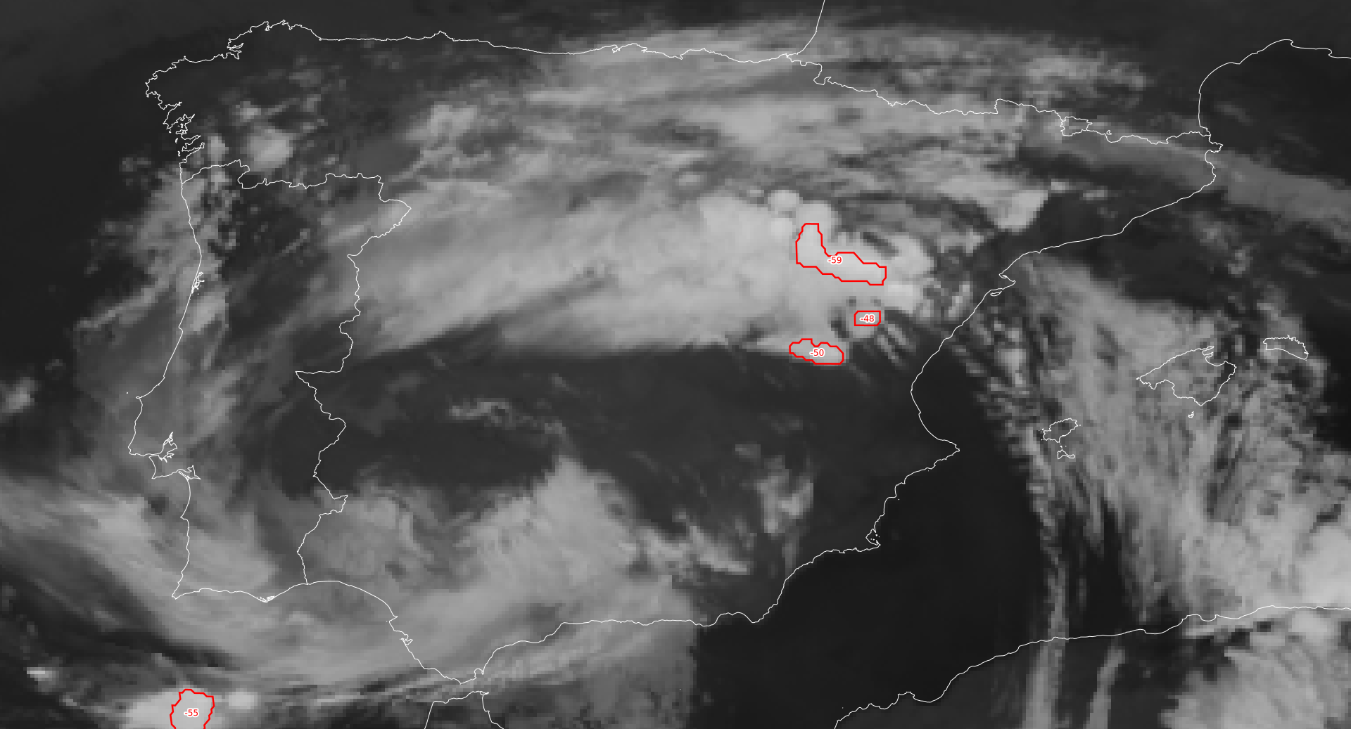
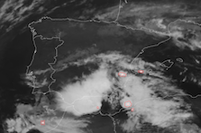
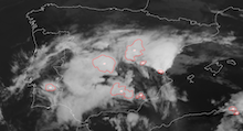
On October 28, 2024, the first strong mesoscale convective systems (MCSs) could develop over the Western Mediterranean. These MCSs affected the Balearic Islands with heavy downpours leading to daily precipitation totals of up to 101.2 mm. The following day, October 29, 2024, the cut-off located over the Iberian Peninsula moved further south. At the northern edge of the cut-off low, the low-level circulation started to advect the very moist air masses from the Mediterranean inland. Near the center of the cut-off low, an MCS developed over the southernmost part of Spain bringing more than 100 mm of rain to the Sierra Nevada. A second MCS moved northwards along the coast of Spain. By 03 UTC, the MCS reached the southern part of the metropolitan area of Valencia. Over the metropolitan area of Valencia, this MCS stalled. While the mean winds advected the system inland, the permanent inflow of very moist air masses from the Mediterranean saw continuous development of new convective cells at the eastern edge of the MCS.
|
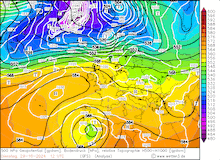
2 hourly infrared satellite imagery and cloud top temperature of multiple MCSs moving over the Iberian Peninsula, 28.10.2024 22 UTC - 29.10.2024 04 UTC, source:
Eumetsat View
|
 |
 |
 |
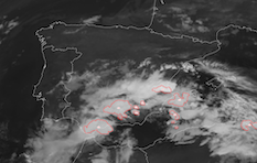 |
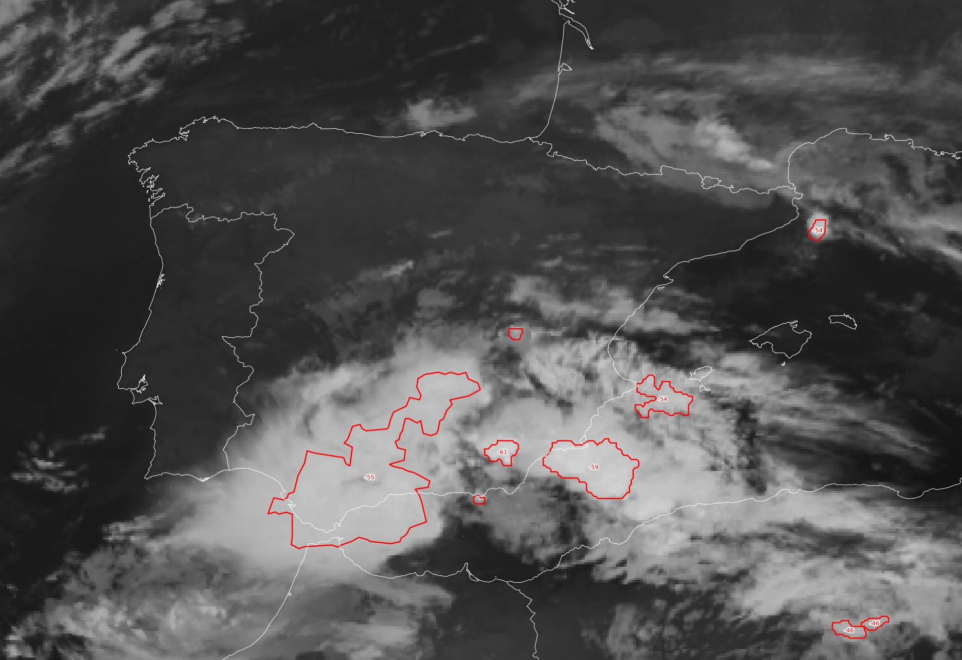
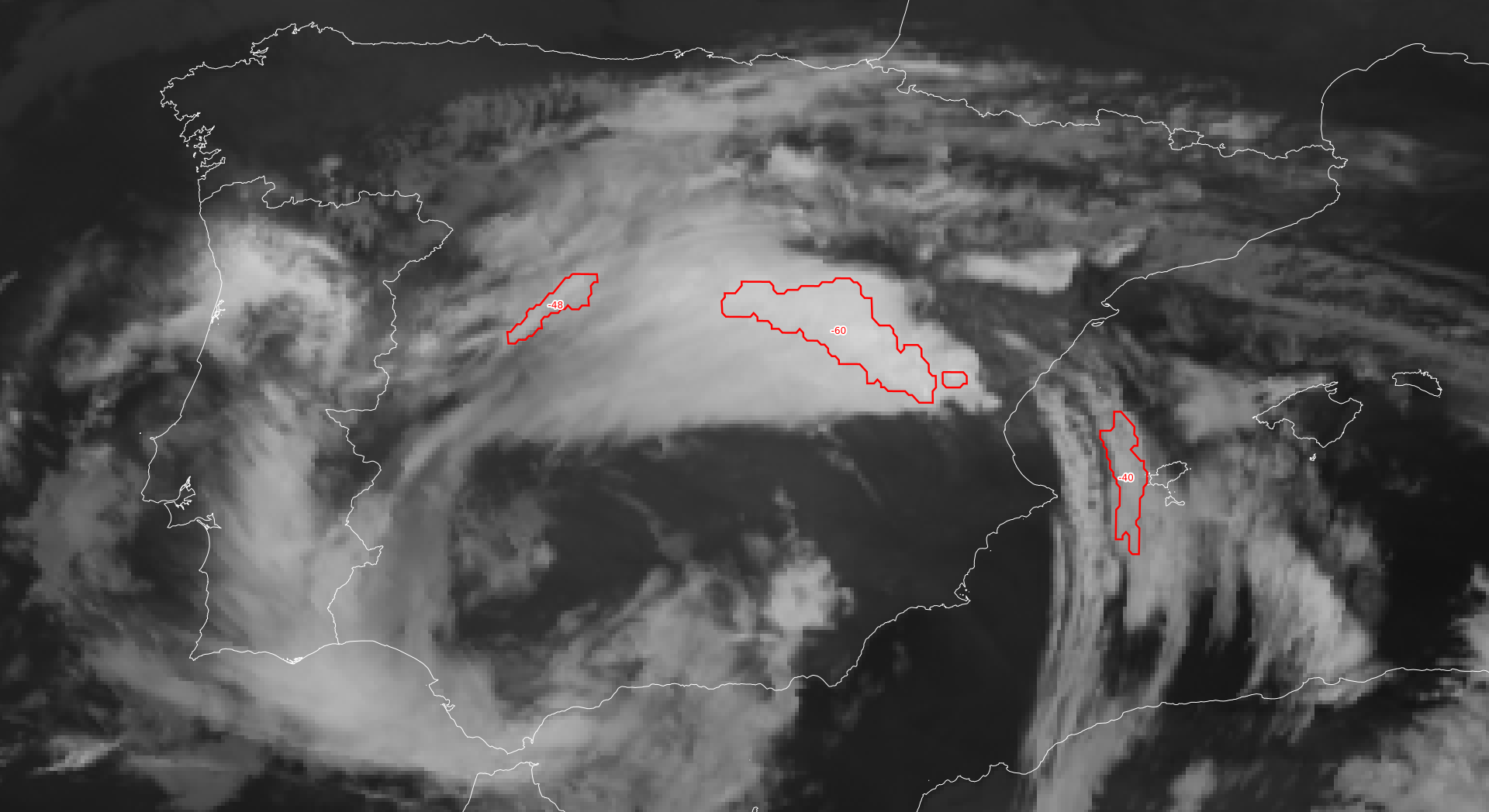
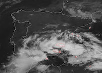
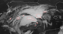
During midday, the convective activity over the Province of Valencia decreased slightly in activity. However by 14 UTC, new strong convective cells developed right over the metropolitan area of Valencia. By 16 UTC, a large, V-shaped MCS cluster had developed over the Province of Valencia. The shape of the cluster indicates a very strong MCS. As such, the system remained nearly stationary over the metropolitan area of Valencia until 20 UTC. As a result, torrential downpours affected the neighboring towns and cities in the mountain ranges surrounding Valencia. Only after 03 UTC on October 30, 2024, the MCS moved out of the affected areas.
|
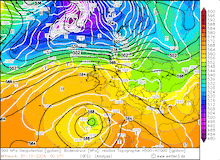
4 hourly infrared satellite imagery and cloud top temperature of multiple MCSs moving over the Iberian Peninsula, 29.10.2024 16 UTC - 30.10.2024 04 UTC, source:
Eumetsat View
|
 |
 |
 |
 |
Within a 24 h period, precipitation totals of more than 500 mm were observed in the mountain ranges west of Valencia. As a reference, the city of Valencia receives on average an annual precipitation of just 457.9 mm. In the town of Turìs, preliminary data shows a 24 h precipitation total of 618.0 mm according to the Spanish Meteorological Agency. Within this 24 h period, the weather station Turìs recorded an hourly precipitation total of 179.4 mm which would be, if confirmed, the new Spanish record for the highest hourly precipitation total. Currently, this record is held by a weather station in Vinaròs with an hourly precipitation total of 159 mm set in October of 2018. Additionally, the weather station in Turìs recorded a peak 10 min precipitation total of 42.0 mm.
|
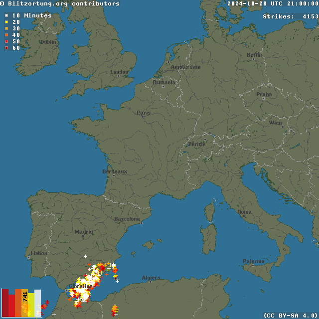
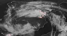
Hourly lightning flashes registrated over Southwestern Europe, 28.10.2024 20 UTC - 30.10.2024 06 UTC, source:
Blitzortung
|
 |
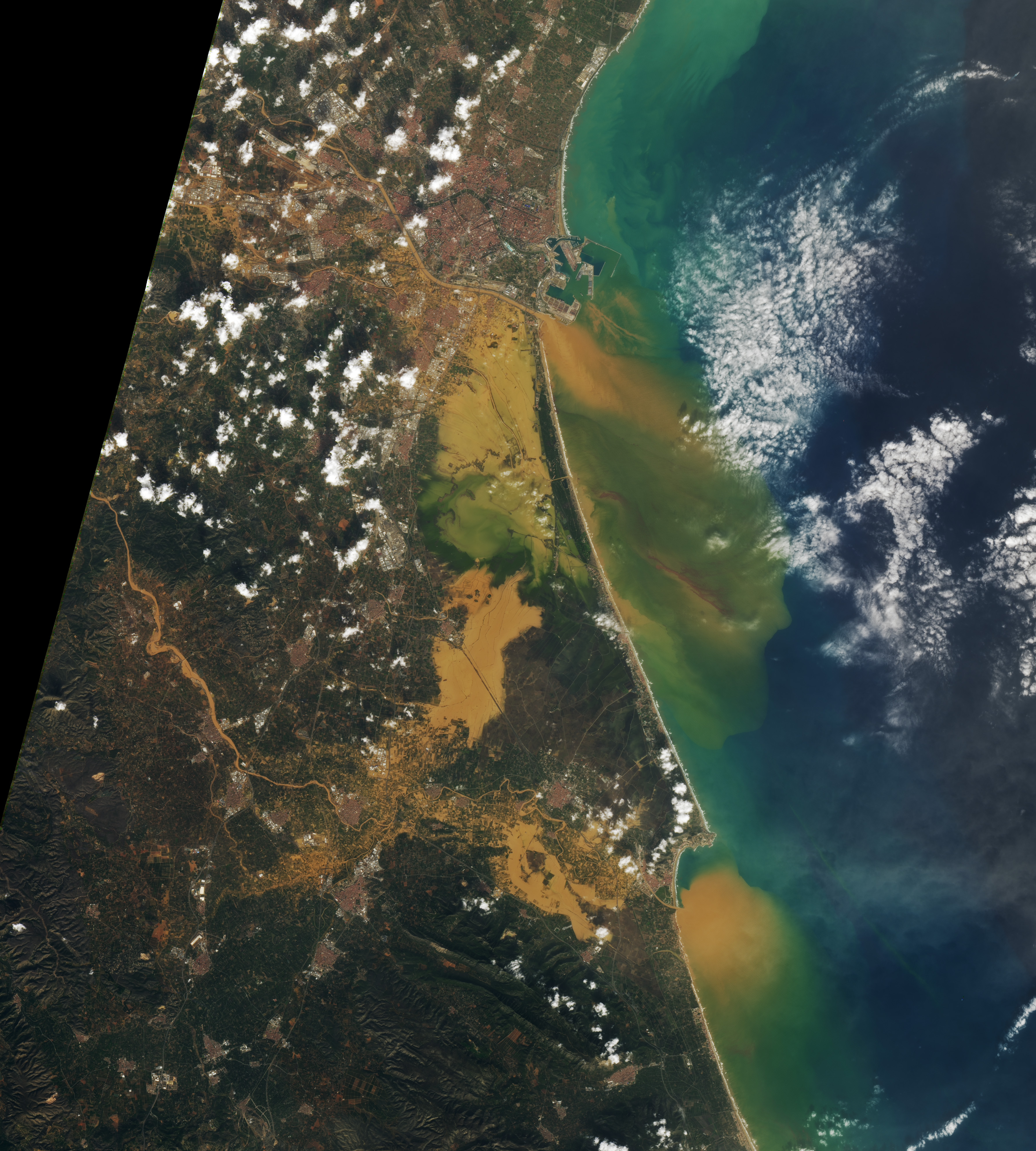
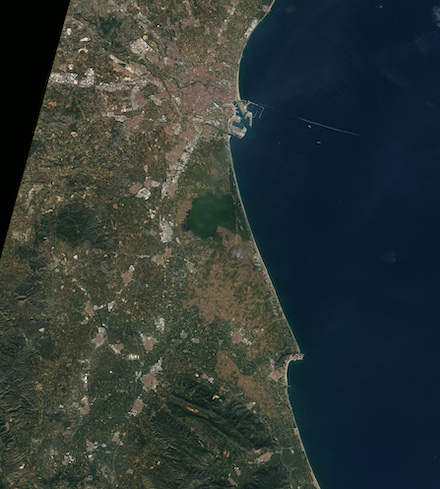
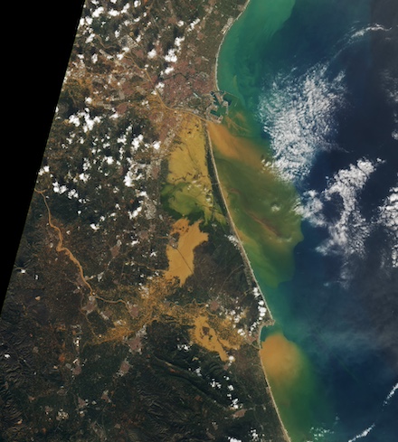
Due to these torrential rains, a devastating flash flood developed in the afternoon hours of October 29, 2024, along the multiple rivers draining the area. The worst flooding was observed along the Magro River, the Poyo Ravine, and the Turio River. All rivers flow through the southern part of the metropolitan area of Valencia. A significant part of the floodwaters drained into the Albufera lagoon south of Valencia. Satellite imagery of the area before the flood and after the flood on October 30, 2024, shows large parts of the typically dry areas of the Albufera lagoon inundated with flood waters.
The devastating flooding in the area led to the loss of at least 217 lives, with many people still missing due to the chaotic situation in the affected areas around Valencia. Many roadways are severely damaged or destroyed by the flooding, impeding rescue missions. Besides the damages by the flood, debris relocated by the floodwaters makes many roads impassable. Further, train lines and the electric and natural gas grid in the area were severely damaged. The town of Paiporta was most severely affected by the flooding on October 29, 2024, with a least 64 people dying in the floods. Due to the catastrophic damages in the Province of Valencia, many cultural events in the area were canceled. This includes multiple football games as well as the season finale of the world motorcycle championship. It is expected that the floods of October 29, 2024, will be the most expensive natural disaster in Spanish history leading to greater damages than the 1983 Spanish floods affecting the city of Bilbao.
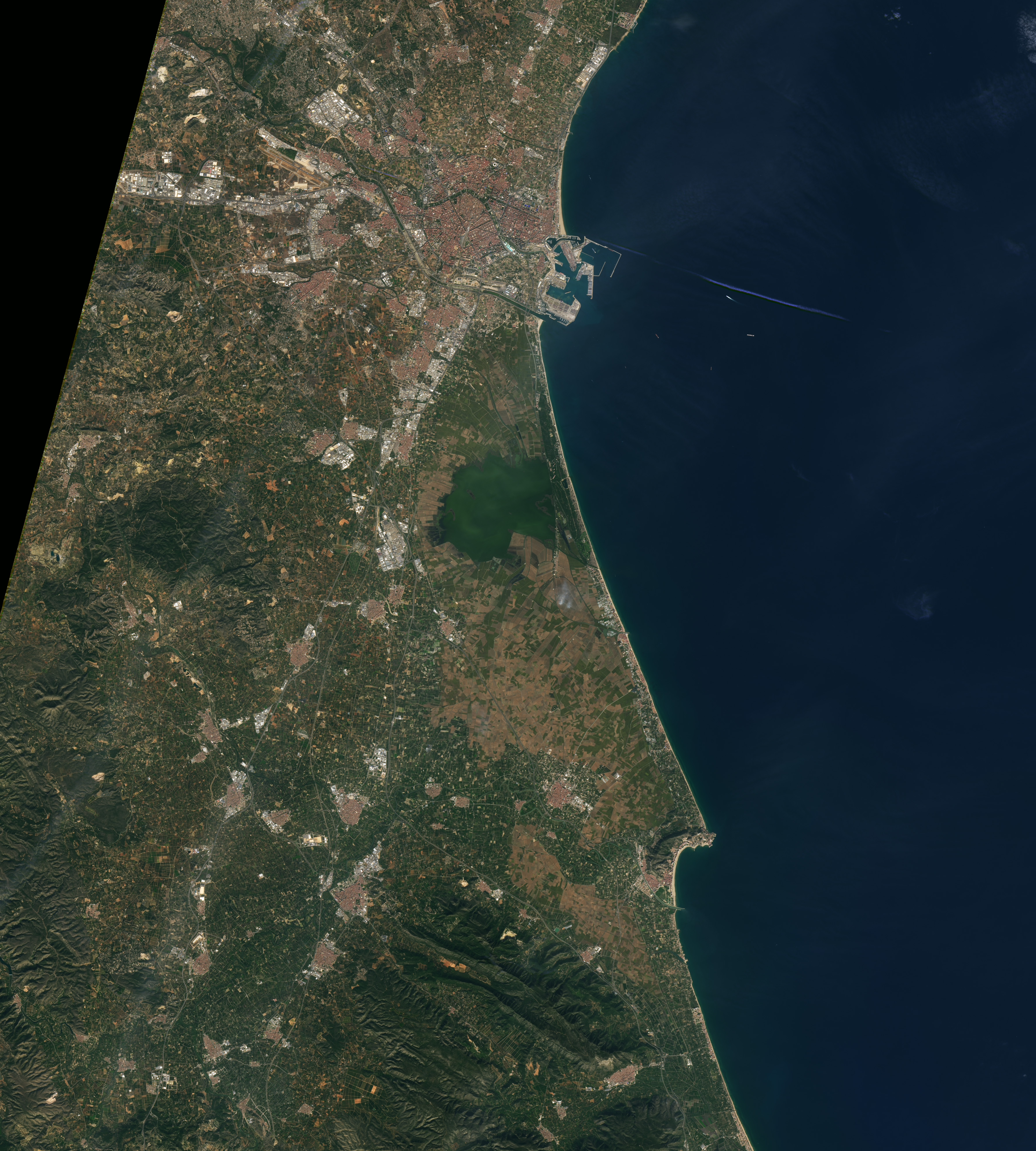
Visible satellite imagery of the Province of Valencia before the floods taken on October 25, 2022, (right) and after the flooding on October 30, 2024 (left),
source:
NASA Earthobservatory
|
 |
 |
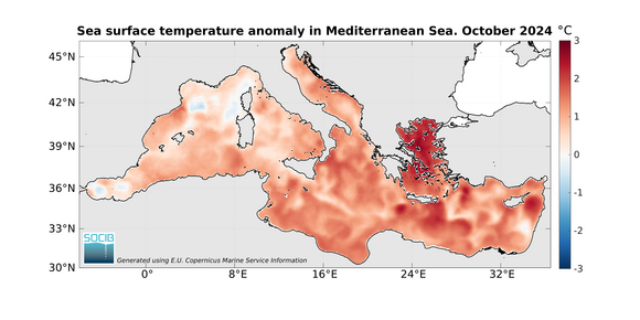
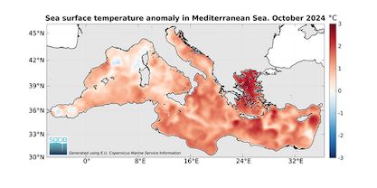
While heavy rains due to upper-tropospheric cold blobs are common in the Mediterranean, the recent flooding in the metropolitan area of Valencia was particularly extreme. The abnormally warm waters of the Western Mediterranean will likely have had an impact on the precipitation totals observed over the Iberian Peninsula by providing anomalously high moisture amounts. Due to the erratic nature of cut-off lows which typically have low movement speeds, the atmospheric conditions could remain favorable for severe convective activity to remain nearly stationary over the Province of Valencia. Moreover, the movement of a cut-off low is difficult to predict which makes precipitation forecasts for convective events even more challenging.
|
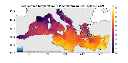
Monthly-averaged sea surface temperatures of the Mediterranean for October 2024 (left) and monthly-averaged sea surface temperature deviations of the Mediterranean for October 2024 (right), source:
SOCIB
|
 |
 |
However, it must be noted that the city of Valencia is no stranger to severe flooding. Often, these floods are associated with cut-off lows in autumn. Back in 1957, a severe river flood along the Turio River led to the death of 81 people in the city. After this catastrophic flood, the Turio River was rerouted into an artificial riverbed south of the city center. During the recent flood, this artificial riverbed prevented major flooding from occurring within the city center of Valencia. However, this of course led to an increased water discharge in the southern suburbs of the city. Additionally, the population in the metropolitan area of Valencia significantly since 1957. Which will have most certainly increased the severity of the recent flooding event due to urban development. Since the 1950s, the population of the city of Valencia increased by more than 50 %. Records of the 1957 flood in Valencia show that the precipitation totals of both the historic and recent floods were of similar magnitude. This once again highlights the problems that may arise during catastrophic flooding events when urban development strives in flood-prone areas.
Text: KG
November 03, 2024
|