|
A strong ridge expanding from the Mediterranean into Europe brought a strong heat wave to large parts of Europe. For Central Europe, this led to the first major heat wave of the summer season 2024. In Western Europe and along the Balkans, temperatures rose to more than 40 °C. At Tama in Northern Spain, a maximum temperature of 43.1 °C was recorded on August 11, 2024. In Germany, the highest temperature of 36.5 °C was observed at Bad Neuenahr-Ahrweiler, RP on August 13, 2024.
The first two months of the summer season of 2024 saw a considerable disparity in the temperatures north and south of the Alps in Europe. While Southern Europe experienced prolonged heat waves, the temperatures north of the Alps were close to or below average. Up until the current heat wave, the mean maximum temperature of the summer was the lowest in 20 years in Germany. After the recent heat wave, this average is close to the climatological mean of the last two decades.
|
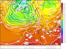
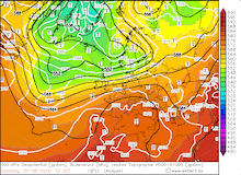
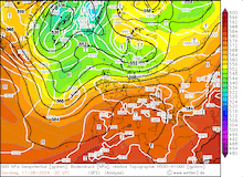
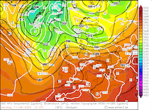
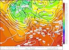
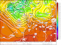
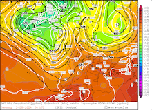
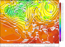
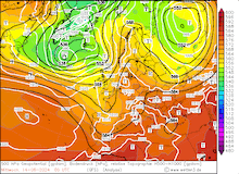
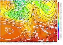
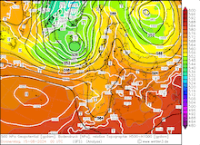
500 hPa geopotential, 1000 hPa to 500 hPa thickness, and sea-surface pressure over Europe, 10.08.2024 00 UTC - 15.08.2024 12 UTC, source:
wetter3.de
|
 |
 |
 |
 |
 |
 |
 |
 |
 |
 |
 |
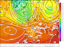 |
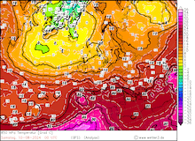
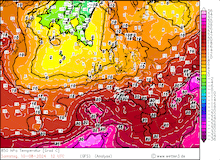
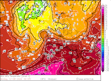
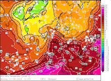
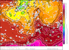
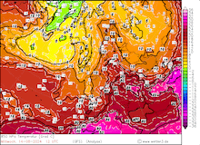
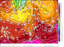
The ridge inducing the heat wave across Europe, developed from a strong zonal flow over the Eastern Atlantic with a very pronounced trough near Iceland. The trough moved across Europe on August 10, 2024. Behind the trough, the zonal pattern across the Eastern Atlantic broke up and a meridional pattern could develop. Over Western Europe, a strong ridge started to expand from the Mediterranean into Central Europe on August 11, 2024. With the ridge, extremely warm air masses were advected into Europe. Initially, the plume of hot air contained air masses reaching 850 hPa temperatures of more than 25 °C.
|
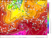
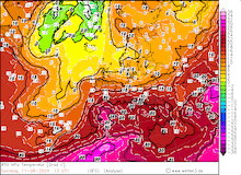
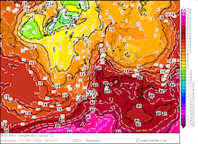
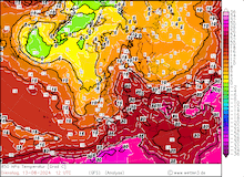
850 hPa temperature over Europe, 10.08.2024 00 UTC - 15.08.2024 12 UTC, source:
wetter3.de
|
 |
 |
 |
 |
 |
 |
 |
 |
 |
 |
 |
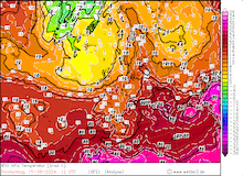 |
On August 12, 2024, the meridional structure of the weather pattern over Europe was exacerbated by an approaching trough over the Eastern Atlantic. As a result, an omega-shaped geopotential pattern developed across Europe, with two troughs on either side of the ridge over Europe. On August 13, 2024, the center of the ridge moved over Germany, with 850 °C temperatures in this area reaching more than 20 °C. The trough approaching from the Eastern Atlantic reached Western Europe by August 14, 2024, with a cut-off low developing at the southern tip of the trough over the Western Mediterranean. This cut-off low induced severe convective activity over the Western Mediterranean. By August 15, 2024, the main trough reached Scandinavia and led to a significant change in the air masses across Central Europe.
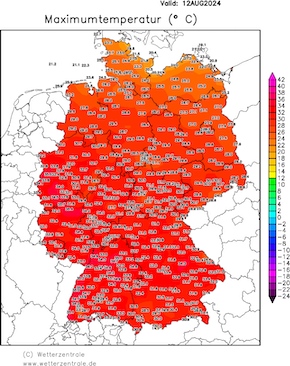
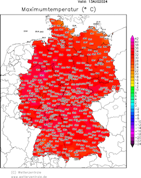
With 850 hPa temperatures of more than 25 °C, the 2 m temperatures on the Iberian Peninsula and Southern France reached more than 40 °C on August 10, 2024, and August 11, 2024. The highest temperature of 43.1 °C was observed at Tama in Northern Spain. In Southern France, temperatures reached 42 °C on August 11, 2024. On August 12, 2024, the plume of the very hot air mass with 850 hPa temperatures of more than 20 °C reached Central Europe. For the first time this summer, widespread maximum temperatures of more than 35 °C were observed mainly in the western part of Germany. The highest temperature of 36.5 °C was observed at Bad Neuenahr-Ahrweiler, RP on August 13, 2024.
|
Daily 2 m maximum temperature over Germany, 12.08.2024 - 14.08.2024, source:
wetterzentrale.de
|
 |
 |
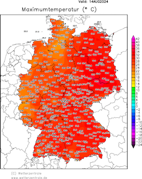 |
Especially in Western Germany, the heat stress was massively exacerbated with very dewpoints reaching more than 20 °C and very high overnight lows in the night from August 12, 2024, to August 13, 2024, with some metropolitan areas of Western Germany observing overnight lows well above the 20 °C mark. On August 14, 2024, cooler air masses reached Western Germany, and the highest temperatures were observed over Eastern Germany on that day. On August 15, 2024, decreasing temperatures were also observed over the eastern part of Germany. Nevertheless, temperatures remained well above average for mid-August.
Aside from the heat, the first convective activity was observed over Central Europe on August 12, 2024, over the Alps and Southern Germany due to orographic effects. On August 13, 2024, the convective activity was much more widespread due to the combination of increased low-level moisture and a weaker capping inversion above the boundary layer. Over Western Germany, very mixed-layer CAPE values of more than 2000 J/kg were recorded in atmospheric soundings in the afternoon.
|
Upper-atmospheric sounding at Essen showing very high CAPE values, 29.06.2024 12 UTC, source:
University of Wyoming
|
 |
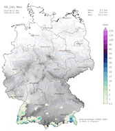
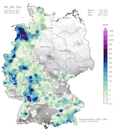
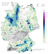
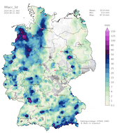
Due to a lack of upper atmospheric dynamics, the thunderstorms developed in an environment of weak shear and upper-level winds. As a result, only a weak degree of convective organization was observed mainly by multiple cells merging into convective clusters. Therefore, the main risks induced by these thunderstorms were severe downpours due to the slow motion of these systems. This was caused by the weak winds and the high precipitation rates due to the abundant moisture in the atmosphere. The mean statewide 72 h precipitation across Germany was only 10 mm on August 13, 2024, and August 14, 2024.
|
Daily precipitation over Germany on August 12, 2024 (left), August 13, 2024 (center left), August 14, 2024 (center right), and 72 h precipitation totals over Germany, 12.08.2024 - 14.08.2024 (right), source:
Wettergefahren-Frühwarnung
|
 |
 |
 |
 |
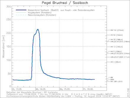
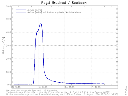
Local precipitation maxima were observed due to the mentioned slow movement of the thunderstorms. In the district of Karlsruhe, on August 13, 2024, a strong thunderstorm formed north of the city of Karlsruhe in the early evening. Within a few hours, nearly 90 mm of rain fell. The measuring gauges at Bretten, BW, and Bruchsal, BW observed 87.3 mm and 90.6 mm of rain respectively. As a result of this heavy downpour, flash flooding in the area was observed. Additionally, most of the precipitation fell in the catchment of the Saalbach River leading to severe river flooding. Early on August 14, 2024, the normally small river reached 100-year flooding stages at Bruchsal. At the peak, the minor river reached a discharge of up to 47 m3/s. Throughout the day, the water levels of the Saalbach River quickly fell. Already by late morning, the river levels dropped below the flooding stage.
|
Water levels (left) and discharge (right) of the Saalbach River at Bruchsal showing a 100-year flooding event due to a severe thunderstorm in the catchment of the river producing up to 90 mm of rain, 13.08.2024 - 16.08.2024, source:
HVZ Baden-Württemberg
|
 |
 |
On August 14, 2024, the nearing trough over Western Europe provided mid and upper-level shear leading to a higher degree of convective organization. However, the available energy for convection was much lower than the previous day. Some well-structured convective activity was observed over Southern Germany, leading to larger hail and some flash flooding. Yet, these were far less severe than the flash flooding observed on the previous day.
Text: KG
August 16, 2024
|


