|
A trough over Western Europe led to a short heatwave over Central Europe with temperatures rising to 35.0 °C at Kitzingen, BY, and inducing severe convective activity over Germany. On June 29, 2024, a large mesoscale convective system moved from south to north across Central Europe bringing heavy downpours and strong convective downdrafts.
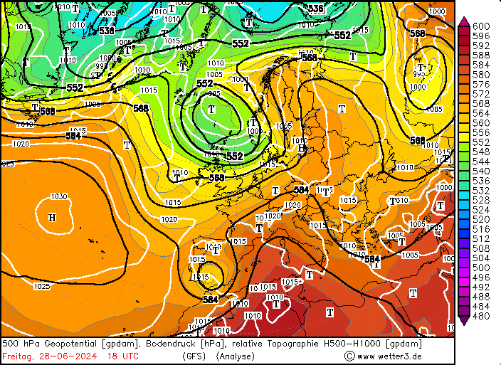
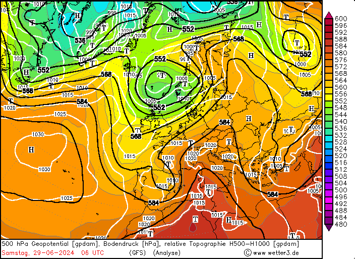
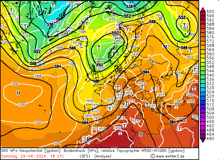
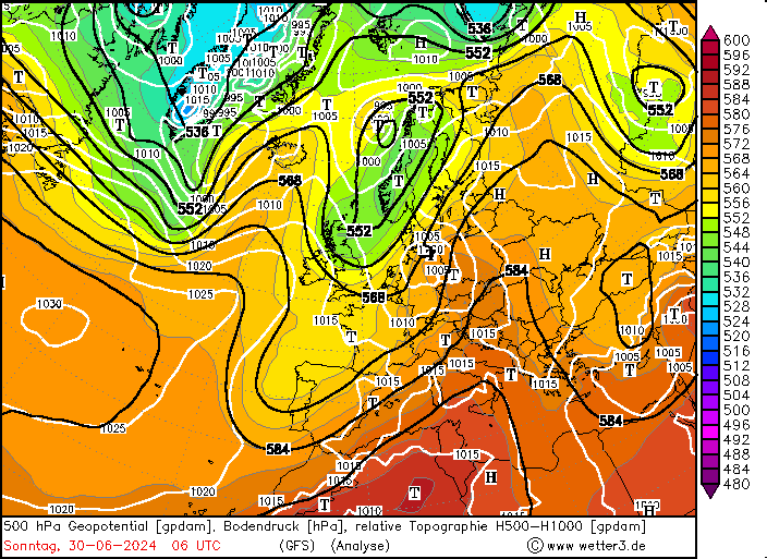
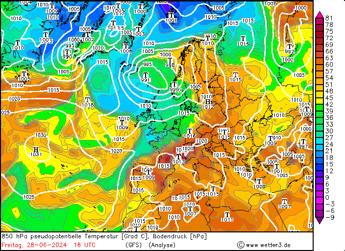
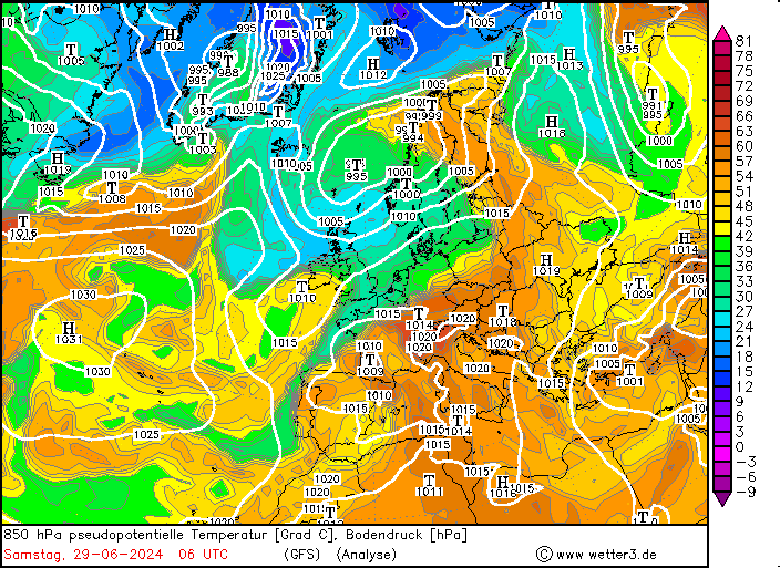
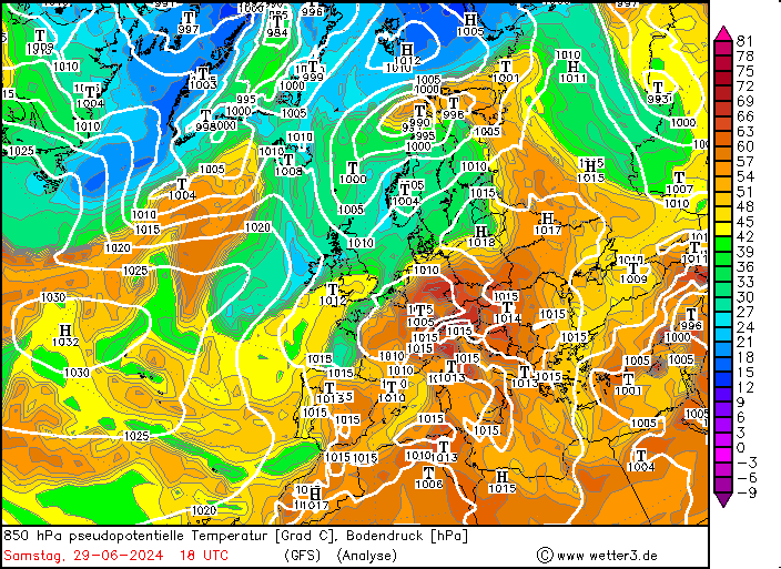
On June 24, 2024, at the southern tip of a trough over the Eastern Atlantic, an upper-level low moved southwards disconnecting from the main upper-level trough. In the coming days, the cut-off low moved slowly across the Iberian Peninsula. By late June 28, 2024, the cut-off low started to interact with the main westerly current. On the following day, June 29, 2024, the cut-off started to accelerate northeastwards as the process of reintegration into the main westerly current started to commence. Throughout the day, the cut-off low formed a short-wave trough moving swiftly northeastwards over Western Europe, reaching over Germany during the night to June 30, 2024.
|
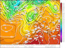
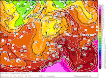
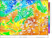
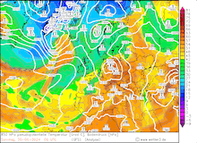
500 hPa geopotential, 1000 hPa to 500 hPa thickness, and sea-surface pressure (upper row), 850 hPa temperature (middle row), and 850 hPa pseudo-potential temperature and sea-surface pressure (lower row) over Europe, 17.06.2024 00 UTC - 22.06.2024 12 UTC, source:
wetter3.de
|
 |
 |
 |
 |
 |
 |
 |
 |
 |
 |
 |
 |
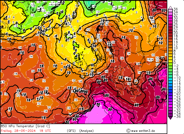
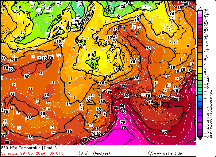
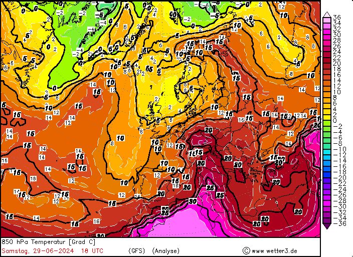
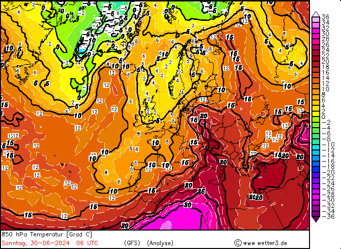
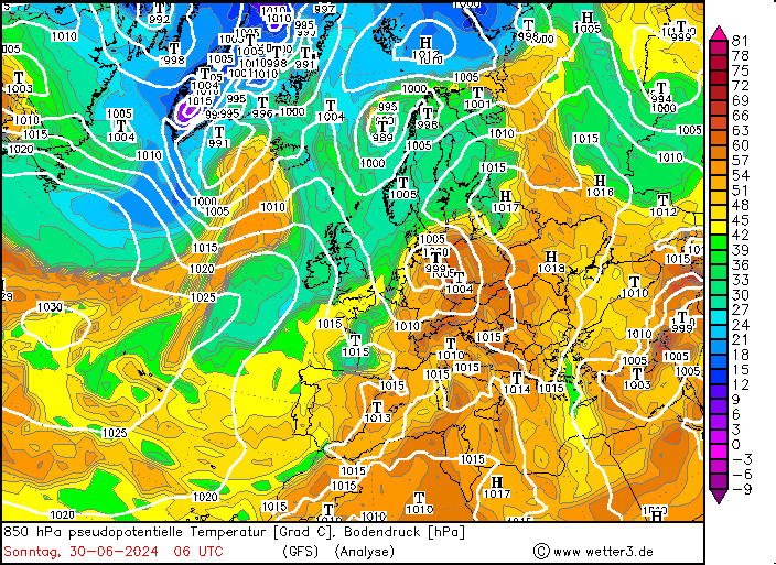
Ahead of the cut-off low very warm and moist air masses were advected into Central Europe. The 850 hPa temperatures in Southern Germany reached more than 20 °C on June 29, 2024. Upper atmospheric soundings both from Stuttgart and Munich recorded an 850 hPa temperature of more than 22 °C on June 29, 2024. In addition to the warmth of the air mass, the moisture content of the atmosphere was exceptionally high, with 850 hPa pseudo-potential temperatures over Germany reaching up to 70 °C during the afternoon of June 29, 2024. Additionally, the nearing trough over Western Europe provided mid-level lifting ahead of the trough, creating an environment very favorable for severe convection to occur.
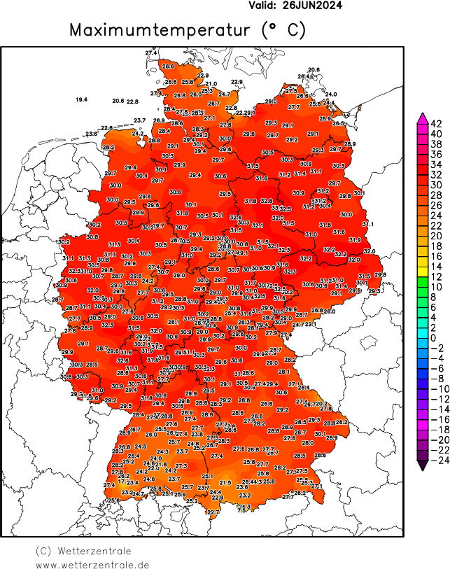
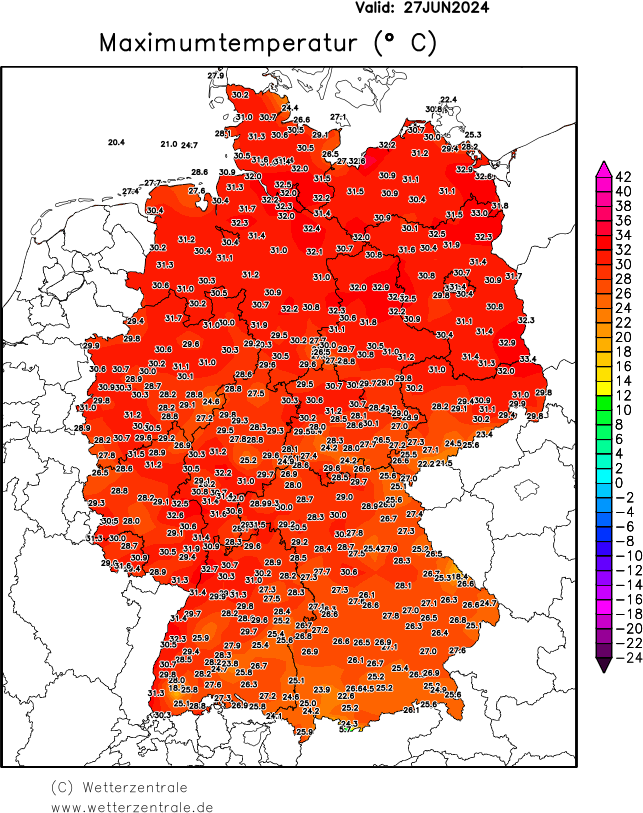
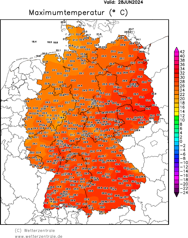
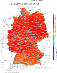
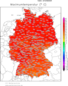
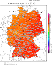
As mentioned, the cut-off low over the Iberian Peninsula led to the advection of very warm air masses into Central Europe. As a result, many weather stations across Germany recorded 30+ °C-days. North of the Main River, most weather stations recorded their first 30+ °C-day of the year on June 26, and June 27, 2024. On both days, the highest temperature was observed in Eastern Germany with temperatures reaching up to 33 °C. On June 28, 2024, a weak cold front from the surface low over the North Sea moved over Germany leading to a temporary reduction of temperatures, especially in the northwestern part of Germany.
|
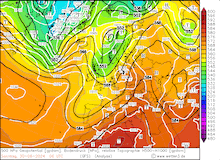
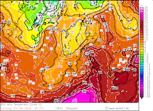
Daily 2 m maximum temperature over Germany, 18.06.2024 - 21.06.2024, source:
wetterzentrale.de
|
 |
 |
 |
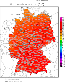 |
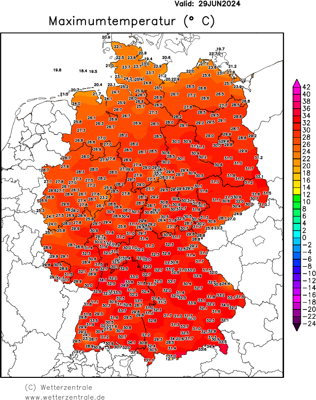
On the following day, June 29, 2024, the cut-off from the Iberian Peninsula started to move northeastwards across Western Europe. Ahead of the upper-level trough, the advection of very warm and moist air masses was exacerbated. As a result, the 850 hPa temperatures over Southern Germany reached more than 20 °C. South of the Main River, the maximum temperatures reached more than 30 °C. The weather station at Kitzingen, BY recorded the highest temperature of 35.0 °C. Notably, many alpine valleys that are susceptible to southerly Föhn events recorded very high temperatures due to the strong downslope Föhn winds. In some alpine valleys along the Northern Alps, maximum temperatures of more than 34 °C were recorded at altitudes of more than 600 m ASL.
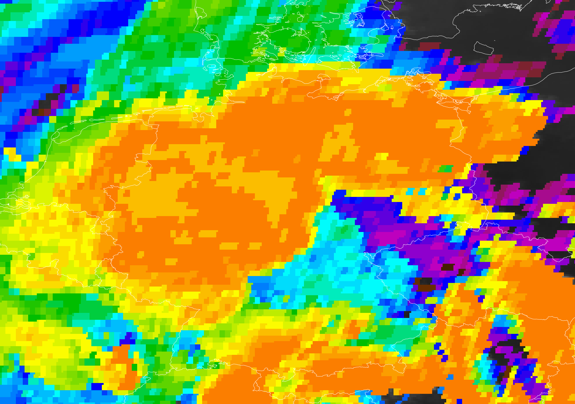
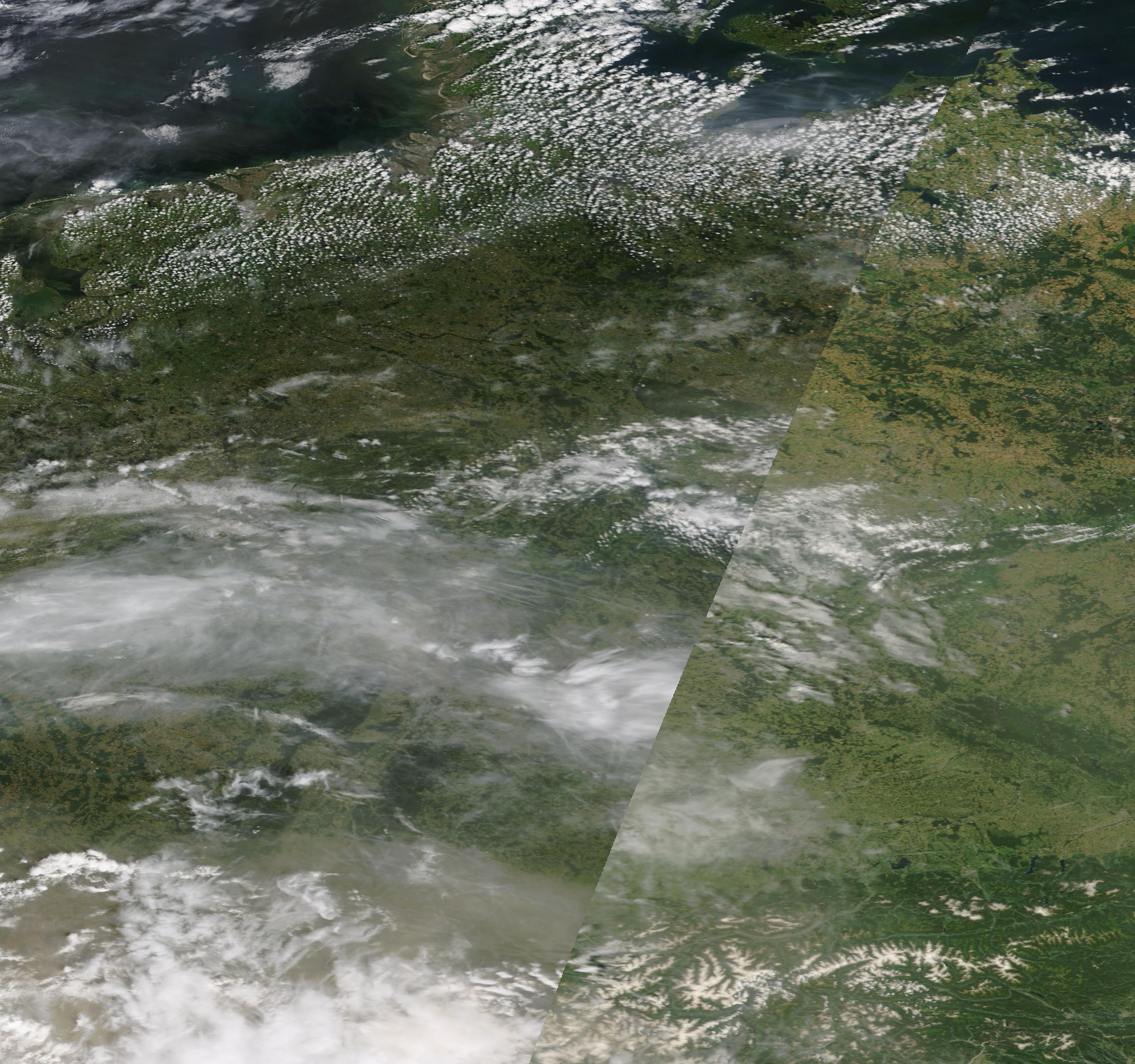
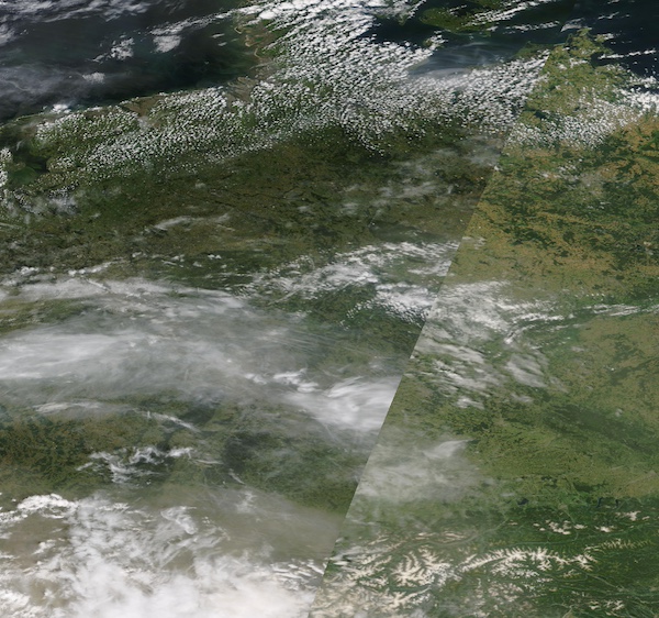
The intensity of the heat was further exacerbated by very high dewpoints, leading to a very high heat stress in parts of Southern Germany. Along the Danube and Rhine Rivers in Southern Germany, the 2 m dewpoints reached nearly 25 °C. Due to a strong export of mineral dust from the Sahara, the daytime maximum temperatures were reduced slightly due to the absorption of solar radiation by the mineral dust in the atmosphere.
|
Visible satellite imagery of Germany with clearly visible Saharan Dust in the atmopshere, 29.06.2024, source:
NASA Worldview
|
 |
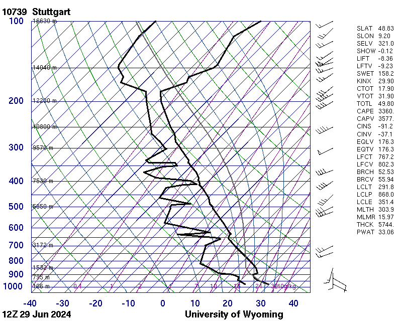
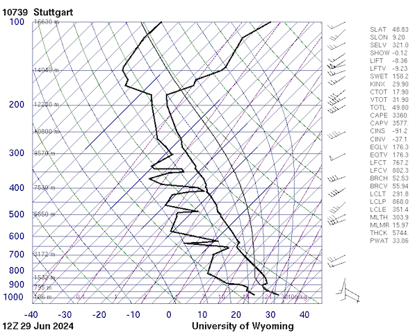
The combination of the very high temperatures and the exceptionally high dewpoints across Southern Germany provided an environment very favorable for severe convection to occur. Over Southwestern Germany, the mixed-level CAPE values reached values of more than 2500 J/kg with mixed-level CIN values of 70-80 J/kg. This created a very favorable environment for highly organized convection to form. Further east across the Bavaria, the capping inversion of the boundary layer was too strong for convective activity to form. Notably, DCAPE values reached more than 700 J/kg at the upper-atmospheric sounding at Stuttgart at 18 UTC, giving abundant potential energy for severe convective downdrafts in strong thunderstorms.
|
Upper-atmospheric sounding at Stuttgart showing very high CAPE values, 29.06.2024 12 UTC, source:
University of Wyoming
|
 |
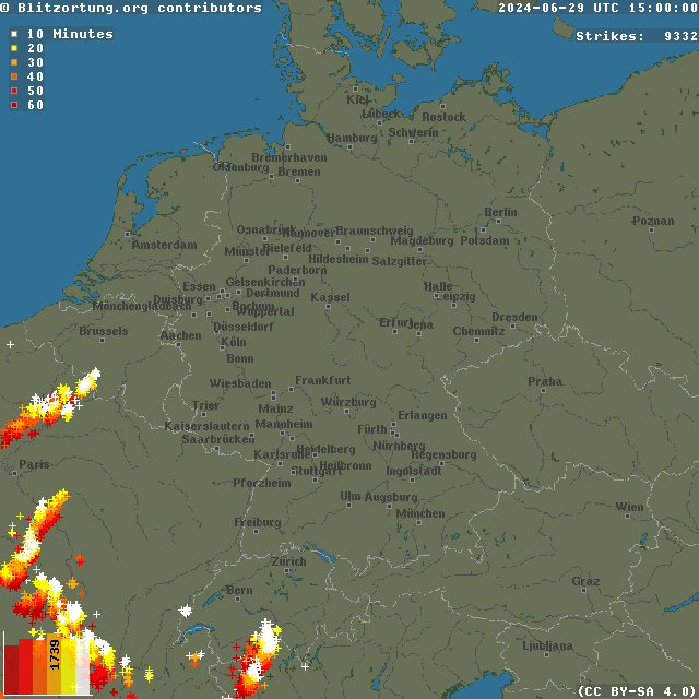
By 18 UTC, a strong convective cell started to mature north of the Vogese Mountains in the Alsace Region. In the following hours, the cell started to form a small squall line moving northwards across Rhineland-Palatine. By 20 UTC, the squall line had expanded westwards and connected with a large mesoscale convective system (MCS) over Eastern France and Belgium. As the MCS moved northwards, strong supercells started to form at the eastern flank of the system by 22 UTC over Rhineland-Palatine and Hesse. By midnight, the cells over Northern Hesse began to form a strong squall line with a maturing bow echo over Northern Germany.
|
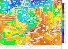
Hourly lightning flashes over Central Europe, 29.06.2024 14 UTC - 30.06.2024 08 UTC, source:
Blitzortung.org
|
 |
Throughout the night, strong thunderstorms started to form ahead of the large MCS over the northeastern part of Germany. Simultaneously, the MCS moved northeastwards across the northwestern part of Germany, forming a strong bow echo in the second half of the night. By 06 UTC on June 30, 2024, the remaining squall line moved over the Baltic Sea. Behind the MCS, cooler air masses reached Germany with light rains being observed over the western half of Germany.
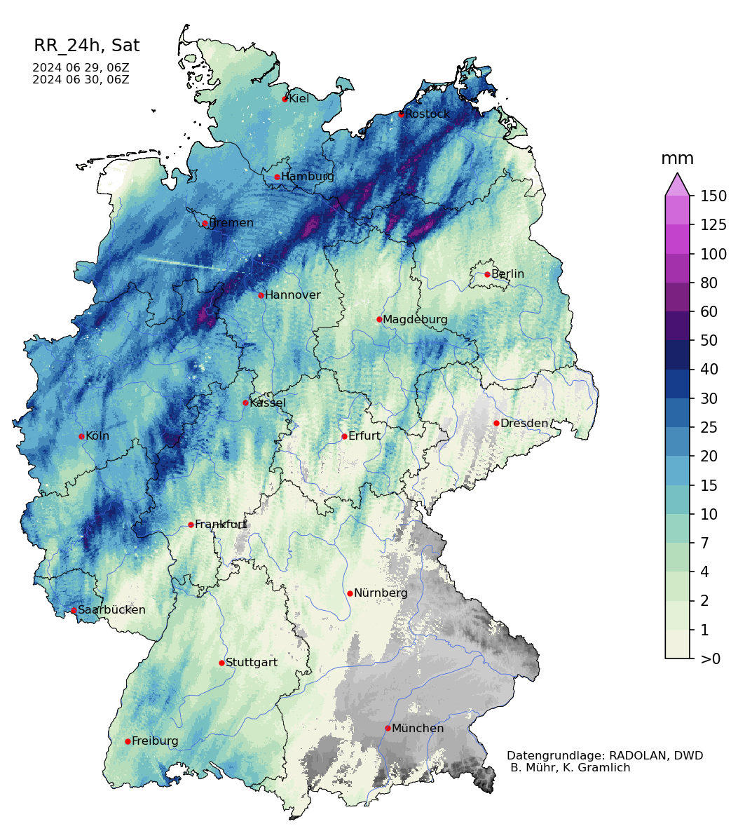
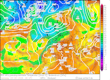
Radar-indicated precipitation totals over Germany showing the tracks of multiple severe
embedded thunderstorms moving over Germany, 29.06.2024 06 UTC - 30.06.2024 06 UTC,
source:
Wettergefahren Frühwarnung
|
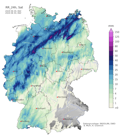 |
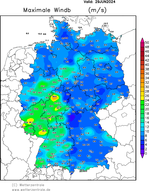
In a narrow strip over the northwestern part of Germany, the 24 h precipitation totals reached more than 60 mm with the highest 24 h precipitation being observed at Uelzen, NI with 73.9 mm/24 h. Over Rhineland-Palatine and Hesse, strong convective downdrafts were observed, with the highest gust of 106.6 kph being recorded at Frankenberg-Geismar, HE.
Contrary to initial forecasts and warnings, the overall convective activity was weaker than anticipated. The Saharan Dust in the upper atmosphere has likely influenced the severity of the convective activity over Germany. As a direct effect, the mineral dust in the upper atmosphere leads to the extinction of solar radiation. In an indirect effect, the Saharan Dust serves as condensation nuclei for ice crystals forming cirrus clouds. On June 29, 2024, both effects were observed to some degree over Central Europe, likely leading to a reduction of CAPE due to lower boundary layer temperatures. Furthermore, the synoptic forcing of the convective activity gives uncertainty to the severity of the convective outbreak, which likely also contributed to the overestimation of the convective outbreak over Germany.
Text: KG
July 04, 2024
|