|
The first heat wave of the summer of 2024 over Central Europe was accompanied by severe thunderstorms bringing large hail and violent convective downdrafts. The highest temperature in Germany of 32.1 °C was observed at Weingarten (District: Ravensburg) on June 19, 2024. In Austria, temperatures rose to 34 °C on several occasions.
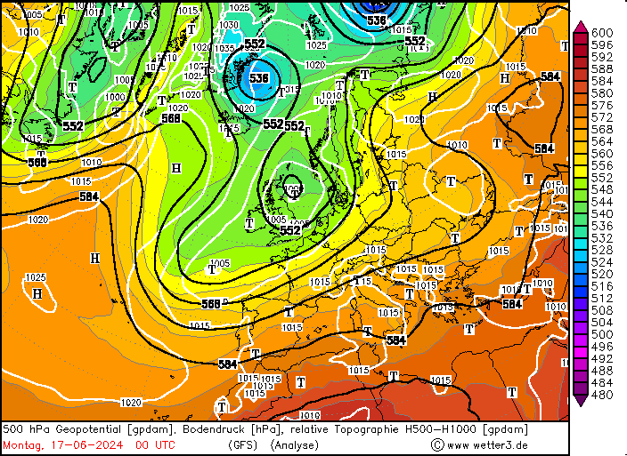
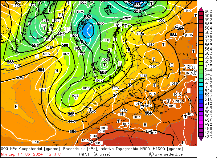
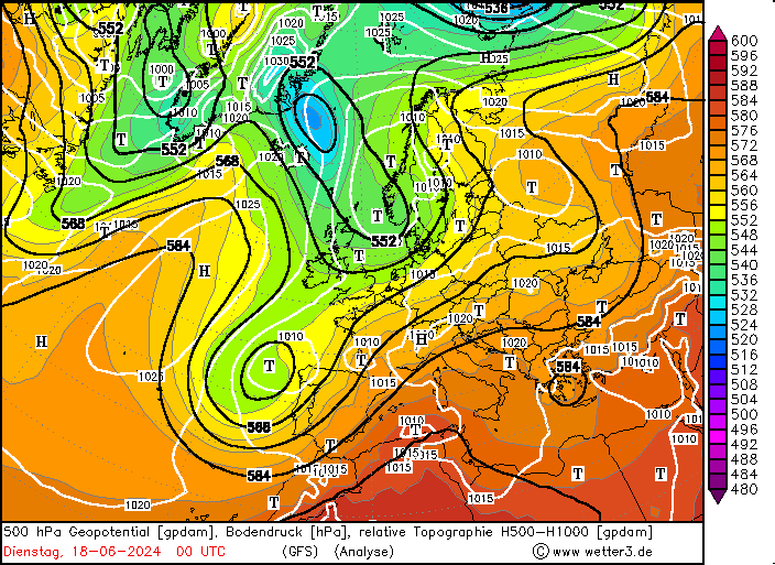
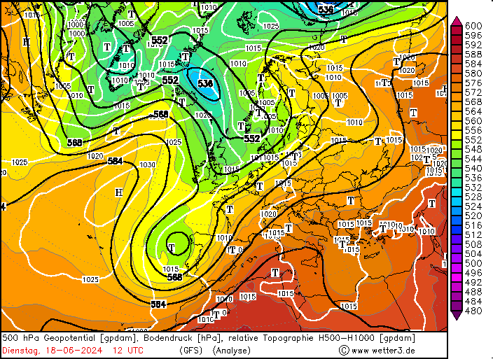
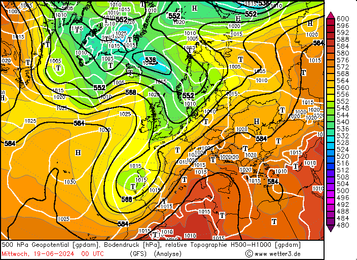
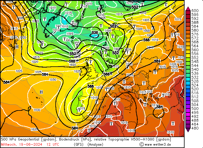
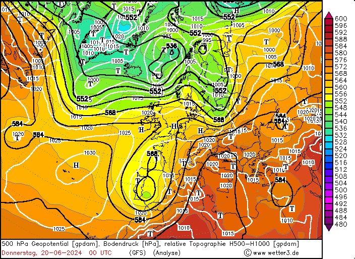
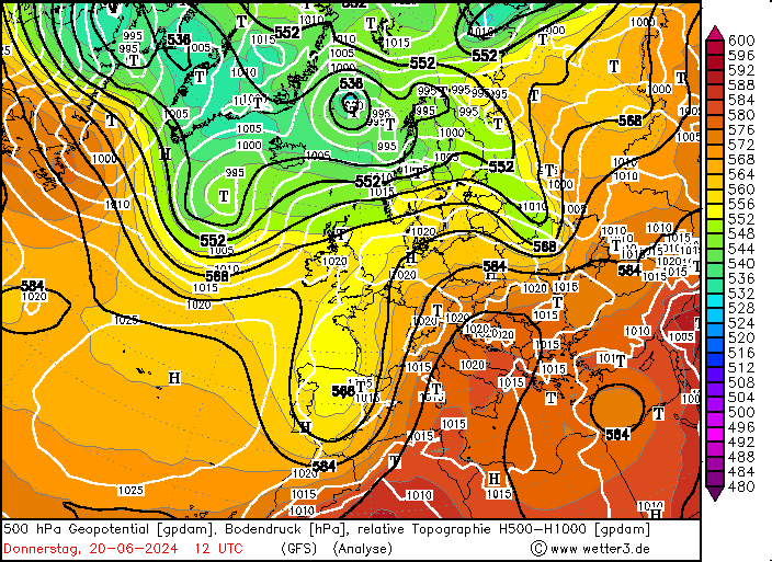
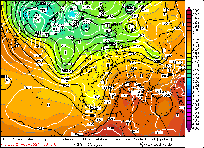
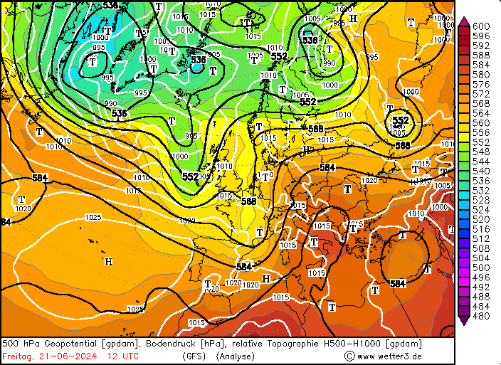
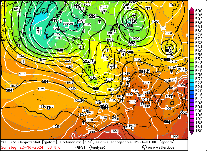
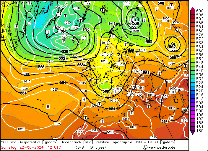
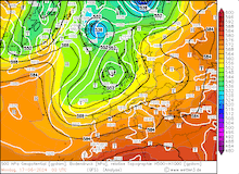
After the first half of June 2024 was unseasonably cool in Central Europe, the weather pattern changed significantly by mid-month. The dominating trough over Scandinavia shifted westward into the Eastern Atlantic. Over Europe, a ridge from the Mediterranean extended into Central Europe. The synoptic pattern led to the advection of moist and warm air masses from the Mediterranean and Northern Africa into Central Europe. For the first time this summer, the 850 hPa temperatures reached up to 20 °C over Southern Germany.
At the southern tip of the main trough over the Eastern Atlantic, a secondary trough developed by June 17, 2024. The secondary trough moved slowly eastwards over the Iberian Peninsula. Further north, the main trough shifted also eastwards into the North Sea Area by June 19, 2024. The synoptic conditions led to an environment that was favorable for severe convection to occur, as unstable air masses reached Central Europe which were superposed by strong shear provided by the approaching upper-level troughs. A secondary maximum of convective activity was observed, when the secondary trough over the Iberian Peninsula was advected into the main westerly current on June 20 and June 21, 2024, moving northeastwards over France and Germany.
|
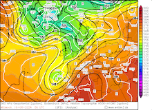
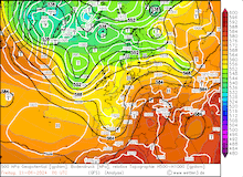
500 hPa geopotential, 1000 hPa to 500 hPa thickness, and sea-surface pressure over Europe, 17.06.2024 00 UTC - 22.06.2024 12 UTC, source:
wetter3.de
|
 |
 |
 |
 |
 |
 |
 |
 |
 |
 |
 |
 |
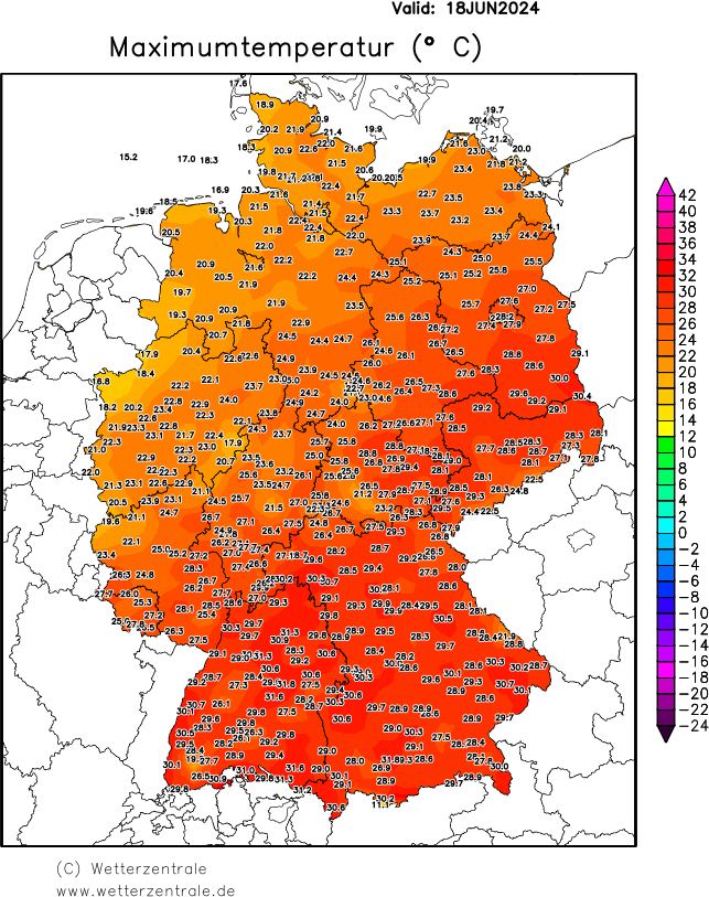
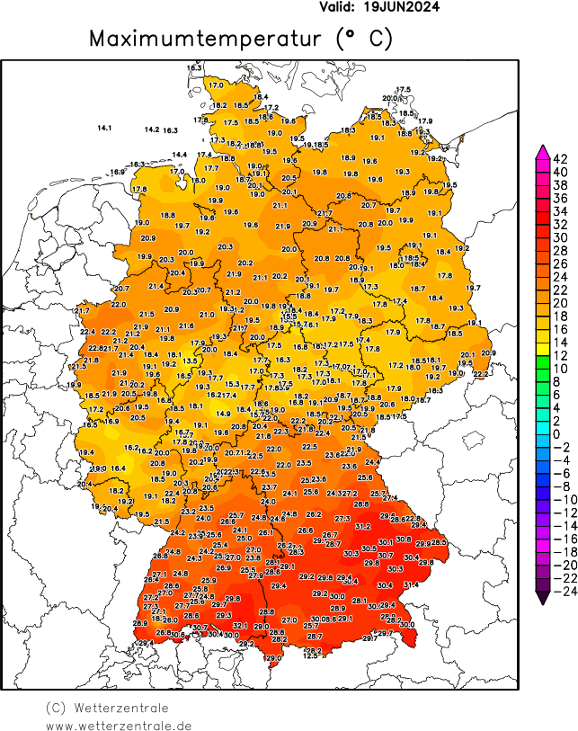
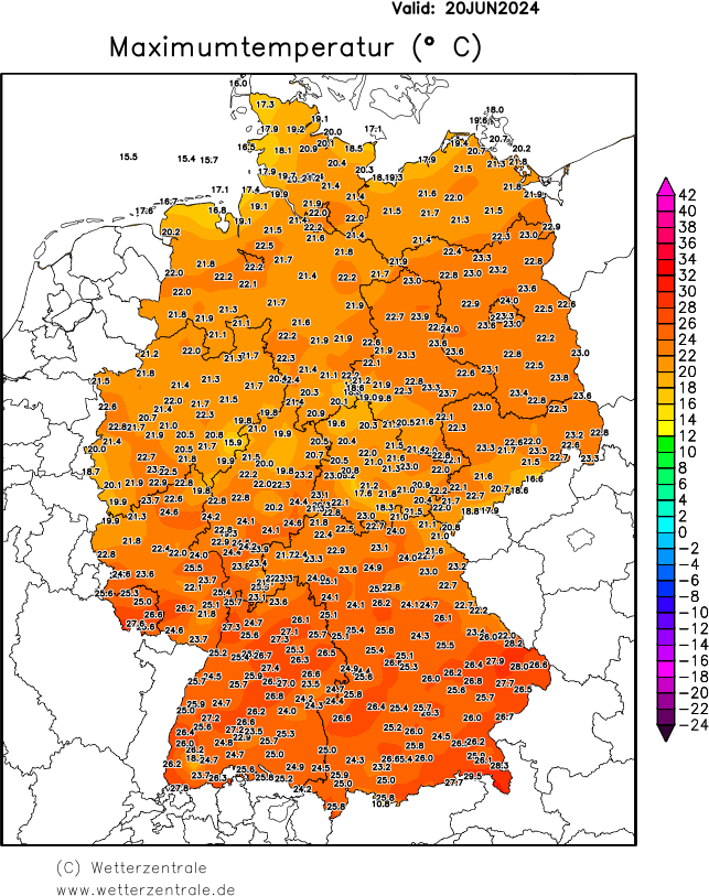
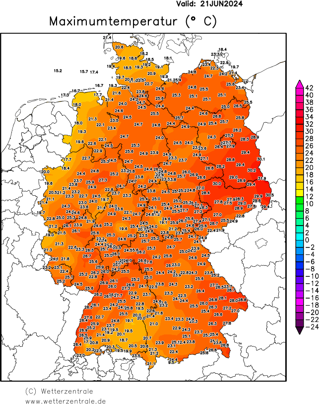
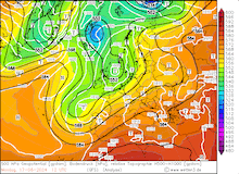
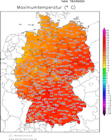
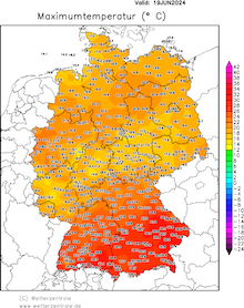
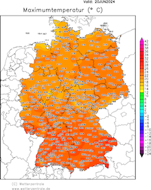
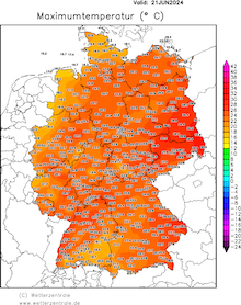
Ahead of the troughs, moist and warm air masses were advected into Central and Eastern Europe. In Germany, many stations southeast of a line stretching from Mannheim, Würzburg, Leipzig, and Frankfurt (Oder) recorded their first 30+ °C day. The highest temperature in Germany of 32.1 °C was observed at Weingarten (District: Ravensburg) on June 19, 2024. Further east in Austria, daytime maximum temperatures reached up to 34 °C on several days. Temperatures of up to 39 °C were recorded over the Balkans.
|
Daily 2 m maximum temperature overGermany, 18.06.2024 - 21.06.2024, source:
wetterzentrale.de
|
 |
 |
 |
 |
In addition to the heat, multiple rounds of severe convective were observed over Central Europe as the synoptic pattern created an environment very favorable for severe convection to occur. The overlap of abundant CAPE and shear in combination with the right initiation created an environment so well for thunderstorm formation which is only very rarely observed over Central Europe.
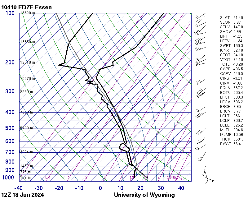
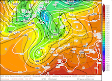
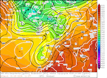
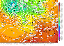
Upper-atmospheric sounding at Essen showing less CAPE than further south in the central part of Germany,
18.06.2024 12 UTC, source:
University of Wyoming
|
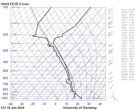 |
The first outbreak of severe convective activity occurred on June 18, 2024, as the main trough over the Eastern Atlantic moved eastwards into the North Sea Area. Ahead of the trough over Central Europe, moist and warm air masses were present with CAPE values of more than 1000 J/kg over the central part of Germany. By morning, the first mesoscale convective system moved over Rhineland-Palatine bringing locally heavy downpours. Said convective system formed the day prior over Southwestern France, moving northeastwards into the western part of Germany. By early afternoon, the strong diurnal insolation led to multiple very potent right-moving supercells developing over the central part of Germany moving into Eastern Germany by evening.
|
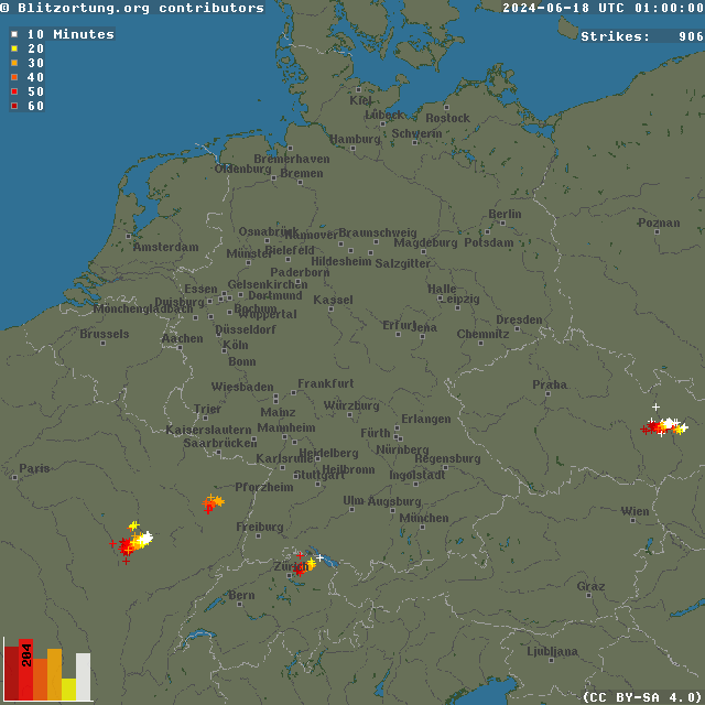
Hourly lightning flashes over Central Europe, 18.06.2024 00 UTC - 19.06.2024 00 UTC, source:
Blitzortung.org
|
 |
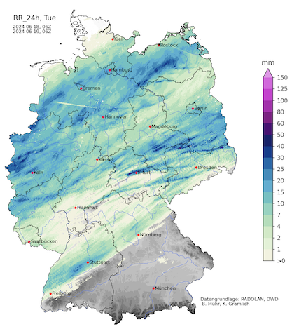
Notably, a very strong supercell moved from Frankfurt over Thuringia to Dresden bringing heavy downpours and large hail with hail stones reaching diameters of up to 5 cm. North of this supercell, a mesoscale convective system moved eastwards over Germany. Due to the high degree of organization, heavy downpours and strong convective downdrafts with wind gusts of up to 110.2 kph at Neu-Ulrichstein were observed. In the evening, a second round of severe convection developed in the lee of the Thuringian Forest, moving into Eastern Germany bringing once again heavy downpours. By midnight, a last supercell moved across the Eifel mountains. As the thunderstorms moved quickly eastwards, the daily precipitation at most measuring gauges remained below the 30 mm threshold.
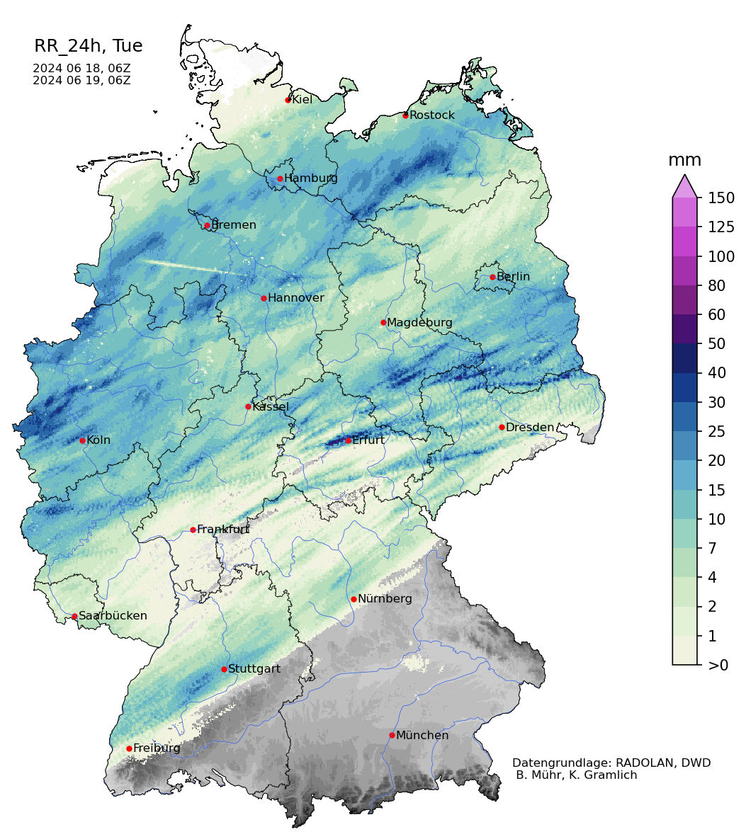
Radar-indicated precipitation totals over Germany showing the tracks of multiple
severe thunderstorms moving over Germany, 18.06.2024 06 UTC - 19.06.2024 06 UTC,
source:
Wettergefahren Frühwarnung
|
 |
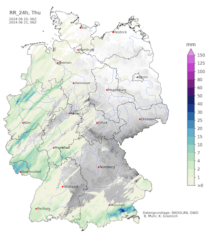
On June 19, 2024, no convective activity was observed over Germany. In the central part of Germany, continuous precipitation was observed with daily precipitation totals of less than 10 mm.
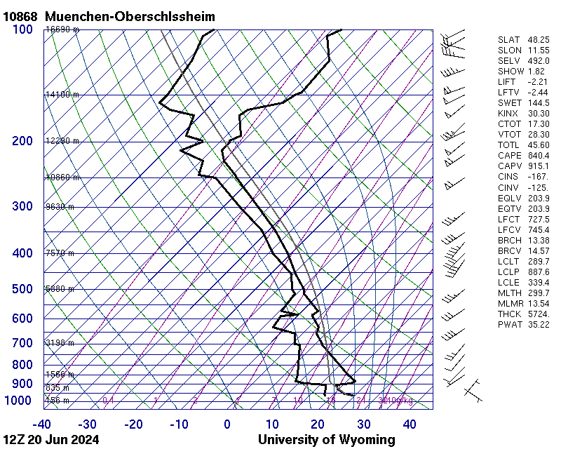
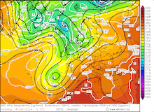
On June 20, 2024, the secondary trough over the Iberian Peninsula started to move northeastwards and started to be integrated into the main westerly current. Due to strong diurnal insolation, a very unstable air mass was present in the afternoon hours north of the Alps in Bavaria. Due to a strong CIN-capping, it remained uncertain if convection could break the capping inversion. This setup favored very few but very potent convective systems to form, which would in turn find a very favorable environment in the atmosphere above the boundary layer with mixed-layer CAPE values of up to 2000 J/kg.
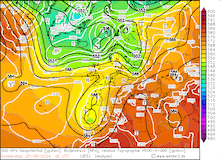
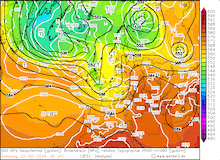
Upper-atmospheric sounding at Munich showing a strong capping inversion above the boundary layer
with high CAPE values, which would increase further during the afternoon, 20.06.2024 12 UTC,
source:
University of Wyoming
|
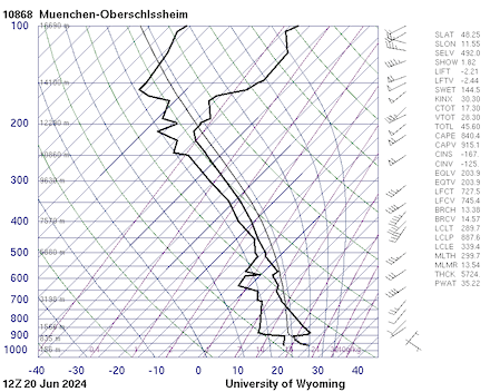 |
By 14 UTC southeast of Munich, a single convective cell could break the capping inversion with the help of the orographic forcing of the Northern Alps. Within an hour, a very strong supercell formed, bringing heavy downpours as it moved eastwards along the Northern Alps, narrowly missing the city center of Salzburg by early evening. The cell eventually decayed over the Danube Plain in the night. From space, the single cell formed a massive and nearly circular cirrus shield above the thunderstorm with a single over-shooting top near the center of the cirrus disk.
Radar-indicated precipitation totals over Germany showing the track of the supercell
just north of the Alps, 20.06.2024 06 UTC - 21.06.2024 06 UTC,
source:
Wettergefahren Frühwarnung
|
 |
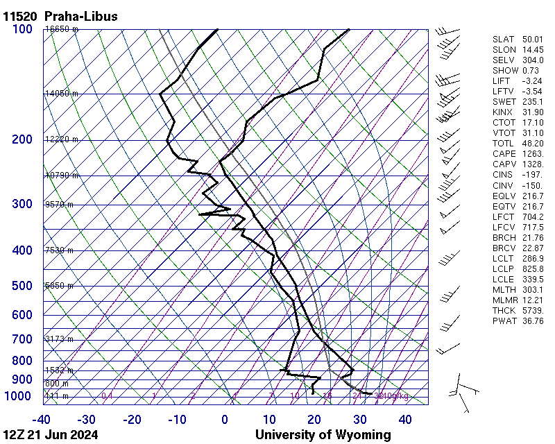
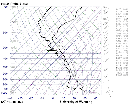
On June 21, 2024, most of Central Europe experienced convective activity. While over the western half of Germany, the convective activity was mostly non-severe, the eastern half of Germany and neighboring countries showed once again an overlap of high CAPE values and strong shear, creating a very favorable environment for convective activity.
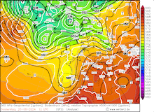
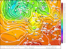
Upper-atmospheric sounding at Prag showing a strong capping inversion above the boundary layer
with high CAPE values and strong shear in the atmosphere, 21.06.2024 12 UTC,
source:
University of Wyoming
|
 |
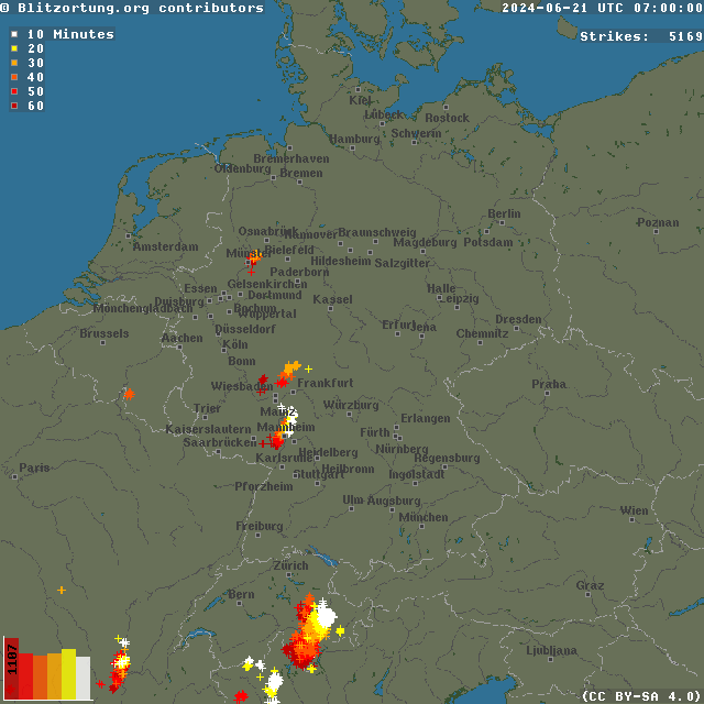
By afternoon, strong thunderstorms developed over Eastern Germany and Western Czechia. By evening, a strong degree of organization in Czechia and Eastern Germany was observed. Later, the thunderstorms moved quickly into Western Poland. The thunderstorms slowly decayed during the night over Poland.
|
Hourly lightning flashes over Central Europe, 21.06.2024 06 UTC - 22.06.2024 00 UTC, source:
Blitzortung.org
|
 |
Further south in Austria in the Danube Plain, extreme CAPE values were present. However, the boundary layer was capped by a very strong capping inversion. At Vienna, a radiosonde launched at 15 UTC recorded a mixed-layer CAPE of 3430 J/kg and a mixed-layer CIN of -178 J/kg. No convective activity could penetrate through the capping inversion, leaving the extremely large energy reservoir in the atmosphere unused. Nevertheless, the boundary layer humidity was remarkable with 2 m dewpoints reaching more than 20 °C. The highest 2 m dewpoint of 24.4 °C was observed at Neusiedl am See.
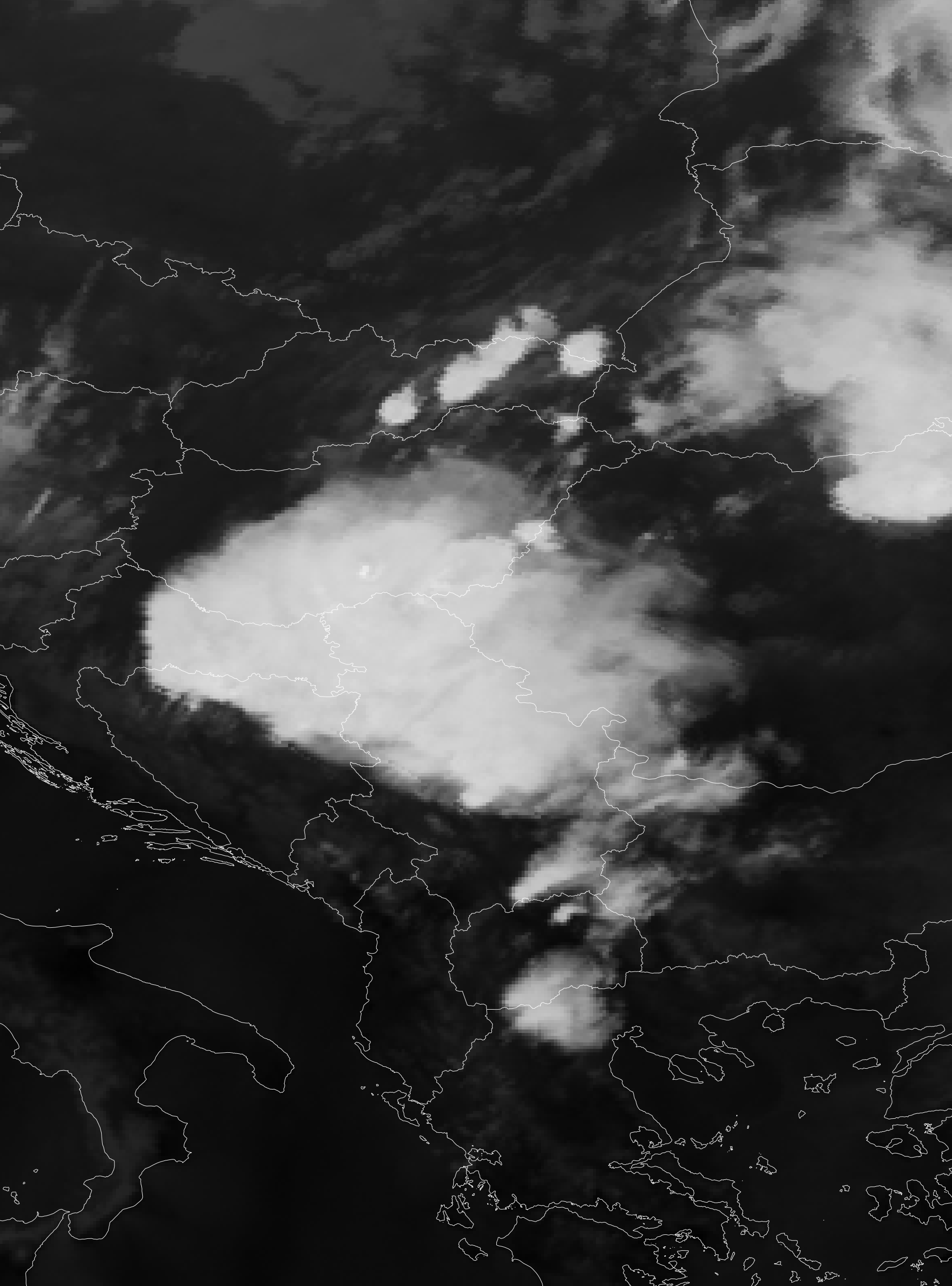
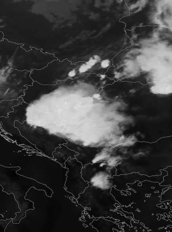
By June 22, 2024, a much drier air mass reached Central Europe, leading to a much-reduced convective activity. Over Eastern Europe once again severe convective activity occurred. Over the Balkans, the severe thunderstorms brought large hail, heavy downpours, and violent convective downdrafts.
|
Satelite-imagery of severe thunderstorms developing over the Balkans, 22.06.2024 18 UTC, source:
EUMETSAT View
|
 |
Over Germany, the past week brought an uncommon outbreak of severe weather for the region, with a rare overlap of strong shear provided by two upper-level troughs and a very moist and warm air mass in the lower atmosphere providing high CAPE values. The intensity of both quantities in the overlap is close to the climatological maximum for June over Central Europe.
|
7-day river levels of the Rhône River at Branson showing a prominent peak on the night from June 21 to June 22, 2024, source:
Hydrodaten.admin.ch
|
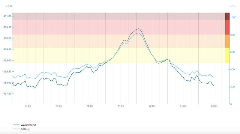 |
Additionally, the cool and snowy start to the month led to a very large snowpack in the Alps still close to the seasonal maximum. Combined with heavy downpours, this led to enhanced surface run-off in many Alpine Valleys. Most notably in the region around Zermatt, many mountain towns experienced severe flash flooding and rockslides due to the combination of the onset of the high-elevation snow thawing and heavy downpours from severe thunderstorms. As a result, some Alpine Valleys experienced historic surface run-off, and important rail lines and streets were damaged by the floods.
Text: KG
June 24, 2024
|