Severe thunderstorms Western Germany
02 - 03 May 2024
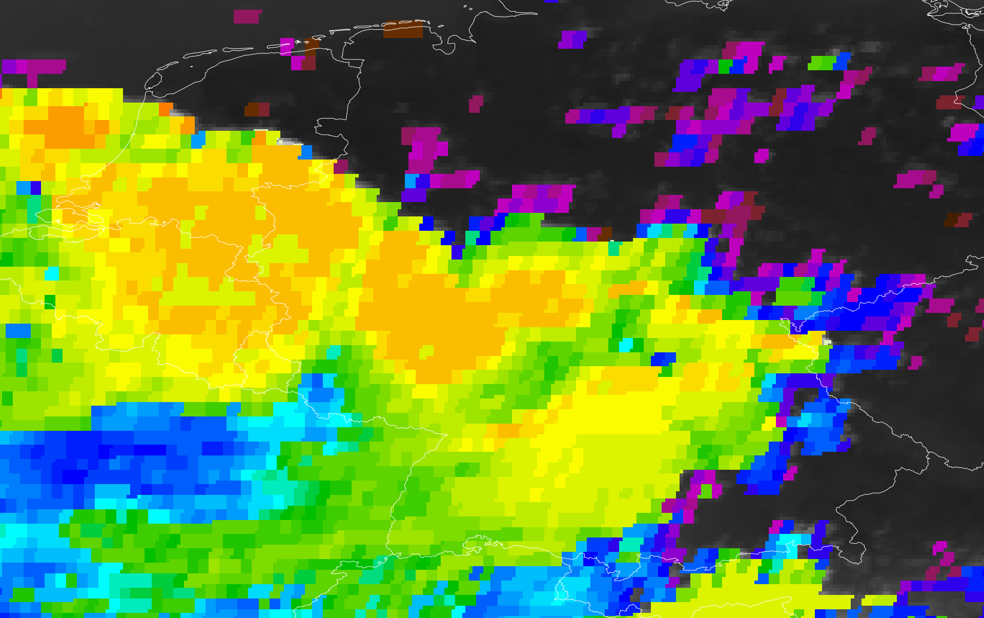
Satellite derived cloud top height over Germany, 02.05.2024 18 UTC
Source: EUMETSATview
Low Flurina led to the first outbreak of severe thunderstorms of the summer season over the western half of Germany. The severe thunderstorms brought torrential downpours as well as hail and strong winds, especially over Rhineland-Palatine the downpours led to flash flooding.
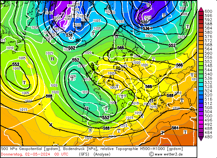
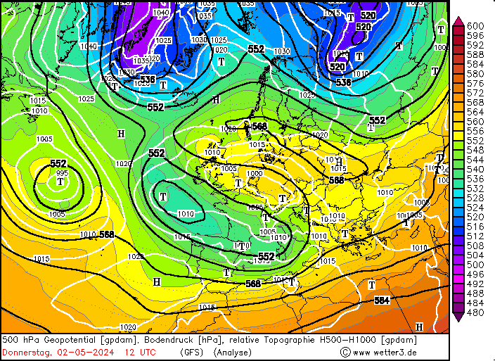
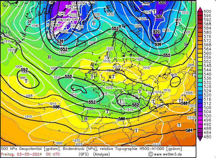
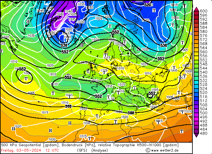
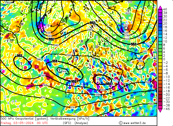
In the last days of April 2024, a ridge dominated the weather conditions over Central Europe. Concurrently, a strong trough was located to the west of said ridge. By May 01, 2024, a secondary trough started to expand into the Western Mediterranean over the Iberian Peninsula. The weather pattern started to resemble a high-over-low pattern. Ahead of the trough over the Iberian Peninsula, a surface low started to develop over Germany. On May 02, 2024, the surface low intensified as the trough over the Mediterranean Sea expanded further eastward, effectively cutting off the ridge over Central Europe.
500 hPa geopotential, 1000 hPa to 500 hPa thickness, and sea-surface pressure over Europe, 02.05.2024 00 UTC - 03.05.2024 12 UTC, source:
wetter3.de
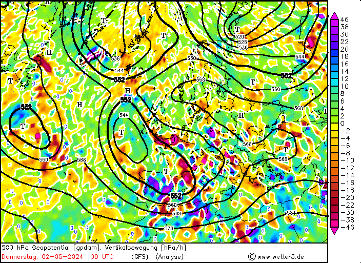
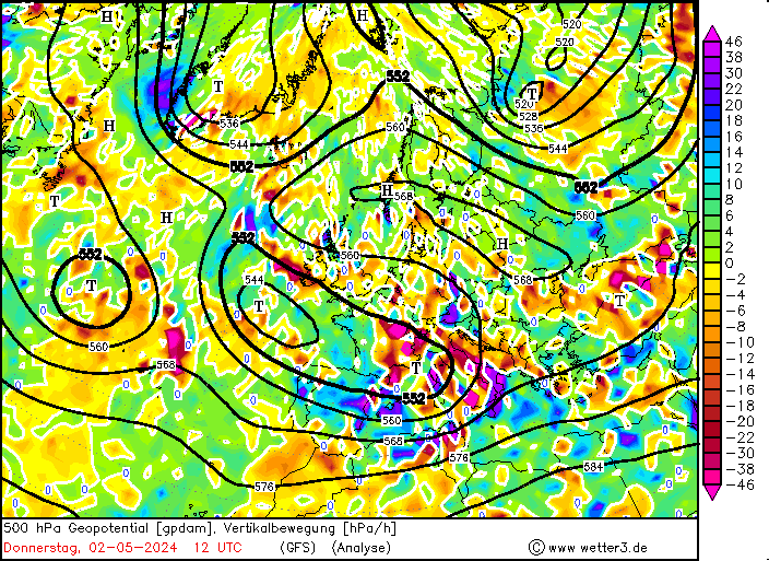
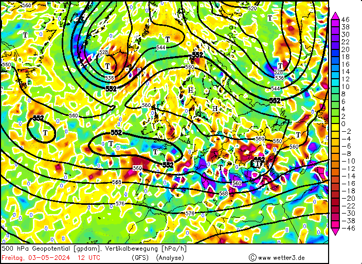
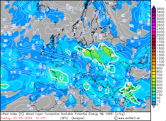
The upper-level trough led to mid-level lifting. In combination with the surface low over Germany, a narrow stretch over the western half of Germany provided an environment with favorable conditions for convection. In the first half of May 02, 2024, a strong capping inversion at the top of the boundary layer prevented low-level cumulus development. By midday, daytime heating of the boundary layer, weakened the boundary layer capping inversion gradually and the first convective cells started to form over the westernmost Eifel mountains and the Black Forest. By 13 UTC, the convective activity grew and the first major convective cells started to form.
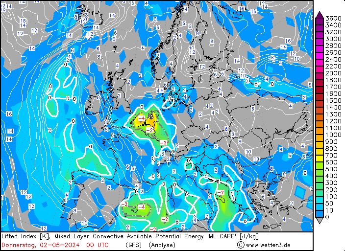
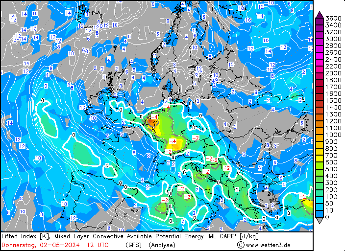
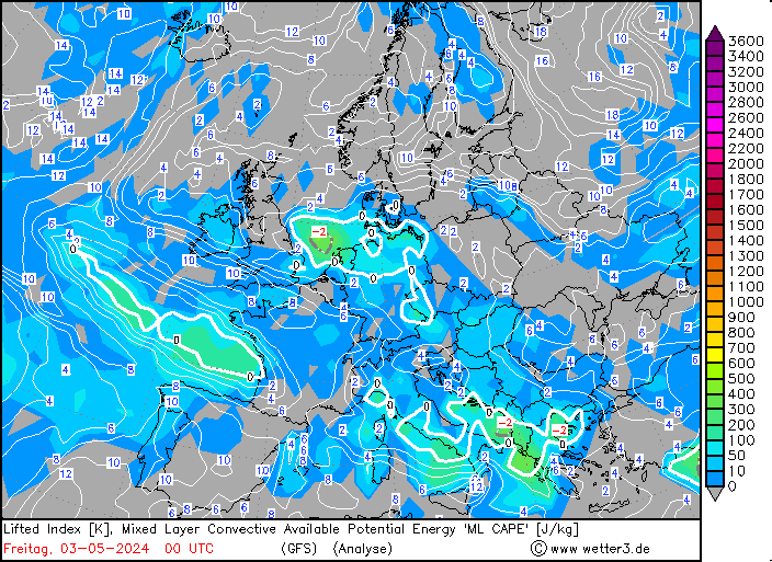
500 hPa geopotential and vertical velocity (upper row) and lifted index and mixed-layer CAPE over Europe, 02.05.2024 00 UTC - 03.05.2024 12 UTC, source:
wetter3.de
In Rhineland-Palatine, a strong convective cell started to form in the lee of the Hunsrück mountains. The thunderstorm brought a torrential downpour to the town of Morbach with hourly precipitation totals of more than 50 mm, leading to flash flooding in the town. In the following hour, a cluster of thunderstorms started to form over the western Eifel mountains. At the eastern flank of this cluster, continuous thunderstorm development brought extreme downpours to the Ahr valley.
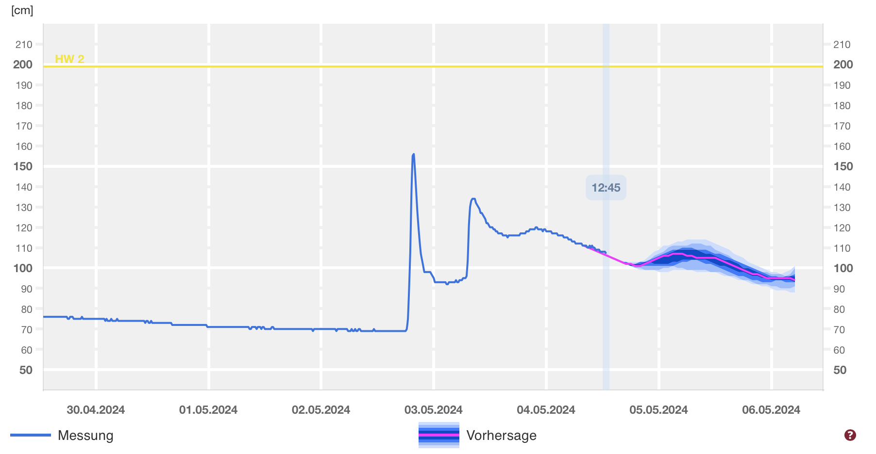
River level of the Ahr River at Bad Bodendorf with a very sharp increase on May 02, 2024, source:
Hochwasser RLP
Less than three years prior, an extreme precipitation event in July 2021 led to severe flooding along the Ahr river, killing more than 130 people. Within one hour, the weather station at Bad Neuenahr-Ahrweiler recorded a precipitation total of 58.3 mm at 17 UTC on May 02, 2024, nearly the same amount is typically seen here in the entire month of May. The heavy downpour led to flash flooding in the town which had been severely affected by the flood in 2021. Downstream of the town, the Ahr River rose by 87 cm within one hour. Even though the river levels of the Ahr did not reach flooding stages, it highlights the potential of the Ahr valley as a hotspot for flash flooding. The combination of a very rugged terrain and a narrow river gauge can lead to severe flash flooding, both as the water pours down the valley slope as well as the quickly rising river combined with a lot of buildings being built close to the river.
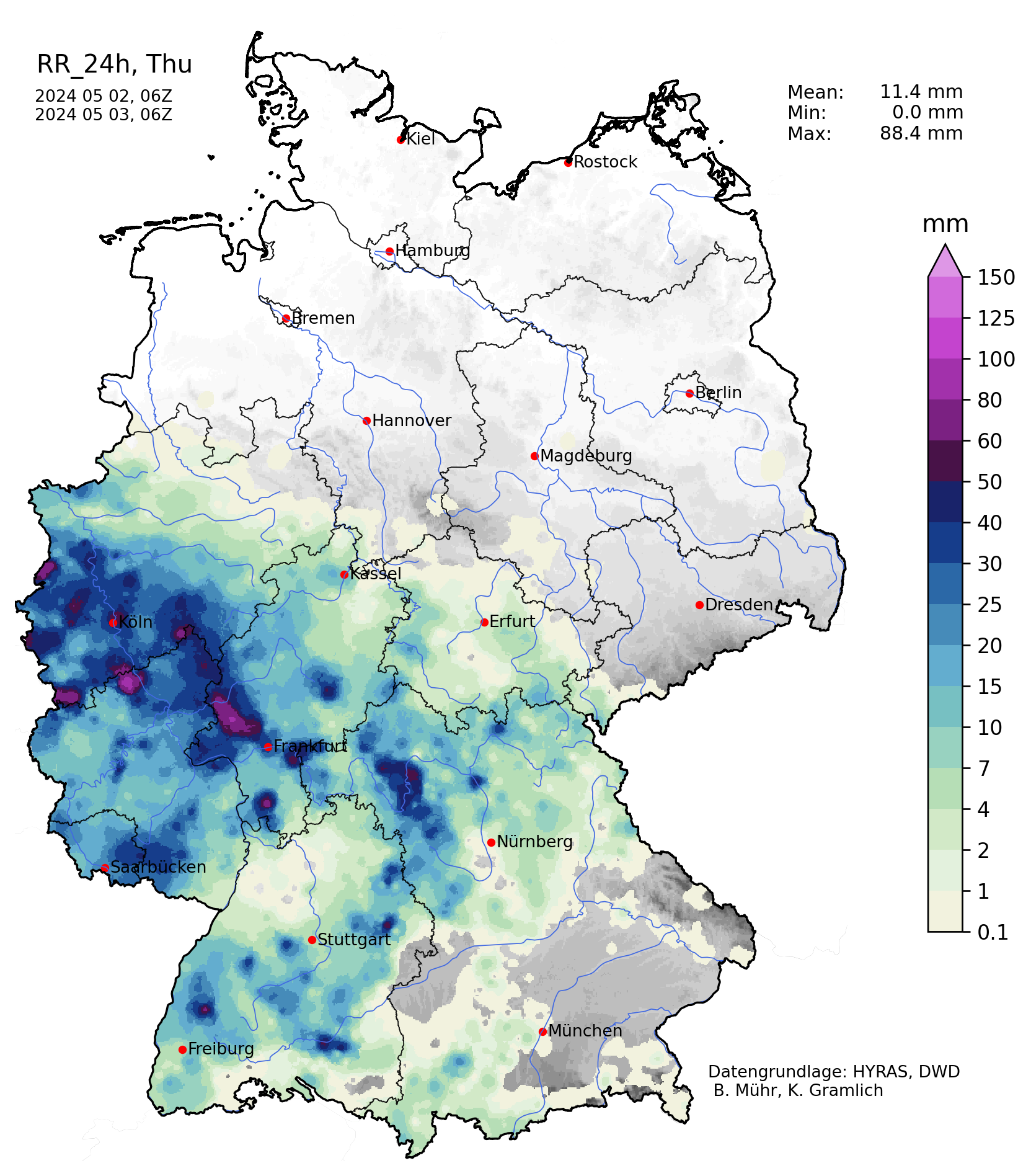
Hourly precipitation rates over Germany, 02.05.2024 12 UTC - 03.05.2024 12 UTC, source: Wettergefahren-Frühwarnung
Further east, another cluster of thunderstorms developed the metropolitan area of Frankfurt bringing heavy downpours. At peak intensity, the thunderstorms led to hourly precipitation totals of up to 50 mm, leading to flash flooding, especially in dense urban environments. The thunderstorms slowly moved westwards into the Taunus mountains, connecting with thunderstorms that formed in the vicinity of Cologne.
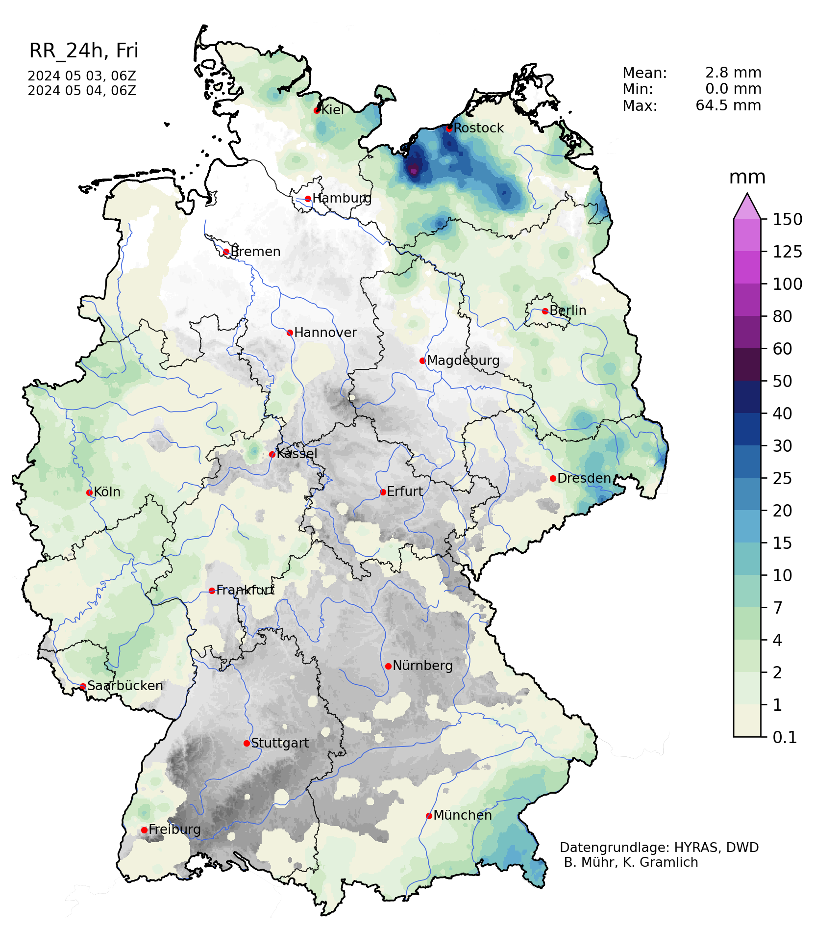
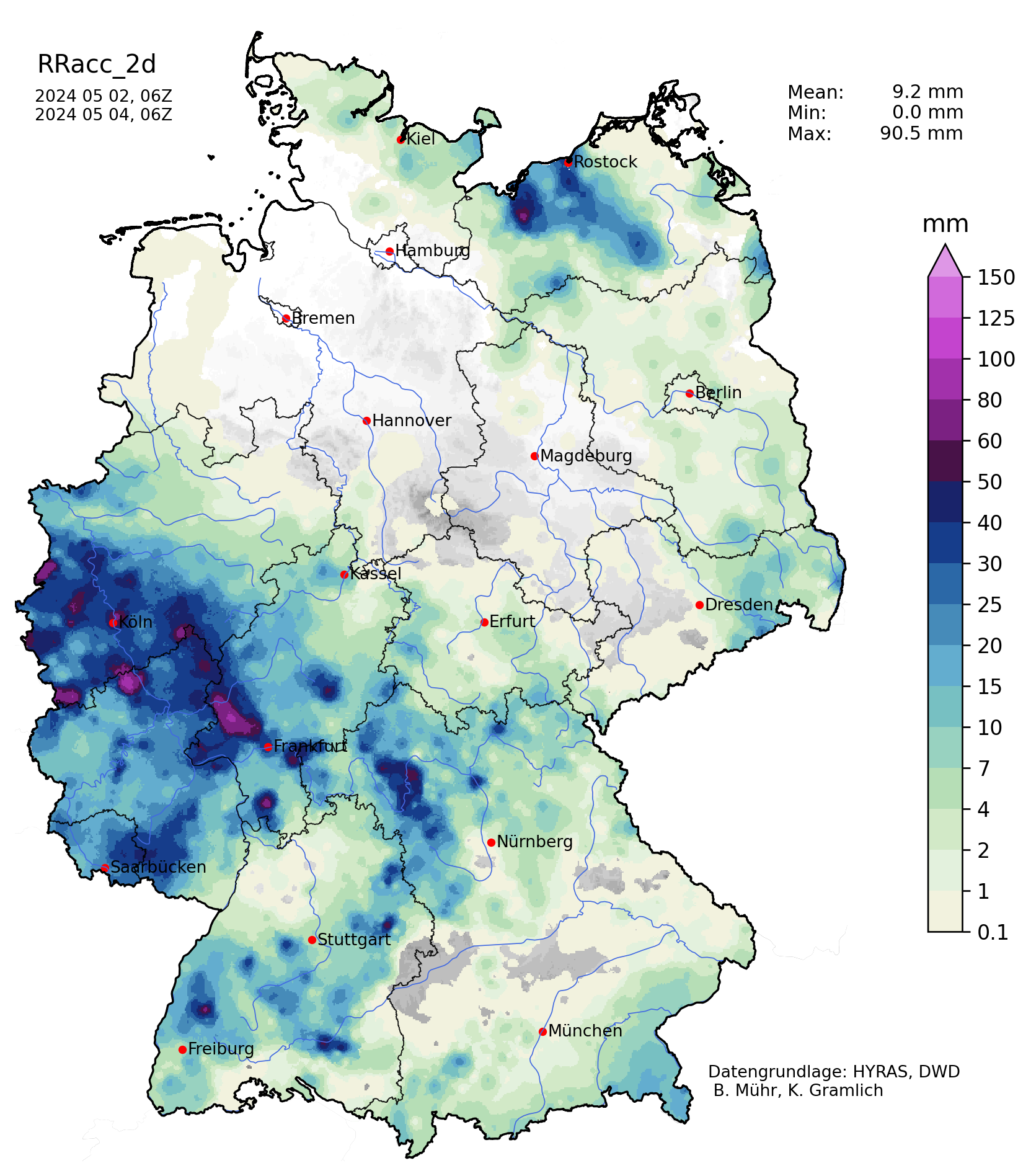
Accumlated over Germany on 02.05.2024 (left), 03.05.2024 (middle) and 2-day accumulated precipitation over Germany, 03.05.2024 (right), source:
Wettergefahren-Frühwarnung
In the evening hours, a large convective cluster with its center over the northern part of Rhineland-Palatine led to heavy continuous precipitation with hourly precipitation rates of more than 10 mm. Throughout the night, the large convective cluster started to resemble more and more a small-scale low-pressure system, with dry inflow from the northeast and the heaviest precipitation just south of the city of Koblenz. Due to very weak upper atmospheric winds, the cluster was nearly stationary, and precipitation in the region continued until the next day. South of the city of Koblenz, the rains finally stopped around 12 UTC on May 03, 2024.
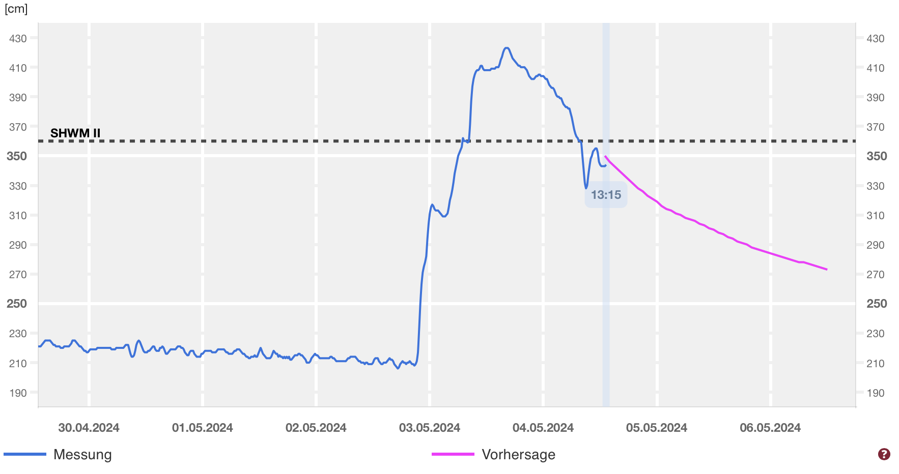
River level of the Lahn River at Kalkofen with a very sharp increase on May 03, 2024, source:
Hochwasser RLP
Here, the widespread precipitation totals reached more than 30 mm/24 h, with the highest precipitation totals being observed in the catchment of the Lahn River. The highest 24 h precipitation total was observed in the town of Bad Camberg. Subsequently, the Lahn River rose by more than 2 meters.
In the second half of May 03, 2024, convective activity was observed in the eastern half of Germany, though it was weaker than the convection over Western Germany the day prior. Ultimately, the convective activity highlighted the increased potential for flash flooding in the coming summer months, especially over the western half of Germany, where the past months have been exceptionally wet leading to saturated soils incapable of absorbing heavy rains.