|
A strong trough over the Arabian Peninsula led to the formation of exceptionally strong mesoscale convective systems bringing torrential downpours to parts of the Arabian Peninsula. The city of Dubai was severely hit by these thunderstorms, bringing more than twice the annual precipitation, leading to widespread flash flooding within the city.
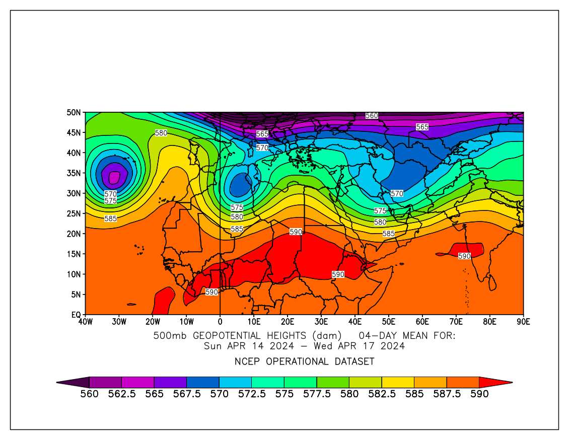
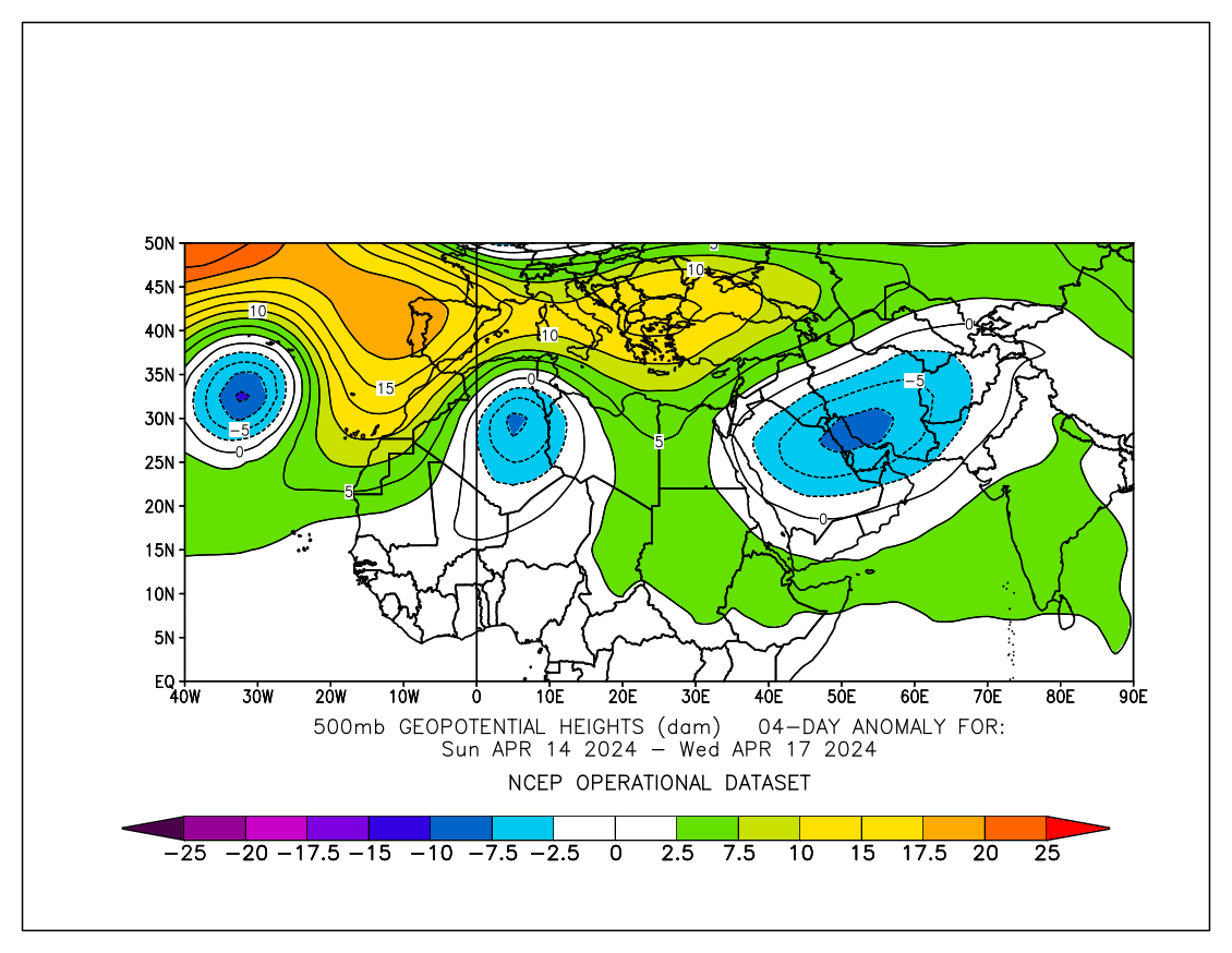
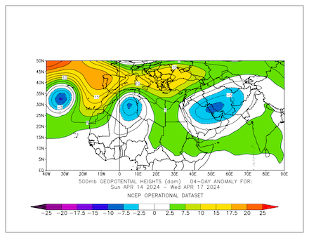
After a significant change in the weather pattern across Europe, a large trough dominated the weather across Europe. South of the said trough, three cut-off lows had developed in mid-April, positioned over the Azores, over Northern Africa, and the Arabian Peninsula. The cut-off low over the Arabian Peninsula had more similarities to a secondary trough, being somewhat connected to a large trough over Asia and expanding unusually far south.
|
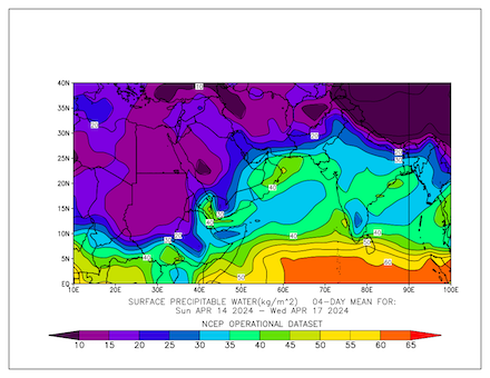
4-day averaged 500 hPa geopotential (left) and 500 hPa geopotential anomaly (right) over Northern Africa and the Arabian Peninsula, 14.04.2024 - 17.04.2024, source:
PSL NOAA
|
 |
 |
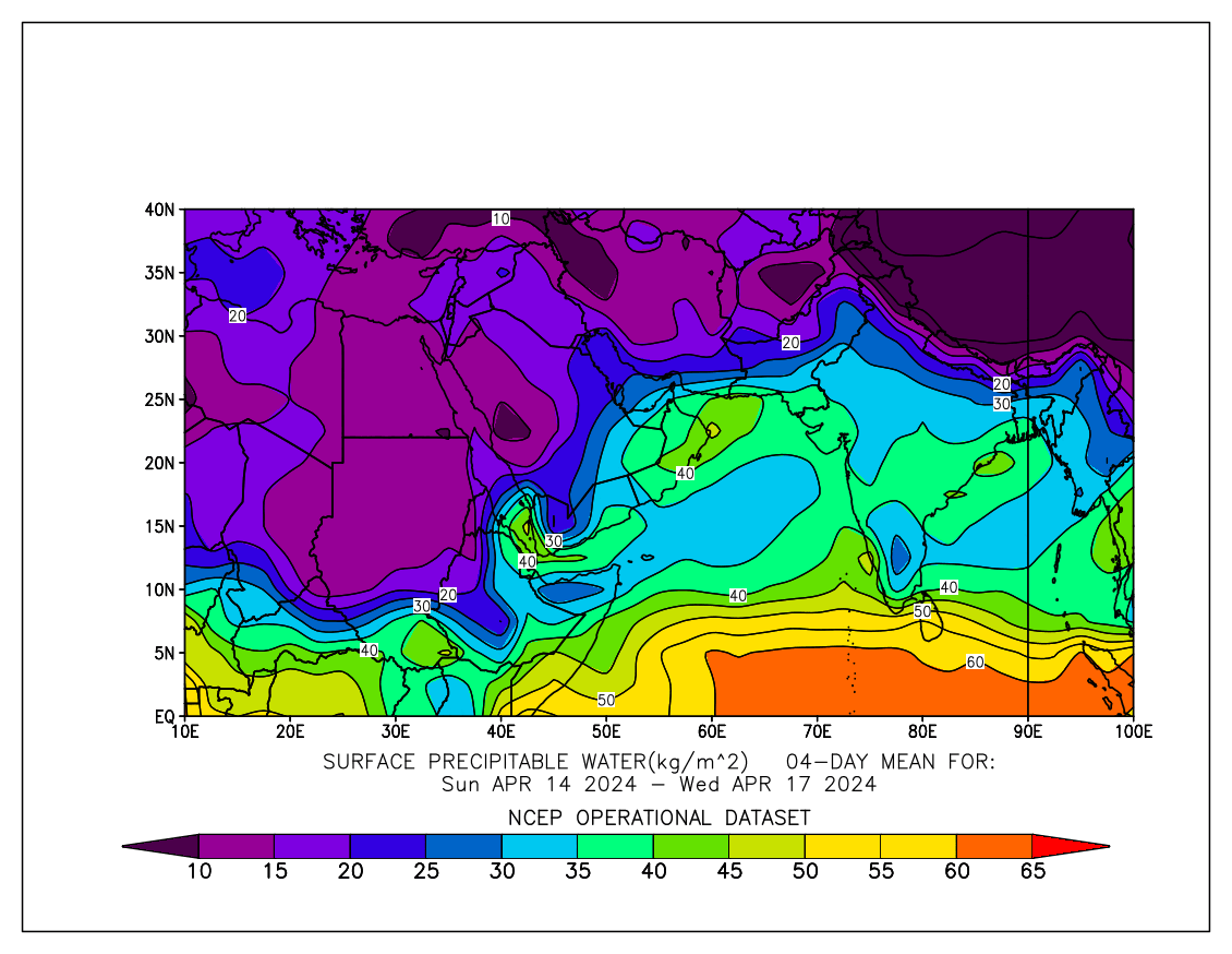
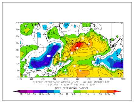
The trough over the Arabian Peninsula led to a very large convergence of moisture at lower altitudes in the atmosphere in the region. This distinct water anomaly over the Arabian Peninsula in the lower altitudes can be observed in the precipitable water anomalies. Especially, in the region around the United Arab Emirates the highest precipitable water anomalies over the Arabian Peninsula can be observed in the period from April 14 to April 17, 2024. Combined with the increased instability by the upper-atmospheric trough, the environment was favorable for the initiation of organized convection.
|
4-day averaged precipitable water (left) and precipitable water anomaly (right) over Northern Africa and the Arabian Peninsula, 14.04.2024 - 17.04.2024, source:
PSL NOAA
|
 |
 |
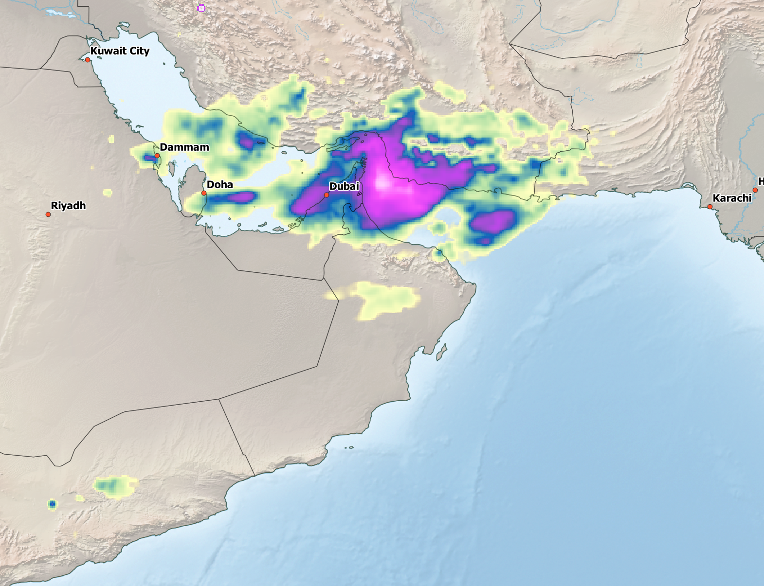
On April 16, 2024, weaker convective systems could be observed over the Persian Gulf. On the next day, April 17, 2024, the convective activity over the eastern flank of the Arabian flank increased. Consecutive mesoscale convective systems formed over the warm waters of the Persian Gulf, moving southeastwards inland into the United Arab Emirates. The city of Dubai was the focal point of these convective systems bringing torrential downpours to the city. Throughout the day, multiple mesoscale convective systems moved across the city bringing extreme amounts of rain to the city.
|
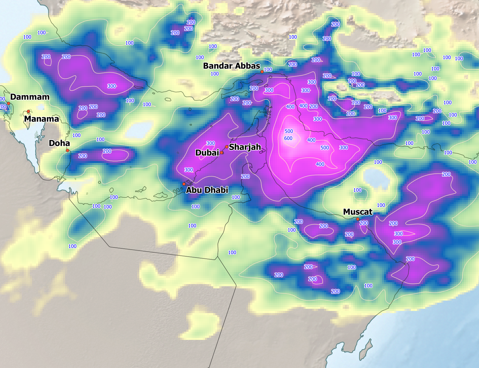
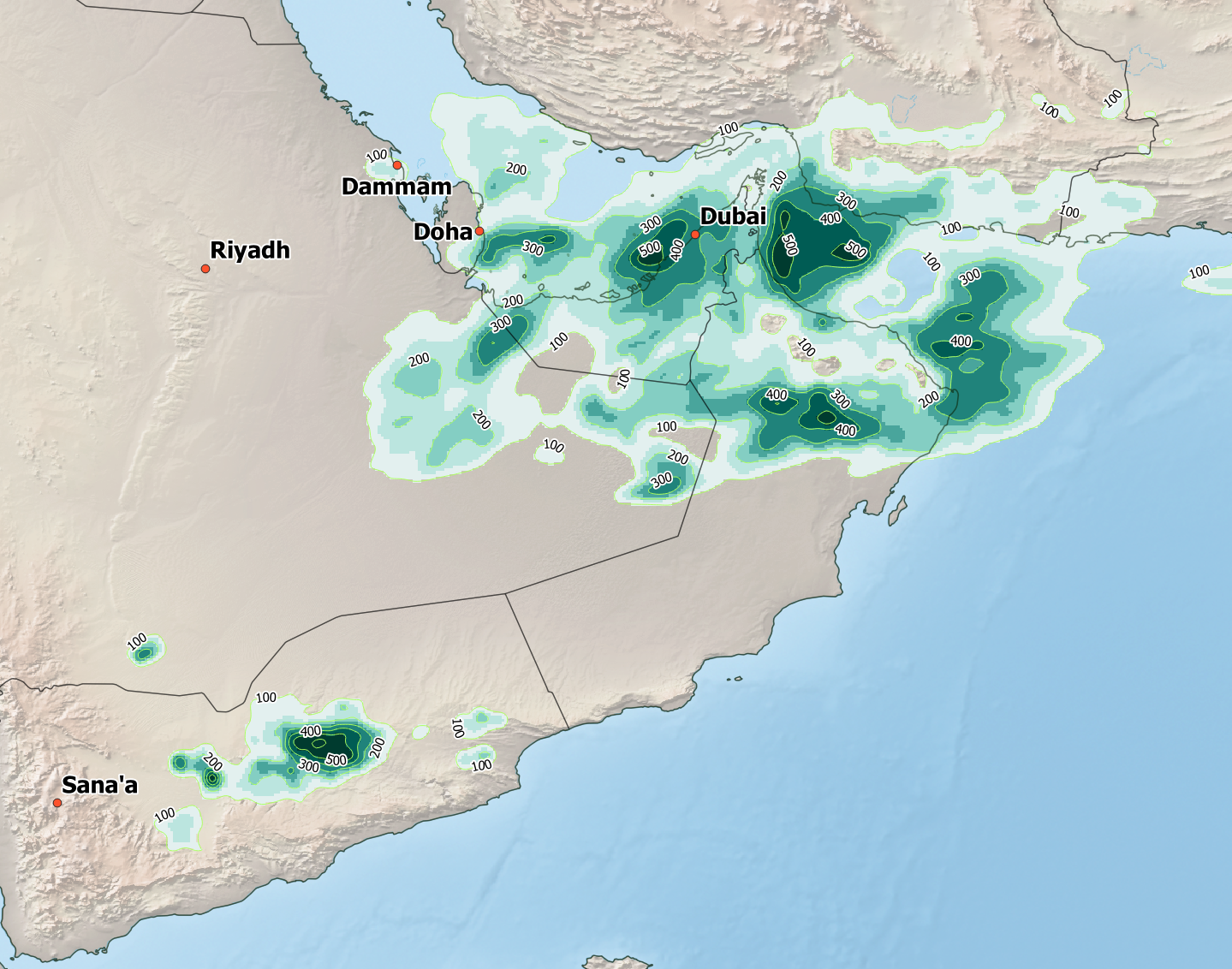
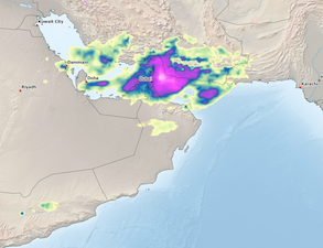
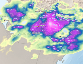
Accumulated precipitation on April 16, 2024 (left), 7-day accumulated precipitation between April 12 to April 19, 2024 (middle), and percentage of the annual precipitation recorded during that same period (left) over the Southeastern Arabian Peninsual, source:
IMERG, visualization: B. Mühr
|
 |
 |
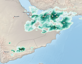 |
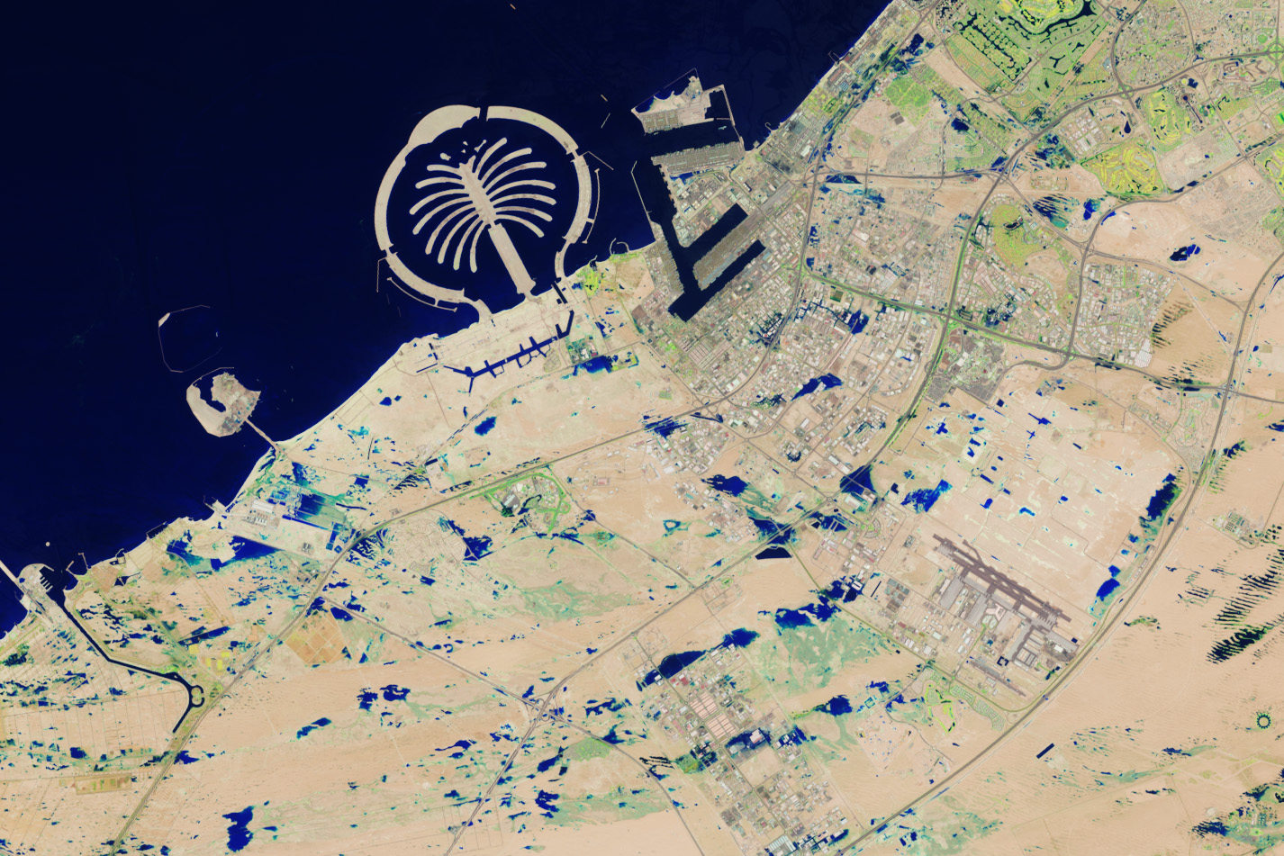
The city of Dubai receives on average 75 mm of precipitation annually, highlighting the aridity of the climate. Within the outbreak of convective activity, the rain gauge at the Dubai International Airport recorded a precipitation total of 164 mm, more than two times the typical annual precipitation. The extreme precipitation in such a short time led to widespread flash flooding within the city. The flooding was so severe that it was even visible from satellite imagery. During the storms, the airport of Dubai had to pause its service, further at least five people died in the floods. Many states around the Arabian Peninsula recorded severe convection during the period from April 12 to April 19, 2024, which all are related to the strong trough over the Arabian Peninsula bringing abundant precipitation to a region that is normally known for its aridity.
Text: KG
April 24, 2024
|